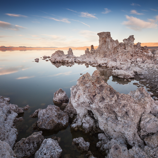
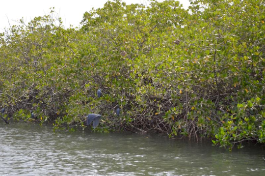
#coastal and oceanic landforms
Photo

Diamond Beach
#Any Vision#Labels#arctic#calm#coast#coastal and oceanic landforms#horizon#ocean#rock#sea#shore#sky#water#wave#wind wave
5 notes
·
View notes
Text
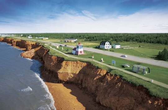
Acadian Coastal Drive, New Brunswick, Canada (source)
#don’t forget about Canada’s other French-speaking province!#canada#new brunswick#ocean#landscape#cliffs#coastal erosion#coastal landform#geography#geology#geomorphology#beach#lighthouse#atlantic ocean
9 notes
·
View notes
Text
Asteroid that wiped out the dinosaurs also triggered a global tsunami | CNN
Asteroid that wiped out the dinosaurs also triggered a global tsunami | CNN
Sign up for CNN’s Wonder Theory science newsletter. Explore the universe with news on fascinating discoveries, scientific advancements and more.
CNN
—
When a city-size asteroid slammed into Earth 66 million years ago, it wiped out the dinosaurs – and sent a monster tsunami rippling around the planet, according to new research.
The asteroid, about 8.7 miles (14 kilometers) wide, left an…
View On WordPress
#accidents#animals#asteroids and comets#atlantic ocean#celestial bodies and objects#coastal areas#dinosaurs#disasters and safety#earth#earth sciences#earthquakes#environment and natural resources#gulf of mexico#indian ocean#landforms and ecosystems#life forms#natural disasters#oceans#oceans and seas (by name)#pacific ocean#physical locations#planets and moons#science#space and astronomy#tsunamis
0 notes
Note
🧡 for Hyeonsik. \(^^ )
🧡- Your Oc has retired. Do they talk about their experience or leave it behind perfusely?
(Note: My tablet is acting up again and got rid of my drawings. So, pencil sketches for now until I figure out what is going on with it)
------------------------------------------------------------
Ring... Ring... Ring...
No response. Aera placed the telephone handset back onto the cradle. This is the third time this week she has tried to call Hyeonsik. The third time since that her calls have yet to be answered. It's been two months of silence. What was Hyeonsik doing that he could never answer her calls? I have to visit his house! I don't care how far away it is from the mountains! She stood up and walked into the new Deputy Chief's office to inform her of her absence in the future.
The southern parts of Nisara were an interesting part of the country. It goes from a Piedmont landform to a coastal plains landform. Aera had always wanted to visit the coastal plains, and she was a bit lucky that she would visit the area since Hyeonsik is from this part of the island or at least lives here. She could see the damage the war had done as she drove through the Southern region. Many villages were still burnt to the ground, and many families were still trying to salvage what was left of their homes. It broke her heart to see this. Sadly, it's the consequence of war. She passed some security checkpoints and entered a small village.
The village began rebuilding itself, but many parts were still damaged. Aera walked through the town and watched as many families walked around. Aera pursed her lips. Hyeonsik hates being around families. And for a good reason. Aera finally found a small house, and the address on the envelope matched the address. She knocked on the door. She was not expecting a response, but the door opened.
"Aera? What are you doing all the way down here?" Hyeonsik asked. He let his friend into his home. Aera smiled. Finally, after two months, she can see her dear friend. She gave him a quick hug.
"You haven't answered my calls! I've been calling for two months straight. And no, don't you try to tell me that your phone isn't working. I know it is!" Aera explained. Hyeonsik pursed his lips. Aera was like a mother, constantly nagging and cutting off any arguments he could make. Hyeonsik sighed.
"I-I just want to forget it all. My service meant nothing. It was worthless like me," Hyeonsik said quietly. Hyeonsik looked away from Aera. He knew Aera was going to be on him for this. "Just forget it. You've traveled from the mountains. Why don't I get you something to eat?"
"...Ok," Aera said. She knows more than anything that Hyeonsik hates being questioned. So, she will do her best to get him to open up again. The last time he opened up was the third year of their service in the military police, which was many years ago. So, it was rare for him to allow himself to be vulnerable.
Aera and Hyeonsik sat on the porch in silence. They watched as the ocean tide moved. It was honestly a refreshing day if you forget about the war and deaths. Aera quickly noticed that Hyeonsik had not grabbed anything to eat for himself. It made Aera feel awkward about eating. However, she can tell that Hyeonsik was waiting for her to eat. So, she did. Oh! I brought that stew from the mountain. I'm sure he'll eat that, at least! Aera grabbed her bag and pulled out the bowl.
"Y-You don't have to. I'm not hungry right now," Hyeonsik said as he saw the bowl. He really wasn't feeling hungry. Aera shook her head as she handed the bowl to him.
"You need to eat. I know you've always avoided eating back on base. But you're at home. You need to learn to eat more," Aera explained. She still remembers the day he had fainted due to a lack of nutrients. And she still remembers watching him avoid food at all costs. If she was honest with herself, she was scared watching him basically starve himself. Hyeonsik pursed his lips, but he finally took the bowl from her.
The stew was surprisingly still warm. However, the smell of it was too strong. Hyeonsik felt a bit sick from it. He didn't want to eat it but knew Aera would nag on him for not eating. He sighed. He might try to eat a little. With some hesitation, he finally placed the spoon in his mouth. He felt like he was going to throw up already. Hyeonsik had to cover his mouth to prevent spitting the food out. He chewed on one part of the vegetables as long as he could until he felt it was mushy. Hyeonsik pushed the harder, unchewed vegetables to the front of his mouth as he began to try to swallow the chewed vegetables. As he tried to swallow, he felt his throat constricting. He gagged and lurched forward as he pushed the chewed vegetables back to the front of his mouth. He couldn't do it. He can't swallow it! He'll choke if he tries again!
He felt a tap on his shoulder. He looked over to see Aera handing him a cup of water. He took it and drank it all. Luckily, it helped him swallow the food. The wind soon began to pick up. Neither of them noticed.
"You're still having trouble to eat? Have you thought of going to the doctor for that?" Aera asked. Hyeonsik shook his head. He hadn't tried because it didn't matter. "Hyeonsik! Why won't you go? This is so unhealthy! You'll get sick if this keeps up!" Aera already knew Hyeonsik was a bit sick, but at this rate, he may end up in the hospital or worse.
"Shut it. Why do you even care?" Hyeonsik hissed. Aera blinked, but Hyeonsik could tell she was mad.
"Because you're my friend! We've been through hell and back together! I won't lose you because you won't eat! Why can't you eat?" Aera shouted. Hyeonsik was taken aback by the shouting, but he wouldn't sit there and take it.

"Why should I? Huh? My family can't eat then how can-" He stopped. He didn't mean to bring that up. Aera knew everything that happened in his past, so she knew what he was going on about. He could feel his chest tighten. He began to shake. After all that work of getting rid of his emotions, why was he now losing control of his feelings?
"Hyeonsik..." Aera whispered. She wanted to tell him that it wasn't his fault. He wasn't to blame for his wife and child's death. But she wasn't there. She didn't even know him during that time. What could she say to comfort her friend? What could she do to help him? All she could do was stay silent.
"I just can't anymore. Ever since I left, I don't have anything to distract myself. I just keep reliving that moment. I keep dreaming about it. I can't even cook because I'm scared of the flames. Why can't I just forget it all! Why do I always have to be reminded?" Hyeonsik said. At this point, he didn't know what he was saying. He just spat out whatever words came into his thoughts.
"Hyeonsik, breathe! Please!"
Hyeonsik stopped talking. He took a deep breath. He looked up to see Aera confused but relieved. He gave a small smile.
"Thanks," he said. He didn't even notice that he was even breathing correctly. He keeps breathing in and out. He failed to notice Aera becoming even more confused. And he failed to see that the voice who shouted did not belong to her either.
"Thanks? I didn't do or say anything?" Aera said. Hyeonsik seemed too busy breathing to notice what she said. She wondered what he meant when she thanked her, but she decided to not question it. He was calming down, which was more important than getting an answer.
The two sat silently as the roaring wind settled into a gentle breeze. The flowers swayed, and the tides slowly pushed onto the shore and retreated. Yet, the sun began to be covered by the moving clouds. Was anything even accomplished today?
------------------------------------------------------------
Thanks for the ask!
I hope this ask was responded to properly. I ended up writing so much that I am bit concerned for the length of it. My writing skills is not the best, but I loved responding to this ask (and hopefully it makes sense). This has to be my favorite response! Especially since I got the explore the relationship between Aera and Hyeonsik. Didn't expect myself to traumatize Hyeonsik to this extent...
3 notes
·
View notes
Photo


Tone will be impersonal, neutral, and informative.
ID Text in Keep Reading. Descriptions of regions in Keep Reading. Spoilers for KF (2015), KF (2017), KF2, and KF3 once you reach the region descriptions. Thank you to everyone who helped with this.
The following two photos consist of two Kemono Friends 3-era Japari Park maps. The first is unedited and directly from the game. The second got edited by Japari Park Companion to contain each known area name. Major credit to the fan-run Japari Library and its users for its titled maps over the years, referencing a couple.
As much as it attempts to avoid headcanon, please do not take it as absolute accuracy. These have no association with Japari Library or Kemono Friends Project outside of using their content as sources. All are free to sample it for their appropriate and KFP-friendly needs.
Kemono Friends 3 is not after Kemono Friends 2 or Kemono Friends 2017. It is an indirect sequel to Kemono Friends 2015, the original mobile game that started the franchise.
Japari Library Wiki’s own version of this map is on this page.
[ID: The first photo is a fictional map of Japari Park from Kemono Friends 3; it is on a cyan ocean background with a tan border:
The tan border has “Japari Park” written as a title. It is from an official mobile game that roughly takes place in a time known as Generation 2 in Japari Park. Japari Park is an archipelago; with several islands surrounded by water and near each other. Japari, in full: is one large island and six smaller ones. Japari’s geographical landforms are based on real-life Japan but are still fictional. It is often described as a large open zoo far from the world’s continents.
The second photo is an identical map - but is this time edited to list several of the geographical regions, being:
Park Central.
Sankai.
Nakabe.
Rikuhoku.
An’in.
Anyo.
Gokoku
Kyōshū.
Akushima.
Riukiu.
Hokkai.
And finally, Hōtoku.
The contents and appearances of these regions go as follows:
Park Central.
Being the bottommost middle part of the main island, Park Central can be described as an equivalent to the real-life Japan’s Kanto Region with a capital also known as “Park Central” akin to real-life Tokyo. The region is known for its green forested scenery. Park Central’s capital resembles a huge circular theme park surrounded by a large wall.
Said capitol has rides such as Ferris wheels, structures such as the Kemono Hospital, and attractions such as the Japari Park Pavilion and the vast Kemono Castle. Earlier into Gen 2, said castle was occupied by the defunct original mobile game’s antagonist, the Cellien Queen, resulting in its destruction until being repaired in Kemono Friends 3.
According to the fan-site Japari Library, not the location of Japari Library, by the time of Kemono Friends 2, Gen ?, around Park Central somewhere are the Azura Park bamboo grove, the cruise-able stage show inhabited coastal aquatic Marine Life Park, the densely tree-covered Jungle Park with a nearby research lab, the scorching cactus-strewn tropical savanna South Maerica Park, and the whale-shaped Japari Hotel, all connected to the Japari Line monorail service. The monorail was still under construction around early Kemono Friends 3, Circa Gen 2.
Sankai Region.
Being a part of the main island to the left of Park Central, Sankai can be described as an equivalent to Japan’s real-life Kansai Region. The region is notably home to various caves and is known for its tannish and sandy desert scenery. Notable locations of the said region include Oasis No. 1, the region’s primary water source. And an expansive underground shopping mall called the Odyssey.
Due to its harsh climate, several roads dot it that occasionally pass-through tunnels. Following an incident during Kemono Friends 3, disrepair temporarily fell upon the Odyssey. During Kemono Friends 3 as well, there was a Japari Museum, a massive warehouse. The Sankai Region is occasionally described by the name of the Desert Area.
Nakabe Region.
Being a part of the main island above Park Central, Nakabe can be described as an equivalent to Japan’s real-life Chubu Region. The region is known for its largely swampy, brown, and green waterfront scenery. Notable locations of the said region include the renowned Amatatsu Waterfall and the nearby mechanized “Undine” water treatment plant in Serenity Jungle. It is most known for the extensive concert venue located inside the region. The Nakabe Region is occasionally described by the name of the Waterfront Area.
Rikuhoku Region.
As part of the main island, not much is known about the Rikuhoku Region by the Japari Park Companion team. On the map Rikuhoku is located near mountains and has green mountain scenery. It is close to Nakabe.
An’in Region.
Being the farthest left part of the main island, An’in can be described as equivalent to real-life Japan’s San-in Region. The region is known for its sometimes mountainous, other times densely forested, and infrequently open green jungle scenery.
Notable locations of the said region include the vital An’in Ferry Terminal and the Japari Park Security and Research Team headquarters that acts as JSRT’s main base. In Season 3 of Kemono Friends 3, by referencing the An’in Ferry Terminal in-game collectible photo, the Ferry Terminal may be the one notable for being the perceived site of the first long-term guest to Japari Park, Hikari. The An’in Region is occasionally described by the name of Jungle Area occasionally as well as Forest Area.
Anyo Region.
As part of the main island, not much is known about the Anyo Region by the Japari Park Companion team. On the map Rikuhoku is located near mountains and has green mountain scenery. It is close to An’in.
Hōtoku Region.
Being the farthest right and the last currently recorded region on the main island, Hōtoku can be described as an equivalent to Japan’s real-life Tohoku region. The region is known for its often cloudy and broad green high mountain scenery. Notable locations of the said region include sites for holding sky races. It is often known as the Sea of Clouds by inhabitants and visitors alike. The Hōtoku Region is also occasionally described by the name of Sky Area.
Gokoku Region.
Being the closest smaller island to the left mainland shores of the An’in Region, Gokoku can be described as an equivalent to Japan’s real-life Shikoku region. The region is known for its varied climates and sometimes mountainous, occasionally cavernous, largely green open scenery, lush forests being the most common of them during Kemono Friends 3.
Notable locations of the said region include sites for holding art festivals, sites for producing independent films, and the presumed headquarters of the Japari Park Guard Team. Due to the positioning of the archipelago - in Chapter 4 of Cellval's Hang Out Story in Kemono Friends 3, it could potentially be the site of the Chinatown-Esque Japari Night Market, although it could not be.
Kyōshū Region.
Directly below the island region of Gokoku and the left mainland shores of the An’in Region, Kyōshū can be described as an equivalent to Japan’s real-life Kyūshū region. During the times of the defunct original mobile game in early Gen 2, Kyōshū was well known for being a collection of mild grasslands. But by the time of Gen ? Sandstar had morphed and split the region into at least ten to eleven or more distinct climate areas with a colossal Sandstar volcano in the middle.
Notable splits of the said region include the Savanna Area, the Jungle Area, the High Mountain Area, the Desert Area, the Waterfront Area, the Plains Area, the Forest Area, the Snowy Mountains Area, the Ocean Area, the Tropics Area, and the Sandstar Volcano Exterior.
Notable locations of the said region include the Savanna Area Mountaintop Watering hole, the Savanna Area Gate to the Jungle Area, the Jungle Area Tour Walkaway, the Jungle Area An’in Bridge, the High Mountain Area Mountaintop Japari Café, the Desert Area Underground Roadside Tunnel, the Desert Area Underground Labyrinth, the Waterfront Area Lake Shore, the Plains Area Castle, the Plains Area Dojo, the Forest Area Japari Library, the Waterfront Concert Venue, the Snowy Mountain Hot Springs, the on the way from the Snowy Mountains Area to Hinode Port Lodge, the Sandstar Volcano surrounding Hinode Port, the Sandstar Volcano far-off surrounding Amusement Park, and finally the Sandstar Volcano itself.
Additionally, there is a Japari Museum, a massive warehouse, and in circa Gen 2, replacing the Gen ?-era Café is the High Mountain Area Mountaintop Japari Cabin. The Gen 2 Japari Café‘s location is currently not recorded.
Akushima Region.
Directly to the right of the island region of Kyōshū and below the in-between between the middle mainland shores of Park Central and the Sankai Region, not much is known about the Akushima region by the Japari Park Companion team. On the map, Akushima is the smallest island and has green scenery. In the defunct original mobile game, there are some forests with large trees, a few mountains, and an open shore.
Riukiu Region.
To the lower left of the island of the Akushima Region and below the mainland shores of Park Central, the Riukiu Region can be described as an equivalent to Japan’s real-life Ryukyu Region. The region is known for its palm tree-strewn green climate and tropical sandy beach scenery.
Notable locations of the said region include Riukiu Aquarium, the Starry Sky Data Library, a Japari Café, and the Shiserval Dojo. And by at least Kemono Friends Festival, similar to Kyōshū, Riukiu is home to Area splits of its own. The eight are the Tropics Area, the beach-filled Ocean Area, the shipwreck-strewn droughted Desert Area, the Jungle Area, the High Mountain Area, the Lake Shore, the Snowy Mountains Area, and the Savanna Area.
Hokkai Region.
Being the closest smaller island to the right mainland shores of the Hōtoku Region, the Hokkai Region can be described as an equivalent to Japan’s real-life Hokkaido Region. The region is known for its harsh tundra climates adorned with frozen over huddles of water, scattered hot springs, and mountain scenery.
Notable locations of the said region include the Tsubekuri Snowfield, various cabins, and one Hot Spring near a Sandstar volcano in the vicinity. The Hokkai Region is occasionally described by the name of Snowfield Area.
End ID.]
#Kemono Friends#Kemofure#Kemono-Friends#Japari Park#ID#ID Text#ID Text in Keep Reading#Lore#Japari Park Companion to Japari#Fictional Map#Kemono Friends Project#Textwall#Textwall in ID#Kemono Friends Spoilers#Kemono Friends 2 Spoilers#Kemono Friends 3 Spoilers#Japari Park Companion#Longpost
4 notes
·
View notes
Text
Land of Japan:
youtube

-Taishō Pond in Kamikōchi Valley, central Honshu, Japan. Mount Hotaka behind.
The mountain arcs correlate to Japan's primary physiographic regions: Hokkaido, Northeastern (Tōhoku), Central (Chūbu), and Southwestern—as well as the Ryukyu and Bonin archipelagoes. The Chishima and Karafuto arcs merged to form the Hokkaido region. The backbone of the area runs north to south. The Chishima arc reaches Hokkaido as three volcanic chains with altitudes exceeding 6,000 feet (1,800 metres), which form a ladder and finish in the region's core. The Kitami Mountains in the north and the Hidaka Range in the south are the mountain system's main components.
-Lake Towada, Towada-Hachimantai National Park, northern Honshu, Japan.
The Northeastern Region runs from southwest Hokkaido to central Honshu, almost paralleling the northeastern mountain arc. Several rows of mountains, valleys, and volcanic zones are closely aligned with the insular arc of this region, which is convex towards the Pacific Ocean. The Kitakami and Abukuma mountains on the east coast deviate from the normal trend; they are primarily formed of older rocks, with plateau-like landforms surviving in the core. In the western zone, the formations follow the overall trend and consist of a basement complex overlain by thick accumulations of young rocks that have undergone modest folding. The East Japan Volcanic Belt includes the Ōu Mountains, which are separated from the coastal ranges by the Kitakami-Abukuma lowlands to the east and a succession of basins to the west.
-The Hida Range, part of the Japanese Alps, in central Honshu, Japan.
The Central Region in central and western Honshu is defined by the convergence of the Northeast, Southwest, and Shichito-Mariana mountain ranges around Mount Fuji. The mountain, lowland, and volcanic zones form a nearly right-angled pattern over the island. The Fossa Magna, a massive rift valley that runs from the Sea of Japan to the Pacific, is the most remarkable physical feature on Honshu. It is largely covered by mountains and volcanoes from the southern section of the East Japan Volcanic Belt. Intermontane basins are located between the partly glaciated Akaishi, Kiso, and Hida mountains (Japanese Alps) to the west and the Kantō Range to the east. The Kantō Plain, located east of the Kantō Range, is Japan's largest lowland. Tokyo, the country's largest metropolis, occupies a significant portion of the plain.

-Coast of the Inland Sea, Okayama prefecture, Japan.
The Southwestern Region, which comprises western Honshu (Chūgoku), Shikoku, and northern Kyushu, largely correlates with the southwestern mountain arc. The overall tendency of highlands and lowlands is broadly convex towards the Sea of Japan. The area is separated into two zones: the inner zone, generated by complicated faulting, and the outer zone, formed by warping. The Inner Zone is mostly made up of ancient granites, Paleozoic rocks (250 to 540 million years old), and geologically more recent volcanic rocks that are placed in complex juxtapositions. The Outer Zone, which includes the Akaishi, Kii, Shikoku, and Kyushu mountain groups, is distinguished by a consistent zonal arrangement from north to south of crystalline schists and Paleozoic, Mesozoic (65 to 250 million years old), and Cenozoic formations. The Inner Zone, focused on the Chūgoku Range, has a complex mosaic of fault blocks, whereas the Outer Zone is continuous except for sea straits that divide it into four autonomous groupings. The Inland Sea (Seto-naikai) is the location with the most depression, resulting in seawater incursion. The northern margin of the Inner Zone is studded with massive lava domes generated by Mount Dai, which, along with volcanic Mount Aso, conceal a large portion of the western extension of the Inland Sea in central Kyushu.
-The caldera of Mount Aso in central Kyushu, Japan
The Ryukyu Islands Region comprises the majority of the Ryukyu arc, which extends into Kyushu as the West Japan Volcanic Belt and ends with Mount Aso. The arc's effect may be observed in the pattern of elongated islands off western Kyushu, such as Koshiki, Gotō, and Tsushima. The Izu-Ogasawara Region, to the east of the Ryukyu arc, consists of a series of volcanoes on the undersea ridge of the Izu-Marina arc, and the Bonin Islands, which include Peel Island and Iwo Jima.
Havard referencing:
The Editors of Encyclopaedia Britannica. (1998). The major physiographic regions. [Online]. britannica. Last Updated: 27 October 2023.. Available at: https://www.britannica.com/place/Japan/Soils [Accessed 19 February 2024].
1 note
·
View note
Text
Test Bank For Living Physical Geography Second Edition Bruce Gervais

Table of Contents
Contents
The Geographer’s Toolkit
1. This introduction covers the traditional and modern tools and foundational concepts in wide use in geography.
Part I Atmospheric Systems: Weather and Climate
Part I explores how solar energy in the atmosphere creates atmospheric phenomena and organized systems. One chapter is devoted to the topic of climate change.
2. Portrait of the Atmosphere
3. Solar Energy and Seasons
4. Water in the Atmosphere
5. Atmospheric Circulation and Wind Systems
6. The Restless Sky: Severe Weather and Storm Systems
7. The Changing Climate
Part II The Biosphere and the Geography of Life
Part II is contextualized around solar energy’s work in the biosphere. Major ecological units and human modification of the biosphere are emphasized. One chapter is devoted to marine ecosystems.
8. Patterns of Life: Biogeography
9. Climate and Life: Biomes
10. Ocean Ecosystems
11. Soil and Water Resources
Part III Tectonic Systems: Building the Lithosphere
Part III explores uplift and building topographic relief via geothermal energy.
12. Earth History, Earth Interior
13. Drifting Continents: Plate Tectonics
14. Building the Crust with Rocks
15. Geohazards: Volcanoes and Earthquakes
Part IV Erosion and Deposition: Sculpting the Earth’s Surface
Part IV examines the work of solar energy, water, chemical reactions, and gravity in grading the Earth’s surface.
16. Weathering and Mass Movement
17. Flowing Water: Fluvial Systems
18. The Work of Ice: The Cryosphere and Glacial Landforms
19. Water, Wind, and Time: Desert Landforms
20. The Work of Waves: Coastal Landforms
Read the full article
0 notes
Text
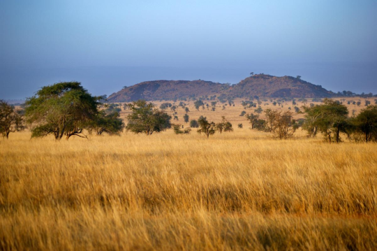
Things to Know To Enjoy a Vacation in the Wild on a Kenya Safari Trip
Kenya is famous for its wilderness and wildlife charm. Consider exploring and understanding the African safari destination for the best Kenya safari trip.
The best of Savannah, mountain highlands, and landforms that hug the Indian Ocean are in the East African nation- of Kenya. It is a popular haven for big cats like the cheetah, buffalo, elephant, rhinoceros, and lion.
Highlights of a safari in Kenya are watching the annual Wildebeest migration, viewing wildlife, and staying in exotic safari lodges. When you go on a safari vacation to Kenya, expect to enjoy unique wildlife experiences.
What can be the best time for a safari trip in Kenya?
The best time for a Kenyan safari is from June to October. You can also enjoy the best safari experiences during the dry season in Kenya.
Top experiences of a Kenya Safari
Exciting Game Drive
Kenya safari tour’s most essential part is a game drive. You can enjoy a morning, late afternoon, or evening game drive to witness the wildlife in the wilderness. Game drives in Kenya’s best national parks and reserves help you experience the thrill of wildlife encounters.
The Bird watching tour
Kenya is home to the world’s most ferocious predators and many exotic bird species.
There are over 817 bird species across the Kenya National Parks and Reserves. Consider a bird safari to explore the coastal estuaries, wetlands, rocky gorges, papyrus, Acacia savannah, and vast lowland. The most popular bird-watching tours are best in Kenya’s Masai Mara and Lake Baringo.

Top Kenya safari destinations to explore
The Masai Mara National Reserve
The Maasai Mara Reserve is famous for its abundant wildlife, particularly the annual wildebeest migration. The wildebeest Migration takes place from July - October in Mara Reserve. The Masai Mara reserve covers an area of 1,510 km² and is home to a wide range of wildlife like zebras, giraffes, elephants, cheetahs, and lions.
Location: Southwest region of Kenya
Top Attractions:
The annual wildebeest migration
Balloon safari
Mara Triangle
Bush camping.
Park entry fees:
Non-residents: $80/$70 per adult per day, $45 per child per day
The Tsavo East and West National Parks
The Tsavo East and West National Parks are two adjacent national parks in southeastern Kenya. The parks have diverse landscapes, including open savannah, riverine forests, and rugged hills. They are home to a wide range of wildlife, including the Big Five (Lion, Elephant, Buffalo, Leopard, and Rhino) and numerous bird species.
Location: Located in Coast Province of Kenya in between Nairobi City and Mombasa Top Attractions:
Tsavo East:
The Galana River is home to crocodiles and hippos.
Aruba Dam is a popular spot for wildlife viewing.
Tsavo West:
Mzima Springs is a series of natural springs with underwater viewing hides. ● Shetani Lava Flows, a vast expanse of the black lava flow.
Ngulia Rhino Sanctuary is a protected area for endangered black rhinos. Park entry fees:
Non-residents: $52 per adult per day, $35 per child per day

Lake Nakuru National Park
Lake Nakuru National Park is a protected area on the floor of Great Rift Valley in Kenya, known for its vast soda lake and abundant birdlife, including flamingos. The park is home todiverse wildlife, including endangered species such as the Rothschild's giraffe and black and white rhinos. The surrounding landscape features acacia forests and grasslands.
Location: Great Rift Valley in Kenya
Top Attractions: Rhino Sanctuary, Makalia Falls, Baboon Cliff, Lake Nakuru, and Hyrax Hill Prehistoric Site.
Park entry fees:
Non-residents: $60 per adult per day, $35 per child per day
Conclusion:
A safari is the ultimate way to feel the real thrill of the diverse African wildlife. Kenya beholds many exciting things for its visitors. Experience the excitement and adventure on a Kenya safari trip with Kenya Tru Nomads!
#kenya safari trip#kenya flight safaris#masai mara tours from nairobi#mombasa excursions#nairobi safari tour package
0 notes
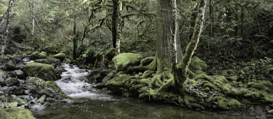
Photo

16/11/2021 - A Day in The Life
#Voigtlander NOKTON classic 35mm F1.4 II SC VM#ILCE-7C#Water#Plant#Blue#Fluvial landforms of streams#Natural landscape#Mountain#Coastal and oceanic landforms#Lake#Bank#Riparian zone#original#japanese#japan#diary#photo#photography
2 notes
·
View notes
Text
Sea
https://www.mopik.net/sea-523.htm
Sea HD Mobile Wallpaper

2 notes
·
View notes
Photo

Makarska Brela
#Any Vision#Labels#Landmarks#Riwiera Makarska#aerial photography#bay#cliff#coast#coastal and oceanic landforms#fjord#headland#hill#horizon#landscape#mountain#ocean#photography#promontory#sea#shore
0 notes
Photo

“I must be a mermaid, Rango. I have no fear of depths and a great fear of shallow living.” ―
#sea#coast#rock#coastal and oceanic landforms#shore#promontory#ocean#headland#water#cliff#art#painting#machine#vision
1 note
·
View note
Text
Sydney Houses: NSW Properties, Residences
Sydney Homes, NSW Houses, New South Wales Property Designs, Residence Photos
Sydney Houses : NSW Properties
New South Wales Property Developments, Contemporary Australian Homes
post updated 31 Jul 2021
Sydney House – Latest Property Additions
New South Wales Properties – latest additions to this page, arranged chronologically:
17 Jul 2021
Stealth House, Hunters Hill
22 Jun 2021
Kingsford House
22 Apr 2021
Coast House
Design: Luke Moloney Architecture
photograph © Tom Ferguson
Coast House
A single-storey cottage overlooking the ocean received a new first floor to take advantage of spectacular coastal views. An economical design tailors simple materials to make a comfortable home for a busy couple with young children.
16 Feb 2021
McLeod House
Design: Ian Moore Architects
photograph © Daniel Mayne
McLeod House
The four-bedroom McLeod House is located on a ridge above Sydney’s Middle Harbour, with significant district views as well as a distant view to Chatswood in the west. Officially it is alterations and additions to a 1970’s house, as 30% of the original house had to be retained to allow the house to retain it’s floor area, height and location on the site, all of which exceeded new planning controls for the area.
8 Feb 2021
Dodds House
Design: Ian Moore Architects
photograph © Daniel Mayne
Dodds House
This restoration of a one-bedroom house designed by Ian Moore in 1998 and completed in 2001, which had been unsympathetically altered by a previous owner.
17 Feb 2021
Hastings van Nunen House
3 Dec 2020
Escu House
23 Nov 2020
Chimney House
16 Nov 2020
Mosman White House
5 Nov 2020
House Anand
19 Oct 2020
Eagle’s Nest, Collaroy Plateau, New South Wales
Architects: Ian Bennett Design Studio
photo : Clinton Weaver
Eagle’s Nest, Collaroy Plateau
Perched high on a prominent escarpment in the highest level of bushfire attack; Flame Zone, Eagle’s Nest aspires to balance and curate the experience of outlook and expansiveness of site, with privacy and seclusion. The restrained material palette heightens this experience of site, landscape and built form along with the changing dynamic of light and shade.
20 Sep 2020
Pindimar Lake House, NSW
4 Sep 2020
Next Generation House in Pittwater, NSW
28 Aug 2020
Oye Mi Canto House, Carriageworks cultural precinct, Sydney, New South Wales, Australia
Design: CplusC Architectural Workshop
photo : Murray Fredericks
Oye Mi Canto House
An alterations and additions project on a terrace-house located in the leafy suburban streets of Sydney’s Newtown, nestled into a narrow site backing onto the Carriageworks cultural precinct.
14 July 2020
A+C Residence in Seaforth
29 June 2020
The Waterfront Retreat, Newport, New South Wales, Australia
Architecture: Koichi Takada Architects
photo : Tom Ferguson Photography
The Waterfront Retreat Newport, NSW
The Waterfront Retreat is the epitome of an Australian dream home, adorned with a private beach, garden and open-plan living. Responding the clients’ brief – a house offering sanctuary and entertainment, the Waterfront Retreat is designed to allow nature to lead, offering maximum seclusion and connection to its surrounds and outlook.
23 June 2020
Hart House, Great Mackerel Beach, New South Wales
Design: Casey Brown Architecture
photo : Rhys Holland
House on Great Mackerel Beach, NSW
This new property is located on the idyllic shoreline of Great Mackerel Beach, and was conceived as a contemporary interpretation of the quintessential one-room Australian beach shack. The form was derived from a wrapped ‘box’ open to one side.
17 June 2020
Blackwood Residence, Clovelly, eastern Sydney
Architects: McGregor Westlake Architecture
photo : Brett Boardman
Blackwood Residence in Clovelly
This NSW residence is a recently finished alteration and addition to a house in Boundary Street, Clovelly.
8 June 2020
St Peters House II
Architects: Kreis Grennan Architecture
photo : Douglas Frost
St Peters House II in Suburbian West Sydney
The St Peters House II is built at the rear of a narrow lot in the Sydney suburb of St Peters. The client’s backyard provided a new site for his freestanding home. The original dwelling remained, creating additional accommodation and a sensible approach to increased urban residential density.
19 May 2020
YrdPods
Architects: Kreis Grennan Architecture
photo : Douglas Frost
YrdPod Garden House
YrdPods are a type of tiny homes that makes architecture accessible for everyone. They are not the type of tiny houses on wheels, but a permanent structure located in backyards.
19 May 2020
New House in Clovelly
Architects: Modscape
photo : John Madden
New House in Clovelly, Sydney
9 Mar 2020
Infinity House, Curl Curl
Architect: CplusC Architectural Workshop
photographers : Murray Fredericks and Simon Whitbread
Infinity House in Curl Curl
This new NSW property is an exercise in material, time, and cost efficiency. A specific project brief included two bedrooms with built-in robes, bathroom/laundry, an open plan dining, kitchen, living space, and a deck.
5 Mar 2020
Tennyson Point House
Architects: CplusC Architectural Workshop
photograph : Murray Fredericks
Tennyson Point House
Working within the bones of a solid, well-constructed water front home built in the 1960s on Parramatta River, the adaptive reuse of this multi-level dwelling involved various changes. All the internal workings of the existing structure were removed, the central circulation core was re-invigorated, light and cross ventilation was developed, and the waterfront outlook reinforced.
2 Mar 2020
Porter St Ryde Apartments, Shepherds Bay, Meadowbank Precinct, Ryde, New South Wales
Architects: Glyde_Bautovich
photograph : Atelier Illume
Porter St Ryde Apartments in Sydney, NSW
Planning approval obtained for this new residential project within City of Ryde’s Shepherds Bay, Meadowbank Precinct.
4 Feb 2020
Townhouses on Tamarama, Upper North Shore, NSW
Architects: David Mitchell Architects and Chapman Architecture
photograph : Michael Nicholson
Tamarama Townhouses NSW, Upper North Shore
Three luxury properties on Tamarama’s waterfront have been designed to cut into the slope of the site’s natural landform allowing the building to open generously to the view as it simultaneously bunkers down to the landform.
29 Jan 2020
The Balcony House in Newtown
29 Jan 2020
Copper Top House in Mosman
17 Jan 2020
Iron Maiden House in Longueville, New South Wales
More contemporary Sydney Houses online soon at e-architect
Sydney Houses in 2019
5 Dec 2019
Balmoral House in Mosman
17 Nov 2019
Beachside Sanctuary House in Mona Vale
9 Jul 2019
Fundamental House in Annangrove
30 May 2019
Clovelly house, eastern suburbs of Sydney
Architects: Rolf Ockert Design
photograph from architects
Clovelly house
Having seen some of our earlier work the owners of this extraordinary oceanfront site invited us to submit ideas about what a new house there could look like.
14 Apr 2019
Taylors Bay House in Mosman, NSWW
4 Apr 2019
Avoca Beach Beach House, Avoca Beach, Central Coast, NSW
Architects: Architecture Saville Isaacs
photograph : Kata Bayer
Beach House in NSW
The core idea of people living and engaging with place is an underlying principle of this architecture practice, given expression in the manner in which this home engages with the exterior, not in a general expansive nod to view, but in a varied and intimate manner.
2 Apr 2019
Twin Houses
Architects: Architecture Saville Isaacs
photograph : Kata Bayer
Twin Houses in Sydney
Responding to the irregular site boundary and contextual differences, the houses take on different yet complementary forms. No.2 presents a street façade of sensually curved brick mass with window penetrations.
27 Mar 2019
Garden House
Architects: James Design Studio
photograph : Simon Whitbread
Garden House in New South Wales
A new home in the upper north shore using vernacular forms and gables defined by differing materials with a link in the middle giving a glimpse of what lies beyond while providing a framework for privacy.
3 Mar 2019
Wentworth House, Vaucluse, New South Wales, Australia
Architects: MHN. Design Union
photo : Brett Boardman
Wentworth House in Vaucluse, NSW
Wentworth House is located on the southern ridges of Sydney Harbour at the crest of a gully which feeds into Vaucluse Bay.
13 Feb 2019
International Lodge Apartment
Design: Ian Moore Architects
photo : Iain D. Mackenzie
International Lodge Apartment, NSW
International Lodge is a Harry Seidler designed apartment building in Elizabeth Bay, Sydney, completed in 1962. The building was designed as compact 40 square metre 1 bedroom and 29 square metre studio apartments.
2 Feb 2019
Tamarama House, Upper North Shore
Architects: Modscape
photo courtesy of architects
Tamarama House in NSW
Located just a few minutes’ walk from the beach, this elegant home in Tamarama, NSW is beautifully detailed to create a sophisticated, functional, light-filled family home.
31 Jan 2019
Earth Wind and Fire – The Village House, Upper North Shore
Architects: Luigi Rosselli Pty Ltd
photo © Justin Alexander
New House in Upper North Shore
Earth is one of the oldest construction materials known to man; it can be fired, as with bricks and tiles, or used in its raw state as with adobe or rammed earth.
More new Sydney Houses welcome for consideration on e-architect
Sydney Houses in 2018
1 Nov 2018
Sunrise House, South Coast, NSW
Architects: MCK Architecture & Interiors
photograph : Michael Nicholson Photography
South Coast NSW Home
A robust yet finely articulated home arranged as a collection of positive and negative spaces, opens up completely to its immediate landscape, or shuts down as the coastal weather turns.
7 Oct 2018
Hidden Studio, Byron Bay, northeastern New South Wales
Design: Harley Graham Architects
photo : Andy MacPherson
Byron Bay House
Nestled into rainforest on a 20acre property in Coopers Shoot Byron Bay, ‘Hidden Studio’ by Harley Graham Architects is a private sanctuary with views over the hinterland and Pacific Ocean beyond.
16 May 2018
North Curl Curl House
Architect: Rolf Ockert
photo © Luke Butterly
North Curl Curl House
The clients fulfilled their dream to live by the beach when they bought one half of a new subdivision of a double size block on a quiet street with great views across the road to the lagoon and beach of North Curl Curl.
25 Apr 2018
Escarpment House, Gerringong, Illawarra region, New South Wales, Australia
Architects: ATELIER ANDY CARSON
photograph : Michael Nicholson
New House in Gerringong
This modest two bed guest house explores the vernacular farm shed, with a plan that’s charmingly simple yet highly considered in its detail. Located on a quintessentially NSW South Coast dairy farm. The design explores the vernacular steel portal frame typology in a highly refined and detailed way.
23 Apr 2018
Headland House, Gerringong, Illawarra region, New South Wales
Design: ATELIER ANDY CARSON
photo : Michael Nicholson
New House in Gerringong
This new home designed by Atelier Andy Carson is a sanctuary from its harsh surrounds, perched on a sprawling coastal site overlooking Werri Beach, New South Wales. Green pastures and paddocks running dairy cows line this 150-acre property on one side, rugged coastal cliffs and ocean on the other.
18 Apr 2018
The Books House, Mosman
Design: Luigi Rosselli Architects
photo © Justin Alexander
New House in Mosman
Subtle and thoughtful new property that focuses on the startification of the rock found – and exposed – on the site of the residence. The concrete structure of each floor is oriented differently to suit the views, and also maximise the distances from the neighbours on each side.
10 Apr 2018
Double Bay House
Architects: SAOTA
photograph : Adam Letch
Contemporary House on Sydney Harbour Shore
An oversailing timber roof canopy connects the street side to the garden and the beach. It permeates the interior, presenting itself at odd moments, it protects and defines the collection of internal and external spaces composed beneath.
2 Feb 2018
Mt Duneed House, Geelong, Victoria
Architects: Lachlan Shepherd Architects
photo : Ben Hosking
New House in Victoria
An honest, low-slung building in a suburb of Geelong, Victoria. the property sits sympathetically with its surroundings. Simply clad with corten steel and recycled timber, the home is positioned on the crest of a gentle hill and surrounded by paddocks with scattered trees.
5 Feb 2018
Glebe House
Design: Nobbs Radford Architects
photo : Murray Fredericks
Glebe House
The project is primarily focused on the interconnections of cloistered spaces, created and selected framed openings. The outer concrete elements contrast with the timber elements that further define the various internal zones and functions within the house.
1 Feb 2018
Small Living Spaces Apartment, Surry Hills
Design: Catseye Bay
photo : Katherine Lu
Small Living Spaces Apartment
A New South Wales studio apartment structured by colour.
29 Jan 2018
House Pranayama, Bellevue Hill
Design: Architect Prineas
photo : Ben Hosking
Home Pranayama in Bellevue Hill
This residential project involved a narrow three-story side addition to a 1920s two storey brick house. The clients desirted space for a study, library and rumpus area that also provided an opportunity for internal connection/lift access from the previously separate garage.
13 Jan 2018
Maybanke House
Architects: AJ+C
photo © Michael Nicholson
Maybanke House
Design ingenuity and a dose of respect for its original Gothic Revival bones deliver a blighted 1870s harbourside home in Sydney into the 21st century.
Archive of NSW residences posted up to and including 2017:
Sydney Homes
More New Sydney Properties online soon
Sydney Housing
Location: Sydney, NSW, Australia
Architecture in Sydney
Contemporary NSW Buildings
Sydney Architecture News
Sydney Architect Studios
Sydney Architecture
Sydney Buildings
Sydney Architecture Photos
Australian Architectural Links
Australian Houses
Australian Architect Studios
Properties / photos for the Sydney Homes – NSW Residential Architecture page welcome
Website: Visit Sydney, New South Wales, Australia
The post Sydney Houses: NSW Properties, Residences appeared first on e-architect.
1 note
·
View note
Text
Non-Boring Environments that need Fantasy Representation
Tropical Rainforests

Scrubland/Dry Forests. For extra effect make them the sort that burn very often; some native plants never germinate until after a fire, and some animals not only rely on fire to smoke out prey, but may even start them themselves.

Savannas/Tropical Grasslands
Temperate Rainforests. I almost didn’t include this bc New Zealand is covered in them, and that’s where they filmed Lord of the Rings. But tbh, no one really knows about them, so it belongs here
Taiga Forests
Barren Tundra, perfect for some extreme seasonal dichotomy


Polar Ice Sheets

Desert-Grasslands (arguably the same as Scrubland but Australia’s good at adding its own twists)
Barren Desert
If you like Cacti, look at American Deserts like the Sonoran

Salt Flats

Soda Lakes and Alkaline Lakes
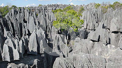
Madagascar’s Karst Limestone Formations
Madagascar’s Spiny Forests
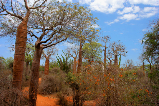
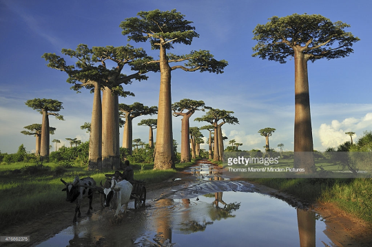
Madagascar’s Baobab Forests
Madagascar’s Subhumid Forests (Madagascar is cool as hell ok)

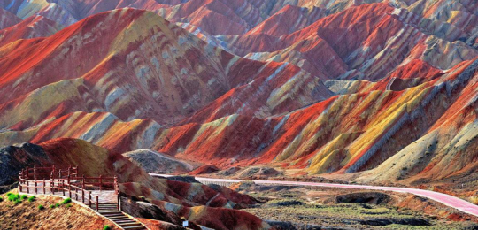
Danxia Landforms
Badlands/Mountainous Deserts

Steppes and Highland Prairies

Flood Basalts


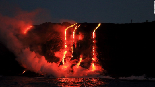
Newly-Formed Islands, still rife with Volcanic activity

Now for Underwater Environments, sure Coral Reefs are cool.

But there are SO MANY other kinds of environments for aquatic settings, it’s unbelievable:
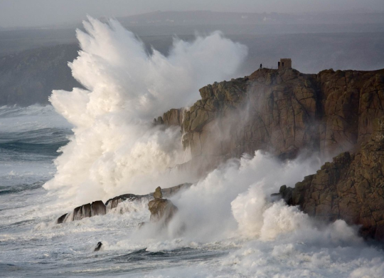
Seaside Cliffs
Archipelagos. Not just Tropical Island chains like Polynesia (Moana anyone?) but also Coldwater Archipelagos like the Aleutians.


Tidal Flats

Bayous/Cypress Swamps


Tropical River Basins, AKA Seasonally Flooded Rainforests
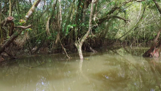
Mangrove Swamps/Deltas/Beaches
Kelp Forests
The Open Ocean

Coastal Seabeds
Rocky Beaches with Tidepools

And there are a LOT more I could name but this post is already obscenely long as is, if you’d like to toss in your own go right ahead, but my point is if you limit yourself to European Deciduous Forests you’re a wimp.
109K notes
·
View notes
Link
Sapphire blue 100 denier opaque tights
2 notes
·
View notes
Note
I hope this isn't a silly question but can beaches be in downtown areas? I personally live in a downtown area full of high rises with the harbour right in front of it. So why can't harbour be replaced with beach. Also some beach pics I find actually have lots of high rises in the backdrop, aren't those downtown areas too? Anyway both my beta and a writing friend are saying that beach in downtown makes no sense.
Synth: Downtown beaches are absolutely a thing that exist, though depending on the level of urbanization, they may not be naturally occurring ones. Last year the city I live in built a permanent beach downtown. Replaced an old docking area with gently sloping concrete slabs and dumped a whole load of sand on them. It has been very popular. IIRC Paris does something similar, trucking in huge amounts of sand to build temporary beaches in a few spots along the Seine during summertime (IDK what happens with all the sand when summer is over). If your city was carefully planned by the original builders, it’s not far-fetched at all to think they would have worked around any already existing natural beaches to preserve them for its citizens’ use.
Tex: I need to orient myself a little bit on this question, so I’m going to pull out a few definitions here.
Downtown:
Downtown is a term primarily used in North America by English-speakers to refer to a city's commercial, cultural and often the historical, political and geographic heart, and is often synonymous with its central business district(CBD). In British English, the term "city centre" is most often used instead. The two terms are used interchangeably in Colombia.
The Oxford English Dictionary's first citation for "down town" or "downtown" dates to 1770, in reference to the center of Boston.[2] Some have posited that the term "downtown" was coined in New York City, where it was in use by the 1830s to refer to the original town at the southern tip of the island of Manhattan.[3] As the town of New York grew into a city, the only direction it could grow on the island was toward the north, proceeding upriver from the original settlement, the "up" and "down" terminology coming from the customary map design in which up was north and down was south.[3] Thus, anything north of the original town became known as "uptown" (Upper Manhattan), and was generally a residential area, while the original town – which was also New York's only major center of business at the time – became known as "downtown" (Lower Manhattan).[3]
Beach:
A beach is a landform alongside a body of water which consists of loose particles. The particles composing a beach are typically made from rock, such as sand, gravel, shingle, pebbles. The particles can also be biological in origin, such as mollusc shells or coralline algae.
Some beaches have man-made infrastructure, such as lifeguard posts, changing rooms, showers, shacks and bars. They may also have hospitality venues (such as resorts, camps, hotels, and restaurants) nearby. Wild beaches, also known as undeveloped or undiscovered beaches, are not developed in this manner. Wild beaches can be appreciated for their untouched beauty and preserved nature.
Beaches typically occur in areas along the coast where wave or current action deposits and reworks sediments.
Harbour:
A harbor or harbour (see spelling differences; synonyms: wharves, haven) is a sheltered body of water where ships, boats, and barges can be docked. The term harbor is often used interchangeably with port, which is a man-made facility built for loading and unloading vessels and dropping off and picking up passengers. Ports usually include one or more harbors. Alexandria Port in Egypt is an example of a port with two harbors.
Harbors may be natural or artificial. An artificial harbor can have deliberately constructed breakwaters, sea walls, or jettys or they can be constructed by dredging, which requires maintenance by further periodic dredging. An example of an artificial harbor is Long Beach Harbor, California, United States, which was an array of salt marshes and tidal flats too shallow for modern merchant ships before it was first dredged in the early 20th century.[1] In contrast, a natural harbor is surrounded on several sides by prominences of land. Examples of natural harbors include Sydney Harbour, Australia and Trincomalee Harbour in Sri Lanka.
Since “downtown” usually means a highly-developed area, there’s a 50/50 chance that they’ll even be near a body of water - and if they are, the coastal areas are possibly also developed into harbours/wharves because water transportation of goods is economically efficient. Under these constraints, a beach would be a stretch of un- or under-developed coastline that doesn’t generate as much revenue for the taxable area it’s connected to compared to a harbour.
Frequently, beaches generate revenue under the auspices of tourism, which means that the area would be cultivated accordingly - esplanades, or promenades, are a popular choice, and often grow near a harbor as a natural extension of a money-generating area. Seaside resorts are a closely-related cousin of esplanades, and sometimes have the focus of being a retreat.
Many of the beaches I’ve been to that have high-rises in the background are either those of hotels - who might own the beach property adjacent to their building(s) - or those of businesses. Idyllic beachfront properties that have a low overall skyline can be low-populated areas (which usually mean drawing a low-income from tourism), protected areas of varying degrees, unsafe for people to play in, or are owned by people in the immediate residential areas and thus private property.
Artificially-constructed beaches, as Synth mentioned, are possible but often costly because of the amount of effort and material that needs to be brought in. Those who build such things need to consider the possible costs and revenue of a beach compared to a harbor, and whether it would be financially beneficial for the area to convert it.
Highly-developed areas like city centers carry the risk of polluting the nearby environment, as evidenced by the history of:
The Nashua River in the US
The Ganges River of the Indian subcontinent
The Citarum River in Indonesia
The Yellow River in China
The Sarno River in Italy
The Matanza River of Argentina
The Gulf of Mexico “dead zone”
The Kamilo Beach of Hawai’i
Guanabara Bay in Rio de Janeiro, Brazil
Bajos de Haina in the Dominican Republic
Hann Bay in Senegal
Your beta and writing friend do, unfortunately, have a point - downtown beaches are rarely a thing, and if they are then they’re not likely to be very well-maintained or aesthetically-pleasing. It is possible to have one, if they follow the model that Synth mentioned, but it’s usually expensive, time-consuming, difficult to keep sufficiently clean, and their existence needs to be balanced against the current revenue-generating area that is probably a harbour.
If the society you’re worldbuilding settles a coastal area with the intent to preserve the coast and develop it into a beach, you have a good shot of putting one into your story, but harbours are disinclined in many ways to be replaced by a beach.
Constablewrites: Our idea of the beach as a pleasant leisure destination seems to have started with the English upper classes in the 1700s, and expanded as the growth of the middle class and advances in travel technology made tourism accessible to a larger population. And the business district of a city is built on commerce, which in our world heavily involves shipping. So if the city was developed before industrialization, its planners were far more likely to look at a beach and think “what a terrible place to unload a ship, we should fix that” than “oh, how pretty, people might come here to relax.” Plus, “downtown” generally refers to an area of only a few square miles at most where real estate is in high demand, so any stretch of open land is unlikely to remain open for long.
Now, because today we do value beaches as pleasant leisure destinations, it’s entirely possible that a city might create an artificial beach along its coast. River beaches are also a thing in several European cities, and many of them are temporary summer installations made with imported sand. And though they’re unlikely to be strictly in the downtown area, you can indeed find beaches in highly urbanized areas like in Miami, Vancouver, and frankly most of Southern California but let’s specifically say Santa Monica. But a city developing organically isn’t going to have a beach unless there’s significant incentive to designate and maintain one instead of using that land for something more lucrative. And unless the city was founded and built specifically around tourism, a beach is always going to be in addition to a city’s harbor, never in place of it. (Hell, even then. Cruise ships were one of the earliest and still an extremely popular method of tourism, and even if your tourists want to see the beach, they’re not getting to it without a harbor.)
Feral: Downtowns may be on waterfronts, but as previously pointed out, downtowns are generally not going to be developed on naturally occurring beaches, here being the sandy, ocean front stretches of land. Tex and Constable bring up great points about economic incentive, but also consider the physical constraints of what can be built on the beach - I think Jesus had something to say about building castles on sand, and as the son of a carpenter, I think he would know. In the States, Chicago and Charleston come to mind as being particularly relevant to your query.
Chicago is on Lake Michigan, which does have a sandy beach that is somewhat removed from downtown by various parks and smaller scale infrastructure. Downtown Charleston is a peninsula formed by the confluence of the Ashley and Cooper Rivers where they join to flow into the ocean, creating a small bay. The beaches associated with Charleston are actually on the nearby islands, not downtown Charleston, which has piers, wharfs, etc, as expected in a city founded by pirates.
A lot of the question of whether you can feasibly “build” a downtown on a beach is how built - literally - up you want it to be. The incredible innovation that went into building Chicago’s downtown, particularly its high rises and skyscrapers, is pretty well known in a general sense but you might want to look into how they were able to accomplish what they have given the very difficult topography. Charleston has no skyscrapers. In addition to the unstable, sandy soil, building in Charleston is made more unstable by being in an earthquake prone area. The big issues with downtowns being on traditional sandy beaches are the quality of the soil and bedrock and the question of erosion, which is a greater issue when dealing with ocean currents and tides.
Basically, it’s not impossible for a downtown area to have a beach, but given the issues that beaches present to building a downtown and the economic influences of why there would or would not be a beach, it’s unlikely without a lot of story behind it. And as you’re writing a story… that might be worthwhile to you. Or it might be a distraction from the story you really want to tell.
44 notes
·
View notes
Last Seen Blogs

lolaakstark
Khaleesi (P.A.K.)

whyso-quiet
not all there.

currencies-europ
Currencies of Europe

lord-ofbears
Grimble Gramble

fap-materials
Fap Collections Teehee