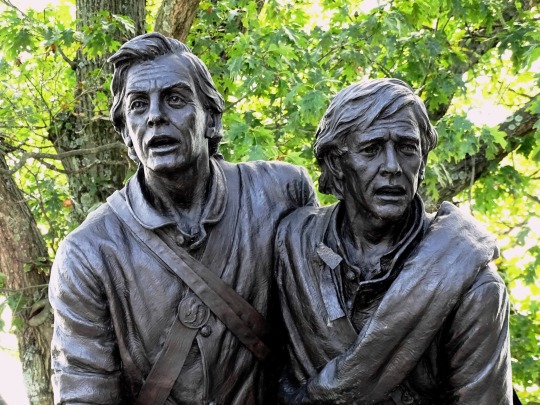
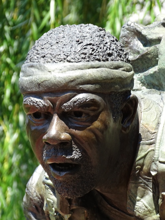
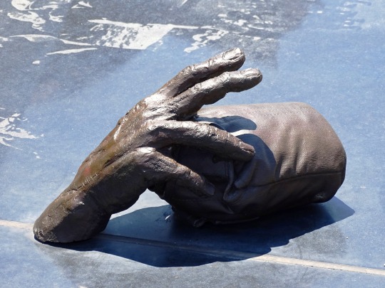
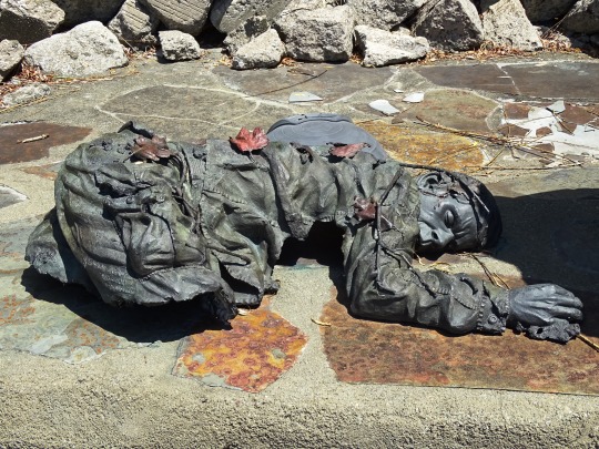
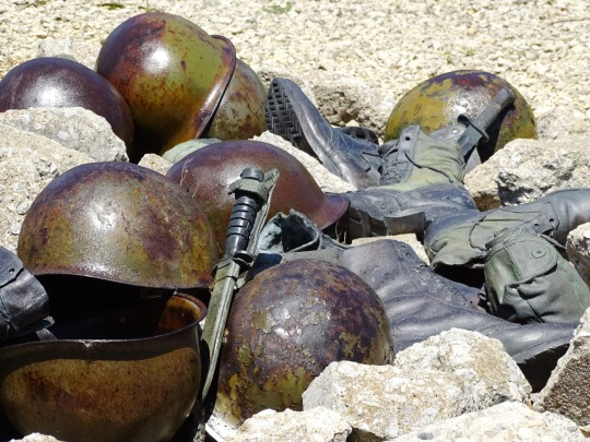
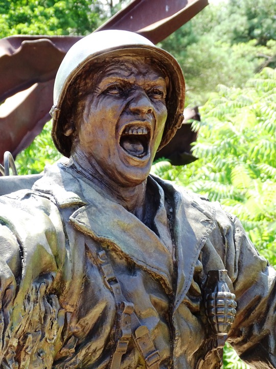
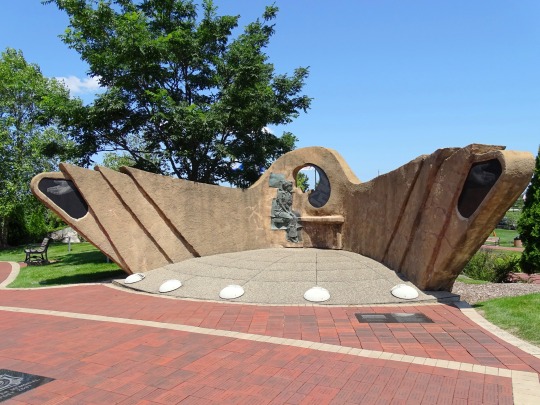
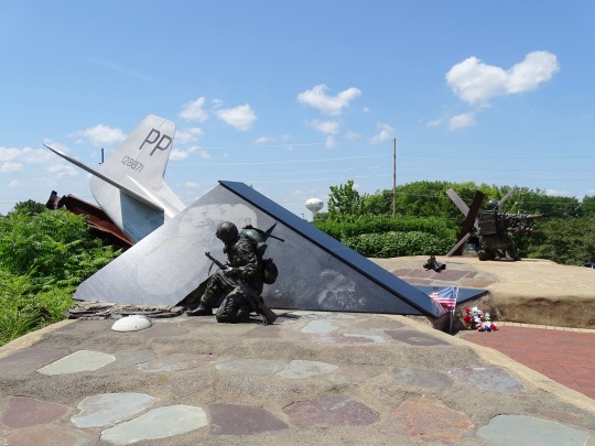
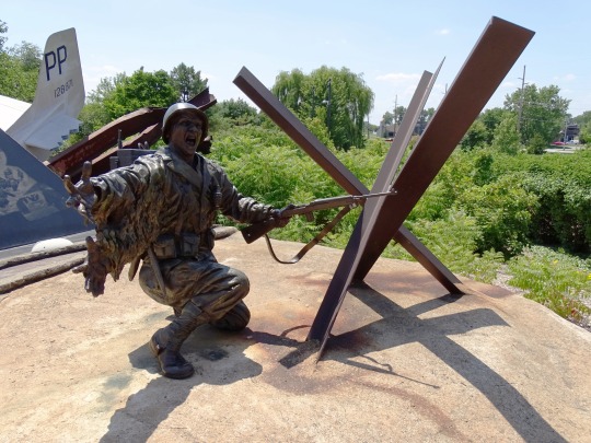
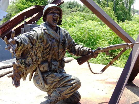
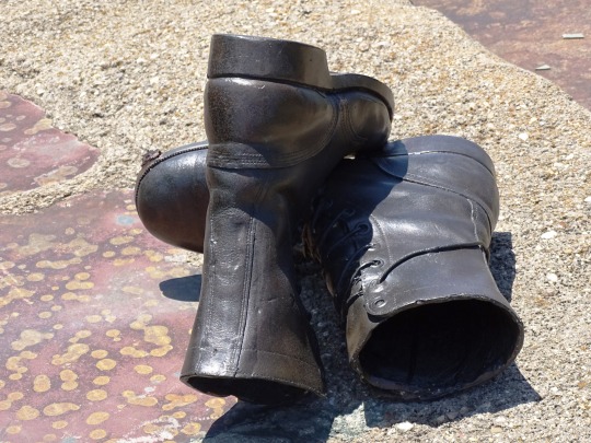
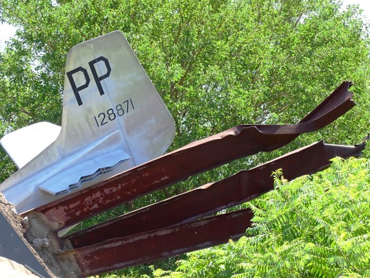
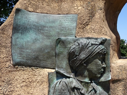
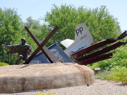
#Pacific Monument
Photo


Memorial Day
Memorial Day on May 29 conjures images of hamburgers, hot dogs, swimming pools, and summertime for many Americans. But the last Monday in May serves, most importantly, as a time to honor those who died while fighting in the U.S. Armed Forces. It’s a holiday steeped in somber American history and tradition. The day actually began as “Decoration Day,” following the Civil War, when mourners placed flowers on the graves of Union and Confederate soldiers. Yes, Memorial Day has also come to signify the “unofficial” start of summer, but let’s remember the heroes who made it all possible.
When is Memorial Day 2023?
Men and women who’ve served and sacrificed their lives in the U.S. Armed Forces are honored on Memorial Day on May 29.
History of Memorial Day
The Civil War ended in the spring of 1865 when Robert E. Lee surrendered the last major Confederate army to Ulysses S. Grant at the Appomattox Court House on April 9. Over 620,000 soldiers died in the four-year conflict. General John A. Logan of the Grand Army of the Republic (an organization of Union veterans) would eventually select May 30, 1868, as a day to pay tribute to the fallen:
“The 30th of May, 1868, is designated for the purpose of strewing with flowers, or otherwise decorating the graves of comrades who died in defense of their country during the late rebellion, and whose bodies now lie in almost every city, village, and hamlet churchyard in the land…”
Logan apparently chose May 30 because flowers would be in bloom all over the country. By the end of the 19th century, Memorial Day ceremonies were being held on May 30 throughout the nation. States passed proclamations, and the Army and Navy adopted rules for proper observance at their facilities.
The crowd attending the first Memorial Day ceremony at Arlington National Cemetery was approximately the same size as those that attend today’s observance — about 5,000 people. Small American flags were placed on each grave — a tradition still followed at many national cemeteries today. In recent years, the custom has grown in many families to decorate the graves of all departed loved ones.
By 1890, each Northern state had made Decoration Day an official holiday. But this was not the case in the South, where states continued to honor their dead on separate days until after the First World War.
The May 30 date held for decades. But, in 1968, Congress passed the Uniform Monday Holiday Act, which established Memorial Day as the last Monday in May in order to create a three-day weekend for federal employees. The change took place in 1971. The same law also declared Memorial Day a federal holiday.
Memorial Day timeline
1864 Beginning of a Tradition
Women from Pennsylvania place flowers on the graves of fallen soldiers after the Battle of Gettysburg.
May 5, 1866 Birthplace of Memorial Day
Waterloo, New York, begins hosting an annual community service in remembrance of soldiers whose lives were lost.
May 5, 1868 It’s Official
Major General John A. Logan issues General Order No.11, making the day official.
2020 Virtual Solidarity
The organization American Veterans (AMVETS) holds a virtual motorcycle rally in honor of Memorial Day.
Traditions of the Day
Many Americans observe Memorial Day by visiting cemeteries or memorials, holding family gatherings, and participating in parades. It’s the three-day weekend that kicks off the summer season and the time for hanging out at the beach and lakes, and barbecuing with friends and family. But Memorial Day is also the most solemn American holiday — a day to remember those who made the ultimate sacrifice while defending their nation.
Towns and cities across the country host grand Memorial Day parades every year, often featuring senior veterans and military personnel. Some of the biggest parades take place in New York, Chicago, and Washington, D.C. Cemeteries and memorials are also visited by Americans, with some citizens wearing or holding red poppies to symbolize those who have fallen in war. This tradition has been around since World War I. Weekend trips and parties are also arranged to balance out the somberness of the day and welcome the summer.
By the Numbers
620,000 – the number of soldiers who died on both sides of the Civil War.
1868 – the year when President James Garfield delivered a very long speech on Memorial Day.
2500 – the number of motorcyclists who participated in the first Rolling Thunder rally.
$1.5 billion – the number of dollars typically spent on meat and seafood in preparation for Memorial Day weekend.
60% – the percentage of American households who attend or host a barbecue on this day.
1.5 million – the number of people who watch the National Memorial Day Parade.
900,000 – the number of people who gathered for the Rolling Thunder Memorial Day motorcycle rally in 2019.
260,000 – the number of graves at Arlington National Cemetery adorned with flags in 2019.
45 million – the number of men and women who have served in a time of war for the U.S.
3 P.M. – the time of day when a moment of silence is observed by Americans throughout the country on this day.
How to Observe Memorial Day
Pay your respects
Participate in the National Moment of Remembrance
Fly the flag
Lay flowers on the grave of a family member or friend who died while serving. If you don't personally know any fallen soldiers, visit a local cemetery anyway. After all, they made the ultimate sacrifice for you.
By doing so, you'll be joining millions of Americans in national unity to honor Memorial Day for what it truly is — a day to remember those who laid down their lives in service of their country and its citizens.
If you have an American flag at home, be sure to fly it at half-mast until noon, then raise it to full mast for the rest of the day. The practice of lowering and then raising the flag has been observed for over 100 years to symbolize America's persistence in the face of loss.
5 CREATIVE WAYS TO DECORATE FOR MEMORIAL DAY
Unfurl those flags
Line your walkway with mini flags
Red, white, and blue layered cake
Stars and Stripes windsocks
Symbolic flowers
Often people store their American flags and raise them only during patriotic holidays. This is definitely one of those days.
Nothing honors our deceased veterans like dozens (or even hundreds) of flags in your front lawn and entryway.
It’s a decoration you can eat.
It’s festive, fun, and patriotic. Need we say more?
Even if you haven’t lost a loved one who served in the military, you can still honor the fallen with flowers at home. Red, navy, and blue dahlias combined with white rose silk flowers can make a stunning visual combination.
Source
#Maryland State Monument by Lawrence Monroe Ludtke#original photography#Gettysburg National Military Park#Community Veterans Memorial#Munster#Indiana#Pennsylvania#Europe Monument#Pacific Monument#Omri Amrany#A Soldier's Sacrifice by Julie Rotblatt-Amrany#Vietnam Veterans Memorial by Maya Lin#Washington DC#summer 2019#2009#free admission#tourist attraction#landmark#architecture#cityscape#Memorial Day#29 May 2023#last Monday in May#MemorialDay
2 notes
·
View notes
Text

Jeffrey pine (Pinus jeffreyi), San Gabriel Mountains National Monument, California, 1990.
#landscape#high altitude#tree#jeffrey pine#pinus jeffreyi#san gabriel mountains national monument#pacific crest trail#los ángeles county#california#1990#photographers on tumblr
170 notes
·
View notes
Text
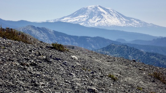
Mt. Adams from Windy Ridge, Mt. St. Helens National Volcanic Monument, Washington, 2014.
#landscape#mountains#vulcanism#blast zone#mt adams#mount st helens national volcanic monument#washington state#2014#photographers on tumblr#pnw#pacific northwest
44 notes
·
View notes
Text
I made a slideshow to go along with Everett Ruess's Poem, Wilderness Song. It features places he went to & things he wrote about: The Sierra Nevadas, Cali coast, Grand Staircase-Escalante, Monument Valley, & the desert sands of the American Southwest.
Listen to the series if you haven't already.
#wilderness song#Everett Ruess#my podcast#the American Southwest#Sierra Nevadas#monument valley#Pacific Ocean#Grand Canyon#adventure#travel#my photo#southwest#desert#mountains#utah#photography#arizona#aesthetic#landscape#poem
54 notes
·
View notes
Text
Colorful Clays of the Painted Hills area

The Painted Hills are one of the most popular and well-known of Oregon's scenic treasures. The towering ridges of yellow, red, and black clays reveal part of the complex geologic story of Oregon when the area was a tropical rainforest, or a hardwood temperate forest, or a volcanic hellscape at different times. The different bands and layers are folded, warped, and faulted by complex plate tectonics. Here though, at Painted Cove just behind the main Painted Hills viewpoint, the story is just a little different.

Painted Cove is a couple of shallow gullies linked in a loop by a boardwalk and trail. In here, you pass through areas of bold red and yellow clays before reaching a gully flanked with a light purple rock. The light purple is of a completely different origin than the clays, which are effectively fossilized soil layers.
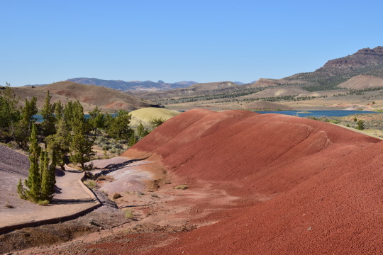
This is a weathered outcrop of rhyolite lava, a lava composition that is mostly quartz by mass. This area grades from purple to brown to red. This is an actual preserved soil horizon. If you dig a hole, you go through different soil horizons - or chemical and physical conditions - before you reach bedrock. Commonly these are O (for organic-rich), A, B, and C. B and C are closest to bedrock and include chunks of weathered, eroded source rock. Here, the purple is that C horizon, then the brown layer is B, and the red is an A horizon mantling the rhyolite lava flow. This whole stack of soil is somewhere around 25 million years old!
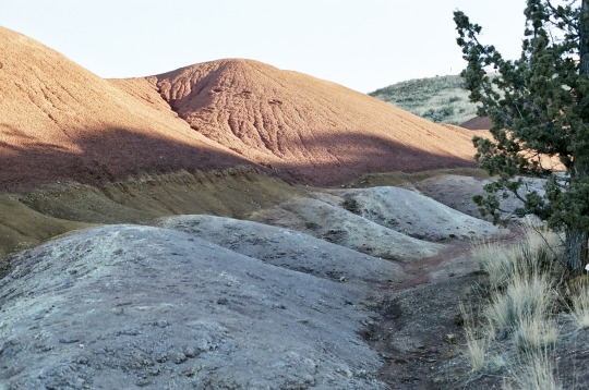
This is one of my favorite rock outcrops in all of Oregon because of how elegantly and simply it displays soil development processes from more than 25 million years ago!
(A note for other geologists: my soil horizon analogy isn't completely accurate since these paleosols have different classifications than regular young soils do, and I'm not very well-versed in those at all)
If you're in to photography, these are (with the exception of the 2nd to last shot) shot on Fuji Color 400 with my Nikon FM2.
#oregon#geology#photography#pacific northwest#bettergeology#adventures#rocks#fujifilm#photographers on tumblr#nikon#film photography#central oregon#eastern oregon#painted hills#john day fossil beds national monument#john day fossil beds
20 notes
·
View notes
Text

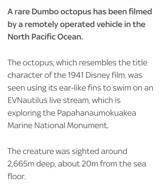

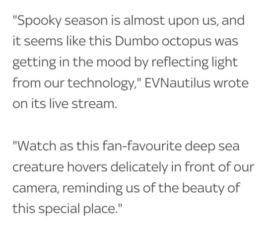
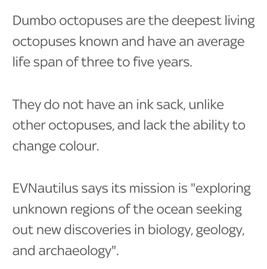

#Dumbo octopus#EVNautilus#Papahanaumokuakea Marine National Monument#North Pacific Ocean#deep sea creature#octopuses#Grimpoteuthis#pelagic cirrate (finned) octopods
13 notes
·
View notes
Text
Papahānaumokuākea Marine National Monument is the largest contiguous fully protected conservation area under the U.S. flag, and one of the largest marine conservation areas in the world. It encompasses 582,578 square miles of the Pacific Ocean (1,508,870 square kilometers) - an area larger than all the country's national parks combined.
Papahānaumokuākea Marine National Monument
#quote#Papahānaumokuākea#Hawaii#Papahānaumokuākea Marine National Monument#nature#conservation#ecology#marine#marine conservation#oceans#Pacific Ocean
7 notes
·
View notes
Video
flickr
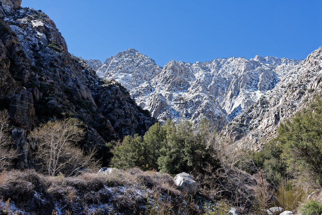
Snow Covered Peaks of the San Jacinto Mountains by Mark Stevens
Via Flickr:
While at the Palm Springs Aerial Tramway with a view looking to the southwest to snow covered ridges and peaks of the San Jacinto Mountains. My thought on composing this image was to take advantage of the way the canyon to my front channeled the view leading up to those distant ridges and peaks. I kept a portion of the blue skies above as I felt it helped to highlight those mountains. The rest was ensuring that I metered the image properly to not below any highlights, while still being able to pull out the nearby shadowed areas later in post production.
#Azimuth 219#Blue Skies#Central and Southern California Ranges#Day 3#Desert Mountain Landscape#DxO PhotoLab 6 Edited#Joshua Tree National Park and California#Landscape#Landscape - Scenery#Looking SW#Mount San Jacinto State Park#Mountain Peak#Mountains#Mountains in Distance#Mountains off in Distance#Mountainside#Nature#Nikon D850#No People#Outside#Pacific Ranges#Palm Springs Aerial Tramway#Peninsular Southern California Ranges#Portfolio#Project365#Ridge#Ridgeline#Ridges#San Jacinto Mountains#Santa Rosa and San Jacinto Mountains National Monument
2 notes
·
View notes
Photo
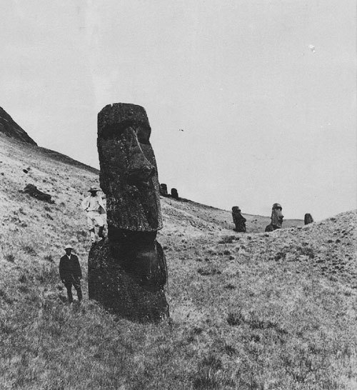
Easter Island c.1880
#Easter Island#photography#b&w photography#black & white photography#archeology#monuments#ancient civilizations#South Pacific#chile#1880#19th century#19th century photography#XIX century
82 notes
·
View notes
Text
Messages
Sometimes messages are loud and clear and easy to read. We especially try to do this with warnings.
Getting to McCarthy is not always easy.
Sometimes they need a little interpretation.
Residents of the Wrangells really like their guns.
But are generally kind, loving people.
Sometimes we read messages from the past, but can no longer understand them.
These petroglyphs are nearly a thousand years…

View On WordPress
#Alaska#climate change#Death Valley#Lens Artists Photo Challenge#Lens-Artists#McCarthy Road#National Monuments#National Parks#nature#Pacific Coast#Washington#wildflowers#wildlife#Wrangell-St. Elias National Park
3 notes
·
View notes
Text
"The U.S. government is entering a new era of collaboration with Native American and Alaska Native leaders in managing public lands and other resources, with top federal officials saying that incorporating more Indigenous knowledge into decision-making can help spur conservation and combat climate change.
Federal emergency managers on Thursday also announced updates to recovery policies to aid tribal communities in the repair or rebuilding of traditional homes or ceremonial buildings after a series of wildfires, floods and other disasters around the country.
With hundreds of tribal leaders gathering in Washington this week for an annual summit, the Biden administration is celebrating nearly 200 new agreements that are designed to boost federal cooperation with tribes nationwide.
The agreements cover everything from fishery restoration projects in Alaska and the Pacific Northwest to management of new national monuments in the Southwestern U.S., seed collection work in Montana and plant restoration in the Great Smoky Mountains.
“The United States manages hundreds of millions of acres of what we call federal public lands. Why wouldn’t we want added capacity, added expertise, millennia of knowledge and understanding of how to manage those lands?” U.S. Interior Assistant Secretary Bryan Newland said during a panel discussion.
The new co-management and co-stewardship agreements announced this week mark a tenfold increase over what had been inked just a year earlier, and officials said more are in the pipeline.
Newland, a citizen of the Bay Mills Indian Community in northern Michigan, said each agreement is unique. He said each arrangement is tailored to a tribe’s needs and capacity for helping to manage public lands — and at the very least assures their presence at the table when decisions are made.
The federal government is not looking to dictate to tribal leaders what a partnership should look like, he said...
The U.S. government controls more than a quarter of the land in the United States, with much of that encompassing the ancestral homelands of federally recognized tribes...
Tribes and advocacy groups have been pushing for arrangements that go beyond the consultation requirements mandated by federal law.
Researchers at the University of Washington and legal experts with the Native American Rights Fund have put together a new clearinghouse on the topic. They point out that public lands now central to the country’s national heritage originated from the dispossession and displacement of Indigenous people and that co-management could present on opportunity for the U.S. to reckon with that complicated legacy...
In an attempt to address complaints about chronic underfunding across Indian Country, President Joe Biden on Wednesday signed an executive order on the first day of the summit that will make it easier for tribes to find and access grants.
Deanne Criswell, administrator of the Federal Emergency Management Agency, told tribal leaders Thursday that her agency [FEMA] began work this year to upgrade its disaster guidance particularly in response to tribal needs.
The Indigenous people of Hawaii have increasingly been under siege from disasters, most recently a devastating fire that killed dozens of people and leveled an entire town. Just last month, another blaze scorched a stretch of irreplaceable rainforest on Oahu.
Tribes in California and Oregon also were forced to seek disaster declarations earlier this year after severe storms resulted in flooding and mudslides...
Criswell said the new guidance includes a pathway for Native American, Alaska Native and Hawaiian communities to request presidential disaster declarations, providing them with access to emergency federal relief funding. [Note: This alone is potentially a huge deal. A presidential disaster declaration unlocks literally millions of dollars in federal aid and does a lot to speed up the response.]
The agency also is now accepting tribal self-certified damage assessments and cost estimates for restoring ceremonial buildings or traditional homes, while not requiring site inspections, maps or other details that might compromise culturally sensitive data."
-via AP, December 7, 2023
#united states#us politics#natural disasters#disaster relief#public lands#land back#indigenous#native american#first nations#indigineous people#sovereignty#president biden#biden administration#hope#good news#land management
592 notes
·
View notes
Text

World War II: Nazi Germany and Slovakia invaded Poland, beginning the European phase of World War II on September 1, 1939.
#World War II#Germany#invaded#Poland#start#WWII#WW2#World War Two#1 September 1939#original photography#vacation#travel#tourist attraction#landmark#architecture#Europe Monument by Omri Amrany#Pacific Monument#Community Veterans Memorial#Munster#Indiana#history#anniversary#USA#summer 2019#Home Front Monument
1 note
·
View note
Photo

Monument at the Top of Rogers Pass Marking Completion in 1962 of the Transcanada Highway (Canada 1), Glacier National Park, British Columbia, 2019.
Additional stretches of the road were completed later, but opening of the Rogers Pass road made it possible to drive from the Atlantic to the Pacific without leaving Canada. I fondly remember a trans-Canada trip in that year.
#highways#monuments#mountain passes#canada 1#rogers pass#british columbia#canada#2019#photographers on tumblr#pnw#pacific northwest
8 notes
·
View notes
Text
Newberry Crater lava flow with East and Paulina Lakes, Oregon, 2014.
#landscape#vulcanism#crater#lava flow#lakes#newberry crater national volcanic monument#deschutes county#oregon#2014#photographers on tumblr#pnw#pacific northwest
10 notes
·
View notes
Text
BREAKING NEWS
NOAA considers sanctuary in waters around Pacific Remote Islands

Today, NOAA announced it is starting the process to potentially designate a new national marine sanctuary in the Pacific Remote Islands area under the Biden-Harris Administration. The proposed area in the central Pacific Ocean includes marine areas within the existing Pacific Remote Islands Marine National Monument, as well as currently unprotected submerged lands and waters, an area totaling about 770,000 square miles.


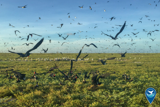

A sanctuary designation would help conserve the atolls, shoals, seamounts, banks and reefs surrounding the Pacific Remote Islands. This area is home to some of the most diverse and remarkable tropical marine ecosystems on the planet, and provides a haven for a host of wildlife, including corals, sharks, fish, marine mammals, seabirds and invertebrates.

NOAA invites the public to comment on the proposed sanctuary designation through June 2, 2023.
#EarthIsBlue#NOAA#News#Science#Marine Conservation#Breaking News#National Marine Sanctuary#Science News#Conservation#Ocean#Pacific Remote Islands#Pacific#Sea#Marine Life#Earth#Nature
1K notes
·
View notes
Text

Why should low-carbon projects be permitted to destroy legendary Native American sacred sites? Yakama elders witnessed the construction of The Dalles Dam that flooded and silenced Celilo Falls on the Columbia River. Since time immemorial, Celilo Falls was one of history’s great marketplaces. Multiple tribes had permanent villages near the falls. Thousands of people gathered annually to trade, feast, and participate in games and religious ceremonies over millennia. During spring, this natural monument surged up to 10 times the amount of water that passes over Niagara Falls today.
What must Indigenous people continue to sacrifice for energy development? The Seattle Times editorial board recently announced support for the Goldendale pumped-storage hydroelectric project to benefit the state’s clean-energy portfolio [“Goldendale energy project can help meet state’s clean-energy needs,” Sept. 2, Opinion]. The board constructed an alternate reality where tribal nations could find common ground with the developer and resolve objections to project construction. The board wrote, “A compromise that would allow the project to go forward while respecting tribal concerns would be a benefit for all.” The board ignores the realities of Native American history and the history of this project, which the Confederated Tribes and Bands of Yakama Nation (Yakama Nation) have objected to from the initial development proposal at this site.
The project site is situated on Pushpum — a sacred site to the Yakama Nation, a place where there is an abundance of traditional foods and medicines. The developer’s footprint proposes excavation and trenching over identified Indigenous Traditional Cultural Properties, historic and archaeological resources and access to exercise ceremonial practices and treaty-gathering rights.
Notably, the project site covers the ancestral village site of the Willa-witz-pum Band and the Yakama fishing site called As’num, where Yakama tribal fishermen continue to practice their treaty-fishing rights.
Yakama Nation opposes the development. The developer proposes two, approximately 60-acre reservoirs and associated energy infrastructure within the Columbia Hills near the John Day Dam and an existing wind turbine complex. The majority of the nearly 700 acre site is undeveloped; the lower reservoir would be located on a portion of the former Columbia Gorge Aluminum smelter site. The tribe’s treaty-reserved right to exercise gathering, fishing, ceremony and passing of traditions in the area of the proposed project has existed since time immemorial. The tribe studied mitigation; it is impossible at this site.
Columbia Riverkeeper, and more than a dozen other nonprofits, stand in solidarity with Yakama Nation and oppose the development: The climate crisis does not absolve our moral and ethical responsibilities. Both tribal nations and environmental organizations have worked tirelessly to stop fossil fuel developments and secure monumental climate legislation in the Pacific Northwest. But we refuse to support a sacrifice zone to destroy Native American cultural and sacred sites in the name of combating climate change.
Environmental justice is on the line with the pumped-storage development. Seventeen tribal leaders sent a letter to Gov. Jay Inslee, urging him to reject development permits. The leaders explained, “Our ancestors signed Treaties with the United States, often under threat of violence and death, in exchange for our ancestral lands and sacred places. Through these treaties, we retain the rights to practice and live in our traditional ways in these places. Yet, the promises made by the government have been broken time and time again.”
Earlier this year, the Washington State Office of Equity, located within the governor’s office, released the state’s inaugural five-year Washington State Pro-Equity Anti-Racism Plan & Playbook. Gov. Inslee stated, “We will no longer replicate and reinforce systems, processes and behaviors that lead to inequities and disparities among various communities.” Now is the time to apply the playbook to climate change and energy siting.
There is no room for compromise. The choice is stark: Continue to advance our nation’s and state’s history of sacrificing Indigenous resources through broken promises, or work with tribes committed to tackling the climate crisis while, at the same time, protecting the last remaining sacred sites.
---
Text by: Jeremy Takala and Lauren Goldberg. “Stop sacrificing Indigenous sacred sites in the name of climate change.” The Seattle Times. 25 September 2022.
4K notes
·
View notes
Last Seen Blogs

faecatastrophe
Iorweth's Strongest Fae

requiemforatem-blog
i have some concerns

reputationaceservice
Untitled

hrryfrat
mar

stickyduckbailiffdonkey-blog
Untitled