
vizcart
Vizcart
Modern and vintage shaded relief maps 🚀vizcart.io
79 posts
Don't wanna be here? Send us removal request.
Last Seen Blogs

byadrawing-blog
Untitled

homeofthehalfbloodshq-blog
🌲 a place to call home 🌲

kitsebastianconnor
Untitled

ceremonials2011
MellowDrama

spiritualgay
Spiritualgay 🔞
Text


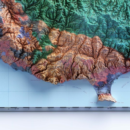
Perhaps the more observant will remember this map of the soil of Cyprus.
We decided to rework it by removing the bathymetric information. This version has reduced saturation and allows for good readability of the labels.
If you like our work, want to see our daily updates (or want to say hello to our studio), consider to follow our Instagram or Twitter account. Otherwise if are interested in our prints or have a custom request check our shop.
0 notes
Text
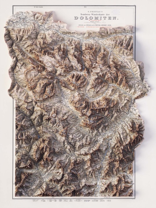
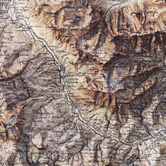
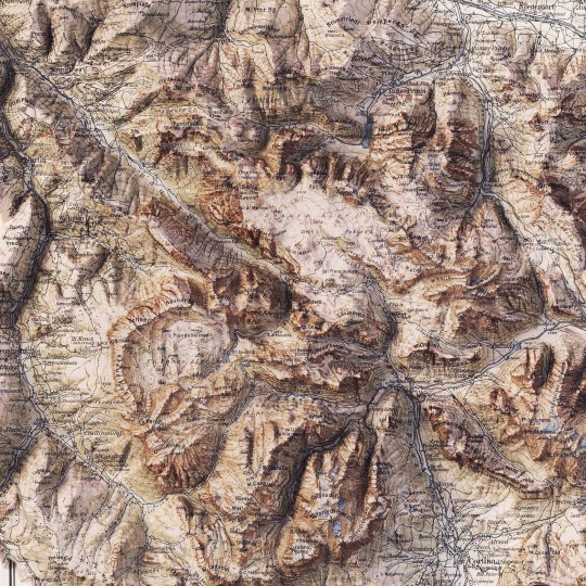
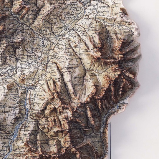
2D printed shaded relief map with 3D effect of a topographic map of Dolomites (Italy), printed and published by G. Freytag & Berndt in 1903.
If you like our work, want to see our daily updates (or want to say hello to our studio), consider to follow our Instagram or Twitter account. Otherwise if are interested in our prints or have a custom request check our shop.
5 notes
·
View notes
Text

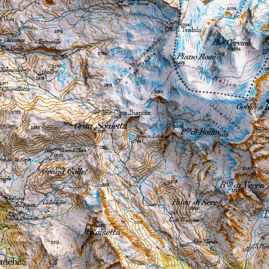
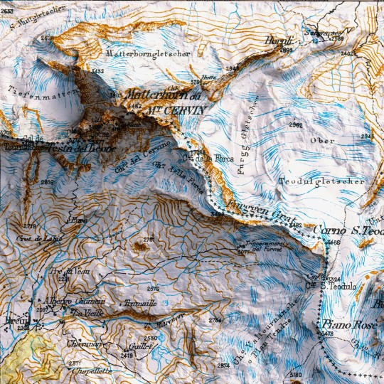
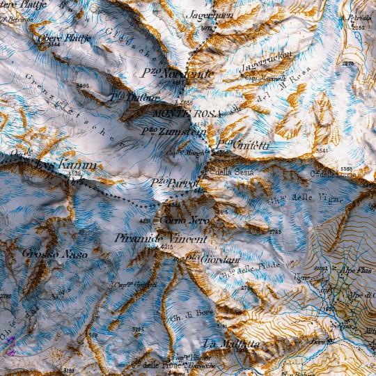
Time for a revamp!
An awesome 1898 map of the Mount Rosa from the collection "Carte du versant italien des Alpes 1899 - 1902".
If you like our work, want to see our daily updates (or want to say hello to our studio), consider to follow our Instagram or Twitter account. Otherwise if are interested in our prints or have a custom request check our shop.
#mattehornglacierparadise#mattehorn#cervinocinemountain#mtrosa#hickingadventures#topographicmap#3dart#3dmap#blender3d#geospatial#geospatialdata#datavizart#dataviz#datavizsociety#vintagemap#shadedrelief#alps#alpi#monterosa#mountain#valledaosta#piemonte#swissalps#italianmountains#vizart
0 notes
Text
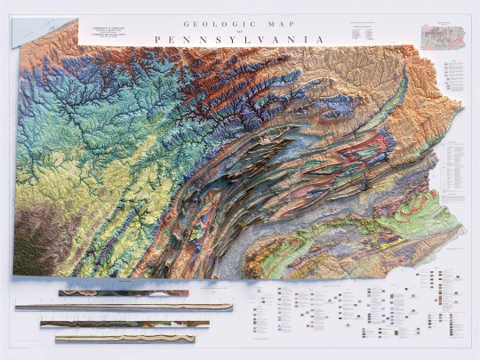
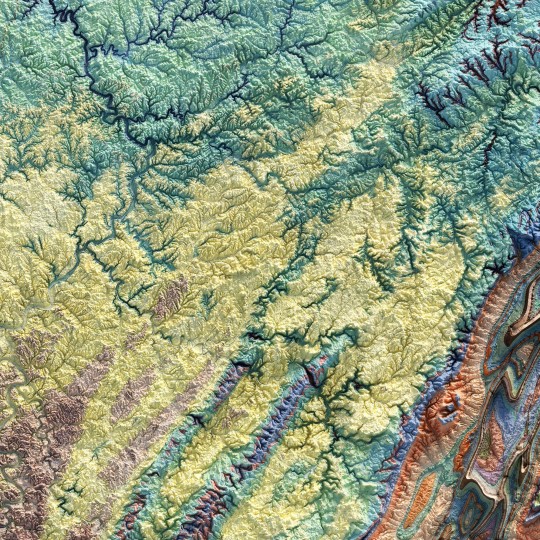
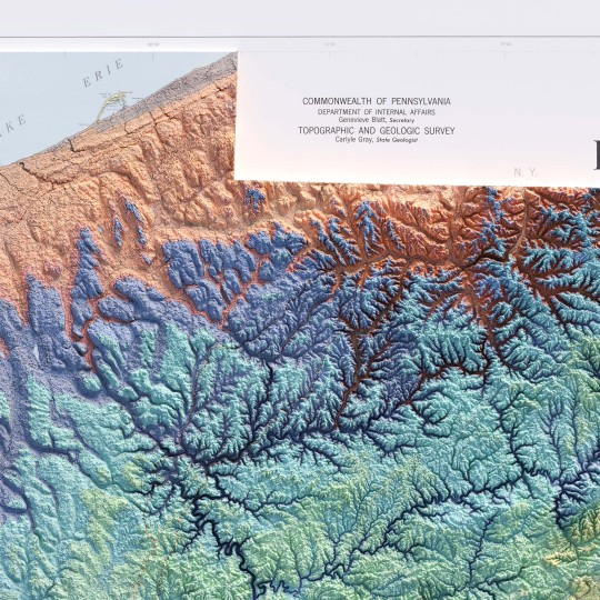
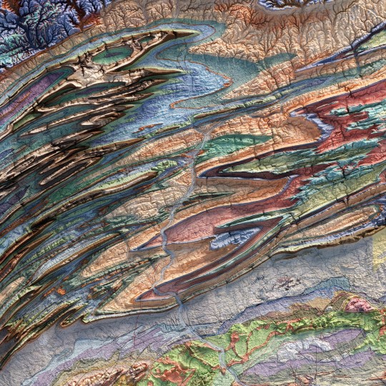
From the 1960s, a (restored) school geological map of Pennsylvania, obviously with shaded relief!
🗺️ 𝗠𝗔𝗣 𝗜𝗡𝗙𝗢
Geologic map of Pennsylvania, Topographic and Geologic Survey, Commonwealth of PA, 1960.
Source: David Rumsey Collection.
If you like our work, want to see our daily updates (or want to say hello to our studio), consider to follow our Instagram or Twitter account. Otherwise if are interested in our prints or have a custom request check our shop.
#Pennsylvania#pittsburgh#usmap#mapdesign#GeologyPA#VintageMap#PennsylvaniaHistory#ShadedRelief#GeologicHeritage#PAExploration#RockFormation#GeologicalTreasure#EarthScience#PennsylvaniaGeology#GeologicWonders#LandscapeHistory#GeologicalArt#ElevationData#GeologicMapping#BedrockGeology#NaturalHistory#GeospatialData#GeologicFeatures#MapArt#vizart
4 notes
·
View notes
Text

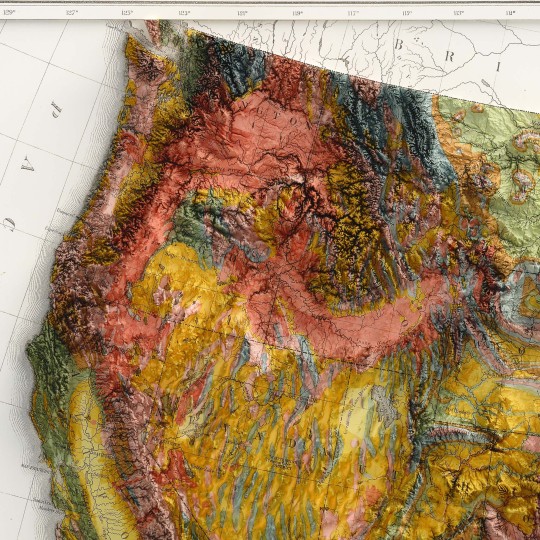


Time for a revamp of a too saturated vintage map. We decided to improve the readibility of the map, so this is a new, balanced USA map of 1874.
🗺️ 𝗠𝗔𝗣 𝗜𝗡𝗙𝗢
Geological map of the United States compiled by C.H. Hitchcock and W.P. Blake from sources mentioned in the text. 1874. Lith. by J. Bien, N.Y.
Source: David Rumsey Collection
If you like our work, want to see our daily updates (or want to say hello to our studio), consider to follow our Instagram or Twitter account. Otherwise if are interested in our prints or have a custom request check our shop.
#usa#statesofamerica#vintageusa#nevada#Wyoming#california#newyorkcity#maine#TimeTravelCartography#VintageMap#antiquecartography#historicalgeography#OldWorldCharm#CartographicTreasure#ShadedRelief#VintageUSA#MapEnthusiast#3dmap#vizart
0 notes
Text
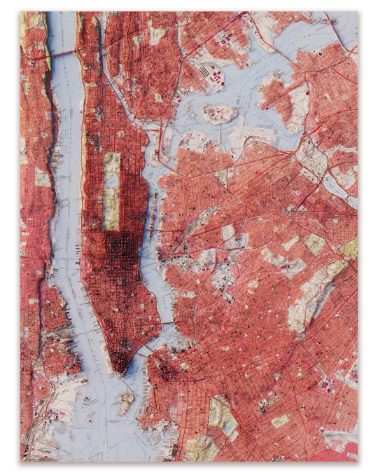
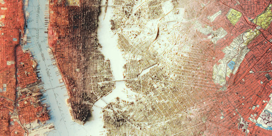
New York City.
We realized this custom print last year, but never published it.
The original map was a 50's map made by USGS.
www.vizcart.io
2 notes
·
View notes
Text


Hydrological map of India. The original map was published in 1973 and with a deep restoration it gains the color and lost some of his years.
If you like our work, want to see our daily updates (or want to say hello to our studio), consider to follow our Instagram or Twitter account. Otherwise if are interested in our prints or have a custom request check our shop.
#datavisualization#reliefmap#geography#mapporn#cartography#mapping#gis#blender3d#dataviz#india#indiamap#nepal#Bangladesh#physicalmap#physicalmapofindia#Everest#VintageMap#vintagemaps#vizart
2 notes
·
View notes
Text
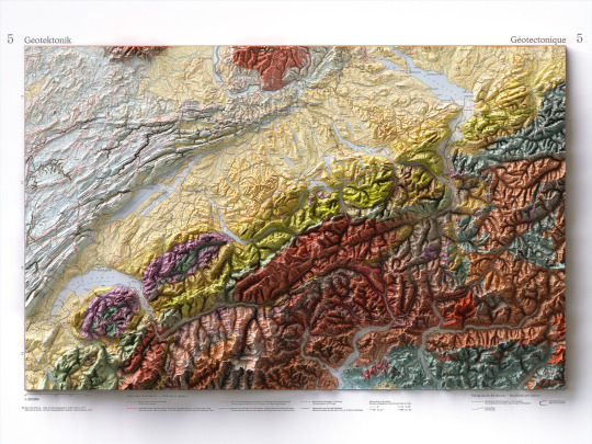
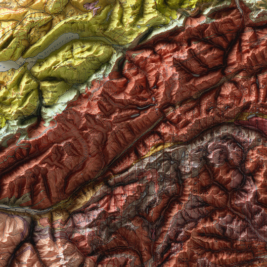
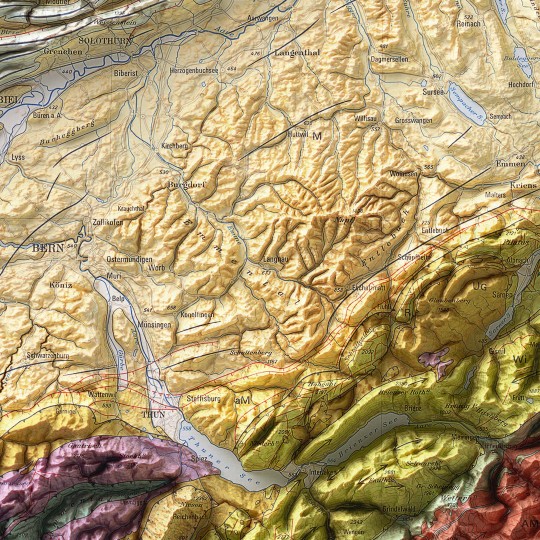
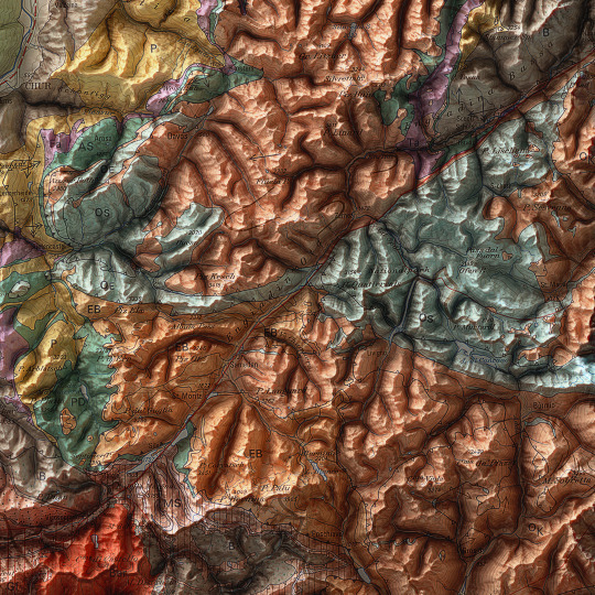
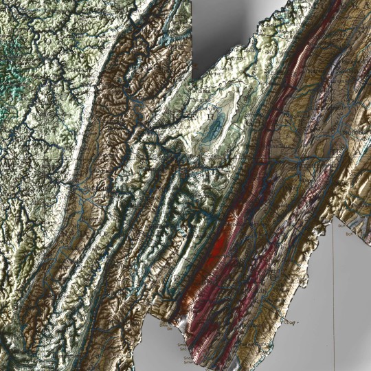
As announced, a new map has been added to the European collection.
We had started this paper years ago, but it had never been finalized. Since we didn't even have a dedicated map of Switzerland yet, we thought it was appropriate to remediate!
This is a geotectonic map of Switzerland that among the authors also has Imhof. It was realized in 1972 but published in 1978 inside the Atlas of Switzerland.
You can find the original sheet in the David Rumsey Map Collection.
If you like our work, want to see our daily updates (or want to say hello to our studio), consider to follow our Instagram or Twitter account. Otherwise if are interested in our prints or have a custom request check our shop.
#switzerlandnature#switzerland🇨🇭#switzerlandtour#switzerlandmylove#switzerlandvacations#berna#ticino#ticinoturismo#geneva#ginevra#geotettonica#geotectonic#geologia#geologist#MapCenter#designmap#shadedreliefmap#shadedrelief#gis#blenderart#blenderartist#cartography#imhof#imhoff#digitaldesign#digitaldesigner
8 notes
·
View notes
Text
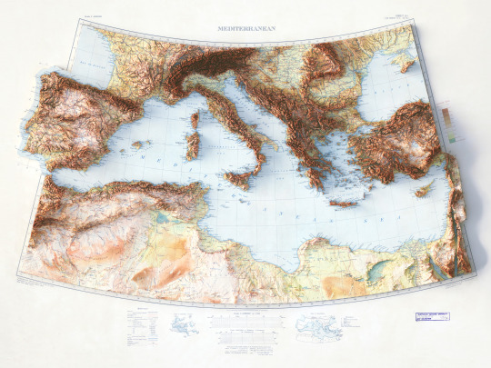
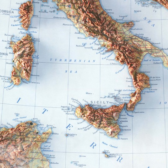


This map is not a revamped map, just a little improved with soft color correction.
We made this map with great effort, both because the map we started from was very beautiful and because of what the Mediterranean represents to us.
So let's reintroduce the Mediterranean Sea map.
If you like our work, want to see our daily updates (or want to say hello to our studio), consider to follow our Instagram or Twitter account. Otherwise if are interested in our prints or have a custom request check our shop.
#printdesign#topographic#VintageMap#topography#shadedrelief#shadedreliefmap#3dmap#3dcartography#Mediterranean#mediterraneansea#mediterraneansea🌊#mediterranee#italy🇮🇹#spain🇪🇸#france#turkey#greece#tunísia#morocco#tripoli#tripolitania#cyrenaica#Libya#gulfofsuez
0 notes
Text


A new map from the past.
This was supposed to be part of a great new series on North America, but we are not currently free enough to plan a thematic collection, so we hope you will still enjoy the end result and digital restoration of this 1932 Geological map of West Virginia.
🗺️ 𝗠𝗔𝗣 𝗜𝗡𝗙𝗢
Geological map of West Virginia, West Virginia Geological and Economic Service, 1932.
If you like our work, want to see our daily updates (or want to say hello to our studio), consider to follow our Instagram or Twitter account. Otherwise if are interested in our prints or have a custom request check our shop.
#printdesign#3dmap#topographic#VintageMap#vintagemaps🗺#storicalmaps#usamap#usamaps#USGS#WestVirginia#westvirginiamountains#westvirginiauniversity#Virginia#UnitedStates#cartography#cartographyproject#cartographycommunity#geologia#geological#geologists
0 notes
Text
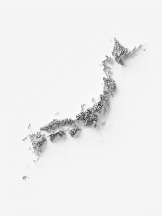
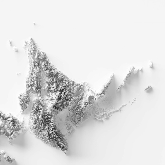
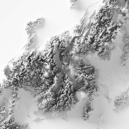
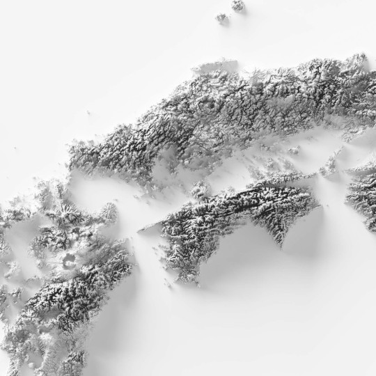
Today we share a minimalist elevation map of Japan, with soft lighting, low contrast, and exaggerated relief.
If you like our work, want to see our daily updates (or want to say hello to our studio), consider to follow our Instagram or Twitter account. Otherwise if are interested in our prints or have a custom request check our shop.
#japan#japantravel#japanese#japantrip#nippon#nippon_lovers#lovejapan#fuji#maps#mapofasia#cartography#cartografía#digitalart#digitalartist#designlovers#designstudio#asiatravel#tokyo#tokyojapan
1 note
·
View note
Text
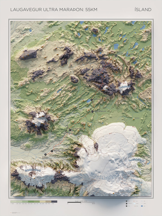
Laugavegur - ULTRA maraþon
How we realized a requested custom map of the Laugaver Ultra marathon, the 55km off road race in the southern islands of Iceland.
#iceland#ultra marathon#topografia#topographic map#glacier#shadedrelief#cartographyart#3dmap#custom map#mappart#vizart studio
1 note
·
View note
Text


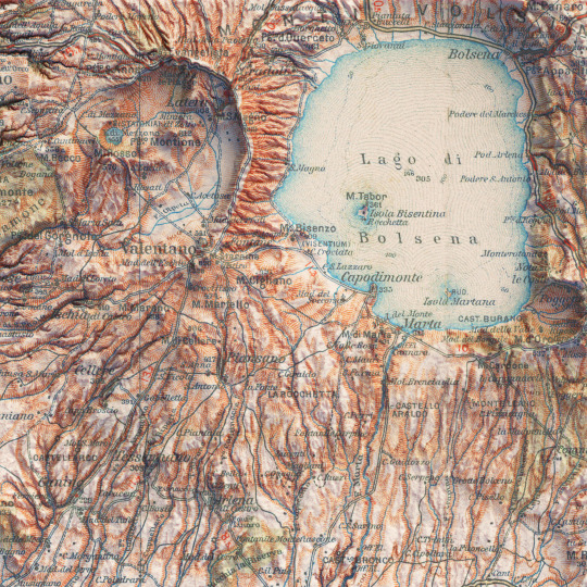
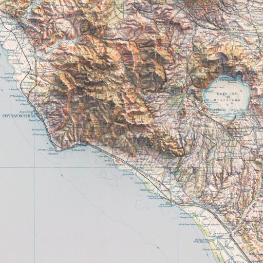
Italian Touring Club map: Civitavecchia. This map was realized by the geographic institute De Agostini and dates back to 1946-50. This map as a whole is marvellous for the simple clarity of the drawing, which highlights the volcanic conformations of the main lakes in Lazio.
If you like our work, want to see our daily updates (or want to say hello to our studio), consider to follow our Instagram or Twitter account. Otherwise if are interested in our prints or have a custom request check our shop.
#civitavecchia#lazio#italy#volcanic lakes#lago di vico#lago di bolsena#lago di bracciano#cartography#topography#vintage maps#old prints#shaded relief maps#touring club#topographic map#mapporn#vintage italy
2 notes
·
View notes
Text
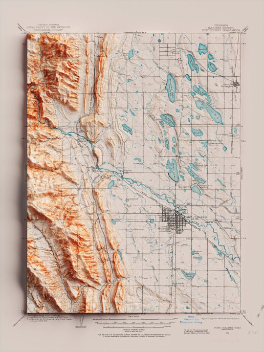
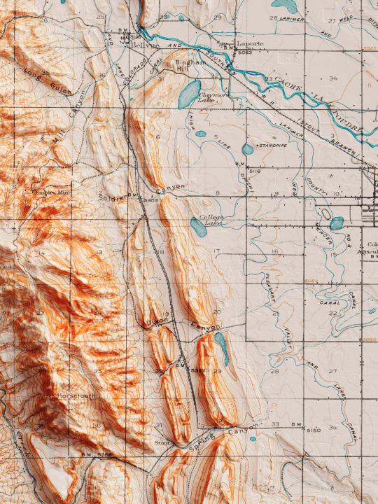
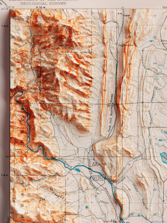
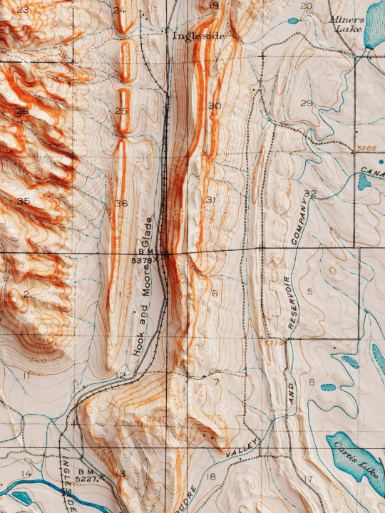
Shaded relief map with 3D effect of a topographic map of Fort Collins, Colorado (United States of America), in the quadrangle series and prepared and published by U.S. Geological Survey in 1906.
If you like our work, want to see our daily updates (or want to say hello to our studio), consider to follow our Instagram or Twitter account. Otherwise if are interested in our prints or have a custom request check our shop.
#homedecor#shadedrelief#shadedreliefmaps#map#cartography#cartographer#cartographie#cartographycommunity#vintagecartography#usa#usa🇺🇸#fortcollins#fortcollinsart#fortcollinscolorado#coloradogram#coloradotography#coloradosprings#3darts#digitalart#digitalartist#blendercycles#blenderartist#fineartprints#fineartprintshop#fineartprintstore#fineartprintstudio
7 notes
·
View notes
Text
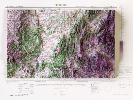
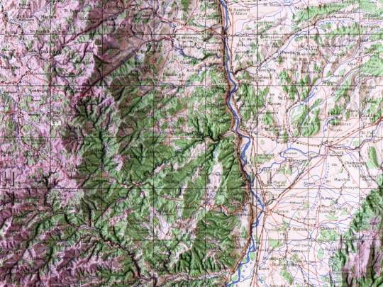
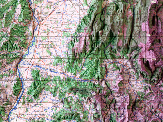
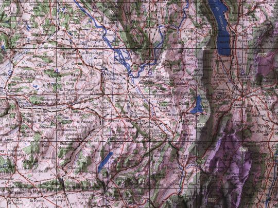
In its entirety, the map of Grenoble from the GSGS 2738 series, made by the British Army in 1943. The map is scale 1:250000 and the style of the series is conform to army/air requisitory, as specified by notes of the GSGS.
If you like our work, want to see our daily updates (or want to say hello to our studio), consider to follow our Instagram or Twitter account. Otherwise if are interested in our prints or have a custom request check our shop.
#grenobleturism#grenoblemaville#mappart#monclergrenoble#visitgrenoble#grenobleturisme#hystoricalplace#france🇫🇷#grenoblehistory#cartographie#bookstagram#map#mapofeurope#shadedrelief#elevationmap#artofmapping#alps#francetourisme#Francia#cartedefrance#wwii#wwiiaviation
1 note
·
View note
Text

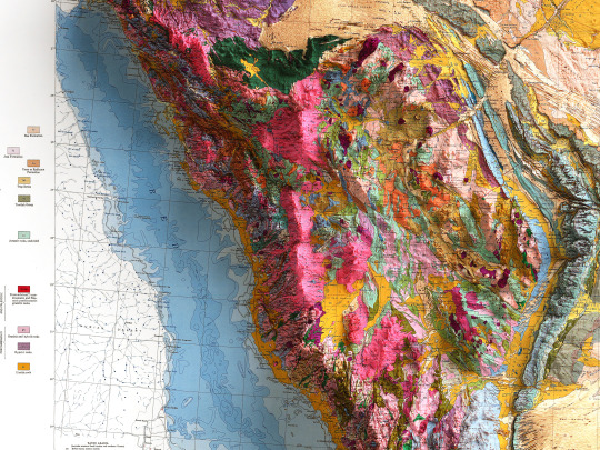
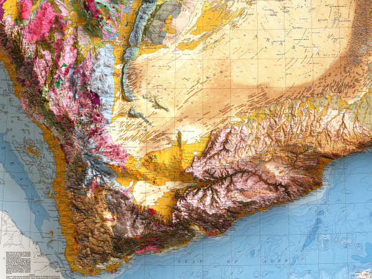
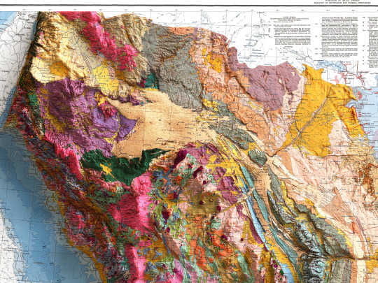
With this soil map, we go a long way from home as we explore the Arabian Peninsula.
The map was realised in 1963 through the joint sponsorship of the governments of the United States and Saudi Arabia.
🗺️ 𝗠𝗔𝗣 𝗜𝗡𝗙𝗢
Soil map of the Kingdom of Saudi Arabia. Ministry of petroleum and mineral resources. Compiled by the U.S. Geological Survey and the Arabian American Oil Company untder the joint sponsorship of the Kingdom of Saudi Arabia, Ministry of the Petroleum and Mineral Resources, and the U.S. Department of State; 1963.
If you like our work, want to see our daily updates (or want to say hello to our studio), consider to follow our Instagram or Twitter account. Otherwise if are interested in our prints or have a custom request check our shop.
#saudiarabia#saudiarabian#arabianpeninsula#geologyporn#mapporn#cartography#cartographyart#cartographycommunity#oilcompany#geologicalsurvey#shadedrelief#petroleum#petroleumgeology#3dmap#3dmapping#yémen#asiamaps
1 note
·
View note
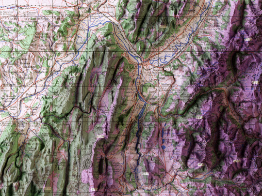
Text

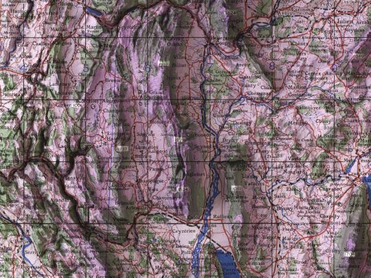

Lyon, topographic map realized by the British army in 1943.
Roads from this G.S.G.S. series are taken from Michelin maps at a scale of 1 : 200 000.
map info:
Lyon. GSGS (Series); 2738. 2nd ed.,Great Britain. War Office. General Staff. Geographical Section. 1943.
If you like our work, want to see our daily updates (or want to say hello to our studio), consider to follow our Instagram or Twitter account. Otherwise if are interested in our prints or have a custom request check our shop.
#mapping#travel#lyoncity#traveladdict#mapart#geography#mapmaking#geografia#history#france#countries#lyonnaise#lyon#urbanphotography#maps#mappe#CARTE#cartedefrance#dataviz#cartography#blender3d#shadedrelief
6 notes
·
View notes