#elevationmap
Text
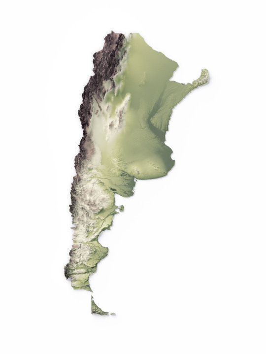
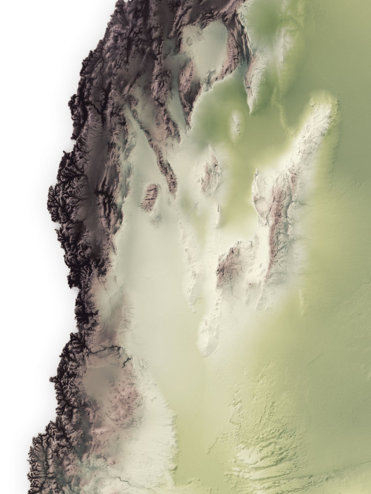
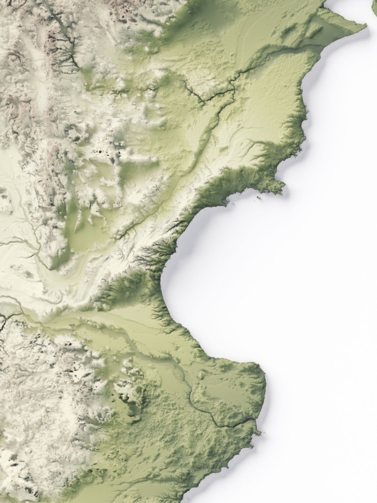

We made a series of elevation maps of Argentina.
The first shows the geological gradient starting with deep green and ending with the highest point on dark brown.
If you like our work, want to see our daily updates (or want to say hello to our studio), consider to follow our Instagram or Twitter account. Otherwise if are interested in our prints or have a custom request check our shop.
#argentina#argentinaig#argentinatravel#argentina🇦🇷#southamerica#southamericatrip#sudamérica#latinamerican#mappe#map#cartography#cartographyartist#cartographycommunity#cartographymagazine#cartographycollective#cartographyproject#GIS#elevationmap#america#geography#geografía#shadedreliefmaps#mapoftheworld
13 notes
·
View notes
Video
Laying out the town for my comic Cold Iron. Even have an elevation map. Getting real into this. #coldiron #3dmodeling #city #comics #indicomics #maps #elevationmap #mfdoom #madvillain #accordion
1 note
·
View note
Text
Just saw the trailer for fox’s show 9-1-1
It showed a tsunami that towered over the Santa Monica pier and emergency sirens only going on when the wave was about to hit.

Now I looked up the shows description...

So it draws from real life high pressure experiences but when is there ever going to be a wave that big? The tsunami in the Indian Ocean reached heights of 100ft and that was caused by a 9.1 earthquake. While tsunamis do travel quickly for one to be that size wouldn’t there have had to be an earthquake fairly close to Southern California and so there shouldn’t be that many people on the beach especially with how many people are watching for tectonic activity and tsunami bouys will report a tsunami coming if the earthquake was too far too feel.
A topographical map of Santa Monica shows the cliffs are a little over 100ft high.

Map source: http://www.floodmap.net/Elevation/ElevationMap/?gi=5393212
While the marina and Venice will suffer severe damage, the upslope of Santa Monica after the cliffs will likely severely limit the damage of a tsunami impact. I didn’t even mention the islands that are off the shore which will take away some of the tsunami’s energy
I guess they went with the shock factor for this one instead of thinking if a tsunami of that size is something could occur in that area
0 notes
Link
0 notes
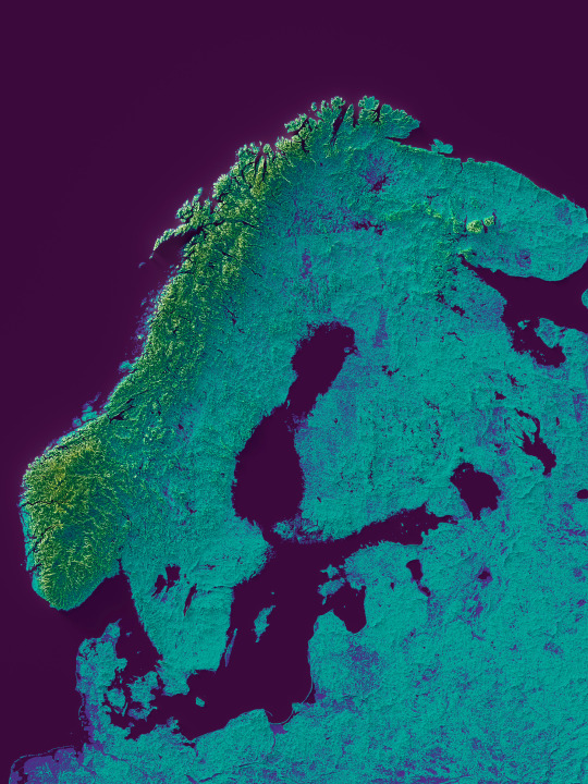
Text
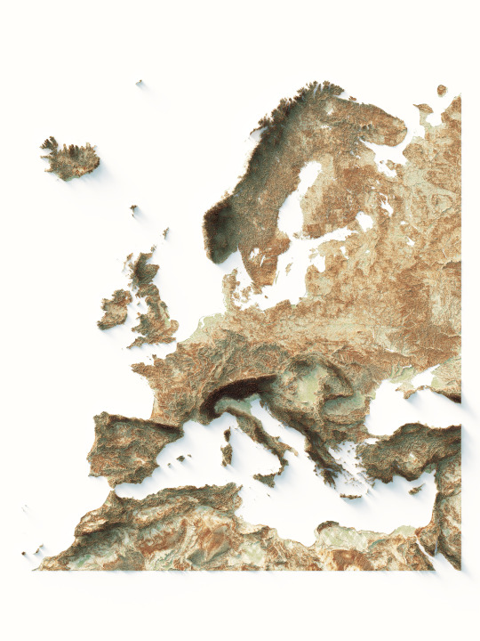

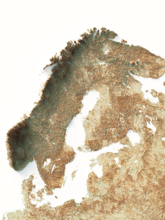
Shaded relief map of Europe.
We use geo palette with hypsometric coloration.
If you like our work, want to see our daily updates (or want to say hello to our studio), consider to follow our Instagram or Twitter account. Otherwise if are interested in our prints or have a custom request check our shop.
#elevationmap#elevationtint#europe#maps#mapstagram#topographicmaps#mapsarecool#europemap#green#traveler#cartography#europa#geography#geoart#european#datavizsociety#europe trip#geographic#geografia
2 notes
·
View notes
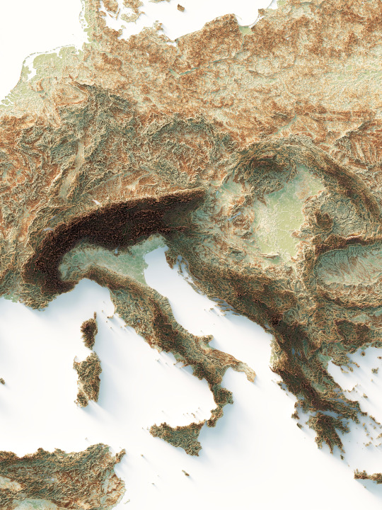
Text


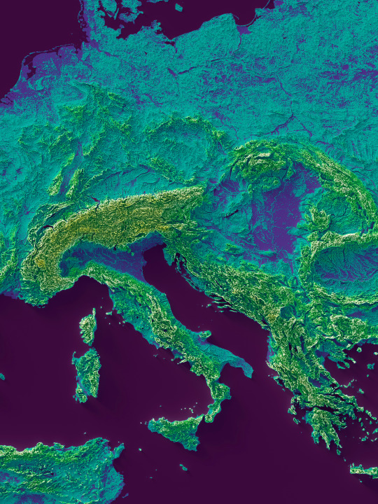
New map of Europe. The result is really pop!
The gradient colour used for this map is called Viridis.
If you like our work, want to see our daily updates (or want to say hello to our studio), consider to follow our Instagram or Twitter account. Otherwise if are interested in our prints or have a custom request check our shop.
#elevationmap#elevationtint#europe#maps#mapstagram#topographicmaps#mapsarecool#europemap#green#traveler#cartography#europetrip#europa#geography#geoart#european#datavizsociety
2 notes
·
View notes
Text
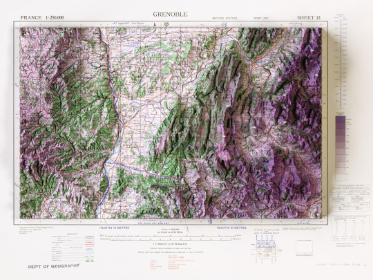
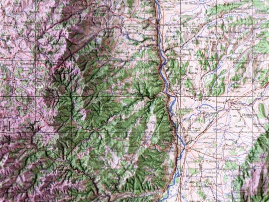
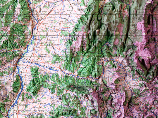
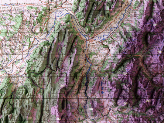
In its entirety, the map of Grenoble from the GSGS 2738 series, made by the British Army in 1943. The map is scale 1:250000 and the style of the series is conform to army/air requisitory, as specified by notes of the GSGS.
If you like our work, want to see our daily updates (or want to say hello to our studio), consider to follow our Instagram or Twitter account. Otherwise if are interested in our prints or have a custom request check our shop.
#grenobleturism#grenoblemaville#mappart#monclergrenoble#visitgrenoble#grenobleturisme#hystoricalplace#france🇫🇷#grenoblehistory#cartographie#bookstagram#map#mapofeurope#shadedrelief#elevationmap#artofmapping#alps#francetourisme#Francia#cartedefrance#wwii#wwiiaviation
1 note
·
View note
Last Seen Blogs
serrr
SERRR

emanueleiaia
Only photos taken with iPhone 5

crownedclaw
The only reason I’m fat is that a tiny body couldn’t store a

gachamiddleschool
Gacha Middle School
whoracle
!