#shadedrelief
Text
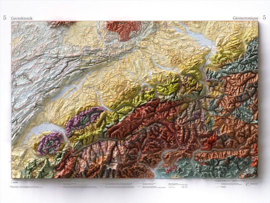
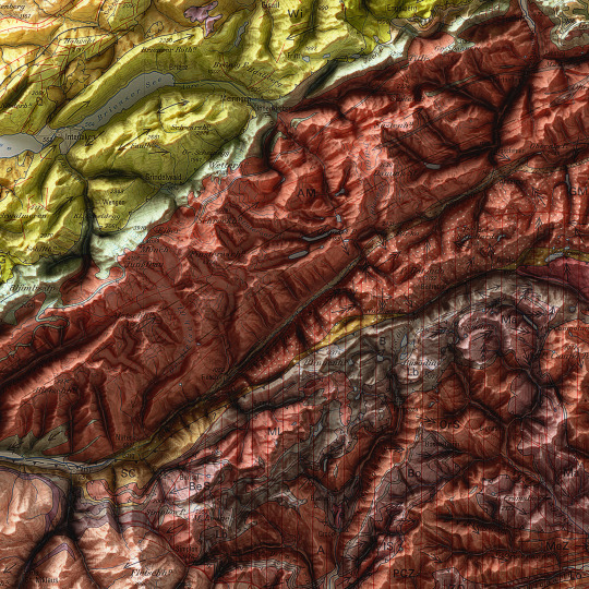
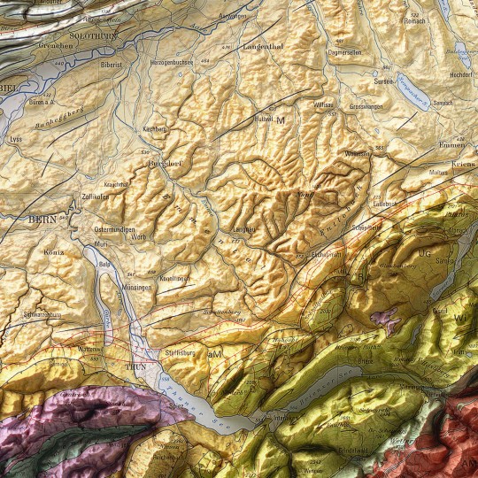
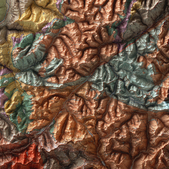
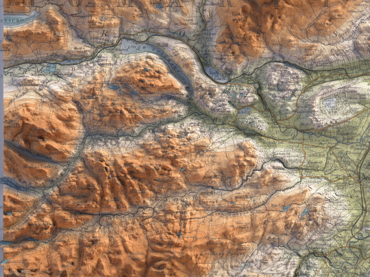
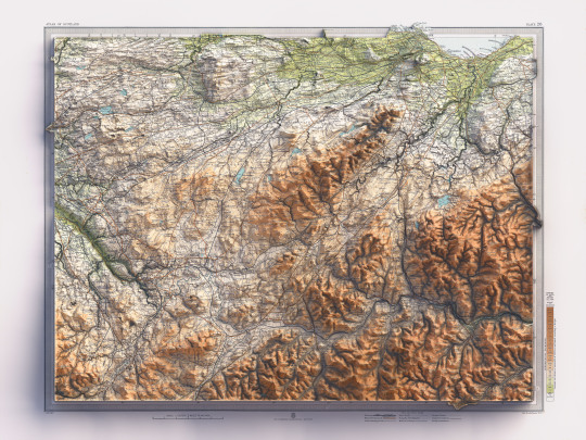
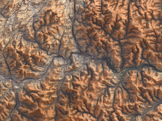
As announced, a new map has been added to the European collection.
We had started this paper years ago, but it had never been finalized. Since we didn't even have a dedicated map of Switzerland yet, we thought it was appropriate to remediate!
This is a geotectonic map of Switzerland that among the authors also has Imhof. It was realized in 1972 but published in 1978 inside the Atlas of Switzerland.
You can find the original sheet in the David Rumsey Map Collection.
If you like our work, want to see our daily updates (or want to say hello to our studio), consider to follow our Instagram or Twitter account. Otherwise if are interested in our prints or have a custom request check our shop.
#switzerlandnature#switzerland🇨🇭#switzerlandtour#switzerlandmylove#switzerlandvacations#berna#ticino#ticinoturismo#geneva#ginevra#geotettonica#geotectonic#geologia#geologist#MapCenter#designmap#shadedreliefmap#shadedrelief#gis#blenderart#blenderartist#cartography#imhof#imhoff#digitaldesign#digitaldesigner
8 notes
·
View notes
Photo
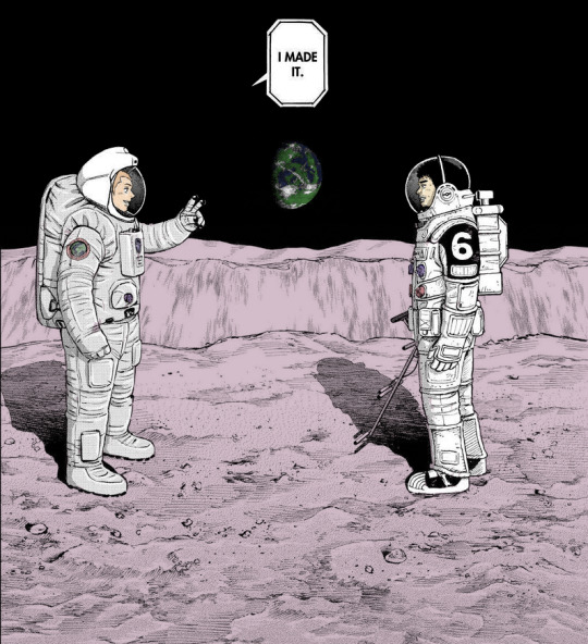
#space brothers#uchuu kyoudai#when the brothers... are in space 🥺🥺🥺#caps#edits#i guess#I have not tried coloring in a looooooong time#got the earth clouds from shadedrelief(dot)com
40 notes
·
View notes
Photo
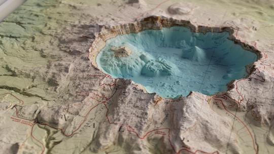
Crater Lake in oblique
by u/shadedrelief
294 notes
·
View notes
Photo
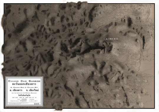
Chiang Dao Sunrise (2017)
Shaded relief map of Thailand’s third tallest peak, at the foot of which Shambhala In Your Heart Festival is held annually in February.
#mostserene#handdrawnmap themapisnotthethingmapped#contours shadedrelief#artmap#mountains doiluangchiangdao
1 note
·
View note
Photo
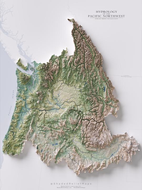
"Hydrology of the Pacific Northwest Region - Stream Order [OC]"- Caption by shadedrelief - Detail: https://ift.tt/37qXZqv. Filed Under: 1,000 ways to visualize Data. Curated by: www.eurekaking.com
0 notes
Text
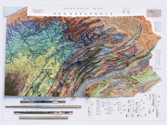
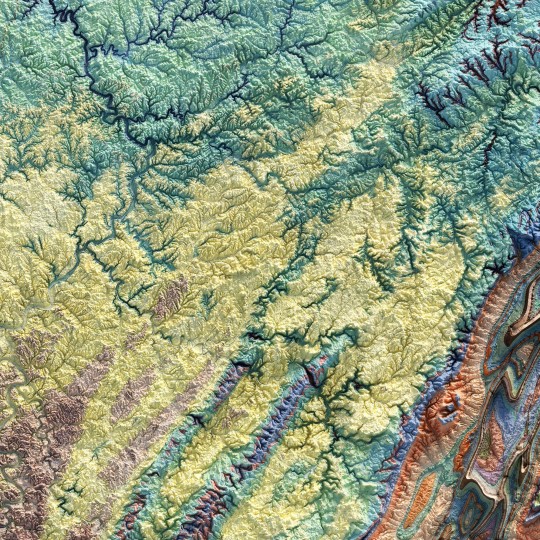
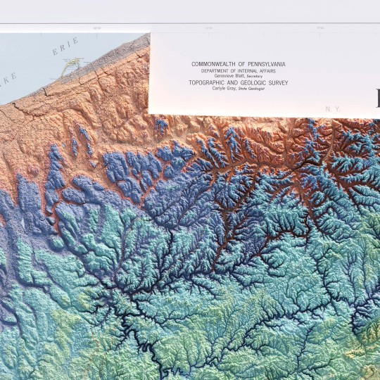
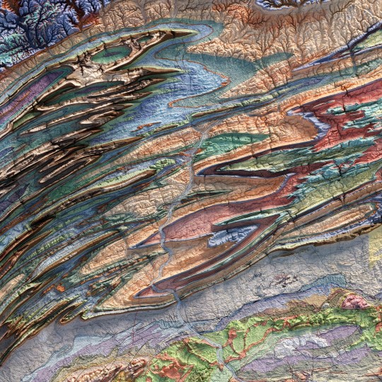
From the 1960s, a (restored) school geological map of Pennsylvania, obviously with shaded relief!
🗺️ 𝗠𝗔𝗣 𝗜𝗡𝗙𝗢
Geologic map of Pennsylvania, Topographic and Geologic Survey, Commonwealth of PA, 1960.
Source: David Rumsey Collection.
If you like our work, want to see our daily updates (or want to say hello to our studio), consider to follow our Instagram or Twitter account. Otherwise if are interested in our prints or have a custom request check our shop.
#Pennsylvania#pittsburgh#usmap#mapdesign#GeologyPA#VintageMap#PennsylvaniaHistory#ShadedRelief#GeologicHeritage#PAExploration#RockFormation#GeologicalTreasure#EarthScience#PennsylvaniaGeology#GeologicWonders#LandscapeHistory#GeologicalArt#ElevationData#GeologicMapping#BedrockGeology#NaturalHistory#GeospatialData#GeologicFeatures#MapArt#vizart
4 notes
·
View notes
Text
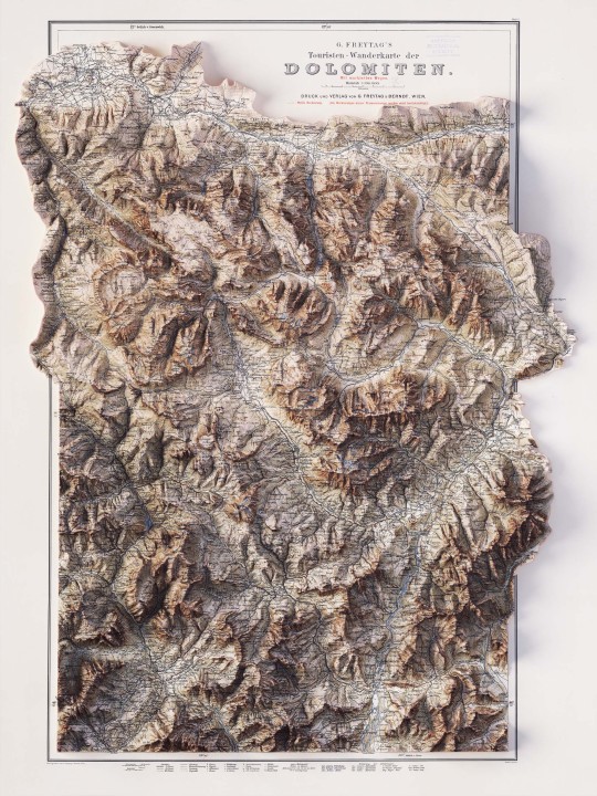
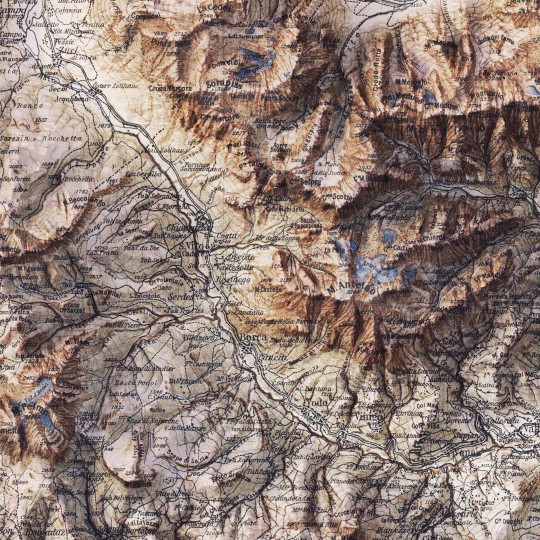
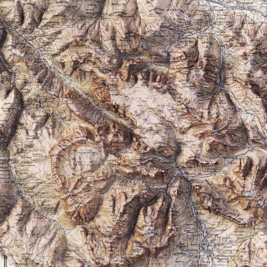
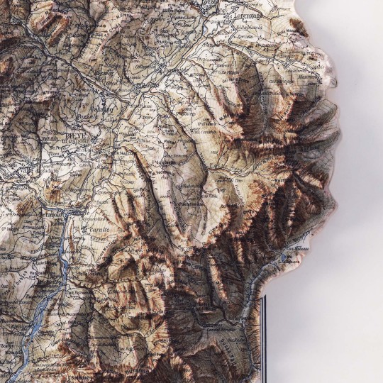
2D printed shaded relief map with 3D effect of a topographic map of Dolomites (Italy), printed and published by G. Freytag & Berndt in 1903.
If you like our work, want to see our daily updates (or want to say hello to our studio), consider to follow our Instagram or Twitter account. Otherwise if are interested in our prints or have a custom request check our shop.
5 notes
·
View notes
Text
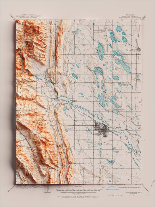
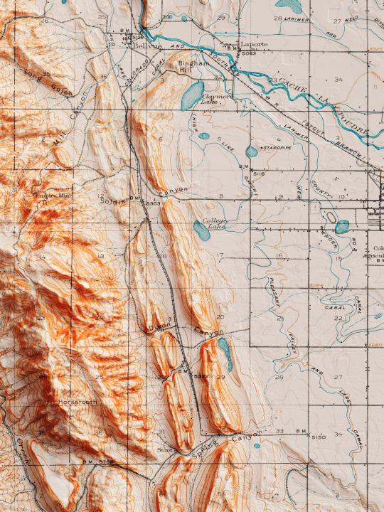
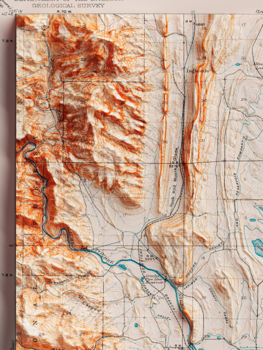
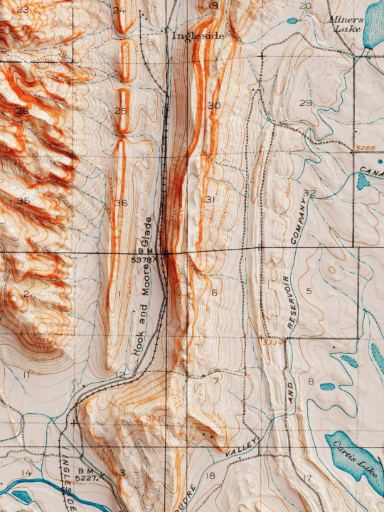
Shaded relief map with 3D effect of a topographic map of Fort Collins, Colorado (United States of America), in the quadrangle series and prepared and published by U.S. Geological Survey in 1906.
If you like our work, want to see our daily updates (or want to say hello to our studio), consider to follow our Instagram or Twitter account. Otherwise if are interested in our prints or have a custom request check our shop.
#homedecor#shadedrelief#shadedreliefmaps#map#cartography#cartographer#cartographie#cartographycommunity#vintagecartography#usa#usa🇺🇸#fortcollins#fortcollinsart#fortcollinscolorado#coloradogram#coloradotography#coloradosprings#3darts#digitalart#digitalartist#blendercycles#blenderartist#fineartprints#fineartprintshop#fineartprintstore#fineartprintstudio
7 notes
·
View notes
Text

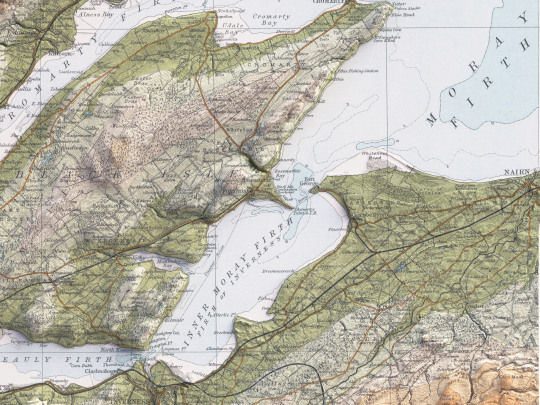
Third map of the series dedicated to Scotland.
Inverness! Map was published by John Bartholomew & Son in the Survey Atlas of Scotland in 1912, like all maps devoted to Scotland (for Wales and England gonna change).
Are we already mapped an area you love or is it still missing?
Credits to NLS (Reproduced with the permission of the National Library of Scotland).
If you like our work, want to see our daily updates (or want to say hello to our studio), consider to follow our Instagram or Twitter account. Otherwise if are interested in our prints or have a custom request check our shop.
#maps#mapart#mapdesign#shadedrelief#mapstagram#mapporn#cartography#geography#scotland#scotlandlover#scotlandshots#scotlandtravel#scotlandhighlands#scottishhighlands#inverness#invernessscotland#greatbritain#greatbritain🇬🇧#unitedkingdom#unitedkingdom🇬🇧#blender#reliefmap#datavisualization#qgis#blender3d#dataviz#b3d#bartholomew#atlasmountains
8 notes
·
View notes
Text


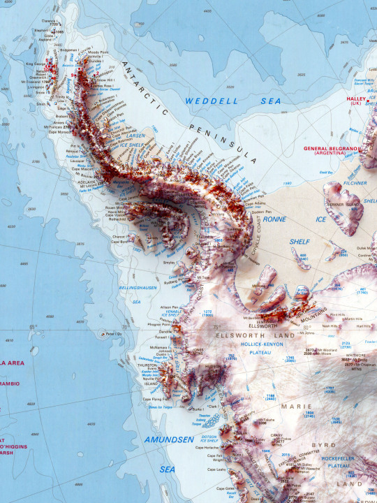
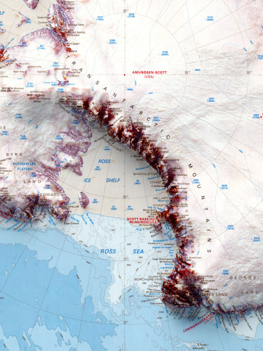
Explore the mesmerizing beauty of Antarctica through this exquisite shaded relief map, digitally restored by Vizart Studio. Capturing the stunning terrain of the icy continent, this vintage map from 1986. ❄️🌍
Map info:
Antarctica, McDoland Islands and Heard Island and Macquarie Island. 1986. Division of National Mapping of Australia.
Source: University of Wisconsin, Milwaukee.
If you like our work, want to see our daily updates (or want to say hello to our studio), consider to follow our Instagram or Twitter account. Otherwise if are interested in our prints or have a custom request check our shop.
#Antarctica#VintageMap#ShadedRelief#FineArtPrints#VizartStudio#maps#map#mapporn#cartography#travel#traveller#travelling#travelgram#travelblog#travelingram#traveladdict#travelblogger#3dart#blender#datavisualization#qgis#geography#gis#blender3d#dataviz#b3d
11 notes
·
View notes
Text
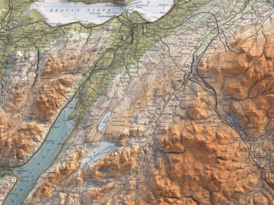
Finally our series dedicated to Great Britain is ready to be published!
We start with Scotland, then Wales and England. More maps will come in the future!
Today is time for Edinburgh. It was published by John Bartholomew & Son in the Survey Atlas of Scotland in 1912.
The entire series devoted to Scotland come from the same Atlas, instead Wales and England from a different one (not going to spoiler it, you will see).
Depending on its success, our idea was to expand the collection and be able to cover a large part of Great Britain.
Maps (all them) coming from NLS (Reproduced with the permission of the National Library of Scotland).
If you like our work, want to see our daily updates (or want to say hello to our studio), consider to follow our Instagram or Twitter account. Otherwise if are interested in our prints or have a custom request check our shop.
#maps#mapart#mapdesign#shadedrelief#mapstagram#mapporn#cartography#geography#scotland#scotlandlover#scotlandtravel#scotlandexplore#scotlandhighlands#edinburgh#edinburghcastle#datavisualization#qgis#gis#blender3d#digitaldesigns#dataviz#greatbritain#uk#uktravel#unitedkingdom🇬🇧#unitedkingdom#pentlandhills#pentlandhillsregionalpark
3 notes
·
View notes
Text
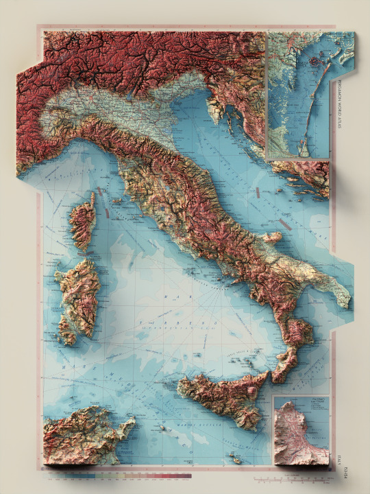
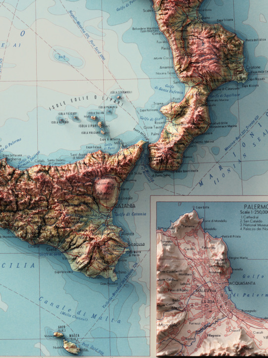
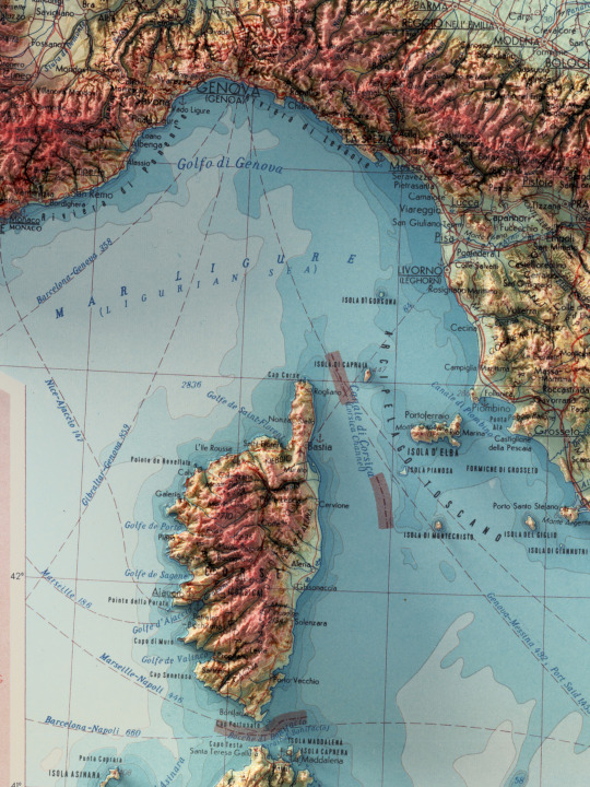
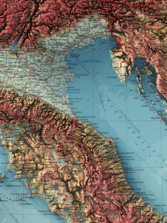
This map is a real treasure. We fell in love with this atlas and if we could we would do 3D shaded relief of every single page.
This one in partcular is dedicated to Italy.
Map info: Italy. (inset) Palermo. (inset) Venezia (Venice). Pergamon World Atlas. Pergamon Press, Ltd. & P.W.N. Poland 1967. Sluzba Topograficzna W.P.
source: David Ramsey collection
If you like our work, want to see our daily updates (or want to say hello to our studio), consider to follow our Instagram or Twitter account. Otherwise if are interested in our prints or have a custom request check our shop.
#3dmap#mapping#actofmapping#shadedrelief#datavisualization#cartography#geography#3dart#visualgraphc#digitalart#visualdesign#blenderart#italy#italia#pergamonatlas#atlas#sicilia#palermo#venezia#corsica#visititaly#discoveritaly#oldatlas
9 notes
·
View notes
Text
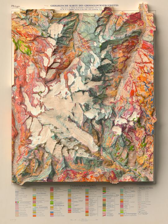
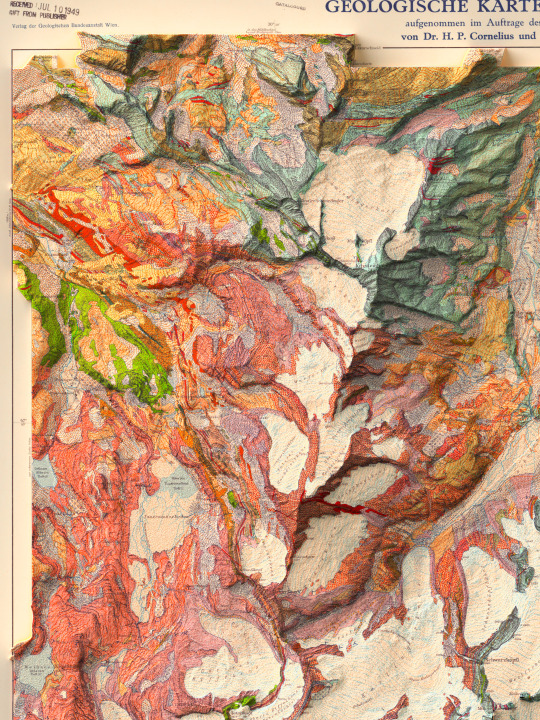


Anothe piece from our Alpine collection: the Grossglockner.
The base image was a 1939 geological map.
If you like our work, want to see our daily updates (or want to say hello to our studio), consider to follow our Instagram or Twitter account. Otherwise if are interested in our prints or have a custom request check our shop.
#alps#alpine#mountains#grossglockner#maps#geography#cartography#blender3d#qgis#datavisualization#shadedrelief#austria#germany#mountainslover
2 notes
·
View notes
Text


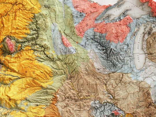

Geological map of United States, 1874.
Compiled by C.H. Hitchcock and W.P. Blake.
original map source: David Rumsey Collection
If you like our work, want to see our daily updates (or want to say hello to our studio), consider to follow our Instagram or Twitter account. Otherwise if are interested in our prints or have a custom request check our shop.
#hellovizart#shadedrelief#3dmaps#digitalart#cartografia#ilovegeology#geological#usa#unitedstates#vintagemaps#reliefmaps#artprint#retromaps#mapillustration#vintagemapsforsale#cartography#geology#gis#blenderart#3dmap
3 notes
·
View notes
Text
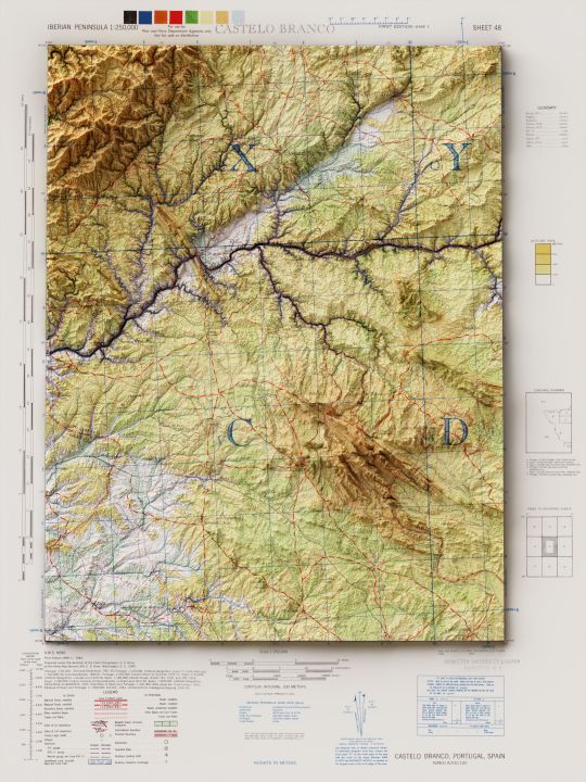
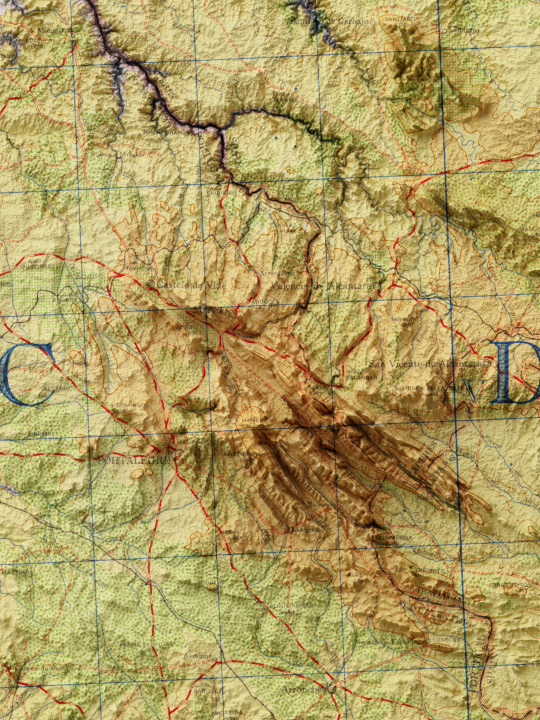
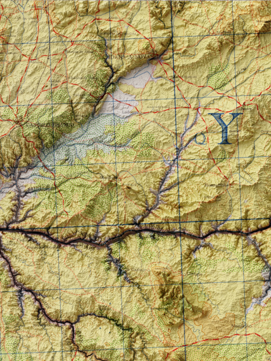
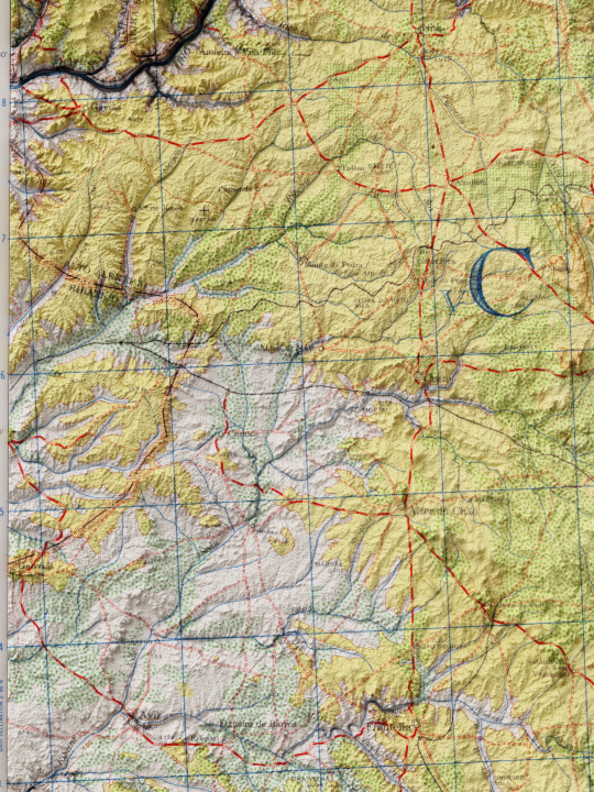
Topographic map of the Castelo Branco area in Portugal from 1944.
🗺Map info:
Iberian Peninsula 1:250,000: Castelo Branco, sheet 48. Series A.M.S. M581. 1944
Source: University of Texas.
If you like our work, want to see our daily updates (or want to say hello to our studio), consider to follow our Instagram or Twitter account. Otherwise if are interested in our prints or have a custom request check our shop.
#portugal#lisboa#lisbon#super_portugal#visitportugal#portugaldenorteasul#ig_portugal#portugal_de_sonho#portugal_em_fotos#wu_portugal#portugalalive#portugalcomefeitos#amar_portugal#loves_portugal#shadedrelief#3dmap#maps#topographicmap#europe#Iberia#mappart#artmap
2 notes
·
View notes
Text

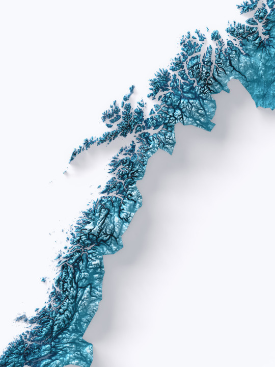
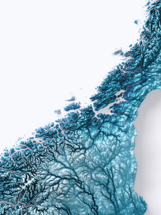
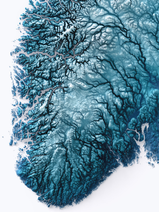
This year is almost at an end and in the days to come we will show the last elevation maps made in 2022.
Today it is time for Norway, with its tapered shape and jagged coastline. The colouring is Deep Blue, but we will show some other variations later on.
Would you also like to see the Scandinavian peninsula?
Let us know in the comments!
If you like our work, want to see our daily updates (or want to say hello to our studio), consider to follow our Instagram or Twitter account. Otherwise if are interested in our prints or have a custom request check our shop.
#blender#datavisualization#reliefmap#qgis#geography#mapporn#cartography#mapping#gis#blender3d#blendercycles#datavizsociety#dataviz#b3d#shadedrelief#norge#norgefoto#norway#norwaynature#norway🇳🇴#oslo#oslofjord#fjord#lofoten#svalbard#scandinavia
3 notes
·
View notes
Last Seen Blogs
edenziza
Yeaniva

readmebykamal1
Untitled

askaryon
A shelter or a reality escape, it's your call

fetch101
Untitled

haute-la-vie
...LA VIE...