#solway coastwise
Text
Sheeps’ Rink Co’
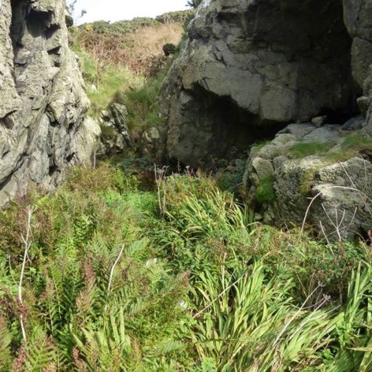
Sheeps'Rink Co', Ardwell Bay - is a tiny cave on the western shore of the Rhins, which was inhabited by Will Purvis in the late 1800s. It can no longer be found on modern maps.
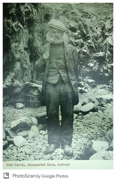
Will Purvis was a former clown and strongman who retired to this cave and undertook odd jobs, as well as selling postcards such as this of himself. He kept a record of the many visitors to his home over the Summer season.
0 notes
Photo
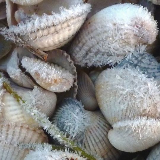
You may only find frosty cockles a few days each year but you can go shell hunting in any season.
Get a look at the online copy of Solway Firth Partnership’s popular shell guide here
#Solway Coastwise#solwaycoastwise#coastwise#dumfriesandgalloway#lovedandg#shells#cockles#frost#winter#guide#coast#solway
1 note
·
View note
Photo
Planning some exploration of coastal locations with the help of archaeologists. Prehistoric woodlands / saltpans / mines / Mulberry harbour remains were all included for our #solwayambassadors
#news#place:cairnhead bay#zoom: 8#solway#solwaycoast#solway coastwise#coast#coastwise#dumfriesandgalloway#lovedandg#scotland#visitscotland#visitdumfriesandgalloway#visitsouthwestscotland#dgwgo#followmetoscotland#followmetogalloway#more
0 notes
Photo
Rockcliffe
Rockcliffe is located by a sheltered bay on the East side of the Rough Firth. It has a sandy beach surrounded by the rocky outcrops from which its name derives. The first signs of development at Rockcliffe can be found on the 1854 O.S. map. New roadways are in place and a house aptly named “Seaside” has been built. By 1893 the picturesque village of “Rockcliffe” has been named and fully developed, along with a Spa hotel,as one of several Victorian coastal holiday resorts along the Solway. Prior to that there were only a few scattered cottages and houses in the area. However a short walk from Rockcliffe there are two dark age hill forts. The nearest of these is Mote of Mark. Up until the 1950s this was recorded on maps as Mark Moat. It is named after King Mark of Arthurian Legend. It is unknown when it was given this name but certainly it was known by that name in the 1700s. Find out more of the Legend surrounding King Mark here. It is believed that the fort was occupied for well over 300 years, being destroyed by fire when under attack in the 7th Century AD. Probably by Angle invaders. The fort had stone and timber ramparts 4m thick and 3m high, defending a large central hall, stables and workshops. The artifacts that have been found there suggest a wealthy community. They were served by metal workers, who produced Celtic-style bronze jewelry with glass and enamel inlays. Remains of imported glass and ceramic pots from France and the Mediterranean have also been found there.
1 note
·
View note
Photo

The history of Kirkcudbright Bay was explored and recorded by several volunteers and archaeologists from SCAPE and the Nautical Archaeological Society. On the Friday there was a guided walk along the Senwick Shore, then on Saturday and Sunday we learnt about marine archaeology and undertook a survey of the Fauna (pictured). Finally on the Monday a rapid survey was carried out of the Monreith at Dhoon Beach.
If you want to find out more about these fascinating wrecks you can read the report here
This project was carried out as part of the Solway Firth Partnership’s Kirkcudbright Bay Views project, which is being supported by The Galloway Glens Scheme.
The fieldwork was organised by Solway Firth Partnership and carried out by local volunteers with training and supervision by staff from SFP, Nautical Archaeology Society (NAS) and SCAPE.
#solwaycoastwise#coastwise#dumfriesandgalloway#lovedandg#scotland#coast#solway#solwaycoast#gallowayglens#ScotlandsCoastalHeritageatRisk#archaeology
1 note
·
View note
Photo

There are a handful of stones with names on the Dumfries and Galloway coast. The Devil Stane on the Arbigland shore was apparently spat out by the Devil after he bit a mouthful of Criffel. We asked on social media if you knew of any more named stones out there?
Thanks to Ding Little on facebook who told us: The legend stems from the Devil's "toothmarks' on the top of the stone which are actually the marks of the beginning of plug and feather to split it but was abandoned for some reason.
Hugh Mcmillan gave us lots of information on other stones in the area. He posted the following on our facebook page: May I refer you to an extract from the article on ‘Stanes’ in the hugely underrated ‘McMillan’s Galloway Encyclopaedia’?
“We may not have the sheer number of ancient stones than they have further north but typically we’ve got some of the weirdest and best.....The Taxing Stone, in Little Laight Hill near Cairnryan, was a toll marker but before that was, according to legend, the grave of Alpin, father of the first Scottish King, Kenneth MacAlpin, who was killed in Glenapp in 741 while leading a Scottish invasion of Galloway.
Try as you might, though, you’ll not find a stane with a better story to tell than the Lochmabenstone. This was a tribal meeting place and also, you can tell by the name, the religious centre for the Celtic Sun God, Mabon, our version of Apollo. It’s mentioned in the famous Ravenna Cosmography, a kind of mad road map of the world written by a monk in Ravenna in North Italy in the 8th century AD. Later in history the Lochmabenstone was a parlay point for the reivers to talk and exchange prisoners and was regarded as marking the southern limit of Scots territory. The Battle of Lochmabenstone, or Sark, on 23 October 1448 saw a Scottish army win a rare victory over the invading English forces of Henry Percy, 2nd Earl of Northumberland, 1,500 English soldiers killed to a mere 26 Scots.
Those are facts, sort of, but the stone is also shrouded in romantic legend. A local story claims it to be the stone that held the sword Excalibur, till Arthur pulled it out. Ridiculous ? In a recent book, The Quest for Merlin, published in 1985, Nikolai Tolstoy places Arthur’s mentor and Merlin in Lochmaben, as a priest of the Sun God.”
If you would like to see some of the other responses and stories we received these can be found on our face book page here
#solwaycoastwise#coastwise#dumfriesandgalloway#lovedandg#scotland#coast#solway#solwaycoast#folklore#stories#shore#criffel#devils#place:arbigland#zoom: 8
56 notes
·
View notes
Photo
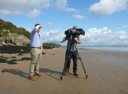
Filmed latest Coastwise inspired Border Life episode with Sandy and Paul in a sunny spell on the Solway coast https://ift.tt/2LtzgWf
1 note
·
View note
Photo
Bonny Well Bay near Port Logan, the OS name book says it "derives its name from a small well now filled up and not visible, it was a well where women drank out of while burning the seaweed for potash to bleach linen"
#solwaycoastwise#coastwise#dumfriesandgalloway#lovedandg#scotland#coast#solway#solwaycoast#place:portlogan#zoom: 8#industry
13 notes
·
View notes
Photo
Although the Solway Coastwise Project has now come to an end this blog will remain open for any posts, photos and information related to places along the Scottish Solway Coast and their names.
We hope you will still find plenty of intersting information here about our wonderful coast. There will alo be shared posts and links to other relevant aand nearby sites, related projects and other interesting facts.
Our social media will now be for all of Solway Firth Partnership. You can still use #solwayambassador.
0 notes
Text
Wildlife Guide
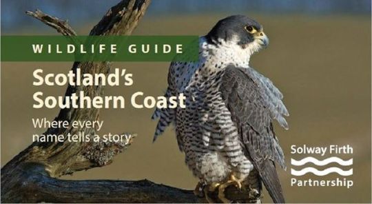
Have a peak at our Coastwise wildlife guide for Dumfries and Galloway here.
0 notes
Text
Nancy Scar
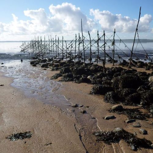
Nancy Scar is the name of a stony area in the Cree, near Carsluith, that provided a firm base for salmon nets.
#fishing#cree#place:carsluith#zoom: 8#salmon#solway#Dumfries & Galloway#coast#coastwise#industry#scotland#history
0 notes
Photo
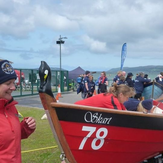
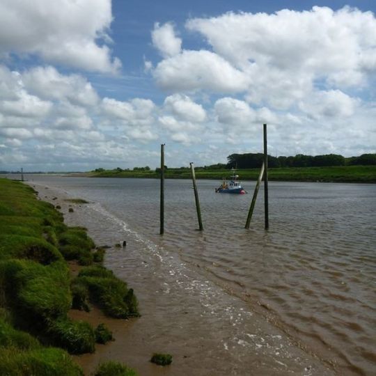
Stranraer Skiffie Worlds event was a great success - local boats are named after coastal landmarks - Lady Bay and Milleur Maid. This boat from NI name checks the local name for a cormorant https://ift.tt/2lga1NM
0 notes
Photo
Port William was founded by Sir William Maxwell of Monreith in the 1770s https://ift.tt/2LAetSP
0 notes
Photo
Waterfoot where the River Annan meets the Solway - discover more place names at an exhibition at Annan Museum http://bit.ly/2WYx0Kz
0 notes
Photo
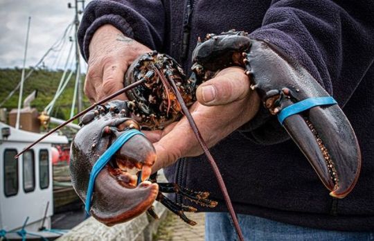
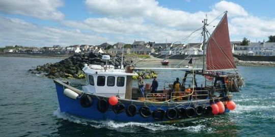
Port William World Oceans Day event 12 noon - 5:00 pm on Saturday 8th June is about more than just lobsters (although you can see them too) discover local history, fish life, place names and the problem with plastic as well as activities for all! Marine Conservation Society, The Whithorn Trust, Freelance Ranger, SMILE Project
#solwaycoastwise#coastwise#dumfriesandgalloway#lovedandg#scotland#coast#solway#solwaycoast#events#place:PortWilliam#zoom: 8#news#WorlOceansDay
0 notes
Photo
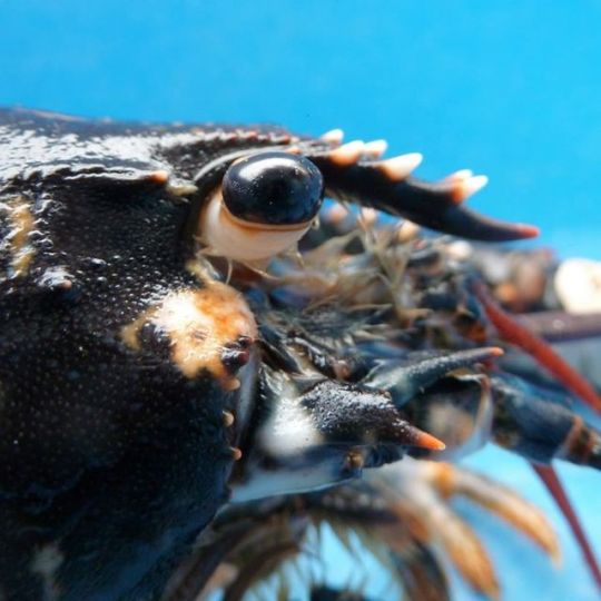
Join us to celebrate World Oceans Day on 8th June by getting up close to lobsters and other sea life with Galloway Static Gear Association at Port William, SMILE Project, Port William Inshore Rescue Service and The View Port William
#solwaycoastwise#coastwise#dumfriesandgalloway#lovedandg#scotland#coast#solway#solwaycoast#place:Port William#zoom: 8#worldoceansday#news
0 notes
Last Seen Blogs

henko5
Henko❄

the-caffienated-reader
Reading Late with The Caffienated Reader

polyrelatables
Random


danycolombia
pantys y bikines