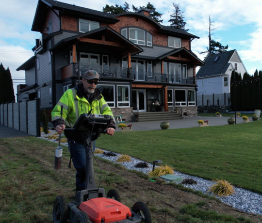
#gpr

Text
#building#design#interiordesign#architecture#homedecor#renovation#art#builder#artwork#carpenter#fireproofing#construction#insulation#demolition#coredrill#gpr#groundpenetratingradar#firestopping#concretecut#constructionservices#coredrilling#aygpr#aygprservices#concretecutting#subcontractor#floridaconstruction#floridasubcontractor#floridacontractor#florida#fireproof
2 notes
·
View notes
Photo


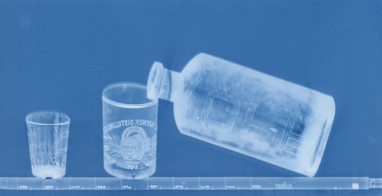
Some Illustrations from Duralande’s GPR Manual
Done this summer out in these days...
27 notes
·
View notes
Note
Heyy, I'm here for the ask game
I choose 🔥for my reading
My initials are GPR and 😬💀
Thank you so much for doing this and have a nice day ❤️
You're hoping for a lovely romance sort of like the ones in sweet Kdramas and can imagine scenes like those, but you know deep down that reality isn't like that. You're kind of shy/slow in love, so you often lose on a lot of opportunities to further develop something into a relationship. Somehow you're 1 step slower in reacting for love, so you do miss out on chances to further a relationship. You're not really the type to put yourself out there for love or to ask someone out directly. Others can feel like you're not interested in love/dating or are in your own world. If you really like someone, it doesn't hurt to let them know that you're interested in them. This doesn't mean you have to confess to them, but you can drop hints that are less subtle.
2 notes
·
View notes
Photo

#cse • @d.s__style . . #ハーレー #ハーレーダビッドソン #ハーレーのある生活#ハーレー好きな人と繋がりたい #harley#harleydavidson#hogsnaps #harleylife#harleydavidsonmotorcycles #glide #lyndallbrakes #131ci #fxlrs #ローライダーs #speedcruiser #clubstyle #speedkings #gpr #feuling #hpi #memphisshades #ローライダーs #krausmoto #hyperprosuspensions #brembo #stm https://www.instagram.com/p/CmthyYyIc-9/?igshid=NGJjMDIxMWI=
#cse#ハーレー#ハーレーダビッドソン#ハーレーのある生活#ハーレー好きな人と繋がりたい#harley#harleydavidson#hogsnaps#harleylife#harleydavidsonmotorcycles#glide#lyndallbrakes#131ci#fxlrs#ローライダーs#speedcruiser#clubstyle#speedkings#gpr#feuling#hpi#memphisshades#krausmoto#hyperprosuspensions#brembo#stm
2 notes
·
View notes
Text
3 notes
·
View notes
Text
#Ground Penetrating Radar Survey Company in India#GPR survey company in India#SUE Survey Company in India#SUE Survey in India#Underground Scanning & Mapping#Underground Utility Survey in India#Underground Utility Survey Company in India#GPR Survey in India#Ground Penetrating Radar Survey in India#SUE Survey#GPR Survey#Ground Penetrating Radar Survey#Underground Utility Survey#GPR
0 notes
Text
Innovative Utilization of GPR for Geotechnical Investigations in Urban Sustainability Planning

Geotechnical investigations play a pivotal role in nurturing sustainable urban growth, ensuring that development aligns harmoniously with environmental preservation efforts. The utilization of Ground Penetrating Radar (GPR) in these studies signifies a significant advancement, augmenting our ability to design environmentally conscious urban landscapes. This article explores the substantial influence of GPR on geotechnical investigations and its contributions to sustainable urban development endeavors.
Geotechnical investigation, which entails analyzing the subsurface characteristics of the earth, is essential for evaluating the feasibility of construction ventures. It scrutinizes soil, rock, and groundwater properties to ascertain their suitability for supporting infrastructure. GPR emerges as a vital instrument in this domain by providing a non-invasive method to probe the subsurface, eliminating the necessity for extensive excavation or drilling. This approach not only saves time and resources but also reduces the ecological impact of investigative procedures.
GPR functions by emitting electromagnetic waves into the ground and analyzing the resulting reflections. These reflections offer insights into subsurface anomalies such as voids, fluctuating water levels, and variations in soil and rock composition. Particularly in urban settings, where the underground landscape is a complex amalgamation of natural and man-made features, GPR offers a nuanced comprehension of the subsurface, facilitating navigation through its intricacies.
The integration of GPR into geotechnical investigations enhances the safety and ecological sustainability of urban development endeavors. By accurately delineating the subsurface, GPR identifies critical hazards such as potential sinkholes or fragile soil layers, essential for averting infrastructure failures. It also aids in protecting existing underground utilities from unintentional damage during construction activities.
Beyond its role in ensuring structural integrity and environmental conservation, GPR empowers urban developers and planners to make decisions in line with sustainable development principles. It furnishes comprehensive insights into subsurface conditions, ensuring that urban projects are built on secure and sustainable foundations.
In conclusion, the incorporation of GPR into geotechnical investigations represents a significant stride in realizing smarter, sustainable urban development strategies. It underscores the potential of cutting-edge technologies to shape urban environments that are both structurally resilient and environmentally conscious. As urban expansion continues, the integration of technologies like GPR in geotechnical studies remains imperative for crafting a sustainable future.
For more information about Geotechnical investigations come and visit our website : https://durkin.au/
0 notes
Text
What is the Role of GPR Scanning for Infrastructure Maintenance?
Ensuring the primary respectability and safety of roadways, barriers, and structures is crucial in the intricate web of today's foundation.GPR scanning has emerged as a progressive force in structural maintenance, providing a safe and effective way to investigate underlying conditions. Beyond the obvious, this innovation makes it easier to plan utility lines, find hidden abnormalities, and assess the quality of asphalt. GPR filtering continues to serve as a development guide as we investigate the challenges of maintaining our fundamental framework, providing invaluable insights that extend the lifespan, security, and maintainability of these fundamental designs. Read more:- https://www.blogbangboom.com/blog/what-is-the-role-of-gpr-scanning-for-infrastructure-maintenance
0 notes
Text
Long article about ground penetrating radar and archaeology. Fun stuff.
0 notes
Link
Ground Penetrating Radar Market Growth Boost by Growing Adoption of 3D Data Formats...
0 notes
Photo

Fim do primeiro semestre... Foi um regresso sem saber no que ia dar, mas agora sei que estou no caminho certo. Há muito a melhorar mas o arranque está dado. Tenho esperança que o futuro se venha a revelar melhor, muito melhor. Obrigado @taniabernardomartins por me apoiares, amo-te! . . End of the first semester... It was a return without knowing where to, but now I know I'm on the right path. There is a lot to improve but the race has started. I am hopeful that the future will turn out to be better, much better. Thank you @taniabernardomartins for supporting me, I love you! . . #maggessi #regressoàuniversidade #ovelhoaindasabeestudar #novafcsh #gpr #fcsh #geografia #geografiaeplaneamentoregional #backtoschool #geography (em Faculdade de Ciências Sociais e Humanas - NOVA FCSH) https://www.instagram.com/p/Cn7HPWusSHF/?igshid=NGJjMDIxMWI=
#maggessi#regressoàuniversidade#ovelhoaindasabeestudar#novafcsh#gpr#fcsh#geografia#geografiaeplaneamentoregional#backtoschool#geography
0 notes
Text

Kitties and stuff
3 notes
·
View notes
Photo

#cse • @d.s__style . . #cse #glide #lyndallbrakes #131ci #fxlrs #ローライダーs #speedcruiser #clubstyle #speedkings #gpr #feuling #hpi #memphisshades #ローライダーs #krausmoto #hyperprosuspensions #brembo #stm #harley#harleydavidson#hogsnaps #harleylife#harleydavidsonmotorcycles#photooftheday https://www.instagram.com/p/CmJExsDoqKa/?igshid=NGJjMDIxMWI=
#cse#glide#lyndallbrakes#131ci#fxlrs#ローライダーs#speedcruiser#clubstyle#speedkings#gpr#feuling#hpi#memphisshades#krausmoto#hyperprosuspensions#brembo#stm#harley#harleydavidson#hogsnaps#harleylife#harleydavidsonmotorcycles#photooftheday
4 notes
·
View notes
Text
Seismic Refraction EpitomeGs
Seismic refraction technique is an advanced geophysical method which is applied for routine investigation of subsurface ground conditions by using surface-sourced seismic waves. Data acquired with the help this technique on site is further computer processed and interpreted to attain models of the seismic velocity and layer thickness of the subsurface ground structure. We are one of best Seismic Refraction Survey Services in India.
The seismic waves disseminate downward through the ground till the time they are reflected or refracted off subsurface layers. Refracted waves are identified by arrays of 24 or 48 geophones spaced at regular intervals of 1 – 10 meters, based on the required depth penetration of the survey. Sources are placed at each end of the geophone array to generate forward and reverse wave arrivals along with the array. Use of additional sources may intermediate positions for entirely covering at all geophone positions. If you are looking for Seismic Refraction Survey Services then you are at the right place.
The penetration depth in a seismic refraction survey is approximately 1/5th of the geophone spread length including offset shots. So if it is required to see 10m deep, you will need room to lay out at least 50m seismic spread, as measured from offset shot to offset shot.
Any of the Geometrics seismographs can be utilized for seismic refraction. Up to24 channels or less, the SmartSeis ST is ideal. When using a laptop in the field works for you, the ES-3000 is a good option to the SmartSeis. For large-scale surveys, the Geode is recommended however For simplerippability, 12 channels will often suffice. For mapping the bedrock topography, a minimum of 24 channels are recommended. The detailed requirement needs more channels.A hammer-and-plate refraction survey is easily attained with two people. Longer lines and/or the use of explosives (which requires digging shot holes) generally need 3-4 people.The survey is used to detect lateral and vertical variations in velocitySeismic surveys are useful in producing detailed images of the subsurfaceUsed to measure stratigraphic unitsThe Response of the seismic refraction survey depends on variations in rock density and elastic constantsSometimes, direct hydrocarbon detection is possible in Seismic refraction survey.Epitome offer these services Seismic Refraction Survey, SRT survey, GPR Survey,Ground Water survey etc,more info: EpitomeGs.com
0 notes
Text
#Ground Penetrating Radar Survey Company in India#GPR survey company in India#SUE Survey Company in India#SUE Survey in India#Underground Scanning & Mapping#Underground Utility Survey in India#Underground Utility Survey Company in India#GPR Survey in India#Ground Penetrating Radar Survey in India#SUE Survey#GPR Survey#Ground Penetrating Radar Survey#Underground Utility Survey#GPR
0 notes
Last Seen Blogs

holidaycampingbhandaradara-blog
Holiday Camping Bhandaradara

ghettopalmsounds-blog
Ghetto Palm Sounds

luchichufer
Luchi 🌺

nextlevelboy2019-blog
Download Jumanji: The Next Level (2019) Full-Movie Subtitle Engl

hungryorion
🥩TUMMY ISSUES