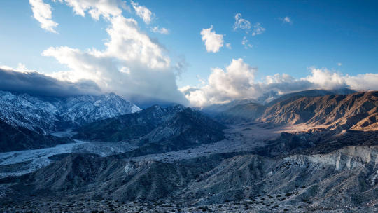
#san bernardino mountains
Text
Would just like to say that this storm in SoCal is the perfect example of incompetence.
Not from the community though.
It has now been 11 (eleven) days without snow plows. San Bernardino County is offering shelter and food at the local high school and other places but the people (including me and my family !) can't even get there because the roads aren't plowed.
The National Guard is supposedly up here but we haven't seen or heard any sign of them.
We've had one grocery store a town over have the entire roof collapse from the weight of the snow.
As a total, my area has gotten over 9 (NINE) feet of snow in just under two weeks.
Gas leaks have begun everywhere because the pipes are shifting from the snow. Two houses that I know of have burned (basically exploded) from gas leaking and the fire department can't get there in time, because the roads haven't been plowed.
The community has turned to help each other though, offering to shovel snow off of decks and roofs to prevent collapse, offering extra food, water, firewood, medicine, pet food. We can't get down the mountain because the roads haven't been plowed and those who are able to find a way down can't get back up.
People need medicine, food, water, heat. We had a diabetic just around the corner who ran a high fever and thankfully made it to the local hospital in time. An emergency CAT plow had to come, but it still took a long time for it to get through the snow. 911 is useless at the moment, they are two to three (2-3) days behind emergency requests. If you're in trouble, you're on your own.
In the meantime, the news is showing lovely helicopter footage of the pretty snow covered mountains (I'm tired of hearing helicopters overhead every 15 min) and San Bernardino County is patting themselves on the back during press conferences saying how good of a job people are doing to help with relief. They have done NOTHING. And the sheriff (who doesn't have jurisdiction over this issue) is trying to deny the hospital helicopter from taking off and landing up in the mountains because there "is too much air travel so it would be dangerous to have this helicopter in the air" but all of the news helicopters doing nothing are perfectly fine. That helicopter has saved lots of lives so far and is the only way down the mountain for those in desperate medical need.
There have been unprecedented avalanches in nearby mountain communities. Forest falls, just below Big Bear, has no water. An avalanche took their water tower out.
The mountain communities need plows. Yes, food and water and shelter are nice in theory, but get us PLOWS. If people can get down the mountain and around town to help others, that would be the best way to get through this.
My family has enough food and heat, thankfully. But we only planned for 2 weeks when we heard of the storm. It's been 11 (ELEVEN) days. The only news we've heard of a plow coming is within 1-2 weeks at minimum. We might run out of dog food, cat food, firewood. And what about other people who didn't stock up or didn't have the money to stock up? What about short time rental users who excepted to be up here for a few days and are stranded without supplies?
Get the mountain communities plows.
#sorry for the long rant#but its so frustrating seeing the news do nothing#and people down the mountain going 'oh look how pretty the snow is'#snow is deadly#socal#southern california#crestline#big bear#lake arrowhead#forest falls#san bernardino#san bernardino mountains#might be doxxing myself but this is important for people to know#irl
102 notes
·
View notes
Text
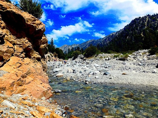
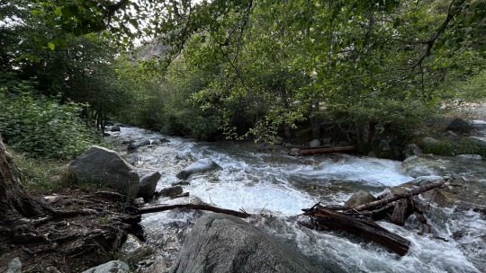
Sand to Snow National Monument
The Sand to Snow National Monument was created by Presidential Proclamation on February 12, 2016 and managed to survive efforts by the Trump administration to undo the designation of this and several other monuments. The Monument encompasses 154,000 acres and is co-managed by the U.S. Forest Service and Bureau of Land Management. It includes 30 miles of the PCT, much of it along Mission Creek as it makes the long climb into the San Bernardino Mountains. The contrast of the Sonoran Desert and the snow-capped mountains can be stunning.

(double click on the photos to appreciate a larger version)

#Sand to Snow National Monument#Mission Creek#Whitewater River#Sonoran Desert#San Bernardino Mountains
4 notes
·
View notes
Text


Evening silent hill hike
#hiking#creek#river#mountains#forest#forestcore#cottagecore#silent hill#fog#foggy forest#hike#woods#it lives in the woods#mine#photography#landscape#forest landscape#san bernardino mountains#mountain landscape#mt baldy
11 notes
·
View notes
Text
Mill Creek Canyon
#mill creek#San Bernardino Mountains#Creek#canyon#San Bernardino National Forest#Forest Falls#San Bernardino County#california#photo#digital#original photographers
6 notes
·
View notes
Text

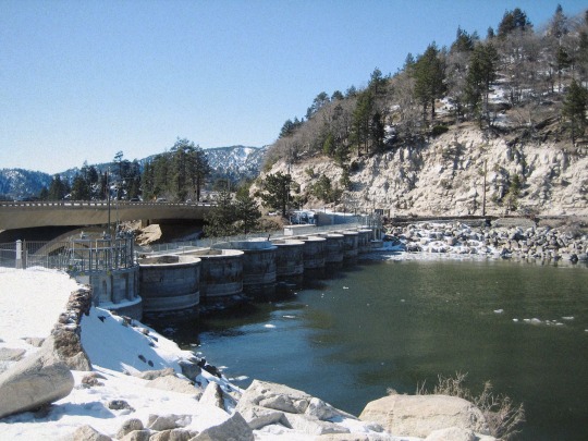
Hwy 18 & Bear Valley Dam
3 notes
·
View notes
Photo
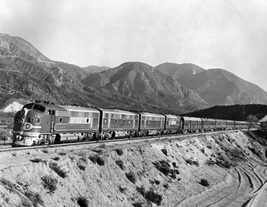
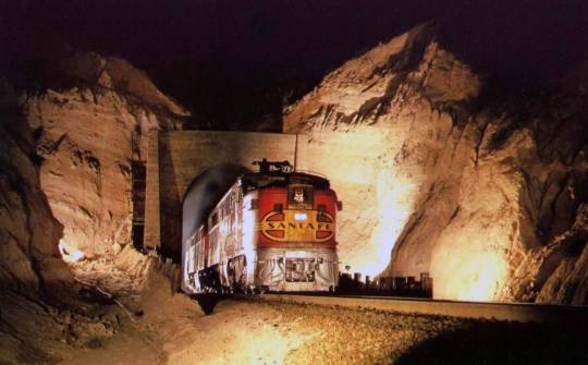
ATSF Super Chief in Cajon Pass, California, 1940's
2 notes
·
View notes
Text
Big Bear Bald Eagle Live Nest - Cam 1
0 notes
Text
Two Gun Bill's Saloon
Located at stop 3 along the Gold Fever Off Road trail is the supposed location of Two Gun Bill’s Saloon in Holcomb Valley, California. The Gold Fever Off Road Trail is a back country drive by some historical sites in Holcomb Valley, in the San Bernardino Mountains. Holcomb Valley located just west of Big Bear, California is the site of the largest gold rush in Southern California.
The trail head…
View On WordPress
#3N16#Big Bear#California#Gold Fever Off Road Trail#Holcomb Valley#San Bernardino#San Bernardino Mountains
0 notes
Text
A long snow day
Why, yes, this did include my daughter (we're in FSD, though, not Irvine). The school/district did a good enough job communicating with us for my own liking (granting that I am probably dispositionally in the bottom decile for concern about this kind of thing) and the kids are all now safe and sound.
0 notes
Text

A sunny springtime favorite, narcissus flowers (also known as daffodils) are lucky when offered as a bunch. Avoid crushing daffodils under your feet, and you may be rewarded with an abundance of good fortune. Never mistake a narcissus bulb for an onion, for they are poisonous! Plant onions and narcissus far apart.
0 notes
Text
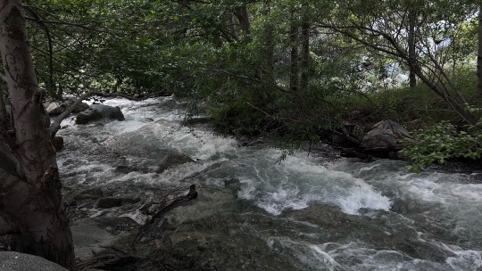
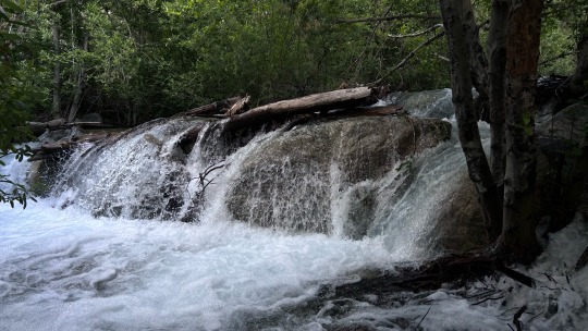
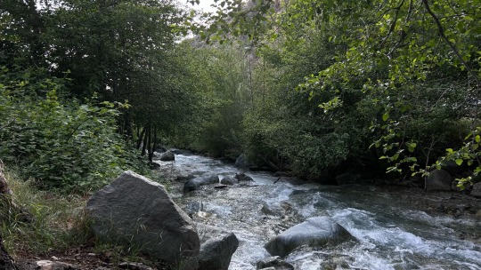
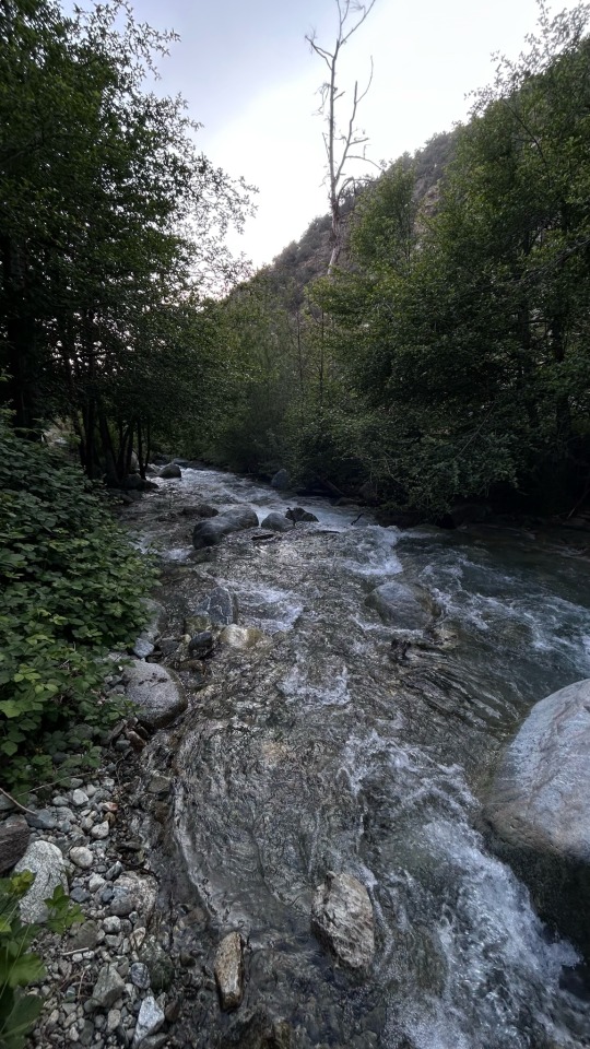
Hurricane Hilary, Whitewater River and the Whitewater Preserve
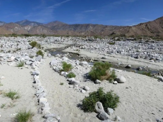
The section of the PCT between the San Jacinto and the San Bernardino mountain ranges was, for me, one of the more challenging sections of the trail. Certainly not the most pristine (it includes the I-10 undercrossing, greater Cabazon, and massive wind farms) and often stark, incredibly hot, and barren until you are well up Mission Creek. The broad flood plain of the Whitewater River normally carries a modest flow from snowmelt in the San Bernardino Mountains. However, late in August 2023, Hurricane Hilary dumped an extraordinary amount of rain in the Whitewater River drainage turning the normal August trickle into a raging torrent:
youtube
Among the casualties was the PCT in that area and the wonderful oasis not far off the trail, the Whitewater Preserve. The Preserve just re-opened on December 11 and the PCT remains seriously impacted. Reports are incomplete but the most significant impacts to travel are in the upper portion of North Fork Mission Creek (~mile 235-239), an area managed by San Bernardino National Forest in Sand to Snow National Monument.
In the next post, we will cover the Whitewater Preserve in a little more detail and share some photos taken during better times.
#Hurricane Hilary#Whitewater River#Mission Creek#Section C#Whitewater Preserve#San Bernardino Mountains#Youtube
2 notes
·
View notes
Text


Evening hike at badly
2 notes
·
View notes
Text

Gambel's Oak
#quercus#oak tree#acorns#San Bernardino National Forest#san bernardino mountains#big bear lake#san bernardino county#california#photo#digital#original photographers
3 notes
·
View notes
Text

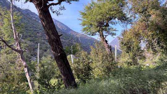
Cave Mountain, California (2023).
78 notes
·
View notes
Text
Santa Fe's Fast Mail Express exits a tunnel at Cajon Pass on February 27, 1967. Photo by William Mills.
1 note
·
View note
Last Seen Blogs

kingdiego313
Planet Diego

cristianibsz466-blog
Chiropractic And Leg And Hip Pain

nostranebula
Nostranebula

incarnationate
cold and wrathful.

dallostrapiombo-blog
La Prossima Volta Salterò a piè pari.