pcttrailsidereader
Pacific Crest Trailside Reader
PCTTrailsideReader.com is an extension of the PCT anthologies, and a place for PCT stories and images from the long-distance trail to be shared and expanded upon....
1908 posts
Don't wanna be here? Send us removal request.
Last Seen Blogs

soohxn-blog
in the end

bymuba-blog
Pereirix

bravely-lost
buydesignersofas.com

edwardsbaileyy
Untitled
Text
The Walking Wordsworths: "Wandering Lonely as a Cloud"
By Howard Shapiro
About a year ago we featured a post regarding Rebecca Solnit’s book on walking. In it she takes some time describing the influence William Wordsworth and his sister Dorothy had on the ideas of landscape and nature. They ambled throughout Cumbria in England’s Lake District as well further south in county Somerset. Their writing; his poetry and her journals, as well as their collaborations or known to be important to the world of literature and poetry. Their work changed the view the public had for embracing nature.
I am currently doing some walking and exploring in the Lake District so the Wordsworth’s figure prominently here. The Wordsworth’s walks remind me of the personal discoveries and wonders that have come to me from walking the PCT. Certainly had William and his sister lived about a hundred years later they may well have come to America to experience what nature had to offer in the early 1900’s. After reading Solnit’s book I have remained interested in understanding more about the Wordsworth’s. Like Muir, Wordsworth saw nature as invigorating stimulation spiritually and creatively. In some ways I would think that Muir and Wordsworth would have been kindred spirits.
Here are some quotes to give you an idea:
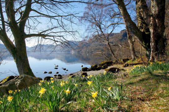
Come forth into the light of things, let nature be your teacher.
Nature never did betray the heart that loved her.
I wandered lonely as a cloud
That floats on high o’er vales and hills
When all at once I saw a crowd
A host of golden daffodils
Beside the lake beneath the trees
Fluttering and dancing in the breeze.
Let the moon shine in thy solitary walk; and let the misty mountain-winds be free to blow against thee.
Given that these thoughts were written over two hundred years ago they still have meaning for anyone who walks or finds themselves in nature even for the briefest of times. There is speculation that the Wordsworths walked nearly 200,000 miles in their lifetimes…that is just over seven PCTs or at least that many triple crowns…

Juliet Whitworth's painting of the walking Wordsworths (and daffodils, of course)
If you are out walking consider Wordsworth and his sister Dorothy and let them be an inspiration for any time you get to have outside surrounded by nature.
1 note
·
View note
Text
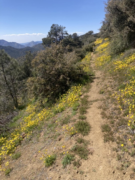

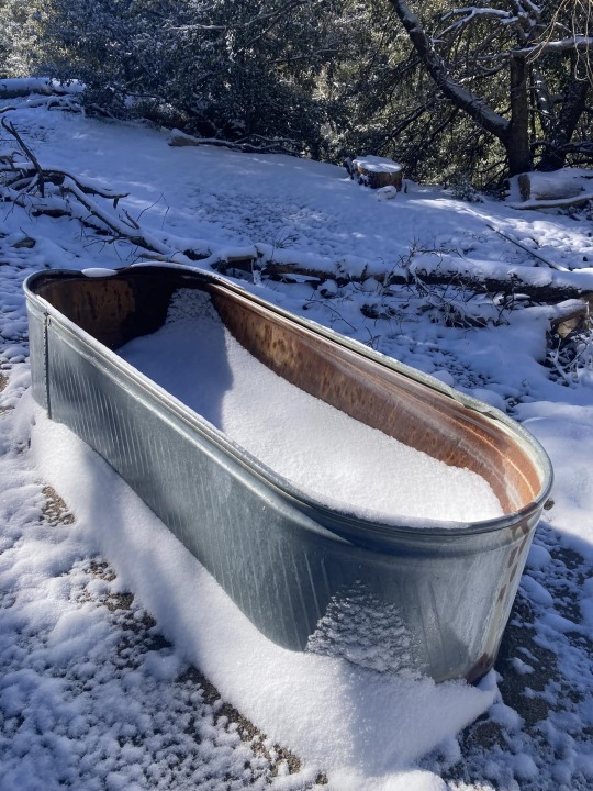
Kelly Ford documents the unpredictability of spring weather on the Southern California PCT. Flowers are popping and snow is dropping . . . all within a few days in mid-April.
3 notes
·
View notes
Text
The Ever-Changing Length of the PCT
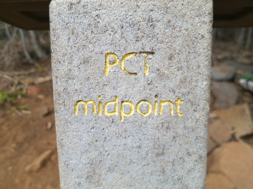
The most recent edition of the PCT's "Trail Dirt" tackled the mystery of the PCT length . . . it has been a topic that has been a curiosity also explored on this website -- https://pcttrailsidereader.com/post/618834872879939586/it-looks-authoritative-and-permanent-but-the The midpoint looks so official but as this article explains, the length of the trail is constantly changing . . . hence moving the midpoint. However, the marker stays put.
Easy, 2,650 Miles, right? Well… not quite.
By Galen Keily
The question of the PCT’s length comes up often, with guidebooks, phone apps, and other sources across the internet offering varying figures. In recent years, PCTA has come a long way in better tracking and calculating distance. While we regularly reference the rounded figure of 2,650 miles as shorthand for the trail’s length, our current best estimate places it at approximately 2655.8 miles. It’s complicated because the length actually varies year by year, and homing in on highly accurate mileage for a trail that spans thousands of miles can pose significant challenges. We know that trail mileage matters a lot to PCT trail users. Read on to discover some of the complexities involved in determining the true length of the PCT.
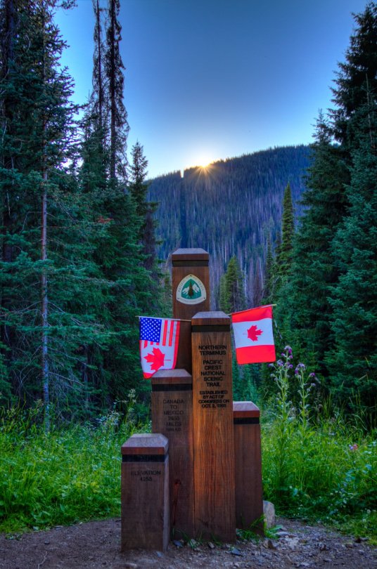
Northern Terminus, Photo by: Ryan Weidert
It Moves!
Sometimes, the trail gains a mile or two, or sometimes, the trail shaves off miles (you’re welcome thru-hikers!) You might be thinking… how does this happen, isn’t the trail already on the ground? While true, PCTA, alongside managing agencies and dedicated trail crews, continually refines and optimizes the trail’s route. These efforts range from minor adjustments to larger-scale relocation projects aimed at enhancing the overall trail experience. For instance, routine maintenance often involves realigning sections of the trail to improve sustainability, such as adding switchbacks or adjusting trail tread within the existing corridor. These alterations might end up making the trail a bit longer or shorter, typically on the order of hundreds of feet. Pretty small potatoes when looking at a trail that crosses thousands of miles. Other times, the PCT undergoes bigger relocation projects based on a process called Optimal Location Reviews (OLR). These relocations can be significant and can take years to complete. These projects aim to relocate the PCT to a location better suited to providing a natural setting, scenic beauty, and safe public access, among other things. As a result of these projects, the trail’s length may fluctuate by several miles. But they also end up making the trail safer and more enjoyable for all.
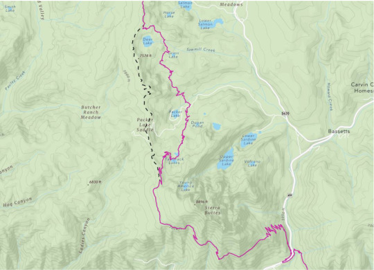
The Sierra Buttes Relocation – Old decommissioned PCT shown in dashed black line, current PCT in maroon.
What’s so hard about miles?
Calculating distance across such a large geographic extent is challenging. Even minor inaccuracies that are repeated hundreds of thousands of times compound errors, resulting in significant discrepancies in overall mileage. For example, if each point in our PCT dataset were off by 1ft, the margin of error would be over 200 miles. Additionally, the translation from a three-dimensional Earth to a two-dimensional map necessitates “projecting” data in GIS (Graphical Informational System) software, which can introduce different types of accuracy loss. However, advancements in technology offer us promising avenues for improvement, such as using LiDAR (laser scans of the earth) to more precisely capture and map changes to the trail.
A little bit about the data
PCTA’s current iteration of PCT mapping data is built upon data that was donated to the organization from the Halfmile Project. You may have heard of Halfmile, he and his team are kind of a big deal. The resulting data from this project’s multi-year effort was the best, most accurate data for the PCT of its time. Volunteers in the project mapped thousands of miles of trail with survey-grade custom and commercial GPS units and spent tremendous amounts of time analyzing, processing, and curating the results.
Halfmile, using his iPhone to control the Long Distance Geo Logger. The blue GPS unit is in the lower black side pocket of his pack. You can see coiled cable right above it.
Building on this legacy, PCTA now builds upon that same highly accurate data from Halfmile, revised to account for re-routes and trail reconstruction that have happened since PCTA assumed control of the data. We maintain our PCT Centerline (the line data for the trail’s location) and Mile Markers (points every tenth or half mile), with new versions released on an annual basis, usually in January. The data is displayed on our Interactive Map and made available on our PCT Data webpage, freely available for download in a variety of formats. By fostering an environment of transparency and accessibility, we empower trail users, app developers, and agency partners alike to utilize this standardized dataset, facilitating seamless communication and navigation along the trail.

Graceland takes an emotional moment at the Northern Terminus after an adventure of a lifetime. Photo by: James Townsend
Conclusions
As we continue to monitor changes, refine our modeling of the PCT, and offer it to users in new ways, we realize that our data remains imperfect. Digitally representing the complexities of the natural world always is. Despite this, the Association’s renewed prioritization of data management, built upon the invaluable foundation set by the Halfmile project, marks significant progress in this work. We recognize that our path toward data accuracy is ongoing and that we’re by no means at the finish line (approx. 2,655.8 ), but we’re always improving, collaborating, and working to celebrate the intricacies of the PCT in this unique aspect of our work.
Author: Galen Keily
4 notes
·
View notes
Text

This photo by Robert J. Ross is one of the winners in the World Nature Photography competition. While the photos have little to do with the PCT, they should be inspiration to all nature photographers to up our game. They are worth a look . . .
0 notes
Text
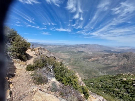
Paul started on March 19th . . . one of the magical views from Mt. Laguna. Paul, in his 50s, is from the U.K.

4 notes
·
View notes
Text
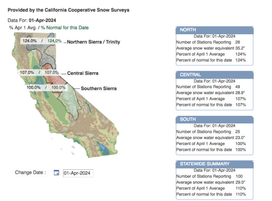
In California, April 1st is considered the peak of the snow year. After April 1st, the snowpack typically begins to diminish. Of course there can be late season snowstorms but as the weather begins to warm and the days lengthen, the snow will begin to melt.

Here is another perspective on the snowpack in Northern California and the Southern Oregon Cascades. As the image snows, much of the region is 'Much Above Normal'.
The mountains of Washington State, however, have developed a snow pack that is running about 75% of average.
21 notes
·
View notes
Text
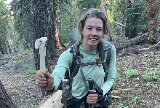
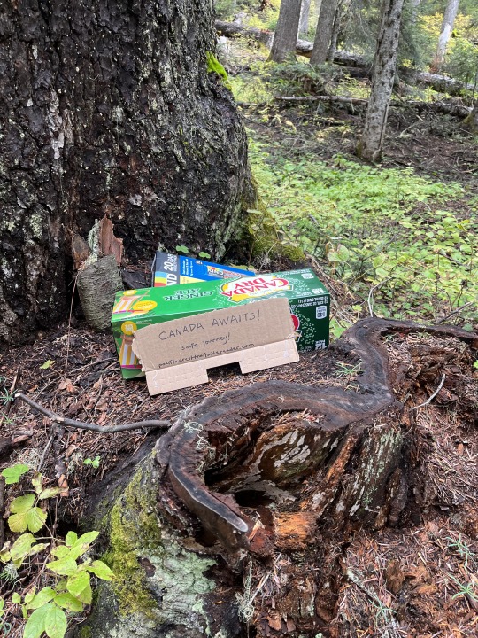
Trash on the Trail -- What's Out There
Bandages, balloons, bullet casings: Here’s how much trash is on the Pacific Crest Trail
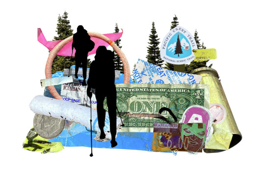
A pair of environmental scientists who thru-hiked the trail last year conducted the largest known and most comprehensive survey of litter on the Pacific Crest Trail. Illustration by Sophie D'Amato/The Chronicle from No Trace Trails elements.
Their findings reflected my own perception of trash on the PCT. The litter I have encountered does seem to be concentrated around highway crossings, campgrounds, trailheads, and high-use areas with easy road access. The issue of toilet paper along the trail is a more complicated issue . . . one that seemingly combines awareness, behavioral change, and some infrastructure support.
ByGregory Thomas and Harsha Devulapalli
Roughly 1 million people per year venture onto the wild and scenic Pacific Crest Trail, the 2,650-mile hiking route that winds through the West Coast’s soaring mountain ranges between Mexico and Canada.
That includes hikers out for a day in the woods, backpackers on multiday trips and thru-hikers seeking to conquer the whole thing in one long trek. Inevitably, some of those nature lovers leave behind micro-trash and bits of plastic litter. No one has sought to quantify the impact of trash on the trail — until now.
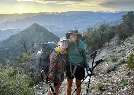
A pair of environmental scientists who thru-hiked the trail last year conducted the largest known survey of litter on the PCT, providing a sharp look at the kinds of materials people leave on the trail, in what concentrations, and where. The project was carried out, mile by mile, by Tori McGruer, 29, who holds a doctorate in environmental toxicology, and Macy Gustavus, 25, who holds a master’s degree in watershed sciences.
Here’s what they found.
A look at a few of McGruer and Gustavus’ findings
Graphic by Sophie D'Amato/The Chronicle from No Trace Trails elements
© OpenMapTiles© OpenStreetMap contributors
McGruer and Gustavus started their journey in March 2023 in Campo (San Diego County), near the Mexican border, the launchpad for northbound thru-hikers. They’d secured $16,000 in funding through grants and partnerships, quit their jobs and hit the trail.
From the get-go, they found significant concentrations of litter — bottle caps, gum wrappers and rubber fragments.
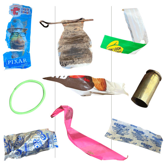
Over the next six months, McGruer (right) and Gustavus hiked the full 2,650-mile trail, which crosses the High Sierra and the Cascade Range, to the Canadian border. They cataloged — and usually collected — more than 1,000 pieces of trash. They found lots of snack wrappers, used toilet paper, Band-Aids and cigarette butts as well as novelties like Mylar balloons, a spent shotgun cartridge and a rusty horseshoe.

The researchers surveyed 1-kilometer segments of trail at 10-mile intervals — a total of 260 survey areas ● (a rate of about 2-3 per day). Each hiker scoped for litter on her respective side of the trail to a distance of about 6 feet from its center.
They handled trash objects with plastic salad tongs for sanitary reasons and deposited them into waterproof stuff sacks, “so if there was something gross we could put it in there and not worry about it leaching out,” McGruer said.
Certain heavy or cumbersome items, like pieces of an abandoned car, were cataloged but left on the trail. They categorized each item using Rubbish, a mobile app that helps users organize and geolocate litter in open spaces.
So, the dirtiest stretch of the entire trail?
A long segment bookending the San Gabriel Mountains on the outskirts of Los Angeles was the dirtiest of the entire PCT, presumably due to its proximity to a major metropolis. One-third of all the trash the researchers logged during their trip came from this region.
A few survey areas there contained hundreds of litter items. However, the researchers set a 100-item maximum when counting litter in a given survey area. When they hit that threshold, they believed they could extrapolate the trash concentration with reasonable accuracy, they said.
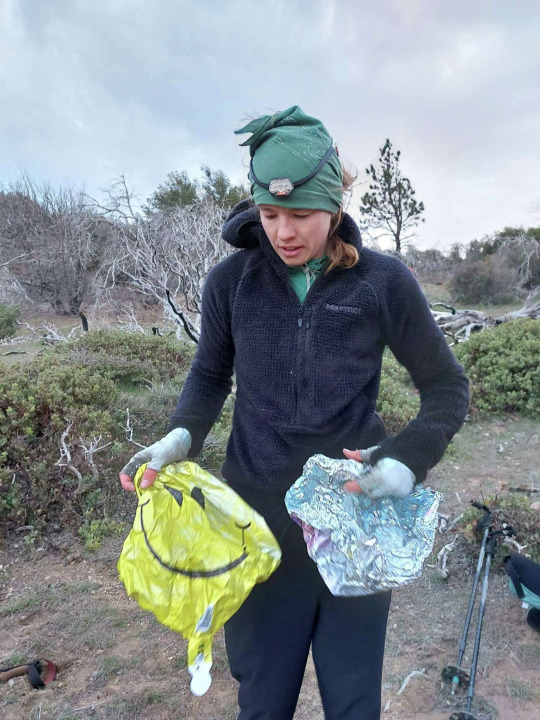
Mylar Balloons
Those shiny, metallic, helium-filled balloons are remarkably durable and capable of floating long distances. Strangely, they are winding up in remote wilderness areas at a rate that is concerning to biologists, as the Chronicle has recently reported.
McGruer retrieved several of them in the Southern California desert — one stuck in a patch of bushes, another submerged in a river. Survey aside, she made it a personal mission to remove the ones she found.
“One day I had like three partially inflated ones attached to my pack and someone passing us on the trail said ‘happy birthday’ to me,” she said.
The researchers found trash in about 60% of the 260 survey zones, meaning 40% contained no discernible litter. The hot spots along the trail tended to correlate with areas of easy access and high human traffic like highway crossings, campgrounds and day-use areas.
Brian Feulner/Special to the Chronicle
Many of the zero-trash areas were in remote mountain regions like Northern California’s High Sierra and Washington’s Cascade Range, where few people set foot.
That finding tracks with the experience of Jack Haskel, trail information manager for the Pacific Crest Trail Association, which maintains the trail on behalf of the U.S. Forest Service.
“Much of the trail is pretty pristine regarding trash but you do find hot spots where there’s a lot of it,” he said.
The most common trash materials found were: soft plastics, such as bits of bar wrappers or cuts of duct tape; hard plastics like water bottles and broken trekking pole baskets; brass bullet casings; paper shreds and used toilet paper; cigarette butts; and miscellaneous fragments.

In many instances, researchers encountered single pieces of stray trash, one at a time. But sometimes they’d find dozens of pieces of litter linked to a single event. For instance, in the backcountry of Shasta County they found 50 or more strands of tree-flagging tape used by foresters scattered on the ground.

What’s that?
In some cases, differentiating rubbish from natural ground materials was challenging. Identifying and classifying objects required four of the five senses — sight, smell, touch and, at one point, taste.
Unsure about the makeup of a smooth chunk of translucent detritus they found in the dirt –— was it plastic? glass? a natural mineral? — Gustavus popped it into her mouth and bit down. Glass, she decided.
“That’s not common,” Gustavus said. “I don’t encourage people to do that.”

Toilet paper
Used toilet paper left along the trail — half-buried, stuffed under a rock, clinging to bushes — is the PCT’s single, stand-out trash problem, according to Haskel of the Pacific Crest Trail Association. It is a gross, unsightly bane of trail rangers and volunteer stewards. The trash researchers found a lot of it — particularly in the northern states.
“In Oregon and Washington there was toilet paper everywhere,” McGruer said. “I was like, what is happening?”
In lieu of using a toilet, backpackers and hikers should bury their waste several inches deep in the ground, or use a wag bag and carry it out, and take their soiled toilet paper with them. Poop carries toxins and bacteria that, even when buried, can leach into nearby water sources and infect wildlife, Haskel said.

Biodegradables
Sunflower seeds, pistachio and peanut shells, orange peels — the researchers found them scattered along the entire trail route, and seeing them drove Gustavus “absolutely insane.” Yes, they should technically break down over time, she said, but hikers shouldn’t feel free to dump them in the natural environment.
“It’s kind of a misguided principle,” Gustavus said. “That stuff does not belong out there.”
Pictured: Pistachio shells on the trail in the mountains of Washington State.
The pair completed their thru-hike in September 2023. McGruer (left) and Gustavus are shown here at the PCT's northern terminus in the remote mountains where Washington State meets Canada.
It’s important to note that many PCT users actively beautify the trail each year.
Local volunteer groups, rangers and backpackers are all known to pick up trash they encounter on their outings as a simple act of altruism. Also, eight years ago a pair of young men made it their mission to remove the junk they encountered during their thru-hike; they ended up with more than 700 pounds of stuff, including a mattress.
Extrapolating from their data, McGruer and Gustavus estimate there to be about 200,000 pieces of trash along the trail at any given moment. But that’s not to say the trail feels trashy, McGruer said.
“We frequently saw trash, but often there would be a small piece in one of our 1-kilometer surveys. You wouldn't register that as a ton of trash,” she said. “I think what our survey findings say is that people leave a trash footprint wherever we go with these materials that really don't break down in the environment.”
The survey project, which the researchers dubbed No Trace Trails, was supported by grant funding and financial backing through the Moore Institute for Plastic Pollution Research in Long Beach via the Richard Lounsbery Foundation in Washington, D.C., and the American Alpine Club.
McGruer and Gustavus are putting together a research manuscript for peer review. They’re also seeking funds to help analyze the microplastic content of a series of soil samples they collected during their hike.

Sarah “Mountain Goat” Steinbauer from Austria hikes the Pacific Crest Trail near Quincy (Plumas County) on June 19, 2023. The heavy snowfall in the Sierra Nevada that year created special challenges for thru-hikers along the PCT. Brian Feulner / Special To The Chronicle
Credits
Reporting by Gregory Thomas. Reporting and graphics development by Harsha Devulapalli. Editing by Yoohyun Jung and Kate Galbraith. Design, development and illustration by Sophie D'Amato. Design editing by Alex K. Fong. Visuals editing by Ramin Rahimian. Powered by the Hearst Newspapers DevHub.
8 notes
·
View notes
Text
Early Trip Challenges
Anne-Marie started from the southern border on the 22nd of March with the intent of reaching Kennedy Meadows by mid-May. Walking the PCT is a dream that she can now pursue upon her retirement.
March weather, even in Southern California, can be unpredictable . . . often sunny and dry. On Anne-Marie's second day out approaching Lake Moreno, the rains began. On the morning of day three, here was her journal entry:

Weather outside is delightful, haha if you like rain, hail, sleet and gusty winds! Many fellow PCT hikers including us are waiting out the storm today at Lake Moreno state campground and will start back on trail Monday. There are 10 rustic cabins on site, we were able to book one for tonight but it is not available till 3 pm. The cabin overlooks Lake Moreno and has electricity, heat and wood frame beds (queen and 1 bunk). While we wait we visit the local Malt Shop (shout out to Lily, our cook- food was awesome!) and stand around the picnic pavilion huddled close to stay out of rain. Our hike umbrellas have really come in handy! The bathrooms are not heated but have showers and flush toilets- a luxury for a hiker! I set up a clothesline in the bathroom for girls to dry out sleeping bags, tents and clothes and placed quarters in the shower (.25 cents for 2 minutes) for anyone who wants to wash off. Some Dr Bronners camp soap washes clothes, hair and body!
As more hikers come off trail drenched (some close to hyperthermia) we make the call that anyone with a cabin makes room for a hiker. That said we gave our cabin up to young 6 girls and will bunk with Bear & Sassy, who are close to our age and we have really bonded well with.
Cabins open up, we move in, another clothesline goes up to continue to dry out. Peter makes a run to the malt shop for carry out pizza dinner and some Makers Mark and we also have a bottle of wine to share. We set up a hiker-coterie with our leftover hiker snacks and enjoy dinner and conversation. We all take turns trying to find the leak in my sleep pad to no avail-my hips are getting used to hard surfaces (wood slats tonight).

Both Crossing Paths and The Pacific Crest Trailside Reader: California have stories about winter weather in the Lagunas . . . when the calendar says 'spring'.
1 note
·
View note
Text

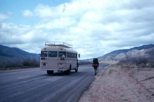

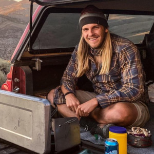
It was April 1, 1975 … gasoline cost 44 cents a gallon, Saturday Night Live had its first show, the average house cost $39,300, the movie ‘Jaws’ premiered, the Vietnam War was formally ended, and Gary and Steve Funk started their thru hike of the PCT.
Gary returned to the PCT 40 years later (documented on this website) and thru-hiked again with his son-in-law and niece.
These three photos from the top moving clockwise: 1) a very different border scene than today’s steel curtain; 2) Warner Springs Resort; and, 3) walking below the San Felipe Hills.
2 notes
·
View notes
Text

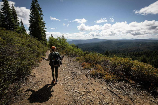
Often overlooked by thru-hikers finished with the High Sierra and racing to reach the North Cascades, the mountains of Northern California bring the PCT its own stunning beauty. Please, don't plan to race north! Give yourself time to enjoy these amazing mountains too!
2 notes
·
View notes
Text
Support Comes in Many Ways
So often we write about our experiences as hikers on the PCT. We describe places, challenges, feelings, and even a few frustrations. In a recent article posted by Julia Clarke she reminded me of another aspect of hiking the PCT or anywhere really. She outlines the ways we can support a thru hiker(s) or anyone who is getting on a trail for an extended period...five days, fifteen, or longer but not a full 4-5 months.
Rees, Jim, and I have benefited from the kindness of friends as well as strangers (at least they were initially). We have gotten rides, sodas, a much deserved and required shower, and more over the years. When I read Julia Clarke's article it reminded me of just how important it is to be a supporter of a hiker. Sure, we would all like to walk in someone else's shoes, at least vicariously, but when we can't we can still be a key part of someone's journey.
Clarke suggests six ways we can support a hiker. She specifies a thru hiker but in my mind I won't limit the support you and I can offer. These six suggestions all have relevance.
Logistics
As for any kind of short to long duration hike, finances, gear, rest days and transportation all must be coordinated.Whether or not you are planning a long distance thru-hike or a shorter hike it still takes a lot of research and effort.
A hiker needs to figure out getting to the trail, what they need for their entire journey, and how to get it to the right places. Calculating or at least guesstimating how far they’ll have to walk each day if they want to reach their goal or are trying to beat winter all come into play. How often breaks occur and stays in towns along the way all have to be budgeted for. When the hike is complete a hiker also needs to make a plan for how to get home.
Lastly, previous or prior knowledge can be very valuable to a hiker. If you happen to have specific knowledge of a specific hike or hiking/backpacking in general you may provide a valuable benefit to a prospective hiker. Assisting with logistics could be a great way to help someone with their hike. This is another way to share the 'load' with someone.
2. Re-Supply
Re-supply is an essential part of any longish hike. More and more we hear about hikers flying by the seat of their pants/hiking shorts and shopping as they go. Depending on local towns for re-supply, can be an expensive way to do things. Re-supply boxes on the other hand are mailed to a drop point such as a post office or store along the trail and held until the hiker arrives. Costs are expended on the front end of a hike and not throughout the length of a hike. Both shopping along the way and re-supply boxes can be effected by store and post office hours. Nevertheless, arriving to discover your re-supply box hasn’t made it can be disastrous. It can really be important that a hiker has someone they trust in charge of this getting boxes shipped on time to the right place. If you choose to offer this level of support you’ll need a space that you don’t mind being filled with boxes until they go out the door.
3. Transportation
Getting to and from a trailhead requires some help. These trailheads, especially for long distance hikes, are often in remote areas, so a hiker may need someone to give them a long ride at the beginning, end or one or more times along the way. The PCT is over 2,000 miles long so working out transportation is a key element. Yes, there is hitchhiking but as I have found it doesn't always work the way I planned, at least how I imagined it in my head.
4. Trail Magic
If you happen to live near a stretch of any long distance trail, one of the most feel good efforts you can make is to support a hiker by performing a little “trail magic.” Trail magic is basically just a hiking version of random acts of kindness. This usually entails providing hikers on the trail with something as ordinary as a soft drink or extraordinary in the form of a meal. Any and all is often greatly appreciated. Trail magic is typically something a hiker may enjoy while they’re hiking. I still remember finding some mandarins just south of Cajon pass.
Trail angels, can perform their act(s) anonymously and leave a camping cooler full of fruit or lemonade and soda on the trail, or even set up a table with food like home-cooked brownies. A trail angel might also offer hikers rides into town, buy them dinner, or even offer them a bed and a warm meal for the night. These offerings are acts of service, with nothing expected in return, and will make memories that hikers cherish forever, I know I have.
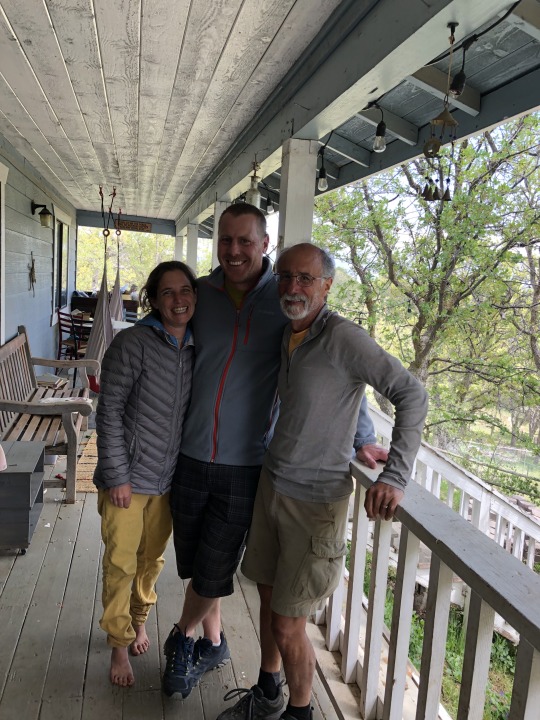
Two of my favorite Trail Angels in Tehachapi
5. Visit Them
If you know someone who is heading out on a long hike, a nice way to support them might be with a little company. Even though hikers on long distance trails often meet other hikers throughout their time on the trail, they might still appreciate seeing a friendly face show up to walk with them. If you’re not a hiker, you can still plan to meet them in town during one of their zero days. If you are a hiker then you may like joining them for a day hike an overnight or even a section hike over a few days to keep them company.
6. Trail Crew
Most hikers rely on there being a well-maintained trail so they can live out their hiking dreams. Trails don’t just create themselves. It takes a small army to build water diversion dams, cut back brush, clear trees and replace signage, and most of that work is performed by volunteers.
You can donate your time (or funds) to help maintain a section of a long distance trail. This could be a one time commitment or an annual or on-going role. Remember, this work can be physically demanding and usually requires you to be available for an extended period of time. It entails lots outdoor time with like-minded people and can be very rewarding. The PCTA manages many of these crews and they welcome people to join their efforts.
Whether or not you are embarking on your next great PCT or some other hiking adventure it is worth considering another way or ways to experience the PCT. Providing support to one or more hikers can be very rewarding on a variety of levels. You may be a believer in karma or you may simply want to take an opportunity to return a favor you enjoyed in the past. Either way offering support to one or more hikers can have a lasting impact for you and them.
A little something along the way
2 notes
·
View notes
Text
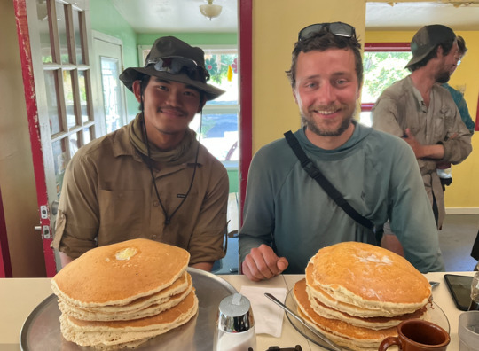
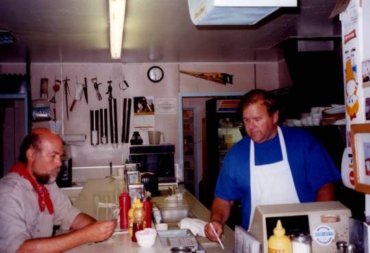
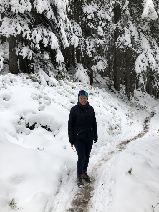
The Seiad Valley Pancake Challenge remains one of the PCT traditions. Five humongous pancakes eaten in two hours and they are free.
Seiad Valley is a tiny trail town in Northern California along the Klamath River wedged between the Marble Mountains and the Siskiyous. The focal point is the Seiad Valley Store and Cafe which has, for years, been home to the challenge.
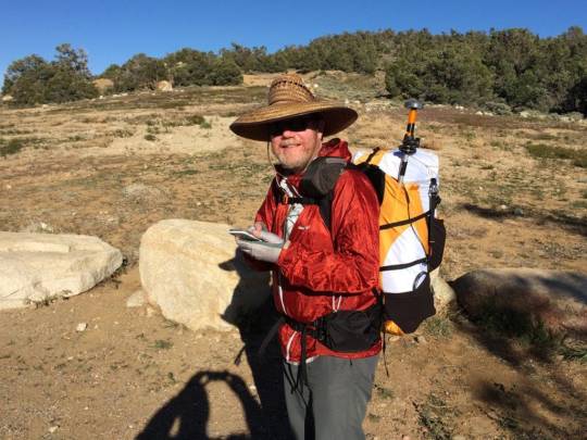
I wrote my own tale of trying the Pancake Challenge in The Pacific Crest Trailside Reader: California (2011). [Here I am gearing up long ago.]
1 note
·
View note
Text
High Sierra Avalanches
By Norman Clyde
Norman Clyde was a young high school principal in Independence, California in the 1920s. Clyde had been inspired by the writings of John Muir and became well known for his high country exploits. By the age of fifty in 1935, Clyde was the veteran of more than six hundred mountain ascents. During a "vacation" in Glacier National Park, Clyde scaled thirty-six peaks in an many consecutive days. We included a wonderful story he wrote, "The Search for Walter Starr", in The Pacific Crest Trailside Reader: California.
The short piece below is from a short tome that Clyde authored in 1962, "Close Ups of the High Sierra", focused on avalanches in the Sierra. It touches on a subject that is especially relevant to PCT hikers who enter the Sierra earlier and earlier in the year.
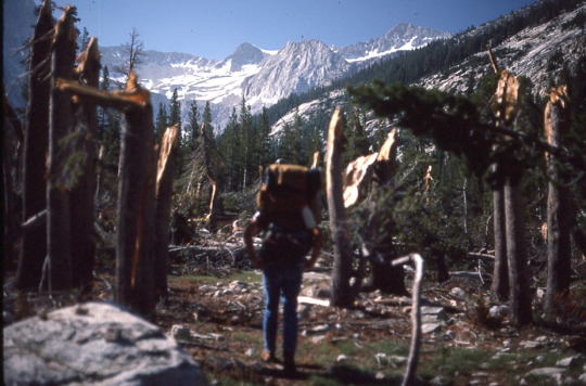
(Walking through an avalanche field in the Sierra where the trees have been snapped off by an avalanche. Photo credit: Rees Hughes)
Avalanches are much more numerous in the High Sierra during the winter and spring than those who have not spent considerable time there are aware. Their number varies greatly being much ore frequent and of greater volume during seasons of high precipitation. That comparatively slight damage has been done to property and few lives lost is due, in large measure, to the fact that most occur when there is little property to destroy and no person in the pathway.
Snowslides in the higher portions of the mountains take place most frequently in couloirs or chutes. After heavy snowfalls, numerous slides course down. . . . In spring, after a storm, almost as soon as the sunshine strikes new snow, it may let go and come rushing down the couloir. After a storm in May, I have seen as many as a dozen slides coursing down as many couloirs in beautiful snowfalls.
Avalanches take place on smooth slopes on steep mountain faces. Powder snow does not cling to these faces. If it happens to be wet, as sometimes happens, even in the High Sierra, a considerable amount may adhere to the rocks. As the temperature warms this usually sloughs off in avalanches.
Many slides to not reach the underlying terrain. Except on protected slopes or basins, snow that falls in the Sierra may be packed by the wind or thaw on the surface. As the temperature drops, a crust is formed. If alternate thawing and freezing continues, neve, or granular snow is formed. By spring, much of the snow, particularly on exposed slopes is of this form.
Rough slopes which would prevent snow from sliding are sometimes smoothed over. Should a heavy snow fall of such a surface, particularly if the slopes is above 45 degrees, the danger of a slide is great. Many of the spring slides are of this type.
Avalanches usually start slowly. A crack runs along, then slowly widens and a sheet of snow begins to move. Once started, the acceleration may be great. If it travels three thousand feet down a steep slope, it may reach express train speed. Its momentum being sufficient, it may run across several hundred yards of terrain at the foot.
On one occasion, weary of slogging through wet snow well up to my knees, I hit upon the idea of starting miniature snowslides and riding them. This I did by sitting down heavily, causing the layer of new snow to begin to slide. The acceleration was rapid. Eventually I struck a shadowed area, where an icy crust had formed.
Instantly, the slide shot forward, with a cliff only a short distance ahead. By swimming and rolling, I managed to get off the slide and watched it vanish over the cliff. That was the last time that I deliberately rode a snowslide.
2 notes
·
View notes
Text

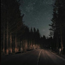
Waning light on the PCT . . .
I am so ready for the coming of spring. It is hard not to have dreams about evenings like the one captured in this image.
13 notes
·
View notes
Text
Anticipation
We are closing in on the month of March. By now there are a lot of people are preparing to set forth on the Pacific Crest Trail. These hikers will be identified as "the class of 2025" A majority of March's hikers will begin their journey from the southern terminus at Campo. With the imposing 'border wall' at their backs they will head north with a full complement of expectations, dreams, and goals. Some will be realistic some not so much but that is the nature of the trek north from Campo. Whether these people have big mileage goals or brought too much gear, have the wrong shoes, that will all get revealed sooner than later.
I often think back to my hike from Campo. I was forced to delay this portion of the PCT until my work commitments were set aside. Setting work aside I was truly free to pursue my desire to complete the PCT in a series of sections as I had been doing for several previous decades. Yes, decades. Here I was at Campo pinching my self realizing I was actually doing this. My ultimate goal was to complete everything (all the sections) I had left over the next few years. Now I was beginning. I was excited and a little overwhelmed too.
"Doing this" was only happening because the stars had aligned. My longtime hiking partner Rees Hughes had agreed to accompany me on what would be repeat for him. He would walk with me to the Paradise Valley cafe. From there my friend Billie Robinson would join me to I-10 outside of Palm Springs. My wife, Kathy, had encouraged me whole heartedly and if I was going to do this now was my time to complete the sections between Campo and Cajon pass.
Of course my anticipation was running high as my departure date approached. I had done so much planning that now all that was left was to put one foot in front of the other, take it all in, and celebrate making a long held dream a reality. Sounds simple. For me it was relatively simple if I tamped down my fears and anxieties about being one with the weather, snakes, and whatever else. I kept reminding my self to expect the unexpected. To be clear the unexpected was not necessarily a negative it was just that, outside the parameters of my 'plan'. I would have to add flexibility to however things unfolded.
Right now there are lots of people who are experiencing something close to what I was feeling preparing for and hiking to Cajon pass. Many of these hikers are planning to go all the way to Canada. Some won't get farther than Scissors Crossing. There will be a variety of reasons for their exit. Some will come back some will never return. All will try their hardest to anticipate what lies ahead for them.
Carly Simon wrote a song back in the 1970's entitled 'Anticipation'. The opening lines seem to apply right now as my fellow hikers are preparing for their own journeys.
We can never know about the days to come
But we think about them anyway
My one piece of unsolicited advice is to not overthink it. We don't know about the days to come but they will likely be much better than we thought or at least different. The key is to embrace this experience in your own way and style. Trust your self and your decisions knowing you can change your mind and create new choices along the way. No matter what it will be memorable.

2 notes
·
View notes
Text
Just a Little Bit
As the seasons begin to change and thoughts of getting outside start to bubble up into our hopes, dreams, and memories it seems appropriate to consider options. Generally when the topic of the Pacific Crest Trail comes up in conversation or reading, or in film it is framed around thru hiking. Beginning to end, start to finish. "Damn the torpedoes! Full speed ahead!" or something like that. Thru hikes are stories mostly full of success. Participants overcome adversity and find their way forward. Thru hikes get the glory it seems.
A short snowy early fall day hike on the PCT with a friend.
To day hike on the PCT is easier for some than others mostly given where you live. Living in Kansas for example, you are not going to call your friends up and say, "Hey, how about we day hike from Rainy Pass to Cutthroat Pass this weekend?" or " Let's meet at Kennedy Meadows and do a day hike...what do you say?" The day hike option in the immediate sense is challenging for a lot of us. Less so when people have some time but not a lot of time to do a more challenging or ambitious undertaking like in the summer months.
I met a fellow once who was driving to PCT trailheads on the weekends and day hiking out and back to his car. He didn't have the luxury to take extended time off of work and other responsibilities so this worked for him. To be honest the PCT is not exactly easy to move from trail head to trail head everywhere. He happened to live where it was more possible.
In my case I can easily consider various day hikes on the PCT from where I live. They might be longish days or require sleeping in my vehicle or a nearby accommodation but still doable. If you are dreaming of a PCT experience here is your opportunity to get a taste.
Jack Haskel at the PCTA wrote a really honest and informative essay in the organizations magazine 'The Communicator' last spring. He writes," The decision around what to pack for a day hike also became easier when I stopped overthinking it. I embraced the 10 essentials, added a couple of extras, and now all the necessary items live in my day pack permanently." Here's the list:
Navigation- paper maps and/or phone app maps
Headlamp-sometimes the best laid plans just take longer than your think.
Sun protection
First aid- maybe not for you but for someone else...
Knife plus gear repair kit
Fire (matches, lighter, tinder and/or stove)
Shelter (ultralight mylar emergency shelter that fits two people)
Extra food
Extra water
Extra clothes
In addition tell someone where you are going and when you plan to get back. This is critically important for staying safe. Jack also carries a knife, compass, energy bar, and some spare batteries. His view, and I agree, better to be safe than sorry.
If you don't have the time, energy, desire, opportunity, or some other good reason for a lengthy PCT hike consider a day hike. Just walking a short distance with friends on the PCT has been rewarding for them as much as it has been for me. They got a taste of what my experience was and it sprouted some great conversations and experiences of their own. These experiences bring up so many memories flooding my brain from past hikes when I have done this.
2 notes
·
View notes
Text
Frog Lake to Barlow Pass on the PCT
As hikers walk north from Warm Spring Reservation heading toward Mt. Hood, they pass Timothy Lake and Little Crater Lake before crossing Warm Springs Highway and reaching Frog Lake, with its popular campground and day use area. One of the smoothest sections of the PCT trail in Oregon is between Frog Lake and Barlow Pass trailheads. The trail is fairly wide and almost always in great condition, making it a fast run. The Frog Lake to Barlow Pass distance is just 5 miles.

Old wooden trail sign at Twin Lakes – PCT trail junction.
Not far north of Frog Lake, the PCT passes Twin Lakes, lakes fed from nearby springs providing crystal clear waters that in the right light provide reflections from Mt. Hood to the north.

Mt. Hood from Upper Twin Lake.

Mt. Hood and Balsamroot at Palmateer Point
Barlow Pass and the famous Barlow Wagon Road, another emigrant route built in 1846, passes not far to the south of Mt. Hood. Its construction allowed covered wagons to cross the Cascade Range and reach the Willamette Valley, which had previously been nearly impossible. Even so, it was by far the most harrowing 100 miles of the nearly 2,000-mile Oregon Trail.
The Pacific Crest Trailside Reader: Oregon and Washington includes a story about the Barlow Road. There are many parallels between the Naches Pass Road mentioned in the previous post and the Barlow Road.
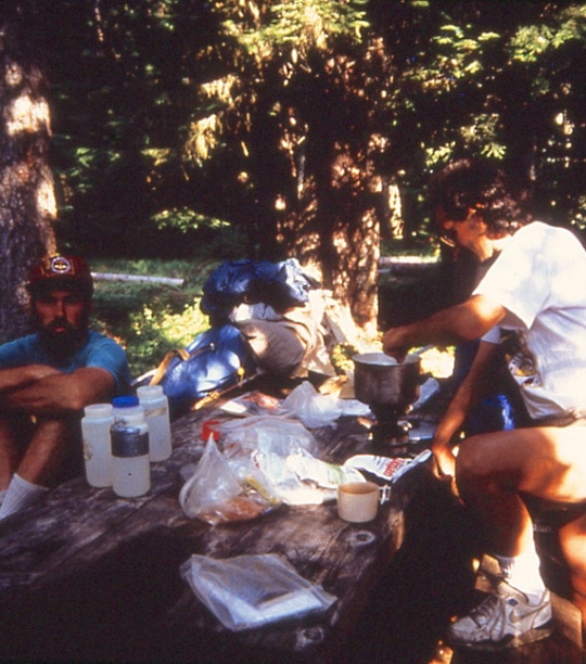
Dinner at Little Crater Lake Campground, 1991
"It was a wonderful swim at Timothy Lake and enjoyable evening at Little Crater Lake which is a 45-foot deep artesian spring . . . absolutely crystal clear and 40 degrees. We are camping in a 'self service' campground with a few people camped here also. It seems a little strange to have cars driving around and other people camped nearby, but it is made up for by having a PICNIC TABLE to sit at, and water from a pump to drink." July 29, 1991 (Jim Peacock)
The next day we walked 16 miles stopping for lunch at Frog Lake, continuing the "unremarkable". I walked in tennis shoes to give a 'hot spot' on my little toe some relief. We continued pass Barlow Pass another three miles positioned for our exit the next morning at Timberline Lodge.
4 notes
·
View notes