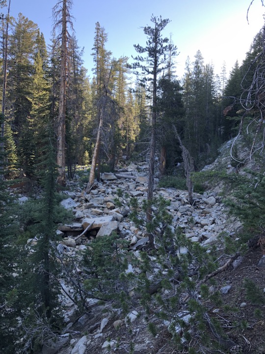
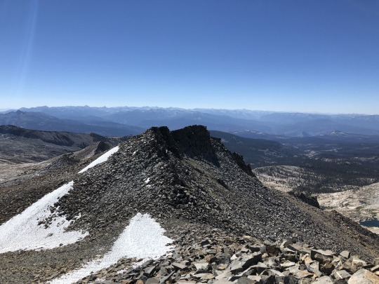
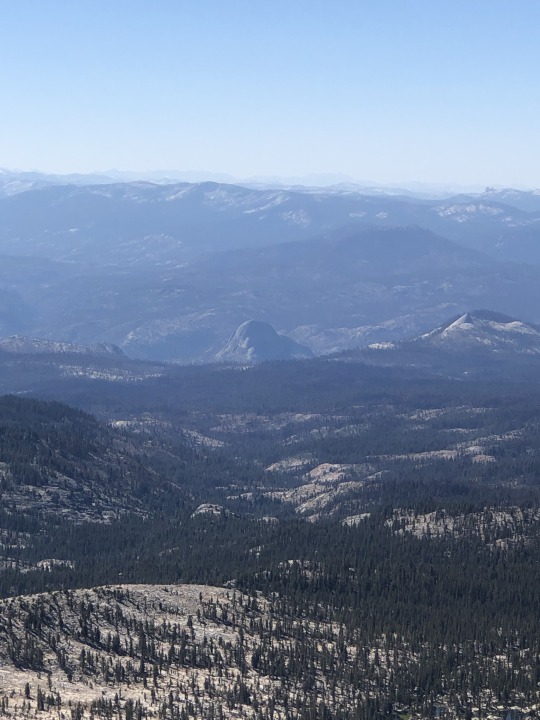
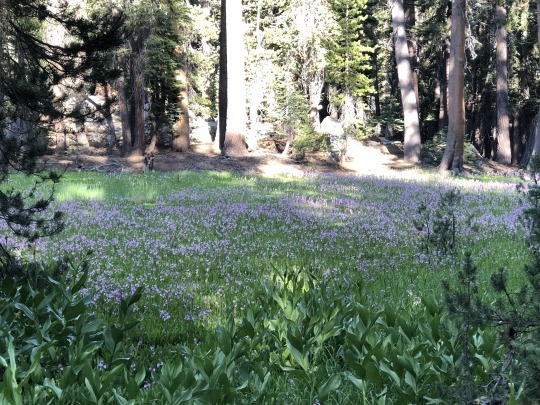
#looking east down yosemite valley
Text
windswept
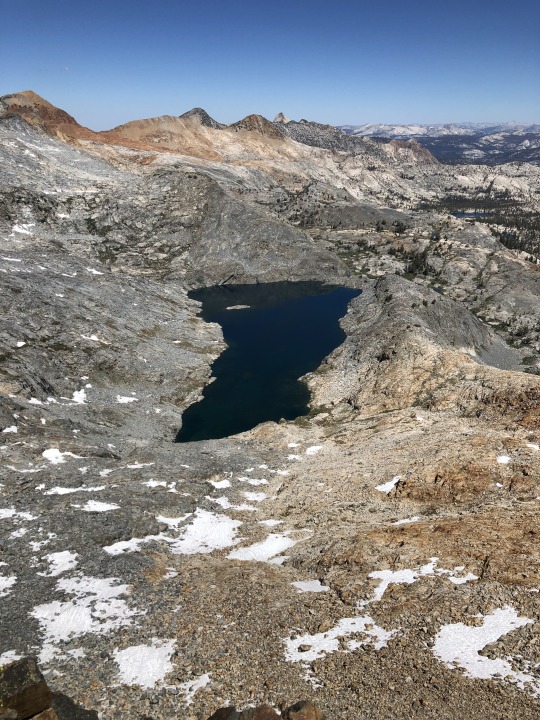
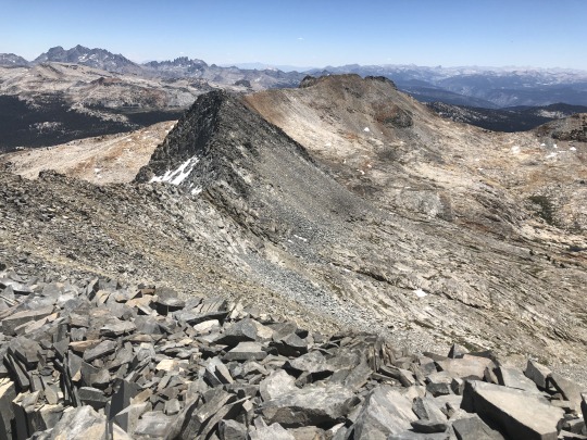
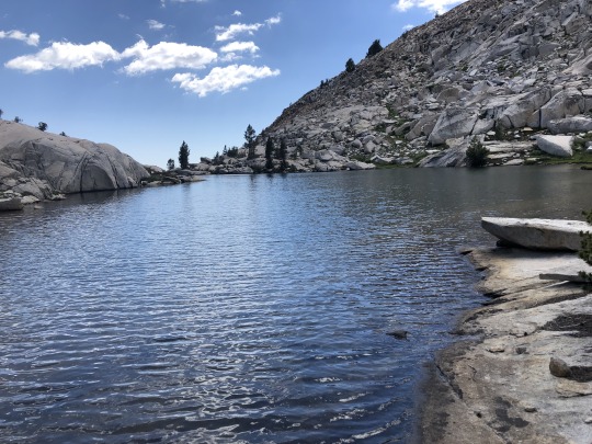
#horizon forbidden west#hfw#aloy#this is technically out of bounds#looking east down yosemite valley#it's above cauldron kappa and the game yells at you if you set foot there lol#but you can walk around quite a bit before it kicks you out#is there a name for this area? i don't want to call it sheerside mtns...#in my brain i call it the bulwark valley but idk if they ever give it some sort of a name in the game#anyone know?#hfw out of bounds#out of bounds exploration
42 notes
·
View notes
Text
Deeds That Beckon
Unitarian Universalism has a number of heritage stories of which we can be proud, some stories we should know even though they do not inspire pride, and a lot of stories that we need to reconsider in the context of our anti-racist and and anti-oppressive learning. May we respond to our history by seeking transformation, finding hope, and choosing the foundations we need for the future. Rev. Lyn Cox updated and delivered this sermon to The Unitarian Society in East Brunswick on October 15, 2023.
As Unitarian Universalists, we need stories that help us, on an emotional and metaphorical level, understand who we are and how to live in the world. Our history provides those myths. Stories about admirable Unitarian Universalists are grown from seeds of historical accuracy, yet they are family stories. When we study our prophetic ancestors and take up the path of service in our own generation, we are becoming part of that mythic story.
The seminary I attended invited us into one such story. My school was named after Thomas Starr King, a minister who served both Universalist and Unitarian congregations in the 1840s through the 1860s. He got a lot done. Thomas Starr King was about five feet tall. One of his famous quotes is, “though I weigh only 120 pounds, when I am mad I weigh a ton.”
As a nature writer, he persuaded people of the importance of preserving places like the White Mountains of New Hampshire and Yosemite Valley in the West. His accounts were published in the Boston Evening Transcript. He has two mountains named after him, one in New Hampshire and one in California’s Sierra Nevada.
He helped the Unitarian church in San Francisco grow into their mission as a vital congregation involved in the life of the city. Starr King was a vocal abolitionist. When the Civil War broke out, he traveled up and down California, speaking to everyone from miners to legislators about joining the Union instead of the Confederacy or trying to become a separate country.
When I lived in California and walked the hills of San Francisco, sometimes I would think, “If Thomas Starr King could hike up the mountains, I can, too.” Visiting Yosemite, I could see his point about the landscape being the scenic equivalent of Beethoven’s ninth symphony. Acts of service are like moveable temples, places where we can go to greet the spirits of our beloved ancestors, both blood ancestors and chosen ancestors.
Individualism and White Supremacy Culture
The story of Thomas Starr King can function as a UU religious story, bringing connection and inspiration, and a way to enter the story through acts of service. Even so, it’s worthwhile to go back and take another look at the stories that are important to us through the lens of white supremacy culture.
White supremacy culture is a system of oppression that uses everything from social norms to cultural narratives to corporate policy to federal law to maintain the privilege of one group over all other groups. White supremacy functions even in the absence of people who self-identify as racists. By design, the power and operating rules of white supremacy are unnoticed by most of the people who benefit from it.
Even when we have a story about someone like Thomas Starr King, who dedicated his life to causes like ecological preservation and abolition of slavery, we have to ask ourselves about what ways the form of the story we are telling upholds white supremacy culture. Sometimes oppression is baked in from the beginning, with our admired ancestors working against justice in certain facets while making progress in other facets. Sometimes the white supremacy culture is in our retelling, in the details we emphasize or the details we forget.
Tema Okun has been writing since 1999 about the characteristics of white supremacy culture. She writes about white culture as an insider, and self-identifies as a white person with Jewish ancestry from an upper class background. Okun credits several teachers and learning experiences, including the Challenging White Supremacy Workshop from The People’s Institute for Survival and Beyond. Okun focuses on the unspoken norms that maintain the status quo, even in organizations devoted to justice. The characteristics aren’t about individual people or specific groups of people, they are about a cultural and economic system that harms people and is good at perpetuating itself. She writes, “white supremacy culture trains us all to internalize attitudes and behaviors that do not serve any of us.” There is a lot to unpack in her writing, so I’d like to focus on one characteristic now and one a little later in the sermon.
One of the characteristics of white supremacy culture that Okun describes is individualism. Organizations that are under the influence of individualism have difficulties with working in teams. Individuals believe they are responsible for solving the problems of the organization alone. There is an emphasis on individual recognition and credit, leading to isolation and competition. Few resources are devoted to developing skills in how to cooperate.
The way we UU’s typically tell the story of Thomas Starr King is steeped in individualism. He did do important things, but a lot of his impact was through organizing and teamwork, and those are the strategies that are hard to replicate based on the mythology that we carry on in his memory. He didn’t just go around preaching on street corners, he traveled to speak with and work with coherent groups of people from different social classes and walks of life. He made a difference because of the way he was able to get outside his comfort zone and work with teams, not by his preaching skills alone.
The way history is taught and discussed in general is susceptible to this pitfall, and the way we talk about Unitarian Universalist history in particular is vulnerable to individualism. Sometimes our quick introductions focus on famous Unitarian Universalists, trying to make our religious movement more familiar by reminding people of its famous adherents.
One of the most famous UU’s is Ralph Waldo Emerson, who wrote an essay called “Self-Reliance” in 1841. In his memory, I worry that Unitarian Universalism has taken individualism to a place that limits our mutual accountability and our responsibilities to the most vulnerable among us. In his defense, Emerson’s 19th-century version of the concept of self-reliance is not the same as how most people think of the concept in the 21st century. He shares these characteristics with his friend Henry David Thoreau, who I mentioned earlier in the Time for All Ages story.
I appreciate Emerson’s healthy skepticism toward the way things have always been done. Emerson’s suggestion that sometimes social expectations are not the most important value is important for our anti-racism work, because you have to push back on politeness at least a little bit if you are challenging white supremacy. And. It is important not to let our admiration for Emerson’s “Self-Reliance” prevent us from being in covenant with each other, being loving in our truth-telling, and opening ourselves up to learning new ways of cooperation.
Contrast the image of Emerson as a poet who stands apart, an individualist hero, with what we know about another writer, Frances Ellen Watkins Harper. Harper was born into a family of free Black educators in Baltimore in 1825. She joined the First Unitarian Church of Philadelphia in 1870, and also maintained her membership in the African Methodist Episcopal Church. Like Emerson, Harper wrote poems, essays, and lectures. She also wrote short stories and novels. Like Emerson, she wrote about personal development and used her writing to promote social causes.
Unlike Emerson, Harper also wrote about responsibility to the community, and she practiced it in concrete ways. In her 1855 article, “A Factor in Human Progress,” she spoke of “the science of a true life of joy and trust in God, of God-like forgiveness and divine self-surrender.” In other words, she was more clear about working together with entities outside of her own mind.
Harper worked in her community feeding the poor and mentoring youth. She was part of several groups who moved toward progress together, for women’s suffrage and for Black suffrage, against lynching, for peace. We learn from her legacy that a writer can be a literary voice and also be a leader who encourages cooperation, solidarity, and true relationship with the people who are most impacted by oppression.
Individual effort has its good points, yet there is more to Unitarian Universalist history and more to our current character and potential than we can access through that doorway alone. Hyper-individualism maintains white supremacy culture when it prevents us from getting outside ourselves and building relationships with interfaith partner and community partner organizations. Hyper-individualism privileges the lone dissenter to the point where it is hard to put personal preferences aside so that congregations can work one one thing together. Hyper-individualism leads us to celebrate only the heroic faces of social justice, forgetting to gather in those who are called to work behind the scenes. There is a place in this congregation, this faith, and in the movement for people with many different talents and ways of being. As we study the past, may we celebrate the groups and movements as well as the superstars, knowing that progress is a team effort.
In addition to individualism, another characteristic of white supremacy culture we can explore in our UU history is paternalism. Paternalism is a cultural norm that shows up, as Okun writes, when “those holding power control decision-making and define things [such as] standards, perfection, [and the] one right way.” She goes on to name that “those holding power often don’t think it is important or necessary to understand the viewpoint or experience of those for whom they are making decisions, often labeling those for whom they are making decisions as unqualified intellectually, emotionally, spiritually, or physically.”
From the perspective of the person who thinks they are doing a good deed, paternalism can feel like compassion, yet often paternalism gets in the way of true progress. Impact is more important than intention. Among other suggestions, Okun advises, “when working with communities from a different culture than yours or your organization, be clear that you have some learning to do about the communities’ ways of doing; assume that you or your organization can't possibly know what’s best for a community in isolation from meaningful relationships with that community.”
If we want a positive example of grounded leadership in our UU history, consider Fannie Barrier Williams. She was an organizer, lecturer, journalist, artist, and musician. She was born in 1855 to one of the few Black families in Brockport, New York. She is most famous for her work in Chicago, where she belonged to All Souls Unitarian Church. Williams made strides in integration through the establishment of the Provident Hospital, joining the Chicago Woman’s Club, and serving on the Board of the Chicago Public Library. She also worked within the African American community. She helped start the National Association of Colored Women, which, through their 200 local clubs, provided child care centers, classes, employment bureaus, and savings banks.
The compassion that gets mixed up with paternalism might be a good impulse that gets misdirected. So let’s start with what’s good. Being true to compassion means meeting challenges and growing from them, allowing our minds and hearts to be transformed.
Dorothea Dix found that out when she entered the East Cambridge Jail as a teacher in 1841. Dix was horrified by what she saw. The jail was unheated. All of the residents were housed together: people who had been convicted of crimes, people with mental illness, children with developmental disabilities, all mixed together in unfurnished, unsanitary quarters. The only thing the residents had in common was that society had given up on them.
Using her contacts in Boston, Dix got a court order for heat and other improvements at the jail. She then set about a systemic investigation of jails and almshouses in Massachusetts, making personal visits to document conditions. She said, “what I assert in fact, I must see for myself.” She read about mental illness and treatment and interviewed physicians. She gave her data to a politically connected friend who presented her findings to the Massachusetts legislature. After some attempts at denial and misdirection, funding came through to modernize the State Mental Hospital at Worcester. Dix followed the same pattern in New York, New Jersey, and Pennsylvania. Hospitals sprung up in her wake.
OK, so all of that is great; however, in our continuing efforts at health care reform and mental health care and accessibility, we would need to do things differently today. Dorothea Dix did try to understand the experience of the people who were most impacted by incarceration, but she did not hold that all people have equal inherent worth.
For instance, she did not think that slavery was wrong. [Dix’s failure to support abolition is mentioned in an article in Psychiatric News. On this point, Wikipedia cites Holland, Mary G. (2002). Our Army Nurses: Stories from Women in the Civil War. Roseville: Edinborough Press. p. 77.] Dix felt that mental illness for educated whites was a separate issue from the conditions of non-whites. [Jackson, Vanessa (2007). "Separate and Unequal: The Legacy of Racially Segregated Psychiatric Hospitals"]. Born to a Catholic family, Dix harbored prejudice against Catholics later in life, and this got in her way when she served as the Superintendent of Army Nurses during the Civil War. [Wikipedia cites Barbra Mann Wall, "Called to a Mission of Charity: The Sisters of St. Joseph in the Civil War, Nursing History Review (1998) Vol. 6, p85-113; and also Maher, Mary Denis. To Bind Up the Wounds, LSU Press, 1999, p. 128 ISBN 9780807124390.]
Compassion is good. Deciding that you and people like you have to take leadership in compassionate change because you are better than the people you want to help is problematic.
Today, trying to undo the legacy of paternalism, we are called to support the leadership and voices of the people who are most impacted. We can work with coalitions led by people who are formerly incarcerated and their families. We can support organizations like ADAPT, led by people with disabilities; the organization is even now fighting for the right of people with disabilities to live in the community rather than in institutions. Books like Loving Our Own Bones: Disability Wisdom and the Spiritual Subversiveness of Knowing Ourselves Whole by Julia Watts Belser, recently published by Beacon Press, can give us theological grounding and encouragement for disability justice The legacy of paternalism gives a heroic glow to our ancestors who struggled for others, but it is time for us to learn new skills of struggling alongside neighboring communities, learning how to accept the leadership of people who know the most about the issues they are facing.
The path of service spurs us to many kinds of transformation. We meet challenges and build skills we didn’t have before. We gain awareness of a timeless spiritual truth, which is our oneness. Reflecting on history and our own experience, taking in the lessons of dismantling individualism and paternalism, the transformation that compassion brings becomes a spiritual as well as an ethical reality.
Conclusion
Collective kindness is a tradition worth growing. Role models from UU history and from our own congregation help us to place ourselves on a path with a past, yet a path where we have a choice going into the future. The practice of compassion is a tradition we receive, nurture, and share with the next generation. May we find our place in the mythic story of UUism. May we be transformed. May we come to new understandings of our past and our future. So be it. Blessed be. Amen.
4 notes
·
View notes
Video
Discovering a True East-Northeast in Yosemite National Park by Mark Stevens
Via Flickr:
A setting looking to the east-northeast while taking in views across the forested Yosemite Valley at Tunnel View in Yosemite National Park. My thinking in composing this image was another attempt at an idea I'd seen on Flickr and other sites where one holds a a compass in hand with an easily identified location off in the distance. I closed down on the aperture to have more of the image in focus, but the focus point was on my hand and compass.
#Azimuth 77#Bridalveil Falls#California and Oregon Road Trip#Cathedral Rocks#Central Yosemite Sierra#Compass in Hand#Day 5#Dried Up Waterfall#DxO PhotoLab 5 Edited#El Capitan#Evergreen Trees#Evergreens#Flickr Idea#Forest#Forest Landscape#Half Dome#Hand#Higher Cathedral Rock#Ideas I Got From Others#Landscape#Landscape - Scenery#Looking ENE#Lower Cathedral Rock#Mostly Cloudy#Mountain Peak#Mountains#Mountains in Distance#Mountains off in Distance#Mountainside#Nature
0 notes
Text
Hook up places near cleveland

Cleveland Gay Sauna & Cruising Bar Guide 2022 - misterb&b.
Cleveland Singles, Dating Cleveland OH, Free Cleveland Chat.
10 Amazing Places to Go Camping Near Cleveland, Ohio.
10 spots to camp on Lake Erie's Ohio shores.
Chowhound.
Hook up in cleveland ohio. United States of America Single men and women.
Hook ups in Cleveland, Cleveland Hookup Site, Cleveland Free Dates - ohio.
Stream NBA Games & Watch Highlights | NBA.
Gay Ohio Guide 2022 - bars, clubs, saunas & more.
17 Proven Ways To Find Cleveland Hookups & Meet Girls.
Best Places To Meet Girls In Cleveland & Dating Guide.
Uvalde urges Biden to ‘do something’ | WKBN.
Hook ups in Cleveland, Cleveland Hookup Site, Cleveland Free Dates.
Cleveland Gay Sauna & Cruising Bar Guide 2022 - misterb&b.
Private Dating Scan Near Clayton Delaware; Private Dating Scan Near Clayton New Jersey; Private Dating Scan Near Clovis, speed dating over 30 near morningside heights, dating life sayville new york, fordham dating someone from. My name is Sarah. I am never married christian white woman without kids from Denver City, Texas, United States. Now I. Best Place Hook Up Near Cleveland Oh - If you are looking for someone you can have fun with then our service is the best place for you. Best Place Hook Up Near Cleveland Oh. Best Place Hook Up Near Cleveland Oh, Free Dating App In Rosaryville Maryland, Alternative Dating Near Fillmore Ca, Jamaica Hookups, Black Dating Woodridge, Manitowoc Free.
Cleveland Singles, Dating Cleveland OH, Free Cleveland Chat.
Thank you for making Chowhound a vibrant and passionate community of food trailblazers for 25 years. We wish you all the best on your future culinary endeavors. Tinder is an easy place to find a hookup tonight if you're super hot already. The opposite of AFF, which tends to work best for most guys, is Tinder. Tinder is great for guys who fall into the top 10-15% in looks and have a lot of confidence. If that sounds like you then Tinder is going to be a lot of fun.
10 Amazing Places to Go Camping Near Cleveland, Ohio.
Here are some good places to do just that Rocky River Reservation Lakewood Park Cleveland Botanical Garden hook up spots in cleveland Cultural Gardens Metroparks Zoo The Aquarium Better Than Companionship - Twenty Million Users Worldwide Millions of members free registration 1000s singles online. Cons: If Berkshire the lava flows that will.
10 spots to camp on Lake Erie's Ohio shores.
Gay Ohio Guide. The best gay bars & dance clubs, gay-rated hotels, gay saunas, cruise clubs and gay massage spas in Ohio. Here's where you can meet singles in Cleveland, Ohio. Our Cuyahoga County singles are in the 440 area code, and might live in these or other zip codes: 44130, 44129, 44134, 44188, 44135, 44125, 44144, or 44128 personals. There are thousands of active singles on DateH looking to chat right now. 100% Free Cleveland Hookup Site & Hook ups. Signup free & meet 1000s of sexy Cleveland, ohio singles on BookofM™.... Near Cleveland in akron (32 miles) WHITEBOI44CLE, Man, 44... Start meeting people in Cleveland, ohio right now by signing up free or browsing through personal ads and choosing which local sexy singles to hookup with.
Chowhound.
These are jumbo grass pitches with electric hook-up, suitable for units measuring more than 5m x 9m. Worth Noting There is a large recreation room on site with table tennis tables, TV and other games available. Explore up and down stream (no real trail) to find the places in the photos. POHONO BRIDGE (POHO): Nice little swimming hole in the Merced River in the heart of the Yosemite Valley under a bridge. To get here continue east on RT 120 then turn south (right) on Big Oak Rd. and/or just head for Yosemite Village on RT 140.
Hook up in cleveland ohio. United States of America Single men and women.
Ottawa Overlook Backcountry Site. Buckeye Trail, Brecksville Reservation, Brecksville. As.
Hook ups in Cleveland, Cleveland Hookup Site, Cleveland Free Dates - ohio.
Watch free NBA video highlights, news, and analysis. Also, explore NBA TV & League Pass subscriptions to watch live games on your favorite devices. 100% Free Cleveland Hookup Site & Hook ups. Signup free & meet 1000s of sexy Cleveland, tennessee singles on BookofM™.... Near Cleveland in dalton (26 miles) TRACYD123, Man, 52 Looks: Average... Start meeting people in Cleveland, tennessee right now by signing up free or browsing through personal ads and choosing which local sexy. We know that these days a lot of guys will only care about a list of singles bars and nightclubs to pick up Cleveland girls so here ya go: FWD Day +.
Stream NBA Games & Watch Highlights | NBA.
Find 1 listings related to Hook Tools in Cleveland on YP See reviews, photos, directions, phone numbers and more for Hook Tools locations in Cleveland, OH.... Places Near Cleveland, OH with Hook Tools. University Circle (8 miles) Lakewood (9 miles) Brookpark (11 miles) Rocky River (12 miles) Maple Heights (14 miles) Featured Electric. Saunas & Cruising Flex Hotel and Spa Cleveland 2600 Hamilton Avenue Saunas & Cruising Body Language 11424 Lorain Avenue/West 115th Street Saunas & Cruising The Club 3219 Detroit Avenue Who'll be your next misterb&b host in Cleveland? - Cozy apartments, private rooms and amazing homes: be welcomed by the gay community in over 200 countries..
Gay Ohio Guide 2022 - bars, clubs, saunas & more.
. President Joe Biden sought Sunday to comfort a city grieving the killings of 19 elementary school pupils and two teachers at the hands of a lone gunman. Faced with chants of “do something” as.
17 Proven Ways To Find Cleveland Hookups & Meet Girls.
Best Places To Meet Girls In Cleveland Dating Guide FWD Day Nightclub at 1176 Front Ave Society Lounge at 2063 E 4th St Great Northernnbsp Meet local singles. instead of online dating 17 proven ways to find cleveland hookups meet girls in 2022. Cleveland dating guide advises how to pick up Ohioan girls and how to sex and how to get laid in. Campsites: 340 electric sites, 51 full hook-up sites, 160 non-electric sites Amenities: Lake Erie beach, boat launch, bike rentals, camp store, 18-hold disc golf course, walking trails. Sandusky.
Other links:
Mandurah Best Dating
Bisexual Dating Canberra Act
Speed Dating Meetup Near St Kilda East
Springvale Free Dating Service
1 note
·
View note
Text
Love and Monsters Lore/Meta/Headcanons
Spoilers ahead!!!! I feel like I shouldn’t have to say it but obviously this will have spoilers for the movie.
Okay so strap in kiddos because I have spend my entire day rewatching the film, writing down all the little lines I could find and I think I’ve build a pretty decent understanding of its lore despite not having much information to fall back onto from other sources. (I don’t think it’s an easily accessible movie and there’s no wikis or whatever yet.)
Alright so here we go:
Part 1: The apocalypse
The apocalypse in this universe started 7 years before the story starts. An asteroid called Agatha 616 was headed for Earth. And in response Earth send up a bunch of chemical bombs to break up the asteroid.
It worked, a little too well. And those chemicals came back down on Earth and mutated all Cold-blooded animals. (Insects, fish, arachnids, reptiles, amphibians) From what we can tell, that’s all the chemicals affected. Warm blooded animals like Mammals and Birds don’t seem to be affected. But the source material isn’t very definitive on this.
In the opening story Joel talks about how 95% of humanity basically got eaten to death by the mutated creatures. Even Clyde alludes to humanity being unaffected by referring to a line said by the governments/scientists at the time; “We’re the lucky ones, or so they said.”
To me that makes sense, insects in particular are so vast and so well adapted that if they ever got to the size of a truck, they would dominate pretty much all other species around them. That might also explain why we don’t see many mammals or birds around. I’ve been looking, haven’t found them just yet. Aside from Gertie the cow and Boy the dog.
One of the places were the apocalypse seems to have kicked off is in Fairfield, California. Clyde calls it ‘basically ground zero’ and is amazed that Joel (and Aimee by extension) even made it out of there. Although a part of that may be because I believe the whole “cast” is from the area between Sacramento California and San Fransicsco. I have my reasons for that, which I will explain in headcanons.
Another, based on a news clip in the beginning might be Washington DC and I think it slowly escalated from there, going Global in a matter of days. I think the highest concentration of humanity fell first (cities), which would make sense as more humans generally also means a lot of insects and other scavengers. Conflict would be high in these areas and a lot of people would die at once.
Joel also talks about how the military and the ‘big ones’ basically cancelled each other out and died out after another. Which again makes sense to me, you’d want the most dangerous creatures to be taken out first. A cockroach the size of a tank is definitely a priority. Although how one would kill a cockroach that size is also very questionable, considering what they can survive.
I think humanity held out for several months before they were forced into hiding by the mutated creatures and the news articles that seem to be around throughout the world and in the beginning seem to suggest that as well.
Part 2: Joel’s Journey
Now I am not an American and a lot of places have names that I know nothing about. So I had to Google it, rehear it and figure it out. But Joel’s journey takes him to Jenner Beach, we know based on a sign post that he passes Fulton and is headed off towards Sonoma Coast State Park. Based on those signs I have a made a trajectory of about 85 miles and approximately located Joel’s colony.


I’ve also circled Fairfield here to indicate where he started out. Now as I said, this is guess work based on what the movie gave me from the sign post.
Sonoma Coast state Park (30 miles), Fulton (6 Miles)
And from what the characters in the movie have been saying; Jenner Beach. So yeah, it’s guess work and I might be a couple of miles off, but I like to think this gives a good perspective.
7 days seems to sort of check out though, considering the terrain is rough and hilly/mountainy, you’d constantly have to hide, and you’d need to sleep/forage. But you’d be walking pretty slow still. I think you could make the journey in 5-6 days as well on foot.
Part 3: Clyde and Minnow’s Journey
Now these two are far more difficult to figure out because we don’t know much about them. Wikipedia indicates Clyde is a survival expert, so that’s the official title that I went with as well. He says he had a son named Elliott and that he was in a colony with Elliot, Minnow, and Minnow’s dad. Minnow also indicates that their colony was in a subway station. They were mostly headed North.
I think the most likely candidates for their ‘home base’ were Sacremento, but then why did they cross Joel’s path and didn’t head for Yosemite/ Mt. Whitney if they wanted to go to the mountains?
Or another likely candidate was Richmond. Which is what I went with. This is more headcanony though. Only because they mentioned going to the North as opposed to going East, towards Mt. Whitney. Maybe Sacremento and it’s valley are a no-go zone? That would sense, large open spaces are probably where larger creatures reside.

Part 4: Headcanons
Okay this last section is purely headcanon material and not at based on facts. So please don’t shoot me. (Yes, you may copy the headcanons if you like, I don’t mind.)
Clyde is a survival expert, hunter, and doomsday prepper in the city. He used to lead rich tourist/people onto expeditions into the wilderness of California.
His son Elliott was a State Ranger in one of the local wildlife parks/reservations. He was also very gay,
Clyde is a simple but open minded man who loved his son/family. He really didn’t care his son was gay and supported him.
They lived just outside of Richmond.
Their neighbors was an Indian Transman (as in his ancestors were from India). This was Minnow’s father.
Minnow was one when the Apocalypse hit. (This is somewhat canon actually.)
Her father carried her and gave birth to her, getting a hysterectomy a few months after.
Her father was also a great archer and used to teach people how to use a bow and arrow. He was also a great horseback rider.
When the apocalypse hit they tried to sit it out in Clyde’s shelter but due to circumstance were forced to leave and eventually ended up in a colony in Richmond. Which operated from a subway station.
Elliott and Minnow’s father fell in love and paired up, raising Minnow together. Clyde became her grandfather figure.
They stayed there for about 4-5 years until an attack decimated the colony, including Minnow’s father and Elliott.
Clyde and Minnow have been surviving out on there own ever since and were slowly traveling up North until they found Joel in a Sandgobblers hole.
Part 5: Creatures
We know the following about the categories of creatures:
Insects: Have terrible peripheral vision
Lizards: Can’t climb for shit
Amphibians: Like to hide and lure in their prey
Sandgobblers: Bad asses, find prey by sound and vibration, their queen is bad news and has a fin.
You can tell if a creature is kind by looking into its eyes.
Bouldersnails are friendly, sensitive, but can crush your ass in a heartbeat.
-
And that’s what I have so far. Feel free to reblog and add to it if you’ve found more or want to enter a counter to some of the things I’ve found.
11 notes
·
View notes
Text
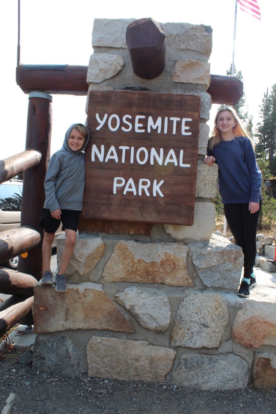
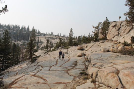
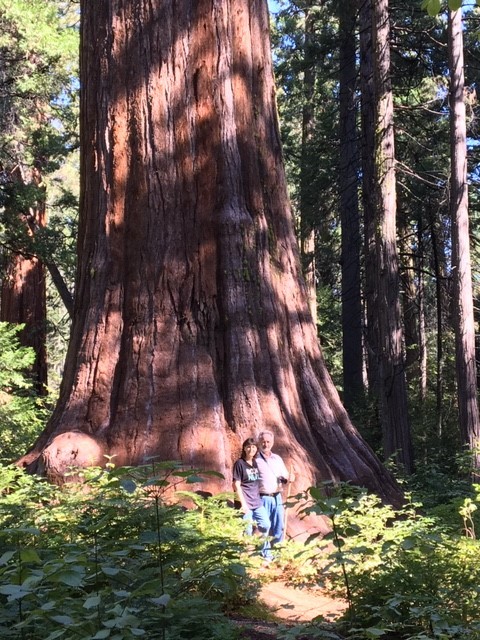
Day 18 & 19 - Yes, I’m at the point of the trip where I’m combining days. The last two days were spent exploring Yosemite. Yesterday, we stayed on the North East end of the park. We hiked around Teneya Lake and the Tuolumne Meadows. The lake hike got a little long and the kids started complaining. I was nervous to do another hike, but as soon as they got into the meadow and saw Tuolumne River they were completely rejuvenated. It is unimaginable to feel anything other than complete tranquility when looking out over the golden grasses, sparkling river, and distant mountains. On our trek back to the car we saw a coyote trotting through the grassy field. Today, we made the long drive into the valley. We hiked the Mist Trail, saw the all inspiring Half Dome, and El Capitan. With the assistance of the binoculars we were even able to spot 7 rock climbers about 2000 feet up the face of El Capitan. I can only imagine what their views must be from that vantage. We saw Steller’s jays, squirrels, chipmunks, deer, and a majestic Grey Fox. We ended the day hiking Tuolumne Grove to see the Giant Sequoias. Chad promised that it was only a 30 minute hike, but an exhausting hour and a half later we finally made it back to the car. However, getting to see those magnificent ancient trees was the perfect way to end our time in Yosemite. It was a fantastic two days full of laughter, sweat, a few melt downs, moments of peace and inspiration, and an appreciation for the beauty of nature.
Day 19 addition - Yay! we just saw a bear!!! We were driving back to our campsite through Lee Vining when we saw a bear cross the street. The kids had been looking for a bear this entire trip and had given up hope. Beckett had fallen asleep and when we yelled, “bear!” Beckett popped straight up and said, “Where’s the Bear?! Where’s the bear?!” We didn’t get any good pics but we got a hilarious video of me wanting to drive closer and Chad and the kids freaking out.


1 note
·
View note
Text
California car shipper quote
https://www.routerunnersautotransport.com/car-shipping-california
California car shipper quote
Want to ship your car to or from California? With our auto transport services, we make it easy to ship your car in or out of the Golden State. California is America’s most populous state with almost 40 million residents. If it were its own country, and some argue for that, California would have the world’s 5th largest economy. That means there is a tremendous number of auto transport California shipments. The greater Los Angeles metropolitan area has nearly 19 million people, roughly half of California. The L.A. Basin unquestionably is the single biggest market for the California car shipping industry.
Unlike New York, where a person can get by without a car because of the elaborate public transportation system, Los Angeles is heavily dependent on the automobile. A quick glance at the L.A. rush hour traffic jams on almost any freeway reveals a staggering number of single driver vehicles. Los Angeles, Orange, and San Bernardino counties do everything they can to encourage carpooling, but nevertheless see an inordinate number of people alone in their vehicles. All those vehicles mean a rich city market for any California car shipping business. It doesn’t matter whether a customer wants to ship a car from Florida to California, or ship car from Texas to California, the Golden State is a favorite destination nationwide.
If you’ve searched “shipping car to California,” or simply “auto transport California,” you’ve likely encountered a large number of options. When it comes to auto transport companies, California has a choice to spare. On this page, our team here at Route Runners Auto Transport will help you narrow your search. We’ll cover the ins and outs of car shipping in California and show you just why our team is an excellent choice — no matter which way you’re traveling. Learn more about California car shipping below, and ship your vehicle with our team today!
Car Shipping Companies in California
Our customers are always looking for the top car shipping companies in California. They want to ship their vehicle quickly and safely across the state with the most reliable auto transporter around. We recommend that each customer do their research and compare prices before making a decision. By using the calculator on this page, you can get an exact quote without having to fill out any personal information. Read our reviews to find out why we’re one of the best car shipping companies in the state.
Shipping Your Car In Los Angeles
In the Los Angeles Basin from the San Fernando Valley to the San Gabriel Valley, from Santa Monica and the South Bay beach towns (hello Manhattan Beach!) to South-Central and downtown L.A., from the Hollywood Hills to East L.A., from City of Commerce and Industry to all of Orange County, the freeway system is laid out perfectly to transport vehicles as efficiently as possible. And everybody seems to have their own strategy for getting from Point A to Point B. But make no mistake about it, we love Los Angeles car shipping! Nearby the L.A. Basin is Orange County and the Inland Empire. Our first of a kind, original Route Runners Auto Transport instant quote calculator is ideal for reliable door-to-door prices going any distance between Los Angeles and any other city.
The Golden State is known for many things. California has several incredible landmarks including The Golden Gate Bridge in San Francisco and Yosemite National Park in the High Sierra Desert. Positioned on the west coast of the United States, California is also known for its mountains and valleys, long beaches, vineyards and wineries, and for having the widest and tallest Redwood trees. It is also a favorite ship car to California thing to do.
Using The Right Car Transport Company in California
Auto transport services to and from California takes a special skill. You definitely want to use a vehicle shipping service. Even if you enjoy a good road trip, hauling an extra vehicle up or down the state is a task you want to leave to the professionals. Expert vehicle shipping companies know how to navigate through this mountainous state and deliver your car to you expeditiously. California is a beautiful state, even from an airplane view. So you won’t miss out. You can fly to your destination, and rely on your vehicle shipping company to deliver your car to you.
California is bordered by Oregon, Nevada, Arizona, and Baja California (a Mexican State) to the south. Whether you need to use an auto transport company to get your car from Sacramento to LA, or through the Central Valley down to the San Diego border, you want a top quality carrier to ship your vehicle. The drivers conducting the auto transport deliveries throughout California can expect to come across these different regions.
Moving Car To California In The Northern & Central Regions
Starting from just below the Oregon border, auto transport teams head down from the North Coast or the Shasta Cascade region. In the Cascade Range in Northern California, you’ll find the Shasta Mountains. One beautiful mountain there is reported to be an active Volcano and contains one of California’s highest peaks.
In the central northeastern part of California, auto transport carriers go through an area called Gold Country. This is the famous area that attracted a wave of people looking for gold to migrate to the west in the mid 1800’s. The narrow strip stretches across the Sierra Nevada to parts in Sacramento.
San Francisco & Bay Area Car Transport Services
One popular spot for vehicle shipping is the San Francisco Bay area. It has the fifth highest population in the country. It would be a good location for auto shipping support because it’s a good area for drop-offs or pick-ups. Just south of San Francisco is another good location for auto transport services, the Monterey Bay Peninsula. It’s good for vehicle shipping because it’s close to the shore and the climate is nice all year round.
California Central Coast Auto Transport
Shipping companies in California can continue to work their way down The Central Coast. The vehicle shipping service can also go through Central Valley, a major agricultural part of the state.
If auto transport carriers are heading east, they’ll enter into The High Sierra, the mountainous area above the deserts. The highest points in California are found here in this region. Sierra Nevada reaches up to 14,000 plus feet high. It is also home to the popular Yosemite State Park.
To the east are the deserts, which take up a good portion of the southeastern part of California, including The Mojave Desert. Death Valley, which holds the title for having the lowest elevation level and the hottest highest temperatures in North America, is positioned in the Mojave Desert. Though typically scary, the vehicle shipping crew will come across a few good sized cities in the desert including Lancaster and Victorville.
Southern California Car Shipping
Vehicle shipping within southern California is not so bad considering the heavy traffic of Greater Los Angeles. This is mainly because auto transport companies will not be challenged with severe weather. It rarely rains in the southern parts of California, and during the winter, you won’t find any snow until you head toward the mountains.
Several interstates run through California, making maneuvering through the diversely elevated state not so difficult for an auto transport team. Highway 5 goes all the way north and south through California and the entire west coast. It stretches from the top of the state to the southernmost tip of the San Diego border. Those who are shipping their car to California from other parts of the state may find it interesting to know that Route 66 ends in Santa Monica, which is adjacent to Los Angeles. Interstate 101, which combines with Highway 1 (Pacific Coast Highway) at some point, travels along the shore. It even travels all the way up the northwestern coast of Washington State.
If you have questions about California car shipping or are interested in using our auto transport services, feel free to contact us by dialing our toll free number (800-600-3750). Or you can speak to an auto shipping customer service representative about how the entire auto transport system works. You can also use our Online Quote Calculator to fill out a simple form or scroll to the bottom of this page to get a free car transport California quote. We make it easy to book your vehicle shipment online.
Car Shipping from New York State to CA
Lots of car owners want to ship their cars to California when they relocate from the East Coast. The two states customers are interested in shipping from the most are New York and Florida. To ship a car from New York state to California, the vehicle would be shipped a distance of 2,915. Using the rule of thumb that a car carrier will travel around 500 miles per day, it would take about 6 days on the road to ship a car this distance. You can use the calculator on this page to get the cost to ship your car from New York to California — or any other destination for that matter.
Car Shipping from Florida to CA
The distance from Florida to California is 2,697 miles, and using the same rule of 500 miles per day, we can estimate that the car transporter would take just over 5 days to complete the trip. If you’d like to estimate the cost to ship your car from Florida to California, use the calculator on this page to get your quote, and then book your transport today.
Ship Your Car From California
California may be one of the biggest states in the Union, but not everyone is heading there in a hurry. In fact, many California residents are relocating to other states in the west and nationwide. If you count yourself among this group, you need a service you can count on to transport your car safely out of California and into your new home. After all, driving it can put unnecessary miles on your vehicle and cost you extra money and time. Partner with our team to have it shipped quickly, and save yourself hassle during your big move — no matter where you’re headed.
The Industry’s Finest California Auto Transport
You’ve searched “shipping car to California.” You’ve read our guide, and maybe you’ve even gotten a quote. How can you be sure that Route Runners Auto Transportis the right choice for you? The first step is getting a second opinion. You’ve heard from us how great our service is — now it’s time to take a look at what others are saying. Head over to Trustpilot, where you’ll find that we hold an excellent 94% five-star rating after hundreds of independent reviews. You can also find reviews from real customers on our Testimonials page.
Committed to making things better for our customers, we’ve led the industry in pushing boundaries and making car transport better. We were the first car transport company to offer an Online Quote Calculator to help potential customers secure fast, affordable, and 100%-transparent quotes in seconds. We also proudly ship cars nationwide — both to and from California — with both uncovered and covered shipping options available. Offering affordable rates, fast shipping times, and incredible customer service, we are an excellent choice for your car shipping needs. Contact us or visit our Blog to learn more about auto shipping, California seasonal updates, and anything else related to car shipping — and ship your car with us today!
1 note
·
View note
Text
Sonora Pass: Losing Frank Hengel
By Dave Baugher
Mile 1030, July 3rd, 2016, 10,000’ on a ridge high above Sonora Pass: Toward dusk on a somber California evening the first faint cell signal found in a week since leaving Tuolumne Meadows I called my wife Luann, who quickly informed me that Frank Hengel was in intensive care and she had just left the hospital. Mind whirling with concern, I immediately hung up and made a call to Alice, Frank’s wife.
That morning my day began with a cup of coffee on the shore of Dorothy Lake in Northern Yosemite. After a day of hiking from Yosemite through Toiyabe National Forest and the Emigrant Wilderness, a new camp was nestled in a grove of bushes and near a notch in the ridge overlooking Levitt Lake near Sonora Pass. There I was able to get that cell signal from the east and made the call to my wife Luann.
I first met Frank Hengel when my family moved to Loganberry Lane in Arnold, CA. Frank and Alice had moved there from Brentwood, CA six years before us. Frank, a natural leader, assumed a position of leadership within the community, and when we arrived, Alice and Frank welcomed our family into their lives, actually becoming surrogate grandparents to my two kids.
In his younger days, Frank had been an avid backpacker and cyclist. Spending his free time biking along the Avenue-of-the-Giants in Northern California, backpacking with his family in the Sierra Nevada and traveling all over the world with Alice, Frank was a special guy. He lived a life that anybody would envy. Professionally, he had served the communities of the Oakley School District, where he progressed from principal to superintendent over a career of 23 years. Frank was known for his ability to listen, counsel and make important decisions to improve education within his community. Schools, libraries and even a street bear the name of Frank Hengel.
In Arnold, Frank stayed busy and active in many organizations including Lions, Rotary, Blue Lake Springs Home Owners Association, and Sons-in-Retirement (SIRS). Around town, he was known as someone who always listened with kind words of wisdom for those who would listen and give salient advice when asked.
In 2009, Frank was diagnosed with Chronic Obstructive Pulmonary Disease (COPD) an umbrella term used to describe progressive lung diseases including emphysema, chronic bronchitis, and refractory (non-reversible) asthma. Patients living with COPD must reduce active lifestyle and the symptoms such as breathlessness and wheezing can be frightening. Living at the 4,000’ elevation in the town of Arnold, a patient has a tough time breathing, so in 2013 Alice and Frank returned down to sea level in the San Joaquin valley to the town of Brentwood, where they had lived before.
Before he and Alice left Arnold, we had an evening conversation over scotch in his living room. “Dave, what are you going to do with yourself once you complete the Pacific Crest Trail?” I was at a loss, I had not thought about that when making my plans to finish the PCT by my 61st birthday. Frank looked at me and said, “Why don’t you keep going?” With those words, I began to contemplate the future and how my goals should not end with the completion of the trail.
Now Alice had taken Frank to the hospital and he was in the Intensive Care Unit. My call to Alice was immediately answered. I asked how Frank was doing and she said I could ask him myself, as she handed him the phone. After saying hello, Frank was obviously short of breath, so I did the talking. After explaining the location where I was, he quietly replied he knew exactly the spot where my camp was located. After hanging up that brief call, I took some pictures of the snowcapped peaks and ridges surrounding me and then forwarded them to Frank’s IPad.
Returning to camp, I got busy to call it an evening when a solitary hiker appeared and asked to share my spot. No problem. Introducing himself as Steve, he quickly set up camp and we promptly turned in for the evening as the temperature dropped with the oncoming darkness.
Night-time brought one of the weirdly beautiful alpine skies with a fat moon floating above the tent, above snowy peaks and the wild flare of the Milky Way banner streaming across the blue-black sky. The ghostly view of the Sierra Ridge bracketing the horizon from east to west from the camp.
I slept peacefully that night and in the morning, Steve and I chatted over shared coffee. He explained that he had already hiked the Pacific Crest trail in 1981 and the experience shaped his life in a way that he had a hard time describing. “When I stood on the Mexican border, I was a completely different person than when I finished.” Steve had formed the Mount Hood Chapter of the PCTA and its members had tallied over 11,000 volunteer hours in 2014 alone. Now he was retracing his trip to see how it and the people who walked it had changed. Later, I researched Steve Queen and discovered he had served the PCT trail community for many years in Portland Oregon and had received the PCTA Lifetime Achievement Award in 2011. (These details of his life memorialized the book “The Pacific Crest Trail,” by Mark Larabee and Barney Scout Mann.)
We broke camp that following morning and Steve continued with an easy gait that quickly left me behind. I followed, continuing down the trail to Sonora Pass where I was going to Kennedy Meadows to resupply. Thinking quietly, as the miles went by about Frank and Steve, two guys to look up to in life. Both active, touching and impacting the world and people around them.
It’s funny, here were two guys, Frank and Steve, both had trekked the PCT, Sierras, and on that morning, the same path I followed. They left a mark where ever they passed and impressions on the people, communities, and me. I would not find out for several days that Frank passed away that same morning when I was chatting with Steve on July 4th.
Frank, I’ve kept going and probably will forever, following those adventures, future trails and hoping to meet more admirable folks like yourself.

4 notes
·
View notes
Text
So Many, It’s a Bullet List
This trip results in a veritable bullet list of check-offs – both bucket list items and general check-off items on a ‘to do’ list. You know, those things that are must-do’s before you die, as well as those that fail to make that list, but shouldn’t be passed up if in the vicinity - like the world’s largest iron skillet, or the gravesite of Herman Munster, that kind of thing.
We started with Arizona’s Meteor Crater. It measures 55’ deep and a mile across. It is impressive. Anyone there 50,000 years ago would have remembered the event well. We didn’t have time to adequately enjoy the Grand Canyon, so that bucket list item has to wait. It’s too big to have given it a check-off list cursory viewing. So our next stop was Las Vegas. Viva-I-don’t-care. We’d both been there before but it had changed in the intervening 30-40 years. It can change back to desert as far as we care.
Death Valley is a sight (several, actually) to behold. The temp was in the moderate 90’s yet very do-able. Within a couple hours we were at America’s lowest elevation (-282’) and saw the lower 48’s highest – Mt. Whitney. We got a picture of a cool abandoned church at a tiny rundown town where America interred 10,000 of her citizens of Japanese descent during WWII.
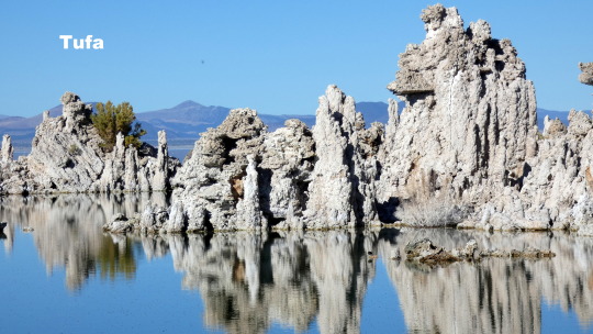
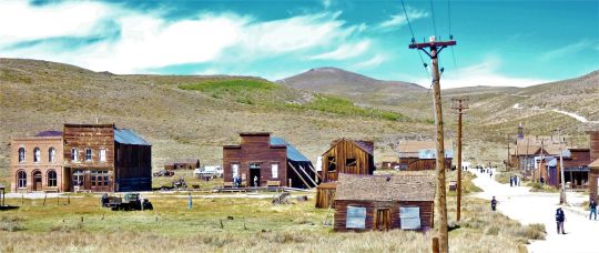
Wayne’s sister, Marla, met us at a cool little town on the east side of the Sierras – Lee Vining. From there we saw the Mono Lake tufas and learned a great story about how a very small community fought and beat the water-stealing megalopolis of L.A. That was also the launch for the best ghost town anywhere – Bodie, CA. Look it up. It’s fantastic. As were the giant Sequoias a short distance from Marla’s Sierra Mountain home.
October in San Francisco is definitely the time to go. We toured Alcatraz, walked the Golden Date, drove Lombard Street, visited Haight/Ashbury (a location of infamy for our generation), saw Chinatown, snapped a pic of the house from Full House, visited Fisherman’s Wharf and ate the world’s best sourdough bread while on a bakery tour. All this, as well as a few other check-offs while in town.
The 17-mile drive through Pebble Beach was a check-off that, after seeing it, might ought to have been on the big list merely for the Pacific surf views. And just down the road are San Jose and Santa Cruz where Wayne shared amazing sights and a little historical tour of his own – even the locations of 3 motorcycle wrecks. Oh, and Debbie got stuck in Lodi again.
For Debbie, we ventured to Monterey fairgrounds, site of the 1967 Monterey Pop Festival and the inspiration for her short story, Monterey Papa. And who could pass up an opportunity to see Carmel-by-the-Sea, where Clint Eastwood wooed a majority of voters? We had lunch beneath a portrait of him in full western movie costume.
We toured a winery in Napa Valley and the Jelly Belly factory in Fairfield. A Saturday morning visit to a farmers’ market in Modesto provided a chance to help judge a chili cookoff.
A major highlight was Yosemite National Park and the black bear that Marla saw first. He (or she) was mostly bashful but very accommodating, allowing a nice video. El Capitan, Half Dome, a hike and a couple waterfalls did not disappoint. The climbers waaaaaay up high on the face of El Capitan added a little excitement. Trying to one-up her companions who reportedly had better vision, Debbie claimed she saw that one of the climbers had cavities. We all swallowed several grains of salt at that one. That Debbie!

Not to be deprived, we saw deer, buffalo, and over a hundred antelopes at play. We drove past miles and miles of orchards and vineyards, wondering what were the actual crops, wishing for helpful signs.
Our return home took us to beautiful Lake Tahoe and the Mormon Tabernacle where we both saw and heard the pipe organ. As impressive to me was an actual cowboy, a long way from a visible ranch, sitting his horse while overlooking a herd of cattle. It could’ve been a scene in a western movie. And not far from there we witnessed a man swinging by a cable from a helicopter (in very strong winds, mind you) to be placed atop a metal power pole tower, the kind that looks like the Eifel Tower’s poor cousin.
Old town Laramie and Cheyenne, as well as Ogallala (remember Clara and Ellie of Lonesome Dove?) were cool. But alas, there was no social club in sight in the very western downtown.
The lonnnnnnnnnnng drive to and from California included 13 states, and mostly their desert-y or plateau-y areas. It was really nice, after 3 weeks, to drop down into NW Arkansas and let our eyes settle on the lovely green hillsides again.
1 note
·
View note
Text
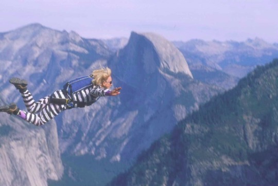
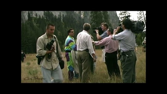
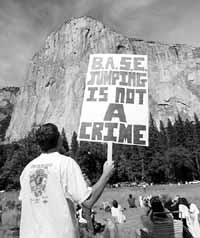
Parachutist Dies in Fall at Yosemite's El Capitan
Tragedy: A Santa Barbara woman, 60, leaps from the cliff in protest of a National Park Service ban on such jumps. Chute fails to open as husband watches.
October 23, 1999|From Associated Press
YOSEMITE NATIONAL PARK — A parachutist plunged to her death off Yosemite's most forbidding peak Friday during a protest of park rules banning such jumps.
Jan Davis, a 60-year-old Santa Barbara resident, was the fourth of five jumpers in the protest, which was organized in response to the June 9 drowning death of a jumper who successfully parachuted off El Capitan, only to drown in the river below while trying to flee rangers.
"The first three were beautiful. And then she jumped. Everybody thought it was OK, and then people said, 'Open up! Open up!' said Paul Sakuma, an Associated Press photographer.
Davis fell to the base of 3,200-foot El Capitan, and rangers quickly cordoned off the area. Davis' husband, photographer Tom Sanders, who was among the spectators, slumped onto his camera in grief after she fell.
The danger of the extreme sport of jumping off buildings, antennas, spans and cliffs has led the National Park Service to ban such jumps. Nationwide, an estimated 21 people have died jumping that way in the last 20 years.
Rangers have arrested anyone caught jumping off El Capitan, seized their equipment and put them in the local jail.
Davis was jumping with borrowed gear because she did not want her own to be confiscated by the park rangers waiting to arrest her on the valley floor, witnesses said.
"If only she had used her own gear. If she had only had her own gear," Sanders said over and over again, according to friends who tried to console him. Sanders told them that Davis usually pulls a cord on her back; on the borrowed jumpsuit, the cord was on her leg.
Also, since BASE jumpers do not have time to open a second chute from such low altitudes, she had no backup, said Chris Conkright, an employee of Aerial Focus, the Santa Barbara-based aerial cinematography company she and her husband ran.
"This wouldn't have been her first choice on gear," Conkright said. "This was her first choice on gear that you would surrender to the rangers."
Park rangers and parachutists have tried to reach an accommodation after rangers who staked out a landing area on an informant's tip tried to capture Frank Gambalie III on June 9. Gambalie tried to flee and drowned in the Merced River.
Friday, Gambalie's mother joined about 150 people, including the five jumpers' families and friends, in what was supposed to be a carefully staged demonstration that such jumps can be made safely.
"They agreed ahead of time to land in a designated area, allow themselves to be arrested, forfeit their equipment. We give them a citation for illegal air delivery and the U.S. magistrate sets the fine, traditionally about $2,000," said Scott Gediman, a park spokesman.
The earlier jumps, under a beautiful blue sky, were flawless, according to Riccarda Mescola, Gambalie's mother, who was on the phone with the AP when Davis' chute failed to open.
Ranger Confidential, which covered the careers of several rangers in a number of US National Parks. There was a section on BASE jumping.
“When she saw the blond hair, Mary thought, This isn't so bad. Then she looked down. She was standing in fat. She looked up. Body tissue hung in the trees. It was a mess, and now somebody had to clean it up. The spandex suit that Davis wore as a joke had kept her legs intact so that a pair of black-and-white-striped legs stuck out from a two-foot-deep crater the impact had made in the decomposed granite. The mind of the special agent on the scene produced an unavoidable comparison. The black-and-white-striped legs reminded him of the Wizard of Oz, when the Wicked Witch of the East was flattened by Dorothy's tornado-tossed house.”
#jan davis#jan#davis#parachute#parachutes#cliff jumping#yosemite#el capitan#el capitan mountain#mountain#died#high fall#fall#dies#fatal#death#park ranger#cliff#rip
1 note
·
View note
Video

flickr
This is Yosemite National Park-Land! by Mark Stevens
Via Flickr:
A setting looking to the east-northeast while taking in views forested landscape present in Yosemite Valley at Tunnel View overlook. My thinking in composing this image was to capture more of a leveled-on, balance view across this part of the national park. The highpoint overlook that I was located on allowed me to create a sweeping view across the forest leading to the ridges and peaks of the Central Yosemite Sierras. I closed down a little bit on the aperture so that I could ensure much of the image was in focus, including even the distant Half Dome in the image center.
#Azimuth 74#Bridalveil Falls#California and Oregon Road Trip#Cathedral Rocks#Central Yosemite Sierra#Day 5#Dried Up Waterfall#DxO PhotoLab 5 Edited#El Capitan#Evergreen Trees#Evergreens#Forest#Forest Landscape#Half Dome#Higher Cathedral Rock#Landscape#Landscape - Scenery#Looking ENE#Lower Cathedral Rock#Mostly Cloudy#Mountain Peak#Mountains#Mountains in Distance#Mountains off in Distance#Mountainside#Nature#Nikon D850#No People#Outside#Overcast
0 notes
Text
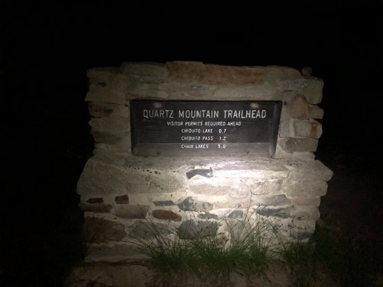
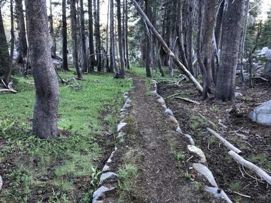
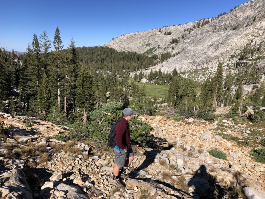
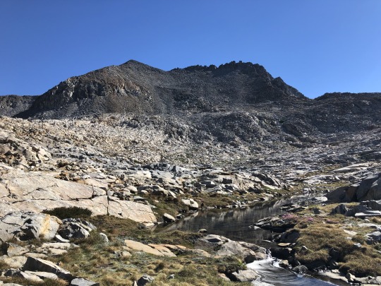
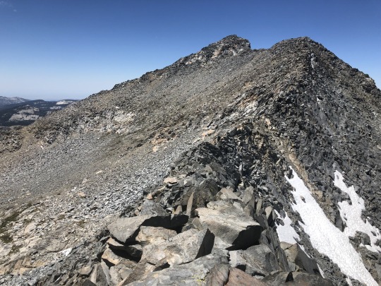
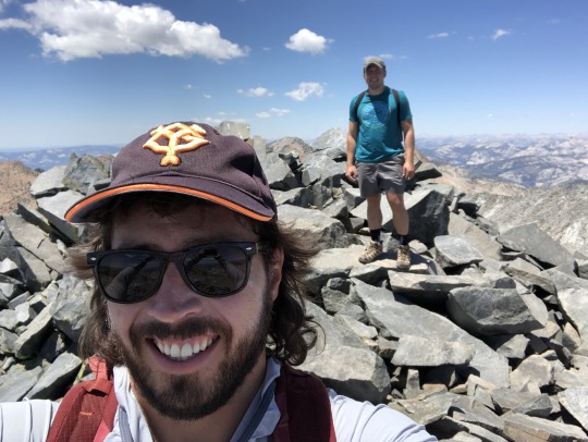
Triple Divide Peak & Merced Peak, A Day Hike from Quartz Mountain Trailhead
I had been planning a combination day hike of Triple Divide Peak and Merced Peak for over a year. I mapped out a route and saved it to my phone, but a whole summer came and went without me actually getting the opportunity to attempt it. This year I made a mental note to prioritize it as an early season hike. While my planned loop was rather long, elevation gain was moderate which made it a good conditioning hike. I selected an open weekend and planned to do it solo, until Zach asked me if I was interested in doing a hike. I proposed my idea, cautioning him that it was about 25 miles, and Zach gladly accepted with no complaints. Now that doesn’t happen every day. We met in Livermore and carpooled together for the long drive to the Quartz Mountain Trailhead. From reading previous trip reports, I expected a rough road, but found much the opposite. I feel like a 2WD vehicle could have made it to the trailhead if driven with care. Zach slept outside in a tent while I slept in the car. My alarm went off at 3:30am the next morning and we were on the trail a little after 4am.
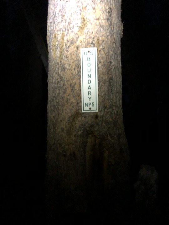
The hike almost ended before it got started. There was a lot of deadfall covering the beginning section of the trail, and I couldn’t uncover where it resumed. We both had headlamps, but we needed a flood light. I felt so helpless stumbling around in the dark. Finally I rediscovered the trail, and hope was reinstilled. While things were certainly better, certain sections of trail were still a little tough to follow. I really had to focus all the way until Chiquito Pass where there is an intersection and the trail becomes more pronounced. I guess this section of trail gets little maintenance as it lies just outside of Yosemite National Park.
The first mile of the hike was all downhill followed by another mile of mostly flat terrain. I spent those miles staring at the sky and admiring the stars. The third mile marked the beginning of gradual uphill climbing. The sun began to rise as the moon began to set.

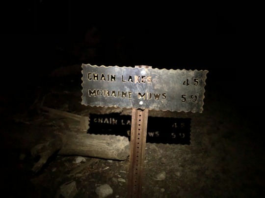
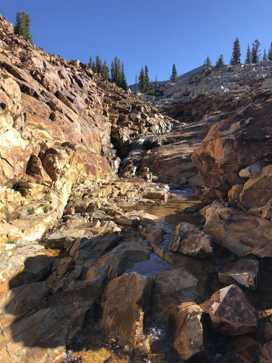
After 4 miles we reached the outlet of Chain Lakes and our first reliable water source. We were entering a summer following a low snow year, so I took note of this stream with concerns that most of the hike would be dry.

We followed the creek down about a hundred vertical feet before beginning another very gradual climb through the forest. Sunrise brought about mosquitoes, and while it was nice to have light, I preferred to be left with my blood accounted for. The swarms got so bad that we couldn’t even stop for a sip of water. This did have one positive impact, as it motivated us to keep moving, for as long as we kept hiking at a brisk pace, they could not draw blood.
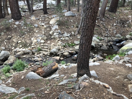
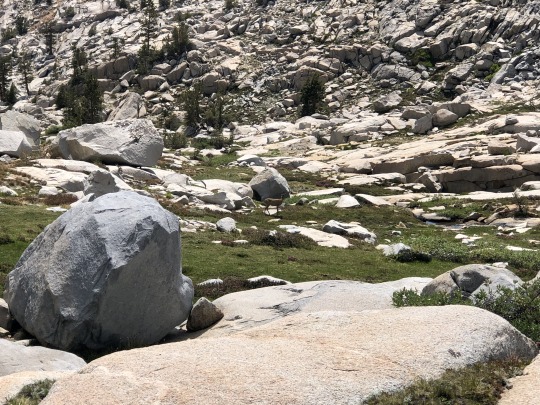
After 6.5 miles we reached Moraine Meadows and the South Fork of the Merced River. This qualified as another dependable water source.
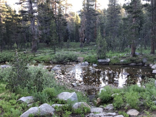
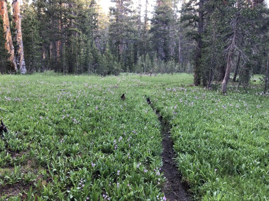
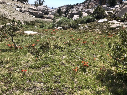
I couldn’t even stop mid crossing to take a photo upstream. It was not even worth it with the bloodthirsty mosquitoes waiting for their opportunity. We turned right across the river and followed the footpath through the Sierra Shooting Star covered meadow.
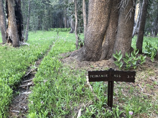
Rather than continue to Fernandez Pass, we left the trail and followed the South Fork of the Merced River upstream. I was hoping to find a use trail alongside the river but found nothing of the sort.
Cross country travel up this canyon was relatively easy.

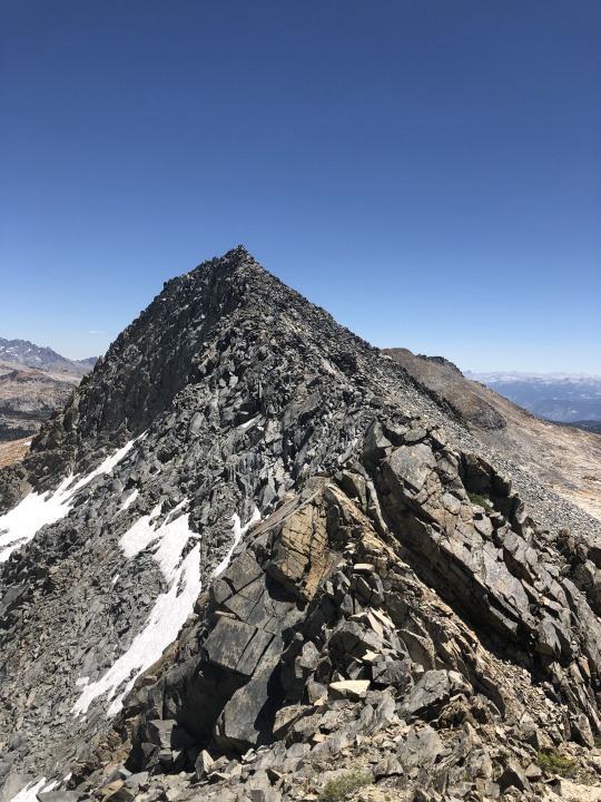
Triple Divide Peak was the first summit to come into view that morning.
We passed through some small alpine meadows, mostly sticking to the watercourse.
I studied the map and concluded the best place to leave the stream. I don’t know why I was so concerned about water beforehand. We were following the headwaters of a major river. At any rate, I instructed Zach to fill up here before climbing out of the bottom of the canyon towards Triple Divide Peak. The water was as fresh as could be.

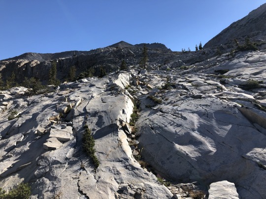
I picked a route up smooth granite slabs. I was very happy with the gentle nature of the terrain.
Merced Peak finally emerged from behind the curtain.
We crossed several more seasonal creeks as we made our way to the foot of Triple Divide Peak, and we eventually reached a tarn. So much for my water concerns.

We hiked along the left side of the tarn and began making our way up the final boulder field. Peak 11261 looked impressive to our south.
The following section was a classic class 2 slog. We took it in stride.


Balloon Dome became visible as we climbed higher.

This section wasn’t as bad as I thought it would be. It wasn’t long before we started nearing the summit.
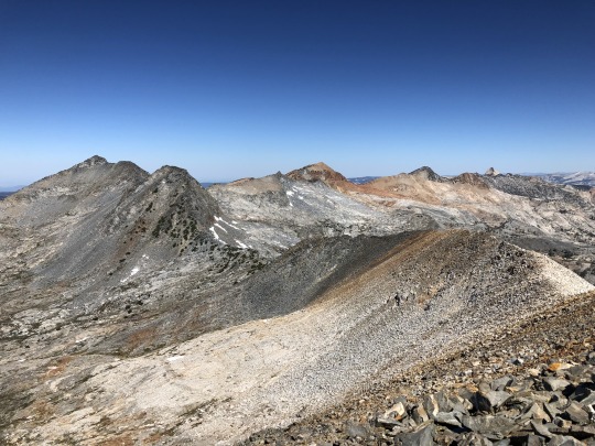
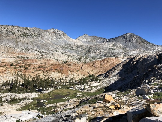
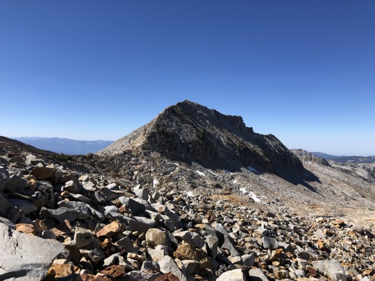
We reached the summit of Triple Divide Peak a little after 10am; 6 hours after starting off. To the east were Mt Banner, Mt Ritter and the Minarets.
To the southeast were too many peaks to name. The notable ones were Red Slate Mountain, Red and White Mountain, Mt Gabb, Silver Peak, Seven Gables and Mt Hooper.
To the south were the impressive Peak 11261, Gale Peak and Madera Peak.
To the northwest were Merced Peak, Red Peak, Grey Peak and Mt Clark.
To the north were the headwaters of the main fork of the Merced River. This drainage eventually leads to Yosemite Valley.
To the northeast were Mt Florence, Mt Maclure, Mt Lyell, Rodgers Peak and Foerster Peak.
Balloon Dome
We took a long, well deserved rest on the summit. A few mosquitoes showed enough perseverance to follow us up to 11,611 ft. Give them credit.

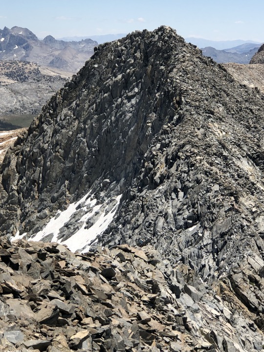
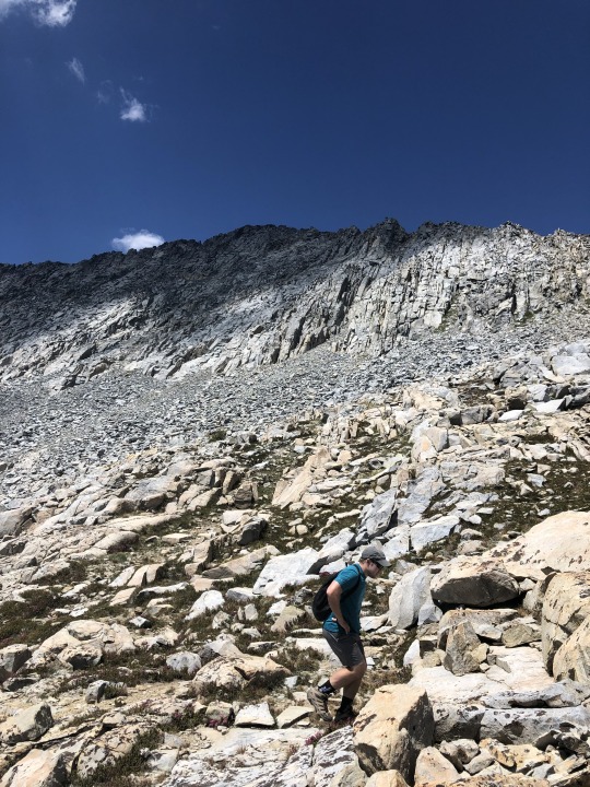
Now the interesting part was about to begin. My only beta was an old, and somewhat incorrect, trip report from Bob Burd. I had studied the topo map and the satellite images and figured a ridgeline traverse to Merced Peak would be manageable. We stated off down the ridge along very tame terrain.
I was able to move at a very fast pace. The rock was solid and I was almost jogging. However, It only takes one loose rock to change everything. I put all my weight on one rock and it shifted, leaving me perpendicular to the ground. I came down straight on my side, with my ribs smashing against an angular piece of talus. I audibly let out a grunt. I felt like an idiot. I examined my body and aside from a bruise, I was in one piece. I looked back at Zach and he was way behind me, so I took a few minutes to take in the views. Merced Peak stood defiantly to our west.
Edna Lake and the Clark Range stole the show further north.
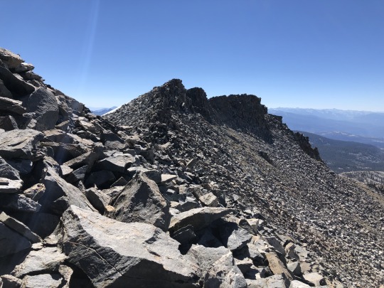
Zach caught up to me after a few minutes. He saw my fall and heard my grunt. He was going very slow so I hope my accident didn’t scare him. The rock transitioned from a white granodiorite, to a more reddish talus and then to a dark grey talus. The ridge became a little more loose but remained mostly class 2 with a few sections of easy class 3. There was an impressive cliff to our right, so we took care to straddle the south side of the ridge.
We carefully dropped down to the saddle between Triple Divide Peak and Merced Peak. Zach was moving very slow, but I reminded myself that while he is an excellent trail walker, he is still new to scrambling. I patiently sat on a rock and went back and forth between looking at the views and the map on my phone.

We still were less than halfway done with the ridgeline traverse. It was going to be a long day. After regrouping, we began a steep climb up towards Peak 11588. This was a mix of class 2 and class 3, but I sought out the latter to make the climb more interesting. I found myself waiting a lot, so I took a selfie and again went back and forth between enjoying the views and staring at my phone.

With 100 vertical feet remaining to Peak 11588, I decided to traverse along the southern side of this peaklet to avoid unnecessary elevation gain.

This idea looked good from the topo and the satellite views, but in reality it wasn’t so straightforward. It was still class 3, but this was probably the most challenging scrambling of the day. If I had it over again, I simply would have climbed over Peak 11588.
Once beyond this obstacle, we reconnected with the top of the ridgeline and followed this carefully for the next few tenths of a mile. I went quickly to give Zach confidence, and I would wait every 50 meters or so. He was doing the right thing by taking his time and scrambling with care.
Peak 11588
Can you spot Zach?
Once I saw Zach was through the difficult section of scrambling, I went off ahead by myself.

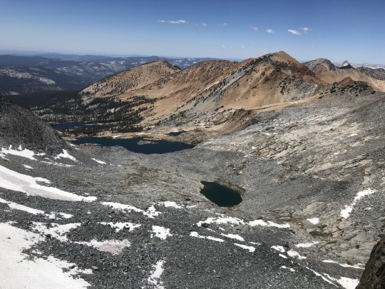
Ottoway Lakes and Red Peak
The last quarter mile to the peak was class 2. I would have the summit to myself for the next 30 minutes. To the east were the Ritter Range and Triple Divide Peak.
To the south were Gale Peak, Sing Peak and Madera Peak.
To the west was the Buena Vista Crest.
To the north were Red Peak, Grey Peak and Mt Clark.

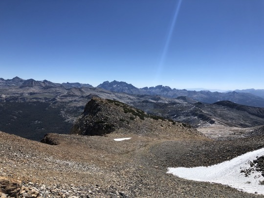
To the northeast was the Yosemite High Country.
I ate a late lunch on the summit. It took Zach 3.5 hours to complete the 1.5 mile traverse.
From the summit of Merced Peak, we dropped off the southern face. I did this quickly, and again had to wait for Zach to catch up. This allowed me to take a split break overlooking a beautiful tarn.

Zach showed up right after I finished. From the toe of the talus field, we dropped into a drainage with a developing stream and followed this downhill.


We followed a cross country route that aimed to take us right back to our earlier trail junction where we first encountered the South Fork of the Merced River. We passed by a beautiful tarn along the way and I couldn’t pass up the opportunity for a swim.
I felt refreshed afterwards, but Zach did not want to partake. He still has not completed an aqua challenge to this date, and I can say confidently that he is missing out.
Merced Peak
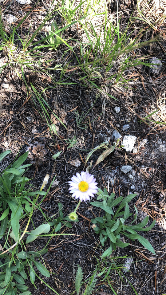
Subapline Fleabane
From the tarn we cut across some more slabs and meandered through the forest. I was getting pretty tired of all the downhill as we neared the end. My route worked almost perfectly, and we were deposited within a few hundred feet of the trail junction. I wanted to rest at the South Fork of the Merced River, but the mosquitoes were still too much for me, and I continued on without even stopping. The hike back had several meadows that were full of blossoming Sierra Shooting Stars.

Northern Alligator Lizard

The mosquitoes kept us honest and we continued most of the way back without any breaks. I wasn't that tired since I spent so much time resting along the ridgeline traverse waiting for Zach.
With two miles to go, I made some distance ahead of Zach. At Chiquito Pass, I passed the intersection and was too tired to make sure Zach knew the correct way back. Instead I got a head start on the uphill section which seemed much longer than what I remembered from the morning. Seeing the area in light made navigation much easier. Zach eventually caught up to me, and we walked out together. It was a 24.4 mile, 15 hour day, however I felt pretty good. We didn't waste much time at the trailhead and began our drive back out to civilization. We stopped for dinner in Oakhurst and drove back home that night.
0 notes
Photo

Sierra High Route Day 19: Today we cross the border and leave Yosemite for Inyo National Forest, but it's not the last time we'll be in Yosemite on this trip - the high route enters Yosemite again further north. Our first objective, Mineshaft Pass, is littered with the ruins of an old mining camp - and presumably mineshafts (but they're all filled in). We're officially out of Yosemite - no bears, very disappointing (the Yosemite border is actually just south of Mineshaft Pass). We heard from not one but two people that we should stay high following the pass and avoid dropping to the lake below (which will get up to the same place but with a lot of unnecessary elevation gain). The high route works and before long we're back on a trail. Taking a break near a lake, two groups of day hikers pass us. This area is actually relatively accessible via Saddlebag Lake Road (east of Yosemite's eastern entrance on Highway 120). Despite our proximity to a road, the trail soon disappears once again as we make our way to the eastern ridge of Mount Conness. We climb up, skirt the ridge, and drop down towards North Peak into a valley filled with turquoise lakes with water so delicious looking that I assume it must be poisonous. Our next destination, Skypilot Col, is visible and it looks impossibly steep. However, I've learned that (usually) things aren't nearly as steep as they look (particularly at this distance). Continuing through the valley, we agree on a campsite (below Skypilot Col) and I run ahead to make camp and repair a puncture that @paulinadao has in her sleeping pad. I make it to our campsite, pitch the tent, and find the puncture (or so I think). When @paulinadao arrives and lays down, she's still loosing air; I missed the puncture by a few centimeters. Luckily, I've taken to carrying multiple patches and my second attempt at a repair is successful. HUZZAH! Day: Tuolumne to Secret Lake Distance: 11.08 mi / 17.83 km Elevation gain: 3,927 ft / 1,197 m 📷1/3: @paulinadao #SierraHighRoute #SHR #SierraNevada
0 notes
Text
First and foremost:
I am absolutely sorry for the last blog post that you may or may not have seen if you subscribe to this blog (It’s gone now). I was not hacked but apparently James was. Also, apparently he was set as a contributor to this blog. So someone hacked into his account and published some sub-par English (like I have any room to complain!) post about something or another… I am sorry to be a cruddy email in your inbox though and thank you so much for those of you who let me know so I could handle it! It has been fixed and I’ll do my very best to not let it happen again!
Quick Recap!
So, 13 months, to the day, is how long we were on the road. And 39,998 miles (I’d like to just round that up bat I can’t do it). In that time we were able to hit 45 national parks (all of them in the lower 48 excluding 4 island parks accessible only by boat or plane). We can all, including Denver, say we’ve been to 48 of the 50 states.
I did technically take a computer but it was not easy to hook it up to the internet (I attached via phone). Then, every time I did my computer wanted to update. So any time I wanted to write a blog post I had to basically wait 2-4 hours and hope I remembered enough to scribble it down. As you can see, I think I wrote about 6 blog posts the whole time we were out and that was from my phone (its not easy to blog via touch pad!). I’m sorry for that but it was a lot more fun exploring the country!! Hopefully, if you wanted you were able to find us on Instagram where I still updated.
We left in the middle of some hot and heavy tiny house discussions and it’s pretty much been tabled the whole time we were away. We are very happy to be back thought to finish working through the nuances and hopefully make it easier to live tiny in Idaho at least!
Before That Happens Though:
We have to find a home base. The thought of mooching off any family while we figure it out is not appealing. We have great tenants in our ‘real’ house and have no ambition to kick them out just so we could live there a little while. We can’t occupy the tiny house. Short term (or long term) rentals are astronomical in Boise right now. (Click here for a special link to Yahoo about our hometown)
This left us with one logical answer. When James moved in to the tiny he never fully downsized. He just kind of put his things in boxes and then built a basic, detached garage for his ‘real house’, then stored all of his stuff in there. So we’re converting that garage into some temporary housing for our family of four!
Our Anniversary
We didn’t just end our trip 13 months to the day after take off, we also ended it one our anniversary. Every year we take a family photo in front of our home as a snapshot of the year. I am glad to get another picture with ‘Lil Beastie! (our camper). Here are our anniversary photos to date, I wonder what next year’s will look like! ha!
We lead a pretty cool life, I am so glad I, on a whim, started taking these pictures!
Year six, can you believe we were on the same vacation as the picture taken one year earlier! 🙂
Year Five, new home on wheels for a while
Year four, no new family members!, yea!
Year three, Miles is just about done cooking!
Year two, surprise baby Hazel!
Year one, the day Denver came to live with us!
First date – who even gets this picture??
Now The Downsizing Begins Again!
James has been hardcore into the real downsizing efforts. A year on the road has been pretty eye opening for both of us on what we really need (spoiler: less than what we currently own!). Honestly, I have cleared the tiny house of several truck loads of stuff! Our kids have grown up in a year and they really don’t need all the baby stuff we had. James has gone through box upon box. We’ve taken two truck loads to the dump, were planning a yard sale for anything else. Whatever doesn’t sell will be donated to start a new life elsewhere. Hazel and Miles have been going through all their stuff, they are excited to earn money from their toys AND plan on hosting a lemonade stand for cool refreshments. I absolutely cannot believe the amount of STUFF we have accumulated in our tiny little places!
Building Anew!
After this weekend we really get going! We will be adding a kitchen, a custom playhouse/fort for the kids, and doing all those little projects that take a garage to a home for a family of four and their dog! I will try to do updates because its totally relevant to ‘tiny homes’ and living in small spaces. Sometimes Instagram is just easier for me because it’s quicker (and can be done from my phone). I will definitely update on the legalities once that conversation gets going too. I am happy to be back and ready to rock this world again! In the mean time here are some of my favorite pictures of our adventures!
Also, this is not the end of our travels, we absolutely plan to make it to those four parks we skipped and are already planning our trip to Alaska (my last state) for next summer followed by celebrating James’s 40th birthday next fall in Hawaii! We should be able to see all these amazing National Parks before too long!
Oh, P.S.
Our cat is mad we are back. Did you know we had a cat? It’s probably because I am a dog person ;-).
He misses his bachelors pad and all the fancy parties he used to throw! While we were away we had an RFID cat door programmed to his microchip so that he could enter and exit the house at will (but nothing else could). We set up a camera pointed at his food so we could make sure he was alive and eating. Any time the food got low we would order another bag from Amazon and have James’s sister or mom run over and fill his dish. Pretty sure he enjoyed that set up a whole lot more than he enjoys our company!
The Pictures
Tetons NP
Washingtons Peninsula
Cascade NP
Mt. Rainier NP
The Oregon Coast
Crater Lake NP
Redwoods NP
Patricks Point, CA
Everglades NP
Bug watching, She is the best at finding lizards, frogs and catipilars
Bryce Canyon NP
Death Valley NP
Suguaro NP
Florida dog beach
Grand Canyon NP
Yosemite NP
California Free Camping
Zion NP
Zion Hike
Utah Farm
Mesa Verde NP
Black Canyon of the Gunnison NP
The dop of the highest sand dune in North America, Great Sand dune NP
Petrified Forest/Painted Dessert NP
Painted Desert NP
Spring in Death Valley NP
Death Valley
Death Valley Dunes
Joshua Tree NP
Saguaro NP
White Sands NM
White Sands NM
Big Bend NP
One of MANY awesome aquariums (this one is in Mississippi)
Mardi Gras Parade in New Orleans!
Cocoa Beach with Poppy
Furthest South Point in the US
Disney’s Animal Kingdom
Disneys Magic Kingdom
Florida
North Carolina
Playgrounds across America!
Mammoth Cave NP
Smokey Mountain NP
Random Virginia picture (such a pretty state!!)
Shanendoah NP
Shanandoah NP
West Virginia
Washington DC
Wild ponies!!
Birthday Boy in Maine
Furthest east point in the US
Denver could not contain himself around that much water!
thousand Island area in New York
Hot springs
Sibling bonding
Denver got a lot of this!
He learned to fake his first smile and I caught it on camera!
Sand dunes in Michigan
Teddy Roosevelt NP
National Grasslands
Idaho is kinda pretty too 🙂
Learning new tricks
Glacier NP
Teton NP
Mt. Rushmore
Badlands NP
Rocky Mountain NP
Happy Campers!
Colorado bonding
Great Salt Lake
Spiral Jetty, UT
Great Salt Lake
AND… We’re Back! First and foremost: I am absolutely sorry for the last blog post that you may or may not have seen if you subscribe to this blog (It's gone now).
1 note
·
View note
Text
Camping Essentials - What To Pack For A Weekend Of Tent ... in Lake Isabella
youtube
Keep these items on your person UnderwearBras/camis/undershirtsSocks (plus at least one additional set) PJsTrail pants Long-sleeve shirtsT-shirtsShorts Rain jacketRain pantsFleece jacket Hats * Gloves * Bandana Cross-trainers Treking bootsSlip-on camp shoesShower shoes Toothbrush/toothpaste/dental flossBody wash/soapDeodorantFace washLip balm*Sunscreen* ShampooBrush/combEarplugs/eye maskHair elasticsTampons/pads * Birth control/condoms * Hand sanitizer *First-aid set* Insect repellent * Medications/vitamins *Discomfort relievers* Map and map case * Camping/hiking guidebook * Compass * GPS *Walkie-talkie* Personal location beacon * Emergency contacts * Camping area booking printouts and allows * Maps/directions * Bank/credit card contact information * While the above packaging lists will get you through practically any automobile outdoor camping or backpacking journey in spring, summertime, or fall, there are products you'll need to switch out for extremely cold conditions, and a couple of to consider packing for backcountry outdoor camping.
The type of outdoor camping and variety of people on your journey will determine the kind of tent you'll need. When we invest in a camping tent, we search for low-volume three-season tents made with durable materials, like aluminum poles and breathable polyester walls. For solo backpacking, we like Marmot's one-person Tungsten UL Camping Tent for its fully-sealed waterproof flooring and rain fly, and added vestibule for boot and pack storage to keep it neat.
We like compact double-door alternatives, like Mountainsmith's Celestial Camping tent, for duo backpacking treks. Both featured tents will get you through years of journeys and tracks, as long as you're not planning for any major mountain climbing up or cold-weather outdoor camping. For that, you'll require a four-season camping tent, like Marmot's Thor model, with a sturdy six-pole style to keep your camping tent grounded in harsh winds and secure versus heavy snowfall that would weigh down the roofing of a two or three-season camping tent.
A spacious 4- or six-person camping tent, like these options from Kelty and Big Agnes, are best for families and large groups looking to bunk together. We specifically like their big panel mesh ventilation and additional in-tent storagejust do not pack either for a winter season weather vacay! You'll need a large four-season option, like Marmot's Lair Camping tent, for any mountain trips.
Family Camping Essentials Checklist - Activekids Kernville
Most camping journeys only truly need two pairs of shoes: a tough pair of boots to cover your daytime experiences, and a water resistant set of slip-ons or sandals for showering, popping in and out of your tent, and walks to close-by lakes or beaches. If you have additional space in your pack, add a little luxury to your journey by packing three sets of shoesboots, flip flops, and waterproof slip-ons.
Under Armour Post Canyon Low Hiking Boot Hunter Norris Chelsea Boot Birkenstock Arizona EVA Sandal Timberland White Ledge Mid Waterproof Boot Merrell Waterproof Slip-On Shoe Rainbow East Cape Molded Rubber Sandal Simply say no to excess! Makeup, various clothing for every day, not practical shoes, hardback books, brass instrumentsleave all of it in your home.
While parks often have visitor centers and park stores with some basics, it's not like you'll have the ability to simply run around the corner and select up something important that didn't make the cut due to packing your entire closet - kern river ca. The point of camping is to take pleasure in the excellent outdoor and to exist off of simply what you require.
And while it's fun to bring a guitar, parlor game, or book along, don't bring a lot of. Among each will likely be more than you'll use. If you're solo backpacking and wish to bring a book for business, tear the pages out as you check out and recycle them when you can or use them for campfire fuel to keep your pack light.
Packing For A Family Camping Trip - Modern Tent Camping in Lake Isabella
They're snug, safe, and would never imagine riding up, dropping, or becoming a sweaty swampfesteven after miles on the path in the dead of summer. They're made with super-strong natural cotton threaded with antimicrobial silver, implying a single pair can be worn more than one time in between washes.
A UNESCO World Heritage Website, Great Smoky Mountains National Park is popular for its clear streams and waterfalls, incredible wild- and birdlife, and 850 miles of treking routes. Fishing, rafting, horseback-riding, skiingor merely taking in the gorgeous viewsare other popular activities in the Smokies. The park's Cades Cove is one of the National Park Service's a lot of sought-out automobile camping spots in all 50 states for its extensive views and simple access to landmarks, like Rocky Top and Abrams Falls.
Numerous nature fans cite the one-million-acre Glacier National forest as their absolute preferred destination. The park's huge surface, open all 365 days a year, consists of lovely lodges on all sides, like Numerous Glacier Hotelwith simple access to spectacular Grinnell Glacierand Lake McDonald Lodge, which watches out onto the park's largest, deepest lake.
Famous for its awe-inspiring granite cliffs, towering sequoia trees, stunning canyons, sky-high waterfalls, and dozens of walkings leading to sweeping views of the valley, Yosemite National Forest lures countless visitors of visitors every year. The UNESCO World Heritage Site is home to tops El Capitan and Half Dometwo of the most most popular websites within Yosemite's nearly 750,000 acres - rv booking.
12 Motorcycle Camping Tips - Harley-davidson Usa Los Angeles
Specifically daring spirits aiming to deal with Half Domea 16-mile round-trip trek with a 4,800-foot elevation gain!must pack at least one one-liter Camelbak for each person treking, along with a headlamp, extra batteries, and a set of climbing up gloves for the notorious 400-foot stretch of cables to the walking's top.
For skilled backpackers searching for a tough trip, there's nothing quite like treking the 47 miles of trail around the Grand Canyon, from rim to rim to rim! For long backpacking trips with numerous days spent straight in the components, we suggest packing additional requirements in your bag, like water filtration tablets, in case you need to establish camp wherever you land, and extra compression bags to assist maintain your limited pack area as you unload and repack your fundamentals like your range kit and fuel, silverware, and dishware day after day.
The most popular warm-weather tourist attraction lacks a doubt a trek through The Narrows, an area of the Virgin River that streams through the narrowest area of Zion Canyon. If you pick to do the complete hike (which we highly advise!) arrive prepared to wade through the river by packing a pair of boots made particularly for water hikes, like Merrell's Waterpro Maipo Water Shoe, and a quick-drying outfit, like this SPF 50+ athleisure gown from Nuu Muu.
Unlike backpacking, glamping suggestions the scales of excess when it pertains to taking what you can bring. As long as you can fit it in your automobile, do not hesitate to bring any of life's high-ends into the outdoors with you on your glamping adventure, like a full canvas tent, wood-burning stove, portable hot showereven inflatable pull-out couch.
What Is The Most Important Gear To Bring On A Camping Trip ... Bakersfield
And don't forget the canopy lights!.?.!! From Mammoth Hot Springs to Old Faithful to Grand Prismatic Spring, there are a lot of stunning sights to take in year round at Yellowstone, the very first National forest in the U.S. While most of the park's yearly three million visitors are households visiting in the spring and summertime, devoted outdoor adventurers enjoy Yellowstone for its winter season backcountry campingwhen temperatures can plunge to 30 listed below zero and conditions include snow and even avalanches.
In addition to your cold-weather camping outfit, ensure to bring water resistant utility snow boots, an insulated hat, neck warmer, safety glasses, winter gloves, and ear warmers. Likewise required are a, ice axe, trekking poles, and snowshoes. While an over night trip in Yellowstone's winter backcountry is a severe undertaking, it would no doubt be an once-in-a-lifetime experience.
If your trip is over a weekend, you can most likely skip the shower. If you'll be camping for a variety of days, however, prepare to brave the general public centers. Constantly remember to load shower shoes in your bag, and arrange your toiletries in a method that permits you to carry and hang them in the shower while you utilize them.
If your camping site does not provide showers and you intend on staying awhile, you can always bring your own. All you require is a couple of gallons of water and the completely located tree branch. The outright most convenient way to start a campfire is to utilize newspaper, branches, wood, lighter fluid, and a match.
Tent Camping 101: Tips For Beginners - Tent Camping Tips in the Sequoias
Collect twigs from around your camping site and organize them in a pyramid shape around the wood. Utilizing ripped and crumpled newspaper for starter at the base of the pyramid, squirt lighter fluid onto the paper and twigs and light it with a match. The paper and twigs will burn initially, but flames from the pyramid should capture on the wood, beginning your real campfire, which will burn through the night just by adding logs as needed.

Constantly remember to pack your tarp, and cover your camping tent with its rainfly when you've ended up establishing camp. Bring a water resistant jacket or hooded poncho, and purchase a solid pair of waterproof treking boots. If you choose to pack on the extra-safe side, an extra tarpaulin or 2, and a handful of bungee cables or zip ties, are your best choice for keeping yourself and your personal belongings dry if rain begins to fall.
Numerous camping areas have their own water pumps with stations for refilling water bottles and containers. It's best to load 5 or more gallons to begin your trip, and refill every water container as you go. Similarly, it's finest not to presume the camp host or ranger station will have fire wood waiting upon your arrival.
Whether you're backpacking or automobile outdoor camping, opportunities are your trip will consist of time on the tracks. The finest method to prevent blisters as you acquire mileage on foot is to measure a minimum of a half or even a full size when you buy your treking boots. Many outdoor enthusiasts discover their feet swell after an hour or more of consistent hiking, so your shoes might feel loose when you begin your trip, however will likely feel tight by the end of the day. rv booking.
The Millennial Woman's Guide To Camping: Necessities - Medium in Lake Isabella
Band-Aid's blister cushions are the very best item for quickly recovering a blister as soon as one has actually formed. All items have actually been carefully picked by our authors and editors. Products acquired through links might earn us a commission. vacation trailer rentals.
From beginners to veterans a list can make the difference in between an outdoor camping journey that is as fun as you hoped, or one you suffer through. They can be particularly valuable to brand-new campers since they may likewise suggest outdoor camping items you might not have actually thought of. As you scan the list listed below, do not get overwhelmed remember, you will not require whatever on it.
Also, when printed or deemed a pdf, (links listed below), this checklist is formatted as a one-page "checkable" list Bonus blankets/sheets Pump for air mattressesTip: A pillow isn't really "optional," you will want one, even if it is only a little camping-size pillow. Also, whether it is a convenience or age option lots of cars and truck campers, (this isn't gear you wish to back-pack into your site), have switched from sleeping pads to inflatable air mattresses/beds.
Have a look and see what is readily available for your outdoor camping comfort. Camping tent rain-fly or tarpaulin Entryway door mat/carpet Sm. Wisk broom dust pan Cot( s) Mosquito/Insect netting Rope for extra tie-down lines Extra tent stakes Duct tape or camping tent repair package Tent-pole repair work sleeve Guy-line markersTip: Much like a camping pillow, a camping tent light isn't truly "optional" unless you are a back-packing or "bare-bones" camper.
0 notes
Text
If You Really Want to Visit a National Park, Skip the Big Ones
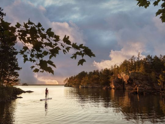
Paddleboarding in Minnesota’s Voyageurs National Park | Getty Images
America’s larger parks are attracting major crowds. Here’s where to avoid them
As summer creeps into full swing and cities across America do the dance of easing, and then reinstating, COVID-19 restrictions, people are clamoring to be someplace — anyplace — besides their own homes. While there is no form of travel that’s perfectly safe right now, there are certainly more responsible options than others for scratching the itch.
National parks, in all their wide-open space, are more befitting a socially distant vacation than, say, resort towns or theme parks. But even vast wilderness expanses have potential for riskier areas — visitor centers, for one, and popular trailheads near main parking areas. And then there are the mosh pit-like crowds at Yellowstone’s Old Faithful or the scenic drive at Zion National Park, which has been so popular since reopening that the park had to cap access at 6:30 a.m.
Now more than ever, then, this is the time to visit some of America’s lesser-known national parks. Steering clear of the millions of tourists at Yosemite, the Grand Canyon, and the Great Smoky Mountains, exploring new territory provides a sense of discovery, with the added benefit of having the trails mostly to yourself. The adventure doesn’t stop at park boundaries, either, as these less-famous parks are often surrounded by bucolic communities and smaller cities rich with their own charms, including destination-worthy restaurants, unexpected speakeasies, and a chicken-fried Texas saloon.
As enticing as all this sounds, it’s important that travelers tread carefully in and around all national parks, since these smaller gateway communities are not equipped to handle a potential outbreak brought in from visitors. It’s a double-edged sword for small businesses that rely on tourism dollars to survive, which is why it’s important to maintain the same caution on your road trip as you’ve maintained at home; just because you’re on vacation doesn’t mean you can put your face masks in storage. Wherever you are, social distancing and rigorous adherence to health mandates are of the utmost importance, in order to support these communities while keeping them safe.
So, with safety top of mind, here are some alternative parks to consider for your 2020 summer escape, and, of course, the best places to eat — to go, dine-in, or dine-out — nearby.

Getty Images/iStockphoto
The boardwalk at Congaree National Park
Congaree National Park, South Carolina
Judging by the fact that Congaree sees about 3 percent of the annual visitors of parks like Yellowstone and Rocky Mountain, it seems many people don’t even know this South Carolina park exists. Located in the middle of the state, the swamp-like terrain feels part Everglades and part Redwood, with the tallest trees east of the Mississippi and labyrinthine waterways ripe for paddling. The park’s most popular attractions, like the Boardwalk Trail, remain closed, but visitors are able to canoe or kayak on Cedar Creek, a narrow waterway that weaves through hardwood forest so tall and dense that it blocks out the sun, which is perhaps why hooting owls can be heard at all hours of the day. For easy hiking, out-of-the-way trails like the River Trail and Oakridge Trail are currently accessible. The park is within 20 miles of the state capital of Columbia, a small city with quality food and drink to be had.
Where to Eat: Before paddling through Congaree, it’s important to fuel up with a hearty breakfast, like tequila-spiked pancakes. Novelty breakfast is the bread and butter of the Black-owned 27 Pancakes food truck, which is operating on weekends only for the summer due to the pandemic. Chef-owner Joy Eggleston is a veritable Willy Wonka with pancake batter, offering classics (e.g., buttermilk, blueberry) alongside more whimsical and savory offerings, like a shrimp-and-grits pancake made with a grits batter, plump baby shrimp, and jalapenos, or the aforementioned tequila pancake, an almond-flour flapjack glazed with a blend of honey, maple syrup, and tequila reduction. Follow 27 Pancakes on social media to check its schedule.

Universal Images Group via Getty
The Starlight Theatre saloon in Terlingua, outside Big Bend
Big Bend National Park, Texas
About four and a half hours southeast of the closest major airport, in El Paso, this sprawling west Texas park has plenty of room (nearly 1 million acres, in fact) to spread out and explore, from Chisos Mountains hikes and soothing hot springs to the Santa Elena Canyon, a vast chasm offering shaded respite along the meandering Rio Grande. Due to its sheer size, geographic diversity, and faraway locale, this is the perfect park to immerse yourself in for a week, with plenty of sights and activities to keep you busy and enthralled. The surrounding communities are rich with character but low on crowds, like the dusty ghost town of Terlingua, which is emerging as a tranquil artist’s enclave, and the peaceful riverside town of Lajitas, where a goat serves as mayor.
Where to Eat and Drink: The star attraction in Terlingua is the Starlight Theatre, a lively contrast to a town filled with graves and derelict homes, both belonging to miners who succumbed to mercury poisoning or mining accidents in the early 1900s. The spacious saloon, known for its thoughtful riffs on gamey West Texas flavors, like chicken-fried wild boar strips with beer gravy and tequila-marinated quail in blueberry-balsamic sauce, is operating with dine-in and bar service at 50 percent capacity, and has added takeout as well as periodic live music performances.
Getty Images/EyeEm
The famous cliff dwellings in Mesa Verde national park
Mesa Verde National Park, Colorado
In lush southwest Colorado, Mesa Verde National Park is once again beckoning visitors itching to hike, drive along the Mesa Top Loop Road, and marvel at the park’s famed cliff dwellings, elaborate structures and communities built centuries ago by Puebloan peoples. At just over 50,000 acres, the park is the perfect weekend getaway, renowned for its mesa-skimming scenic drives and hiking trails that make you feel like you’re traipsing through the clouds, surrounded by panoramic views of the Colorado valley. The arty gateway town of Mancos is small, but surprisingly abundant with galleries, cafes, and restaurants, which have navigated new methods of operation.
Where to Eat: Absolute Bakery & Cafe is a beloved community hub for locals and tourists alike, who pregame before Mesa Verde with avocado omelets, chicken Florentine, Cubano sandwiches, and house-baked pastries like cherry strudel, pumpkin brownies, and coconut-walnut blondies. Since COVID-19, the cafe has extended its service to seven days a week (up from six) in order to serve breakfast and lunch to go, along with take-and-bake meals like pot pie, quiche, and lasagna perfect for cooking up in the RV. It’s also started nightly pizza dinners for takeout, made with sourdough crusts and rotating toppings like asparagus pesto, Hawaiian, and pepperoni. The cafe strongly encourages guests to wear masks, and it’s stocked with hand sanitizer stations.
Matt Kirouac
Kerouac’s restaurant in Great Basin National Park
Great Basin National Park, Nevada
Located along U.S. Route 50, a highway so desolate that its nickname is “The Loneliest Road in America,” and next to the tiny town of Baker, Great Basin National Park is the ultimate park for social distancing. Aside from the people you travel with, it’s unlikely you’ll encounter other humans here at all. This Great Basin region of eastern Nevada, sandwiched between the Sierra Nevadas and Wasatch Mountains, is a place of extremes — from the skyscraping tip of Wheeler Peak, the highest point in the park (and second highest in Nevada) at 13,065 feet, to the craggy passageways within Lehman Caves and the gnarly looking bristlecone pines, the oldest trees on Earth, some nearing 5,000 years of age. Best of all? With under 200,000 annual visitors and 77,000 acres worth of diverse terrain, you’ll find plenty of solitude among the epic environs.
Where to Eat: An homage to the ultimate road-tripper, Kerouac’s Restaurant is a seasonal restaurant open May through October at the Stargazer Inn in Baker. Due to COVID-19, the restaurant is only offering counter service this year, with food and drink available to go or for dining on the homespun front patio. The menu reads like a hit list of American comfort classics, sure to satisfy after a long drive or a long hike. Think pesto-mushroom pizzas, spicy chicken sandwiches, veggie burgers, oatmeal cranberry cookies, and even strawberry-rhubarb Moscow mules.

Getty Images/iStockphoto
Grassy rolling hills in Wild Cave National Park
Hotel Alex Johnson / Facebook
The rooftop deck at Vertex Sky Bar in Rapid City
Wind Cave National Park, South Dakota
Western South Dakota is well known for iconic parks and monuments, like Badlands National Park and Mount Rushmore, but for those looking to eschew crowds, Wind Cave is a good choice for a day trip. Though the cave itself — a dense maze of jagged calcite formations, like needle-looking frostwork, and boxwork, a rare grid-shaped feature found in almost no other cave on Earth — is currently closed down, the park has many miles (and some 30,000 acres) of peaceful prairie hikes, rolling hills, and meadows strewn with wildflowers so vibrant they look like fields of confetti. Keep your eyes peeled for a chance to spot bison, prairie dogs, elk, and the rare black-footed ferret.
Where to Eat: As the urban hub of western South Dakota, Rapid City’s got an impressive food scene despite its small size and population. An hour’s drive from Wind Cave, head to the bi-level Vertex Sky Bar atop the historic Hotel Alex Johnson to drink in the Black Hills views while drinking in the rosé, or dine at Kōl, which reopened for reservations-only dine-in service with tables spread six feet apart, for wood-fired pizzas, steaks, and roast chicken. In the morning, downtown’s Harriet & Oak cafe reduced seating and limited the amount of time customers can linger to two hours, which is still enough to enjoy a trendy latte and some oh-so-Instagrammable avocado toast. Curbside pickup and online ordering is also available.
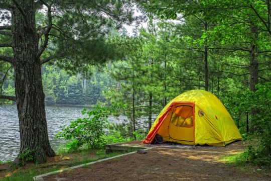
Getty Images/iStockphoto
Lost Lake campsite at Voyageurs National Park
Voyageurs National Park, Minnesota
On the northern border of Minnesota lies Voyageurs National Park, a tranquil landscape of lakes and islands, where loons replace the din of city sirens. Up here, in the heart of the Land of 10,000 Lakes, it’s easy to maintain social distance for a few days, considering a third of the 250,000-acre park is, well, water, and most activities involve kayaks, canoes, and fishing.
Where to Eat: It doesn’t get more quintessential Minnesota Northwoods than the Rocky Ledge, a cabin-like restaurant on the tree-lined shores of Kabetogama Lake, with a penchant for Minnesota specialties like wild rice casserole. And in case you weren’t able to reel in your own catch on the lake, fear not: the restaurant offers fry-bread fish tacos and breaded walleye sandwiches to make up for it.
Matt Kirouac
The tap lineup at Superior Bathhouse
Hot Springs National Park, Arkansas
For travelers who prefer a more relaxed experience over, say, a backcountry trek, Arkansas’s historic Hot Springs is a tiny city park that’s ideal for an afternoon stopover. Anchored by ornate bathhouses utilizing the region’s famed thermal waters, the town is nicknamed “The American Spa,” and it’s been enticing visitors for more than a century. Bathhouse Row is the heart of the park, lined with steaming water fountains and palace-sized buildings with intricate Gilded Age architecture. While you may not be able to take a traditional bath quite yet, visitors can hike up the gentle slopes of Hot Springs Mountain, whose summit affords vista views of the bright-green Ouachita Mountain range, and then imbibe that spring water at the rare brewery located within a national park.
Where to Eat: Superior Bathhouse, located in one of the former bathhouses along Main Street’s Bathhouse Row, has reopened for limited counter service. Visitors are required to wear masks, unless they’re eating (beer cheese dip and sweet potato-beet sandwiches are excellent choices), or drinking one of the beers brewed on-site — e.g., hazy blood-orange I.P.A., honey-basil kolsch, oatmeal stout — made with Hot Springs’ thermal waters. To connect with the Southern soul of Hot Springs, head to Emma Lee’s, a warm and welcoming dining room wafting with aromas of buttery peach cobbler, beef roast, and fresh cornbread. The family-run restaurant is the dream of owner Courtney Sanders, who pays homage to his grandmother Emma Lee with her most beloved recipes. The restaurant is still offering curbside pickup along with limited dine-in service on Wednesdays, Thursdays, Saturdays, and Sundays. No matter what’s on deck for the day, be it thick slabs of smoky brisket and candied yams or mac and cheese served bubbling-hot under a golden-brown crust, this is the kind of restaurant that’s sure to warm hearts during a time when it’s needed most. Masks are required for entry, but customers can remove them while seated.
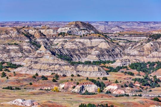
Getty Images
The rugged badlands of Theodore Roosevelt National Park
Theodore Roosevelt National Park, North Dakota
Badlands, petrified wood, roving bison, and wild horses make it clear what endeared President Theodore Roosevelt to this tranquil part of the country, where you’re more likely to encounter chirping prairie dogs on your hike than people. Split into two main north and south districts, each worth visiting for a day or two, the 70,000-acre park feels like the quintessential Wild West, with the Little Missouri River zig-zagging through fields of verdant grassland and eroded sandstone formations that look like super-sized sandcastles. Medora is the tiny home of the park’s popular south unit, but nearby Dickinson is a small city with an array of independent options.
Where to Eat: There’s really no better way to kickstart your day than with a blackberry pancake latte and a sticky caramel roll, and the Brew, a former church-turned-coffee shop, delivers on both fronts. Later, unwind with a sweet and spicy jalapeno honey beer and a Badlands pizza, made with pepperoni, Italian sausage, and ricotta, at Phat Fish Brewing. The brewpub is open for dine-in seating, with spaced-out indoor tables and a sprawling patio with a grassy lawn. It’s also offering take-and-bake pizza kits and bottled beers to go.
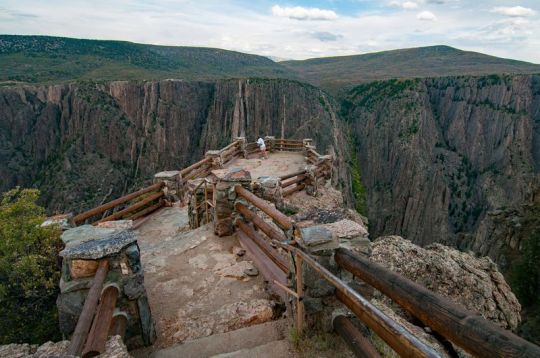
Getty Images/iStockphoto
An overlook at Black Canyon of the Gunnison National Park
Black Canyon of the Gunnison National Park, Colorado
With its blissfully warm temperatures, lush forests, and wildly diverse terrain, Colorado is popular for outdoorsy recreation, but rather than queueing up at crowded Rocky Mountain National Park, try the lesser-known Black Canyon of the Gunnison. The state’s least visited national park, Black Canyon is open for hiking along both the north and south rims, with trails that’ll get you unnervingly close to the breathtaking canyon and the raging river far below. Both sides of the canyon are worth visiting, so be sure to carve out at least two or three days to thoroughly explore. Since the only way to the north rim is driving all the way around the southern end of the canyon, it requires some added travel time. For fearless hikers, the park also has a few steep trails down to the canyon floor, which is a nice way to get out of the sun, since the canyon is so tall and narrow that it’s almost constantly shrouded in its own shadow. Nearby, the town of Montrose is the entry point to the park’s southern rim, which has the most trails and scenic viewpoints.
Where to Eat: It’s not often a speakeasy offering craft cocktails and charcuterie platters can be found on the outskirts of a national park, which is what makes Phelanies a special find. Accessed down an alley off one of Montrose’s main streets, the spacious lounge has gone alfresco for the first time, adding a patio and expanding its menus to include more food (like Korean barbecue pulled pork and duck wontons) and seasonal cocktails, like honeydew margaritas and the timely COVID Reviver No. 19, a Corpse Reviver riff with gin, orange liqueur, Lillet Blanc, lemon, and a CBD tincture. Guests are asked to wear masks any time they’re not seated, and limit movement around the bar except for necessities like bathroom runs.
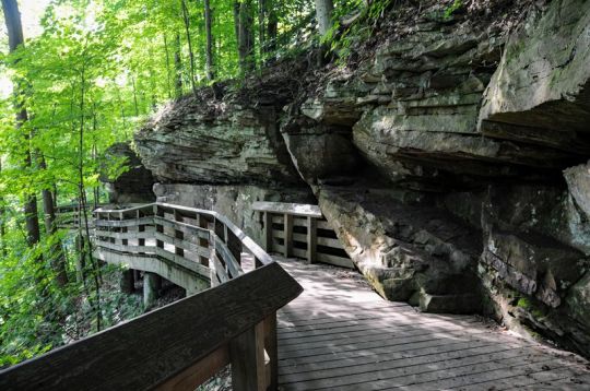
Getty Images/iStockphoto
The Brandywine Falls Trail at Cuyahoga Valley National Park
Cuyahoga Valley National Park, Ohio
Sandwiched between the nearby cities of Cleveland and Akron, hugging the crooked Cuyahoga River for some 30,000 acres, Cuyahoga Valley provides a literal breath of fresh air for Ohio city-dwellers seeking to escape the traffic for the day and replace it with dense green forests, babbling creeks, and 70-plus waterfalls. While popular sites like the Brandywine Falls boardwalk remain closed, there are still opportunities for hiking along miles of woodland trails, horseback riding, fishing, and kayaking.
Where to Eat: The park is a convenient day trip from larger cities in Ohio, making it ideal for safe travel, since visitors are able to minimize their footprint without having to stay overnight. If you’re traveling from Cleveland, start your day with a fried ring of purple-hued blueberry cake, bursting with juicy, tangy flavor, from the Vegan Doughnut Company. Located in suburban Lakewood, the Black-owned bakery from sisters Kharisma and Kyra Mayo exhibits a penchant for vibrant, whimsical pastries, like a birthday-cake doughnut strewn with multicolored sprinkles and crushed Golden Oreos, or a vanilla-glazed variety decorated with chocolate chips and dollops of cookie dough. For now, the shop is open weekends only for to-go doughnuts. Later, after you’ve chased a few waterfalls in the park, wood-fired pepperoni and banana-pepper pizza is an apt pick-me-up, and you can get your fix at Sarah’s Vineyard and Winery. Housed in a timber-clad barn that doubles as an art gallery, the lofty restaurant and tasting room has reopened for dine-in, spread out its ample patio seating, added hand sanitizer stations by the entrance, and shifted its menu to heartier crowd-pleasers like pulled pork sandwiches, nachos, and pizza. Sit outside for sweeping vineyard views and pair your spicy pie with a carafe of sweet Ohio-grown Vidal.
Getty Images/iStockphoto
Rattlesnake Canyon at Carlsbad Caverns National Park
Carlsbad Caverns National Park, New Mexico
The world-famous caverns — brimming with stalagmites, stalactites, and a colony of Brazilian free-tailed bats so populous that they look like clouds of swirling black smoke on their nightly flights — are still closed to visitors, but the underrated hiking trails on the surface are well worth the excursion, especially for a morning or late-afternoon hike (the sun gets pretty scorching midday). With nearly 50 miles of trails through the peaceful Chihuahuan Desert, from Rattlesnake Canyon to Guadalupe Ridge, there’s plenty to explore, and plenty of opportunity to break away from crowds and convene with cacti and roadrunners.
Where to Eat: In the nearby town of Carlsbad, Guadalupe Mountain Brewing Company reopened for dine-in service, with restricted hours and a patio. House-brewed beers run the gamut from a puckering grapefruit gose to creamy coconut porters, while the thin and crispy brick-oven pizzas are so popular they sell out regularly. They also offer gluten-free crusts, cauliflower-crust pizzas, and periodic specials like berry-studded dessert pizzas and New Mexican green chile pies.
A full-time RV traveler and freelance travel writer, Matt Kirouac is the co-founder and co-host of Hello Ranger, a national parks community blog, podcast, and forthcoming app.
from Eater - All https://ift.tt/38HIo58
https://ift.tt/2Zbjk3i
Paddleboarding in Minnesota’s Voyageurs National Park | Getty Images
America’s larger parks are attracting major crowds. Here’s where to avoid them
As summer creeps into full swing and cities across America do the dance of easing, and then reinstating, COVID-19 restrictions, people are clamoring to be someplace — anyplace — besides their own homes. While there is no form of travel that’s perfectly safe right now, there are certainly more responsible options than others for scratching the itch.
National parks, in all their wide-open space, are more befitting a socially distant vacation than, say, resort towns or theme parks. But even vast wilderness expanses have potential for riskier areas — visitor centers, for one, and popular trailheads near main parking areas. And then there are the mosh pit-like crowds at Yellowstone’s Old Faithful or the scenic drive at Zion National Park, which has been so popular since reopening that the park had to cap access at 6:30 a.m.
Now more than ever, then, this is the time to visit some of America’s lesser-known national parks. Steering clear of the millions of tourists at Yosemite, the Grand Canyon, and the Great Smoky Mountains, exploring new territory provides a sense of discovery, with the added benefit of having the trails mostly to yourself. The adventure doesn’t stop at park boundaries, either, as these less-famous parks are often surrounded by bucolic communities and smaller cities rich with their own charms, including destination-worthy restaurants, unexpected speakeasies, and a chicken-fried Texas saloon.
As enticing as all this sounds, it’s important that travelers tread carefully in and around all national parks, since these smaller gateway communities are not equipped to handle a potential outbreak brought in from visitors. It’s a double-edged sword for small businesses that rely on tourism dollars to survive, which is why it’s important to maintain the same caution on your road trip as you’ve maintained at home; just because you’re on vacation doesn’t mean you can put your face masks in storage. Wherever you are, social distancing and rigorous adherence to health mandates are of the utmost importance, in order to support these communities while keeping them safe.
So, with safety top of mind, here are some alternative parks to consider for your 2020 summer escape, and, of course, the best places to eat — to go, dine-in, or dine-out — nearby.
Getty Images/iStockphoto
The boardwalk at Congaree National Park
Congaree National Park, South Carolina
Judging by the fact that Congaree sees about 3 percent of the annual visitors of parks like Yellowstone and Rocky Mountain, it seems many people don’t even know this South Carolina park exists. Located in the middle of the state, the swamp-like terrain feels part Everglades and part Redwood, with the tallest trees east of the Mississippi and labyrinthine waterways ripe for paddling. The park’s most popular attractions, like the Boardwalk Trail, remain closed, but visitors are able to canoe or kayak on Cedar Creek, a narrow waterway that weaves through hardwood forest so tall and dense that it blocks out the sun, which is perhaps why hooting owls can be heard at all hours of the day. For easy hiking, out-of-the-way trails like the River Trail and Oakridge Trail are currently accessible. The park is within 20 miles of the state capital of Columbia, a small city with quality food and drink to be had.
Where to Eat: Before paddling through Congaree, it’s important to fuel up with a hearty breakfast, like tequila-spiked pancakes. Novelty breakfast is the bread and butter of the Black-owned 27 Pancakes food truck, which is operating on weekends only for the summer due to the pandemic. Chef-owner Joy Eggleston is a veritable Willy Wonka with pancake batter, offering classics (e.g., buttermilk, blueberry) alongside more whimsical and savory offerings, like a shrimp-and-grits pancake made with a grits batter, plump baby shrimp, and jalapenos, or the aforementioned tequila pancake, an almond-flour flapjack glazed with a blend of honey, maple syrup, and tequila reduction. Follow 27 Pancakes on social media to check its schedule.
Universal Images Group via Getty
The Starlight Theatre saloon in Terlingua, outside Big Bend
Big Bend National Park, Texas
About four and a half hours southeast of the closest major airport, in El Paso, this sprawling west Texas park has plenty of room (nearly 1 million acres, in fact) to spread out and explore, from Chisos Mountains hikes and soothing hot springs to the Santa Elena Canyon, a vast chasm offering shaded respite along the meandering Rio Grande. Due to its sheer size, geographic diversity, and faraway locale, this is the perfect park to immerse yourself in for a week, with plenty of sights and activities to keep you busy and enthralled. The surrounding communities are rich with character but low on crowds, like the dusty ghost town of Terlingua, which is emerging as a tranquil artist’s enclave, and the peaceful riverside town of Lajitas, where a goat serves as mayor.
Where to Eat and Drink: The star attraction in Terlingua is the Starlight Theatre, a lively contrast to a town filled with graves and derelict homes, both belonging to miners who succumbed to mercury poisoning or mining accidents in the early 1900s. The spacious saloon, known for its thoughtful riffs on gamey West Texas flavors, like chicken-fried wild boar strips with beer gravy and tequila-marinated quail in blueberry-balsamic sauce, is operating with dine-in and bar service at 50 percent capacity, and has added takeout as well as periodic live music performances.
Getty Images/EyeEm
The famous cliff dwellings in Mesa Verde national park
Mesa Verde National Park, Colorado
In lush southwest Colorado, Mesa Verde National Park is once again beckoning visitors itching to hike, drive along the Mesa Top Loop Road, and marvel at the park’s famed cliff dwellings, elaborate structures and communities built centuries ago by Puebloan peoples. At just over 50,000 acres, the park is the perfect weekend getaway, renowned for its mesa-skimming scenic drives and hiking trails that make you feel like you’re traipsing through the clouds, surrounded by panoramic views of the Colorado valley. The arty gateway town of Mancos is small, but surprisingly abundant with galleries, cafes, and restaurants, which have navigated new methods of operation.
Where to Eat: Absolute Bakery & Cafe is a beloved community hub for locals and tourists alike, who pregame before Mesa Verde with avocado omelets, chicken Florentine, Cubano sandwiches, and house-baked pastries like cherry strudel, pumpkin brownies, and coconut-walnut blondies. Since COVID-19, the cafe has extended its service to seven days a week (up from six) in order to serve breakfast and lunch to go, along with take-and-bake meals like pot pie, quiche, and lasagna perfect for cooking up in the RV. It’s also started nightly pizza dinners for takeout, made with sourdough crusts and rotating toppings like asparagus pesto, Hawaiian, and pepperoni. The cafe strongly encourages guests to wear masks, and it’s stocked with hand sanitizer stations.
Matt Kirouac
Kerouac’s restaurant in Great Basin National Park
Great Basin National Park, Nevada
Located along U.S. Route 50, a highway so desolate that its nickname is “The Loneliest Road in America,” and next to the tiny town of Baker, Great Basin National Park is the ultimate park for social distancing. Aside from the people you travel with, it’s unlikely you’ll encounter other humans here at all. This Great Basin region of eastern Nevada, sandwiched between the Sierra Nevadas and Wasatch Mountains, is a place of extremes — from the skyscraping tip of Wheeler Peak, the highest point in the park (and second highest in Nevada) at 13,065 feet, to the craggy passageways within Lehman Caves and the gnarly looking bristlecone pines, the oldest trees on Earth, some nearing 5,000 years of age. Best of all? With under 200,000 annual visitors and 77,000 acres worth of diverse terrain, you’ll find plenty of solitude among the epic environs.
Where to Eat: An homage to the ultimate road-tripper, Kerouac’s Restaurant is a seasonal restaurant open May through October at the Stargazer Inn in Baker. Due to COVID-19, the restaurant is only offering counter service this year, with food and drink available to go or for dining on the homespun front patio. The menu reads like a hit list of American comfort classics, sure to satisfy after a long drive or a long hike. Think pesto-mushroom pizzas, spicy chicken sandwiches, veggie burgers, oatmeal cranberry cookies, and even strawberry-rhubarb Moscow mules.
Getty Images/iStockphoto
Grassy rolling hills in Wild Cave National Park
Hotel Alex Johnson / Facebook
The rooftop deck at Vertex Sky Bar in Rapid City
Wind Cave National Park, South Dakota
Western South Dakota is well known for iconic parks and monuments, like Badlands National Park and Mount Rushmore, but for those looking to eschew crowds, Wind Cave is a good choice for a day trip. Though the cave itself — a dense maze of jagged calcite formations, like needle-looking frostwork, and boxwork, a rare grid-shaped feature found in almost no other cave on Earth — is currently closed down, the park has many miles (and some 30,000 acres) of peaceful prairie hikes, rolling hills, and meadows strewn with wildflowers so vibrant they look like fields of confetti. Keep your eyes peeled for a chance to spot bison, prairie dogs, elk, and the rare black-footed ferret.
Where to Eat: As the urban hub of western South Dakota, Rapid City’s got an impressive food scene despite its small size and population. An hour’s drive from Wind Cave, head to the bi-level Vertex Sky Bar atop the historic Hotel Alex Johnson to drink in the Black Hills views while drinking in the rosé, or dine at Kōl, which reopened for reservations-only dine-in service with tables spread six feet apart, for wood-fired pizzas, steaks, and roast chicken. In the morning, downtown’s Harriet & Oak cafe reduced seating and limited the amount of time customers can linger to two hours, which is still enough to enjoy a trendy latte and some oh-so-Instagrammable avocado toast. Curbside pickup and online ordering is also available.
Getty Images/iStockphoto
Lost Lake campsite at Voyageurs National Park
Voyageurs National Park, Minnesota
On the northern border of Minnesota lies Voyageurs National Park, a tranquil landscape of lakes and islands, where loons replace the din of city sirens. Up here, in the heart of the Land of 10,000 Lakes, it’s easy to maintain social distance for a few days, considering a third of the 250,000-acre park is, well, water, and most activities involve kayaks, canoes, and fishing.
Where to Eat: It doesn’t get more quintessential Minnesota Northwoods than the Rocky Ledge, a cabin-like restaurant on the tree-lined shores of Kabetogama Lake, with a penchant for Minnesota specialties like wild rice casserole. And in case you weren’t able to reel in your own catch on the lake, fear not: the restaurant offers fry-bread fish tacos and breaded walleye sandwiches to make up for it.
Matt Kirouac
The tap lineup at Superior Bathhouse
Hot Springs National Park, Arkansas
For travelers who prefer a more relaxed experience over, say, a backcountry trek, Arkansas’s historic Hot Springs is a tiny city park that’s ideal for an afternoon stopover. Anchored by ornate bathhouses utilizing the region’s famed thermal waters, the town is nicknamed “The American Spa,” and it’s been enticing visitors for more than a century. Bathhouse Row is the heart of the park, lined with steaming water fountains and palace-sized buildings with intricate Gilded Age architecture. While you may not be able to take a traditional bath quite yet, visitors can hike up the gentle slopes of Hot Springs Mountain, whose summit affords vista views of the bright-green Ouachita Mountain range, and then imbibe that spring water at the rare brewery located within a national park.
Where to Eat: Superior Bathhouse, located in one of the former bathhouses along Main Street’s Bathhouse Row, has reopened for limited counter service. Visitors are required to wear masks, unless they’re eating (beer cheese dip and sweet potato-beet sandwiches are excellent choices), or drinking one of the beers brewed on-site — e.g., hazy blood-orange I.P.A., honey-basil kolsch, oatmeal stout — made with Hot Springs’ thermal waters. To connect with the Southern soul of Hot Springs, head to Emma Lee’s, a warm and welcoming dining room wafting with aromas of buttery peach cobbler, beef roast, and fresh cornbread. The family-run restaurant is the dream of owner Courtney Sanders, who pays homage to his grandmother Emma Lee with her most beloved recipes. The restaurant is still offering curbside pickup along with limited dine-in service on Wednesdays, Thursdays, Saturdays, and Sundays. No matter what’s on deck for the day, be it thick slabs of smoky brisket and candied yams or mac and cheese served bubbling-hot under a golden-brown crust, this is the kind of restaurant that’s sure to warm hearts during a time when it’s needed most. Masks are required for entry, but customers can remove them while seated.
Getty Images
The rugged badlands of Theodore Roosevelt National Park
Theodore Roosevelt National Park, North Dakota
Badlands, petrified wood, roving bison, and wild horses make it clear what endeared President Theodore Roosevelt to this tranquil part of the country, where you’re more likely to encounter chirping prairie dogs on your hike than people. Split into two main north and south districts, each worth visiting for a day or two, the 70,000-acre park feels like the quintessential Wild West, with the Little Missouri River zig-zagging through fields of verdant grassland and eroded sandstone formations that look like super-sized sandcastles. Medora is the tiny home of the park’s popular south unit, but nearby Dickinson is a small city with an array of independent options.
Where to Eat: There’s really no better way to kickstart your day than with a blackberry pancake latte and a sticky caramel roll, and the Brew, a former church-turned-coffee shop, delivers on both fronts. Later, unwind with a sweet and spicy jalapeno honey beer and a Badlands pizza, made with pepperoni, Italian sausage, and ricotta, at Phat Fish Brewing. The brewpub is open for dine-in seating, with spaced-out indoor tables and a sprawling patio with a grassy lawn. It’s also offering take-and-bake pizza kits and bottled beers to go.
Getty Images/iStockphoto
An overlook at Black Canyon of the Gunnison National Park
Black Canyon of the Gunnison National Park, Colorado
With its blissfully warm temperatures, lush forests, and wildly diverse terrain, Colorado is popular for outdoorsy recreation, but rather than queueing up at crowded Rocky Mountain National Park, try the lesser-known Black Canyon of the Gunnison. The state’s least visited national park, Black Canyon is open for hiking along both the north and south rims, with trails that’ll get you unnervingly close to the breathtaking canyon and the raging river far below. Both sides of the canyon are worth visiting, so be sure to carve out at least two or three days to thoroughly explore. Since the only way to the north rim is driving all the way around the southern end of the canyon, it requires some added travel time. For fearless hikers, the park also has a few steep trails down to the canyon floor, which is a nice way to get out of the sun, since the canyon is so tall and narrow that it’s almost constantly shrouded in its own shadow. Nearby, the town of Montrose is the entry point to the park’s southern rim, which has the most trails and scenic viewpoints.
Where to Eat: It’s not often a speakeasy offering craft cocktails and charcuterie platters can be found on the outskirts of a national park, which is what makes Phelanies a special find. Accessed down an alley off one of Montrose’s main streets, the spacious lounge has gone alfresco for the first time, adding a patio and expanding its menus to include more food (like Korean barbecue pulled pork and duck wontons) and seasonal cocktails, like honeydew margaritas and the timely COVID Reviver No. 19, a Corpse Reviver riff with gin, orange liqueur, Lillet Blanc, lemon, and a CBD tincture. Guests are asked to wear masks any time they’re not seated, and limit movement around the bar except for necessities like bathroom runs.
Getty Images/iStockphoto
The Brandywine Falls Trail at Cuyahoga Valley National Park
Cuyahoga Valley National Park, Ohio
Sandwiched between the nearby cities of Cleveland and Akron, hugging the crooked Cuyahoga River for some 30,000 acres, Cuyahoga Valley provides a literal breath of fresh air for Ohio city-dwellers seeking to escape the traffic for the day and replace it with dense green forests, babbling creeks, and 70-plus waterfalls. While popular sites like the Brandywine Falls boardwalk remain closed, there are still opportunities for hiking along miles of woodland trails, horseback riding, fishing, and kayaking.
Where to Eat: The park is a convenient day trip from larger cities in Ohio, making it ideal for safe travel, since visitors are able to minimize their footprint without having to stay overnight. If you’re traveling from Cleveland, start your day with a fried ring of purple-hued blueberry cake, bursting with juicy, tangy flavor, from the Vegan Doughnut Company. Located in suburban Lakewood, the Black-owned bakery from sisters Kharisma and Kyra Mayo exhibits a penchant for vibrant, whimsical pastries, like a birthday-cake doughnut strewn with multicolored sprinkles and crushed Golden Oreos, or a vanilla-glazed variety decorated with chocolate chips and dollops of cookie dough. For now, the shop is open weekends only for to-go doughnuts. Later, after you’ve chased a few waterfalls in the park, wood-fired pepperoni and banana-pepper pizza is an apt pick-me-up, and you can get your fix at Sarah’s Vineyard and Winery. Housed in a timber-clad barn that doubles as an art gallery, the lofty restaurant and tasting room has reopened for dine-in, spread out its ample patio seating, added hand sanitizer stations by the entrance, and shifted its menu to heartier crowd-pleasers like pulled pork sandwiches, nachos, and pizza. Sit outside for sweeping vineyard views and pair your spicy pie with a carafe of sweet Ohio-grown Vidal.
Getty Images/iStockphoto
Rattlesnake Canyon at Carlsbad Caverns National Park
Carlsbad Caverns National Park, New Mexico
The world-famous caverns — brimming with stalagmites, stalactites, and a colony of Brazilian free-tailed bats so populous that they look like clouds of swirling black smoke on their nightly flights — are still closed to visitors, but the underrated hiking trails on the surface are well worth the excursion, especially for a morning or late-afternoon hike (the sun gets pretty scorching midday). With nearly 50 miles of trails through the peaceful Chihuahuan Desert, from Rattlesnake Canyon to Guadalupe Ridge, there’s plenty to explore, and plenty of opportunity to break away from crowds and convene with cacti and roadrunners.
Where to Eat: In the nearby town of Carlsbad, Guadalupe Mountain Brewing Company reopened for dine-in service, with restricted hours and a patio. House-brewed beers run the gamut from a puckering grapefruit gose to creamy coconut porters, while the thin and crispy brick-oven pizzas are so popular they sell out regularly. They also offer gluten-free crusts, cauliflower-crust pizzas, and periodic specials like berry-studded dessert pizzas and New Mexican green chile pies.
A full-time RV traveler and freelance travel writer, Matt Kirouac is the co-founder and co-host of Hello Ranger, a national parks community blog, podcast, and forthcoming app.
from Eater - All https://ift.tt/38HIo58
via Blogger https://ift.tt/2DnLPCm
0 notes
Last Seen Blogs

what-ever-happened
show me the stars

diaryofabroquegirl
Untitled

laorelcreates
Laorel

overratedwithsemin
Whisper Your Heart...

annfirestar
Shipper Ltd.✨