#Maritime map
Text
#Gulf Shores#Alabama Riviera#Beach vibes#Coastal charm#Retro design#Maritime map#Laid-back style#Exclusive tee#Beach destination#Local pride#Tourist attraction#Coastal allure#Vibrant locations#Retro-inspired#Iconic imagery
0 notes
Photo
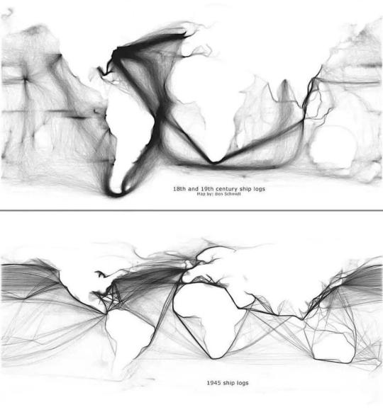
Ships logs from 18th/19th centuries vs 1945
4K notes
·
View notes
Text
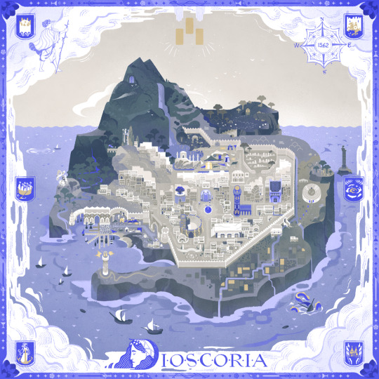
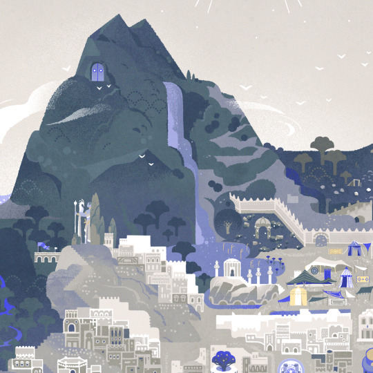
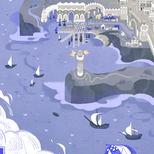
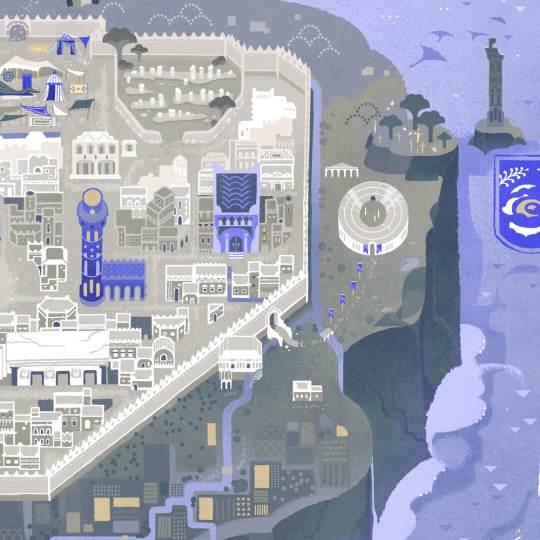
Discoria - The Hidden Isle 🌊
#illustrators on tumblr#artists on tumblr#illustration#ttrpg#the hidden isle#indie rpg#ttrpg community#island#map#nautical#maritime#seafaring#maps#sefirot tarot#Sefirot#had so much fun working on this map even though it took forever I'm so proud of it!#feel free to check out our newest Sefirot project
2K notes
·
View notes
Photo
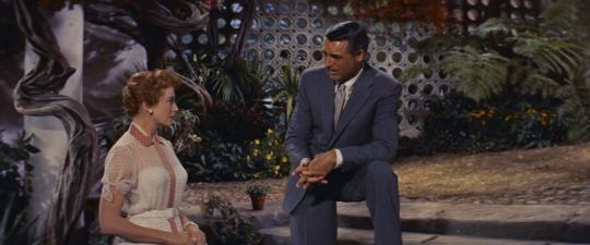

An Affair to Remember
Leo McCarey. 1957
Stairs
06230 Villefranche-sur-Mer, France
See in map
See in imdb
#leo mccarey#an affair to remember#cary grant#deborah kerr#villefranche sur mer#villefranche-sur-mer#movie#cinema#film#location#google maps#street view#1957#french riviera#provence-alpes-côte d'azur#alpes-maritimes
71 notes
·
View notes
Text

You know you’re in for a good doomed polar voyage when it opens with a map that looks like a fucking etch a sketch
#books#maps#polar exploration#cannot stop laughing at this route#maritime history#madhouse at the end of the earth
22 notes
·
View notes
Text
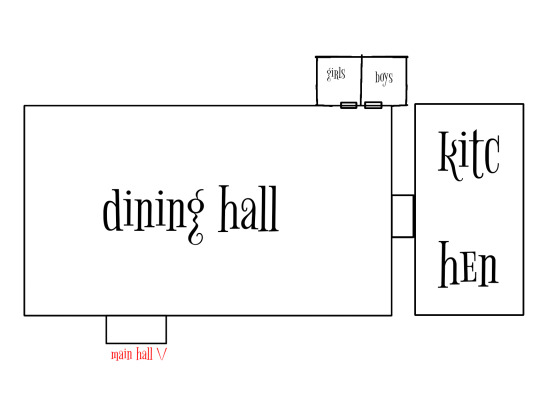


We're working on a floor one layout, feel free to critique in any way!
#danganronpa:macabre maritime#danganronpa fangan#fanganronpa#danganronpa fangame#fan project#fangames#fangan#indie dev#video games#map#video series#game maps
12 notes
·
View notes
Text
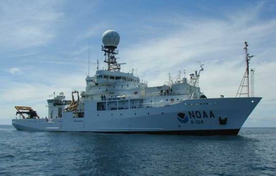
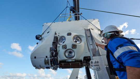
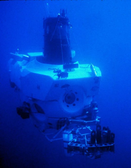
I FUCKING LOVE SCIENTIFIC RESEARCH SHIPS AND SUBMERSIBLES!!!!!!!!
OH YEEEEEAAAAAH!!!!!!
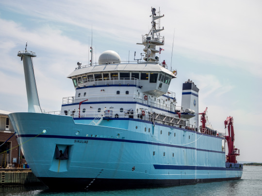
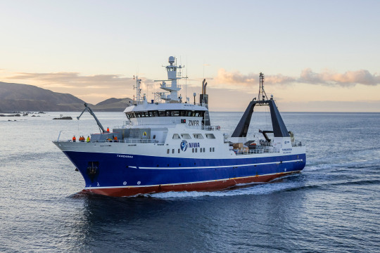
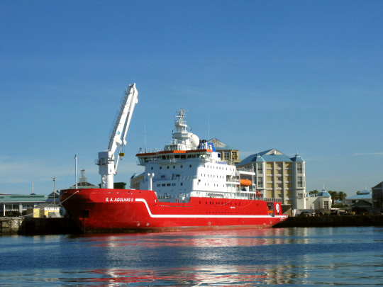
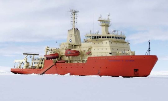
Sure I don’t know SHIT about hydrography or oceanography or maritime research or any of that stuff.
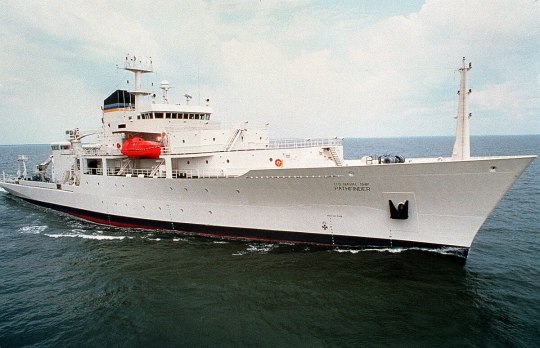
But I love seeing such advanced equipment and ships being used for this kind of stuff!
Pure research for its own good!
Amazing.
#personal stuff#dougie rambles#research ships#submersible#DSV limiting factor#noaa#oceanography#hydrography#scripps institute of oceanography#triton submarines#gabe newell#inkfish#full blown research#atmospheric research#survey#sea floor mapping#maritime shit#gushing#science#research
21 notes
·
View notes
Text

50 notes
·
View notes
Text

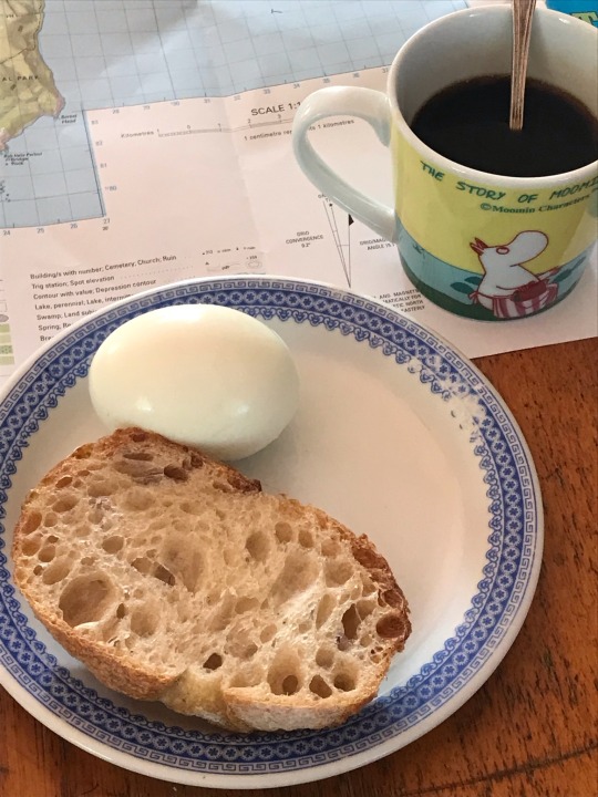
im like some sort of grizzled 19th century maritime man
#with my maps and my hard boiled egg and my crust of bread and my black coffee#max omg i was planning on a daytrip before ur tags on my isthmus post augh im so glad i knew that… lunawanna-alonnah u will ALWAYS be famou#*that isthmus post#my photos#maritime
14 notes
·
View notes
Text
Barbie should just be outright banned in the country following Vietnam's stance tbh, it's not like there isn't any precedent for it since we also banned Abominable like 4 years ago 🤷♀️
#solidarity and all#those who say there's no propaganda on the map are the ones who also don't know the ongoing SE Asia vs China maritime dispute#the same one that's been going on for a century and still going strong
2 notes
·
View notes
Text
For instance, no one now disputes that when Europe's great age of maritime discovery was just beginning, Chinese navigation was far more advanced and Chinese sailors already knew the coasts of India, Arabia, East Africa, and perhaps Australia.*
*Some people think Chinese sailors even reached the Americas in the fifteenth century, but as I will try to show in Chapter 8, these claims are probably fanciful. The closest thing to evidence for these imaginary voyages is a map of the world exhibited in Beijing and London in 2006, purporting to be a 1763 copy of a Chinese original drawn in 1418. The map is not only wildly different from all genuine fifteenth-century Chinese maps but is also strikingly like eighteenth-century French world maps, down to details like showing California as an island. Most likely an eighteenth-century Chinese cartographer combined fifteenth-century maps with newly available French maps. The mapmaker probably had no intention of deceiving anyone, but twenty-first-century collectors, eager for sensational discoveries, have happily deceived themselves.
"Why the West Rules – For Now: The patterns of history and what they reveal about the future" - Ian Morris
#book quotes#why the west rules – for now#ian morris#nonfiction#maritime discovery#maritime navigation#maritime history#europe#china#india#arabia#east africa#australia#the americas#15th century#beijing#london#maps#world map#00s#2000s#21st century#60s#1760s#18th century#10s#1410s#cartography#california#deception
0 notes
Text
Map Project Digitally Unlocks The Past - Technology Org
New Post has been published on https://thedigitalinsider.com/map-project-digitally-unlocks-the-past-technology-org/
Map Project Digitally Unlocks The Past - Technology Org
History buffs interested in tracing the journeys of some of the Asia-Pacific’s greatest explorers will now be able to do so at the click of a button, thanks to a new digital map created by James Cook University researchers.
The time-layered online mapping tool is an open-access archive comprised Russian, French, Dutch, Spanish and British voyages. Image credit: JCU
Using an Australian-developed time-layered online mapping tool that combines spreadsheet data and Google Earth, JCU History Lecturer Dr Claire Brennan and College of Arts, Society and Education Dean Professor Koen Stapelbroek have tracked all documented scientific voyages between the Cape of Good Hope and Cape Horn between 1768 and 1834.
Dr Brennan said the exhaustive open access archive comprised Russian, French, Dutch, Spanish and British voyages, including the notable grounding of HMB Endeavour on the Great Barrier Reef on June 10, 1770, commanded by the then Lieutenant James Cook.
Only months earlier, the crew of the Endeavour had sighted the east coast of Australia and made their first landing at Botany Bay.
“The maps themselves can be used in various ways, sorted by place, time and nationality, and will link back to the journals produced by the voyages,” Dr Brennan said.
“The project produces a digital tool that creates a new way of interacting with these voyages, and with the records they produced.”
Dr Brennan said the map’s ability to collate the documented observations of various Pacific islands from early explorers had the potential to challenge previously held historical assumptions.
“Anthropologists are always interested in these voyages because this is first contact and while the Europeans at the time had some strange interpretations of what they’re seeing, often you can look through and undo the distortions knowing what we know now about the people who lived in these places,” she said.
Prof Stapelbroek said the broader project first came about following discussions with JCU coral taxonomists Dr Tom Bridge and Professor Andrew Baird, and JCU maritime archaeologist Dr Madeline McAllister.
The Coral Discovery Project uses historical sources and expertise to cast light on the origins of coral specimens within the world’s museums.
“In a museum you basically have dead coral, but the taxonomists don’t know where it was from,” Prof Stapelbroek said.
“However, they do know when it was picked up in the late 18th to early 19th century and the year it was first described, so they are looking for a journey prior to just before that year. Once we’ve located a record of that journey, coral taxonomists can then travel to that area, collect new coral samples, and then compare them to the existing old samples for any similarities.”
Prof Stapelbroek lauded the map, which has brought together JCU historians, coral taxonomists, data scientists, anthropologists and archaeologists.
“The best part of this project is you no longer just have scientists and historians staying in their respective lanes,” he said.
“We can get something that really fits with where we are and the mission of James Cook University. When you get all these people from different disciplines working together, you get to do something that’s producing new knowledge.”
To view the digital map, head to www.expeditionstothepacific.org
Source: James Cook University
You can offer your link to a page which is relevant to the topic of this post.
#Arts#Asia#Asia-Pacific#Australia#barrier#bridge#challenge#data#earth#education#Featured technology news#Google#History#it#Light#Link#map#mapping data#maritime#museum#Open access#Picked#project#Scientific#society#Software news#technology#time#tool#travel
0 notes
Photo
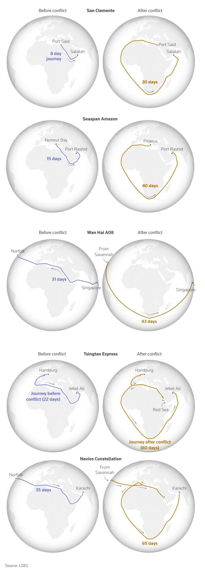
International shipping routes before and after the Houthi attacks in the Red Sea
832 notes
·
View notes
Text
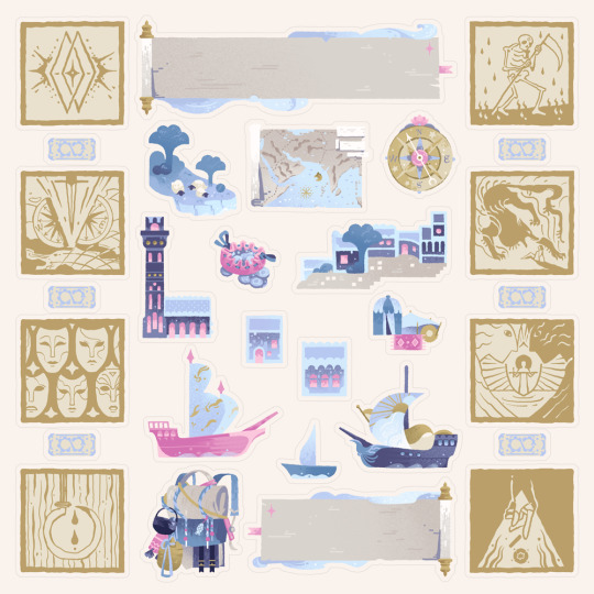

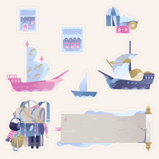
The Hidden Isle 🏝️ - Stickersheet for your campaign notes
#artists on tumblr#illustrators on tumblr#dnd art#the hidden isle#nautical#seafaring#maritime#cities#maps#dnd classes#stickers#stickersheet#ttrpg community#ttrpg#dnd notes#campaign notes#sefirot#sefirot tarot
956 notes
·
View notes
Photo


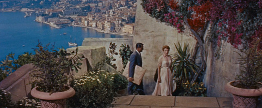
Lucy
Luc Besson. 2014
Cliff
Le Pertuiser, ancien arche, Étretat, Francia
See in map
See in imdb
#luc besson#lucy#scarlett johansson#Falaise La Manneporte#le pertuiser#étretat#france#normandy#seine-maritime#movie#cinema#film#location#google maps#street view#cliff
26 notes
·
View notes
Text
Please follow the link and check out the great products created from this nautical chart at Fine Art America. If this isn’t the nautical chart you’re looking for, I have additional nautical charts covering the Florida East Coast.
#Florida nautical chart#Florida nautical Charts#Florida Chart#Florida Charts#Nautical Chart#Nautical Charts#Florida map#Florida maps#East Coast Chart#ocean map#maritime#coastal decor#nautical decor#NOAA Chart#Beach House decor#fishing#boating#navigation chart#navigation#Atlantic Ocean#East Coast#Key Largo#Florida Keys#Islamorada#Plantation Key#saltwater fishing#nautical#nauticaldecor#coastaldecor#nauticalcharts
0 notes
Last Seen Blogs

coachsuaib
Coach Su'aib

peekayyy
peytonalexandra

cherrysbloom
Cherry

timmy1112
Tim Menjos

marketingdigitalgisele
Curso de Marketing Digital