#Manzherok
Text
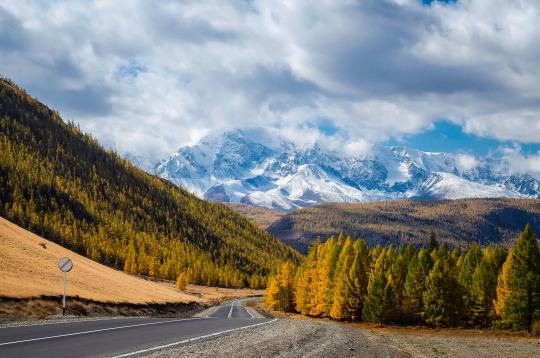
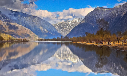
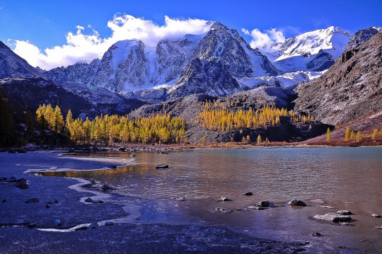
Город Манжерок | The city of Manzherok

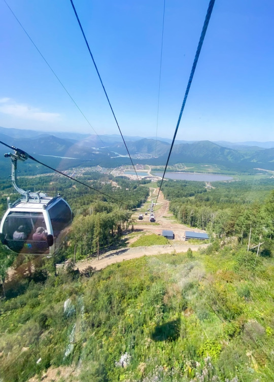
#пейзаж@gorod_v_kadre#фото@gorod_v_kadre#Россия#Russia#Алтай#Altai#село#village#Манжерок#Manzherok#канатная дорога#cable car#курорт#resort#туризм#tourism#путешествие#travel
3 notes
·
View notes
Text
How Duo Made Me Nostalgic
There is a sentence in the Chinese course on Duo:
They (girls) want hot milk.
It reminded me about an episode from my crazy times in the university. I have many crazy and fun memories about my 1990-s, but I treasure this one a lot.
So, it was winter 1996-1997, my second year in the university. My bff and I went to the Altai Mountains for winter break. Students could get a tour for half of the price, so we saved and rewarded ourselves with a pleasant winter vacation.
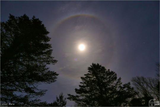
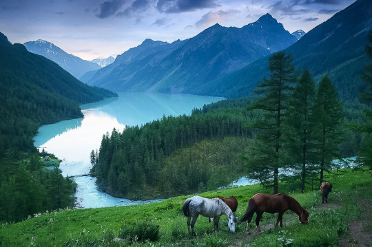
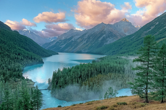
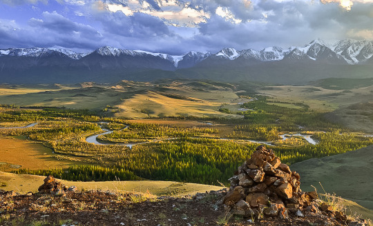
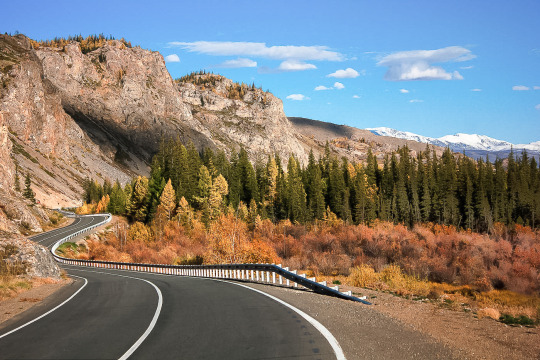
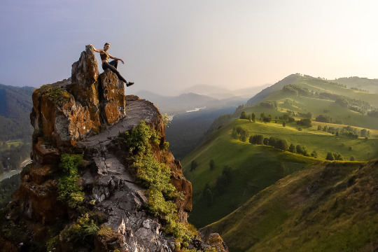
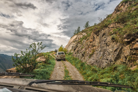
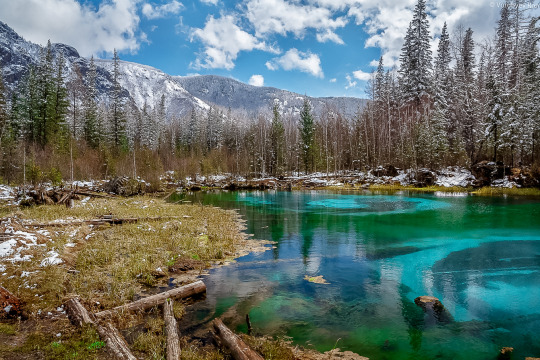
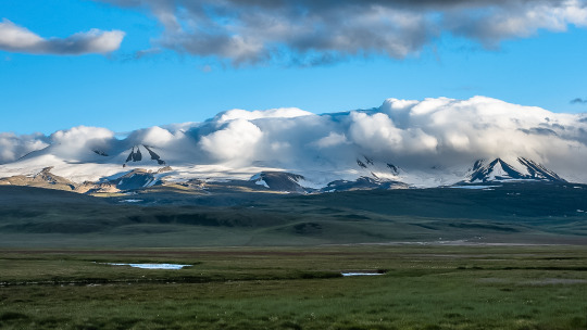
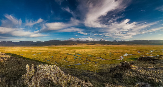
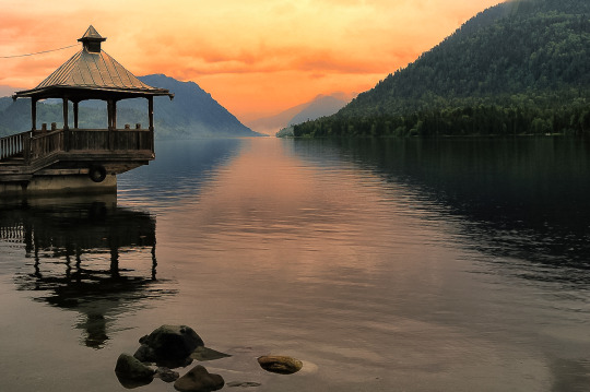
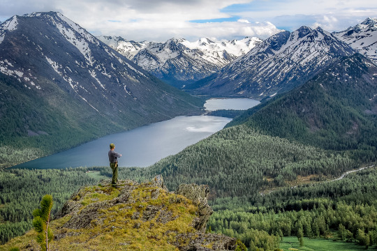
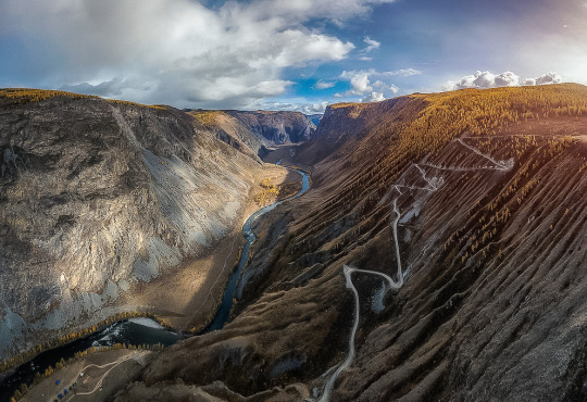
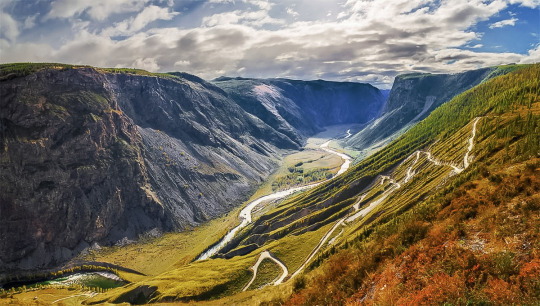
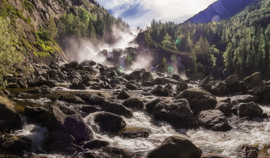
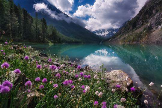
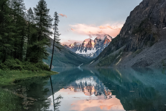
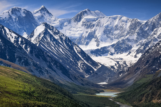
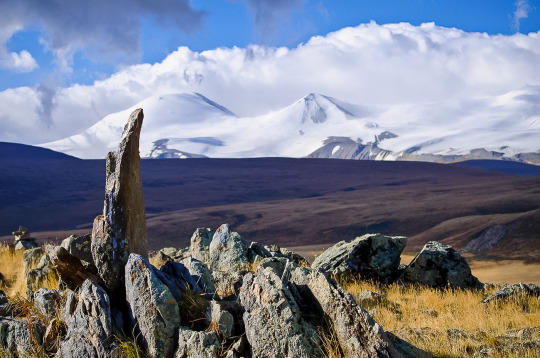
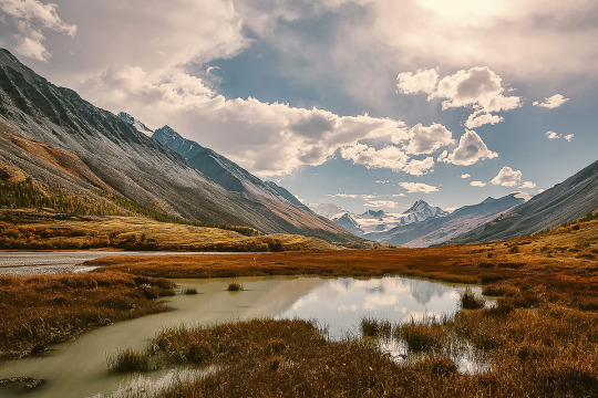
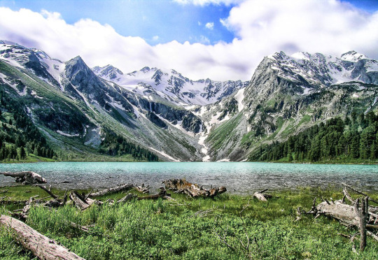
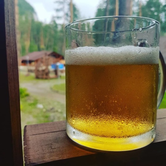
The camping was in Manzherok, near a very fast, only partially frozen river, and, of course, mountains. The setup looked exactly like this:
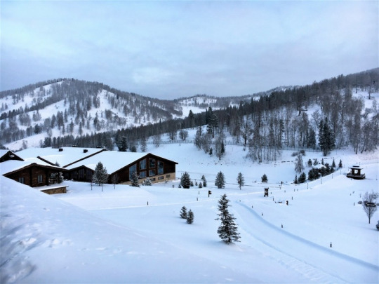
Mountains and white snow created magic: when it was -4F/-20C outside, we didn't feel cold at all, because sun reflected from the snow, and there was no wind, as mountains protected the area.
We were the only two linguists in the group, other students were either economists or law school students. And, gosh, they drank. I liked fun and was no stranger to alcohol, but it was a bit too much for me.
So, one night, when the rest of the group was particularly in the mood to get drunk, my bff and I decided to explore the surroundings. The plan was: to climb to the nearest mountain and watch the area from up there. Only one little nuance that we ignored: there was a river in our way to the mountain. and it wasn't fully frozen.
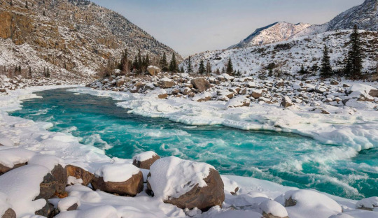
Yet, we didn't stop and managed to cross the river through its frozen parts (in the dead of night). And we indeed climbed to the mountain, at night. When we reached the peak, clouds went away, and we saw a starry sky and the Moon with the beautiful purple halo. We were on the top of the world.
And then we had to go down, down, down. It was the largest slide I've ever had! We literally slid down, trying to avoid pines and particularly large rocks. We only stopped when we reached the river again.
We looked like two huge snowballs, and we laughed and laughed, because it was the stupidest and craziest thing we could do.
When we finally got back to the camping we realized that we were hungry as wolves. Adrenalin faded out, and our bodies demanded for energy recharge.
We had hot chocolate powder in our room. But we needed hot milk. And we went to a canteen at 4 am, and asked a guard for hot milk.
Surprisingly, he found a jar with fresh goat milk and allowed us to boil the milk right in the canteen. The hot chocolate that we drank that night was the sweetest thing on Earth for me.
In the morning, our guide told us that if we went out to the mountains at night one more time, she would send us home right away. But it was too late, we already got what we wanted. Looking back, I do realize that we could break our necks many times, we could drawn in the river and our bodies wouldn't be found until spring, we could get lost in the mountains... But who cares? We saw the purple lunar halo from the top of the mountain! And, yes, we desperately wanted hot milk :)
35 notes
·
View notes
Link
The company already has a robot disinfector and a robot sommelier, but they are not like people Sberbank is planning to produce its own humanoid robots, Stanislav Kuznetsov, deputy chairman of the bank’s board of directors, told reporters about this during events dedicated to the opening of the Manzherok resort. He also noted that the company plans to become a leader in this area, despite the fact that Western companies are currently leading in this segment. [caption id="attachment_85251" align="aligncenter" width="780"] humanoid robots[/caption] “We are focused on leadership in this direction,” Sber is working on creating humanoid robots We confirm that Sberbank has developed its own anthropomorphic robots. Western companies are the first there now, but we are focused on leadership in this direction. Sberbank has its own Robotics Center, whose task is “to create robots and other cyber-physical systems using artificial intelligence to solve the business problems of Sber and its clients.” The bank has already presented a disinfectant robot for automatic disinfection of offices, medical institutions, hotels and other premises, as well as a sommelier robot, which is designed for the presentation and sale of wines. But these robots are not humanoid.
#AI_robots#Artificial_Intelligence.#bipedal_robots#human_like_robots#Human_robot_interaction#humanoid_robot_technology#humanoid_robotics_research#Humanoid_robots#robot_design#robot_locomotion#robot_programming#robot_sensors#robotic_engineering.#robotics#robotics_applications#robotics_development#robotics_in_healthcare#robotics_in_industry.#Robotics_Innovation#robotics_technology#social_robots
0 notes
Photo
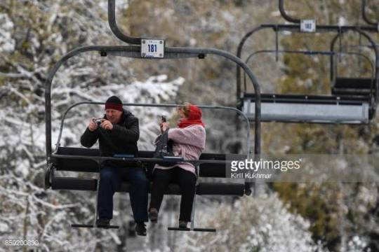
01-01 REPUBLIC OF ALTAI, RUSSIA - OCTOBER 6, 2017: People with cameras on a ski lift on Mount Malaya Sinyukha at the Manzherok ski resort in Maima District of Russia's Republic of Altai in ... http://dlvr.it/Q8PL1Z
0 notes
Text
Mountain Altai, country of the spirits.
Greetings, my dear reader! Today I would like to tell you on my blog page about the region of the country that is popular in Russia and is loved by all Siberians — the Mountain Altai. Perhaps in this difficult time for the whole world, we need reasons to distract from sad thoughts, to dream about future trips, when the Covid-19 epidemic will finally be defeated by humanity and all roads and borders will be opened to us again.
So, this is a post about natural and tourist attractions. A kind and dreamy topic that I would like to write about in my blog first of all.
Everyone loves the Mountain Altai. Perhaps outside of Russia this area is not as well known as for example the same lake Baikal or other business cards of tourism in Russia. Or am I wrong, and this is a fairly well-known topic? My dear reader, feel free to write about it ;)
In any case, I hope you will be interested to learn something new. Or just look at photos of nature. This is a review post, it will not contain much specifics, if you want to find out more, write to me, and I will try to cover the topic that interests my reader in more detail.
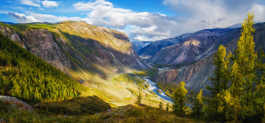
Mountain Altai is an amazing and very beautiful region, about which many enthusiastic words have been said and written. Golden mountains-this is how Altai is translated from the Turkic languages. Mountain Altai is located in Central Asia, Siberia and borders countries such as China, Mongolia and Kazakhstan. The capital of the province is Gorno-Altaysk. The most popular place to start a trip to Mountain Altai, where there is a major transport hub and an international airport — the city of Barnaul.
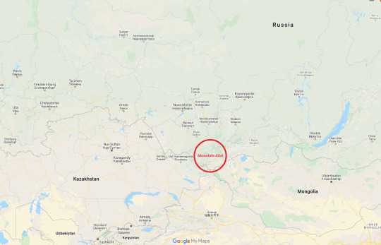

Residents of the European part of Russia sometimes confuse the Mountain Altai with the Altai country. These two regions border in the Siberian Federal district, but they are quite different: mountain landscapes are typical for the Mountain Altai, but the Altai country is green steppes and Terry hills.
Mountain Altai is probably one of the favorite vacation spots of my countrymen.. About 700–800 kilometers from my hometown is just a day’s drive away. You can have time to go to the Altai for some long weekend. It should be noted that Mountain Altai is one of the cleanest regions of Russia. There are no industrial enterprises or Railways. Only infinitely beautiful and fascinating nature. It seems impossible to remain indifferent to the natural beauty of the Altai mountains.
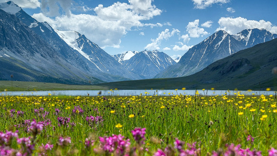
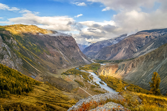
The nature of Altai is not just diverse, it is extremely contrasting. Taiga forests quickly give way to dry steppes, low mountains and hills change to snow-capped peaks, among other things the highest in Siberia, and rivers and lakes here change their color depending on the time of year. The weather and climate in the neighboring valleys can vary greatly — Altai is striking for its variety of nature and landscapes on a relatively compact area of the planet, which is of course extremely convenient for tourists.
At the same time, the tourist infrastructure is relatively well developed (in the whole Eastern part of Russia). First of all, of course, tourists should count on an inexpensive and unpretentious level of tourist bases, especially far from civilization. But there are also more expensive hotels for the demanding traveler. I am glad that here you can arrange a vacation at any level of available funds, while the prices IMHO are the most honest and balanced in Siberia.
It is worth noting that the Altai mountains with their natural attractions are included in the UNESCO world heritage list.
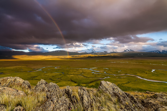
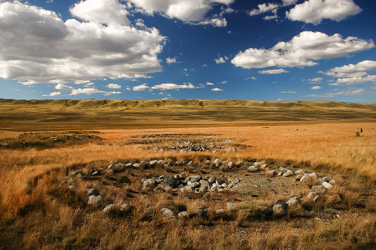
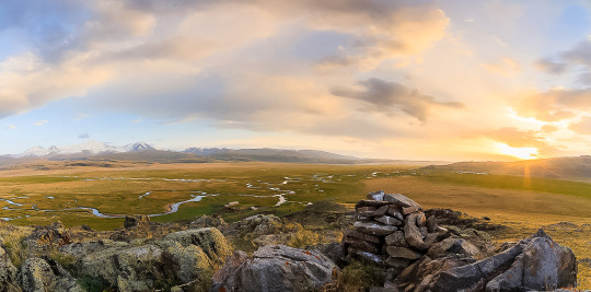
This is the Land of seven thousand lakes, turbulent rivers and silent landscapes. Here rises the largest mountain in Siberia, and passes one of the most picturesque roads in the world, archaeologists find ancient artifacts in mounds, and shamans conduct their mysterious rituals in places of power.

In ancient times, the paths of nomadic tribes crossed in the Altai mountains. Hundreds of thousands of years ago, people already lived in this area, and traces of them are found throughout the territory: unique rock petroglyphs, burials in places of power, and Parking lots.
For centuries, this harsh but picturesque region was part of the great Mongol Empire: the horses of Genghis Khan’s army trampled the delicate bowls of Edelweiss in the valleys and overcame steep mountain passes.
Altai is an ideal place for eco-tourism. The main value of the region is its nature, and the path to the most picturesque places is often thorny, but the effort is worth it. Here you can organize a week-long hike, swim in one of the crystal-clear lakes, go fishing or pick berries.
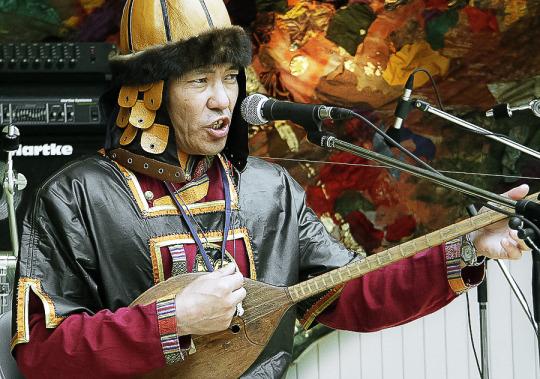
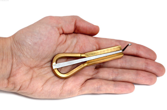
Another format of travel in the Altai is ethnographic excursions. For example, in the Yurt-gallery of Kalambina Zheltkovskaya, guests are introduced to traditional felt products, and in the ethnomaster “Aychus” they are told about Turkic patterns, learn to make amulet dolls and play national instruments: Komus and Topshuur.
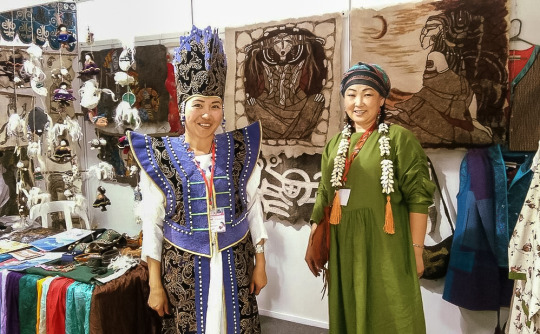
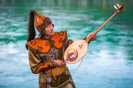
national musical instrument Komus:
national handmade guardian amulet Aichus:
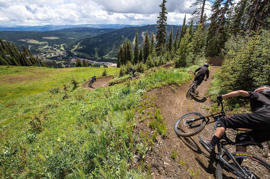
And, of course, extreme tourism! Ascents to the peaks, rafting of any level of complexity on rough rivers, skiing: there are good trails on the shore of lake Teletskoye, and the resort “Manzherok” is not only the slopes, but also the first professional Bike Park outside the Urals.

What to see in Altai? Cascades of rivers, mountain tops, crazy passes. What to do in Altai? Wake up with the sunrise, wash with cold water from the stream, admire the views from the car window, conquer the mountains, breathe deeply, listen to the legends about the eternal lands that the locals love to tell in the evenings.

Who is suitable for a holiday in the Altai mountains?
This region is for those who are willing to sacrifice comfort in order to see the incredible landscapes and pristine nature with their own eyes. There is often no net, you can only drive an SUV, and from the nearest village to the next lake or mountain you need to walk for several days. But it is in such places that you relax from the city, put your thoughts in order and get charged with energy!
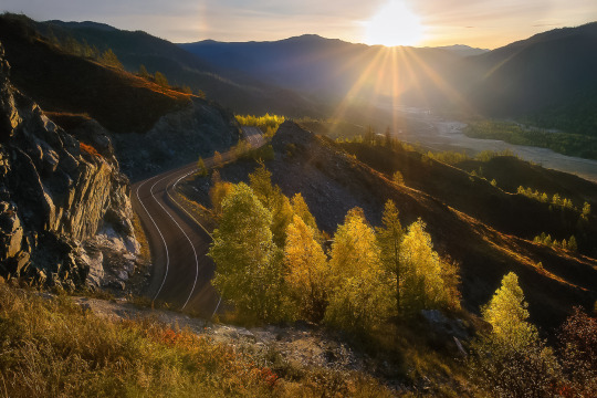
The best way to explore the Altai Mountains is to travel by car along the Chuysky tract. This is a Federal highway with a length of 968 kilometers that crosses the region from Novosibirsk to Mongolia, it is called the most picturesque road in Siberia, and the magazine National Geographic Russia even included the Chuysky tract in the top 10 most beautiful roads in the world!
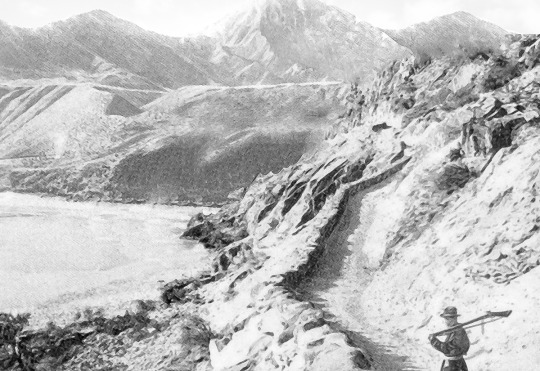
In places, the remains of the old road remain near the new highway. The Chuysky tract has existed for many centuries and in ancient times was part of the Great Silk Road from China to Europe!
ancient and modern photos of the preserved section of the old Chuysky tract:
In the year of Gorny Altai is visited by about two million people! Today I’m talking about what is interesting in this region and where to look for the most-the most places.
The mountain Devil’s Finger
On the way from Biysk to the Seminsky pass, make a small stop and climb the Devil’s Finger. The ascent will not take much time, but you will get a stunning view — it is not for nothing that it is included in almost all the lists of “What to see in the Altai”.
There are many such “magic fingers” all over the world — a giant rock ledge on a mountain, pointing to the sky. But ours is also with a marigold, so they love to look at it in the Altai.
According to legend, this is the finger of a villain named the Devil. He came to these lands to capture them, but one of the brave Altaic warriors was able to fight back. The devil was trampled into the ground, and only his petrified finger remained on the surface. According to another version, the enemy was repulsed by the Moon itself — it descended to the Earth and drove our enemy so deep that only a finger and a nail remained.
The Devil’s Finger is really an amazing place — esotericists believe that a great power is stored in the rock, which can cure infertility and energize. Do not be lazy to go up and see what kind of view opens from the observation deck: the valley of the Katun river and the entire Altai at a glance.
the rapids of a mountain river:

How to get there: from Biysk through the village of Souzga about 114 km. The reference point will be a telephone tower installed near the mountain.
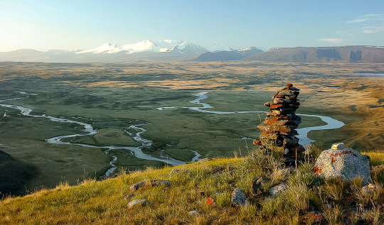
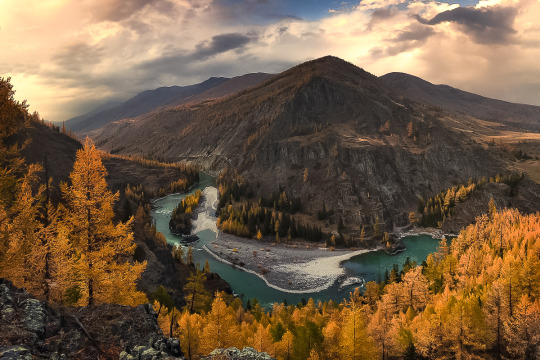
The Katun river — the hostess of Altai
“Mistress” — this is how its name is translated. The largest river of the Republic originates at the slope of Belukha and rushes away for 688 kilometers. On its way there are rapids and boulders, which then turn into flat areas, and the total height difference along the course of the current reaches two kilometers! This is due to the” restless nature “ of Katun: it flows softly, then rumbles between the stones. The river crosses all types of Altai landscape, so the animal and plant life along it is very diverse.
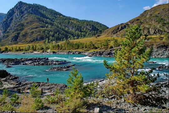
In the area of Biysk Katun meets Biya — the confluence of these rivers is considered one of the most picturesque in the Altai! Katun changes its color throughout the year, acquiring the famous turquoise hue in early autumn.
Hundreds of thousands of tourists flock to Katun every year: some-to relax on its banks in a tent or at a recreation center, others-to test their strength by rafting on the river. Most rafting routes start in the Katun nature reserve.
rafting on the Katun river:
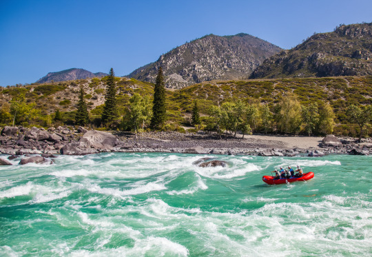
Katunsky reserve is a border area, so you need to get a pass in advance before visiting it. To enter the reserve, you also need to get a permit — you can do this in its administration, which is located in the village of Ust-Koksa. Most of the river downstream has free access.
The coordinates of the source of the Katun: 49.779 318, 552 86.592.
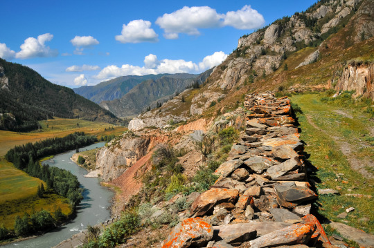
Chike-Taman Mountain Pass
Mountain pass… ract. Now a new, good road has been laid here. At the same time, the preserved old trail, which zigzags along the neighboring slope, almost overgrown, adds color to the already gorgeous view of the huge Terektinsky ridge, which opens from the observation deck.
the old road of the Chike-Taman mountain pass, it is still possible to drive along it. It is part of the ancient Great Silk Road:
How to get there: the Pass is located on 685 km of the Chuysky tract, 320 km from Biysk and 75 km from the Seminsky pass. The ascent, as well as the descent, is four km.
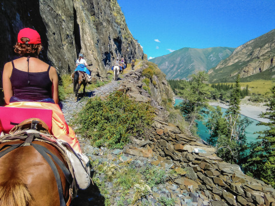
sightseeing tour of tourists on horseback along the preserved from ancient times section of the Great Silk Road from China to Europe in the area of the Chike-Taman pass:
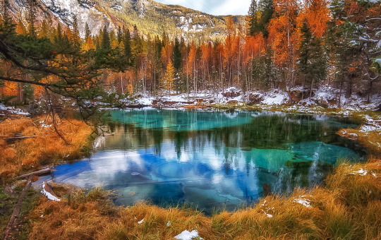
Geyser lake
This small lake, located near the village of Aktash, does not freeze even in winter. Its water has an unusual pattern formed by circles of blue clay-they are carefully “laid out” on the bottom of the underwater keys. The drawing is not static and changes throughout the day.
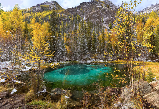
Now the lake is the property of the camp site “Little Paradise”, which recently leased it for 20 years. Every year this place becomes more and more popular with travelers, so you should come here early in the morning to catch up before the arrival of tourist groups. And it is best to stay for a day at this camp site, then you can easily choose a time period for viewing the Geyser lake more convenient. The camp site is not expensive, spending will not hit your pocket. Passage to the lake is paid: about 50 rubles (less than one Euro), guests of the camp are free of charge.
Coordinates: 50.290 140, 87.673 125.
The Ukok high plateau — is a mysterious place of power
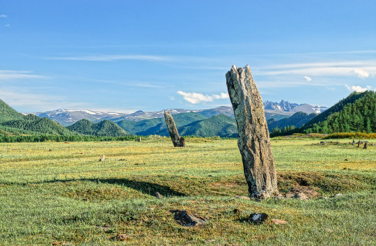
It is located in the very South of the Altai Mountains, near the border crossing of four countries: Russia, China, Mongolia and Kazakhstan. Here, at an altitude of more than 2200 meters above sea level, 150 archaeological monuments were discovered: prehistoric rock paintings-petroglyphs, deer stones, burial mounds of the Pazyryk culture, Scythian graves.
In 1993, archaeologists unearthed a mound that perfectly preserved the remains of a female mummy more than 2,500 years old. She was named the “Princess of Ukok” and taken to the soran Museum of archeology and Ethnography in Novosibirsk. In 2012, the “Princess” was returned to Altai, and since 2014, the local Council of elders has been seeking to re-bury the find: according to the elders, natural disasters have struck Altai because of the mummy being disturbed.
On the territory of the plateau there is a natural Park “Ukok”, which is divided into three zones: one of them prohibits any activity other than scientific, the other allows only limited and regulated access, and only the third is available to travelers. The fauna of the plateau untouched by civilization is very diverse: here you can easily see a wild horse, a wolf, a Fox and even a snow leopard! And in the sky above the silent landscapes soar eagles, Golden eagles and black storks.
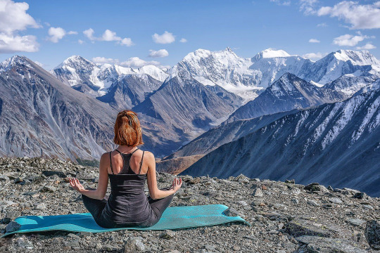
Walking tours and yoga tours are organized on the plateau, esotericists often come to this place, and shamans conduct their rituals here.
Coordinates: 49.360 813, 88.76 642.
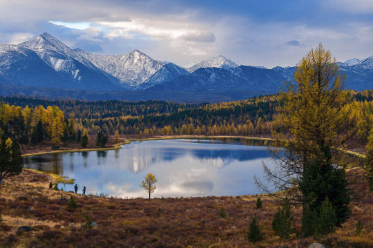
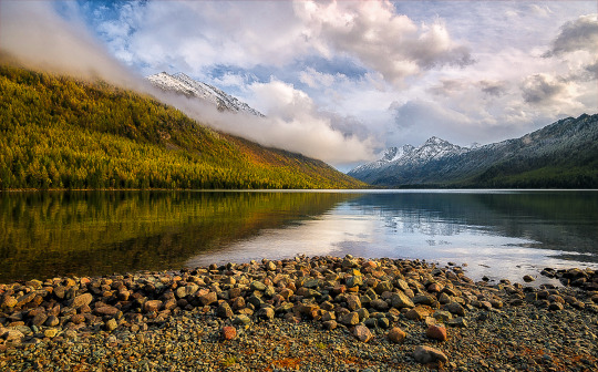
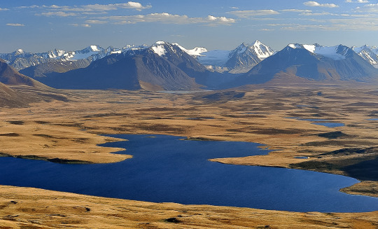
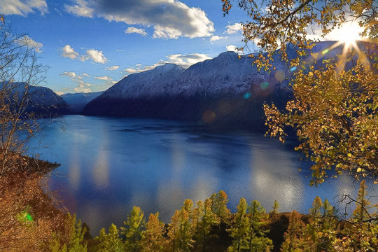
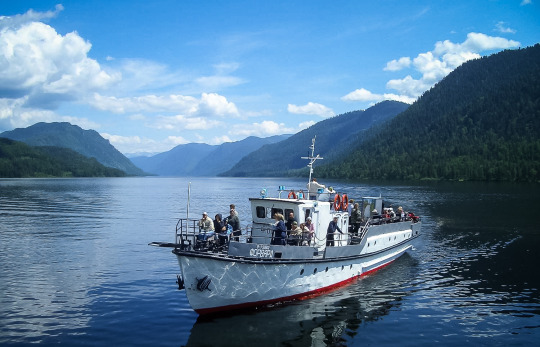
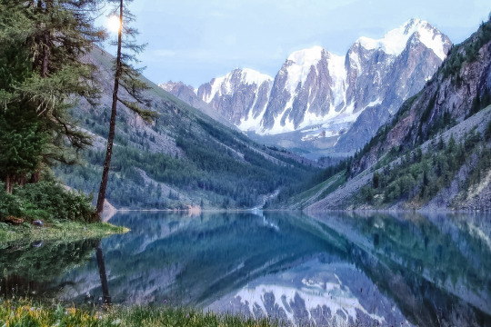
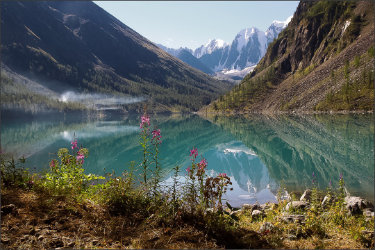
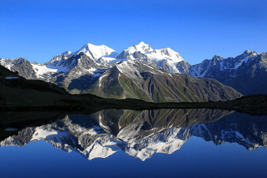
Lake Teletskoye
Perhaps the most popular attraction of the Altai mountains. It is the largest lake in the region and the second largest freshwater reservoir in the country after lake Baikal. The depth of the Teletskoye reaches 325 meters. Three small villages Nestle on its banks: Yaylu, Iogach and Artybash. To relax and swim, choose one of the hotels on the southern shore: in summer, the water temperature rises to +17°C — + 20°C, but in the North, in the area of Artybash, the lake remains cold even in hot weather-about +10 °C.
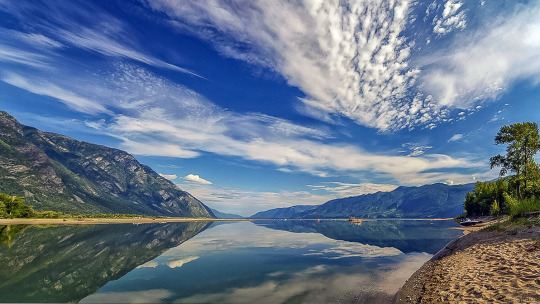
The water in Teletskoye is so clear that even at a depth of 15 meters you can see the stones lying on the bottom. You can set up a tent on the beach or enjoy the scenery of the lake by going for a ride on the ferry: it follows from Cape Kyrsay, which is on the southern coast, to the pier in Iogach — 78 kilometers of the way along the water surface will give you a pleasant experience and gorgeous photos!
Coordinates of Cape Kyrsay: 51.363 980, 87.760 251
Teletskoye lake is famous for its cold water at any time of the year, its gigantic size, many types of fish and amazing landscapes. Here you can come to one of the camp sites or savage, you can fish, go on excursions to the nearest mountains, admire the cascades of waterfalls or even meditate-choose what you like, just do not forget to take warm clothes! Despite the fact that Teletskoye lake is one of the most popular places in Altai, many travelers are forced to avoid it if they choose attractions only along the Chuysky tract. Those who get to Teletskoye lake do not regret the time spent on the road. Even hotels and camp sites that have grown up like mushrooms on the coast do not violate the special atmosphere of this place — it is easy to let go of worries, forget about sorrows, and learn to recharge from nature.
The locals consider the lake Holy and call it the Golden lake-Altyn-Kel in the local dialect. Esotericists believe in its magic power, tourists come from all over the world to Altai, just to see Teletskoye lake and experience its magic for themselves. Do you want to see what this place does to you?
Golden lake-sunset on lake Teletskoye:
Most of the lake is included in the Altai State Natural Biosphere Reserve, so to visit it, do not forget to issue a pass — it is easy to get it in the village of Artybash or the village of Yaylu.
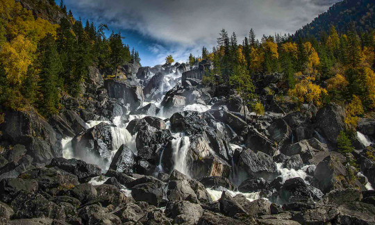
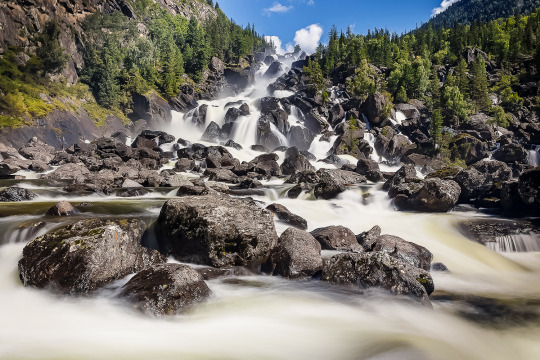
What to see in the surrounding area: Korbu and Chodor waterfalls, Karagay Bay, Chulyshman valley, zoo and ethnopark in Artybash village, Tilan-Tuu and Kokuya mountains (the latter can be reached by lift).
How to get there: the most convenient way to get to Teletskoye lake is from Gorno-Altaisk-it is 269 km to the nearest village to the lake, Artybash. regular buses run along the route. You can get to the South Bank by ferry, which runs from Artybash a couple of times a week, or by a beautiful circular road through the entire Chuisky tract and the terrible Katu-Yaryk pass. The last part of the path is accessible only to all-terrain vehicles.
Multinskoe lake
So we got to the most popular place among tourists in the classic lists of “What to see in the Altai” — the Multin lakes. There are five of them: Lower, Middle, Upper, Transverse and Strong (very logical, Yes). Most often, tourists include the first three in the route. At the same time, the most popular is the Lower Multinskoe lake. It is the largest, it is easier to get to it, there are camp sites nearby and everything you need for a comfortable stay by the water.
The most beautiful thing is waiting for you between the Lower and Middle lakes — this is where the water cascade “Multinskiye shumy”is located. Then the road leads to the Upper lake. It is located on the territory of the Katunsky reserve, so you will need to pass through the cordon, coordinate the route with the Rangers and pay a small fee.

How to get there: from Biysk to the Multin lakes 535 km through the Seminsky pass.
Take care of your documents in advance! Don’t forget to take your passport — there is a Kazakh border near the lakes, they can check your documents. Citizens of the Russian Federation need only a passport, but guests of the country will also have to get a pass. It is issued on request in the Department of the Federal security service of Gorno-Altaisk.
The Petroglyphs Of Kalbak-Tash
A large complex of ancient rock paintings has more than 5 thousand images. According to scientists who have studied Kalbak-Tash, the drawings were created by people who lived here from the Neolithic era (IV-VI centuries BC) to the middle ages (VIII-X centuries ad). on the stones you can see figures of animals that inhabited the Altai several thousand years ago, hunting scenes and various, including solar, symbols. The people who carved them on the rocks used both stone and metal tools. Researchers refer well-preserved runic inscriptions to the ancient Turkic epoch. Some of the depicted stories can be easily correlated with the well-known Altaic myths.
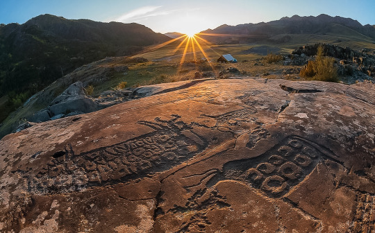
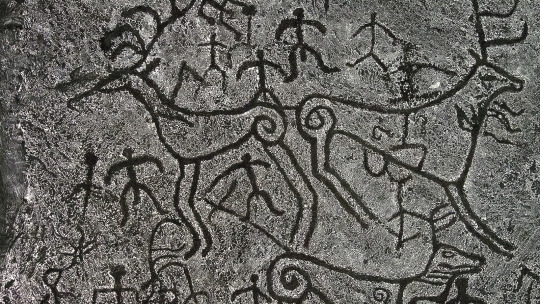
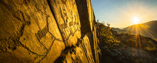

How to get there: the rock art complex is located on the right Bank of the Chui river near the Chuisky tract. After the “723 km” mark, turn left between the fourth and fifth poles of the power line and walk about 20 meters to the rocks.
Katu-Yaryk Mountain Pass
Ready for the most spectacular serpentine ride of your life? The pass is only thirty years old — until 1989, there was only a steep horse trail, now there is a dirt road. Climbing it is wildly scary, but all this will be forgotten as soon as you can look at what opens from above — the winding path of the road, colorful mountains, stormy mountain streams, waterfalls and the tops of centuries-old trees. It’s breathtaking!
Katu-Yaryk in numbers:
Height from the bottom — 892 m;
The average slope of 18% (10°);
Slope steepness-70% (35°);
Length-3.9 km;
The number of turns is 9.
How to get there: by ferry across lake Teletskoye (the cost of crossing one car is 10,000 rubles). Then go along the Chulyshman valley for about 20 kilometers. The second option is from the village of Aktash, which is located 100 km from katu-Yaryk. Accordingly, this road leads to the southern shore of lake Teletskoye. It is desirable to go in high-traffic vehicles. Low cars often lose their bumpers on the road, and non-four-wheel-drive cars are not able to climb to the top of the katu-Yaryk mountain pass on their own due to too strong a slope and rocky obstacles on a narrow road cut through the rock. However, in the tourist season, a four-wheel-drive truck from the nearest tourist base is always on duty at the bottom of the pass,which for a small fee will drag the monoprivod car up.
Big Chulchinsky waterfall or Uchar
The highest and most unusual waterfall in the Altai mountains! Its waters loudly and spectacularly cascade down from a height of 160 meters. It is located on the territory of the Altai State Reserve.

“Uchar” is translated as “unapproachable”, and the waterfall justifies this name: the way to it through the picturesque expanses of the reserve takes about four hours and requires good physical training — the trail is quite steep, some sections are duplicated by safety cables. However, you can often meet children and elderly people at Uchar. No special skills are required for visiting.
Coordinates: 51.118 079, 88.91 675.
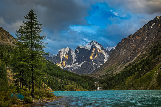
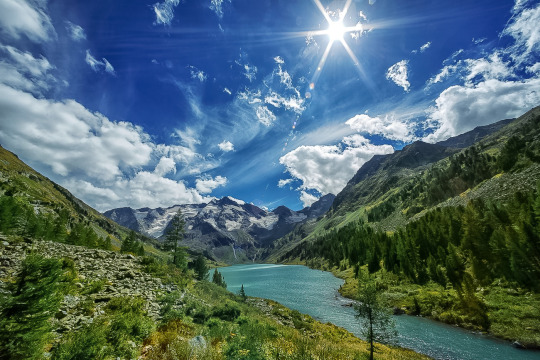
Shavlinskoe lake
They were formed as a result of the melting of ancient glaciers. The lakes are located in the heart of the North Chui Mountain Range and are considered the most picturesque in the entire Altai! Their water has a fantastic bright turquoise color, and from the banks there are incredible views of three Altai peaks at once, whose names are Dream, Beauty and Fairy Tale.

You can get here as part of walking tours organized by companies in Biysk and Gorno-Altaisk. The route starts from the village of Chibit and lasts about a week.
Coordinates: 50.106 689, 87.410 589.

Kek-Tash cave is one of the deepest in the country
Kek-Tash, translated from the Altai means “Blue stone.” This name was given to the cave because of the unusual gray-blue color of its limestone vaults. Bizarre stalactites and stalagmites, labyrinths of caves with dead ends, lakes-inside Kek-Tash a whole underground world with fantastic landscapes! There are several large halls that are connected by narrow passages. This is the deepest cave in Siberia, its length is 2.3 kilometers, and the tunnels go deep into the mountain for 350 meters.
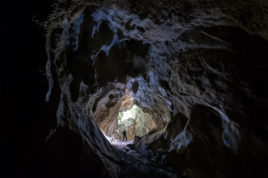

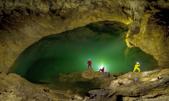
Kek-Tash is located in the North of the Shebali district, and you need good physical training and special equipment to visit it. Basically, come here if you like sports, tourism, diggers and explorers.
The coordinates of the entrance to the cave: 51.728 933, 85.656 417.
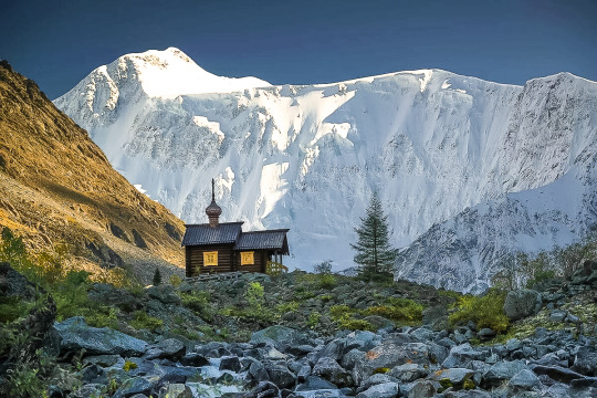
Belukha mountain is the main peak of the Altai
The highest peak in Siberia got its name because of the non-melting snow cap on the top. The locals also call it Uch-Sur — “Home of the Three Gods”. This mountain can be seen on the coat of arms of the Altai. The famous Russian traveler and esotericist Nicholas Roerich depicted its southern slope in one of his paintings. He was sure that the entrance to the mythical land of Shambhala was hidden here. “Lady of the Altai” — so the artist called his mighty snow-covered Muse.
the chapel under Belukha mountain:
The beauty of Beluga is best viewed from the Akkem lake. Climbing to the top with a guide costs about 30 thousand rubles per person. You can also see the mountain from a bird’s-eye view by participating in a group helicopter tour from Gorno-Altaisk. It lasts 7–8 hours, and the cost per person is about 28 thousand rubles.
Climbing Belukha will not be easy, but the tests will pay off with a vengeance — on the way to the top (height-4506 m) you will meet blue lakes with crystal-clear water, unique plants — at the foot of the mountain there are dense coniferous forests, birches, tundra lichens, berry bushes and flowers that are included in the Red book.

The best season to climb the mountain is summer, but even in July, be prepared to get caught in snow. The climb will be difficult and exhausting, and if you are not lucky with the weather, it will be delayed. Yes, it is better to go on such a trip with an experienced instructor or group.
Apart from the road to the bottom of the mountain and the time for acclimatization, the ascent takes about two days. On the first stage, pass the “Watermelon” glacier, Delaunay pass and Mensa glacier, and on the second day they already storm the top.
The coordinates of the vertices: 49.807 679, 023 86.590.
How to get to Altai?
From Moscow to Gorno-Altaisk. Almost all domestic airlines have direct flights to Gorno-Altaisk, and if you buy tickets in advance, you can snatch quite profitable tickets even for direct flights, and with a transfer so much the more. The flight duration is from four to five hours.
From Moscow to Biysk. An option for romantics and lovers of sleeping under the sound of wheels: by train to Biysk, the road will take almost three days, but when did this stop us? When you look at the ticket prices and calculate how much you will save in comparison with the plane, do not forget to add the expenses for food on the road. And in General, familiarity with Russian Railways will expand your horizons and prepare you for difficulties :)
From Saint Petersburg to Gorno-Altaisk. There are no direct flights to Gorno-Altaisk, so you will have to go with a transfer in the capital. If you can snatch cheap plane tickets (in the spring of 2020, there are many such offers), it will be both fast and profitable. If there are no successful plane tickets, then choose a train — one night, and you are there.
Via Novosibirsk to Gorno-Altaisk. This option is ideal for tourists who start their journey not from Moscow — flights fly to Novosibirsk from almost any city in Russia (and besides, they fly for cheap!), and then you can get by plane or bus to Gorno-Altaisk.
Especially worth noting is Barnaul — the largest transport hub relatively close to the Altai Mountains.
Going on a trip to the Altai is easier than it seems — in Biysk, Barnaul and Gorno-Altaisk, you can rent a car (with or without a driver), roads to the main tourist sites are paved, camp sites, hotels are built, and camping sites are equipped. This world is waiting for you!
1 note
·
View note
Photo
Три пня под соснами 😁 (at Manzherok, Altay, Russia) https://www.instagram.com/p/B2oZNino3JL/?igshid=a7084zg2mg14
0 notes

Photo
NEWSLINK: “‘Winter. What do we do in the village?…’ Pushkin ‘Зима. Что делать нам в деревне?’ Пушкин [PHOTOS: Manzherok Village, Altai Republic Siberia, New Year Holiday 2019]” – Medium/ Sarah Lindemann-Komarova "Manzherok Village, Altai Republic Siberia, New Year Holiday 2019 Манжерок Новогодный праздник 2019 ... Photos: "
0 notes
Video
Friendship is Mazherok Agree with me? #rusummertrip #altai #withfriends #summer #mazherok (at Manzherok, Altay, Russia) https://www.instagram.com/p/CD_0pbqD3bukCNNJibNoya6eKhkYRB7Xj2Sw3M0/?igshid=bkbvxlnwezzg
0 notes
Photo

Алтайское местечко Манжерок, река Катунь 🌊 Altai village of Manzherok, the Katun river (at Всесезонный курорт "Манжерок") https://www.instagram.com/p/BrRN3N6lff1/?utm_source=ig_tumblr_share&igshid=m597ffton512
0 notes
Photo

#fujifilmru #natgeoru #vscorussia #natgeotravelru #bearsiberian #showmerussia #russianway #simpleandbeyond #explorerussia #photorussia #russia_img #walk_on_russia #russia_photo #topnature #ruslavia #природароссии #landscape_russia #instagramrussia #инстаграмнедели #cntravellerrussia #большаястрана #rtgtv #eathtpix #eathofficial #roamtheplanet #livefolk #artofvisuals #agameoftones (at Manzherok, Altay, Russia) https://www.instagram.com/p/BnbQn1Jgr8I/?utm_source=ig_tumblr_share&igshid=4z0nojlx2ntm
#fujifilmru#natgeoru#vscorussia#natgeotravelru#bearsiberian#showmerussia#russianway#simpleandbeyond#explorerussia#photorussia#russia_img#walk_on_russia#russia_photo#topnature#ruslavia#природароссии#landscape_russia#instagramrussia#инстаграмнедели#cntravellerrussia#большаястрана#rtgtv#eathtpix#eathofficial#roamtheplanet#livefolk#artofvisuals#agameoftones
0 notes
Photo

ПРАЗДНИК ЦВЕТЕНИЕ МАРАЛЬНИКА. . Уже скоро Алтайские горы зацветут лиловым цветом "Маральника". Кто едет к нам на праздник и на "Майские"? Праздник состоится 1-го Мая на "Бирюзовой Катуни". . #цветениемаральника2020 #маральник #цветениемаральника #Алтай2020 #бирюзоваякатунь #отдыхнаАлтае #турбазыалтая #бухтавесёлогороджера (at Manzherok, Altay, Russia) https://www.instagram.com/p/B8yWCXLKqFb/?igshid=gi84v53bk25e
#цветениемаральника2020#маральник#цветениемаральника#алтай2020#бирюзоваякатунь#отдыхнаалтае#турбазыалтая#бухтавесёлогороджера
1 note
·
View note
Photo

Песню #эдитапьеха #манжерок знаем, а теперь и сами побывали. Сиськи помяли, руки потерли, ноги в озере намочили. Программа выполнена. #шипелкинынаотдыхе #шипелкинынаалтае (at Manzherok, Altay, Russia) https://www.instagram.com/p/BmiwsiEnev1/?utm_source=ig_tumblr_share&igshid=1spn3aw8e9o4o
0 notes
Video
Интересная дисциплина GORA на фестивале ALFAMAN enduro/atv Сняли много горячих кадров, возможно смонтируем видос 😄 #alfaman #квадроблогер #алтай #enduro (at Manzherok, Altay, Russia) https://www.instagram.com/p/CO5NgL3i-TV/?igshid=12zlkd14g1r34
0 notes
Photo
Доброе утро (at Manzherok, Altay, Russia) https://www.instagram.com/p/B0FdJfNoH9b/?igshid=1oj1osor2e0ku
0 notes
Last Seen Blogs

mxcmontgomery
mac montgomery


ydoll
lingerie & bikini sexy

madhuri-dixit
Madhuri Dixit

throwawaythots
Venting