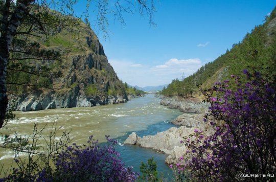
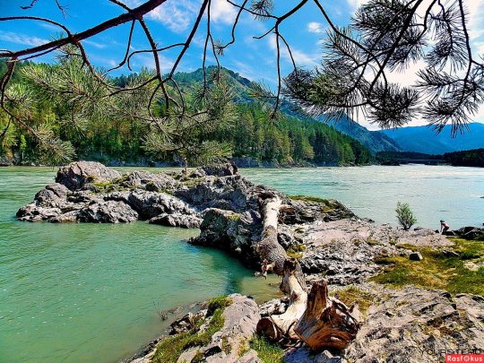
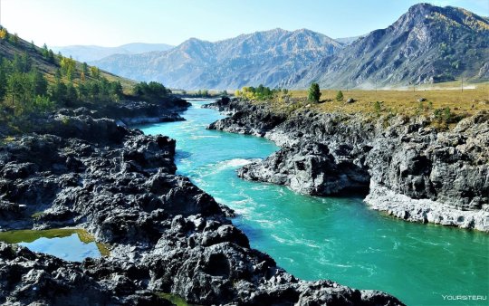
#Altai
Photo
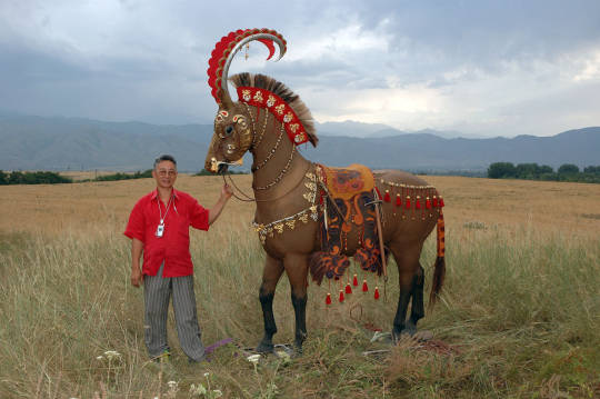
Horse wearing reconstructed 2500-year-old Scythian horse armor unearthed in the Altai Mountains in Siberia
34K notes
·
View notes
Text
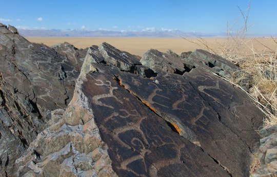
Petroglyphs on the Jalgiztobe hill, Kosh Agach district, Altai Republic
📸 Alexandr Frolov
2K notes
·
View notes
Text

Bursol Lake, Altai. via Mytho Siberia
973 notes
·
View notes
Text

Tӧӧlӧs Turkic girl from Altai, Russia
440 notes
·
View notes
Text
Бирюзовая Катунь достопримичательность Горного Алтая.
Turquoise Katun is a landmark of the Altai Mountains.

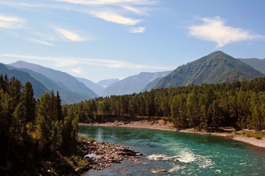

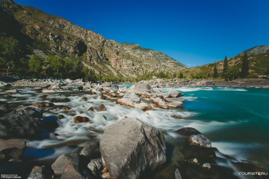
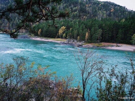


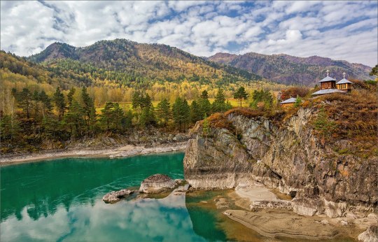
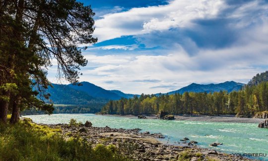
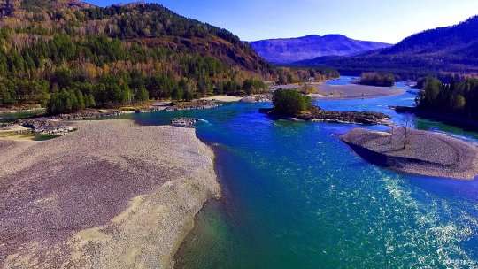
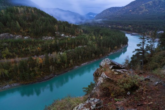
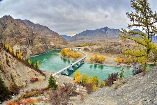


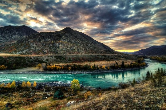
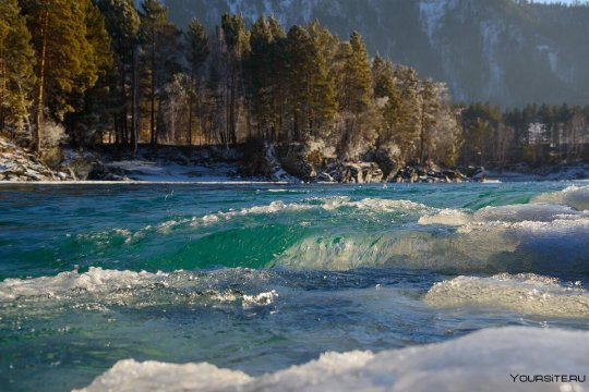

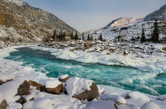


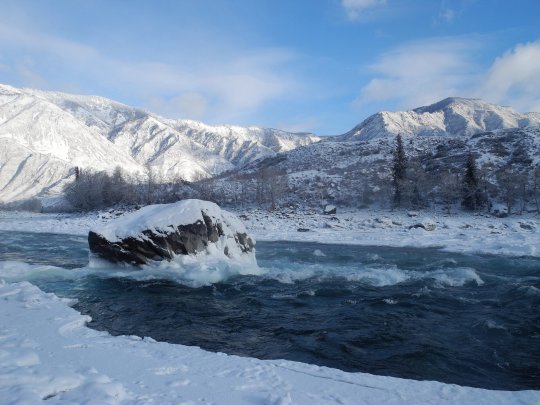
Самая длинная и полноводная в Горном Алтае река Катунь начинается с ледника Геблера у подножия Белухи, и заканчивается в месте слияния с Бией и впадения в Обь. Протяженность — 668 километров. Вода всегда холодная, в жаркие дни ее температура поднимается до 15 градусов.
Особенностью этой реки считают смену цвета в течение года. Так в весенний и летний периоды воды имеют грязный молочный оттенок, что связывают с примесью мелкой породы из-под ледников, питающих реку. Осенью же вода становится прозрачной с бирюзовым оттенком из-за зелено-каменных включений от песчанников в верхнем и среднем участках Катуни. Самая прозрачная, чистая и бирюзовая вода в реке бывает зимой. Большая часть реки зимой замерзает, но на порогах бурные воды Катуни выдерживают серьёзные морозы.
Место слияния Катуни и реки Бии славится своей красотой. Это связанно с тем, что воды Катуни имеют зеленоватый или бирюзовый цвет, а Бии — белый. Смешение воды в летнее время на определенном участке не происходит и выглядит как «полосатое течение». В месте впадения одной реки в другую расположен остров, который носит статус особо охраняемой природной территории.Также месту слияния рек придают мистическое значение старообрядцы, cчитая, что именно здесь состоится последняя битва добра и зла.
The longest and deepest river in the Altai Mountains, the Katun River, begins from the Gebler glacier at the foot of Belukha, and ends at the confluence with the Biya and the confluence with the Ob. Length - 668 kilometers. The water is always cold; on hot days its temperature rises to 15 degrees.
The peculiarity of this river is the change of color throughout the year. Thus, in the spring and summer, the waters have a dirty, milky tint, which is associated with the admixture of small rock from under the glaciers that feed the river. In autumn, the water becomes clear with a turquoise tint due to green-stone inclusions from sandstones in the upper and middle sections of the Katun. The most transparent, clean and turquoise water in the Katun River occurs in winter. Most of the river freezes in winter, but the rapids can withstand severe frosts.
The confluence of the Katun and the Biya River is famous for its beauty. This is due to the fact that the waters of the Katun are greenish or turquoise, and the Biya is white. Mixing of water in the summer does not occur in a certain area and looks like a “striped current”. At the confluence of one river and another there is an island, which has the status of a specially protected natural area. Old Believers also attach mystical significance to the confluence of rivers, believing that this is where the last battle of good and evil will take place.
Источник://itonga.ru/russia/reka-katun/,
//usadba2.ru/look/reka-katun-legendy-i-krasoty-gornoy-reki,
//sportishka.com/turizm/17422-golubaja-katun-gornyj-altaj.html,
/www.vpoxod.ru/page/toponym/katun,
/akkem-tur.ru/stati/reki-altaya/reka-katun/, http://www.sayanring.ru/guide/city/view/44/.
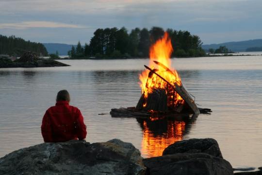
#Russia#Altai#Katun river#nature#nature aesthetic#landscape photography#mountains#river#bridge#trees and forest#winter river#snow#wooden church#travel#bonfire#wonderful#Россия#Алтай#природа#река#Катунь#Пейзаж#горы#лес#зимняя река#снег#небо#церковь#мост#костер
129 notes
·
View notes
Text
Gorno-Altaysk, Siberia by Viktor Kozodoy
68 notes
·
View notes
Text
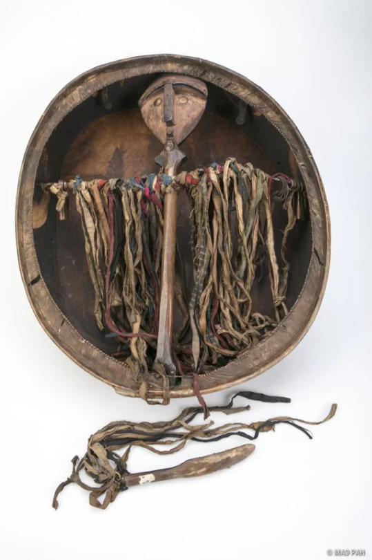
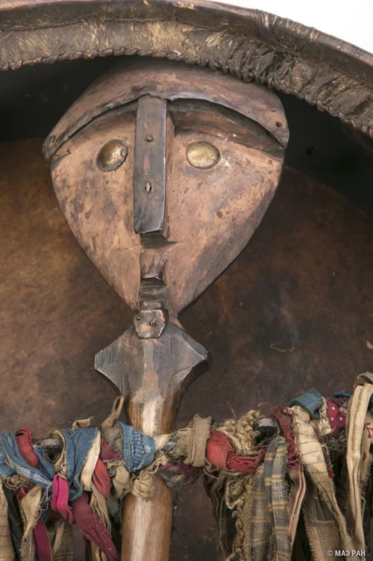
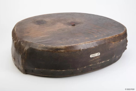

Shaman's drum. ALtai-kizhi. XX
Бубен шаманский. Алтай-кижи. XX
From Kunstkamera archive.
#turkic#non-russian#indigenous russian#indigenous russia#siberian people#Алтай#Altai#Altai-kizhi#Алтай кижи#Altai-kizhi culture#Культура Алтай-кижи#Altai people#Алтайцы#Altai people culture#Культура Алтайцы
49 notes
·
View notes
Text

Siberian elk Cervus canadensis sibiricus
Observed by svetlanaagafonova, CC BY-NC
28 notes
·
View notes
Text
“Però, vedete, se voi desiderate prendere una lepre, che le diate la caccia con i cani o col falco, a piedi o a cavallo, resterà sempre una lepre. La libertà, invece, non rimane mai la stessa, cambia a seconda della caccia. E se addestrate dei cani a catturarla per voi, è facile che vi riportino una libertà da cani.”
Wu Ming - Altai
21 notes
·
View notes
Text

A tiger tattoo on the shoulder of a Scythian male mummy found in 1949 in the Altai Mountains of Siberia. 3rd century BCE
223 notes
·
View notes
Text

Photo by Viktor Belyakov
Altai Mountains are incredibly beautiful all year round. Those blue shadows on the snow...
This is Elanda, Altai republic, today.
45 notes
·
View notes
Text
#Archaeologists in Kazakhstan have unearthed the first ever Turkic Khaganate cult complex found outside of Mongolia. #Artifacts date back to the 6th-8th century AD, including the first representation of a Gokturk Khagan on a belt buckle. Named the Eleke Sazy Khagan social complex, this is a site that captured the attention of the archaeological community in excavations conducted first between 2016 and 2018, but has now revealed its true value to the history of the Eurasian Steppe.
22 notes
·
View notes
Text

Altai. Character from "Mergen"
Read: https://ficbook.net/readfic/018bd190-a9c5-7cf5-b2c4-c29216e59e26
https://author.today/work/331882
9 notes
·
View notes
Text
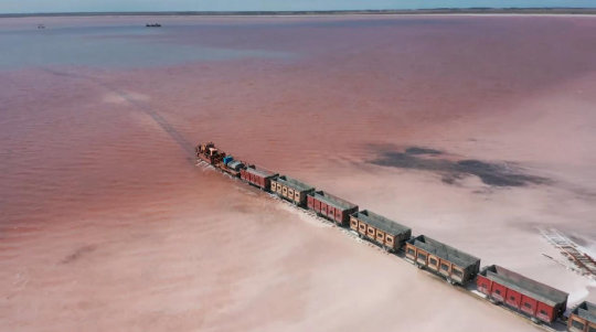
Поезд среди вод Розового озера.
Train among the waters of Pink Lake.


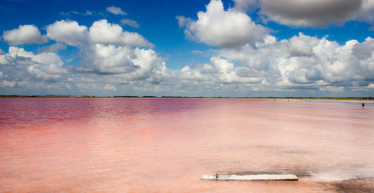
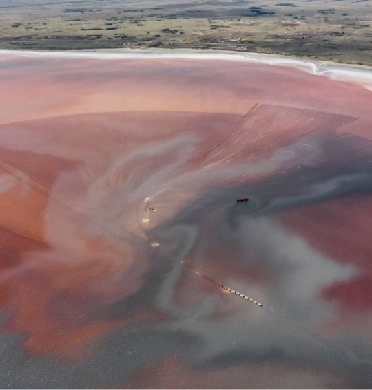
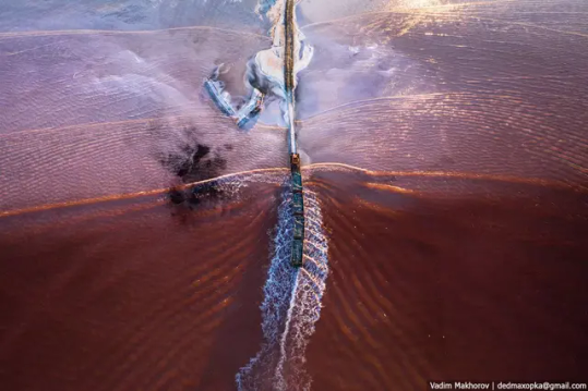
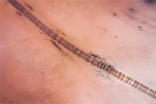


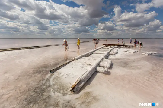
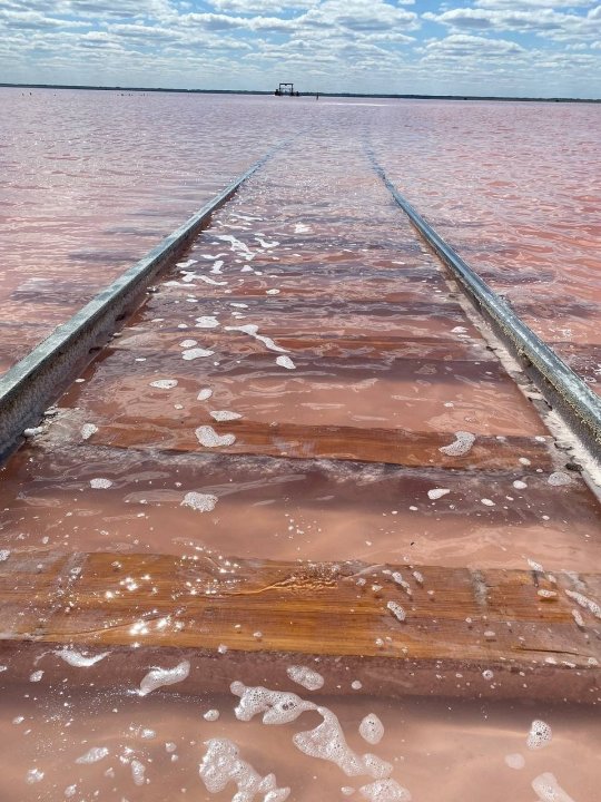
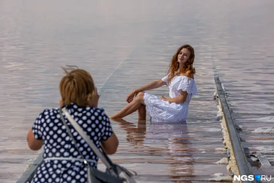
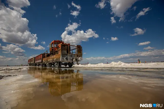


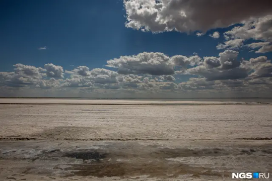
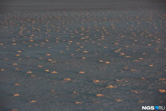
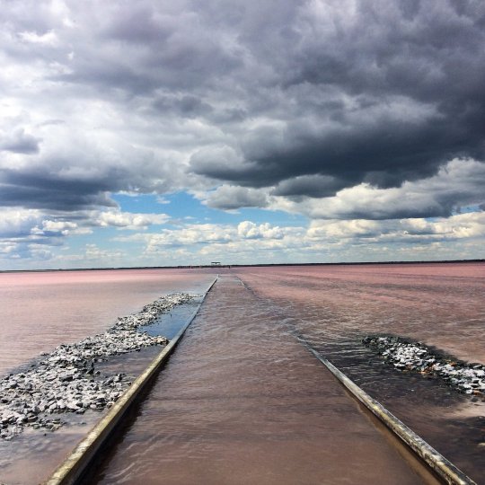
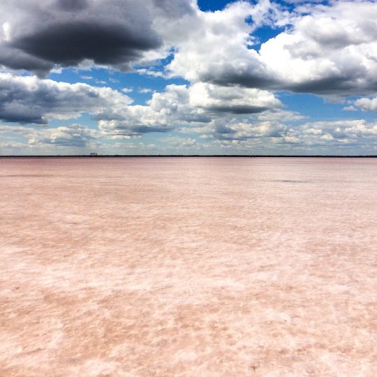


Соленое озеро Бурлинское - достопримечательность Алтайского края, его самая главная примета — розовый цвет, что привлекает к нему многочисленных туристов. Расположено оно на берегу поселка Бурсоль. Однако такого цвета озеро бывает не всегда. Розовый оттенок оно приобретает только в теплую погоду. В остальное время вода в нем привычного цвета. Поэтому лучшее время для посещения Бурлинского озера — жаркие летние дни. Чем выше температура воды и ярче солнце, тем более розовым будет водоем. Причина этого феномена - микроскопическая водоросль. В процессе своей жизнедеятельности она производит пигмент, заставляющий озеро играть всеми оттенками розового — от бледно-лососевого до малинового.
Площадь бессточного озера - 32 квадратных километра, средняя глубина — около метра. Под илом находится слой глауберовой соли, которую добываю прямо на месте. Бурлинское озеро является центром соляного промысла, который зародилось здесь более 200 лет назад.
Salt Lake Burlinskoye is a landmark of the Altai Territory; its most important feature is its pink color, which attracts numerous tourists to it. It is located on the shore of the village of Bursol. However, the lake does not always have this color. It acquires a pink tint only in warm weather. The rest of the time, the water in it is the usual color. Therefore, the best time to visit Lake Burlin is hot summer days. The higher the water temperature and the brighter the sun, the more pink the pond will be. The reason for this phenomenon is a microscopic algae. In the process of its life, it produces a pigment that makes the lake play with all shades of pink - from pale salmon to raspberry.
The area of the closed lake is 32 square kilometers, the average depth is about a meter. Under the silt there is a layer of Glauber's salt, which I mine right on site. Lake Burlin is the center of the salt industry, which originated here more than 200 years ago.
Источник://ngs.ru/text/world/2020/08/08/69392401/,
//ru.sputnik.kz/20200907/poezd-rozovoye-ozero-granitsa-rossiya-kazakhstan-14898936.html,
//www.tourister.ru/world/europe/russia/city/slavgorod/lakes/31633,
//www.tripadvisor.ru/Attraction_Review-g1820314-d10532379-Reviews-Burlinskoye_Lake-Slavgorod_Altai_Krai_Siberian_District.html,
//novate.ru/blogs/090321/58095/.
#nature#nature aesthetic#Russia#Altai#landscape photography#Bursol#lake#salt#sunset#sky#clouds#rails#train#tourism#wonderful#sunnyday#naturelovers#природа#Россия#Алтай#Пейзаж#природнаякрасота#озеро#Бурсоль#солнечный день#соль#поезд#рельсы#небо#облака
101 notes
·
View notes
Text

Indigenous woman from the Altai region of southern Siberia, central Russia
Russian vintage postcard
#carte postale#central#ephemera#photo#historic#altai#postcard#tarjeta#postal#russian#southern#briefkaart#ansichtskarte#region#photography#vintage#postkaart#siberia#postkarte#indigenous#old#russia#sepia#woman
49 notes
·
View notes
Last Seen Blogs
chinosandvans
Menswear Ideas

indigodawns
you are loved

moimooi
Naamloos

fallybest
garçon en manque de sexe

cytion
abby andersons squeaky toy