#Illizi
Video
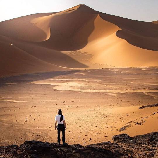
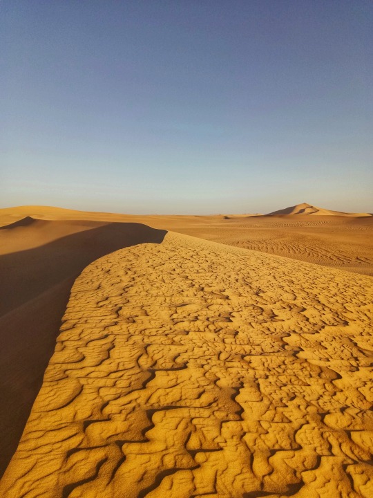
Sand dunes in the Sahara desert, Tassili N'Ajjer National Park, Tadrart Rouge, Algeria by Eric Lafforgue
Via Flickr:
© Eric Lafforgue www.ericlafforgue.com
#Adventure#Africa#Algeria#Algeria-220263#Algerian desert#Algerie#Arid#Color image#Copy space#Desert#Dune#Extreme terrain#Idyllic#Illizi#Landscape#Nature#No people#Non urban scene#North africa#Outdoors#Sahara#Sahara desert#Sand#Sand dune#Scenery#Scenics#Sunny#Tadrart rouge#Tassili#Tranquil scene
3 notes
·
View notes
Photo
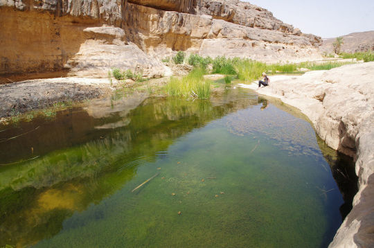
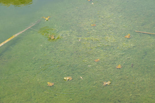
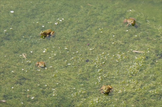

Sahara frogs [Pelophylax saharicus] gathered in a water source in Illizi, Algeria. These North African frogs are common throughout their range, but are threatened by habitat loss and pollution, and many of their populations have been separated due to human encroachment in their habitats. Images by András Zboray.
413 notes
·
View notes
Photo

Beautiful day on a high sandy peak (à Illizi Province) https://www.instagram.com/p/Cj3uF0YKq2l/?igshid=NGJjMDIxMWI=
0 notes
Photo
at Illizi, Illizi https://www.instagram.com/p/Cd6izMEj6Gw/?igshid=NGJjMDIxMWI=
0 notes
Text
"أجمل رحلة هي تلك التي
لم نقم بها بعد 🌄 !".
"The best trip is the one
we haven't done yet 🌄 !".
"Le plus beau voyage c'est celui
qu'on a pas encore fait 🌄 !".
– Loick Peyron
Tadrart Rouge - Illizi - Algeria 🇩🇿 !.
#صحراء الجزائر#الجزائر#الصحراء#الرمل الأحمر#البساط الأحمر#Beauty#Algeria#Tadrart rouge#Tadrart#Red Tadrart#love#Algerie#حياة#life#downfalldestiny#downfall#رحلة#Trip#Voyage#Illizi
40 notes
·
View notes
Text


Tassili N'Ajjer National Park, Djanet | Algeria
#Djanet#Algeria#Algérie#Illizi#Sahara#desert#Sahara Desert#Algerian Sahara#VisitAlgeria#Explore Algeria#Photography#Solo Travel#Tourisme#Tourist#Travelling#Travel#followmyworld#exploretheworld#exploretheglobe#Sand#photographer#voyage#Tassili N'Ajjer National Park#Tassili#north africa#archeology#human history#smaouh#Traveler's shades
5 notes
·
View notes
Photo

Wilaya of Illizi, Algeria.
78 notes
·
View notes
Photo
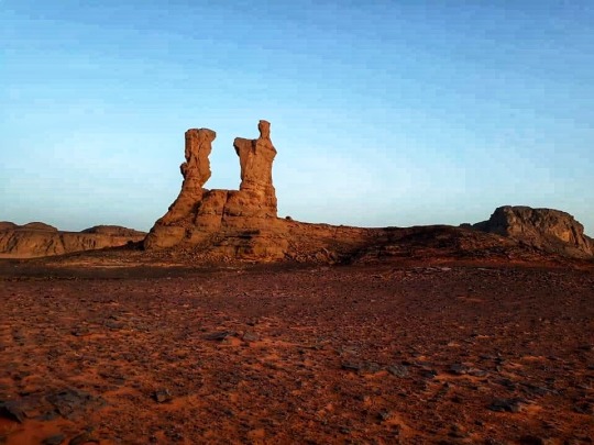
Illizi Province, Algeria
1 note
·
View note
Text
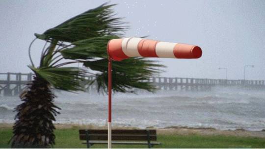
BMS : Des vents forts souffleront mercredi et jeudi sur plusieurs wilayas du sud du pays
BMS : Des vents forts souffleront mercredi et jeudi sur plusieurs wilayas du sud du pays
Des vents forts souffleront mercredi et jeudi sur plusieurs wilayas du sud du pays, parfois en rafales avec des soulèvements de sable locaux réduisant la visibilité, indique mercredi un bulletin météorologique spécial (BMS) émis par le Centre national des prévisions météorologiques.Continue reading
View On WordPress
#BMS : Des vents forts souffleront mercredi et jeudi sur plusieurs wilayas du sud du pays 03/03/2021 - 14:46 Des vents forts souffleront merc#de niveau de vigilance orange#durant la validité du BMS qui court de mercredi à 10h00 à jeudi à 12h00.#El Menea#El Oued#Illizi#indique mercredi un bulletin météorologique spécial (BMS) émis par le Centre national des prévisions météorologiques. Les wilayas concernées#Laghouat#Ouargla#parfois en rafales avec des soulèvements de sable locaux réduisant la visibilité#sont Ghardaïa#Sud d&039;El Bayadh et sud de Djelfa#Touggourt et El Meghaier. Les vents de direction Est à Nord-Est souffleront à une vitesse entre 60 et 70 km/h avec rafales atteignant ou dép
0 notes
Photo
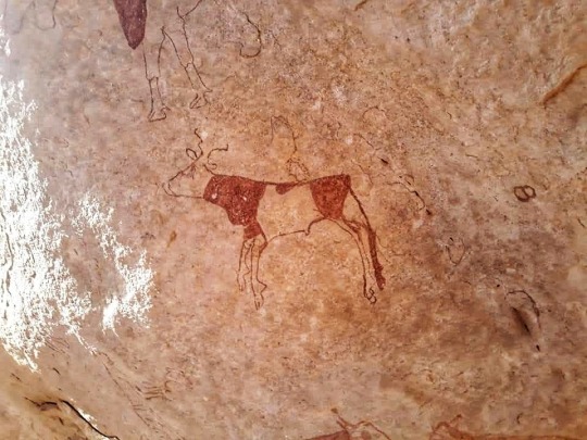
📍تاقمارت 🏞منطقة أثرية بحيث تزخر بالعديد من النقوشات الصخرية والرسومات الصخرية التي تعود إلى 10000000سنة قبل الحاضر .بحيث يوجد بها رسومات لقطيع بقري موضح بالألوان البني القاتم والفاتح والأبيض تعود إلى فترة البقرية .وأيضا يوجد بها حيوانات مفترسة كالنمر والأسد موضحة بشكل جيد ومتقن الزنجرة على واجهات صخرية تفوق ميتران وايضا فيها رسومات توضح فترة الجمال علما أن منطقة تاقمارت تنقسم إلى قسمين تاغمارت الشرقية تحوي القليل من واجهات الصخرية وعدد كبير من كتابات التيفينغ وفيها أيضا أصحاب الرؤوس المستديرة أما تاغمارت الغربية فهي تمثل أجمل لوحات النقش والرسوم الصخرية .فبذلك تعتبر تاغمارت أهم مناطق التي توحي بفكر إنسان ما قبل تاريخ وابداعه في محاكاة يومياته ومحيطه الذي كان يعيش فيه أن ذاك #tamanrasset @touareg_of_algeria_dima4#algerian #adrar🌴 #ghardaïa #bacher#ouargla🐪🌴🇩🇿 #illizi #djanet#algeria🇩🇿 #naturephotography #omanphotography#algerianphotographers #canonm50#nikond5600 #asskrem https://www.instagram.com/p/B3xpTcvFRx-/?igshid=e7m2s7yliiv1
#tamanrasset#algerian#adrar🌴#ghardaïa#bacher#ouargla🐪🌴🇩🇿#illizi#djanet#algeria🇩🇿#naturephotography#omanphotography#algerianphotographers#canonm50#nikond5600#asskrem
0 notes
Photo

Illizi - South of Algeria [OC] [1666×1176] via /r/EarthPorn https://ift.tt/3fnMuog
0 notes
Photo

The hot desert climate of Illizi, Algeria by NASA Johnson
186 notes
·
View notes
Photo

Alhamdulilah 😇 (à Illizi Province) https://www.instagram.com/p/CjbRS0BKm4a/?igshid=NGJjMDIxMWI=
0 notes
Photo
The Hot Desert Climate of Illizi, Algeria
80 notes
·
View notes
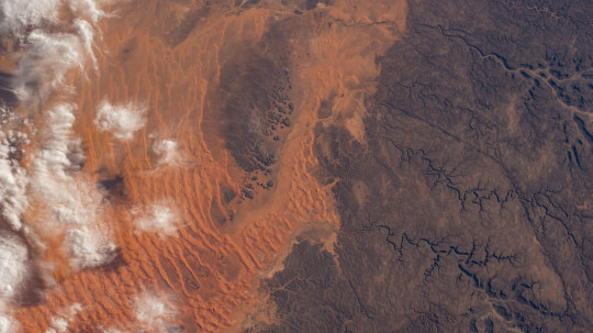
Photo

Algeria’s Tassili n’Ajjer National Park Orange-hued dunes mantle dark sandstone on the northern edge of Algeria’s Tassili n’Ajjer National Park in this photo from an Earth-facing external camera mounted on the International Space Station. The park’s name translates to “plateau of chasms,” and these signature ravines wind through the rock in the right of the image. On the left, wisps of cloud overlie a dune field that has swept over the low-lying regions north of the Fadnoun Plateau. Rising to elevations of over 1,500 meters (4,900 feet) on average, the current plateau has been shaped by thousands of years of water and wind erosion. Though the area is now hyper-arid, ancient rivers once cut narrow canyons almost 240 meters (800 feet) deep into the sandstone as they flowed north toward lakes that filled what are now large dune fields called ergs (“sand seas”). Issaouane Erg, shown above, contains some of the tallest star dunes on Earth. Another erosional feature is the “forest of rock,” large pillars of resistant sandstone that have remained as strong winds eroded the softer surrounding rock. The town of Illizi, home to more than 17,000 people, stands at the northern edge of the plateau and continues a chain of human habitation in the region that dates back to 10,000 BCE. Rock engravings mark this long history and have made the plateau a rich area of study for archeologists and anthropologists. External High Definition Camera (EHDC) photograph ISS064-E-11821 was acquired on December 11, 2020, with a Nikon D4 digital camera using a 100 millimeter focal length and is provided by the ISS Crew Earth Observations Facility and the Earth Science and Remote Sensing Unit, Johnson Space Center. The image was taken by an externally-mounted camera on the ISS during Expedition 64. The image has been cropped and enhanced to improve contrast, and lens artifacts have been removed. The International Space Station Program supports use of the EHDC for Earth observation, acquiring images of Earth that will be of value to scientists and the public, and making those images freely available on the Internet. Additional images taken by astronauts and cosmonauts can be viewed at the NASA/JSC Gateway to Astronaut Photography of Earth. Caption by Alex Stoken, Jacobs, JETS Contract at NASA-JSC.
3 notes
·
View notes
Last Seen Blogs

minkystars
mimi

rainbow-of-gems
A Rainbow

aracelliworld
Aracelli World

tharannas
tharannas does art sometimes

saudiroyalclean18
تنظيف منازل