#Cottonwood Campground
Text
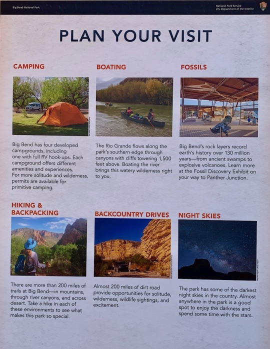
Plan Your Visit To Big Bend National Park
You will find camping, boating, fossils, hiking and backpacking, backcountry drives, and unbelievable night skies in Big Bend National Park. What more could you want in the ultimate outdoor adventure? It is time to plan your visit to Big Bend National P
You will find camping, boating, fossils, hiking and backpacking, backcountry drives, and unbelievable night skies in Big Bend National Park. What more could you want in the ultimate outdoor adventure? It is time to plan your visit to Big Bend National Park!
What will you see on a backcountry drive in Big Bend National Park?
There is the obvious. Big Bend National Park contains several distinct…
View On WordPress
#Adventure#Backcountry drive in Big Bend#Boquillas Canyon#Cacti in Big Bend National Park#Cactus of Big Bend#Camping in Big Bend#Cottonwood Campground#Hiking in Big Bend#Mule Ears Viewpoint#National Parks#Old Maverick Road#Santa Elena Canyon#Should you visit Big Bend National Park#Texas National Parks#Travel#Vacation#Visit Castalon#Visit Chisos Basin#Visit Texas#Visit US National Parks#When is the best time to visit Big Bend National Park
2 notes
·
View notes
Text
sometimes i'm talking about something from my hometown and then i just get this immediate rush of sadness and i... kind of hate it? like. i don't want to miss where i came from because as much as i love the place, (in the most abstract and literal sense of the word), it was a TERRIBLE environment for me with regards to my family and education and the like. but when i'm telling stories and remember things i get this bit of almost regret that i ever left??? like when i'm thinking about the campground i used to go to a couple times every year with the giant rainbow trout statue out front, the river that's so cold it makes your body go numb, and the bison and the sunsets and cottonwood trees and the red dirt and. god. there's so much to love there and i think it just makes me kind of sad that other people made me hate it
#yeah this is. bc of the tumbleweed thing. lol#this isn't /neg btw it just. GETS ME. yknow#i love that place so much. going back makes me sick. i feel trapped when i'm there. etc. GOD#finch chirps#rambling#i've tried to explain this a hundred times in as many different ways. godddd#SOME DAY i will be able to properly voice how i feel about my roots. hopefully
19 notes
·
View notes
Text
a bonus from the enrichment activity of going on a weekend hike with 5 total strangers around familiar stomping grounds: I raised my hypothesis that the (non potable) faucet at the little remote campground was pumping water from a local source/spring down the hill (I have been here before and wandered) which we all walked down to and looked at. It is a little fenced off area with unusual green lushness and some sheet metal covering things unknown.
One of the dudes commented that he agreed with me and look: there is a bigass cottonwood tree growing here, a creature that requires a lot of water to survive. It is the only one of its kind in this general vicinity for quite a ways, since we were in pretty dry parts.
Takeaway: +1 skill point in plant identification, +1 skill point in water source discovery
3 notes
·
View notes
Text
The Best Campgrounds Near Yucca Valley, California United.
Certainly! Here are some of the best campgrounds near Yucca Valley, California:
1. **Joshua Tree National Park:** Offering several campgrounds within its boundaries, Joshua Tree provides stunning desert landscapes, unique rock formations, and excellent stargazing opportunities. Popular campgrounds include Jumbo Rocks, Hidden Valley, and Black Rock. Click Here
2. **Joshua Tree Lake RV & Campground:** Located just south of Joshua Tree National Park, this campground offers RV and tent sites along with amenities such as a lake for fishing and swimming, hot showers, and a convenience store.
3. **Black Rock Canyon Campground:** Situated within Joshua Tree National Park, this campground offers a serene desert setting with spacious sites, flush toilets, and potable water. It's an excellent option for those seeking a quieter camping experience.
4. **Cottonwood Campground:** Another campground within Joshua Tree National Park, Cottonwood is located in the southern part of the park and provides access to hiking trails and scenic viewpoints. It offers tent and RV sites with basic amenities.
5. **Sheep Pass Campground:** Also located within Joshua Tree National Park, Sheep Pass Campground offers a more secluded camping experience, with fewer amenities but easy access to hiking trails and rock climbing areas.
6. **Pioneertown Campground:** This rustic campground is situated near the historic town of Pioneertown and offers tent camping and RV sites. It's a great option for those looking to explore both the desert and the unique charm of Pioneertown.
7. **J Tree Inn and RV Park:** Located in Joshua Tree, this campground offers RV sites with full hookups, as well as tent sites. It's conveniently located near restaurants, shops, and attractions in town.
8. **Indian Cove Campground:** Another campground within Joshua Tree National Park, Indian Cove offers stunning rock formations and easy access to hiking and rock climbing areas. It's known for its beautiful scenery and peaceful atmosphere.
These campgrounds provide a variety of options for camping enthusiasts near Yucca Valley, allowing visitors to immerse themselves in the beauty of the desert landscape while enjoying outdoor activities like hiking, rock climbing, and stargazing.
0 notes
Text
Monday, June 05, 2023 Day 05
End Mileage 29727 2:00 PM MDT
Start Mileage 29585 8:50 AM CDT
Miles 142
Gas 26.00
Gas 16.50
Camp 43.86
Food 28.00
Sundry 6.00
Postcards 12.50
Total 88.36
Started the day being slow to get moving. First stop Nicodemus National Historical Park, Kansas. A small town becoming a ghost town. Walked the streets to some of the buildings. Met an informative NPS staff. Onward to a state historical site – Cottonwood Ranch. Interesting architect and place. An Englishman becoming a pioneer, but not in a frontier fashion. Next visited Sheridan fishing lake after taking a wrong turn to Sheridan Wildlife state refuge. Went down a dirt road before I turned back to US 24. Back at the lake - nice campsites – but too early in the day to make use of them. Kansas fishing lakes are nice to camp with no fees, but no facilities. Took some selfies. Driving to Colby, Kansas to visit the pioneer and art museum. The art section was collections of odds and ends with no rhyme nor reason for how they made their way to Colby other than a loose collection of an old family that once lived in Colby. The Kusac family. Yet it was impressive. The pioneer section was a collection of outdoor buildings that had been relocated to Colby. One was the largest barn in Kansas. The church bell was ring able, but it was heavy to move to ring. Enjoy my time at Colby. At Goodland, Kansas got a campsite and then went and saw the Van Gogh easel painting of sunflowers. Later took a dip in the cold water pool at the campground. Refreshing. It was a good day.
0 notes
Text
Get Best Camping Services from Us at Affordable Pricing
This campsite for families offers basic, no-service camping in a lovely forest setting along the gorgeous Bow Valley Parkway (Hwy 1A). The campsite, which is just 32 kilometres from Banff, is suited for tent camping or small RVs (up to 24 feet) and is close to surrounding sights including Johnston Canyon and Silverton Falls. A short distance from Banff's centre, Two Jack Lakeside Campground offers unserviced Private RV Resorts and tent camping spots. Showers and flush toilets are available. This magnificent alpine lake, which is genuinely teeming with species, is accessible by canoe, kayak, and swimming.

At this campsite on Elkwater Lake, there are 14 lakefront spaces. The distance from your Private RV Campgrounds to the coast is around 30 steps, and it takes two minutes to get to the sandy beach area. Throughout the summer, a number of food trucks stop by, and you can rent bikes, boats, and other watersports gear. Located 90 minutes west of Edmonton, it has a nature loop walking route, crown land quad trails, spring-fed swimming holes, a cedar sauna, a new games room, a café, a kids' bike park, a sports field, a sand volleyball court, laundry facilities, showers, and bathrooms. Sundance Lodges provides luxurious canvas teepees, cosy trapper tents, and unserviced campsites for glamping and adventure travel. Forested, serene, and convenient to plenty of outdoor activities. between Banff and Calgary.
Cottonwood Cove offers both relaxing and tranquil experiences as well as adventurous vacationers who want to fill their days and evenings with resort excitement. Utilize the many water sport activities that the Shuswap lake lifestyle provides. Amazing houseboating, kayaking, canoeing, water skiing, tubing, jet skiing, and swimming on the stunning waterways of the Shuswap. Private RV Parks owners and their visitors are welcome to lounge poolside in the resort's outdoor pool under the sweltering heat. The resort hot tub is a wonderful, relaxing nighttime escape when the day begins to chill down. There are no more private RV lots available in Cottonwood. Opportunities for resort reservations are becoming harder to come by as more individuals seek out a simpler lifestyle. Visit us and reserve a space at Cottonwood Cove RV Resort. For 25 years, Cottonwood has been a popular vacation spot. Visit us online at http://www.campizon.com/
1 note
·
View note
Text
Storms - Devil’s Tower
For summer 2019
Storms are part of travel and camping. The intense storms that wake me up become stories only after we make it through them.
Devil’s Tower is a pillar of stone jutting out of a rolling landscape- the contrast reducing the surrounding hills to flat land. Old craggy cottonwoods growing sporadically throughout the campground belay the water and the weather of their home with the giant ancient pillar. Mom and I and the two kids tuck in after a long day as the wind picks up. The kids are asleep almost instantly but the wind and lightning have me wide awake. No cell phone service and no internet- I cannot check the alerts or the pattern or the movement or intensity of the storm. In tears, I whisper to mom my concerns about the lightning and the nearly instantaneous thunder. She sleepily replies that the biggest lighting rod is within a half a mile and to go to sleep and not wake the kids. Against my better judgement, I curl up with my kids tight to me so if we are found in the morning, I at least died holding my children.
The morning revealed no Hollywood classic lightning strikes but the nearby cottonwood and I had a “chat” about the missing bark in a spiral radial pattern.
Too close.
0 notes
Photo
9 notes
·
View notes
Photo
A few days shy of one year ago, we had actually driven around this area and passed this cute little park. Back then we were tent camping, who woulda thunk?!?? #ontheroadagain #roadtrip #fulltimerv #fulltimetravel #trees #scenery #greenery #photography #photooftheday #travelphotography #cottonwood #mapletree #willowtrees #campground #utah #provo #rvpark #beauty #serenity #blueskies #positivevibes #moving #ontheroadagain #ollancia #ollanciaadventures #adventureattorney #goodbyearizona #helloidaho #lakeside #lakesidervpark #utahlake (at Lakeside RV Campground) https://www.instagram.com/p/CORCOb8JCpL/?igshid=nx49g7dfuuha
#ontheroadagain#roadtrip#fulltimerv#fulltimetravel#trees#scenery#greenery#photography#photooftheday#travelphotography#cottonwood#mapletree#willowtrees#campground#utah#provo#rvpark#beauty#serenity#blueskies#positivevibes#moving#ollancia#ollanciaadventures#adventureattorney#goodbyearizona#helloidaho#lakeside#lakesidervpark#utahlake
0 notes
Text
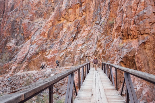
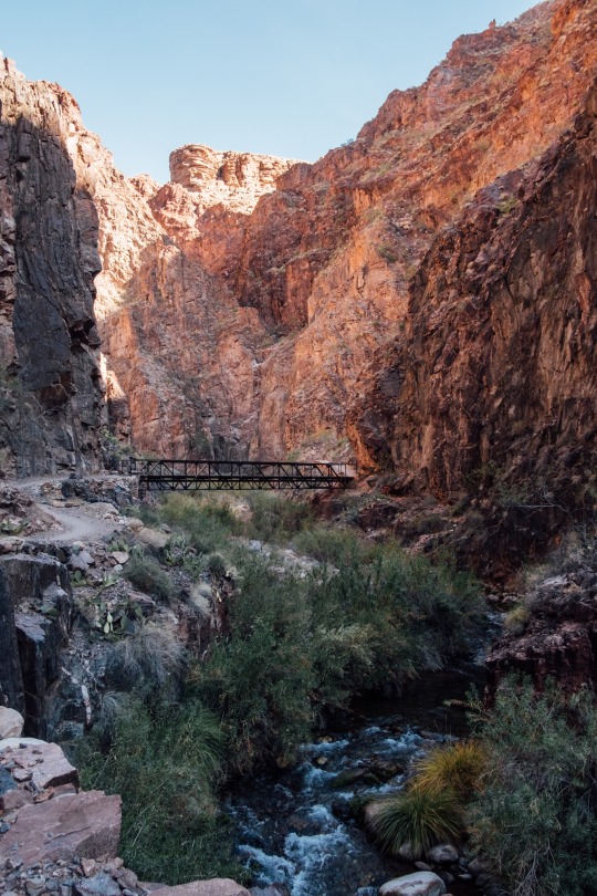
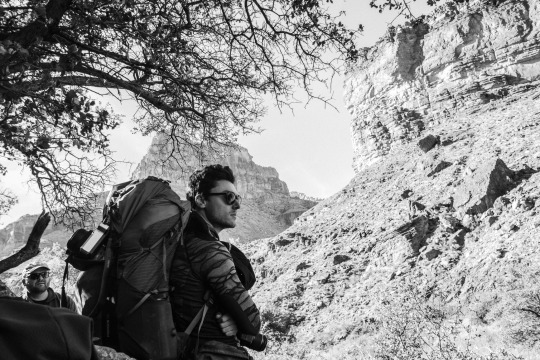
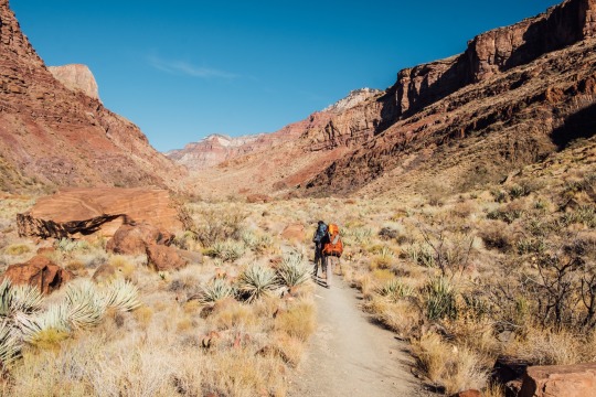
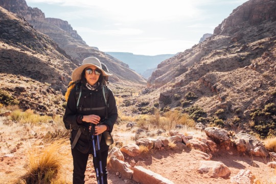
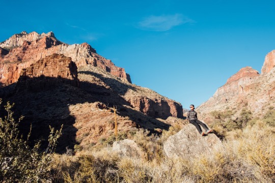
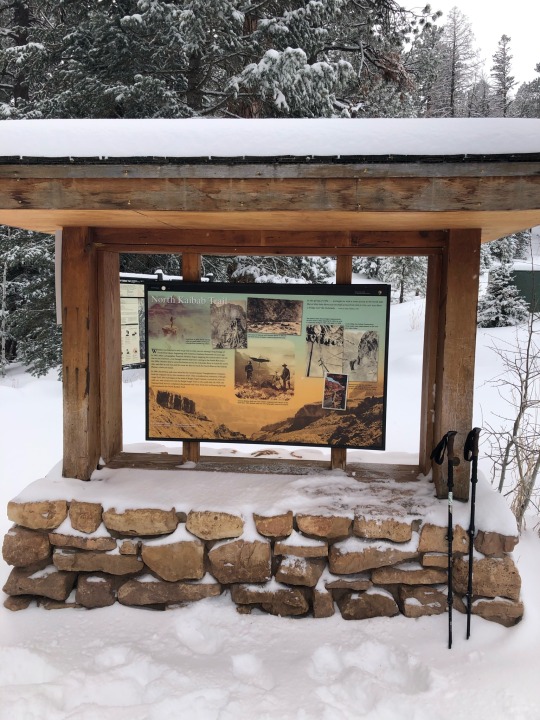
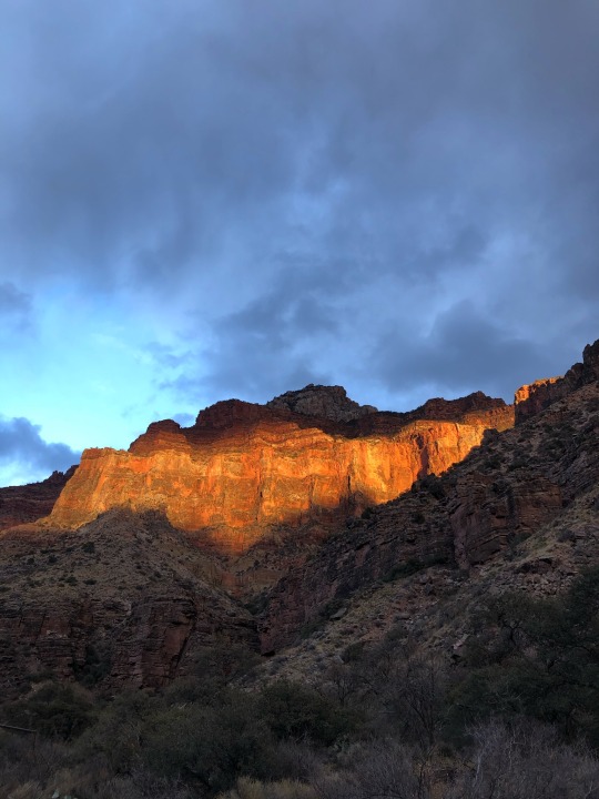
We hiked another 7.5 miles to the Cottonwood campground. This section is mostly flat with only 1200 feet of elevation gain.
#hiking#nature#camping#backpacking#grand canyon national park#grand canyon#landscape photography#photo of a photo#adventure#fujifilmxseries
13 notes
·
View notes
Text
August 6th-August 23rd, Colorado, California
Gae and I have enjoyed a couple visits with our friends Ken and Jil, over our stop in Denver. Gae also got out for a great day swimming with the neighbor, Pam, at Cherry Creek Resevoir. We didn’t expect to have such horrible air quality for our visit, but “the worst air of any city in the world” was in the news for August 8th & 9th.
We had a couple great visits with Ken and Jil during our stay.
We so love these people!
Our friend Daniel and his cousin, Andrea, stopped in Denver to over-night, where I joined them for a wild-meat fest at the 128 year old Buckhorn Exchange.
I flew to San Jose, California, on the 12th to join in my Aunt Alice’s 91st birthday bash.
All of Alice’s kids showed up, incuding David and Peter.
My own family members mad it as well... Joe, Alice, myself and Francie... party time!
Master organizer Taia put on the festival... definitely a chip off Alice’s block!
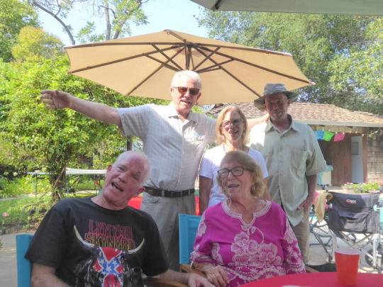
Here’s the whole immediate Larse clan, David, John, Taia, Alice and Peter.
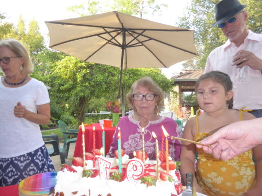
Alice’s great grand-daughter Mia was ready to help with the candles, but it turned out Alice had it covered.
I returned to Denver on the 16th, happy that I’d used an N-95 mask for travelling through packed airports and on packed planes.
Gae’s brother Kirk came out for a visit with his daughter Kourtnee, where Gae, Scrappy and I caught up for a visit. Great minds (or at least siblings) think alike, given these two fashion moguls random clothing choices;-)
Gae and I got one last visit in with Jil and Ken before departing for the Pacific Northwest on the 19th. We overnighted in Grand Junction after traveling over Cottonwood Pass to dodge the I-70 closure near Glenwood Springs due to mudslides... a brutal, narrow, dirt road. I was pleased nothing fell off the van after all the shaking over washboard roads.
We then travelled to and stayed in Brigham City, Utah, where we parked the following day for several hours at Rees Pioneer Park to participate in our Zoom Toastmasters meeting. The park boasts an awesome 50 meter public pool, which we enjoyed after our meeting.
Gae attended church with her friend, Bonnie, at our next stop, Boise, Idaho, on the 22nd. She had mixed feelings about attending, since only a few members wore masks. I was glad she used an N-95 to at least protect herself.
We drove to Emigrant Springs Campground after church, where we decided to stop for a couple nights and relax.
1 note
·
View note
Text
Spot, Spotters, and Spotted
Dave Baugher has been a regular contributor over the past several years. Although most of his posts have touched on the poignant and personal side of being out on the PCT, in this story he takes a mostly humorous examination of the using a SPOT device (although he does conclude with a story that reinforces the importance and value of SPOT devices).
Dave has also included a story in the upcoming 10th Anniversary edition of The Pacific Crest Trailside Reader that the Mountaineers Books will be publishing in 2022.
By Dave Baugher
The backpacker and his GPS are more like a match made in the local tavern, like beer and pretzels. Current Global Positioning tracking technology uses a network of satellites to determine the location of a device that was specifically designed for that purpose. The basic idea is that a GPS tracker uses trilateration to determine its physical location based on its distance from three GPS satellites. For the hiker going about his way on the trail, the technology is innocuous. However, for those following, the technology can spawn a myriad of humor, concerns, and dismay, just like an evening at that local tavern.
However, these devices sometimes baffle sideline audiences and armchair quarterbacks by the hiker's behavior on the trail, as shown on Google maps. Consider a little during-the-hike episode on the second day of my 2014 Pacific Crest Trail hike when I arrived at Lake Morena.

It was one of those quiet afternoons, with a scattering of high clouds, green cottonwoods around the lake, and the smell of fresh-cut grass on the breeze. Arriving at the county campground early in the afternoon, home tonight would be campsite #31. I laid my pack across the picnic table, took a long deep breath, and basked in the afternoon sun, planning for a much-anticipated shower, dinner, and relaxation. Getting up, I grabbed my pack; I walked down the dusty road to the Oak Shore Grocery and purchased a couple beers and a local newspaper. Returning to my campsite, the remainder of the evening played out precisely as planned. The shower was hot and clean; dinner was satisfying, and reading the newspaper with my cold beer was intimately relaxing.
Later, I discovered that my trip to the store generated multiple jokes amongst my friends who were monitoring my progress along the trail via SPOT; my compatriots were closely watching. Little did I know that the store was titled “Ice Cream Shop” on Google maps that year. Doug, a cigar-smoking jokester, slipped in a picture of a hot fudge sundae into my resupply box, retrieved from the Warner Spring Post Office later.
That incident had the usual inferences related to SPOT tracking. However, there is another facet to spotting folks on the trail when looking at the Google maps on a two-dimensional computer screen. That same year, while hiking on the JMT/PCT with my son Jacob and future-son-in-law Patrick, we merrily enjoyed our hike along the John Muir Trail. Family and friends focused on our progress via the SPOT and Google superimposed tracks. Once we returned home, I had several folks question our progress along several specific areas. Looking at the map of these locations, it was apparent that these areas had high elevation gradients sections with steep switchbacks. These challenging vertical sections for folk-uneducated in more nuanced aspects of topographic map detail would look at two-dimensional Google maps as a series of overlapping orange dots on the computer screen and wonder what was going on out there. Interesting indeed.

Another result of this GPS technology is that these devices are fast becoming legendary as a life-saving tool or beacon for someone in trouble. An example from 2017, during my spring solitary PCT hike in the Sierras north of Lake Tahoe. A snowstorm of near-blizzard violence had caught me below a high ridge near the timberline and forced me to take shelter for several nights in my tent. To my wife, Luann, that orange dot, unmoving for three days, meant I was dead, bear bait, feeding the worms, you get the picture. Luann would have called out the military to rescue me if it had not been for my son-in-law Patrick. An Eagle Scout and avid outdoorsman, Patrick had been watching the weather along my route. Understanding where I was and the current weather conditions, Patrick considered the situation. He reassured a panicked mother-in-law that I was ok. On the third day, the storm broke, and my Spot’s orange dot began moving once again on the home computer screen.
On that same trip, several of my “Spotters” discussed why my track appeared not to follow the trail. Confusion reigned amongst these folks spawning conversations about why Dave wandered over the PCT Trail line in a zig-zagging path. I overlapped the trail in quarter-mile eastward only then to veered westward over the track for another half-mile in a wayward fashion. Back and forth for days. Confusion amongst friends? You bet! Why? Well, the trail was covered in a deep spring snowpack, buried in fact. Signs, tree blazes, markers, and PCT emblems were nowhere to be seen in the deep snow. Conserving my GPS battery, I was using map and compass to follow the trail orienteering from one landmark to another,
Obviously, kinfolk following hikers along the trail via a tracking device retains a propriety attitude toward their favorite hiker. Actively considering “they” are, in fact, part of the adventure, living vicariously through the daily movement from the device strapped to a dusty pack. You might get the impression that almost every “Spotter” in my life nowadays has a Dave yarn or two to tell. Many of these should be preserved for posterity.
On another trip, difficulties began when I included a new friend, Steve, on my PCT Spot tracking list. During this particular PCT adventure, I encountered heavy snow depths on the PCT in Northern California. An impending spring storm approached the higher elevations out of Castle Craig’s State Park. After a quiet night's sleep, I awoke to boiling grey clouds, falling snow accompanied by a winter storm warning. Careful consideration of the weather and the impending climb to higher elevations coming along this trail section for the next 60 miles, I pulled the plug on the hike and retreated home.
Unfamiliar to my antics on the trail in the past, Steve was confused about why the orange dot was moving back down the trail along the same path from the day before. He contacted several of my friends about my wanderings. Technology malfunction? Nope, just a wise hiker returning home. Being spotted by spotters with my Spot on backpack, once again.
However, consider this; carrying a GPS transponder on a pack is an insurance policy for protection from the trail's worst events. Let me share the story about another hiker, George, from Palo Alto, CA. On June 30, 2008, during a summer backpacking trip in California’s Kings Canyon National Park, the 52-year-old hiker found himself suffering from acute abdominal pains on day ten of a 200-mile hike along the John Muir Wilderness Trail. At approximately 11:00 pm, George’s pain worsened, which led him to end his trek early and initiate an emergency alert with his SPOT transponder.
From George: “My friend and I were enjoying a great trip when I began experiencing an intense pain in my stomach near Safire Lake as we were setting up camp for the night.” “I knew something was very wrong, but being so far removed from any help at 10,800’ elevation and deep in the backcountry, I had no choice but put my faith in the SPOT, which I recently purchased for checking in with my family during his expeditions, press the 9-1-1 button and wait for help.”
The GEOS international response center received the message from George’s SPOT unit shortly after 11:15 pm and relayed the information to the Kings Canyon Ranger Center. Due to darkness and the ruggedness of George's terrain, the Ranger had to wait until daybreak before he hiked to George’s location to assess the situation.
According to rescue officials, when they reached George, his pain was severe, and there was no way for him to make it off the mountain on his own. That was when they requested a helicopter for an evacuation. George was flown to the Community Medical Centers in Fresno. He underwent immediate surgery for a perforated intestine, which, if left untreated, can be fatal. He was released from the hospital a few days later.
This is beautiful technology — the GPS transponder allowing hikers on the trail to happily wander through the mountains in relative safety. Friends and families able to follow the trek from afar. However, for the hiker going about his way on the trail, the technology is innocuous. Nevertheless, for those following, the technology can spawn a myriad of concerns, humor, and dismay, just like an evening at your local tavern.
2 notes
·
View notes
Text
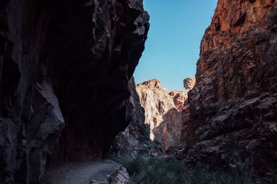
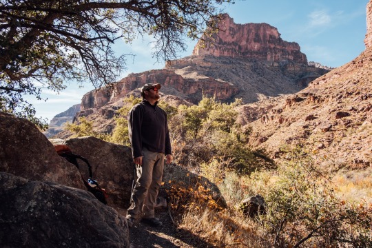
Grand Canyon: Rim to rim to rim.
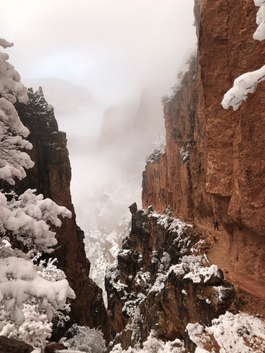
01/22-01/26 2021.
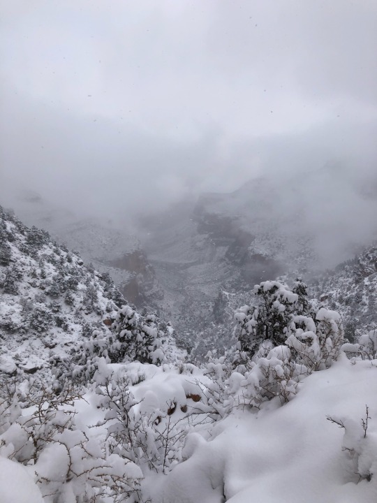
Unknowingly, my cousin and I started down the South Kaibab Trail a day earlier than our permit stated. Luckily it worked out in our favor. 14 miles in I reached Cottonwood campground and was greeted by a very worrisome park ranger. I was in my standard shirt and shorts when she saw me and asked where I was headed. I told her we were camping here for the night and heading up to North Rim the next day. That didn’t sit well with her. She asked me if I would reconsider my hike as the weather was getting very bad and a winter storm was approaching, that if something were to happen to us up there no one would be up there to save us. I told her no, that we were fine and knew what we were doing and that we were looking forward to hiking in that storm. Looking at my pack size, the ranger thought I was a day hiker and did not have the proper gear to survive a few days down in the canyon. I assured her I had everything I needed and that I was experienced and knew what I was doing. That still didn’t change her mind as she kept telling me about how dangerous it was up there and how much she really did not want us hiking up there and with her 15 years of being a ranger there this storm was going to be very harsh. After about 5 minutes I finally agreed with her and said, “Okay, we wont go up there. You’re the ranger and know what you’re talking about so if you say it’s bad up there, we wont attempt it”. She was relieved to hear that and thanked me and gave us permission to changed our permit and camp wherever we pleased. Bummed and feeling let down, we kind of accepted the face that rim to rim to rim might not be possible this trip and went to bed.
Waking up the next morning, the sun was out and the weather was perfect. We spent the morning thinking that we could reach the North Rim, but with everything the ranger told us and knowing that weather in the canyon could be very unpredictable, we accepted our fate and started hiking back South. About 5 miles in we came across an older couple hiking in the opposite direction. I asked if they were heading toward the North Rim which they responded that they were. I told them everything the ranger told us and they responded that they just talked to that same ranger. She told them that with this sudden change of good weather, they could attempt the North Rim as long as they knew when to turn back if they needed to. Also that the ranger felt, “horrible for telling the couple at cottonwood not to go up there because the weather was so beautiful today”. Feeling a bit aggravated and unsure what to do, we thought about it for a minute, said fuck it, and started heading back North. We decided we would camp at Cottonwood again, wake up early and do the North Rim as day hike and come back down to camp at Cottonwood again.
Waking up at 5 in the morning, we ate and packed a day pack and set up for the North Rim. It had rained that night so everything was wet and there was fresh snow at higher elevation. Around 7:30 the sun started peaking out of the cloud to present us beautiful misty views of the North Rim. The snow was fresh and there were no tracks in front of us meaning that we were most likely indeed the only people on the North end of the park. It was cold but as long as I was moving I kept warm and leaded the path up to the top. Just past Supai Tunnel, the post holing really began. Not too deep but enough to definitely slow me down and make me work for it. A few miles in I was starting to consider heading back down. I knew I was getting closer to the top but it was starting to feel never ending. However with the beautiful views and the fact that I was almost there, I had to push through and keep going. At about 9:38 AM, I was at the North Kaibab Trailhead, the only soul on top of the North Rim. Feeling accomplished but knowing that a storm could be approaching any second, I started heading down. I ran into my cousin about a mile from the top and told her she was almost there and that I would wait for her down at the restroom at Supai Tunnel. Not too long after, she came back down after reaching the top and met back up with me and we started heading back down, just as the snow started falling. Coasting down trail was relaxing and rewarding knowing that we just completed rim to rim of the Grand Canyon. We made it back to Cottonwood, chilled in our tents, and avoided the rain.
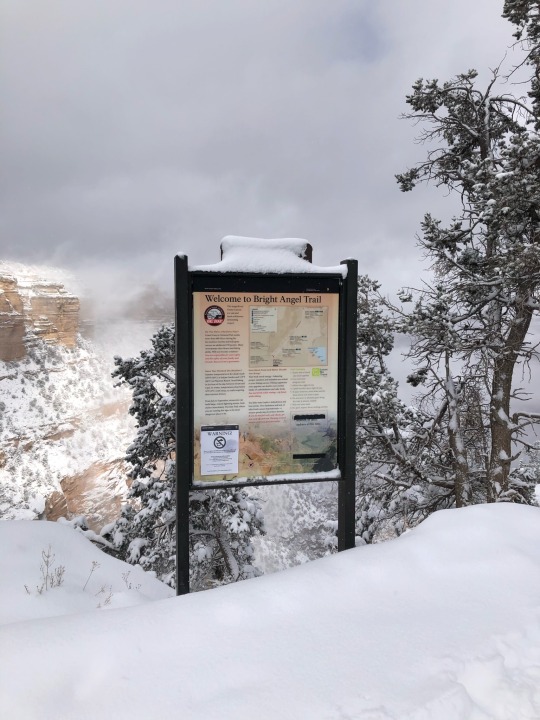
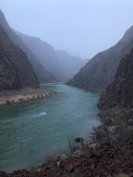
The next morning, we quickly packed up to avoid the morning rain and hiked an easy 7 miles to Bright Angel Campground. Getting there way too early, we had the whole day to relax and do nothing. Bright Angel was a lot more populated with hikers and tourists coming down to Phantom Ranch. (Phantom Ranch: where the tourists come down into the canyon on mules and stay in fancy cabins and get a hot meal from the restaurant with a months in advance reservation). We got the idea that since the weather was shitty, there had to some cancellations at the restaurant and we could maybe snag a fancy gourmet dinner, which to our luck there were and my cousin paid for both of us (thanks Lauren). Dinner was at 6:30, giving us a few hours to hang around and wait. Soon enough the weather hit us with 40 mph wind gusts and some rain. Hunkered down in our tents we waiting it out and hoped that it would end soon, which it did. 6:30 came around and we hit the restaurant and got our meals. A salad, cornbread, vegetarian chili and a cookie for dessert. Coming from previous thru hikes and getting used to the hiker trash lifestyle, I couldn’t help but laugh at how boujee I felt. But it was delicious, rewarding and I enjoyed every second of it. Expecting rain and wind all night, we went to camp and hoped for the best.
The next and last morning, we woke up and was shocked at how peaceful the night was. No rain, no wind, just calmness. Happily packing up dry gear, we left Bright Angel Camp and started on Bright Angel Trail, heading up to the last rim. There were mild rain showers and snow flurries but the views of the Colorado river were epic and the higher we got the views became more epic. The snow on Bright Angel was a lot more chill compared to North Kaibab. I got my groove going and reached Indian Garden in no time. After that it was the home stretch, only 4.5 miles of climbing to the top and we were done. I was back in my groove and was crushing it and by 11:30 AM I was at Bright Angel Trail head and had just completed the rim to rim to rim hike. Feeling accomplished, I took a few pictures and went straight to the restrooms to dry off and to my surprise, there were heaters in the restrooms, the greatest thing I could have asked for at the time. I waited for my cousin to reach the top, high fived and headed back to the car and left the Grand Canyon feeling accomplished. I don’t think that many people experienced their rim to rim to rim hike quite like ours and it was, as the word for this adventure was: epic.
Don’t ever ever ever visit the Grand Canyon in the Summer.
2 notes
·
View notes
Text
Reach For The Stars in Joshua Tree National Park
Price: $950, $250 dollar deposit required, Optional Post-Processing After Workshop for $125
More details on pricing and deposit below.
Join me May 14-16, 2021 in Joshua Tree National Park for a multi-day immersive experience amongst ethereal Joshua Trees, amazing rock formations and dark skies. This unforgettable photographic experience will include four Golden Hours and two nights exploring the vast arid landscapes in one of the country's most interesting National Parks.
Scroll down for all the details
About The Workshop
During this workshop, I will guide you through Joshua Tree National Park while helping you to translate emotion and vision through our photographic medium. I am dedicated to providing the best instruction on all aspects of the art of landscape photography and night photography. Whether you are just beginning or are a seasoned pro, I am ready to help you move forward with your photography as all levels are welcome to participate. Together we will create an unforgettable photographic experience this spring by chasing light and capturing the early spring night sky.
Itinerary
Tentative Schedule: Since this is a field workshop, we will remain flexible to weather and light conditions to ensure we are able to shoot during the most ideal conditions. The final itinerary with exact times will be made available on Day 1. Lodging, airfare, transportation, park fees and all meals are the responsibility of the attendee.
DAY 1: Friday, May 14th
6:00 PM Meet at Park Entrance (Meet and Greet)
6:30 PM Depart for Sunset Shoot
8:00 PM Depart back to Dinner and Rest For Astro Session
11:00 PM Meet For Astro Session
DAY 2: Saturday, May 15th
4:00 AM Move to Sunrise Location (if necessary)
6:00 AM Return To Hotel for Meals and Rest
6:00 PM Meet for Sunset Shoot
8:00 PM Depart back to Dinner and Rest For Astro Session
11:00 PM Meet For Astro Session
DAY 3: Sunday, May 16th
4:00 AM Move to Sunrise Location (if necessary)
7:00 AM Workshop Concludes for rest and easy check out of Hotels.
Transportation
No Transportation will be provided to, from or during the workshop. All attendees are responsible for arranging their own transportation. Any car will be sufficient for our outings, but a vehicle with higher clearance may allow you more ease on some roads throughout the park.
Airports
The nearest airport is in Palm Springs, California
Los Angeles is about 140 Miles to the West
San Diego is about 170 Miles to the South
Rental Cars
Many options are available for renting a vehicle of any kind from either airport listed above. Any car will be sufficient for our outings, but a vehicle with higher clearance could make driving easier on some roads in the park.
Accomodation
Hotels:
There is no lodging available within Joshua Tree National Park. However, there are many places to stay in nearby communities. Please contact area chambers of commerce for information.
I would recommend staying in 29 Palms or just outside of the park towards the town of Joshua Tree. You will find lots of accommodations in both of those areas including hotels and AirBnB.
Camping:
Camping is very popular in Joshua Tree and campgrounds sell out quickly.
Learn more about the nine campgrounds in Joshua Tree.
There are also a number of options for camping outside of the park.
Restaurants, Grocery Stores, & Picnic Areas:
There are no restaurants or grocery stores inside Joshua Tree National Park, but nearby communities provide these services. Check with area chambers of commerce for more information.
Joshua Tree has eight picnic areas: Cottonwood, Indian Cove, Live Oak, Split Rock, Cap Rock, Hidden Valley, Quail Springs, and Black Rock. Their locations are shown on the map here at the bottom of the page.
Remember: help us keep wildlife wild. Never feed wild animals. Store food in hard-sided containers or in your vehicle. Carefully clean up all trash and leftovers, even small crumbs.
Things to Bring
It’s always good to know what equipment you need. If you have any questions about the necessities I’m here to help, but here is a list of essentials and recommendations for the trip:
Equipment:
DSLR / Mirrorless camera and lenses
DSLR or Mirrorless camera is an essential tool to get the most out of the workshop and your photos
Wide Angle Lens - 12-24mm (Faster lenses are better for night photography, but not essential)
Mid to Long Range Zoom - 24-70, 70-200, 100-400 are great ranges to capture intimate scenes
Tripod (Sturdy as the Fall months can have very strong winds)
All filters you might have, a Circular Polarizer is a great tool
Remote / cable camera shutter
Needed for tack sharp images and long exposures
Several memory cards
You never want to run out of space for pictures. Bring several or empty at the end of the day
Spare camera batteries
Another thing you never want to run out of in the field. Bring several fully charged with you and charge over night
Head torch (for any night or low light walking and shooting)
Raincover for camera and camera bag cold come in handy in some rare cases of rain or high wind!
Small Camping Chair or Stool for comfort
Clothing Items:
Many layers -It should be quite mild to warm for our trip, bt May can still hold a few cold nights. Plan for warm days and mild nights
Gloves, Warm Hat, warm socks (If there’s a cold spell)
Sunglasses, Large Brim hat, and Sunscreen are recommended for the daytime
Hiking Shoes\Boots are recommended
FOOD:
Food, Water, and all other essentials. No Food or water will be provided before, during or after workshop; unless otherwise stated in the itinerary.
Plan ahead and have plenty of water available as it is very dry and can warm quickly on clear days.
Physical Requirements
Some hiking will be required, but the hikes will be around 1-2 miles at most. Most of the hiking is very flat and moderate in difficulty at best. Typically shooting is done within a mile of the car and most hiking should be generally light in elevation change. We’ll be sure to move at a fair pace and no student will be left behind.
Please make me aware of any concerns you might have about your physical abilities.
What is Included and Not Included
INCLUDED:
• Tuition
• Expert instruction in the field with Chris Ewen Crosby
• Video Introduction and Presentation Prior to Workshop
• Guidance to key compositional attributes throughout the park
NOT INCLUDED:
• Flights and transportation
• Lodging
• Meals
• Park entrance fees
• Travel and cancellation insurance
Payment, Fees and Terms
COST: The cost of the workshop is $950 and includes everything listed in the “What’s Included” Section
PAYMENT: A non-refundable deposit of $250 is required to reserve a space on this workshop. The final balance of $950 is due and payable 60 days before the workshop begins. Full payment is due at that time or thereafter, and there will be no refunds on the full amount owed if you cancel after final payment. However, if another client happens to fill your space, you will receive a full refund, minus your non-refundable deposit. Payment(s) can be made using the Add To Cart button of this web page using a credit card via Paypal and Stripe. If you would like to pay by another method, use the contact form on this page to ask Chris about options for sending a personal check or bank transfer.
COVID-19 ADVISORY:
In accordance with state and local public health organizations, Chris Ewen Crosby Photography & Samy's Photo School are following all COVID-19 related protocols. All participants will be asked to maintain social distancing protocols of 6 feet from anyone not in their household. Face coverings are mandatory for all. The class size for this event has been limited to only 5 students to further minimize the risks associated with COVID-19. Please do not attend this class if you are experiencing any symptoms related to COVID-19 including fever of 100.4 or higher, cough, shortness of breath, loss of sense of taste/smell, fatigue, diarrhea, muscle aches and headache.
Participants will be required to sign a COVID-19 addendum and assumption of risk form
CANCELLATIONS: Cancellations require me to re-open enrollment and/or to engage in additional promotional efforts to fill the workshop on a short notice, therefore, my policy is that there will be no refunds of the deposit. The balance (minus the non-refundable deposit) is refundable up to the 60-day deadline. Thereafter, the balance is also non-refundable, with one exception: if we find participants to fill all canceled spaces and the workshop is ultimately full when it begins, then you will receive a refund of the balance within two weeks of the workshop’s conclusion. The deposit remains non-refundable. All refunds are subject to a 6% processing fee. I highly recommend that you obtain travel/cancellation insurance for all workshops to protect yourself against unusual circumstances.
PARK FEES: All attendees of the workshop are required to pay the National Park Entrance fees upon entry to the park and are not included in Workshop Fee.
Further instruction will be provided to students prior to their visit.
Joshua Tree Entrance Fee - per vehicle - $30.00
This permit allows all persons traveling with the permit holder in one single private, non-commercial vehicle (car/truck/van) to leave and re-enter the park as many times as they wish during the 7-day period from the date of purchase.
Joshua Tree Entrance Fee - per motorcycle - $25.00
This permit allows persons traveling on one motorcycle to leave and re-enter the park as many times as they wish during the 7-day period from the date of purchase.
Joshua Tree Entrance Fee - per individual - $15.00
This permit allows a single individual traveling on foot or individuals traveling on one bicycle to leave and re-enter the park as many times as they wish during the 7-day period from the date of purchase.
Joshua Tree Annual Pass - $55.00
Annual pass providing free entrance to Joshua Tree for 12 months from the date of purchase
Curriculum
Curriculum will be catered to each individual’s skill level and may vary from student to student. Below you’ll find some common topics based upon different skill levels.
BEGINNER-INTERMEDIATE
I am a big believer in fundamentals in the development of any skill, photography is no different. I start all my workshops by ensuring that we have a good foundation to build on. Below you’ll find some sample topics:
Shooting in Manual Mode
Understand The Exposure Triangle and how each affects the image (aperture, ISO, shutter speed)
How to Meter and Expose for best results
Using light for better captures
Compositions made simple and easy
Understanding and using camera settings and menu options
ND’s, Polarizer and Grads - Which to use and when to use it
Tips and Tricks for easier workflows and shooting experience in the field
Photographing the night sky - Exposure, Focusing, Compositions
INTERMEDIATE - ADVANCED
Those who have a greater understanding of their cameras will get some more advanced shooting techniques to focus on light, location and making good decisions to make the most of the variables. Some advanced topics are listed below:
Exposure bracketing and blending
Focus stacking for depth of field and sharpness
Creative blending to bring the vision to life
Composing for interest, depth and focus
Time Blends for Night Sky
Conclusions and Expectations
SUMMARY
Your satisfaction, enjoyment and educational experience is important to me. The goal of this workshop is to allow you to further understand your camera, composition and artistic expression while using the amazing landscapes of Joshua Tree National Park. I want to ensure that everyone comes away with great instruction as well as a great experience in nature. Most importantly, we are going to have fun! Having fun is a critical part of any good photography adventure. When you have fun, your mind is free to expand and learn.
POST PROCESSING
Post Processing is not included with this workshop. You can purchase an additional 3 hours of post processing instruction with this workshop that will be completed following the workshop. Editing is done via group video session in the following weeks from the workshop. It is recorded and available for download shortly after the session is complete. Instruction is given in both Adobe Lightroom and Photoshop.
Topics of post processing will vary upon your skill level. Common topics below:
Lightroom and Photoshop Workflows
Maximizing your RAW captures
Keys to clean editing
Stacking for depth of field and noise
Use of Luminosity Masks
Blending methods
Finishing an Image
and much more...
Learn More About Chris
Chris is a photographer and educator based in Long Beach, CA. It is a desire to teach, love for the outdoors, and photography which resulted in his role as a landscape photographer and educator. When not sharing his photography knowledge he can be found exploring nature’s beauty in his endless search for perfect light and discovery.
Learn More About Chris’s Workshops
Chris’s workshops cover a wide-range of photographic instruction and all its aspects, but also put an emphasis on having fun to enable creativity to thrive. Chris puts the emphasis your development as a photographer, incorporating infield fundamentals and cutting edge techniques to help you find your vision and bring it to life in post-processing. Whether you are just beginning or a blooming professional, Chris will help you to create meaningful and inspiring photographs while leading you down a path towards finding your own creativity.
#Workshop#Group Workshop#Photo Tour#Photo Adventure#Landscape#Photography#Photography Workshop#Desert#Joshua Tree#National Park#night photography#photo workshop
1 note
·
View note
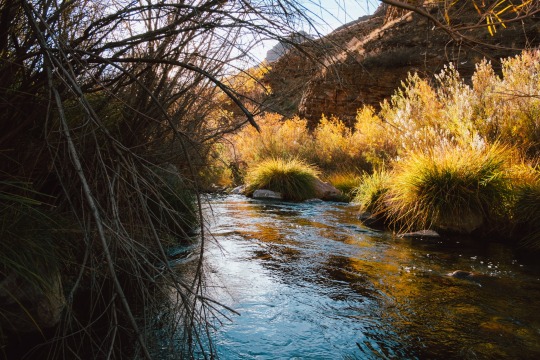
Photo
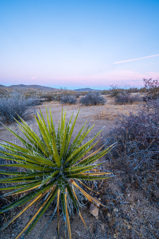
Dawn at Cottonwood Campground
Joshua Tree National Park
53 notes
·
View notes
Last Seen Blogs

greyhound30
Glee Is Amazing

angel-witch
boys can be witches

darling-fascist-bully-boy
Moss Man 2.0
bellaraesnapeart
What I Create

te1epathy
everything in dust