#establishing a few things for later. meheh
Text
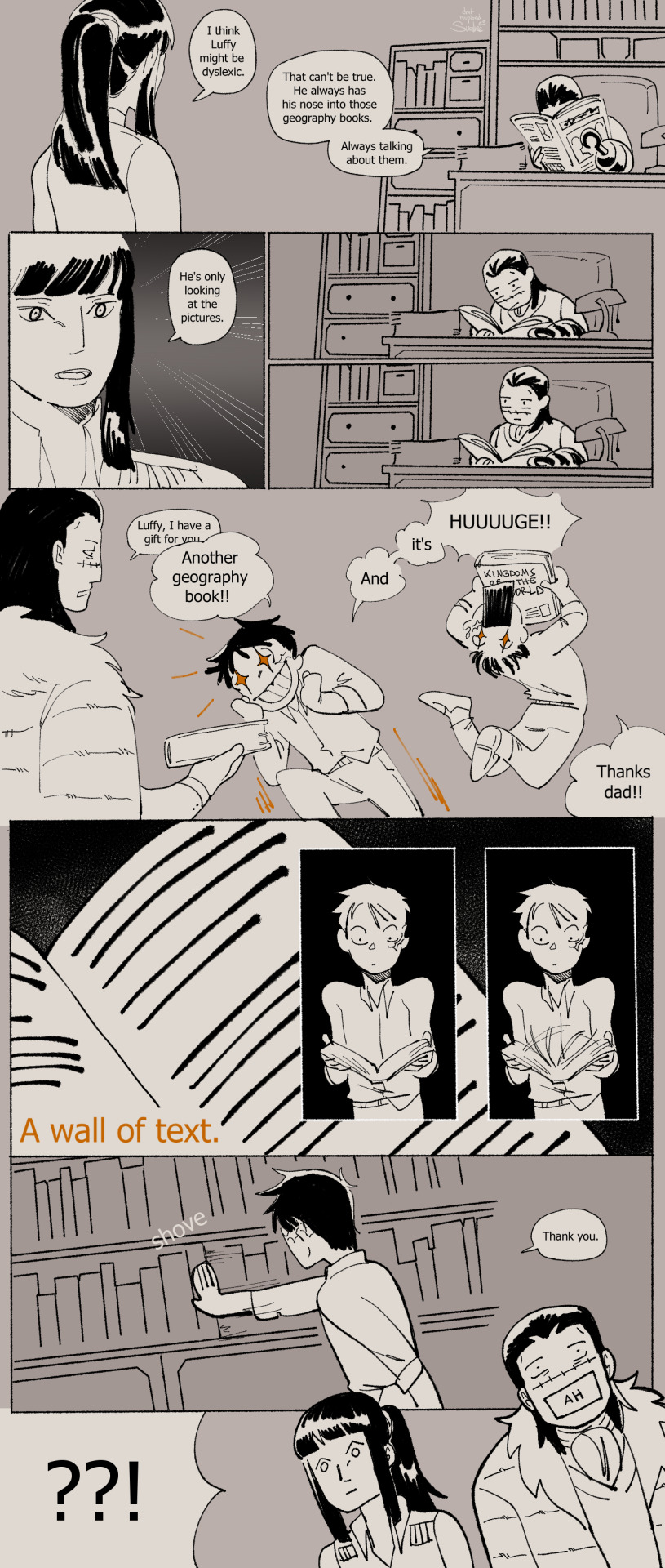
Mr 0 and Miss All Sunday investigate.
(timeline)
#one piece#nico robin#sir crocodile#monkey d luffy#crocodad au#my art#my comic#described in alt text#ive finished it!! :'DD this comic was about how no matter the universe luffy just cant read. i love how easily it is to read luffy as bein#neurodivergent/having (at least one) learning disability. so i wanted to put it here in the au. its important to me. also. quietly#establishing a few things for later. meheh
6K notes
·
View notes
Text
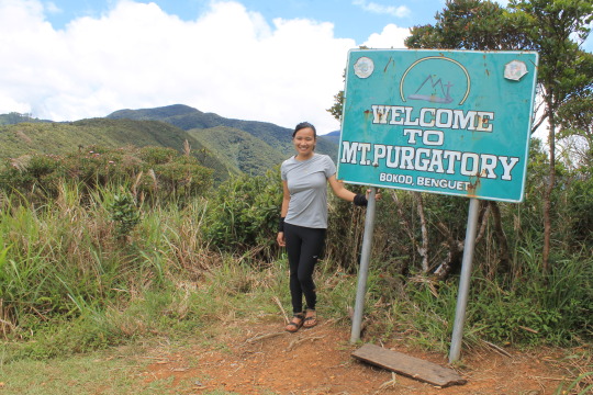
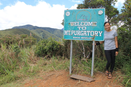
MT. PURGATORY (My 8th Mountain)
MT. PURGATORY (MT. PACK-MT. KOMKOMPOL)
Bokod, Benguet
Entry point: Japas Jumpoff, Bokod
Exit point: Brgy. Ekip, Bokod
LLA: 2290m (Mt. Pack); 2080m (Mt. Purgatory); 2329m (Mt. Komkompol)
Days required / Hours to summit: 2-3 days / 4-5 (Pa); 5-7 (Pu); 9-11 (K)
Specs: Major climb, Difficulty 6/9, Trail class 1-3
Features: Pine forests, mossy forests, Views of Benguet mountains
(Copied from Pinoy Mountaineer)
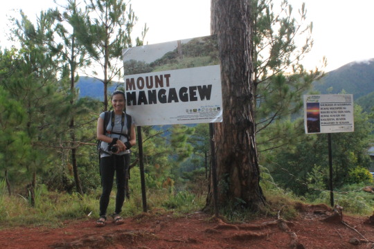
Traverse Mountains: Mt. Mangagew Mt. Pack (2290MASL), Mt. Purgatory (2080MASL), Mt. Bakian, Mt. Tangbaw, Mt. Komkompol (2329MASL) Mt. Tingeban, Mt. Ekip
Hi! Thank you for visiting my tumblr account and you are about to hear my thoughts from my recent adventure (July 9, 2017) in Mt. Purgatory, Bokod, Benguet. Here’s my Mt. Purgatory goes…
I was invited to do a complete traverse of Mt. Purgatory which passes through 6 mountains (that surprised me to 8). Reading some blogs about the trail, at first I don’t find it exciting to do so because the trail doesn’t offer much view but I know will be a challenge so I go, and maybe because of my curiosity what the trail will offer to make it called Mt. Purgatory.
Our van was scheduled to leave at 8PM and everyone arrived before time except for a member that was stucked in terrible traffic. She arrived 9PM in the meeting place and we immediately leave after some short talk.
Everyone was all busy sharing their previous hikes along the road.
At around 4:00AM, we arrived at the jump off point, this is after all the bumpy, zigzagged road of Benguet that cause me not to sleep and hit my head. After all the preparations and photo ops, we leave and start to hit the trail with our guides Kuya John and Ate Ana. Mt. Purgatory is located between Mt. Pulag and Mt. Ugo, there is an available trail for those who want to make it traverse.
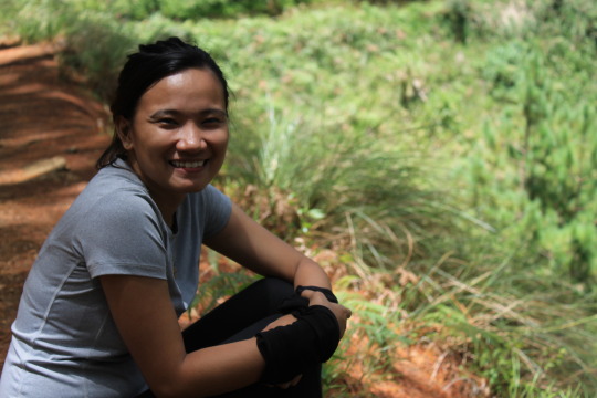
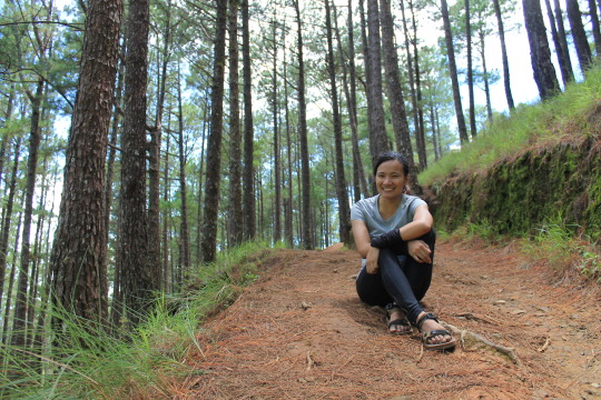
The trail began with steep assaults making everyone catch their breaths. I still have to endure my knee pain from the previous hike (Maculot) so I walk slowly and arrived the first mountain in an hour and 15 minutes.
If I am not mistaken, there are 2 waiting sheds before reaching the first mountain, and I stop in the second to take five. As expected it was cold that cause me to sneeze. :D After taking photos, we leave immediately because we still have 5 mountains to go.
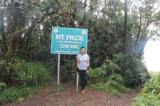
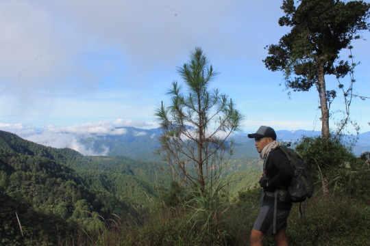
Mt. Pack 2 of 6
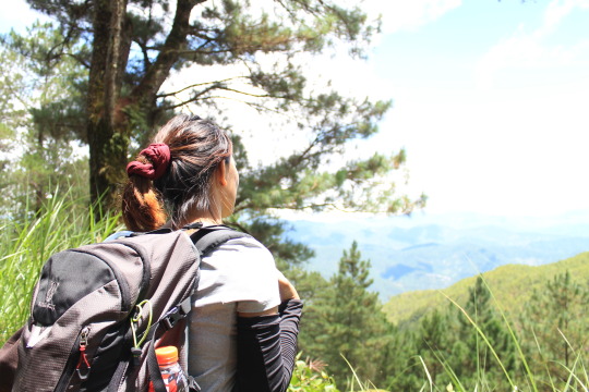
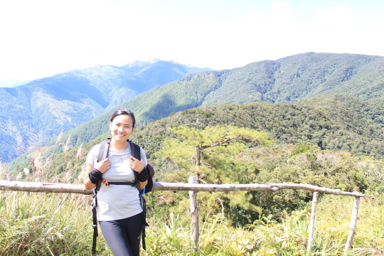
Far from Mt. Mangagew, Mt. Pack is one of the peaks in this traverse. During the trek, I feel my eyes bit heavy and I really wanted to sleep for a while, but I know there is so many way to go so I just decided to eat some trail food to keep my energy. The cool breeze keep me going and I know that there is much more ahead. After some assaults and abundance of pine trees, we arrived the second mountain. We took couple of photos and then proceed to the third mountain. By the way, beside the marker of Mt. Pack, you can see some mountain ranges and Mt. Pulag.
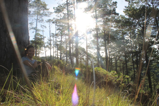
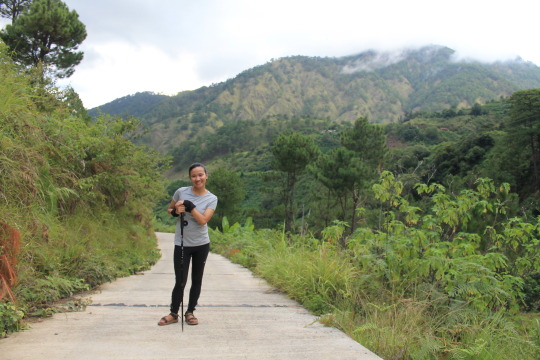
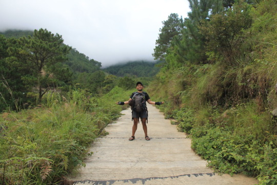
(Below are some photos captured along the trail)
This is after one of the assaults along the trail and I have to make this obligatory photo LOL
Because there is a clearing, I spotted this one, defines captivating.
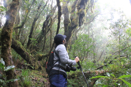
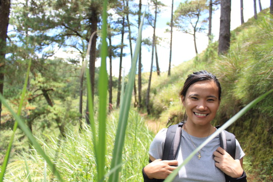
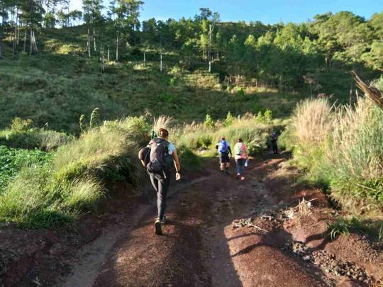
We enter the first mossy forest to reach Mt. Pack.
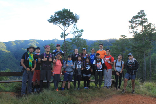
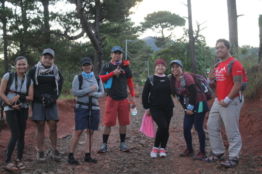
GROUPIE :D
Mt. Purgatory 3 of 6
Before entering the mossy forest - that is said to be present in the entire trail to Mt. Bakian, I feel my knees breaking that cause me to slow down again.
You can feel the cold breeze in the entire forest and you’ll surely feel amazed. Yet along the trail, I found it harder to put weight on my knees, good thing that there is a friend to wait for me and push me to go along.

First part of the trail was assault, where you have to carefully place your foot in woods or else you may twist your ankle, followed by down trail to Mt. Purgatory. After 3kms walk, we arrived Mt. Purgatory and eat our lunch. There is a clearing and from the shed, Mt. Pulag is seen along some mountain ranges. After a quick lunch and photo ops we leave and continue walking in the mossy forest to reach Mt. Bakian.
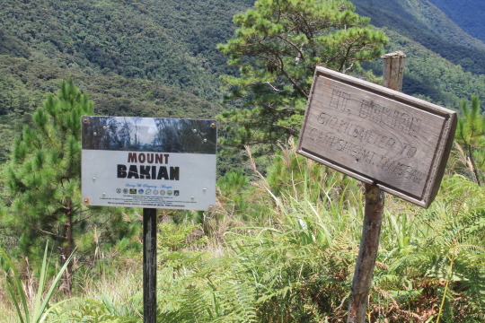
Mt. Bakian 4 of 6
Walking through the mossy forest (which I always enjoy especially if there is no presence of leeches) you can see a lot of spider webs, wild berries and of course greens.
We took photos during take five (which you’ll see below) then proceed again.
Continuing straight, we walk quickly and arrived Mt. Bakian where there are huts and stores where you can eat.
There is always a beauty beyond description
Mt. Bakian pine trees
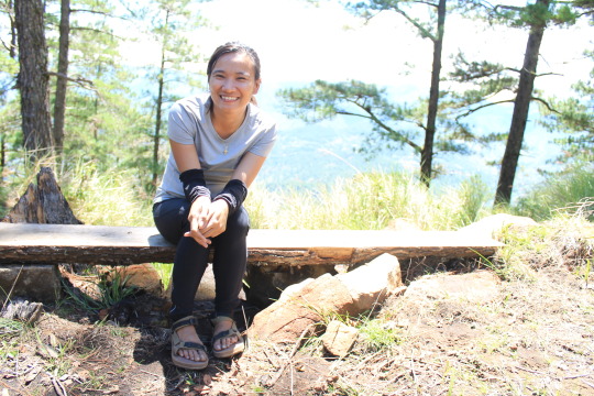
Smile though your knees are aching :D
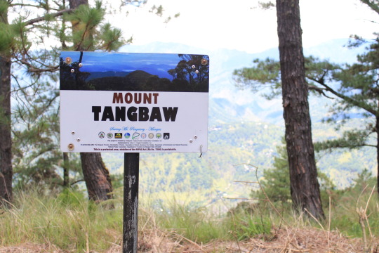
Mt. Tangbaw 5 of 6
By this time I was so sleepy and exhausted because of my knees, I was just being motivated to finish the trail to be honest. The last part going to Mt. Tangbaw was a steep assault, which I have to endure. We got a bit lost, because we are just two walking together that time, so initially we ask the locals which way we have to take. After a long walk, we arrived Mt. Tangbaw and took some photo ops.
We waited for the others to catch up if we will still ascend to Mt. Kom-kompol (6th mountain) or go back trail because Ate Ana said that it will took us 6-8 hours to go down if we did. After several talks, we all decided to ascend to the next mountain.
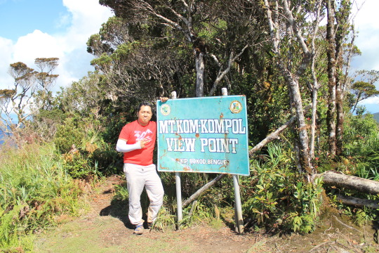
Mt. Kom-kompol 6 of 6
The beginning of the trail is a steep assault that cause me to catch my breath on its half. Reaching the top, I feel my knees breaking and took a rest before proceeding again.
The trail was established and assaults. I was careful in each step because grasses are covering the trail. There are some rope segments along the trail to Kom-kompol because the trail is narrow and mixed to assault and down.
After I think an hour, we arrived Mt. Kom-kompol.
There is a view point where you can see Mt. Pulag along with other mountain ranges.
After taking some photos, we descend the trail. Honestly, it was hard for me because I still fear going down the trail (because of Maculot injury) and I decided to use my trekking pole. The first part of the trail is surrounded by abundant pine trees which I really enjoy. This kind of trail is what hikers will enjoy running, some of them run, but I have to walk slowly.
The second part if was open, and exposed to the heat of sun. On our way, we saw the marker of Mt. Tingeban and a shed where I rest and eat. The trail was made up of tiny rocks and loose soil where I badly fell down on my kness, thankful that I am not alone that time.
We took some photos in the bridge and continue walking down the trail.
The last part trail which is the most tiring is made up of steep incline and decline cemented road. I was annoyed this time because we’re thinking we are lost because the road doesn’t show any end and I don’t have my phone with me and his phone is already drained. (LOL :D If I were along on that road I guess I will panic immediately.) We’re still motivated to go on and wait for motorcycles to pass us through so that we can ask if we’re still on the right path (LOL). We just took some photos to send us good vibes.
My very own guide and porter mehehe.
After the long painful walk, we arrived the jump off point at 6:30pm (not later than). We wash ourselves and leave for the most awaited side trip – Good taste.
That ends our adventure.
Thank you to Kuya John and Ate Ana.
Congratulations to the 15 brave hikers that are with me (Ate Robee, Kuya Poy, Tin, Mark, Kuya Kenny, Mhay, Ate Gretchen, Kuya Joey, Kuya Joel, Juzz, Nox, Kuya Josh, Ate Fatima, Alelie and Floyd.) Hope to hit the trail with you or to ssee you along the trail.
Kuya Josh, Ate Fatima, Alelie, thank you for walking with me along some parts of the trail. And thank you for sharing your trail foods :D
Ate Robee, thank you for inviting me again.
Floyd, thank you for being my personal guide and porter, for patiently waiting for me along the trail, for the trail foods, for the photos, and for making sure I am safe. (Mt. Pigingan is waiting LOL) Thank you for coming with me.
Mt. Purgatory, thank you for the great experience! You’ll be remembered.
NOTES:
1. The mossy forest is long and you can feel the cool breeze.
2. There is a habal-habal present along the trail.
3. There are steep assaults (bring extra knees LOL), make sure you prepare.
4. There are shelters which you can opt if you’re on a 2D1N itinerary.
5. There are few water sources.
6. Descending the trail offers tiny rock, loose soil and later on cemented road.
7. Have all the positive vibes along the way, yay! <3
Ps. Some photos are captured by Alelie Pelagio and Floyd Philip Villarante. Thank you beshies! :D
MTPURGATORYJULY92017
1 note
·
View note
Last Seen Blogs