
bellefemmecamille-blog
Camille
Hike > Travel > Talks & Thoughts
20 posts
Don't wanna be here? Send us removal request.
Last Seen Blogs

nighttime-doodles
nighttime_doodles

jarofalicesgrunge
Artificial Red

se-mona-blog
Inflames

sana134134-blog
Untitled

Text
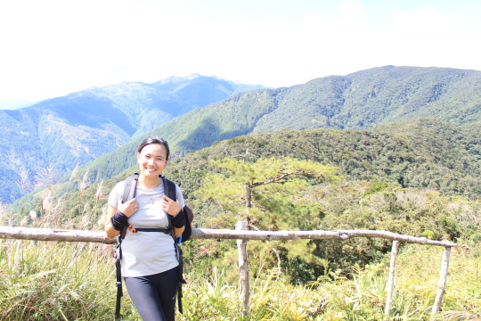
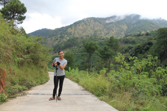
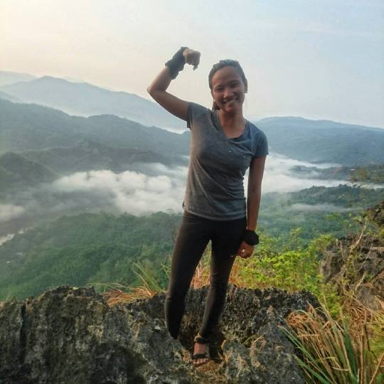
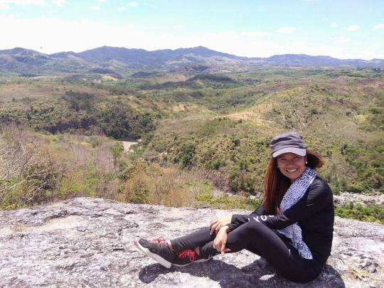
MT. CAYABU - MT. MAYNOBA TWIN DAY HIKE (My 9th mountain)

(CAYABU-MAYNOBA LOOP)
Tanay, Rizal
Trailhead: Brgy. Cayabu, Tanay, Rizal
LLA: 14°36′22.4′′N, 121°25′18.6′′ E, 728 MASL (+470m)
Days required / Hours to summit: 1 day / 2-3 hours
Specs: Minor hike, Difficulty 3/9 (Summit); 4/9 (Loop hike), Trail class 1-4
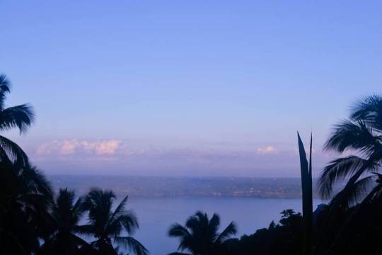
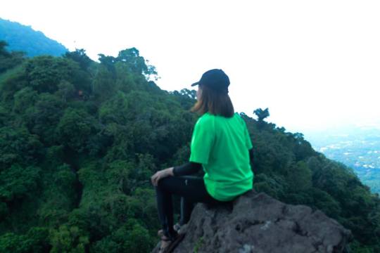
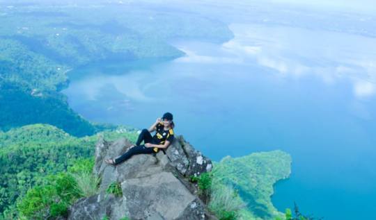
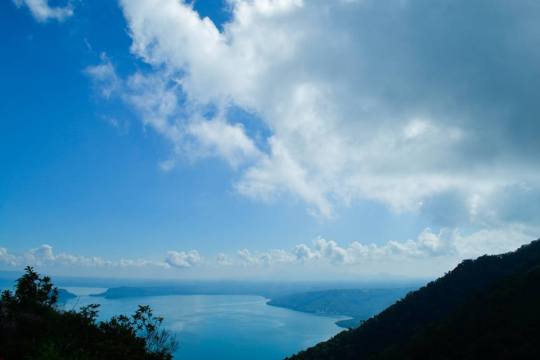
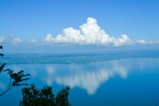
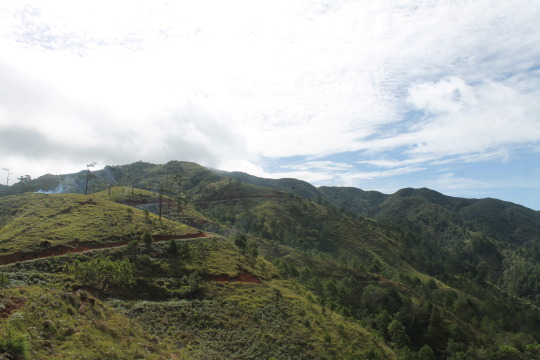
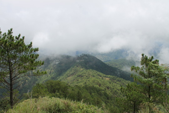
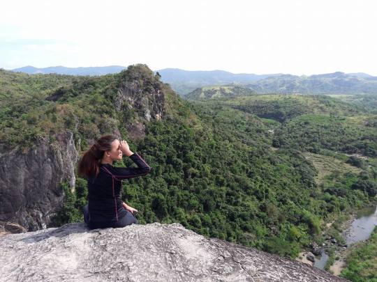
Features: Sea of clouds, scenic views of the Sierra Madre, waterfalls
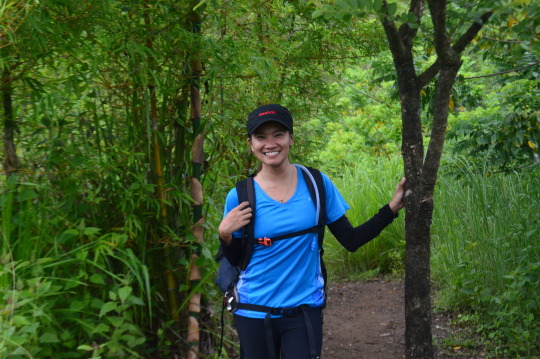
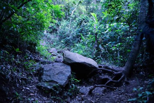
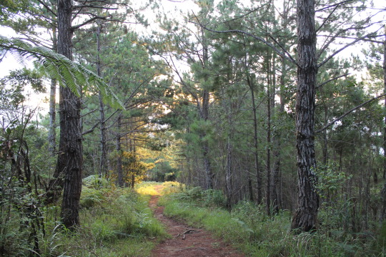
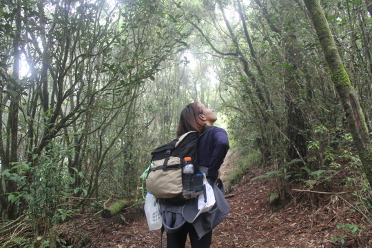
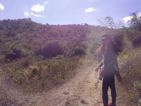
Hi! Thank you for visiting my tumblr account! I am about to share and tell you some tips (feeling expert mehehe) from my latest hike (July 16, 2017) at Mt. Cayabu – Mt. Maynoba, a twin day hike in Tanay, Rizal. They were open for mountaineers last March 2016. It is a loop circuit, which means you have to reach Mt. Cayabu and Mt. Maynoba before circuiting your trail back to the jump-off. One more bonus in the mountain is that along the trail you’ll pass by the big rocks of the mountain trailing down to 8 wonder waterfalls.
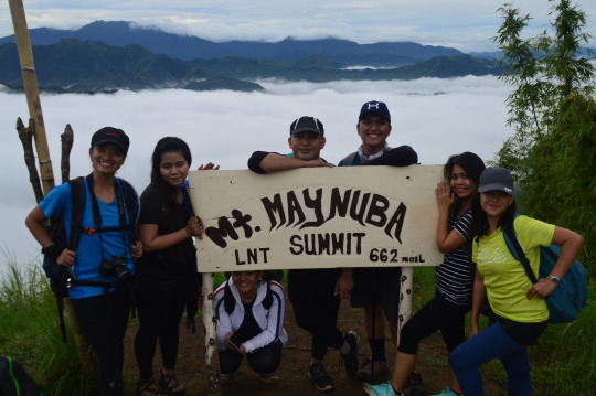
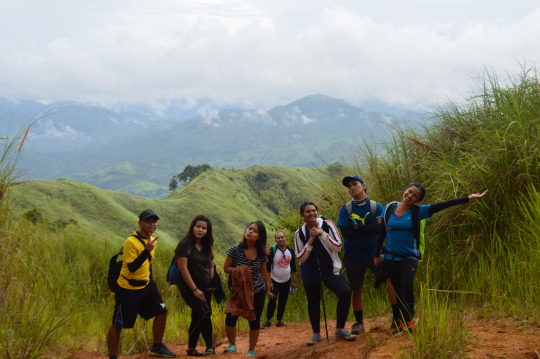
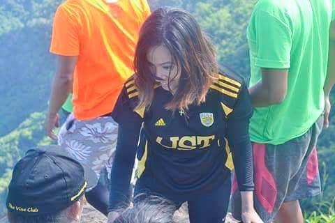
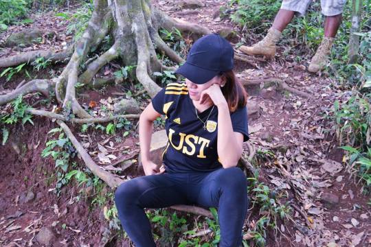
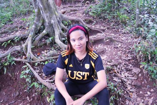
I went there with my college blockmates (Earlind, Jesy, Ray Anne, Gio, Lenard), our professor –Sir Lacerna and Jenny. Two of them are strong first time climbers, which I concluded after the hike and the rest have experienced trekking along trails.
The van was scheduled to leave at 1AM, everyone arrived before time except the driver (LOL, but this is no joke). After some preparations we leave Cubao and travel to Tanay.
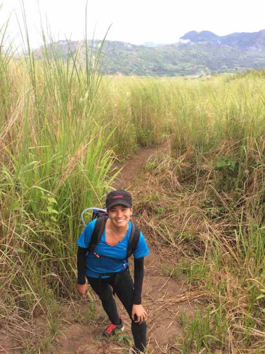
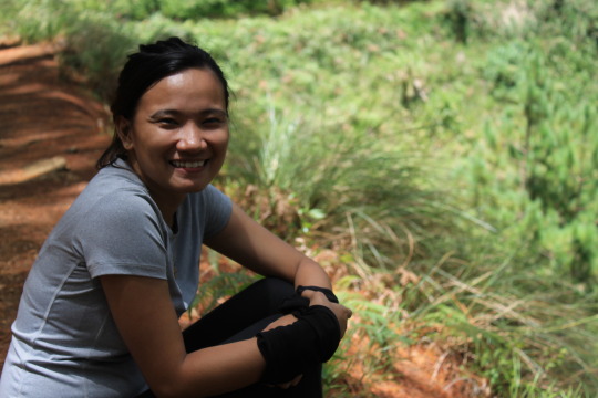
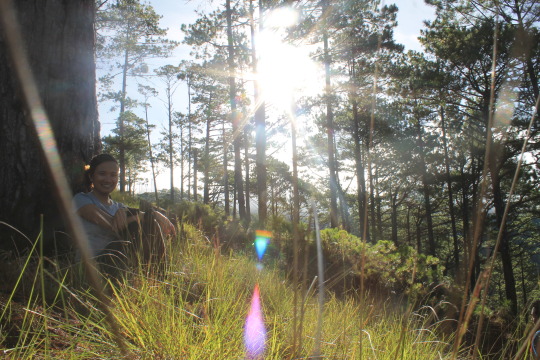
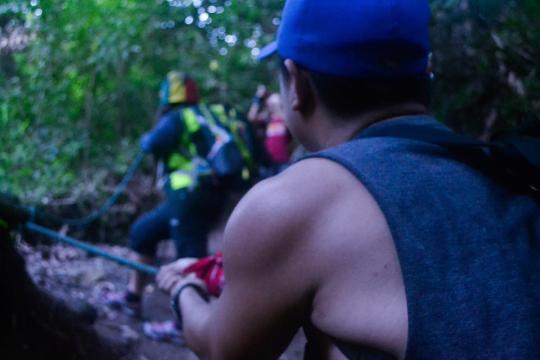
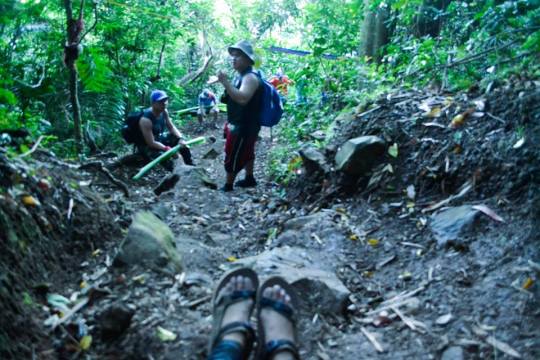
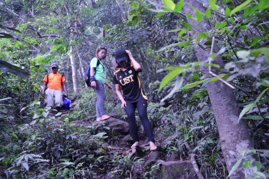
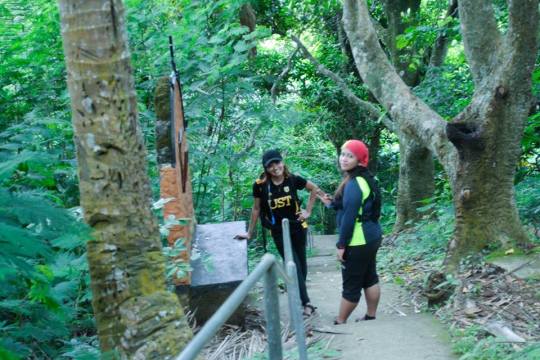
I sat between Lenard and Jenny. We share a lot of catching up while on our way which led us to have no sleep for this hike. We arrived the jump off point 3:00AM and do some orientation and warm ups before proceeding to the hike proper. It was exactly 3:30AM when we started.

At the jump off point before the orientation
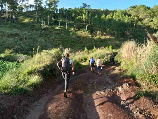
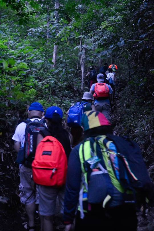
The beginning of the trail was a pure assault, which make each of us catch our breaths. It was a bit muddy that time which make the trek more difficult for us. Of course, it is dark and only two of us brought flashlight so the rest used their phones to light their way.
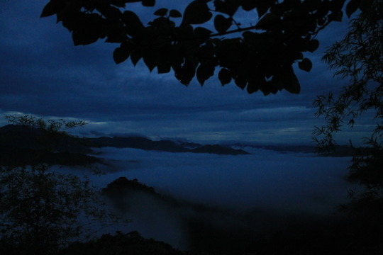
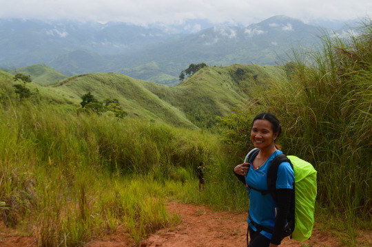
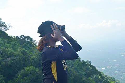
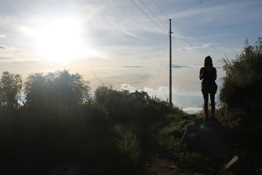
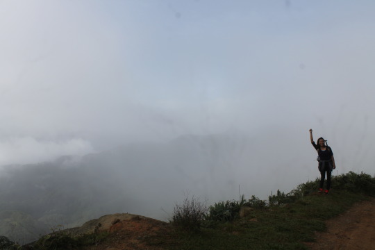
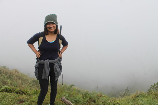
Your shoes will surely slip off the deep muddy trails. It was foggy that morning which assures us that there will be a view of sea of clouds. We arrived at Mt. Cayabu after an hour and half of trek.

Groupie in Mt. Cayabu Marker (L-R Lenard, Jesy, Sir Lacerna, Gio, Jenny, Earlind, Ray Anne)

On take five
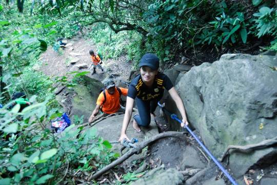
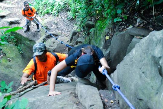
After eating, taking some photos and catching breaths, we leave for the second mountain –Mt. Maynoba.
At first it was a bit descend with some rappelling but most of the trail was a pure assault to its Camp 1.
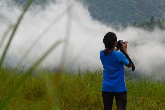
We are all amazed when we saw the thick fog which make us crave to reach the summit. I run with Jenny and Lenard, ascending to the camp 1 while taking photos every time we rest.
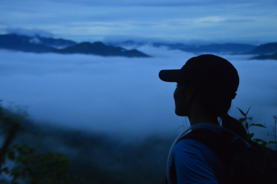
Before you reach the camp 1, you need to ascend to the longest and steepest assault of the hike but surreal, the view was stunning.
AT CAMP 1

Astounding
One with nature

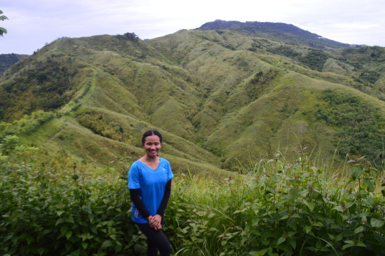
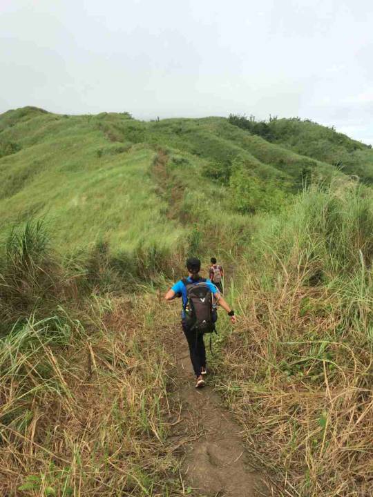
Proceeding to camp 2, there are a lot of talahib along the trail which leave marks on my skin (even I wear sleeves that time). Walking and running along the trail, you will see a lot of amazing landscapes that is sure instagrammable. After a lot of assaults (Yes, I won’t lie. There’s a lot), we reached Camp 2 and the famous Mt. Maynoba marker. I was a bit disappointed because they painted the marker, I bet that the old marker is more beautiful than the new one, nonetheless, we arrived.
Here are some photos along the trail to camp 2.

Forest gangstuh

Great escape

Landscape
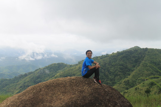
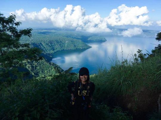
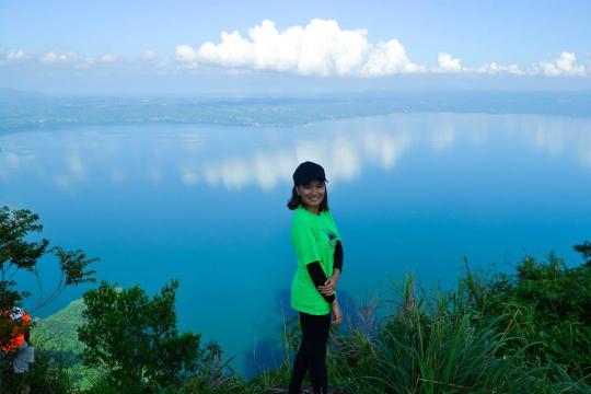
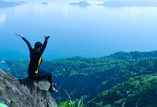
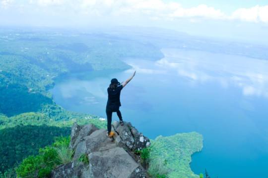
AT THE SUMMIT
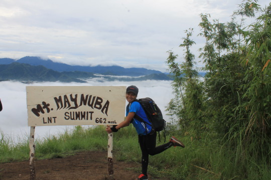
My 9th mountain – Mt. Maynoba, Tanay Rizal

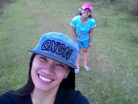
Mandatory Selfie with the hiking buddy - Jenny
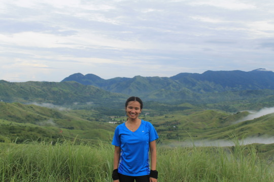
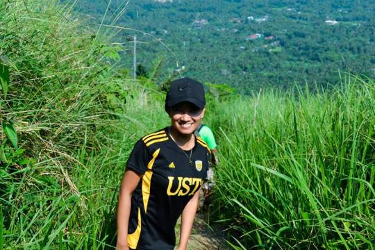
We have our breakfast and took some solo and group photos. After some rest and socials, we ascend to the camp 3, which offer a wide grassland (and yes talahib). This is the kind of trail that hikers will be fun of running.
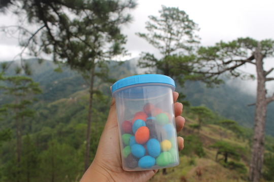
After an estimated 30 minute walk, we arrived Camp 3 and took the longest rest for the hike there. I ate my lunch (burger of course) and rove around the site with Jenny for some photo ops.
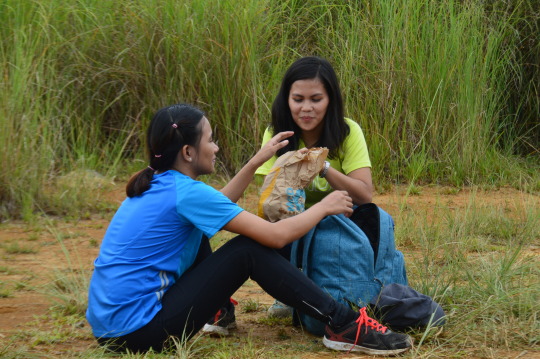
Our favorite Chicken Burger for lunch, Yay!
Been a butiki (lizard) to climb this rock. Found on the way descending
We descend after an hour and everyone is looking forward some dip in the waterwalls. Walking and running down the grassland, we took some group and solo photos. I am walking down with Kuya Ronald and Lenard that time. Kuya Ronald, with the help of Toyota Mountaineering Club discover the trail. He share a lot of stories on how they established the trail and how it attracts Pinoy mountaineers because of its great view of sea of clouds.
TRIVIA: (I found a comment from pinoymountaineer.com from Sir Herbert Espanola -a member of Toyota Mountaineering Club, he said that they accidentally discover the trail when they failed to secure a permit to climb Mt. Irid leading them to discover a trail for a new mountain.) This is exactly what Kuya Ronald, the Vice President of the Tour Guides.
Descending, we saw the 7 out of 8 waterwalls but we decided not to take dip because some of us wants to eat their lunch at the jump off point. We took some photo (which you can see below)

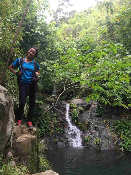
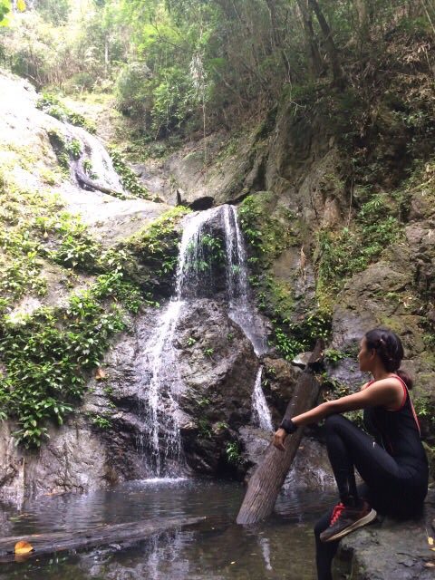
At natatagong paraiso falls
Descending the trail, you’ll have to trek along the rocks, bamboos, and steep down trails. For safety reasons, bring your trekking pole with you or you can get a bamboo stick to help you go down the trail.
You better wear sleeves, I’ve got some scratches from sharp talahib, but it’s just ok, part of being an NPA (LOL)

Be careful in every step descending cause some rocks are wet and muddy

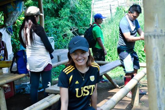
We arrived the jump off point 12:30NN, took a rest and wash up.
That marks the end of our adventure.
NOTES:
1. It is a 10 in 1 destination. Mt. Cayabu, Mt. Maynoba and the 8 wonderfalls (Though it is not the falls that you will expect, it is still great that the climb offers a dip after perspiring)
2. There are no phone signals. NO LTE, NO 3G, H or E. As soon as you are near the jump off point you’ll have not even a bar to send a text message. Surely, you cannot update your followers, nonetheless #lategram and stories on hold :D
3. Bring a trekking pole (Thanks to a friend who brought my trekking pole so my friend can use it) or you can find a bamboo stick along the trail to help you alleviate the pressure.
4. It’s good for beginners but mostly it is assaulted trail. Better bring extra knees (LOL), better prepare, do some leg work outs and warm ups.
5. Wear sleeves. The trail still needs improvement. :)
6. You might get wet descending.
7. You’ll do some rappelling.
Thank you for reading my blog and hope to hit the trail with you!
Thank you Sir Earl for organizing this climb for us.
Thank you Ate Maricar and Kuya Ronald for guiding us along the entire trek.
Thank you Earlind, Gio, Jesy, Ray Anne, Sir Lacerna for trusting me. LOL.
Thank you Lenard for helping me to make this climb possible and for the photos, see you this coming month!
Thank you Jenny, for the photos, for sharing your trail food and for coming with me. More trails and limits to conquer.
Thank you Lord for your creation! You are superb.
Mt. Cayabu-Mt. Maynoba, thank you for the great experience! Sea of clouds, surreal! <3
Ps. Some photos are from Kim Lenard Raypan and Jenny Garcia, thanks guys! :)
0 notes
Text
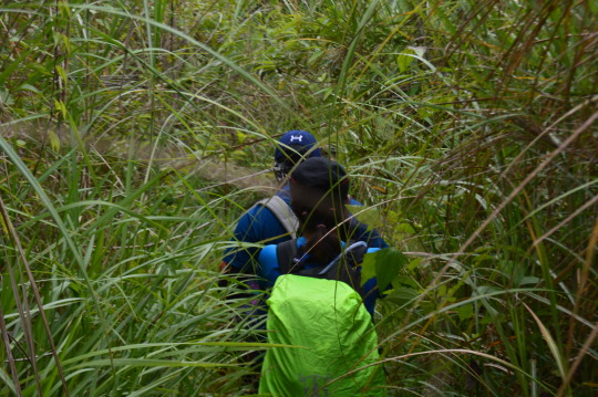
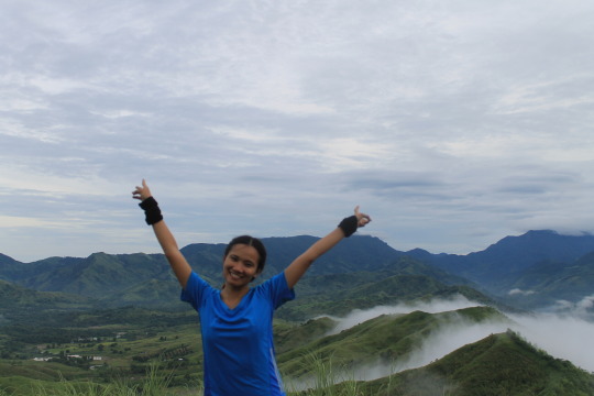
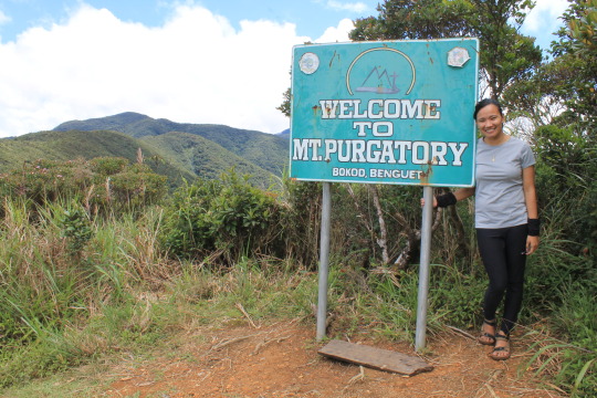
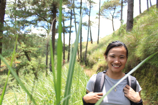
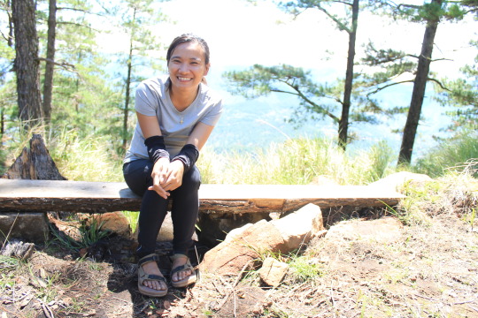
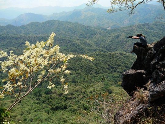
MT. PURGATORY (My 8th Mountain)
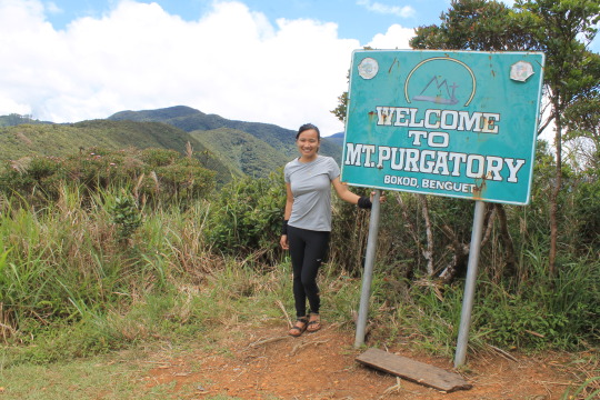
MT. PURGATORY (MT. PACK-MT. KOMKOMPOL)
Bokod, Benguet
Entry point: Japas Jumpoff, Bokod
Exit point: Brgy. Ekip, Bokod
LLA: 2290m (Mt. Pack); 2080m (Mt. Purgatory); 2329m (Mt. Komkompol)
Days required / Hours to summit: 2-3 days / 4-5 (Pa); 5-7 (Pu); 9-11 (K)
Specs: Major climb, Difficulty 6/9, Trail class 1-3
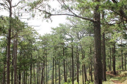
Features: Pine forests, mossy forests, Views of Benguet mountains
(Copied from Pinoy Mountaineer)
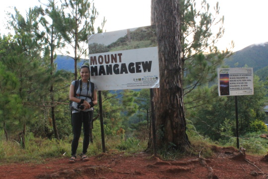
Traverse Mountains: Mt. Mangagew Mt. Pack (2290MASL), Mt. Purgatory (2080MASL), Mt. Bakian, Mt. Tangbaw, Mt. Komkompol (2329MASL) Mt. Tingeban, Mt. Ekip
Hi! Thank you for visiting my tumblr account and you are about to hear my thoughts from my recent adventure (July 9, 2017) in Mt. Purgatory, Bokod, Benguet. Here’s my Mt. Purgatory goes…
I was invited to do a complete traverse of Mt. Purgatory which passes through 6 mountains (that surprised me to 8). Reading some blogs about the trail, at first I don’t find it exciting to do so because the trail doesn’t offer much view but I know will be a challenge so I go, and maybe because of my curiosity what the trail will offer to make it called Mt. Purgatory.
Our van was scheduled to leave at 8PM and everyone arrived before time except for a member that was stucked in terrible traffic. She arrived 9PM in the meeting place and we immediately leave after some short talk.
Everyone was all busy sharing their previous hikes along the road.
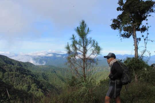
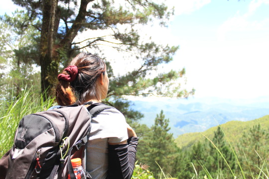
At around 4:00AM, we arrived at the jump off point, this is after all the bumpy, zigzagged road of Benguet that cause me not to sleep and hit my head. After all the preparations and photo ops, we leave and start to hit the trail with our guides Kuya John and Ate Ana. Mt. Purgatory is located between Mt. Pulag and Mt. Ugo, there is an available trail for those who want to make it traverse.
The trail began with steep assaults making everyone catch their breaths. I still have to endure my knee pain from the previous hike (Maculot) so I walk slowly and arrived the first mountain in an hour and 15 minutes.
If I am not mistaken, there are 2 waiting sheds before reaching the first mountain, and I stop in the second to take five. As expected it was cold that cause me to sneeze. :D After taking photos, we leave immediately because we still have 5 mountains to go.
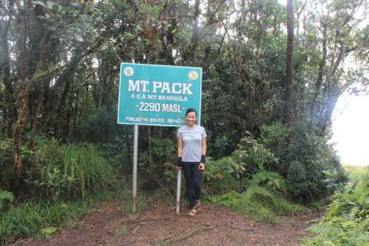
Mt. Pack 2 of 6
Far from Mt. Mangagew, Mt. Pack is one of the peaks in this traverse. During the trek, I feel my eyes bit heavy and I really wanted to sleep for a while, but I know there is so many way to go so I just decided to eat some trail food to keep my energy. The cool breeze keep me going and I know that there is much more ahead. After some assaults and abundance of pine trees, we arrived the second mountain. We took couple of photos and then proceed to the third mountain. By the way, beside the marker of Mt. Pack, you can see some mountain ranges and Mt. Pulag.
(Below are some photos captured along the trail)
This is after one of the assaults along the trail and I have to make this obligatory photo LOL
Because there is a clearing, I spotted this one, defines captivating.
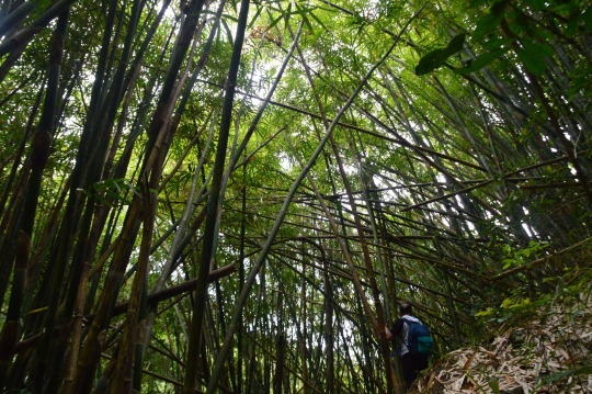
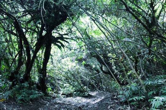
We enter the first mossy forest to reach Mt. Pack.
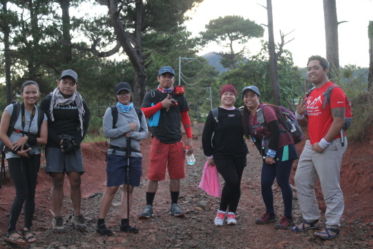
GROUPIE :D
Mt. Purgatory 3 of 6
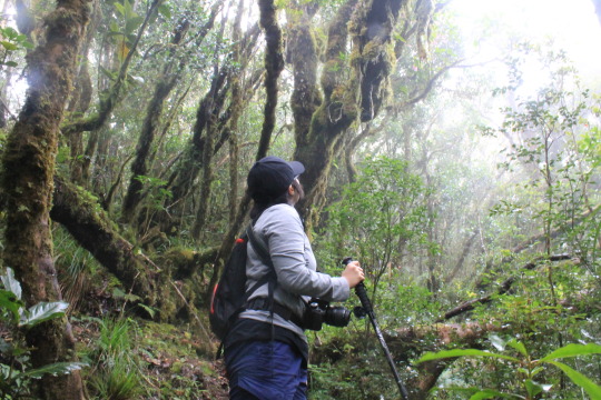
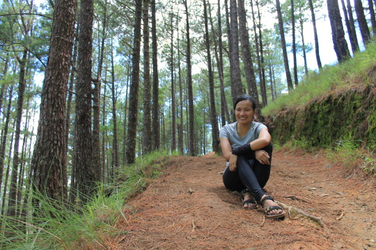
Before entering the mossy forest - that is said to be present in the entire trail to Mt. Bakian, I feel my knees breaking that cause me to slow down again.
You can feel the cold breeze in the entire forest and you’ll surely feel amazed. Yet along the trail, I found it harder to put weight on my knees, good thing that there is a friend to wait for me and push me to go along.

First part of the trail was assault, where you have to carefully place your foot in woods or else you may twist your ankle, followed by down trail to Mt. Purgatory. After 3kms walk, we arrived Mt. Purgatory and eat our lunch. There is a clearing and from the shed, Mt. Pulag is seen along some mountain ranges. After a quick lunch and photo ops we leave and continue walking in the mossy forest to reach Mt. Bakian.
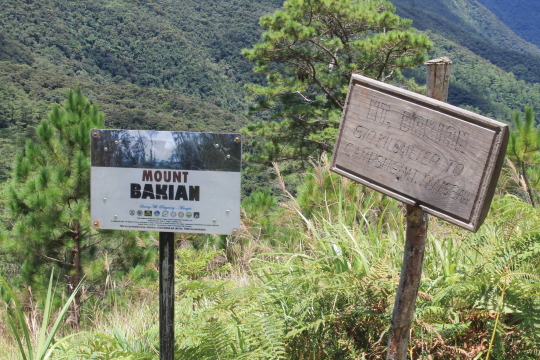
Mt. Bakian 4 of 6
Walking through the mossy forest (which I always enjoy especially if there is no presence of leeches) you can see a lot of spider webs, wild berries and of course greens.
We took photos during take five (which you’ll see below) then proceed again.
Continuing straight, we walk quickly and arrived Mt. Bakian where there are huts and stores where you can eat.
There is always a beauty beyond description
Mt. Bakian pine trees
Smile though your knees are aching :D
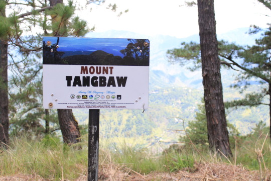
Mt. Tangbaw 5 of 6
By this time I was so sleepy and exhausted because of my knees, I was just being motivated to finish the trail to be honest. The last part going to Mt. Tangbaw was a steep assault, which I have to endure. We got a bit lost, because we are just two walking together that time, so initially we ask the locals which way we have to take. After a long walk, we arrived Mt. Tangbaw and took some photo ops.
We waited for the others to catch up if we will still ascend to Mt. Kom-kompol (6th mountain) or go back trail because Ate Ana said that it will took us 6-8 hours to go down if we did. After several talks, we all decided to ascend to the next mountain.
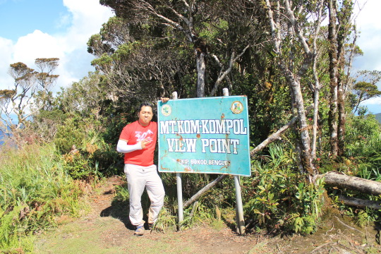
Mt. Kom-kompol 6 of 6
The beginning of the trail is a steep assault that cause me to catch my breath on its half. Reaching the top, I feel my knees breaking and took a rest before proceeding again.
The trail was established and assaults. I was careful in each step because grasses are covering the trail. There are some rope segments along the trail to Kom-kompol because the trail is narrow and mixed to assault and down.
After I think an hour, we arrived Mt. Kom-kompol.
There is a view point where you can see Mt. Pulag along with other mountain ranges.
After taking some photos, we descend the trail. Honestly, it was hard for me because I still fear going down the trail (because of Maculot injury) and I decided to use my trekking pole. The first part of the trail is surrounded by abundant pine trees which I really enjoy. This kind of trail is what hikers will enjoy running, some of them run, but I have to walk slowly.
The second part if was open, and exposed to the heat of sun. On our way, we saw the marker of Mt. Tingeban and a shed where I rest and eat. The trail was made up of tiny rocks and loose soil where I badly fell down on my kness, thankful that I am not alone that time.
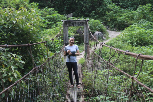
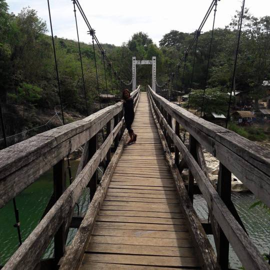
We took some photos in the bridge and continue walking down the trail.
The last part trail which is the most tiring is made up of steep incline and decline cemented road. I was annoyed this time because we’re thinking we are lost because the road doesn’t show any end and I don’t have my phone with me and his phone is already drained. (LOL :D If I were along on that road I guess I will panic immediately.) We’re still motivated to go on and wait for motorcycles to pass us through so that we can ask if we’re still on the right path (LOL). We just took some photos to send us good vibes.
My very own guide and porter mehehe.
After the long painful walk, we arrived the jump off point at 6:30pm (not later than). We wash ourselves and leave for the most awaited side trip – Good taste.
That ends our adventure.
Thank you to Kuya John and Ate Ana.
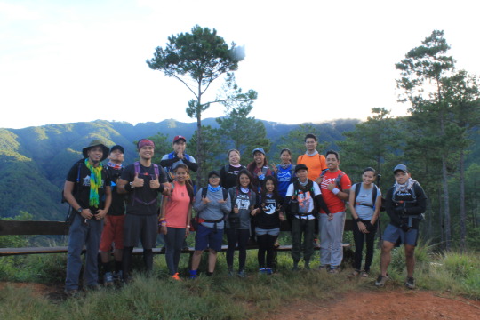
Congratulations to the 15 brave hikers that are with me (Ate Robee, Kuya Poy, Tin, Mark, Kuya Kenny, Mhay, Ate Gretchen, Kuya Joey, Kuya Joel, Juzz, Nox, Kuya Josh, Ate Fatima, Alelie and Floyd.) Hope to hit the trail with you or to ssee you along the trail.
Kuya Josh, Ate Fatima, Alelie, thank you for walking with me along some parts of the trail. And thank you for sharing your trail foods :D
Ate Robee, thank you for inviting me again.
Floyd, thank you for being my personal guide and porter, for patiently waiting for me along the trail, for the trail foods, for the photos, and for making sure I am safe. (Mt. Pigingan is waiting LOL) Thank you for coming with me.
Mt. Purgatory, thank you for the great experience! You’ll be remembered.
NOTES:
1. The mossy forest is long and you can feel the cool breeze.
2. There is a habal-habal present along the trail.
3. There are steep assaults (bring extra knees LOL), make sure you prepare.
4. There are shelters which you can opt if you’re on a 2D1N itinerary.
5. There are few water sources.
6. Descending the trail offers tiny rock, loose soil and later on cemented road.
7. Have all the positive vibes along the way, yay! <3
Ps. Some photos are captured by Alelie Pelagio and Floyd Philip Villarante. Thank you beshies! :D
MTPURGATORYJULY92017
1 note
·
View note
Text
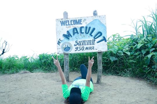
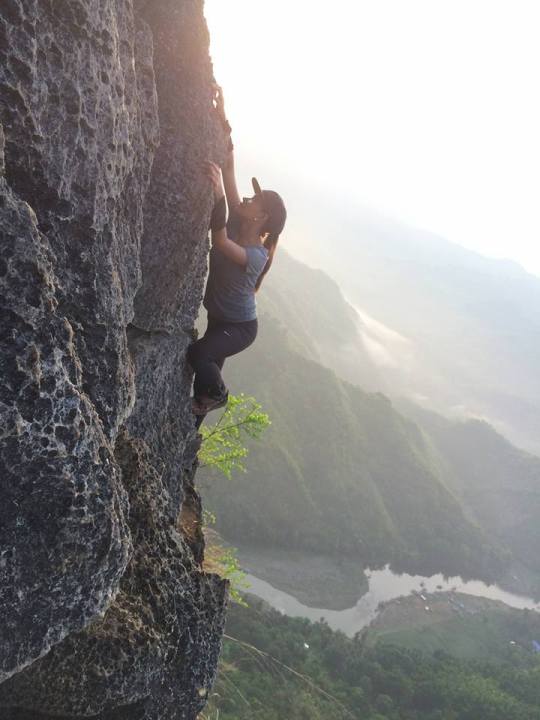
MT. MACULOT ROCKIES-SUMMIT-GROTTO TRAVERSE (My seventh summit)
MT. MACULOT
Cuenca, Batangas
Major Jumpoff: Mountaineer’s Store, Brgy. 7 “Siete”, Cuenca
Exit point (traverse): Brgy 5 (to Grotto), Cuenca
LLA: 13°55 N; 121°2 E; 706 MASL (Rockies) / 930 MASL (summit)
Days required / Hours to Rockies / summit : 1 day / 1-2 hr / 2-4 hr
Specs: Minor, Difficulty 3/9 (Rockies); 4/9 (Traverse) Trail class 1-3.
Features: Scenic views of Taal Lake, rock formations, forests
Hi! Thank you for visiting my tumblr account, and welcome to my world of thoughts and adventure, of course!
This is not just an ordinary hike for me. This happened to be extra special, not just because this is my #birthdayhike (term I heard from them) also because this is the first time I tried to come on a hiking event alone, as in I don’t know anyone from the group even the organizer herself, so it was a bit new for me. (WELL, DON’T ASK ME WHY I’M ALONE. LOL.)
So here is how my Maculot story goes…

Mt. Maculot is really one of the most fame mountains because of its scenic views. Well, I must say, it really has something to offer to those who hit its 3/9 difficulty trail.
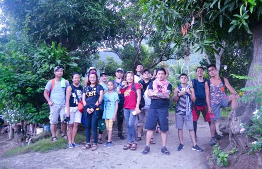
BTW, they are the people behind this story, saying “HI!” to this awesome team for being nice and for taking good care of me and making sure I am safe.

Just like the other mountains, the beginning of the trek is cemented. We walk for about 7-10 minutes to reach the trail itself. Along the walk, I saw different trees and of course, I am into the woods.
After the cemented trail, there is a semi assault to welcome you and 5 minutes from it you’ll reach a rope segment trail.

The trail is good, actually, the assaults will never make you feel that you are trekking long.
Being one of the most favorite in Batangas, you could never go wrong to the number of people you will meet along the trail.


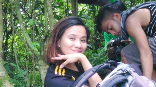
Pwede po magpahinga? Hehe. I guess I was talking with the tour guide asking him some questions about the mountain.On Take five.
We continue walking and climbing until we reach this scenic view.
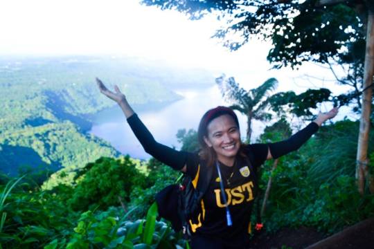
Aside from rocks, Maculot is easily identified for its amazing view of taal lake. I was so happy to witness this site. And really would love to go back here whenever given a chance. (PS. Medyo madami po ‘tong pictures)

Thank you so much to my official photographer LOL.
We continue running along the assaults and rocky trail.
Then someone ask our guide “Gaano pa po kalayo ang rockies?”
Kuya Melvin said “Konti na lang Sir, camp site na tayo.”
So we run as quickly as we can until we reach this point.

BTW, you will encounter a downhill rope segment before you see the final climb to rockies.

We are so excited to see the famous Maculot Rockies, but we REALLY need to WAIT because there are still some groups who came first, so the group decided to take some photo ops around the area.

WITH MY ELEMENT.
Of course, there are some guys in the group who take some candid shots of me and sharing you some of it. :D Haggard si ate girl :D

There’s another point (near the trail where we climb up) where you can also take a legit nice shot. Thanks again for this photo.
UNTIL the long waaaaaaaait is over, it is our turn to take our photo ops to the rockies, and here’s mine :)
Wouldn’t miss this chance to greet myself :D

Here’s more…
These are the breath taking scenes you’ll going to see in the rockies. I won’t mind to climb just to see these.

I am shookt by the way God orchestrated everything I saw, indeed He is awesome.

AMAZING RIGHT? To reach the summit proper, we run and walk the muddy trail for about an hour, and reach the summit to eat our lunch. As usual, nakatulog ako sa summit sa paghihintay :D
So dahil pinagtitripan talaga nila ko, they capture this JWU face of mine :D
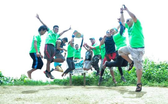
So, we’re about to leave to take our photo ops in the summit proper.

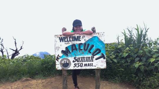
YAY! HAPPENED TO BE MY 7TH – MT. MACULOT, CUENCA BATANGAS! Official! HAHAHA.

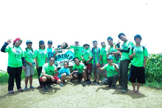
HERE’S OUR GROUPIE.


WAG NÝO PO AKO HANAPIN, AKO PO PHOTOGRAPHER HAHAHA
So from the summit, I slowly walk down the trail cause I got my knees sprained. BUT, DON’T WORRY, MAKAKAAKYAT PA KO, TUMATAKBO PA PO. HAHAHA.
The down trail is really muddy and you’ll see a lot of roots and bamboos where you can hold on to. Special thanks to the team who patiently wait for me kahit mej mabagal ako pababa, pero patakbo pa din tayo. :D LAKAS NYO PO!
SO DAHIL TUMATAKBO PA DIN KAMI AT NAPAKA DULAS, NAG APAK NA SI ATE GIRL. HAHAHA. SORRY NA PO! :D

SO… MEJ BUMAGAL KAMI CAUSE TIME TO TIME I HAVE TO REST, AND DAHIL DIN DON, NAPADAMI ANG STOLEN SHOTS KO. HAHAHA. CREDITS PO. :D MA, OK LANG AKO, PROMISE! HAHAHA.
“GIVE ME A FIERCE LOOK”
OK, SO MEJ HINDI NA MASAKIT, SO WE CONTINUE RUUNNNNNIIIIIIINNNNNNNG THE MUDDY TRAIL. BESH, MAG APAK KA, MAS HEALTHY. HAHAHA.
TRAILS ARE MUDDY AND ROCKY. And for one of my most fave, the rope segment down trail.
Thank you for this photo.
Our goal is to reach the jump-off point 3pm in the afternoon, so we decided to run quick na until we reach the GROTTO, which marks that the trail is about to end.
UNTIL WE MADE IT!

Thank you so much, Mt. Maculot! You’ll be remembered! NA-SPRAIN LANG PO, PERO HINDI PO HIHINTO. Your trails and scenic views excites me to venture more! My experience will be cherished and made more friends because of you! Promise, I’ll get back with you, not too soon.
AGAIN,
Thank you so much team, this hike is fun because of you. Hope to hit the trail again with you.
Thank you so much to our guides and to all the locals who treat us well.
Until the next climb!
THANK YOU FOR READING THIS STORY, AND I HOPE TO HIT THE TRAIL WITH YOU DEAR! :)
PS.
THIS HIKE COST LESS THAN A THOUSAND
YOU CAN HAVE YOUR SIDE TRIP IN TAGAYTAY IF YOU WANT TO! :)
THE GREEN EVENT SHIRT AND BREAKFAST – FREE
0 notes
Text
HOW CAN SOMETHING SO WRONG FEEL SO RIGHT ALL ALONG? :D

June 10, 2017
Jonnas and Maebelyn’s Wedding
1 of 8
Couldn’t believe. Parang dati lang kasi, kaasaran ko lang si Maebelyn at kasama ko lang sa mga trip ko sa buhay. Now, in front of me, SHE’S GETTING MARRIED!
How time flies so fast..
They are starting to build their own home.
I’m so proud of them because at their young age, they stand on their responsibilities of becoming a parent to their son. I admire those guys who can firmly stand with their woman when rages come into the picture of their relationship. Let’s admit it, not all guys are man enough to correct their mistakes. Hindi ko nilalahat, pero we can jump to interview different families and lahat ay may ikikwento na kasalungat nito. Kaya to Jonnas, I salute you, man!
As she walk down the aisle, I really saw how inlove and happy she was. She’s vibrant. Kitang kita sa mata nya how excited she is to marry the man she loves. On the other hand, as Jonnas walk down the aisle, he’s smiles are like of those who won the jackpot prize! Ofcourse, higit pa sa jackpot ang mapapasakanya mga oras na yon.
Someone told me before na not everyone is born for marriage, biblical din naman yon, so naniwala ako. NOT EVERYONE IS BORN FOR MARRIAGE, SO YOU ARE BLESSED ENOUGH IF YOU HAVE SOMEONE WHO IS READY TO COMMIT TO YOU AND WANT TO SPEND THE REST OF THEIR LIVES WITH YOU.
Jonnas and Maebelyn, may you always love each other every waking day of your lives. Congratulations! Excited na kami sa Little Prince natin! :)
0 notes
Text
MT. UGO TRAVERSE (My sixth summit)
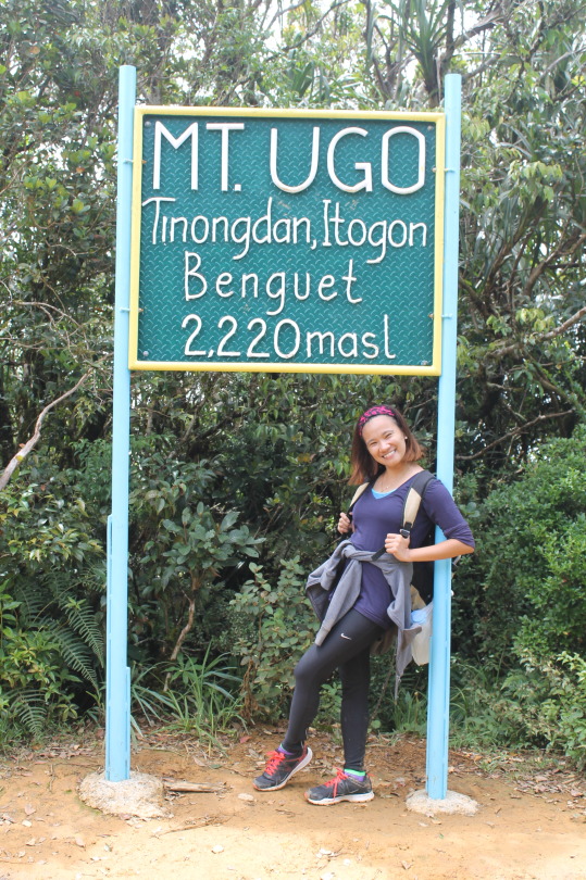
Mt.Ugo, 2,220 MASL
Nueva Vizcaya and Benguet
Jump-off points: Kayapa, N. Vizcaya; Brgy. Tinongdan, Itogon, Benguet
LLA: 16.31916°N, 120.80166°E, 2,220 MASL
Days required / hours to summit: 2-3 days, 9-10 hrs
Specs: Major climb, Difficulty 5/9, Trail Class 1-3
Features: Pine forests, highland villages, views of Cordillera peaks

Truly, there is something about the mountains that keeps me to comeback. The trails may be hard and tough but what awaits are the views that eyes cannot contain. A true rest and a sense of peace.
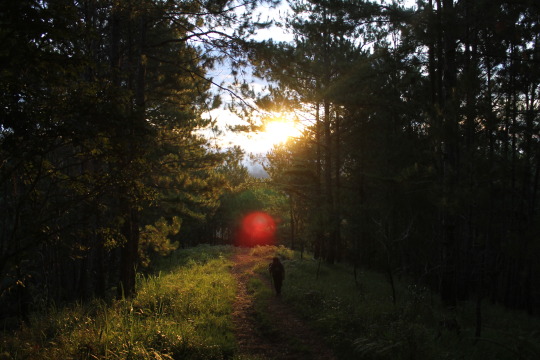
Running up the trail, I saw this very dramatic scene. A scene of hope. Capturing the sunrise always excites me.
Another breath-taking scene. I'm into the woods and really enjoying each steps along the hard trail.
Here's The first peak. Wohooo! Swear my legs and knees are about to say stop, but my trail-heart says "Keep going".
She's so cute, right? A local kid from Vizcaya.

Oh Lord, she keep's on going. HAHAHA. Medyo madamot sa clearing along the trail. Grabe and fog. And seems so cold.
Welcome! HAHAHA. Jusme po. 4 hrs to trail until we reached Benguet from Nueva Vizcaya. Imagine, 4 hrs of upclimb walk. HAHAHA.
Happy Kid! Now she reached the almost 2nd peak HAHAHA. And her knees are crying. :D
The rain started to fell. Lalong nawalan ng clearing along the trail. Foggy, clouds, orange soils are on the way.
This M&M's are my true savior! Thanks for keeping me full of energy along the looooooooong 32km trail.
Where to go? HAHAHA. That's how long the trail is. Actually, yan lang yung nakikita ko. (I think we climb 5 or 6 mountains to reach Mt. Ugo)

Shy type sila beshy. HAHAHA.
This is one of my favorite part of the trail, the mossy forest. Parang sobrang magical while nandyan ako. STUNNING.

Teden! It's almost 11am when we reach the summit. Imagine how tiring and exhausting the trail is, but look, our faces seem to be so happy. Ganon ata talaga no? MAHIRAP, PERO KAYA! Thanks so much, team!

14.5km TO traverse, natapilok si Alelie :( Imagine how painful it is and how looooong is the trail that is waiting. Thanks to kuya josh for assisting her and ofcourse to kuya baryan and kuya jc for carrying her down the trail. Kuya Josh, thank you for guiding me kahit inulan, tumakbo sa batuhan, sa putikan, sa tubig, at sa pagtakbo ng mabilis nung may sumusunod satin. HAHAHAHAHA.

13KM to traverse. Into the woods.
Happy place.
Another favorite.

Hindi na ko masaydong nakapag picture kasi umulan. From 12km down. :( Grabe? Imagine how slippery the trail is. MUD, WATERS ARE ALONG THE TRAIL.
12KM down, we walk run as quickly as we can. 7km we reached last water source. And reached Itogon Jump off finally, running along stones, muds and waters.
This feet will keep climbing and climbing until it can. Thanks to the great experience Mt. Ugo! You will be remembered!
Team (Ate's (Robee, Fatima, Annie, AJ) Kuya's (Josh, Ron, Arvin, Benjo, Marlon and Poy) ofcourse Alelie, thank you! Hoping to hit the trail with you again and to see you along the trail, keep conquering the mountains and your limits!
Kuya Baryan, our guide, thank youuuuuu so much! :)
Kuya JC, thank you for helping us.
LORD, thank You for the protection and grace! Thank You for the strength.
Thank You for the embrace while I'm contemplating along the trail, You are awesome.
MT. UGO TRAVERSE
June 4, 2017
1 note
·
View note
Text
I MISS BIKING

Mehehe :3 I guess, ito talaga ang namiss ko :D TAN LINES. HAHAHA.

Alam ko biglaan lang tong ride na to, Luneta and Moa. Naisipan k oayain yung isa kong kuya tapos ayon, padyak na. Iba ata nagagawa ng bike :3

Minsan, night ride din. Napaka itim ko na dyan tapos ang dilim pa. Saan ba ko dyan? HAHAHA

Happy kid. HAHAHA. Hindi ko alam bakit ako tumatawa dyan. HAHAHA. I guess, palagi naman talaga kong tumatawa. HAHAHA
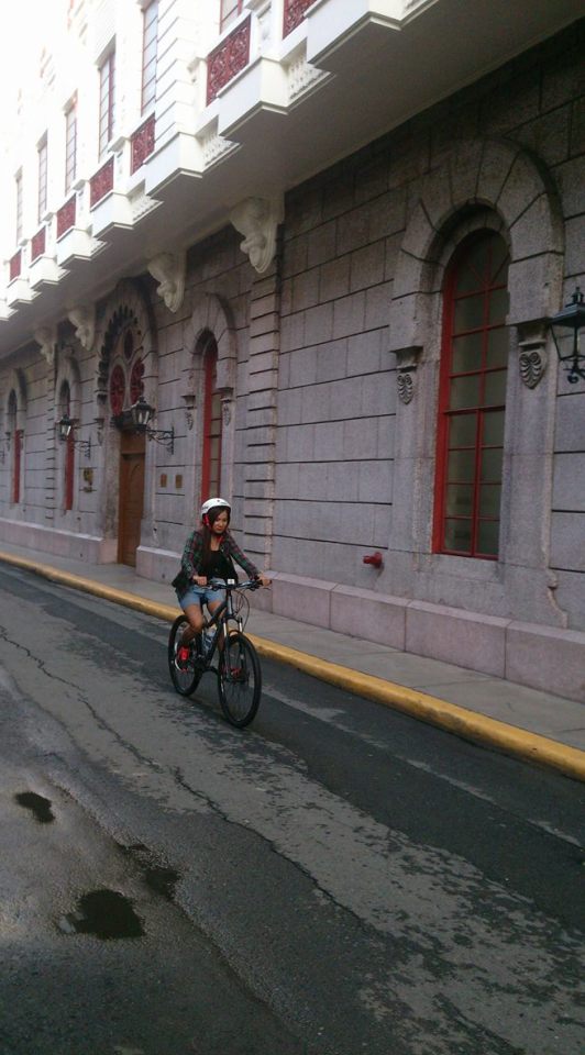
Ang cute nito, pero sana land scape no? HAHAHA. Miss ko na magbike, when the time comes na pwede na ulit at may time na mehehe :3 WILL SURELY GO WHERE TRAILS ARE!
#Bikegirl #Trinx #Kid
0 notes
Text
MONTALBAN TRILOGY (My third, fourth, fifth summit :D)
IN ORDER:
1. MT. BINACAYAN
2. MT. HAPUNANG BANOI
3. MT. PAMITINAN
MT. BINACAYAN
LLA: 14°43′30.5′′N 121°11′26.1′′ E 424 MASL
Days required / Hours to summit: 1 day / 1.5-3 hours (P); 2-3 hours (B)
Specs: Minor, Difficulty 3/9 (P); 3/9 (B) / Trail class 1-4
Features: Limestone formations, scenic views of Sierra Madre and Rizal province
MT. HAPUNANG BANOI
Major jumpoff: Brgy. Wawa, Rodriguez, Rizal
LLA: 14°44′25.3′′ N, 121°11′30.4′ 517 MASL (+460m)
Days required / Hours to summit: 1 day / 2-3.5 hours
Specs: Minor, Difficulty 4/9, Trail class 1-4 with limestone scrambling
Features: Limestone formations, scenic views of Sierra Madre and Rizal province

MT. PAMITINAN
Major jumpoff: Brgy. Wawa, Rodriguez, Rizal
LLA: 14°43′51.7′′N 121°11′29.2′′ E 426 MASL
Days required / Hours to summit: 1 day / 1.5-3 hours (P); 2-3 hours (B)
Specs: Minor, Difficulty 3/9 (P); 3/9 (B) / Trail class 1-4
Features: Limestone formations, scenic views of Sierra Madre and Rizal province
This is my first trilogy hike!
Glad I was able to made this one! :) (Thank you Lord!)
Each of the three summits are all superb climb. :) So far, this is my favorite trail. All the scenic views are uncontainable and edges are really breathtaking!
Mt. Binacayan, which is the first mountain we climb, offers a breathtaking sea of clouds. Wag na lang kayo patanghali besh para abutan nyo talaga. There are assaults, i mean rock assaults. There are also trees along the trail, so hindi mainit, kaso ayon nga wag na kayo patanghali.

BTW, here’s one of the favorite sa Binacayan, the buwis buhay position in the edge. Don’t worry besh, it’s safe naman and kayang kaya mo. :)
We descend sa jump off to eat our early lunch followed by an ascend to Mt. Hapunang Banoi. Besh, please bring your gloves and remove your cap kundi untog ka talaga. Hahaha.
So, heading to Mt. Hapunang Banoi, the trails re all good because it is full of trees but as we continue, puro mga matutulis na bato na ang aakyatin mo. I can’t take so much picture this time kasi medyo nagmamadali ata ako nito, sa mga stop over na lang talaga ko nagpipic, so here’s what I got.

For me, medyo challenging makaabot sa summit kasi besh, napaka init ng mga bato at napakasikip ng mga daanan, and additional, walang puno sa summit so negra ka talaga pagbaba, here’s what my eyes saw in the summit.
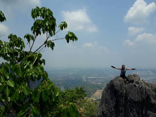
LASTLY, the Rizal’s most favorite, Mt. Pamitinan.
So bear with me, nakatulog talaga ko sa trail dito hahaha. Mahirap kaya maghintay hahaha, so tinulog ko na lang.

But, ito talaga, there is also a buwis buhay must sa trail, and here it goes.

Thanks to Kuya Jino and the rest (12 joiners) for making this trail a memorable one. Ofcourse, special thanks to our tour guide, Kuya Bong and Kuya Eagle who serves not just guides but photographer as well (credits to them to all the buwis buhay shots).
Big thanks to Sir Ged for organizing this trilogy hike, more power to you and to your team! :)
As per me, among all the three, regardless Mt. Hapunang Banoi is the highest and the most difficult (4/9), the hardest mountain for me to climb is Mt. Binacayan. Una kasi namin yon inakyat, so nag aadjust pa legs ko :D HAHAHA. Each mountain tops naman, mahitrap akyatin eh (parang yung nililigawan mo :D, MAHIRAP PASAGUTIN) but once you get there, woooo! sulit!
PS. Gloves, Water and Cap, dontcha forget.
And, also, along the trail may mga tindahan din ng shake, softdrinks, saging, itlog etc, pwede ka bumili.
So where to next? Baka sa next holiday pa, cause ofcourse work is important too! :D :D
More summits to go! :)
0 notes
Text
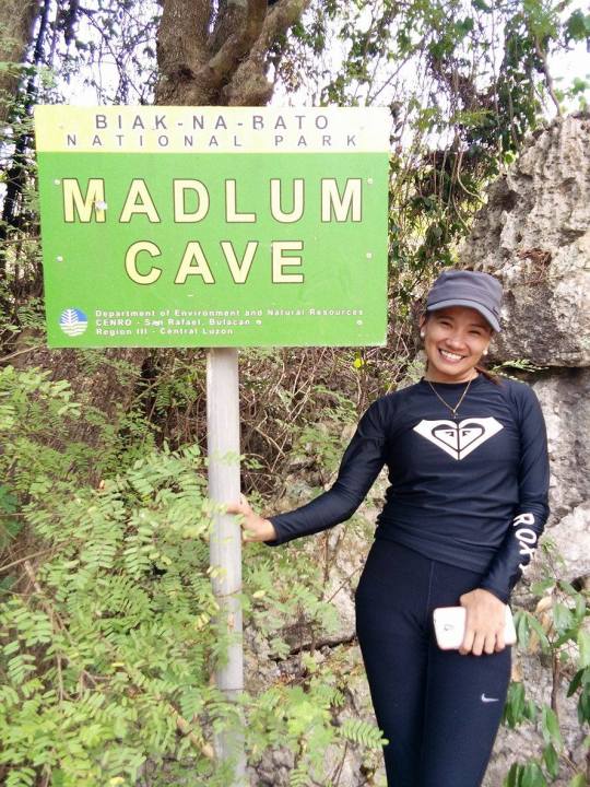
MT. GOLA (My Second Summit)
MT. GOLA
San Miguel, Bulacan
Major jump-off: Sitio Madlum, Brgy. Sibul, San Miguel
LLA: 15°15.11’N; 121°1.22′ E; 196 MASL
Days required / Hours to summit: Half-day / 1 hour
Specs: Minor climb, Difficulty 2/9, Trail class 1-2
My second summit :)
Trails are a bit harder than the first one. There’s a little rappelling and a lot of assaults.

Besh, Mt Gola is Mt. Manalmon’s twin hike, so to go there, you have to descend up to the river crossing and ascend again.
As I’ve said, this is a bit challenger than the usual because of it’s rock assaults, and at the same medyo mainit kasi wala masyado puno.
But definitely, a superb summit, views are Mt. Arayat and sierra madre across the scenic view.

PS. Walang lilim sa summit :( iniiiiiiiit!
PS. Before you proceed to another part of the trail, there is a store where you can buy food and water.
DAMAGE:
300 additional for the tour guide.
0 notes
Text
MT. MANALMON (My First Summit)
MT. MANALMON
San Miguel, Bulacan
Major jump-off: Sitio Madlum, Brgy. Sibul, San Miguel
LLA: 15°15.11’N; 121°1.22′ E; 196 MASL
Days required / Hours to summit: Half-day / 1 hour
Specs: Minor climb, Difficulty 2/9, Trail class 1-2
Climbed Mt. Manalmon twice! Both hikes are superb! :)
Trails are not that hard, but will surely excite you to climb one step higher to reach the summit.
Knowing that Mt. Manalmon is a friendly climb to beginners, I have no doubt that this experience will be of so much fun and will lead me to crave more of the mountain tops.
Manalmon offers a walk in the usual forest. Along the trail, you'll see various trees which you can reach its fruits without even jumping (5"1' ako besh) Wala din masyado assault, aside sa flat rock assault before you reach the summit. Twice na ko nakarating dito, both hikes, mainit. Hahaha. So, better magdala ng madaming tubig and ibalot mo sarili mo hahaha.
For this hike, DIY actually, I am from the Municipality of San Miguel kasi kaya may sasakyan doon na magagamit. Tour guide lang talaga ang damage sakin which cost us 300 pesos, entrance fee of 20 pesos upon entering Sitio Madlum and 10 pesos for registration and environmental fee doon sa mismong jump off kung saan you'll get to know your tour guide. Total: 330 pesos (Invite your friends para mabawasan pa :D)

Before you reach the jump off, you will cross a wooden bridge, makikita mo na din doon yung monkey rope na pwede mo din i-try which costs P25. Madlum River is very inviting because if its green color. You'll see natives na naglalaba din don and soldiers na nagtetraining. Quite disturbing lang kasi may videoke near the river, as per me, better na wala so that people who visits the place will still experience the serenity of the place.
So along the trail, madadaanan yung Madlum Cave, you can try it also but you have to add P150 for the tour guide fee, so when I went there, sinubukan din namin.
As you expect, malamig sa loob, walang tubig dito sa cave na to and is easy compare sa bayukbok cave which is another cave that you can enjoy when you're in the sitio. Tinry din namin 'to and we add 200 pesos for the tour guide. Bayukbok cave also amazed me.
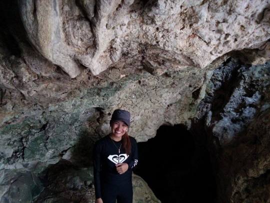
You can see different rock formations and stalagmites, stalactites as you look above. They are really shining. There are just some cases that you have to be really careful, baka mauntog ka. Or baka matisod ka, may mga baging kasi. There's a time na sobrang bumaluktot talaga ko, para magkasya ko. Hahaha.

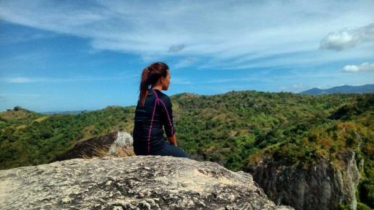
In the summit, aside from the rock assault, you can also enjoy the campsite. Sobrang lakas ng hangin. You can also see Mt. Gola (Manalmon's twin hike-my second summit). Mt. Manibo which is for now, close pa po. The summit experience is not just instagrammable but will surely give you a sense of peace and calmness.
So, thank you so much Sitio Madlum Eco tours! Your staffs and team are really accommodating, especially the tour guides (Fe, on my first time and Kuya Jhun for our second climb).
Thank you for coming with me! Insans and my two best boyfriends, until next climb.
Will definitely love and cherish you, Mt. Manalmon! Thank you for the wonderful experience. See you again, soon! 💕

DAMAGE:
Manalmon Hike (330 pesos only)
SIDE TRIPS:
Madlum Cave (150 pesos)
Bayukbok Cave (200 pesos)
Monkey Rope (25 pesos)
Ps. There are stores in the jump off where in you can buy food and bag tags.
0 notes
Text
25 SUMMITS BEFORE THE AGE OF 25
For more adventures, more travels and more mountain tops! GOALS
0 notes
Text
MY LIFE, MY INSPIRATION, THE REASON BEHIND MY BLISSFUL LIFE
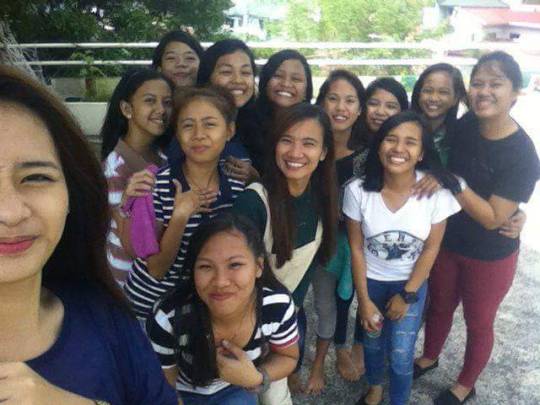
MY DREAM TEAM

The very reason of my dedication and sheer hardwork during my college times and discipling days are this young girls. They transformed me and pushed me to become the person I am now. They believe in my leadership and my ability to lead them. No wonder why the Lord had blessed them with so much more.

We shared a lot of fun, sad, ups and downs together. They are present whenever I experienced something happy nor something bad. I am present also in their downfalls and success, making sure that I am there to pick them. They’ve been my daily dose of happiness, my dose of satisfaction, glory and pride.
In the picture, they just completed my valentines day. :) Guess, I don’t need a boyfriend to celebrate this day with, they are more than just enough.


My life become so meaningful with them having on it. They are my source of joy, inspiration, motivation and my pain too. But, they are worth everything of it.

To my young ladies, I am yours. I am with you with all my heart and soul. I am in a very low state of proposing that I want to be with you for the rest of my life. I love you with all of me, and ate April will do everything it takes to see you growing, to see you happy and to see you succeeding in your journey with the Lord.
Couldn’t imagine what life is without you on it.
0 notes
Text
TESTING :D

My very first villain shoot :D Didn’t give justify to the photos. :D
0 notes
Text
Masscommunicator si ate girl :D

I took up BA Broadcast Communication at the Polytechnic University of the Philippines, Sta. Mesa Manila. I just graduated last December 2016. Nag aral, nadropped, bumagsak, umiyak, nagsummer, grumaduate ang drama, but I still believe in the reality of my dreams and never let it die. So ayan, graduate na syaaaa!
Sabi nila, madali lang daw ang masscomm, sabi yon ng mga students na akala eh pashoot shoot lang kami, papicture picture, pasulat sulat. Kailangan din kaya ng creative na utak at skillful na kamay sa masscom. Walang mahirap at madali na course, lahat yon nasa estudyante, kung gaano sya kadetermindao na makatapos.

Photo taken during one of our airing in DZME 1530, wherein I finished my 200 hours Radio Internship. Experienced a lot in the field and even in the newsroom.

Blessed to be part of the CNN News and Current Affairs Department for my television internship.
0 notes
Text
YOUNG WOMAN OF JERUSALEM

Above all the personalities that you will know about me, isn’t it surprising to know that I am a pastor?
In the picture, I am privileged to minister to the young people of my home church. It’s hard sometimes to live a life that is in the spotlight.Don’t get me wrong, it’s not myself that I want to be glorified but the Lord. :) What I am saying is that it’s not easy to live with expectations but is surely rewarding.
“Part time student, full time disciple”
THAT ONE INTRODUCED ME TO JESUS
May 20, 2016
0 notes