#Vancouver Harbour
Text
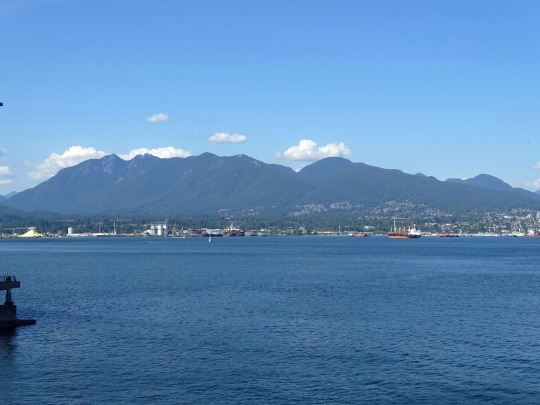
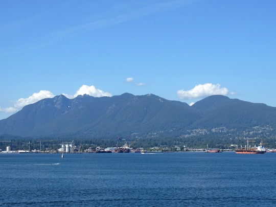
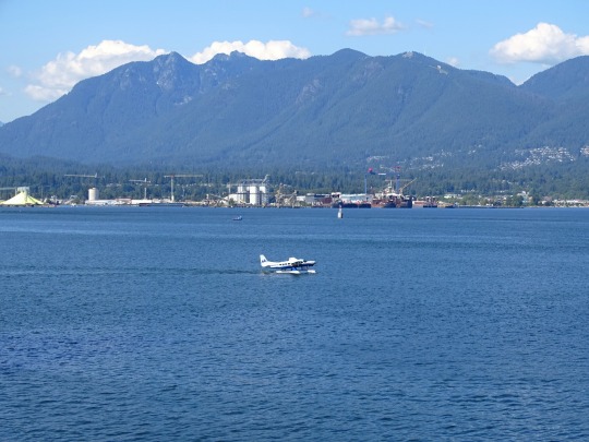
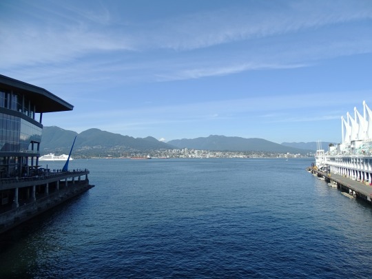
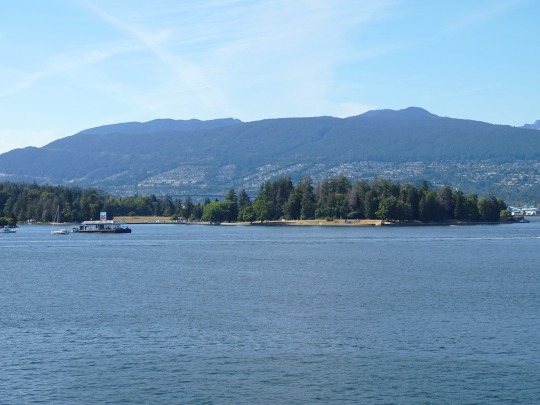
Vancouver Harbour (No. 1)
Burrard Inlet is a relatively shallow-sided fjord in northwestern Lower Mainland, British Columbia, Canada. Formed during the last Ice Age, it separates the City of Vancouver and the rest of the lowland Burrard Peninsula to the south from the coastal slopes of the North Shore Mountains, which span West Vancouver and the City and District of North Vancouver to the north.
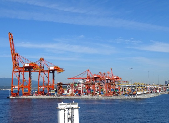
Burrard Inlet opens west into the Strait of Georgia between Point Atkinson and Point Grey. Vancouver's Downtown Peninsula protrudes northwesterly into the inlet, separating it into the wide outer Burrard Inlet to the west and the elongated inner Burrard Inlet to the east. The southeastern portion of the outer inlet is an open bay known as English Bay, which has a narrow eastern inlet called False Creek. The 400-metre-wide (1,300 ft) strait between Prospect Point and the sandbanks just east of the Capilano River mouth, which connects the inlet's outer and inner sections, is known as the First Narrows, traversed by the Lions Gate Bridge. The inner inlet then widens into Vancouver Harbour, which hosts the Port of Vancouver, Canada's largest port.
Source: Wikipedia
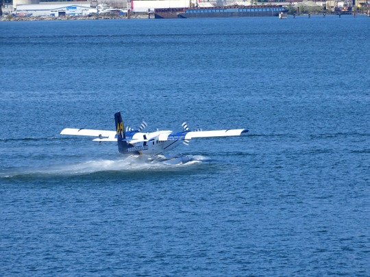
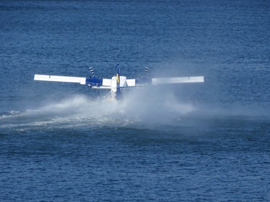
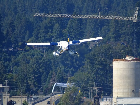
#Burrard Inlet#Vancouver Harbour#Pacific Ocean#travel#original photography#vacation#tourist attraction#landmark#architecture#cityscape#landscape#summer 2023#BC#British Columbia#Vancouver#seaplane#take-off#water#engineering#technology#Vancouver Convention Centre#North Vancouver
9 notes
·
View notes
Text
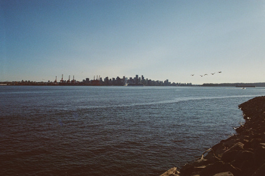
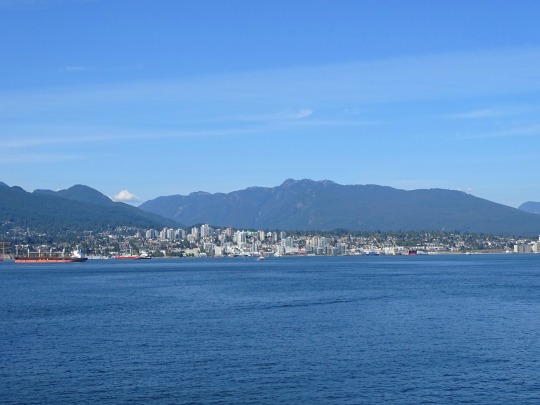
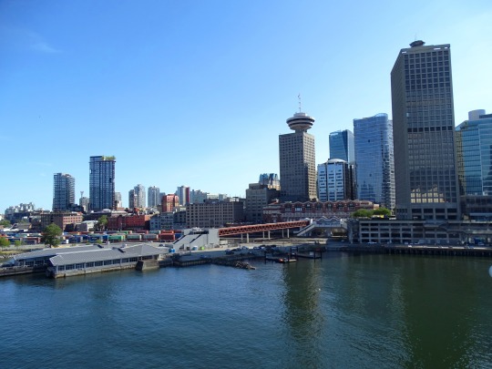
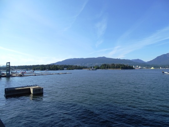
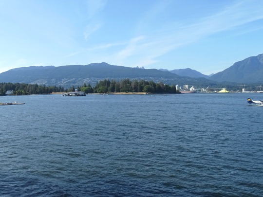
Vancouver
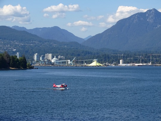
Shot from North Van
7 notes
·
View notes
Text
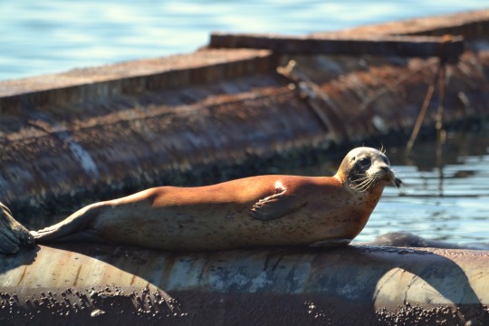
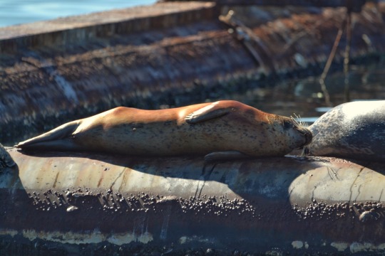
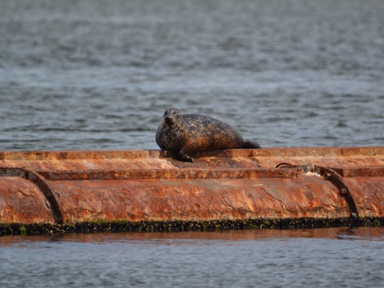
Eepy
#seals#marine mammals#nature#original photography#lensblr#harbour seals#vancouver island#nature photography#pnw#original photography on tumblr
220 notes
·
View notes
Photo

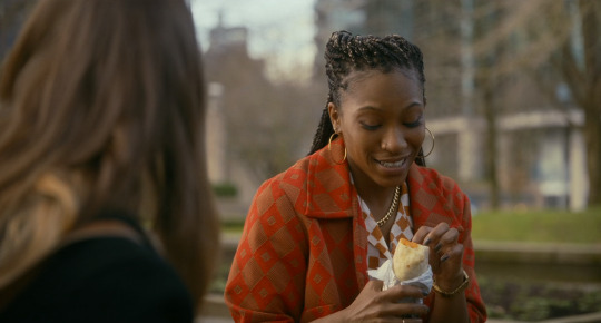


Fresh
Mimi Cave. 2022
Park
Coal Harbour Park, 323 Jervis St, Vancouver, BC V6C 3P8, Canada
See in map
See in imdb
#mimi cave#fresh#daisy edgar-jones#jojo t. gibbs#park#picnic#coal harbour park#vancouver#british columbia#canada#movie#cinema#film#location#google maps#street view#2022
62 notes
·
View notes
Text

Harbor seals (Phoca vitulina)
#true seals#earless seals#seals#phocids#Vancouver Island Harbour Seals#Harbour Seals#Phoca vitulina#sea side#ocean#ocean view#ocean life#pacific ocean#wild animals#animals#animal photoshoot#animal lover#animal photography#wildlife pictures#wildlife photography#wildlife#beautiful#beautiful photos#my photo#photography#photooftheday#naturecore#photoart
29 notes
·
View notes
Text
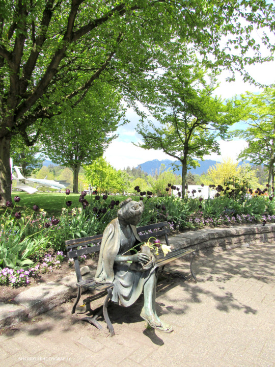
@sherrylephotography Picture taken May 32, 2022
“Flower Lady” is a statue in Coal Harbour's Devonian Harbour Park,
Vancouver BC Canada
"Nothing can dim the light that shines from within." quote by Maja Angelou
picture posted December 2022
#photographers on tumblr#original photographers on tumblr#my photography#coal harbour#Vancouver BC Canada#flowered lady statue#sherrylephotography#road trip#vacation#landscape photography
123 notes
·
View notes
Text
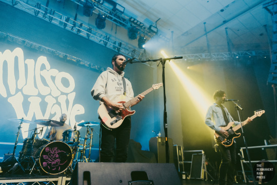
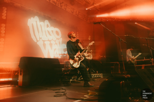
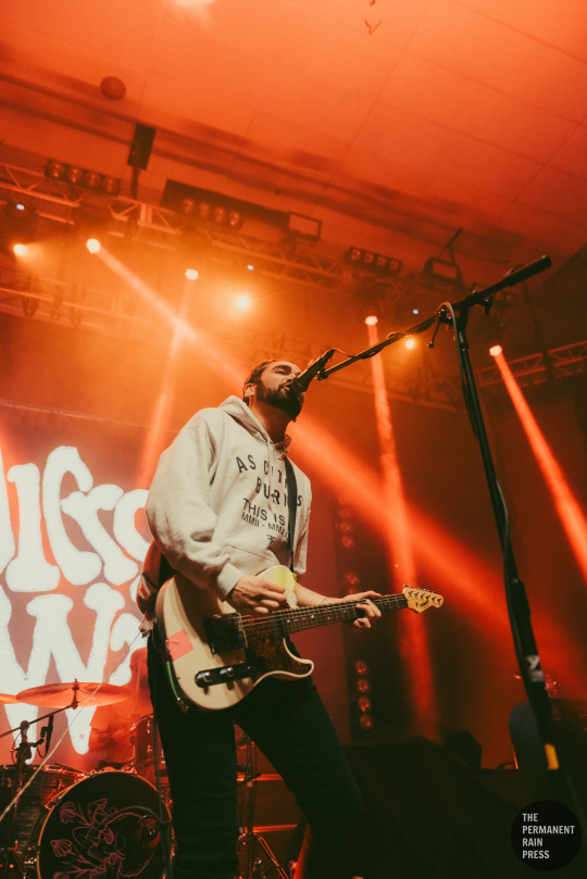
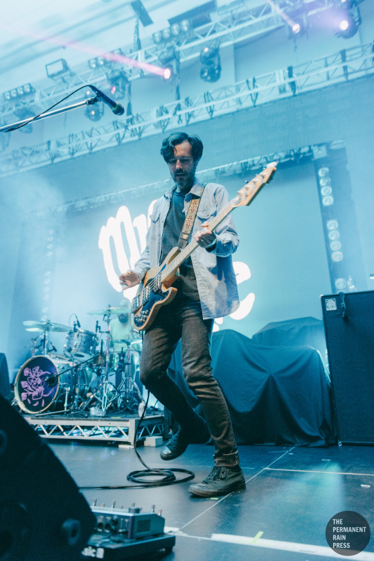
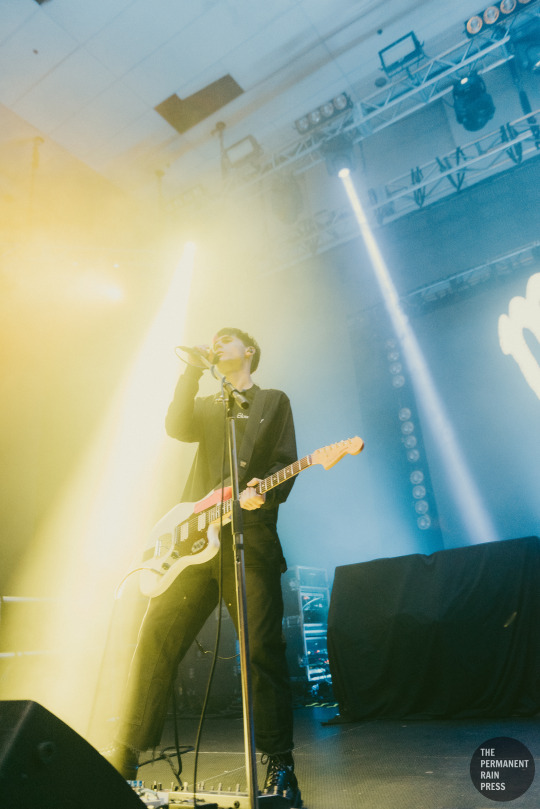
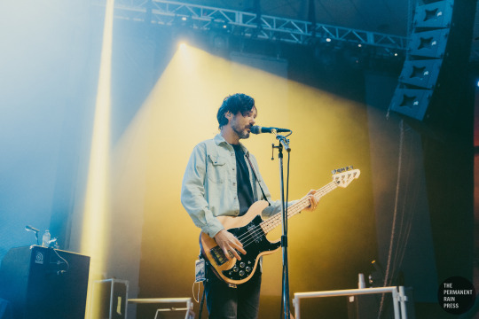
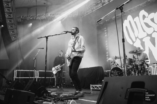
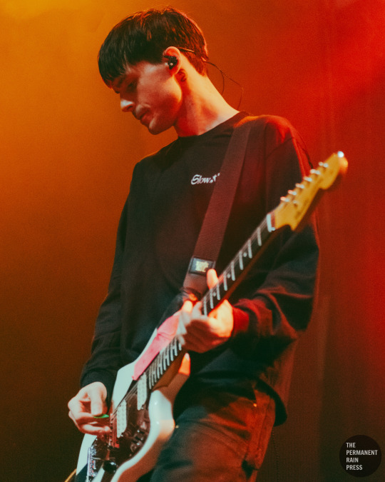
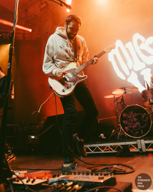
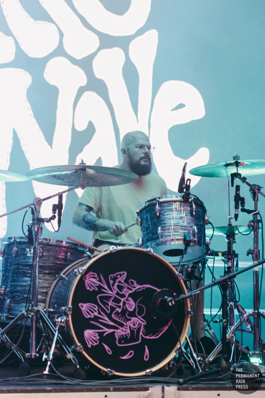
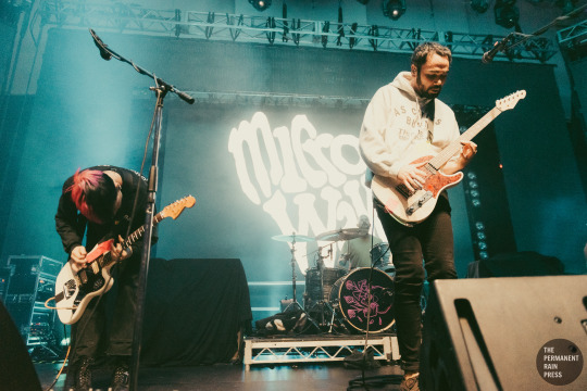
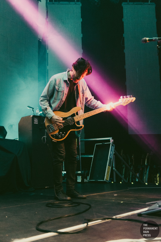
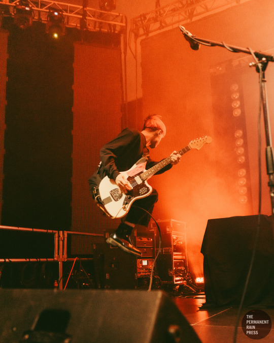
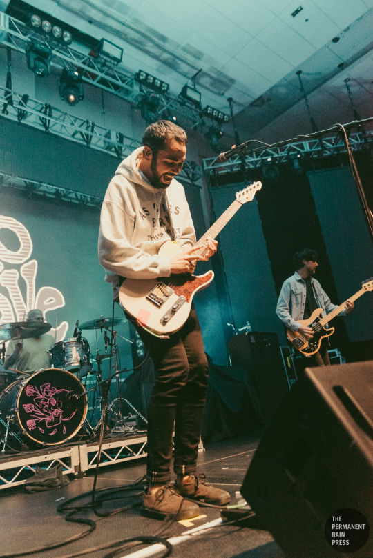
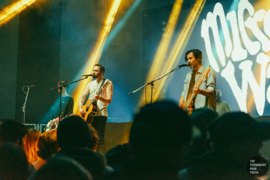
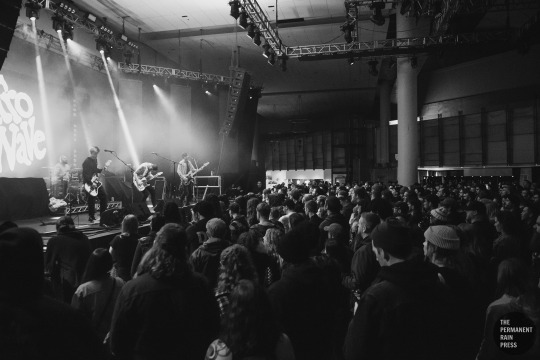
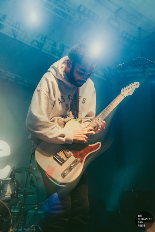
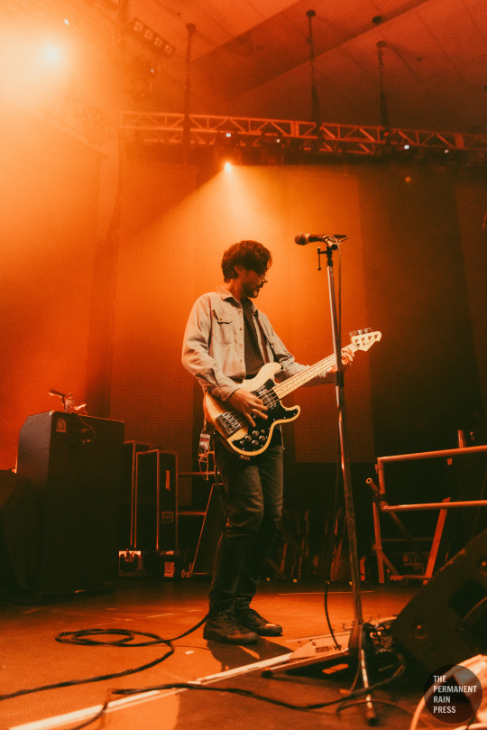
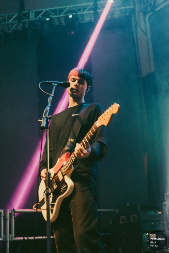
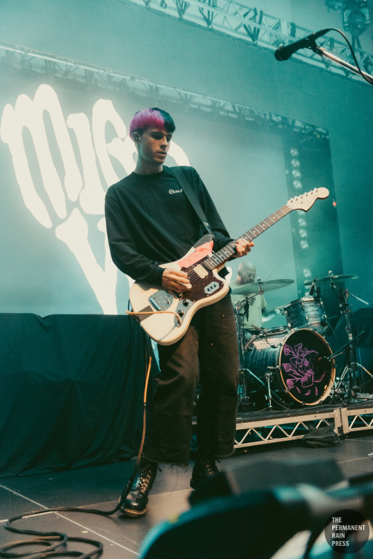
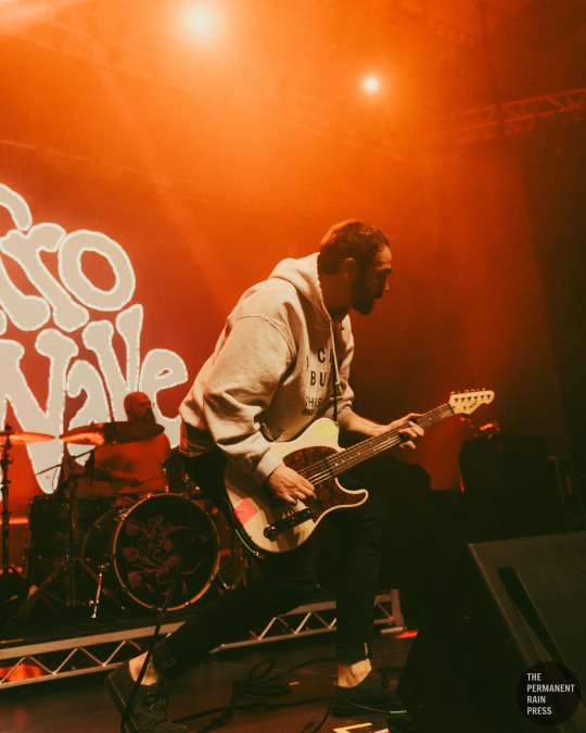
Gallery: Microwave @ Harbour Event & Convention Centre - Vancouver, BC
Date: December 8, 2023
Photographed by: Danielle Costelo
#Danielle Costelo#Microwave#Microwave Band#Microwave Music#PRmusic#PRphoto#Vancouver#yvr#Music#live music#F7#F7 Entertainment#Harbour Events Centre#Harbour Event & Convention Centre#Tyler Hill#Travis Hill#Nathan Hardy#Timothy Pittard#Tito Pittard#Much Love#Stovall#Death Is a Warm Blanket#Circling the Drain#Float to the Top#Pure Noise Records#Lighterless#Something Right#Keeping Up#concert#concert photography
7 notes
·
View notes
Text

#harbour#vancouver#mountains#landscape#skyline#boats#island#plant#sunlight#sky#tree#sun#water#nature#people#ocean#lake#river#clouds
7 notes
·
View notes
Text
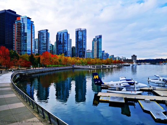
© by Timebird84
#Canada#Vancouver#British Columbia#harbour#skyline#skyscrapers#autumn#fall#autumn colors#autumn leaves#cityscape#city#sea#promenade#photography#photographers on tumblr#timebird84#photography-by-timebird84
36 notes
·
View notes
Text
just randomly remembering this photo I took while I was on holiday
5 notes
·
View notes
Text


CATHERINE'S STYLE FILES - 2016
25 SEPTEMBER 2016 || The Duchess of Cambridge and Prince William spent their day carrying out engagements in Vancouver on the second day of their Canadian Tour.
#catherines style files#style files 2016#mine.#day 2 canada tour 16#canada tour 16#vancouver visit 16#vancouver harbour flight centre 16#sheway charity vancouver 16#immigrant services society of british columbia new welcome 16#telus gardens youth reception 16#kitsilano coast guard station 16#princess of wales#alexander mcqueen.#catherine in russel & bromley.#russel and bromley.#miu miu.#catherine wearing miu miu.#cartier.#ballon bleu watch.#qeii silver jubilee earrings.#british royal family#british royals#royalty#kate middleton#duchess of cambridge#royals#royal#royal fashion#25.09.2016#fashion
28 notes
·
View notes
Text
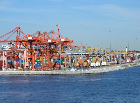
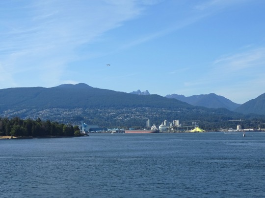
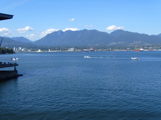
Vancouver Harbour (No. 2)
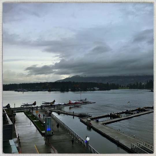
At the eastern end of the harbour, Burrard Inlet narrows again into a 350-metre-wide (1,150 ft) strait between Burnaby Heights and the mouth of the Seymour River, known as the Second Narrows, which is traversed by the Ironworkers Memorial Bridge and the Second Narrows Rail Bridge. After the Second Narrows, it widens again and continues east until the headland near Dollarton, where it splits into two arms. The longer arm, known as Indian Arm, extends northerly between Mount Seymour and Eagle Mountain until it meets the deltas of Indian River mouth. The shorter arm, known as Port Moody Arm or Moody Inlet, courses further east for another 6 kilometres (3.7 mi) past a 320-metre-wide (1,050 ft) strait (traversed only by overhead powerlines) between Burnaby Mountain and the bluffs of Belcarra Regional Park. Port Moody Arm is almost completely encompassed by the City of Port Moody.
Source: Wikipedia
#Vancouver Harbour#Burrard Inlet#Pacific Ocean#British Columbia#Vancouver Convention Centre#North Vancouver#Vancouver#travel#original photography#vacation#tourist attraction#landmark#architecture#cityscape#Canada#summer 2023#Port of Vancouver#Canada Place#BC#mountains#landscape#seascape
2 notes
·
View notes
Photo
38 notes
·
View notes
Text
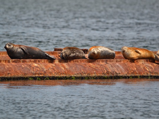
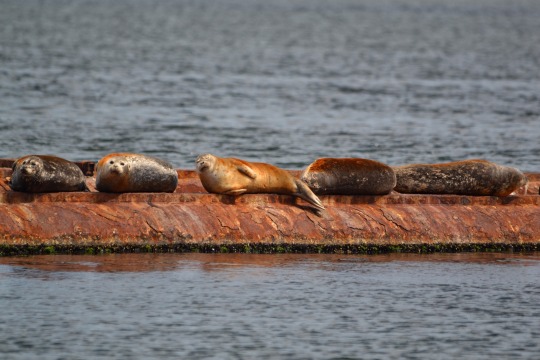
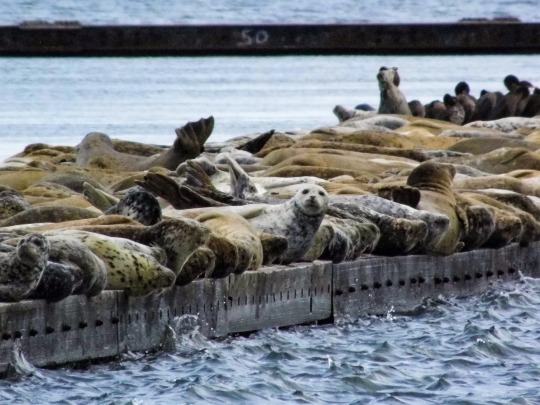
Seals sunning themselves on the old barge, they’re all stained orange from the rust
#they are so cute to me#seals#harbour seal#nature#vancouver island#nature photography#pnw#ocean#wildlife#ocean puppy#original photography#original photography on tumblr
331 notes
·
View notes
Text
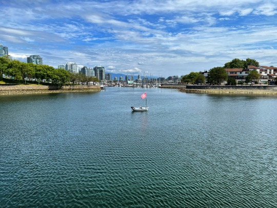
Lone boat in the harbour.
3 notes
·
View notes
Photo
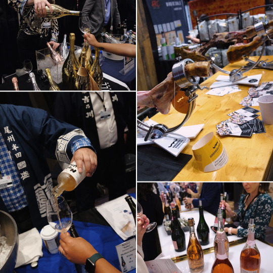
2023 Vancouver International Wine Festival x Canada Place x Waterfront.
[VIWF] returned for eight wine-soaked days of fun. Known as "the largest wine festival in the Americas", VIWF wined and dined thousands of attendees at its various tastings, pairing meals, and signature events across the city.
Bottega Gold Prosecco / Jamoneria by Arc Iberico Imports / Nakano Sakagura Umé
#rick chung#media#features#collage#wine#wines#wine festival#vancouver#vancity#downtown vancouver#coal harbour#canada place#convention#booze#alcohol#tasting#wine tasting#drink#drinks#drinking#sparkling wine#red wine#prosecco#sake#saké#rosê#rice wine
3 notes
·
View notes
Last Seen Blogs

lunesine
lunesine
courtivia-livia
My mom doesn't care
grunty89
A Train of Thought

cryptidhuntersmall-blog
🌻Victor🌻