#Mavic 2 Pro
Photo
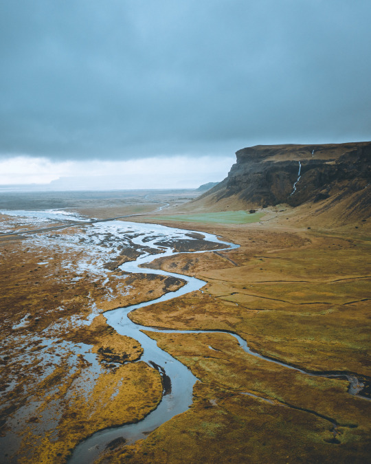
64°50'34.2"N 14°40'13.9"W
instagram/oftwolands
www.oftwolands.com
#iceland#river#landscape#aerial#drone#mavic 2 pro#dji#travel#explore#Adventure#moody#dark#nature#of two lands
1K notes
·
View notes
Video
“ Mythical Creature “ // © Luis Cruz
Music: Hans Zimmer - No Time for Caution
#Hvitserkur rock#elephant rock#Iceland#nature#landscape#coast#shoreline#beach#cloudy#mood#moody#4K#8K#12K#fpv#drone#Mavic 2 Pro#djiglobal#reels#aesthetics#wanderlust#explore#follow#discover
112 notes
·
View notes
Video
Red tulips queueing for the sunset. Ruigeweg, Burgerbrug, Holland. by Alex de Haas
#DJI#Dutch#Europa#Europe#HDR#Holland#M2P#Mavic#Mavic 2 Pro#Nederland#Nederlands#Netherlands#Noord-Holland#The Netherlands#Tour des Fleurs#aerial photography#agriculture#agricultuur#bloemen#bloemenvelden#bollenvelden#bulbfields#drone#farmland#flower fields#flowers#landbouw#landscape#landschaft#landschap
7 notes
·
View notes
Text

Frosted tips 🏔
📷: @franconic89 📍: Italian Alps 🚁: DJI Mavic 2 Pro
#dronephotography#aerial photography#mountains#droneoftheday#aerial view#dronepilot#dji#mavic 2 pro#italy#earth#drone#planet#amazing places
19 notes
·
View notes
Text
Xboom | Experience Best Mavic 2 pro
The Mavic 2 Pro amazing 20-megapixel aerial images and 4K videos are captured by its Hasselblad camera, one of its most outstanding features. With a maximum flight duration of 31 minutes and 360° obstacle identification, the Mavic 2 Pro provides safe and easy flying even in difficult situations.For more information checkout the website.
0 notes
Text
#black sonnie1#mavic 2 pro#canonr6#alexmidence#pexels#shakers cigar bar#haunted house#paranormal#theghosthunterstore#ghosts are real
1 note
·
View note
Video
Strata by David Thompson
Via Flickr:
Switching it up today, and going back to the aerial imagery! It's only taken me 4+ years to share this. I've been working on a bunch of new images, and this is one of them. Im a huge fan of low soft light on badlands and this is a perfect example of that type of light. I’ve been saying it for years now, drone photography gives such unique perspectives! Everyone wants to fly high and go as high as you possibly can go….which is cool and looks awesome, but those lower perspectives.....these are the perspectives where you have to navigate into tight spaces where the drone has its advantages! Not too high, and not too low!
#aerial#aerial photography#drone#drone photography#light#soft light#badlands#glow#glowing#DJI#Mavic 2 Pro#Mavic#Mavic2#MavicPro#SouthWest#landscape photography#Landscape#nature photography#Nature#too high#not too low'.#flickr
0 notes
Text
Automn from sky
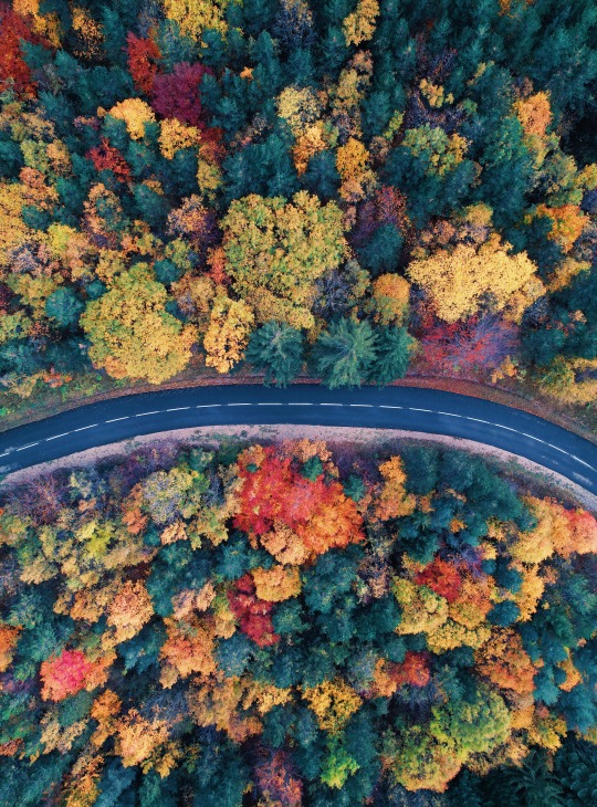
Instagram: @hamza-djenat
#dronephotooftheday#drone photos#dronepointofview#dronefly#droneporn#drone nerds#droneoftheday#mavic 2 pro#air2s#automne#forest#colour#colors#bright colors
0 notes
Photo

Il blu del mare è senza limiti.
Scogliera di Ascea Marina - Salerno
13 notes
·
View notes
Photo
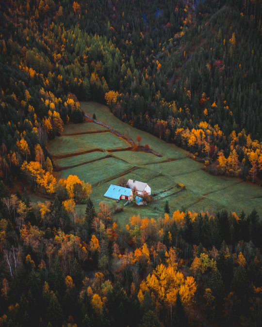
44°58'23.5"N 6°03'54.8"E
youtube/oftwolands
www.oftwolands.com
#france#autumn#outdoor#lifestyle#French alps#alps#tree#colors#woods#alone#tranquilness#peaceful#photography#aerial#drone#dji#mavic 2 pro#landscape#of two lands
308 notes
·
View notes
Video

flickr
Ruigeweg, village of Burgerbrug, The Netherlands. by Alex de Haas
#DJI#Dutch#Europa#Europe#HDR#Holland#M2P#Mavic#Mavic 2 Pro#Nederland#Nederlands#Netherlands#Noord-Holland#The Netherlands#Tour des Fleurs#aerial photography#agriculture#agricultuur#bloemen#bloemenvelden#bollenvelden#bulbfields#drone#farmland#flower fields#flowers#landbouw#landscape#landschaft#landschap
3 notes
·
View notes
Text
X marks the spot 🚧

📷: @razum_10 📍: Russia 🚁: Mavic 2 Pro
#dronephotography#top down#aerial view#drone#road#aerial photography#creative portrait#autumn#russia#mavic 2 pro#djiglobal#dronestagram#droneoftheday
18 notes
·
View notes
Text
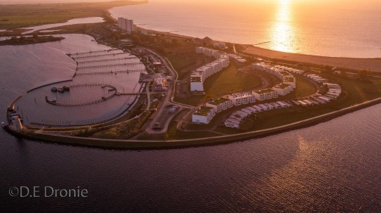
Fehmarn
2 notes
·
View notes
Text
Gundog Training With Tarncrag Gundogs - Rabbit Pen
Follow two young cocker spaniels as they are put through their paces in a rabbit pen by Fran Ardley of Tarncrag Gundogs The pen …
source

View On WordPress
#Cocker spaniel#DJI Mavic 2 Pro#Drone film#Gundog#gundog training#gundog working test#hunting#Nick Ridley#nickridleyphotography#Rabbit Pen#shooting#Spaniel#stud dog#Tarncrag Gundogs#working test
1 note
·
View note
Text
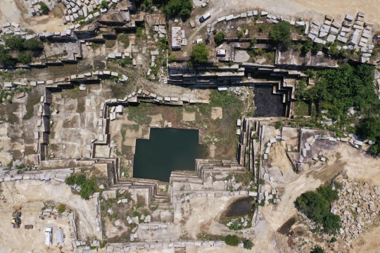
Looking down from 400 ft up at a local quarry
1 note
·
View note
Text
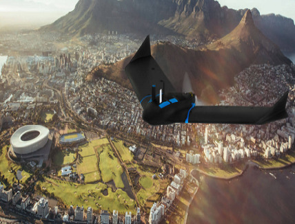
Choisissez le bon drone pour vos besoins de cartographie aérienne : 5 propositions
Les drones révolutionnent la cartographie aérienne. Ces nouveaux outils polyvalents pour des résultats de haute précision
La cartographie aérienne a connu une véritable révolution grâce à l’introduction des drones. Ces appareils volants équipés de caméras de haute résolution et de capteurs spécifiques offrent une solution efficace et économique pour la collecte de données géospatiales. Que ce…
View On WordPress
0 notes
Last Seen Blogs

liftolution-blog
Unbetitelt

kittywhitmo3
Untitled

bialka6
Pati♥
edamamefiend
shrimps is bugs

krisichiki
Krisi Chiki