#GCNRA
Text

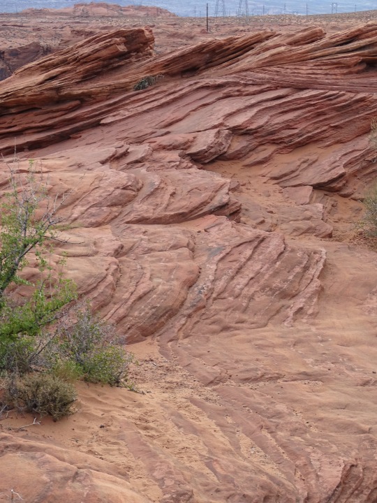
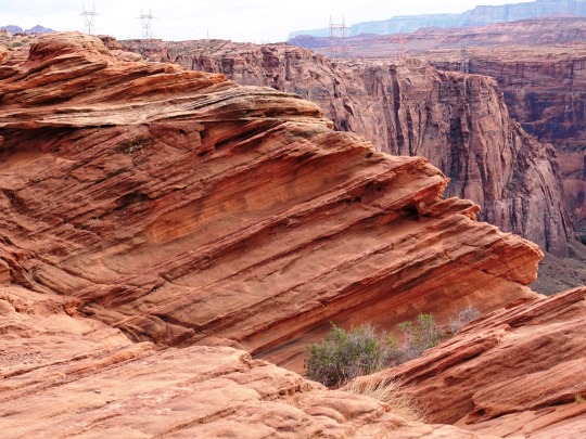


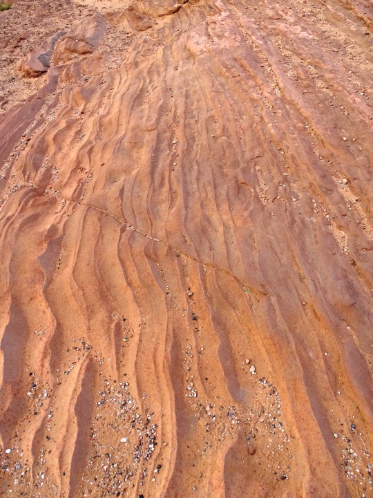

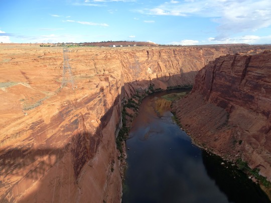
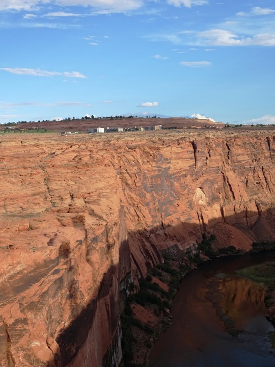
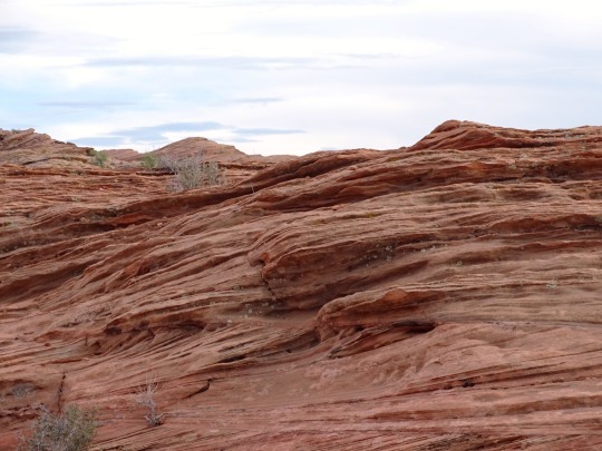
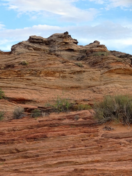
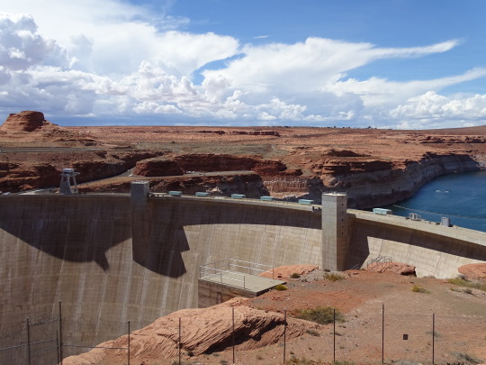
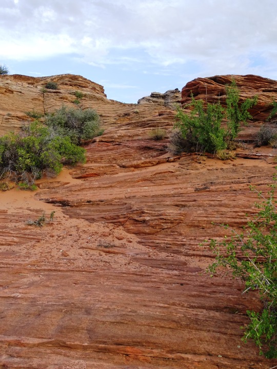
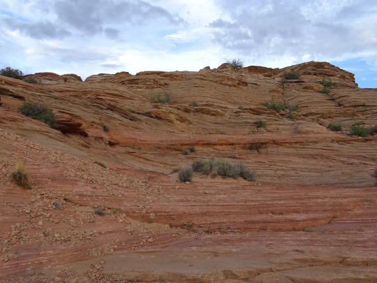
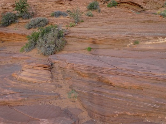
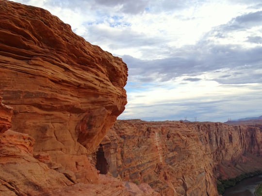
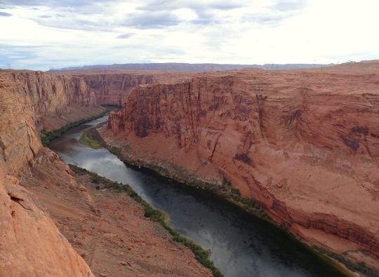
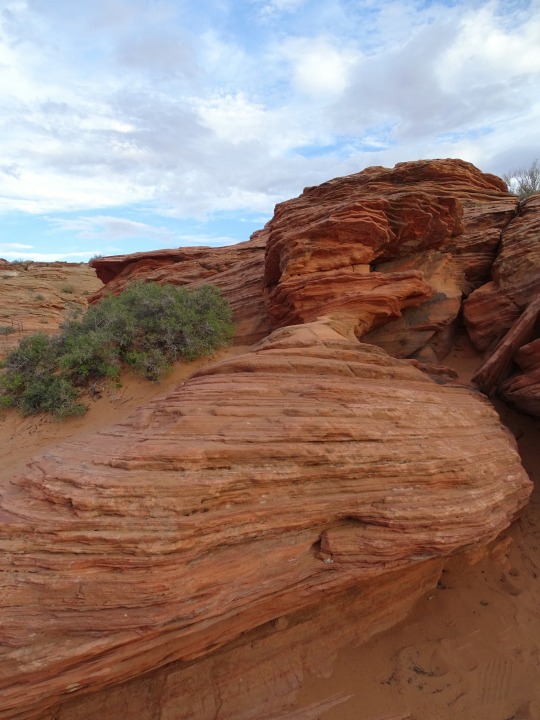
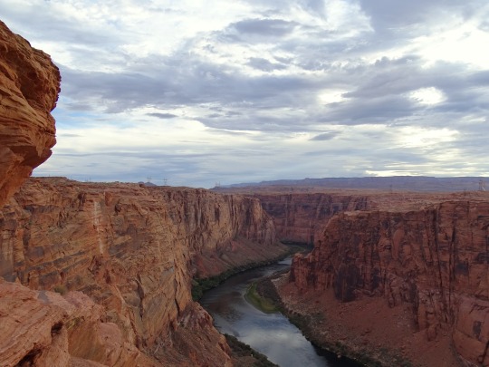
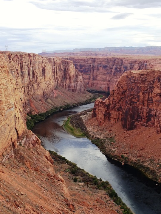
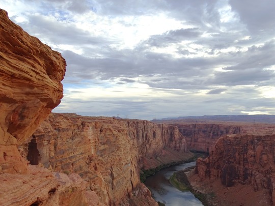
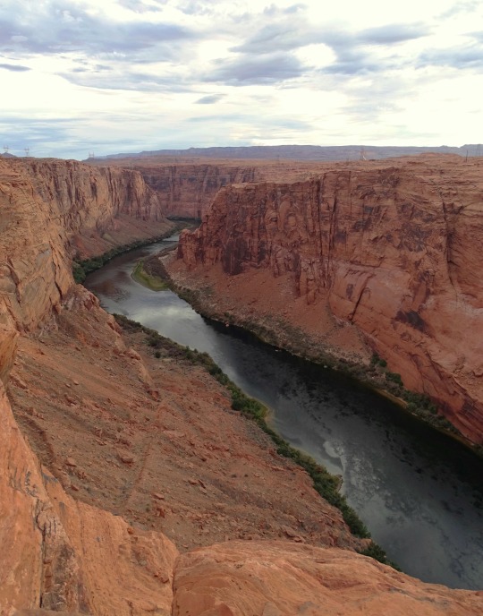
Glen Canyon National Recreation Area, AZ (No. 9)
Dam Overlook Trailhead
This very short walk takes you to a viewpoint on the canyon rim high above the Colorado River. It affords an unparalleled view of the river, the canyon, and Glen Canyon Dam. This scenic view provides spectacular vistas of the Colorado River as it flows through Glen Canyon and of Glen Canyon Dam itself. From the parking area, follow the metal handrail down the uneven rock steps.
Trailhead: From U.S. Hwy. 89, turn west on Scenic View Drive, 1.5 miles (2.4 km) south of Carl Hayden Visitor Center. Take the first road to the right, and park in the parking area at the end of the road. (You may also access Scenic View Drive just south of the Park Headquarters building.)
Source
#Glen Canyon Dam Overlook#Glen Canyon National Recreation Area#Glen Canyon NRA#GCNRA#Coconino County#Southwestern USA#Colorado Plateau#desert#flora#nature#blue sky#clouds#grass#travel#original photography#vacation#tourist attraction#landmark#landscape#countryside#USA#Arizona#summer 2022#red rock#Page#engineering#technology#Colorado River#detail#close up
32 notes
·
View notes
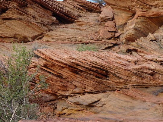
Photo

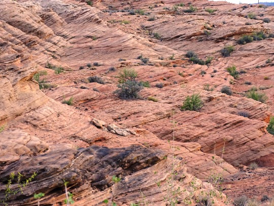
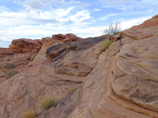
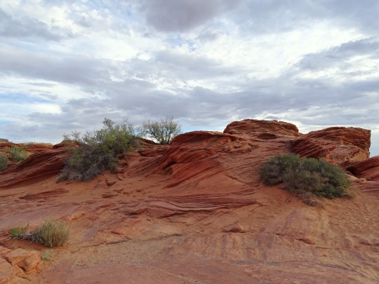
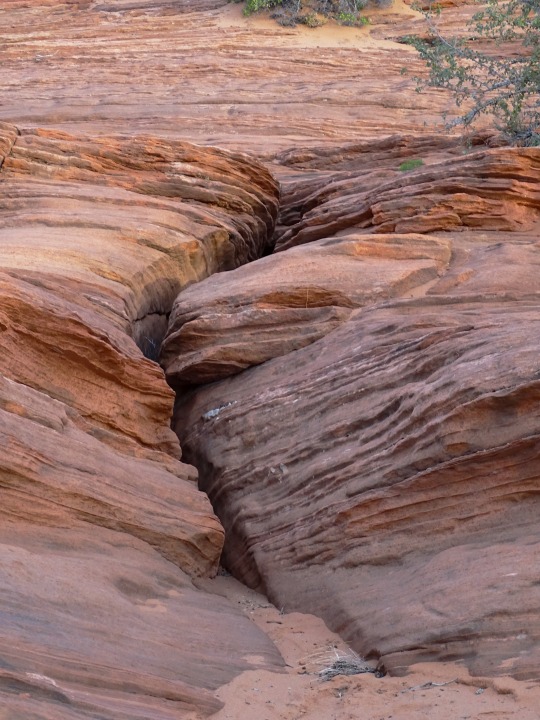
Coyote Gulch, GCNRA, Utah USA | OC | 508 X 900 | IG: @thelightexplorer
📷: The_Light_Explorer
17 notes
·
View notes
Photo

Coyote Gulch, GCNRA, Utah USA | OC | 508 X 900 | IG: @thelightexplorer
0 notes
Photo

Coyote Gulch, GCNRA, Utah USA | OC | 508 X 900 | IG: @thelightexplorer via /r/EarthPorn https://ift.tt/nUq3HGl
0 notes
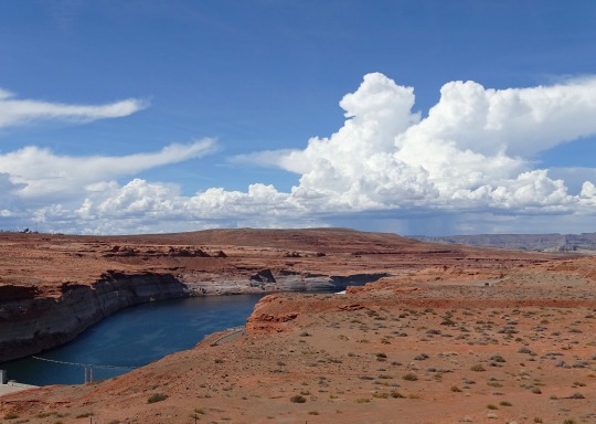
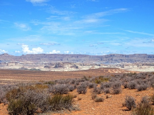
Text
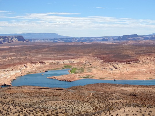

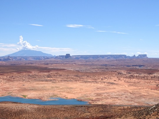


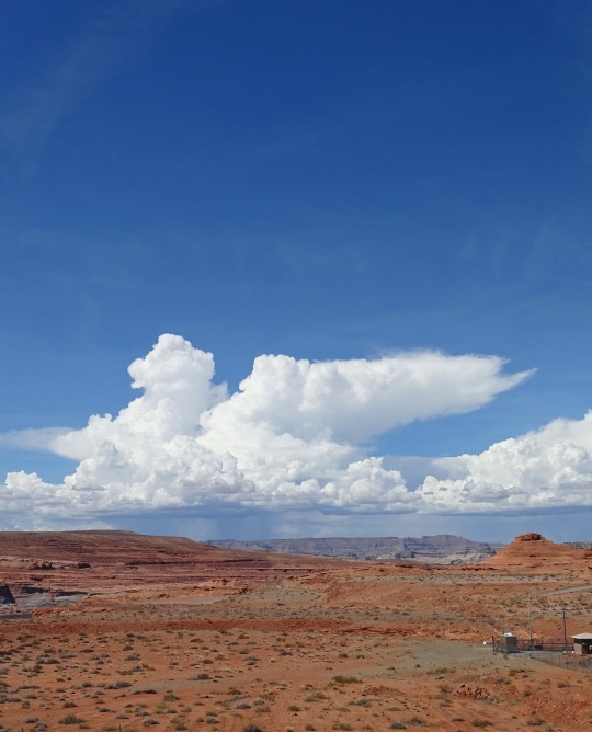
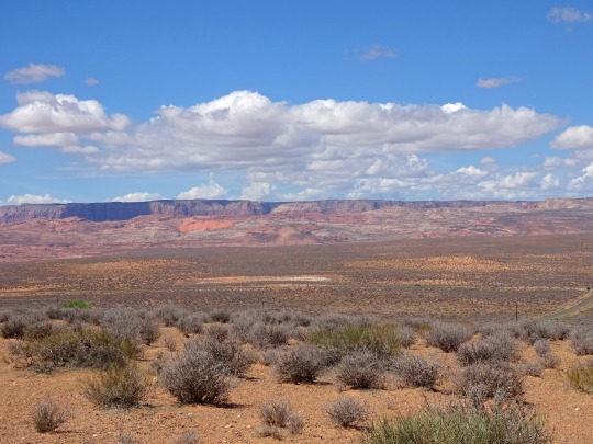
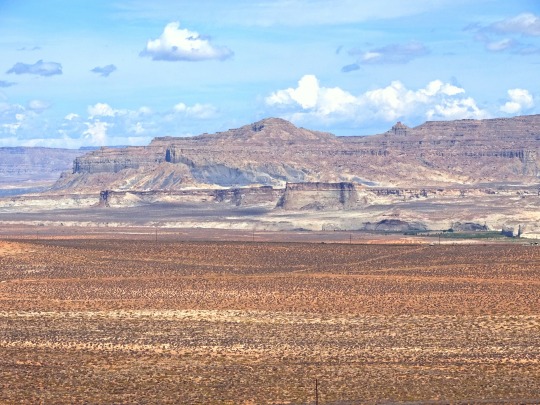
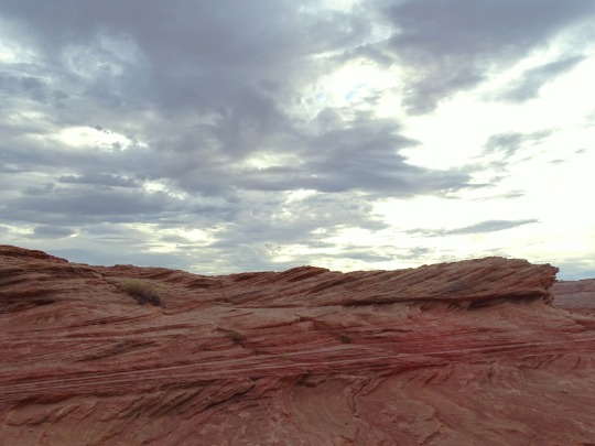
Wahweap Overlook, AZ (No. 4)
Navajo Mountain
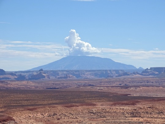
On the far horizon, Navajo Mountain looms, a big dome erupting from the canyon landscape - a laccolith, a volcano that never came to be. Reaching an elevation of 10,388 feet (3,166m) above sea level, Navajo Mountain supports several plant life zones: desert scrub, riparian, pinion-juniper woodlands and ponderosa pine forests. It is one of many mountains sacred to the Navajo People.
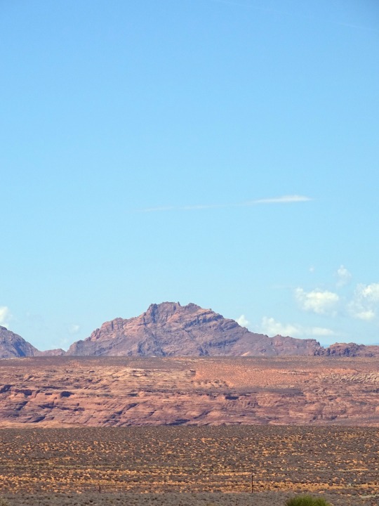
Tower Butte
Glancing across from left to right many buttes and formations appear. The most prominent on the far right is Tower Butte. Once a part of Romana Mesa, time and the erosive forces of water and weather carved and washed away the materials that connected them. Now this 1600-foot (488m) monolith stands solo and someday it too will crumble and disappear into the landscape.
Source
#Wahweap Overlook#Lake Powell Lookout Point#Glen Canyon National Recreation Area#Glen Canyon NRA#GCNRA#Coconino County#Southwestern USA#Colorado Plateau#desert#flora#nature#blue sky#clouds#grass#travel#original photography#vacation#tourist attraction#landmark#landscape#countryside#USA#Arizona#summer 2022#red rock#Page#Colorado River#detail#close up#Lake Powell
25 notes
·
View notes
Photo

Coyote Gulch, GCNRA, Utah USA | OC | 508 X 900 | IG: @thelightexplorer via /r/EarthPorn https://ift.tt/nUq3HGl
0 notes
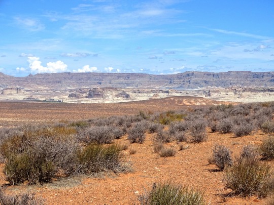
Text


Wahweap Overlook, AZ (No. 3)
Kaiparowits Plateau
Opposite Navajo Mountain, the Kaiparowits Plateau reaches in from your left. Though the origin of its name is unknown, some sources have revealed two possible, yet unsubstantiated meanings: “Big Mountain’s Little Brother”, or “One Arm”. One thing is certain, archeological evidence reveals the fact that Ancestral Puebloans hunted and gathered here. The diversity of the Pinion-Juniper woodland provided nuts, berries and grains to gather, as well as rabbits and deer to hunt. What kind of tools do you think prehistoric humans created to help them survive in a harsh desert environment?
Wahweap Creek
Nested on the edge of the canyon, Wahweap Marina serves as a destination resort and launch point for modern day explorers seeking recreational adventure on present day Lake Powell. Wahweap Bay curves around from the left eventually joining the main channel of the Colorado River. Before the building of Glen Canyon Dam, Wahweap Creek meandered as an intermittent stream. Along this channel, seeps and springs occur, and the Paiute name of Wahweap, referring to the bitter taste of these alkaline seeps, is bestowed upon this canyon. Early river runners hiked up Wahweap Creek to seek out these cool grottoes. Other seep springs thrive within Glen Canyon providing vital habitats for many plant and animal species. Our continued stewardship will help protect these fragile and unique habitats.
Source
#Wahweap Overlook#Lake Powell Lookout Point#Glen Canyon National Recreation Area#Glen Canyon NRA#GCNRA#Coconino County#Southwestern USA#Colorado Plateau#desert#flora#nature#blue sky#clouds#grass#travel#original photography#vacation#tourist attraction#landmark#landscape#countryside#USA#Arizona#summer 2022#red rock#Page#Colorado River#detail#close up#Lake Powell
8 notes
·
View notes
Text


Wahweap Overlook, AZ (No. 2)
Stories Within the Stone
On the north side of Lake Powell, the geological layers of the Straight Cliffs, Tropic Shale, and Dakota formations allude to a world long gone. Within the fossil record, a remnant of the Cretaceous period (144-65 million years ago) is revealed. Plesiosaurs, Ichthyosaurs, and Tortoises swam in a vast inland seaway. The shoreline sported a lush habitat and the first flowering plants appeared. Among them, dinosaurs roamed the earth and early mammals flourished.
Franciscan Explorers
On July 29, 1776 two Franciscan Priests, Padres Francisco Atanasio Domínguez, and Silvestre Vélez de Escalante set out on a quest. With a small assemblage of men, horses, and cattle, they departed Santa Fe, New Mexico in search of a trade route to Monterey, California. With winter soon at their heels, they decided to turn back, reaching the Colorado River at the Paria confluence on October 26. Finding the river difficult to cross, the padres dispatched scouts to seek out a better location. Think of the frustration experienced by these hungry, exhausted, explorers. Imagine the desperate hope that motivated their search. On November 7, they finally forded the river in present day Padre Bay at a location now known as Crossing of the Fathers. Though they failed in their quest to reach Monterey, part of their original route would come to be known as the Old Spanish Trail.
Source
#Wahweap Overlook#Lake Powell Lookout Point#Glen Canyon National Recreation Area#Glen Canyon NRA#GCNRA#Coconino County#Southwestern USA#Colorado Plateau#desert#flora#nature#blue sky#clouds#grass#travel#original photography#vacation#tourist attraction#landmark#landscape#countryside#USA#Arizona#summer 2022#red rock#Page#Colorado River#detail#close up#Lake Powell
7 notes
·
View notes
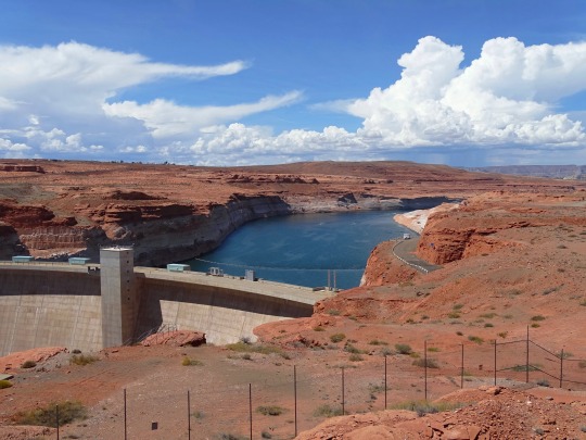
Text


Glen Canyon National Recreation Area, AZ (No. 6)
Glen Canyon's overall design was based on that of Hoover Dam – a massive concrete arch-gravity structure anchored in solid bedrock – with several significant changes. The engineers wanted the dam to rely predominantly on its arch shape to carry the tremendous pressure of the impounded water into the canyon walls instead of depending on the sheer weight of the structure to hold the reservoir back, as had been done at Hoover. The foundation rock at Glen Canyon consists of porous sandstone prone to spalling, in contrast to the stronger granite at the Hoover Dam site, forcing the Glen Canyon design to follow more conservative lines by greatly thickening the abutments, thus increasing the surface area through which the weight of dam and reservoir would be transmitted to the rock and relieving the pressure per square inch on the highly breakable cliffs.
The Glen Canyon Dam is 710 feet (220 m) high from the foundations and stands 583 feet (178 m) above the Colorado River. The crest of the dam is 1,560 feet (480 m) long and 25 feet (7.6 m) wide, while the maximum thickness of the base is 300 feet (91 m). The elevation at the crest is 3,715 feet (1,132 m), and the elevation of the Colorado River below the dam is 3,132 feet (955 m). In total, the dam contains 5,370,000 cubic yards (4,110,000 m3) of concrete and 28,900,000 pounds (13,100,000 kg) of reinforcing steel. The hydroelectric power station and river outlet works are located at the foot of the dam. The outlet works consist of four 96-inch (240 cm) diameter pipes, each controlled by a ring gate and hollow-jet valve. The discharge capacity of the river outlet works is 15,000 cubic feet per second (420 m3/s).
Source: Wikipedia
#Glen Canyon Dam Overlook#Glen Canyon National Recreation Area#Glen Canyon NRA#GCNRA#Lake Powell#Coconino County#Southwestern USA#Colorado Plateau#desert#flora#nature#blue sky#clouds#grass#travel#original photography#vacation#tourist attraction#landmark#landscape#countryside#USA#Arizona#summer 2022#red rock#Page#Glen Canyon Dam#engineering#technology#Colorado River
3 notes
·
View notes
Text


Glen Canyon National Recreation Area, AZ (No. 8)
Glen Canyon Dam's most vital purpose is to provide storage to ensure enough water flows from the Upper Colorado River Basin to the lower, especially in drought years. The 1922 Colorado River Compact requires annual delivery of 7.5 million acre-feet (9.3 km3) to the Lower Basin states of Arizona, California and Nevada; the 1944 treaty with Mexico obligates the U.S. to allow at least 1.5 million acre-feet (1.9 km3) for use in the Mexican states of Baja California and Sonora. Glen Canyon Dam must supply at least 8.23 million acre-feet (10.15 km3) of this water; the remaining 770,000 acre-feet (0.95 km3) comes from other tributaries of the Colorado River.[125] The required release from Glen Canyon is averaged over a 10-year period, so releases in each year may be higher or lower depending on the amount of runoff. In wetter years, the Bureau of Reclamation may decide to release extra water from Glen Canyon Dam if the level of Lake Powell exceeds the "equalization tier", an elevation determined by the difference in storage between Lake Powell and Lake Mead.
Most of Lake Powell's inflow originates as summer snowmelt from the Rocky Mountains of Colorado, Utah and Wyoming. Releases are made over a water year of October 1–September 30, since the annual snowpack begins to accumulate in late autumn. On April 1 of each year, the Bureau of Reclamation releases its official forecast of the April–July (snowmelt season) runoff, and adjusts releases from Glen Canyon Dam accordingly to maintain Lake Powell at a safe level. An accurate forecast is vital to prevent uncontrolled spilling, which would waste water that could have been used for power generation. Although the snowpack typically reaches its peak and begins to melt in April, the picture can occasionally change unexpectedly and dramatically – either due to a hot and dry spring that evaporates snow before it can melt, or an extremely wet spring as occurred in May 1983. After the near disaster in 1983, the USBR has maintained a minimum of 2.4 million acre-feet (3.0 km3) of flood-storage space in Lake Powell at the beginning of each year, to guard against unanticipated high runoff.
Source: Wikipedia
#Glen Canyon Dam Overlook#Glen Canyon National Recreation Area#Glen Canyon NRA#GCNRA#Coconino County#Southwestern USA#Colorado Plateau#desert#flora#nature#blue sky#clouds#grass#travel#original photography#vacation#tourist attraction#landmark#landscape#countryside#USA#Arizona#summer 2022#red rock#Page#engineering#technology#Colorado River
4 notes
·
View notes
Text


Glen Canyon National Recreation Area, AZ (No. 1)
Glen Canyon National Recreation Area (shortened to Glen Canyon NRA or GCNRA) is a national recreation area and conservation unit of the United States National Park Service that encompasses the area around Lake Powell and lower Cataract Canyon in Utah and Arizona, covering 1,254,429 acres (5,076.49 km2) of mostly rugged high desert terrain. The recreation area is named for Glen Canyon, which was flooded by the Glen Canyon Dam, completed in 1966, and is now mostly submerged beneath the waters of Lake Powell.
Glen Canyon NRA borders Capitol Reef National Park and Canyonlands National Park on the north, Grand Staircase–Escalante National Monument on the west, Vermilion Cliffs National Monument and the northeasternmost reaches of Grand Canyon National Park on the southwest, and the Navajo Nation on the southeast. The southwestern end of Glen Canyon NRA in Arizona can be accessed via U.S. Route 89 and State Route 98. State Route 95 and State Route 276 lead to the northeastern end of the recreation area in Utah.
Source: Wikipedia
#Glen Canyon National Recreation Area#Glen Canyon NRA#GCNRA#Lake Powell#Coconino County#Southwestern USA#Colorado Plateau#desert#flora#nature#blue sky#clouds#grass#travel#original photography#vacation#tourist attraction#landmark#landscape#countryside#USA#Arizona#summer 2022#red rock#Page#Glen Canyon Dam#engineering#technology
2 notes
·
View notes
Text


Wahweap Overlook, AZ (No. 5)
The Dynamic Force of Water
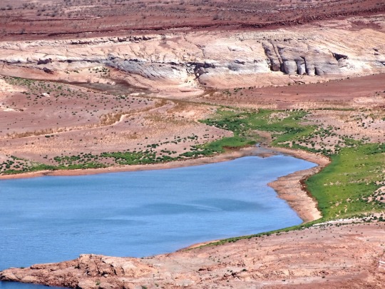
Water has played a significant role in Glen Canyon’s past, and continues to do so today. Deposits left by ancient sea beds, runoff from a melting ice age, undercutting seeps that create a desert oasis, erosion, and the flowing force of the Colorado River have all contributed to the dynamic scene before you. Within this tough and rugged landscape resides the delicate beauty of life. Butterflies dance from one wildflower to another, coyotes lurk in the shadows of twilight, ravens play in the air currents overhead. Water is the liquid gold that makes life possible within the desert environment, however, periodic drought can challenge even the heartiest species. We must be ever mindful of the challenges that plants and animals must endure, remembering we are respectful visitors in their desert home.
Source
#Wahweap Overlook#Lake Powell Lookout Point#Glen Canyon National Recreation Area#Glen Canyon NRA#GCNRA#Coconino County#Southwestern USA#Colorado Plateau#desert#flora#nature#blue sky#clouds#grass#travel#original photography#vacation#tourist attraction#landmark#landscape#countryside#USA#Arizona#summer 2022#red rock#Page#Colorado River#detail#close up#Lake Powell
1 note
·
View note
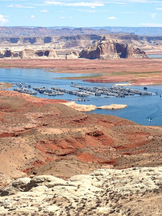
Text
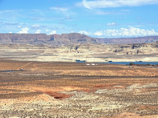


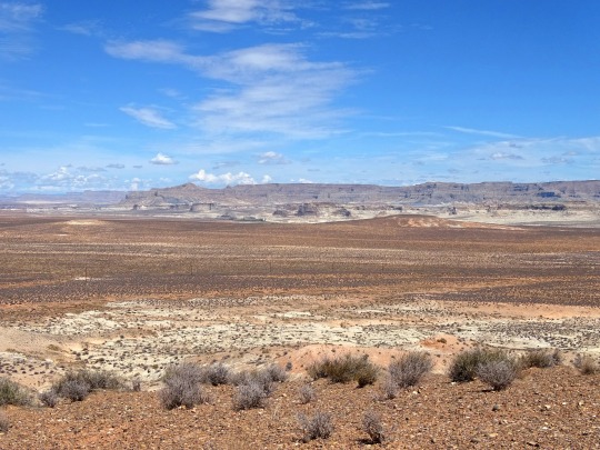


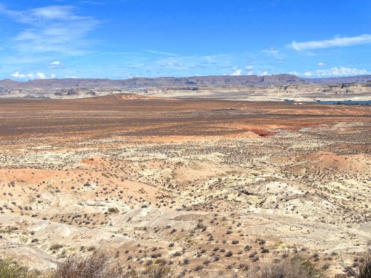

Wahweap Overlook, AZ (No. 1)
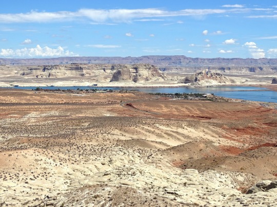
A short journey from the Carl Hayden Visitor Center, you will find the Wahweap Overlook. This high point offers a 360-degree panorama of the Glen Canyon National Recreation Area. It is a “must see” at anytime of day, however, sunrise and sunset adds a fusion of brilliant color to this awe-inspiring scene. There is a shade shelter and a bench for your viewing comfort. Bring a picnic, camera, and binoculars along and enjoy this delightful view.
In every view, there is a story. Like a window to the past, the landscape before you represents a timeline of natural and cultural events. Within the panorama that is Glen Canyon, stories and secrets are revealed; and through exploration, we discover some of its mysteries. Glance over the Glen Canyon landscape, and imagine events form a distant past.
The Colorado River and Lake Powell
In 1869 Major John Wesley Powell led an expedition down the Colorado River, taking copious notes about the geography, geology, natural and cultural history he encountered along the way. With the building of the Glen Canyon Dam, nearly a century later, this reservoir would be his namesake. Lake Powell and the Colorado River provide water, vital to western habitation, by contributing to crop irrigation and water resources for the lower basin states of California, Nevada and Arizona, as well as Mexico. In addition, it provides clean hydroelectric power.
Throughout the years, the Colorado River has been both friend and foe. It has been a barrier to cross and conquer, a way to explore uncharted territories, a provider of vital resources, and simply a means to experience the adventure of it all. Lake Powell and the Colorado River continue to fulfill our zest for adventure.
Source
#Wahweap Overlook#Lake Powell Lookout Point#Glen Canyon National Recreation Area#Glen Canyon NRA#GCNRA#Coconino County#Southwestern USA#Colorado Plateau#desert#flora#nature#blue sky#clouds#grass#travel#original photography#vacation#tourist attraction#landmark#landscape#countryside#USA#Arizona#summer 2022#red rock#Page#Colorado River#detail#close up#Lake Powell
1 note
·
View note
Text


Glen Canyon National Recreation Area, AZ (No. 14)
In Utah, the Colorado flows primarily through the "slickrock" country, which is characterized by its narrow canyons and unique "folds" created by the tilting of sedimentary rock layers along faults. This is one of the most inaccessible regions of the continental United States. Below the confluence with the Green River, its largest tributary, in Canyonlands National Park, the Colorado enters Cataract Canyon, named for its dangerous rapids, and then Glen Canyon, known for its arches and erosion-sculpted Navajo sandstone formations. Here, the San Juan River, carrying runoff from the southern slope of Colorado's San Juan Mountains, joins the Colorado from the east. The Colorado then enters northern Arizona, where since the 1960s Glen Canyon Dam near Page has flooded the Glen Canyon reach of the river, forming Lake Powell for hydroelectricity generation.
Source: Wikipedia
#Glen Canyon Dam Overlook#Glen Canyon National Recreation Area#Glen Canyon NRA#GCNRA#Coconino County#Southwestern USA#Colorado Plateau#desert#flora#nature#blue sky#clouds#grass#travel#original photography#vacation#tourist attraction#landmark#landscape#countryside#USA#Arizona#summer 2022#red rock#Page#Colorado River#detail#close up
1 note
·
View note
Text


Glen Canyon National Recreation Area, AZ (No. 13)
Native Americans have inhabited the Colorado River basin for at least 8,000 years. Starting around 1 AD, large agriculture-based societies were established, but a combination of drought and poor land use practices led to their collapse in the 1300s. Their descendants include tribes such as the Puebloans, while others including the Navajo settled in the Colorado Basin after the 1000s. In the 1500s, Spanish explorers began mapping and claiming the watershed, which became part of Mexico upon its independence in 1821. Even after most of the watershed became US territory in 1846, much of the river's course remained unknown. Several expeditions charted the Colorado in the mid-19th century—one of which, led by John Wesley Powell, was the first to run the rapids of the Grand Canyon. Large-scale settlement of the lower basin began in the mid- to late-1800s, with steamboats sailing from the Gulf of California to landings along the river that linked to wagon roads to the interior. Starting in the 1860s, gold and silver strikes drew prospectors to the upper Colorado River basin.
Large-scale river management began in the early 1900s, with major guidelines established in a series of international and US interstate treaties known as the "Law of the River". The US federal government constructed most of the major dams and aqueducts between 1910 and 1970; the largest, Hoover Dam, was completed in 1935. Numerous water projects have also involved state and local governments. With all of their waters fully allocated, both the Colorado and the neighboring Rio Grande are now considered among the most controlled and litigated river systems in the world. Since 2000, extended drought has conflicted with increasing demands for Colorado River water, and the level of human development and control of the river continues to generate controversy.
Source: Wikipedia
#Glen Canyon Dam Overlook#Glen Canyon National Recreation Area#Glen Canyon NRA#GCNRA#Coconino County#Southwestern USA#Colorado Plateau#desert#flora#nature#blue sky#clouds#grass#travel#original photography#vacation#tourist attraction#landmark#landscape#countryside#USA#Arizona#summer 2022#red rock#Page#engineering#technology#Colorado River#detail#close up
0 notes
Text


Glen Canyon National Recreation Area, AZ (No. 12)
The Colorado River (Spanish: Río Colorado) is one of the principal rivers (along with the Rio Grande) in the Southwestern United States and in northern Mexico. The 1,450-mile-long (2,330 km) river drains an expansive, arid watershed that encompasses parts of seven U.S. states and two Mexican states. The name Colorado derives from the Spanish language for "colored reddish" due to its heavy silt load. Starting in the central Rocky Mountains of Colorado, it flows generally southwest across the Colorado Plateau and through the Grand Canyon before reaching Lake Mead on the Arizona–Nevada border, where it turns south toward the international border. After entering Mexico, the Colorado approaches the mostly dry Colorado River Delta at the tip of the Gulf of California between Baja California and Sonora.
Known for its dramatic canyons, whitewater rapids, and eleven U.S. National Parks, the Colorado River and its tributaries are a vital source of water for 40 million people. An extensive system of dams, reservoirs, and aqueducts divert almost its entire flow for agricultural irrigation and urban water supply. Its large flow and steep gradient are used to generate hydroelectricity, meeting peaking power demands in much of the Intermountain West. Intensive water consumption has dried up the lower 100 miles (160 km) of the river, which has rarely reached the sea since the 1960s.
Source: Wikipedia
#Glen Canyon Dam Overlook#Glen Canyon National Recreation Area#Glen Canyon NRA#GCNRA#Coconino County#Southwestern USA#Colorado Plateau#desert#flora#nature#blue sky#clouds#grass#travel#original photography#vacation#tourist attraction#landmark#landscape#countryside#USA#Arizona#summer 2022#red rock#Page#engineering#technology#Colorado River#detail#close up
0 notes
Last Seen Blogs

omalindia1
Omal - Orient Micro Abrasives Limited

eirasummers
Eira Summers

archivo045
Archivo//045

cokecoke405
yoko#♪

valentina-123
valentina