
rick2paula-blog
Coast to Coast Hiking
Hike Across England
14 posts
Don't wanna be here? Send us removal request.
Last Seen Blogs

masterchinese
masterchinese

jxjxstu
多伦多约炮

bc-mimo
catallena
creativescollection
The Creative's Collection

ahahnopenope
I draw stuff, sometimes.
Text
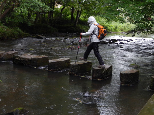
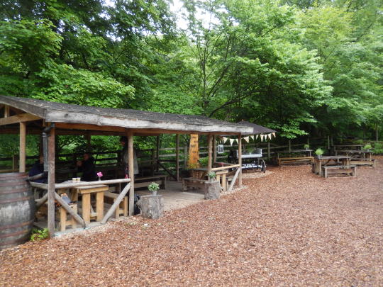
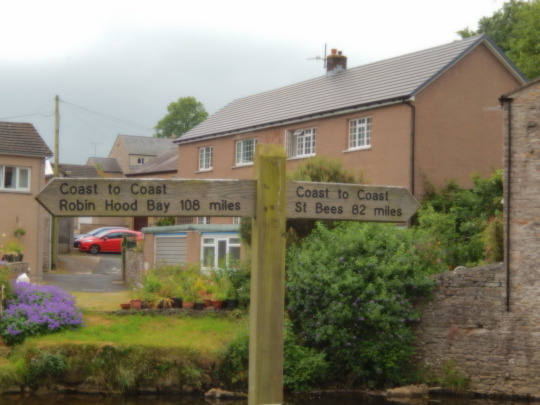
The Grand Finale!
Today was our last day hiking and I though how great everything had been so far. Great weather, interesting accommodations and meeting nice people along the way. That said I thought we would finish the hike without any difficulty. Boy was I wrong. England was not going to let us leave until we truly got a taste of it’s northern weather. We started the hike with a steady misty rain requiring rain gear.

Rick with his rain coat but soon dons his rain pant too.
The walk was 20 miles in rain, temps in the low 50s and blustery weather on the hills. We climbed to about 1000 ft on paths of slippery, muddy rocks and waded through bog after bog after bog. We apparently also walked through a beautiful forest but it was difficult to appreciate it with all the rain and mud.
Some tricky crossings.

Found a cave-like structure from 1799.

We ate lunch outside at this Tea Garden along the trail. The Australians we were with thought it would be a nice place for a wedding.
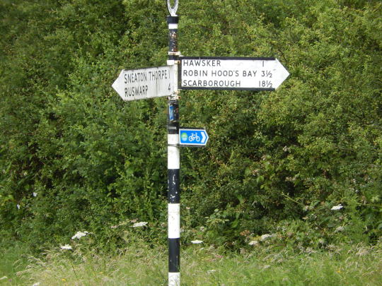
Finally we were close to the end. Only 3.5 miles to go.
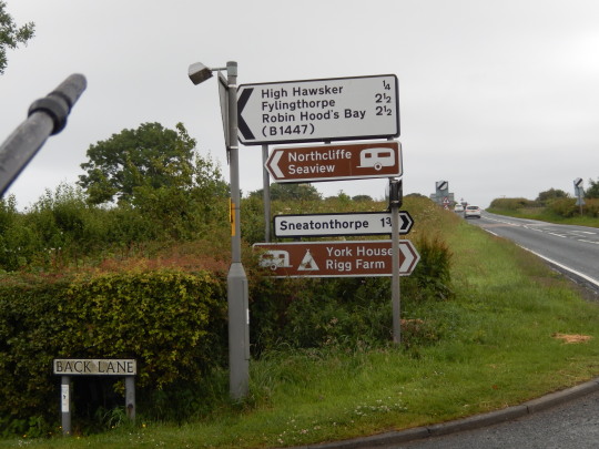
Now only 2.5 miles to go...but not really. That is the mileage via the road. The C2C route is along the cliffs - 4 muddy more miles!!

I’m happy! I can see ocean.

You can tell by looking at Rick’s face that he is loving every minute of it!

You can see the town of Robin Hoods Bay - 0.5km to go.
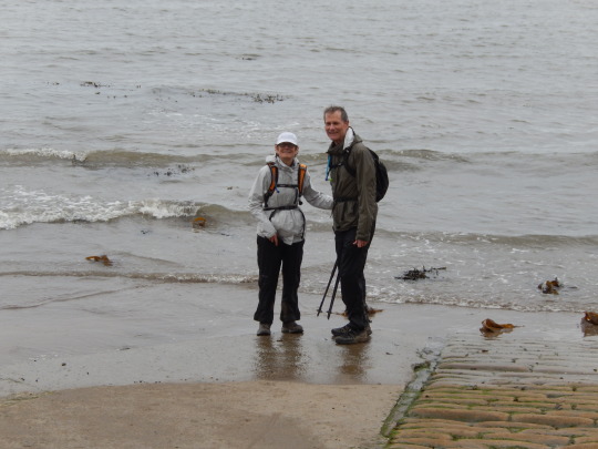
We made it!!
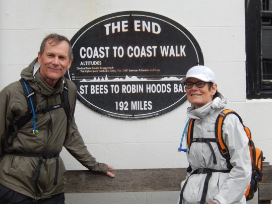
Tomorrow: Bus - Train - Train - Plane - Bus - Plane - Car - Home. That’s our plan. See you soon.
Rick & Paula
4 notes
·
View notes
Text
It’s All Down Hill ...
That was how the book described today’s walk, except for a short up hill at the start. Just as we started walking we realized something was wrong...we forgot our walking poles at the B&B. We made a quick phone call and one of Dave’s buddies drove them to us. That was very kind of him. We absolutely needed them for the up hill start, but probably could have done the remaining incredibly long feet killing hike without them. It was 17 miles in which a good portion of it was on an old railroad bed. The scenery was simply moors and more moors with some more moors with sheep scattered about.

Miles and miles of this scenery. Good news -- no muddy bogs!
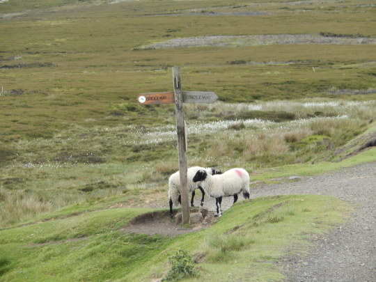
We saw a lot of these friendly creatures.
Then suddenly an oasis appeared in the form of a pub out in the middle of nowhere. We stopped in for an hours break and some lunch. No surprise we ran into several of our hiking buddies all with the same plan. It was a good midway resting point.

I took this picture as the last scenic view of the moors right before we descended into Glaisdale where we are spending the night.
Glaisdale is a cute little village with only 1 pub in which to eat. And, of course the pub is on the other side of the village from where we are staying. So another mile walking there and then a mile walking back to our B&B. 19 killer miles in total today and our feet are really complaining.
Today’s Stats:
Location: Glaisdale
Steps: 44,498
Distance: 19 miles
Tomorrow’s goal: feet in the ocean!!!
2 notes
·
View notes
Text
Last Day of Serious Climbs
Today was great. But it didn’t start out that way. We headed out of Ingleby Cross and on our way to Clay Bank Top. Somehow, despite the maps and GPS we got off trail heading up the moor. To get back on the trail we had to do a little bushwacking. While it was a short detour, it was memorable for the 5 Bs -- buggy, boggy, bushy, briers and just bad. Alas, we got back on track.

A look back at the village of Ingleby Cross -- before we lost the trail.
The hike today involved 5 separate climbs (and descents). The ups and downs all involved pounding our feet on rocks. You don’t appreciate how walking on rocks can hurt until you’ve done several consecutive miles. Ouch!!
After about the 4th climb we were rewarded with a view of the North Sea ... in a distance (unfortunately, still quite a distance). What a wonderful site.

Look carefully at the horizon ... it is ocean!!

We followed a path called Cleveland Way. Don’t know why it is called that but it was a very nicely maintained path that was shared by hikers, bikers and horseback riders. And we saw them all. They were also having a relay foot race on the path so it was quite busy with people.
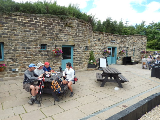
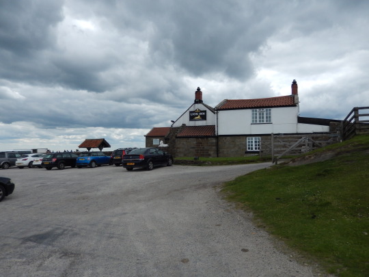
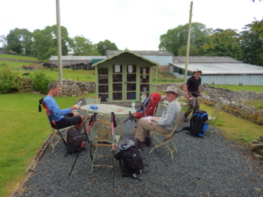
We were also rewarded with a stop at an unusual lunch cafe built into the side of the mountain. It was a great chance to take a break, get something to eat and most importantly, use real bathroom facilities. There is no better site at times than a toilet and a sink with running water!! The three others in the photo are hikers we have been with on the trail this vacation.
We made it to Clay Bank Top and called our B&B to pick us up. There are no places to stay along this part of the route, so B&Bs from nearby villages pick up hikers and drive them down the mountain, and of course, return them the next day to that very spot to continue the hike. So we are staying the night with Dave, a 60 year-old retired builder/hippie who converted an old farm into a B&B for about 12 guests. He runs the entire operation himself. For the evening meal he took us to one of his favorite pubs about 4 miles away. It was great. Got to meet several of his gang of friends. The local pub is really a gathering place for the community -- all family members. We ate in the family room with all the crying kids. Great Thai food!
Today’s Stats:
Location: Clay Bank Top (but really Great Broughton)
Distance traveled: 14 miles
Steps: 33,632
Distance to the ocean: about 40 miles. Can’t wait.
4 notes
·
View notes
Text
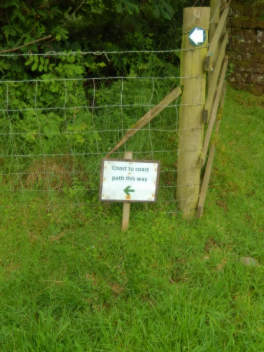
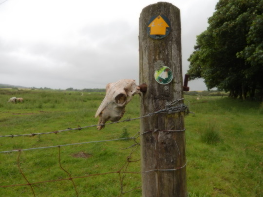
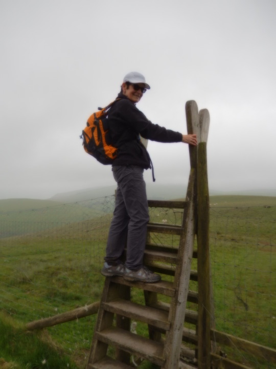
A Walk in the Park
That is what the book says. Today would be an easy, flat meandering stroll through fields and walking on roads. Well not exactly true. Yes it was flat, but it was 17 miles long. We climbed over so many fences and had to dance through countless fields of cow pies and sheep turds that we were worn out. Just as we were approaching our village the last hurdle to cross was the motorway. It was quite busy with traffic so we had to make a run for it and Rick fell “splat” in the middle of the road. I guess his legs just didn’t have the will to move that fast. Fortunately, he was able to quickly get up and make it to the other side with his only injuries being a scraped chin and a bruised ego. (Other hikers saw him splat.)
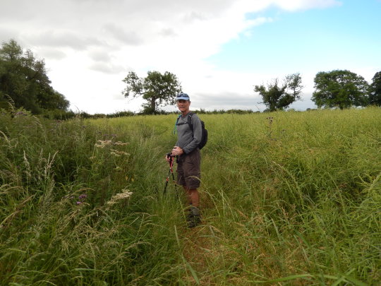
Some of the different fields we had to cross.

Farmers are rather particular about HOW you cross their fields.
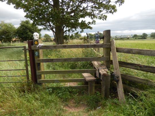
I thing some even try to frighten you off. Note the skeleton head.
At least they warn you that their animals may not appreciate your presence.

And of course we had another cow that didn’t want to move but eventually let us through.

We are spending the night in what I call the gardener’s shed. It is a “tiny” house with a bed, bath, tea making equipment and 2 chairs. No wifi but cable TV. It will be an experience.
Today’s stats:
Location: Ingleby
Distance walked: 17.31 miles (140 miles total)
Steps: 40,841
Total number of blisters on feet: 5
Outlook for tomorrow: 5 hills to climb
Now, off to the pub....
2 notes
·
View notes
Text
Overcast Day in Yorkshire
We started our day off prepared for rain.
We planned to walk about 16 miles to reach Brompton-on-Swale. The walk was fairly easy (compared to several days ago). First it was about 25 degrees cooler. Because of the cooler temperatures we carried very little water. When we hiked in the Lake District with temps in the 90s and the sun beating on us we carried about a gallon of water each. Lugging that weight up and down the mountains was tiring enough. But today was again rolling terrain with misty cool weather.
Gentle hills as above.

Wooded areas too.
We also walked through several small villages. I had to find the village defibrillator. Always in a convenient, centrally located place.

They still have blacksmith shops that are several hundred years old.

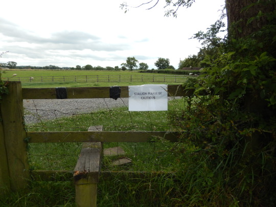
The coast to coast signage was very good in this area so we didn’t get off trail much making the day easier. However, we did have one challenging moment where we had difficulty getting through a gate.

That cow did not want to move and he stomped his feet and just stood there staring at us. Previous times the animals would just move as we approached but not this guy. So I took his picture and then he meandered off. He just wanted attention.
We made it too our B&B only to learn that they had a kitchen fire about 7 weeks ago and cannot serve food yet. But to accommodate us hungry, tired hikers they ordered pizza delivery for us which we ate in the bar. Otherwise we would have had to hike 20 minutes one way to another pub that serves food. Our tired feet were not having it.
Location tonight: Brompton-on-Swale (6 miles passed Richmond)
Total miles covered: 122 miles
Tomorrow’s plan: More fun
3 notes
·
View notes
Text
Days 6 & 7
We missed yesterday’s post because of lack of WiFi -- which I will explain. We took off from Kirkby Stephen with a slight drizzle of rain for which we were prepared.

We invested in rain gear. We may as well use it. But it actually never really rained during the hike.
Shortly after our start we were greeted with this sign.
So we were almost half way. You had the choice to take the high route or the lower route. The recommendation by the book was to go the lower route in bad weather. So because of the threat of rain we decided to go low. It certainly wasn’t the easier route. Lots of mud bogs and we got off the trail multiple times.

This was what we had to slop through much of the day. Since we were out of the lake district, the high mountains were gone, just rolling hills.

Finally, after about 13 miles (some extra because of the crazy trail conditions) we made it to our B&B - The Little Birkdale Farm. A very unique place that is up on top of one of the moors and off the grid. The owners rebuilt an old ruined farm/barn into a home and a small studio. We were the only guests. The owner has it powered by a wind turbine/batteries/back-up gen-set. That is their only source of electricity. They have propane for gas. Hence no WiFi. It was very beautiful. We even got to experience a strong storm that night with very high winds.

Our night’s location. Note the wind turbine.
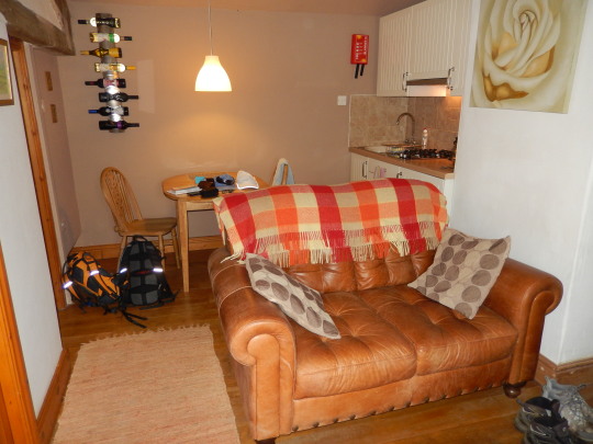
Inside the guest studio.

Nice bathroom.
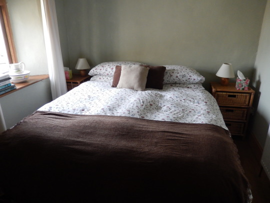
Big comfortable bed.
Completed 93 total miles by way the crow flies. Clearly more by trail.
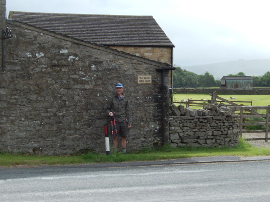
Today we set out for Reeth with the plan to cover about 13 miles. The start of my day required a bit of foot care.

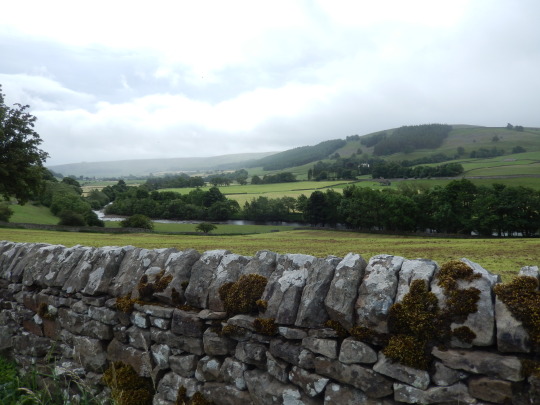
Again the weather was a bit iffy but we did not have actual rain. Instead, we spent a good portion of the day walking through a cloudy mist. There was not too much elevation change so the 13 miles didn’t seem too hard. There was a nice Tea shop where we stopped for lunch and met up with several hikers we have connected with along the route.

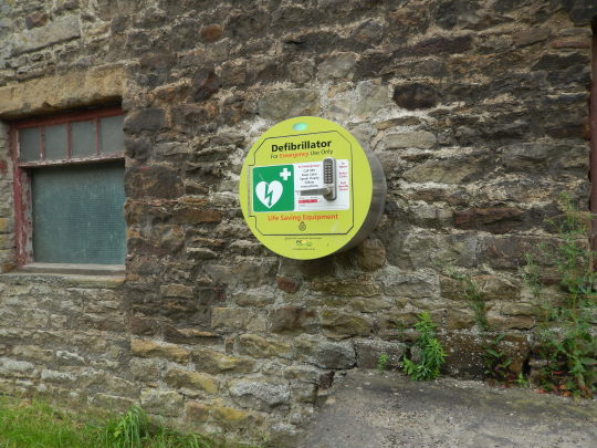
Slightly different scenery than the lake district. Reminds me more of the real England. You walk through these little villages where all the buildings are of stone and look hundreds of years old. The you see something like below. The yellow box on the building is the village’s AED! Incredible.


As you walk along the pastures you have to go through gates and it seems they keep getting more and more narrow. This was one of our tighter squeezes.
Anyway, we made it to Reeth (actually Fremington, just past Reeth) and according to the book a total of 106 miles since St. Bees. Now officially, more than half way.
6 notes
·
View notes
Text
The Longest Hike

Not the way you want to start your 20.5 mile hike to Kirkby Stephen with a blister on the side of your foot. Fortunately we brought two large rolls of moleskin with us. It works wonders. In fact, at breakfast we were passing out moleskin to the other hikers too. No one had heard of moleskin before -- even the Americans.
Even though today’s hike was long, it wasn’t as challenging as the 2 previous days. We literally hiked all day through rolling hill sheep pastures. Beautiful views of the area.

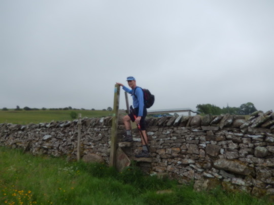
A bit foggy, but this is what we hiked through all day. You have to open and close the gates for all the pastures. I bet we went through at least 30 gates. Some times over them instead.
There are stone walls like this for all the pastures. This might be an answer to our border wall with Mexico. Oh wait, you can easily go over the wall.
A couple of young ladies set up this rest stop on their farm as a way to raise money. They had cold beverages and homemade snacks for hikers. You just make a donation. We are with 2 Brits and a Scot that we have walked on and off with these past few days.
Stats for the Day:
Location: Kirkby Stephen at the Jolly Farmer B&B for the night
Steps: 47,461 - Hiked about 21 miles today.
Weather: Perfect today. Not too hot, not too cold. Britain however is having a heat wave further South. Temperatures were 30 degC (86 degrees F) and predicted to go as high as 34 (93F)! I just don’t want it to rain but that is also predicted for later tomorrow. Oh well.
Cheers.
2 notes
·
View notes
Text
Most strenuous single day route
What a long, tiring day! We started off our day from Patterdale with a good sized breakfast...the same one I have been eating every day.
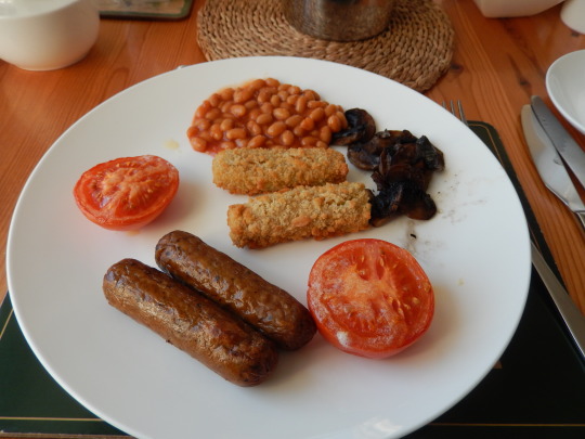
Veggie sausage, beans, tomatoes, mushrooms and veggie sticks. Yum. Some times there is fruit. Oh, and naturally, tons of coffee.
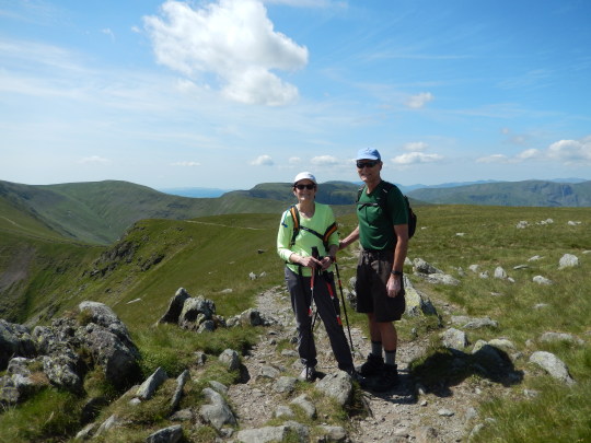
We had a very long steep climb which took the entire morning but we made it to Kidsty Pike, the highest in the region. We had a wonderful lunch on the top.
From there we had a long walk down to a huge lake. The walk was a steep descent, with rocks...of course. The killer part of the hike was along the lake, rock, mud and the sun was just beating down on us.

Haweswater, the reservoir for Manchester, We hiked the entire length of the lake.After that we still had about 6 miles to go and Rick was running low on water. Duh, we just walked along a reservoir but no potable water. Walking past a home, the homeowner thought Rick looked a bit ragged and offered him water. No surprise, Rick took him up on it.
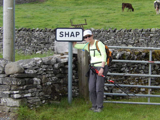
At last we made it to our destination, Shap, a bit tired but still loving it.
We walked much of the way with Emma, a nurse from Scotland, and Alan, a Brit from Newcastle. One thing I have learned, just because someone has a British accent doesn’t mean they know where they are going. Trust them but verify with GPS. Rick and his GPS app saved us multiple times.
Trip Stats:
Miles walked today - about 17.
Steps: 44,742
Total mile completed: 62.1 mile - more than 1/4 of the way.
Tomorrow: Longest mileage 21 miles
Cheers! I am now going to do some laundry.
Paula
3 notes
·
View notes
Text
Day 3 - What was I thinking when I planned this trip!
We are now resting in Patterdale at a small, quaint B&B. What a long, feet torturing day but with fantastic views and great weather -- sunny and temps in the high 70s and low 80s. However, the Brits are all saying it is hot.
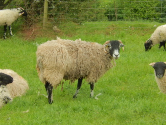
We left Rosthwaite at about 9 am and headed to the top of the mountain. Again, the path was pretty much full of rocks with occasional stream crossings and bogs (sinking your boot into mud and water). However, none of that bothers the sheep.
After that long excursion we had a gentle walk passed a village where most people spend the night. But we had to make it to the next village, again up over a mountain. As we started up the mountain I asked one of local people out for a day hike how far it was to Patterdale. He said , “Oh bloody hell, you are a long ways from there.” That boosted my hiking spirits given my feet were complaining about the rocks.
We did make it to Patterdale at 5:00 pm dead tired. Traveled about 17 miles, 41,000 steps. We are a total of 46.6 miles into the C2C walk!
Sorry there are no pictures. I couldn’t get it to post if I put pictures in. Maybe tomorrow.
4 notes
·
View notes
Text
Rock Garden Heaven
Day 2
Fun Facts: We are now in Rosthwaite, 29 total miles into our journey. Weather - Sunny and warm; Walked 41,591 Steps today and climbed as high as 2000 feet.
Now the details:
We started our hike by going half way around Ennerdale Water. You could take the North route or the South route. We chose the South route as it was shorter and described as a “scramble around”. Language lesson : Scramble around means you will be climbing or walking over rocks. Who knew? And we are not talking chip and seal!
Ennerdale Water

One of the “fun” descents. Yes, that is a cliff at the bottom.
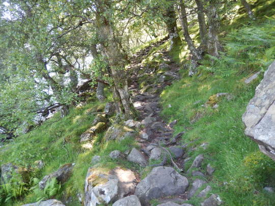
The whole trail around the lake looked like this.
After the “fun” lake hike we headed through a valley and then climbed one of the mountains. Beautiful view from the top.

We hiked all the way from the distant lake you can see.

Beautiful views the rest of the hike...but still “scrambling” on a lot of the trail. We met so many hikers on the trail. We didn’t realize that this weekend there were numerous famous competitions for hikes through the area. We were so into our hiking that we ended up going 1/2 mile past our B&B. Had to turn around so we added an extra mile just for the fun of it.
4 notes
·
View notes
Text
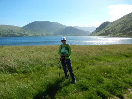
First Day - A Success
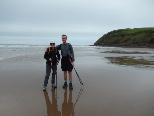
We started our hike in the traditional way - touching the ocean with our feet. The start was very scenic along the coast. Ever wonder why the coastal bluffs are white? A zillion sea gulls inhabit them...look closely.

We had varying terrain from flat pastures to dark forests to climbs into the clouds, all very interesting. The weather was very typical, cool, overcast and breezy which was actually nice because we didn’t workup much of a sweat. So far we have met a lot of nice people from around the world ... Brits (of course), Australians, New Zealanders and Chinese. My cultural lesson for the day was Hiking in New Zealand is called tramping. So I guess hikers are tramps. I think I will stick with the American lingo.
In some places the signage for the trail is very good but mostly it is very challenging to be sure you are going the right way. Of course Rick made sure we stayed on course with the GPS maps on our phone. We had to reference it many times.
Now this is obvious.
This is what happens if you miss the trail and have to back track.
Convenient fence crossing. We walked through so many sheep pastures that it made dodging goose poop on the Intelliplex peoples trail child’s play.
This is the source of you beautiful wool clothing...dog hair much better!
We wrapped up our day by making it to Ennerdale Bridge. From there we had to catch a ride from our hotel van up to the hotel because there is no walking path and the highway is too dangerous to walk on. Signing off from the pub sipping tea and a pint of bitter. Rick & Paula
4 notes
·
View notes
Text
We made it to St. Bees!
After 24 hours of travel -- car-plane-bus-plane-train-train-train -- we finally made it to St. Bees for the start of our hike tomorrow. Although the travel was long with all the transfers our detailed planning paid off. There were no glitches and we made every connection. A shout out to Virgin Atlantic Airways. It was a great flight across the pond. We flew last class (cheapest) but I felt it was just as good as first class. We had great food, free alcohol and free electronic entertainment. I highly recommend them.
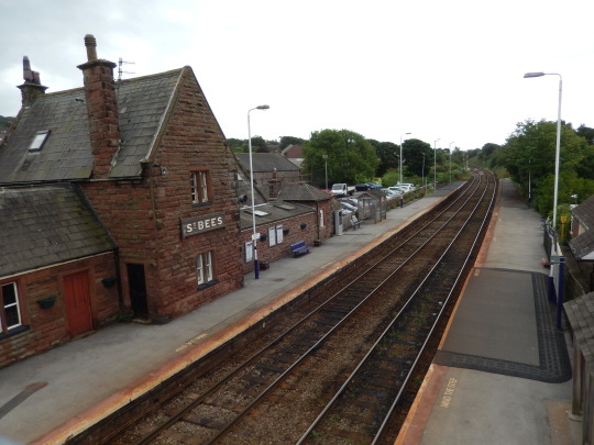
The St. Bee train station. Very quaint and typical small town stop.
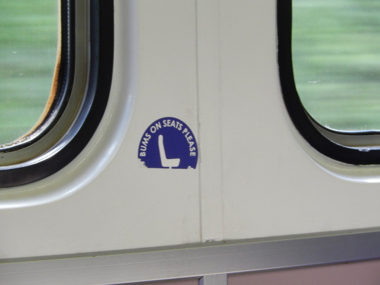
The Brits are so proper! I think the American phrase would be “Sit your ass down”

Our B&B accommodations for the night. Very nice, great food, sketchy WiFi, but typical of Northern England.
3 notes
·
View notes
Text
Wainwright Trail
We should have put the following image in the post yesterday. It is our path for the next two weeks.

1 note
·
View note
Text
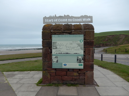
Coast to Coast Walk
This is first blog entry for coast to coast walk. Of course, I am referring to the Wainwright trail across England’s north. The trail begins in St. Bees along the Irish Sea and ends at Robin Hood’s Bay on the North Sea coast. We actually start the walk next Thursday, but wanted to start the blog now to test out.
We are leaving mid-week which is a bit unusual, but found the travel connections were better and less expensive. Trying to get our gear together this weekend so Tuesday night will not be such a rush. The most important item (outside of passport and money) is the rain gear. It is no accident that the B&Bs advertise “drying” rooms as an amenity.
Never the less, we are looking forward to the nice walk through the lake country, Yorkshire moors, and quiet villages. Our last hike in this part of the world was in 1983, so we can check out all of the changes since Margaret Thatcher was calling the shots ... that’s assuming our memory isn’t completely shot.
Will be back later ... Rick and Paula
2 notes
·
View notes