
koala-chaser
Koala Chaser
Wandering around upside-down-land looking for koalas to hugAsk box is open ;)
227 posts
Don't wanna be here? Send us removal request.
Last Seen Blogs

no-se-quien-soy
no sé quién soy

saneriddlefan67
Jerry :3

studynwrite
study'n'write


da-sims-story
Daisuke Arakawa's Diary
Photo
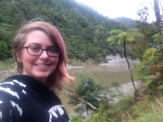

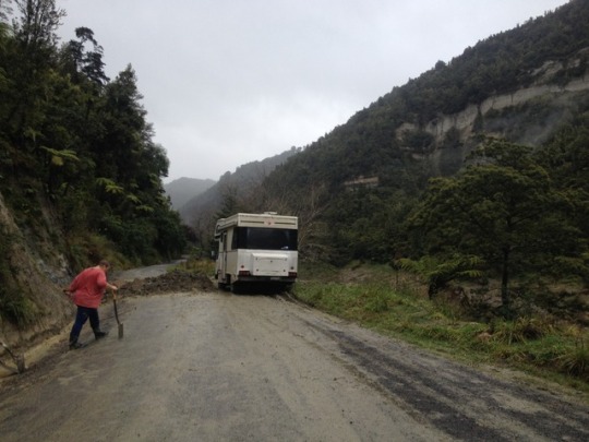


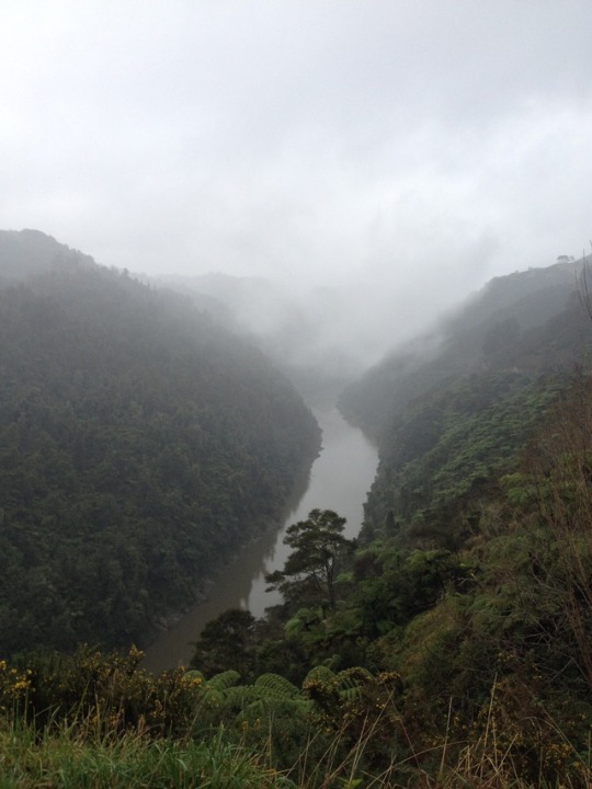


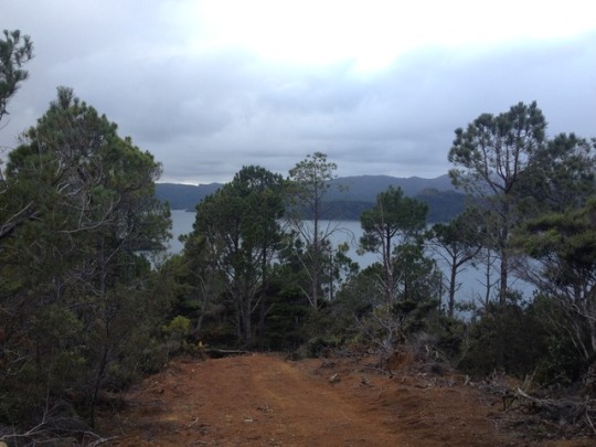
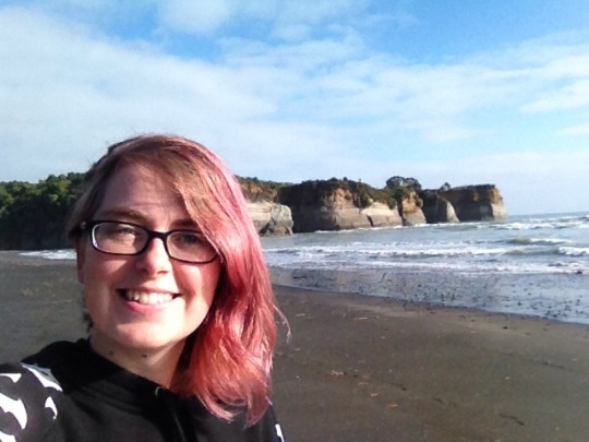
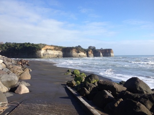
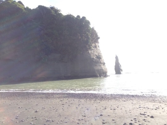
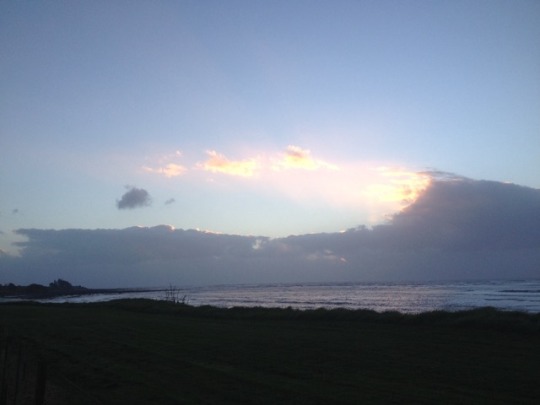
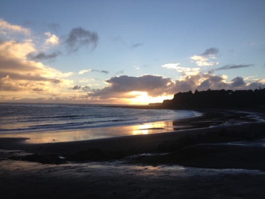
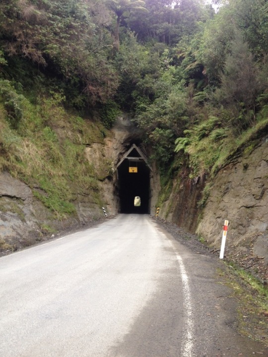
24/25th June Whanganui River Road to Whanganui
The Whanganui river is one of the nine great journeys of NZ! Typically started off the forgotten world highway and travelled via canoe, the bottom 64km can also be done as a road trip if you like narrow roads and tight bends (but it is a sealed road!). I figured it would be more exciting than the highway, and it certainly proved me right. A beautiful winding drive along the wall of a gorge stretching the length of the river. A mix of native bush and pine trees, very little cleared areas and farmland (although a lot of farms, not sure what they're doing with them!). It's largely a DOC national park, but also ancestral land for the local Maori tribes so again there's a number of maraes on the route.
The first adventure came only a few km onto the road where there was a big mud slips. Slips are a pretty common fact of life driving in NZ, particularly with the weather being on and off so much lately. I've been stuck at stop signs waiting for diggers to clear them, more often forced into single lane passages to get around them. This is the first time I've had to help clear one! Luckily my timing was pretty good, I arrived after most of the heavy digging had been done and there was a track through. Unluckily the campervan right in front of me veered a little too far to the side and got stuck. With one local, one camper and two other tourists going the opposite way, we had a bit of a mission to get it out. I had a nice conversation with the van driver, who is from Wanaka in the South Island and came up here for the kiwi picking season, while we waited for the local man to drive home and pick up tow ropes, and then as soon as he'd come back and got everything tied up to his (small, old, not-4x4) car, a massive ute came barreling down from the other side, barely even pausing before the owner jumped out and grabbed his own tow cable.
This must be a fairly common occurrence, I saw plenty of other cleared slips on the drive around. I decided not to chance my driving to get Piri through the mud, but the local guy had her through no hesitation. At least it was a beautiful spot to be stuck for an hour!
Highlights of the drive were an old flour mill, all still left standing as it was and free to access, and the marae at Koriniti which has two meeting houses, both elaborately carved. There's a sign up the top of the road saying visitors are welcome to enter (this is rare for maraes, generally you have to be invited and go through a ceremony) but since it was late and winter there was no one around to let me in! :) it was nice to look at anyway! Further on, I did half of a walk up to a viewpoint before being stopped by the mud and then finding a perfectly good viewpoint on the road :)
Back on the highway, I headed directly for Whanganui which appears to be NZ's big art-focused town, lots of galleries and public sculptures. Although it was Sunday so not everything was open, I explored a few galleries and watched a man working in a glass blowing workshop with lots of heating and rolling and stretching of coloured glass.
4 notes
·
View notes
Photo
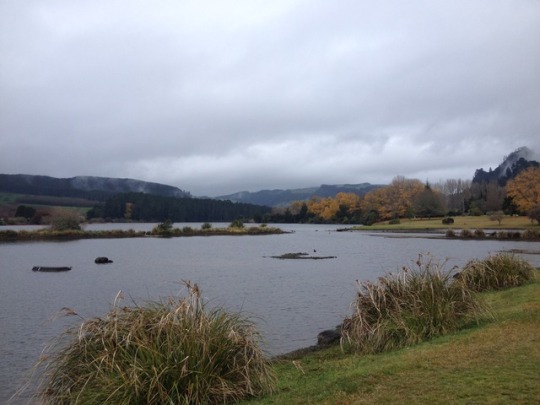


23rd June - Central: Mangakino to Okahune
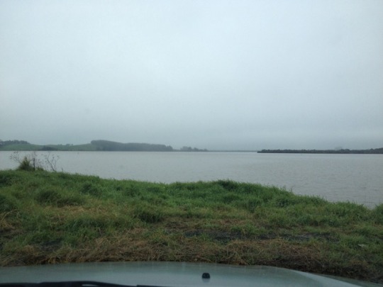
Heading south I was aiming for different roads than before, so I headed down from Mangakino around the west side of lake Taupo. There is a reason the East is the tourist drive! The west is a reasonably nice winding road through the farmland, but there's almost no lake views (I think because of the terrain not the weather, although the lake view I did get is mostly cloud!) I passed another nice power station lake up at Whakamaru, the entrance to a few hikes that would probably be nice on a dry day but otherwise not much.
Further south it was back into National Park territory, but with the clouds still hanging low Ruapehu and Tongariro were virtually invisible. The rain was only getting worse, so I pretty much stuck to the driving down the west side of the park to an overnight camp at Raetihi where I took advantage of the indoors to hone my jigsaw skills (and avoid another night hanging out in the car!). The next morning was not exactly gloriously sunny, but the rain was spitting rather than pouring so I headed up the Okahune mountain road to the Turoa ski field. It's still closed due to lack of snow but there were a couple of waterfalls on the way up, one of which had a starring role in Lord of the rings (Gollum caught a fish there) and they were very pretty. The views would probably be fantastic on a clear day, but I mostly got cloud and rain then back into Okahune to stock up for the Whanganui river road.
36 notes
·
View notes
Photo


22nd June - Central: Ngatea to Mangakino
So much for seeing places without the rain! It started coming down in earnest only a little while after I left camp, varying from torrential to spitting but never actually stopping outright. I visited Karangahake gorge, which looked super beautiful and had lots of interesting walks around old railway lines and mining tunnels that I couldn't do because of the rain. Then I headed up mount te aroha and got a nice view from halfway up but couldn't hike to the top because of the rain.
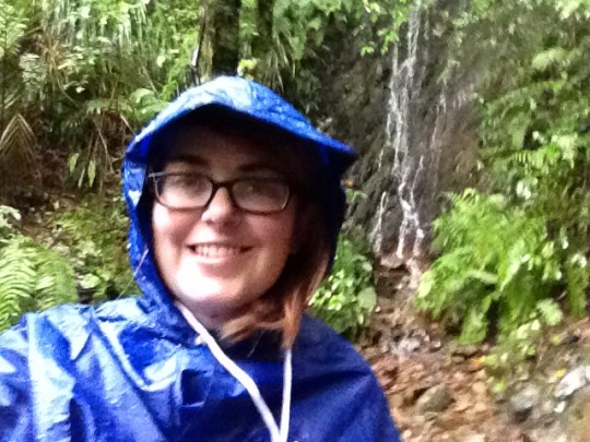
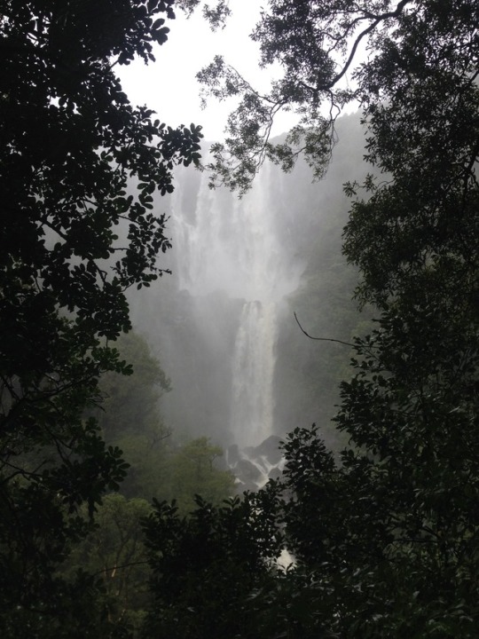
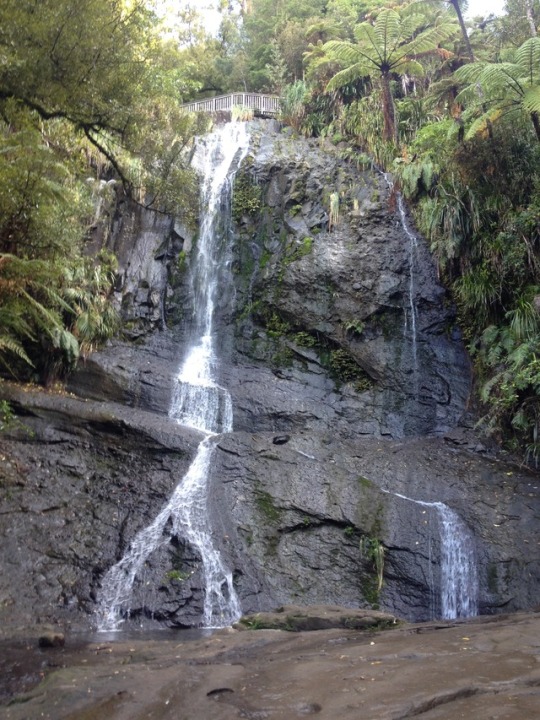
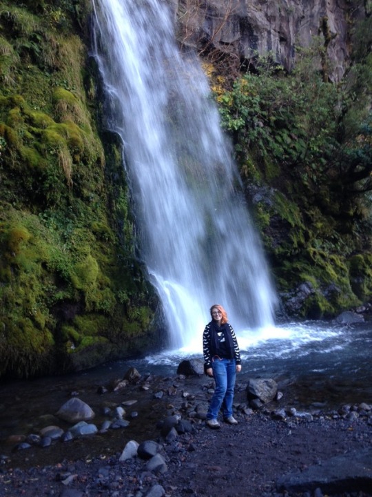
By the time I go to the Wairere falls I was desperate for a break from the car! You couldn't see them from the road so I thought I'd break out my stylish poncho as soon as the rain lessened and see how quickly I could do the 45min walk up to the lookout. Result: sadly not that quickly, since the path had turned into a stream and the walk was mostly done jumping from one rock to another. My poncho was great for heads and upper halves, but my knees down got soaking wet. I'm glad I saw it, the waterfall is the tallest on the North island and is pretty incredible, but I didn't bother trying the climb to the top and I didn't particularly enjoy being soaked so perhaps next time I'll wait for a sunny day.
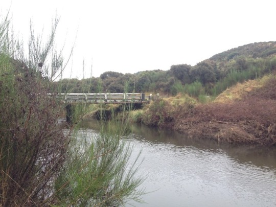
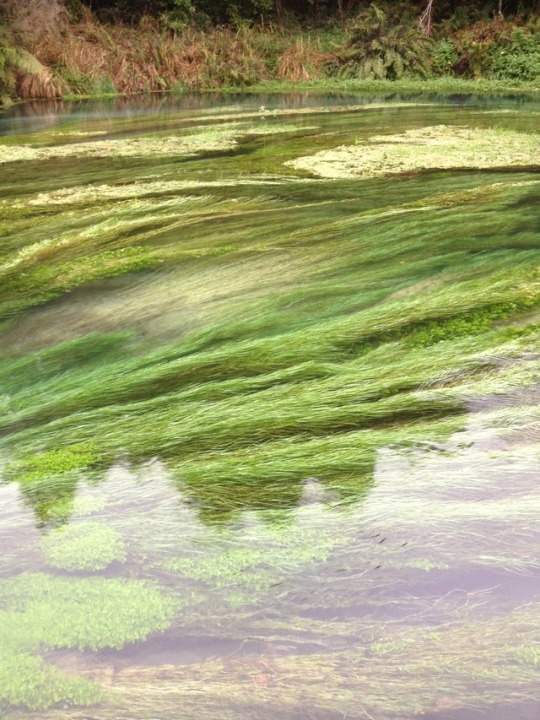
Further south, the rain stopped long enough for a ten minute walk to the blue pools, a beautifully clear river where the water is tinted blue (possibly it's very blue on a clear day). Then I was planning to drive south on the highway but a police diversion led me to pick another route along the Waikato river. Way back when, Hasan and I drove along this river looking for the mythical 'Waikato river trails'. Today I found them! But the shortest one was a solid 11km and the sky was still threatening. I did a short walk to check out a swing bridge over a gorge, very impressive if a bit nerve wracking worrying about phones falling out of pockets on the walk across! The road wound along the river, past various lakes all man made running a power generation system that starts with lake Taupo and runs through nine more dam lake power stations on the way to the sea. My camp for the night was another one at mangakino, very picturesque and not too many people.
#Karangahake gorge#Wairere falls#RAIN#Waikato river#blue pools NZ#Mangakino#road trip#Piri#Koalachaser#main#NZ
8 notes
·
View notes
Photo


21st June - Auckland to Ngatea
The night after the big crew trip I was crashing back in Ket's car port. I'd had a small engine issue that Jono had fixed at the boat, but I wanted to run the car a bit to check that it wasn't going to stop working again as soon as I left the city (and drove away from anyone who could help me fix it again) so the two of us went for a trip up to the Waitakere ranges. Previously I'd driven through them on both my trips to Piha and stopped at different waterfalls each time, this time I didn't need to go as far as Piha, so we picked the closest waterfall and just headed up there instead.
Fairy falls was really nice. Maybe a half hour walk from the main road, but then we easily spent another half hour at it. There's four or five different plunge pools as the waterfall drops down through the trees, and after the last one the river gets shallow enough that you can wade down it even further to explore through the bush. This isn't advised in skinny jeans, but luckily if you have a jumper you can retool it into a stylish skirt to save trying to roll your jeans up. So I finally got photographic evidence to back up all my claims of climbing the waterfalls I visit (I really did climb this one! Look! Proof!) a beautiful spot to swim in summer, we still managed to get soaking wet deciding that the best route down was on the other side of the waterfall therefore the only option was to walk through it. (Yay, logic!)
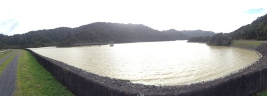
The next day I started heading south again, I'd picked out a new route that went via roads I hadn't visited before, and then very quickly diverted from it onto a road I had. The logic here? Well it was a glorious sunny day and the last time I visited the Wairoa Reservoir it was raining too much to see anything. This time I managed to walk up to the top of the dam, see the sheep grazing down one side of it, and then hike through the hills to get some views out over the lake and round through the bush back to a swing bridge over the river. Definitely nicer with no rain!
I'd stayed at the camp site in Ngatea once before as well, but this time I took advantage of the dry to explore the town a little more, and found a little community vegetable garden to restock my herb supplies.
4 notes
·
View notes
Photo
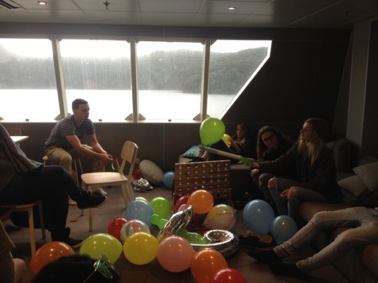
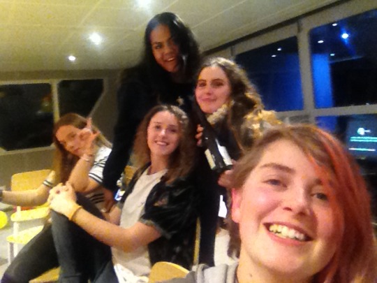


18th/19th June, Crew trip part 2
What’s that? A large group of my favourite people chilling on a boat? Do you think we could have a... party? :D
Back on the boat, after a hot shower (woo!) we had a BBQ dinner and hit the bar. It was an awesome night, balloons and music and a piñata that you couldn't break open with foam swords, although that didn't stop us trying.
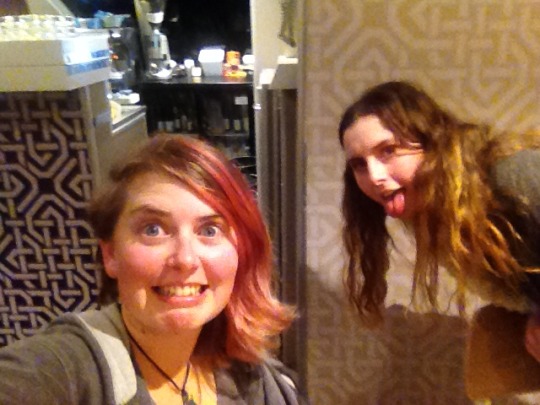
It was a slow morning after, with some moaning and groaning as everyone steadily emerged. A couple of us found the courage to jump off the side of the boat and into the water (which felt a lot colder than the day before!) which wasn't entirely pleasant, but definitely cured the hangover! Then we had to take the tender across to the small town (generous name for a couple of houses and a shop!) to drop off Lucky who was flying back to England that very day. Since the boat wasn't guaranteed to get back in time, Lucky caught a plane from the island to the airport! We were given strict instructions to drop her off quickly and go right back to the boat to head home, but she offered to buy us all ice cream so naturally we went with her up to the shop instead and hung around for a proper goodbye :)
Fortunately no one back on the Ipipiri seemed to mind and after we got back and all the fishing gear was put away we headed home. Taking a similar route back, I hung out in the bridge with Richard and baby Kesia to watch the world drift by until all too soon we were back in Auckland again.
3 notes
·
View notes
Photo


(Once again apologising for the long gap. Again, posts will be dated back to the actual time they happened. Life has been throwing twists and turns again, but a quick summary is I’m back in Auckland now, working full time. More details to come, but for now I’m going to try and catch up on the adventures that slotted in between now and the last posts!)
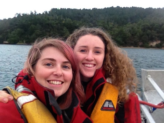
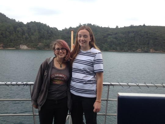
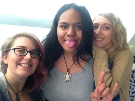
18th/19th June - Crew Trip to Great Barrier Island
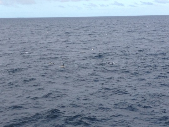
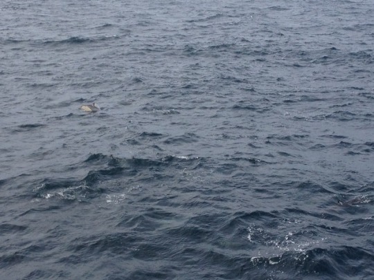
The trip was awesome! Totally worth driving all the way back up for, it was great just to see everyone again and to get to hang out. We had about 38 people on board in the end, including partners and babies. Everyone got cabins (luxury!) and I definitely took advantage of the constant hot shower access (so many showers). To start with we took the boat out and started motoring off towards Great Barrier. It's about four hours from Auckland on the Ipipiri, with some amazing views going past Rangitoto and Waiheke then up the harbour with the whole coromandel peninsula spread out alongside. We had clear blue skies and sunshine for long stretches, and we were sitting up the saloon to watch the world go by and hunt for whales and dolphins. Naturally, it was the middle of lunch when we found them, but it was worth the food going cold! A pod of over a hundred common Dolphins came up to check out the boat, jumping in our bow waves and around our wake. We reckon they were chasing fish, there were plenty of birds overhead looking for their share, but they weren't in any hurry and were very happy to come out on a show and play with us.
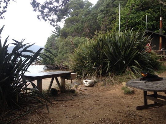
Then it was up to the island! Great Barrier is a pretty big island, there's a small airport and a ferry runs out there occasionally (although it's a long trip). A lot of native bush and DOC campsites, it's also adjacent to Little Barrier Island which is a completely isolated nature reserve - the shoreline is all tall cliffs except for one very small shingle beach where the DOC occasionally risk mooring their boats, so there's no way for predators to get there. We dropped anchor near a bay on great barrier and a few of us took the tender across to a beach area that's been built into a way station for boat travelling long distances around. There's a little bathhouse with a firewood powered water heater, a set of old school water squeezers, toilets and even a bookshelf like hostels have, where you can swap books around. We did a bit of a walk inland up the hills to check out the views, hindered a little by half of us not having shoes, then headed back to the beach for a paddle before tendering back to the boat for sea biscuiting!
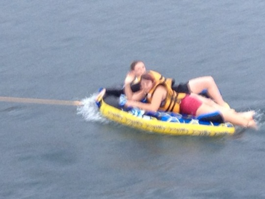
What is sea biscuiting? It's when you inflate a giant circular disk (biscuit) and tie it into your motorboat than drag it along behind until you fall off! I went on with Chloe and we fell off many times, but it was awesome fun. She was mostly better at balancing than me, except for the moment when she started slipping off and decided the solution was to grab the back of my life jacket so I was pulled off too!
5 notes
·
View notes
Photo


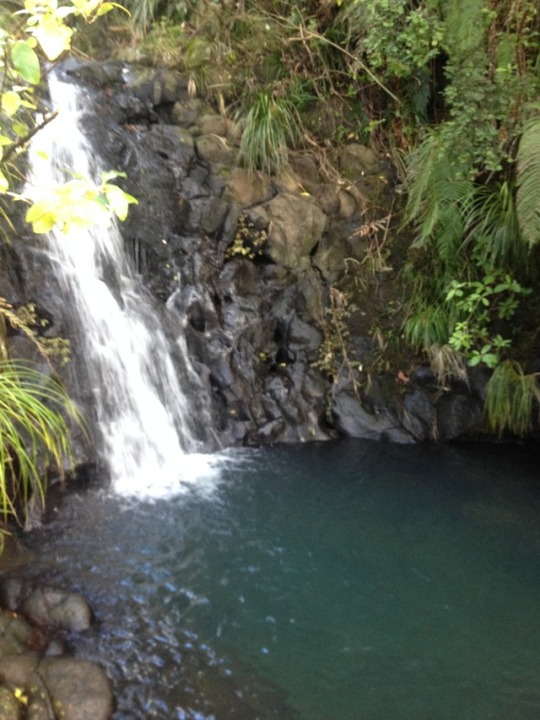
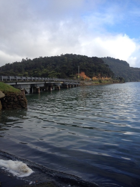
Te Kauwhata to Auckland Although I could have headed on up the motorway, I decided to do some exploring. Just south of Te Kauwhata was a place called Rangiriri where a historic battle was fought between the Maori and the Europeans during the land wars. They have a cemetery there to remember it, although all the graves are for the Europeans who were killed. I think the Maori remains have been moved to a significant site elsewhere. Across the highway, I visited lake Whangape which was an amazingly still, untouched lake with only one public access point for boats, and the water quality is too low to swim in. There was a couple there in a tardis motorhome who were super friendly and we got chatting about NZ, and then their daughter who's in England 'near some town called Stratford' ;) maybe we're neighbours! Heading up north vaguely parallel to the highway I visited Vivian Falls, a little off the beaten track but marked on my road tripper app by other travellers. I wasn't sure about the winding farm roads to get there, but then it was only a two minute walk from the car park and it was a super pretty waterfall, with loads of great rocks for scrambling and a sign dedicated to the Maori history of the area, where a young man had used the falls to train his men before going off to fight the big cannibal leader of the main tribe. I did make the sensible decision to remove a few items of clothing before scrambling on the rocks, but then balanced this by making the less sensible decision to try and climb under the waterfall and getting all the clothes I'd kept soaking wet. This would have been less of a problem if my jeans and leggings hadn't gone in the sea the day before, so I ended up driving to Auckland in my last pair of dry trousers. I thought I'd head straight to the house to dry off, but then the sun came out all of a sudden with blue skies and warmth coming through the windscreen and I thought I had to take advantage! I checked my route up and found the Auckland botanic garden just off the main highway. On the scale of botanic gardens, it's pretty high! A huge area, with a whole section set aside for native bush and then a series of different gardens including roses, winter flowers, South African plants and a big emphasis on education and children. A really nice place to spend an afternoon, although I'll admit I didn't spend much time in the native bush section - when you've been hiking in it for a month you sort of lose the novelty! :)
24 notes
·
View notes
Photo

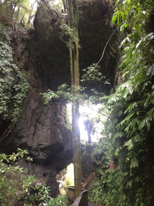


West coast: Waitomo and Kawhia You may recognise the name of this place! Waitomo is the location of the most famous glowworm cave system in NZ, it's where we came on all those hobbiton tours to see the glowworms. I figured I probably didn't need to do that again, but the road wound out west passing a few points of interest so I figured I'd head that way anyway. First up: Mangapohue natural bridge. A rock formation that forms a bridge (I think) 17m over the river below. I wasn't sure what to expect, but it was stunning! The walk out there wound along the edge of a canyon, towering cliffs mixed with native trees. I was there in the rain, but if anything that only added to the atmosphere. The bridge itself is amazing. Bigger than I'd expected, the path goes up underneath instead of over the top and there's something incredible about standing underneath it. This whole cavern, carved out of the rock by a river that seems so tiny in comparison and so much more life than you see in the caves, with trees forcing their way out of cracks and moss growing everywhere. Even the stalactites are different, formed from moss instead of just water, giving them a more bulbous shape. I did the loop walk around to the car park, then went back down the canyon for a second look. There's something very special about it. Second: Piripiri caves. This is a normal cave, there's a structure at the start with steps so that anyone can get in for a look. No lights, so you have to take a torch. A few DOC Rangers were down when I was there, their torches were much better than mine, and they also showed me where to climb down to get deeper into the cave. There's a small path after a rock scramble, leading to a pitch black part of the cave (no glowworms here!). It was a bit too muddy to keep going on after the path, but it looked like the cave system keeps going. Third: Marokopa falls. This was my real target, it's been marked on my 'to visit' map for a while and it didn't disappoint. Beautiful big waterfall, amazing scenery. Only disappointment was that due to the rain and the time of year, the path down to the base was impossible. (Although I was getting wet at the viewpoint, so likelihood is even walking to the base would get you soaking wet from the spray.) I decided I didn't want to go back on myself, so I followed the mountain road up north around an amazing natural harbour and up to Kawhia, a surprisingly busy town considering it's a long way from anywhere. Kawhia has a hot water beach, similar to up the coromandel, but this time in black sand. It was a bit late to go digging, but the beach was beautiful anyway and the water didn't seem quite as painfully cold as everywhere else when I went for a quick paddle in the waves. Back on the main road, I realised I hadn't actually made it very far north at all, and had to push on into darkness on the motorway to make it to my camp. Although it felt like forever in the traffic jams, it was only about 6:30 when I got there (winter means night comes on early!) plenty of time to cook and sleep.
4 notes
·
View notes
Photo


West coast: Waitara to Waitomo I think this is still the surf coast highway, it was certainly very similar, the road winding up past the sea but just offset enough that mostly all you could see was farmland. I stopped at Urenui in the morning, which is a small village on the end of a river winding into the sea. It's interesting with the village set on the river back, and then across on a small spit between the river and the sea is a little secondary village of baches, all built very close together and shut up for the winter. According to a sign, the area originally had tents then people started building permanent structures and it became a Bach town around the 60s when they added power and a sewage system. It would be a great place to have a holiday house, with the cliffs on one side, the river and the sea a little calmer than the beaches up and down the coast. I spent a while walking along the river and the coast, before heading back to the road. Shortly after Urenui, the road curved back inland up through the mountains. Lots of amazing scenery, lots of farms and bush before it wound back to the coast at a place called the three sisters, where the rocks form pillars on the beach. I only saw them from a distance, since the walk out to the beach is only accessible at low tide, but the road stuck to the coast with some nice views back to the white cliffs and out over the sea before heading back inland, through a gorge and up to Te Kuiti, a small town. My camp was nearby at Mangaokewa scenic reserve, a small gorge with a river running through. There was a hike along the edge of the river that ran past two waterfalls. Not the most impressive waterfalls I've seen, but it was a nice enough walk and nice to get back and not have to keep driving!
7 notes
·
View notes
Photo
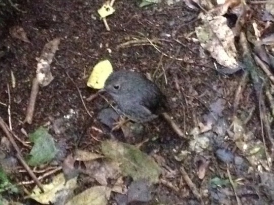


Taranaki: lake Rotokare Had a bit of a change of plan after finishing up the surf coast highway in Hawera. The plan had been to continue heading south via Whanganui to end up in Wellington, but I got a call from Lucky on the boat in Auckland to invite me out for a final crew cruise before the boat came out of the water and went on sale! I know it's hard to believe since it's taken me a month and a half to get down here, but I was technically only one day's long drive from Auckland so I definitely wanted to go. I even had more than one day! So I started heading north again, without too much hurry. The first place I headed out to was just North east of Hawera, a scenic reserve around lake Rotokare. There are a lot of reserves in NZ where they're trying to control introduced animals (possums, goats, rats, stoats) but Rotokare has one advantage: a massive pest proof fence all the way around the circumference! It even has an airlock system going in and out, you have to wait for the gate behind you to close and then check your car and surroundings for any pest before going through the second gate. The last time they caught a possum in the reserve was 2015, so they must be doing something right! It's a beautiful lake, you can walk all around the perimeter and it's a great place to see some native nz birds. I saw a couple of NZ robins which are very friendly, and also completely unlike UK robins (no red at all!) and a bird with an orange mark across the back, that in Maori legend is from Maui the hero's hand grabbing onto the bird's back. Heading north again, I stopped for a walk at a river junction through some native bush and across the river and then at another public garden at Tupare. This one felt a lot more European than Holland gardens, down to the little Tudor houses on the lawn, but a few more flowers were out in spite of the season so it was nice to walk around before heading to a camp right by the beach at Waitara, another surf coast black sand beach.
5 notes
·
View notes
Photo


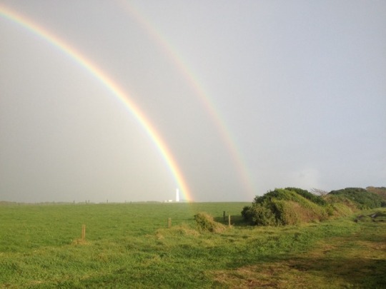

Taranaki: surf coast highway Sadly the sunshine did not last forever, the clouds came rolling back in in the evening and by today the mountain was once again hidden from view. I got a few glimpses driving in the morning, but mostly it was well and truly hidden. Instead of heading up into the rain clouds, I decided to stay low and explore the coast, by driving up to New Plymouth and then around the surf coast highway, which runs all around the national park and the mountain. New Plymouth seems like a nice enough town. It's all coastal, but mostly reclaimed land so no beaches at the city centre. There is a big free museum/library building which has some interesting history on the natural life of the area as well as how the mountain came to be so far out with no other hills around it. (Short answer: it was a volcano, it forced its way up and brought all of the area out of the sea with it). There was also some cultural information about the local Maoris and the traditional Maori myth of the mountain (it used to be over with Ruapehu and Ngauruhoe but they had an argument and Taranaki left to head out west, digging the river as he went). I spent a couple of hours there, then headed out around the coast. As I could've guessed from looking down from Taranaki the day before, there was a lot of farmland. The road didn't actually hug the coastline, mostly the beaches were on the edge of the farms, so to get out to the sea you had to take a side road between farms out to a beach, and then drive back inland to get back to the highway. It's supposed to be a great area for surfing, I guess because it covers three different directions (North, South and west) so there's always another beach option. Possibly because of the weather, I didn't see any surfers today! I did see a shipwreck, caught up on the rocks and because it was low tide I could walk all the way out to it. I also attempted to walk out to the west cape lighthouse, but halfway down the track the clouds suddenly decided to spill out all the rain. I got quite wet, but I also got some cool photos of the rainbow it made so it worked out ;)
5 notes
·
View notes
Photo
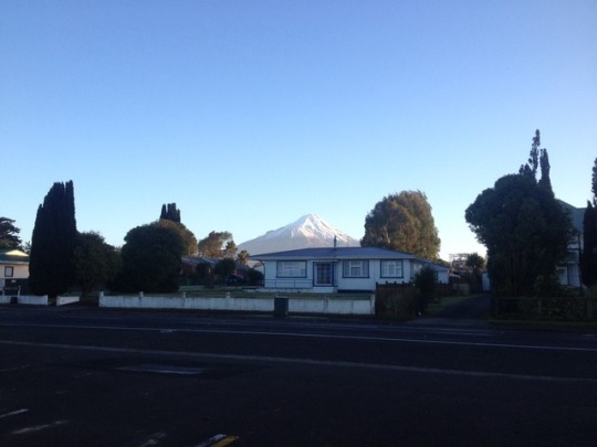


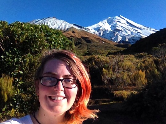


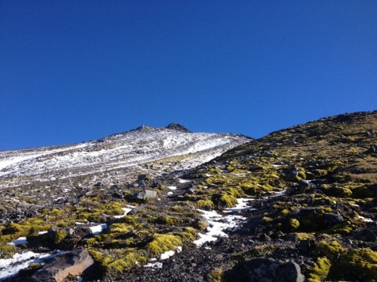
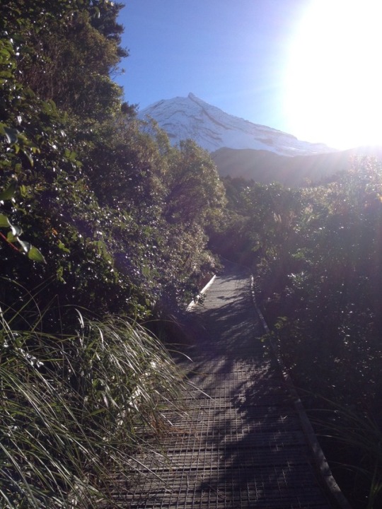
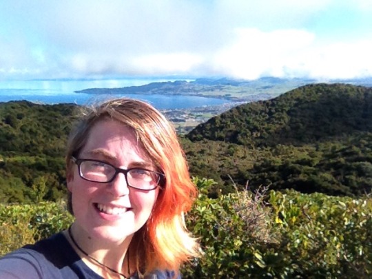
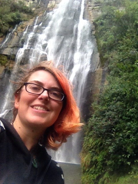
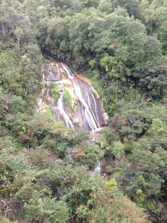
Taranaki The next day I woke up without much hope, but the first thing I saw looking out the window was... A blue sky! Perfectly clear! I leapt out of bed into the car park and up in the distance where yesterday there had been nothing but grey clouds, a mountain had appeared! It was definitely my fastest time from waking up to driving of the whole trip so far! I made it back up to the car park before 9am and got up to the viewpoint and it was AMAZING. Not a cloud in the sky, views up to Taranaki and the adjacent Fantham's peak on one side, and on the other the national park and then the surrounding farmland. If you squint at the pictures, you can even see the curve where the land stops and the sea starts. PLUS out on the left I could see Ruapehu and Ngauruhoe. They didn't come out great in the photos, but in real life they were SO clear, I could make out the snow on the volcano. I'd been planning to do a couple of short waterfall walks around the park, but I went into the info centre again to talk to the DOC lady and she recommended a hike up the slightly smaller Fantham's peak. There were a couple of viewpoints on the hike, it got out above the tree line quickly for the best views and it was a simple up-down walk so I'd be free to go as high as I was comfortable with. It was a fantastic hike, I'd really recommend it. It was mostly steps up through the forest and the first part of the mountain. Normally I'm not a big fan of steps, but these ones must have been exactly the right height or something because I felt pretty comfortable the whole way up. I didn't make it quite to the peak, above a certain point the wind picked up pretty strong and then slightly higher up the steps gave way to a gravel-scree track marked out by poles. It took me about twenty minutes to go half a kilometre or so. It turns out there is a limit to how many times the wind and gravel can knock you off your feet before you turn back, and that limit is 3 ;) according to my GPS I made it to 1500m which is a reasonable way up the mountain, just about level with the first few hints of snow. I took my time heading back down, because the clouds were starting to come in and I didn't want to get caught up in the rain again. In the end I got lucky again though, the mountain itself seemed to be blocking most of the clouds as they came in so although a lot of the view disappeared, my section of the park remained sunny and rain-free. I made it back to the info centre, had a quick lunch, then walked up to Wilkies Pools, a small set of waterfalls in what looks to be a largely dried up riverbed running down the side of the mountain. There were a lot more people around, it being Sunday afternoon and all, but I headed up the falls and soon found a peaceful spot up in the rocks where I could see up to the mountain. After heading down, my legs were staring to ache a bit but I had one more track to do: Dawson's falls, which the whole area was named after. It's one big waterfall, the river also runs a power station that used to power the whole site (now it's also on the national grid, but there is a hotel up there so probably they need the extra power). Not the biggest waterfall, but it's pretty cool how you can see all the different layers of rocks from the volcano in the cliff face. After all that walking, it was getting pretty late and my legs were quite sore, so I headed back to Kapunga for another night. Virtually all the cars did the same thing, I recognised several people both from the night before and from passing them on tracks up the mountain :)
#Taranaki#mt egmont#Fantham's peak#Dawson's falls#Kapunga#mountains#hiking#snow#road trip#Piri#Koalachaser#main#NZ#waterfall
5 notes
·
View notes
Photo


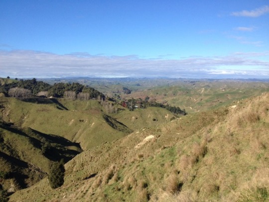

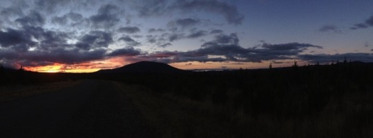
Central: national park to Forgotten World Next stop on the trip was the forgotten world highway (*insert spooky sound effect here*). In reality, it's not s road right out of Jurassic park, it's state highway 43, an old route used by the Maori to travel through the hill and then the first pakeha New Zealand settlers when they were building farms out west. I dragged my feet a bit in national park, since it was too nice a day to spend it all in the car driving, and went for a walk around lake Rotopounamu, a small lake a little way south of lake Taupo with some great birdlife and a walking track all the way around (although the track didn't hug the lakeshore, and for large sections it was hidden by bush). I stopped by lake Rotoaira for a last view of Ruapehu and the tongariro crossing across the larger lake, paused at a viewpoint for lunch looking over lake Taupo and then headed out west. The road followed around the lake to start with, then broke off into the hills becoming very winding. I stopped at another viewpoint over national park, but the single cloud was in exactly the right position to block both large mountains from view. I paused again in Taumarunui, which was oddly familiar and it took me a few minutes to realise it was the same place our bus had stopped on the way to Tongariro way back in April (you'd think I'd remember being stuck there foray hour!) and at Taumarunui the forgotten highway officially started. The highway is about 160km, a very winding track through the hills. As usual it's mostly farms off the each side, but there's plenty of native bush to break them up. It's a 'great walk' region, although in this case the 'walk' is actually a canoe trip down the Whanganui river. My first camp at Ohinepane was set up for people doing the river route, with a boat ramp and a big sign facing the water. The site was great, particularly this week when the moon's been very bright, shining up over the river. In spite of the cold, I sat out at the picnic bench to have my dinner and read for a while (as you can see, the camp site was so crowded... Yeah, I'm finding this a lot. I guess no one else is crazy enough to camp out in winter). The next morning there was a lot of mist over the river and up through the hills, I started moving anyway, but I'd had an uncomfortable night for some reason and my knee was too sore to do long walks. Instead I focused on driving, pulling over for viewpoints and the heritage trail signs dotted along the landscape, pointing out the old roads and river routes that were used by the original pioneers. By the afternoon I'd stretched out a bit, helped along by having to stop for lunch to give a farmer time to get his cattle down the road, and I did a short walk out to mount damper falls. Apparently this is the second highest waterfall in New Zealand. It was a bit of a detour, but worth it to see the way the water falls off the horseshoe shaped cliff. Sadly I couldn't get down to the bottom, but it was still worth the detour for the view. The road wound on through the hills and Tangarakau gorge, (which I'll admit was a bit jurassic-y), passing through Moki tunnel which was dug through a long time ago and is still only a single lane road, limiting the size and height of all vehicles on the highway. Through there it was on to Whangamomona, a town that has declared itself a Republic in defiance of local council area jurisdictions. They elect their own president, who is occasionally even human, and there's a famous hotel/pub which will stamp your passport for the Whangamomona Republic. I found a small campground near by (where once again I was the sole occupant, but at least this time I got a shower to myself rather than just the toilet!) and then headed to the bar where I got my stamp, and had a nice chat with a local farmer, and a farmer from up near the Coromandel who was our in his truck driving cows all over the country, I still don't have an Australian passport stamp, but now I can officially say I've been to the Republic of Whangamomona! :D
#national park#forgotten world highway#Whangamomona#mt damper falls#road trip#Piri#Koalachaser#main#NZ
5 notes
·
View notes
Photo


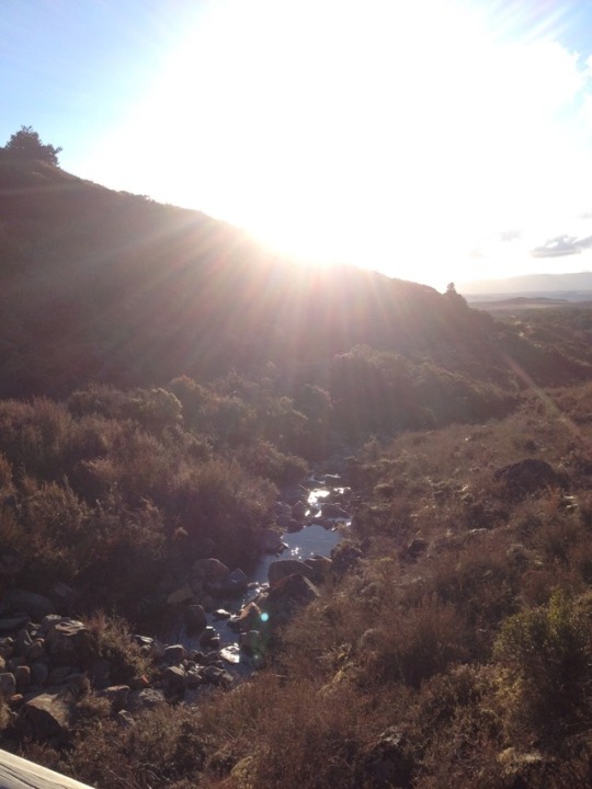

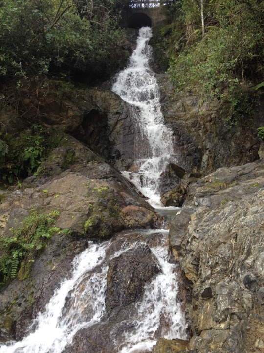
Central: National Park It was a COLD night. Up in the mountains with a completely clear sky in a doc camp in the middle of nowhere = frost everywhere in the morning. It was definitely more of an effort than usual to drag myself out from under the blankets and get dressed and moving. I did a couple of small walks around the camp to warm up, although they were advertised in the area maps none of them were that impressive. The gorge was a selling point of two different walks, but both tracks were mostly through the trees with a few glimpses of river along the way. So I headed back to the road and around to the national park proper (there's a lot of driving around in the park, you can't go straight anywhere because of all those darn mountains in the way). I did head back to the crossing, only to walk a little bit of the start and get some pictures of Ngauruhoe (mount doom!) with snow covering the top. Then I headed to Whakapapa village, down near the base of the Ruapehu mountain range. It being winter, the ski resort further up was apparently open. Since it was only a week into winter and I had no ski gear, I figured it probably wasn't the best time to test the NZ runs and did a 2hr walk around the hills instead. First to Tawhai falls (apparently a lotr filming location, if anyone recognises it?) then up to Taranaki falls, a 20m waterfall that drops over a cliff and falls right through the air. Because of this, it's possible to get behind it if you don't mind being hit by spray, although I did manage to keep my clothes mostly dry this time (progress!). I walked up to the top of a hill to catch the sunset over the park, then headed back to the same campground as the night before. This time I managed to meet a friendly group from Belgium who committed to getting the cast iron fire pit working. After a lot of struggle and wood hunting, we did manage to get a fire only to find that the fancy fire pit managed to block almost all of the heat (not ideal...). I think it was intended to warm up slowly then stay hot for hours, but by the time it was going past 'warm' it was past bed time for me, so I will never know how it turned out! :)
6 notes
·
View notes
Photo

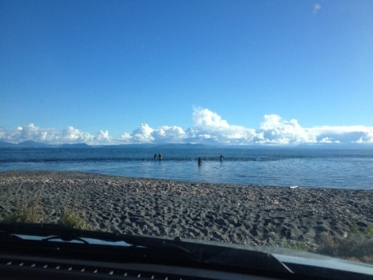


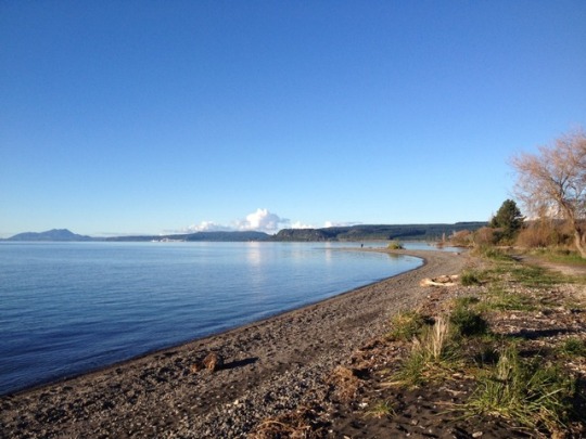


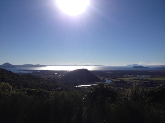
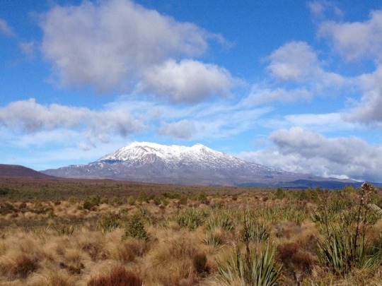
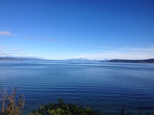
Central: Taupo to National Park The sun was shining, the lake was glistening and I decided to get moving! I started my day with a hike up mount Tauhara for am amazing view over lake Taupo and the surrounding hills. A tiny bit of cloud decided to get in the way, but I still had a good vantage point and the lake is amazing. This was reinforced by driving around it, the road south hugs the lakeshore as much as possible and I was stopping regularly to get out at little picnic stops and camp grounds to have a look. Met some very determined fishermen, wading out into the lake in the freezing water to catch trout. Apparently there's one spot on the lake where the river comes out and people come from miles around to fish there, on a warm day they're standing shoulder to shoulder (hopefully still catching fish and not each other!) After finishing the lake I headed south to a campsite on the north east side of national park. I'd been to the park before, way back in April, to do the tongariro crossing. Now it's winter time, I was hoping to see the mountains covered in snow and do some other (shorter!) walks in the area.
3 notes
·
View notes
Photo


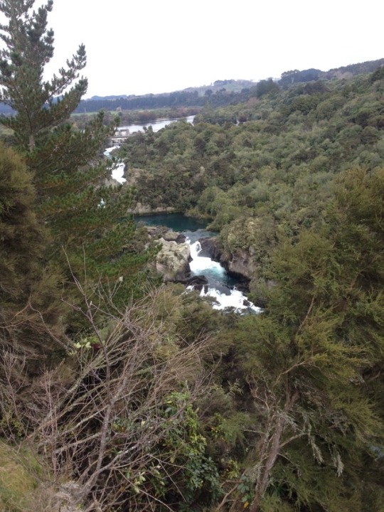
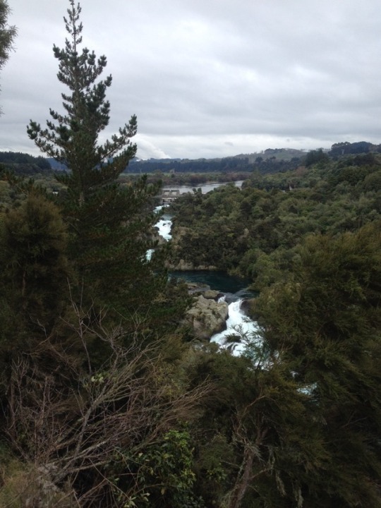
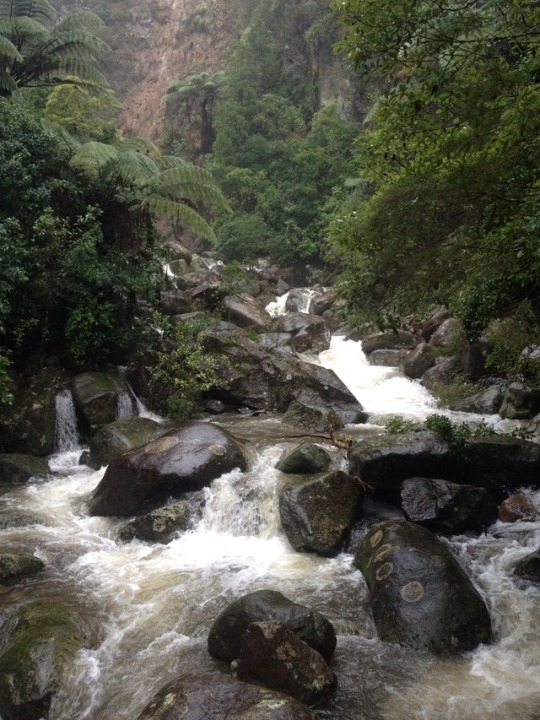
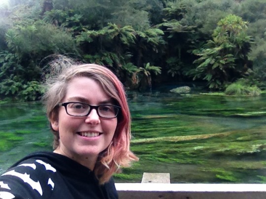
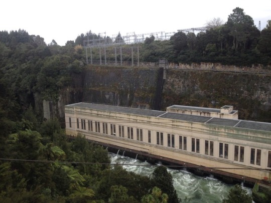
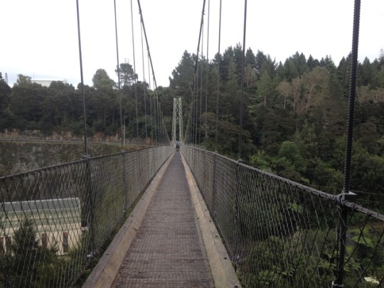
Central: Napier to Taupo The rain returns (I'm getting the feeling it might not be the best time of year for this trip?). I attempted to visit a lookout in Napier, but the weather was so bad I didn't even get out the car (and the view was mostly cloud anyway). Unsure what to do, I retreated to the library to check the maps. I knew I was heading towards Taupo, but maybe there was a stop on the way where it wasn't raining. While I was browsing campsites, a NZ author I follow on Twitter mentioned something about a scifi writing convention. 'Oh that's cool,' I thought. 'I wonder if it's in Auckland or wellington' It was in Taupo. I had a moment of 'huh?' and then I figured why not! Taupo was about 2hours away, the Internet assured me that it wasn't raining there and possibly I could go chat to some people about aliens. I hopped back in my car and headed that way. Lucky I didn't decide to take the drive slowly, there were almost no stops on the way. Considering it's officially the start of the 'thermal explorer highway' there was no signed thermal activity. My camping app said there were hot springs down a long gravel road, but it wasn't sign posted at all on the way. The only thing of interest was a huge, beautiful waterfall. You couldn't get down to it, but there was a fantastic view from a viewpoint at a car park on top of a hill. Even that wasn't well advertised though, the sign pointing to the turn just said 'scenic lookout' with no mention of what the view was of. So I made it to Taupo pretty quickly in the end! The con was at a hotel right on the lakefront, it was a pretty small event where most of the guests knew each other, but they were still very friendly to newcomers. There were a couple of authors there that I'd read, and I got to sit properly and chat with them which was awesome (about their books and then they asked about mine, which was very cool). It was a fun couple of days, chatting about scifi and meeting new people and I even got to spend a night in a hotel room (luxury!) because someone had an extra space. (Kiwis, lovely people, I believe I have said). Taupo is still beautiful, even nicer with decent weather (unlike last time I visited). Although the rain came in on the Monday. I considered driving around the lake anyway, but part of the reason I was aiming for Taupo was because the lake drive was supposed to be amazing so I figured I could wait another night for the sun to return and instead went to the Aratiatia Rapids (filming location for That Barrel Scene in the Hobbit) which would be the largest Rapids in NZ except that the river is dammed so only a bit of water gets over them. Every couple of hours they open the gates so you can see what they would naturally be like, and it's pretty cool to watch the water level rising, the rocks all disappearing beneath the river. In the narrow canyon area the water level rises by at least three or four meters (hard to measure from up on the ridge). If you want to see it, go on YouTube and look for a time lapse vid (there's also a vid of some kayakers white water rafting it in the ten minutes between the water level rising and falling again).
12 notes
·
View notes
Photo


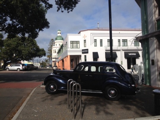

East Cape: Wairoa to Napier And once again back to the Pacific Coast highway! I'm not sure if this is the longest of NZ's scenic roads but it certainly seems to take a while (I've been on it (with a few detours) pretty much since leaving Auckland). The Wairoa to Napier stretch curved back inland pretty quickly, but made up for the lack of beaches with some impressive river canyons, and a couple of detours to waterfalls. My first one was out to Shine falls, in what they call a 'mainland island' which is basically a native flora/fauna reserve, shine falls is a 58m waterfall. It's about a 40min walk through the bush, and the pool you come out at would be a perfect place to go for a swim in summer. I went for a quick paddle with my jeans rolled up, and they betrayed me by falling down. The 40min walk out definitely seemed longer when soaking wet, but I'd still say the falls was worth it ;) (Hasan, I hope when you left your jeans with me you didn't want them back...) My next stop was a couple of lakes, a DOC site where sadly swimming was prohibited because of an Asian weed in the water. They've introduced fish to eat the weeds, but the whole area is closed to boats and swimmers until they can be sure it's all gone. It started spitting when I was there anyway, so I wasn't in a rush to go for a swim! The rain cleared up quickly once I got a bit further down hill and I managed to do a couple more walks, one around a little nature reserve and one out to two more waterfalls, another nice swimming spot (where I decided to stay dry for a change) and one that was just a look out through the trees. Unfortunately the rain started up again when I got back to my car, and didn't let up as the road came back to the coast in Hawkes bay. Normally there'd be amazing views all the way out to Napier, but I didn't end up ps topping much, just drove straight through to a camp right on the coast beside the city centre (thank you Napier council!) Napier is famously an Art Deco style city, after an earthquake destroyed parts of it, they decided to rebuild in the same style and now it's the theme of the whole place. It's pretty cool, lots of vintage shops and unusual buildings. I spent a day exploring around looking at all the buildings and visiting some nice little cafes in the centre.
2 notes
·
View notes