
trekkinginpakistan
Trekking in Pakistan
trek.pk
352 posts
Don't wanna be here? Send us removal request.
Last Seen Blogs

majesticzacharyquinto
Majestic Zachary Quinto

anayteart
Anayte’s very serious portfolio

dovesnowo
DoveSnow Writer


Text
New Post has been published on Trekking in Pakistan
New Post has been published on https://trek.pk/peshawar/
Peshawar
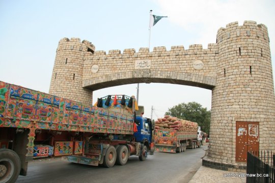
Peshawar (Pashto: پېښور Pēx̌awar [peˈçawar]; Hindko: پشور; [pɪˈʃɔːɾ]; Urdu: پشاور [peˈʃaːʋər]) is the capital of the Pakistani province of Khyber Pakhtunkhwa and its largest city. It is the sixth-largest in Pakistan. Peshawar is also the largest Pashtun-majority city in Pakistan. Situated in the broad Valley of Peshawar near the eastern end of the historic Khyber Pass, close to the border with Afghanistan, Peshawar’s recorded history dates back to at least 539 BCE, making it the oldest city in Pakistan and one of the oldest cities in South Asia.
As the center of the ancient Gandhara region, Peshawar became the capital of the Kushan Empire under the rule of Kanishka; and was home to the Kanishka stupa, which was among the tallest buildings in the ancient world. Peshawar was then ruled by the Hephthalites, followed by the Hindu Shahis, before the arrival of Muslim empires. The city was an important trading center during the Mughal era, before becoming part of the Afghan Durrani Empire in December 1747, and serving as the Afghan winter capital from 1776 until the capture of the city by the Sikh Empire in March 1823, which was then followed by the British in 1846.
History
The modern name of the city “Peshawar” comes from the Persian words ‘Pesh’ – ‘Awardan’ meaning ‘the first coming city. It was named so by Mughal Emperor Akbar from its old name Parashawar, the meaning of which Akbar didn’t understand. The name ‘Parashawar’ itself is seen as a corruption of the Sanskrit name “Purushapura” (Sanskrit: पुरूषपुर Puruṣapura, meaning “City of Men ” or “City of Purusha”). However, the name Purushapura does not appear in any ancient Indian literary sources. The ruler of the city during its founding may have been a Hindu raja (King) named Purush; the word pur means “city” in Sanskrit. Sanskrit, written in the Kharosthi script, was the literary language employed by the Buddhist kingdoms which ruled over the area during its earliest recorded period. The city’s name may also be derived from the Sanskrit name for “City of Flowers,” Poshapura, a name found in an ancient Kharosthi inscription that may refer to Peshawar.
Chinese Buddhist monk Xuanzang’s 7th-century account of a city in Gandhara called the city Po-la-Sha-up-lo (Chinese: 布路沙布邏, bùshābùló), and an earlier 5th-century account by Fa-Hien records the city’s name as Fou-Lou-Sha (Chinese: 弗樓沙, fùlóshā), the Chinese equivalent of the Sanskrit name of the city, Purushapura. An ancient inscription from the Shapur era identifies a city in the Gandhara valley by the name pskbvr, which may be a reference to Peshawar.
The Arab historian and geographer Al-Masudi noted that by the mid 10th century, the city was known as Parashāwar. The name was noted to be Purshawar and Purushavar by Al-Biruni.
The city began to be known as Peshāwar by the era of Emperor Akbar. The current name is said by some to have been based upon the Persian for “frontier town” or, more literally, “forward city,” though transcription errors and linguistic shifts may account for the city’s new name. One theory suggests that the city’s name is derived from the Persian name “Pesh Awardan”, meaning “place of first arrival” or “frontier city,” as Peshawar was the first city in the Indian subcontinent after crossing the Khyber Pass. Akbar’s bibliographer, Abu’l-Fazl ibn Mubarak, lists the city’s name as both Parashāwar, transcribed in Persian as پَرَشَاوَر, and Peshāwar (پشاور).
Geography
Topography
Peshawar is located in the broad Valley of Peshawar, which is surrounded by mountain ranges on three sides, with the fourth opening to the Punjab plains. The city is located in the generally level base of the valley, known as the Gandhara Plains.
Climate
With an influence from the local steppe climate, Peshawar features a hot semi-arid climate (Köppen BSh), with very hot, prolonged summers and brief, mild to cool winters. Winter in Peshawar starts in November and ends in late March, though it sometimes extends into mid-April, while the summer months are from mid-May to mid-September. The mean maximum summer temperature surpasses 40 °C (104 °F) during the hottest month, and the mean minimum temperature is 25 °C (77 °F). The mean minimum temperature during the coolest month is 4 °C (39 °F), while the maximum is 18.3 °C (64.9 °F).
Peshawar is not a monsoon region, unlike other parts of Pakistan; however, rainfall occurs in both winter and summer. Due to western disturbances, the winter rainfall shows a higher record between the months of February and April. The highest amount of winter rainfall, measuring 236 millimetres (9.3 in), was recorded in February 2007, while the highest summer rainfall of 402 millimetres (15.8 in) was recorded in July 2010; during this month, a record-breaking rainfall level of 274 millimetres (10.8 in) fell within a 24-hour period on 29 July 2010—the previous record was 187 millimetres (7.4 in) of rain, recorded in April 2009. The average winter rainfall levels are higher than those of summer. Based on a 30-year record, the average annual precipitation level was recorded as 400 millimetres (16 in) and the highest annual rainfall level of 904.5 millimetres (35.61 in) was recorded in 2003. Wind speeds vary during the year, from 5 knots (5.8 mph; 9.3 km/h) in December to 24 knots (28 mph; 44 km/h) in June. The relative humidity varies from 46% in June to 76% in August. The highest temperature of 50 °C (122 °F) was recorded on 18 June 1995, while the lowest −3.9 °C (25.0 °F) occurred on 7 January 1970.
Cityscape
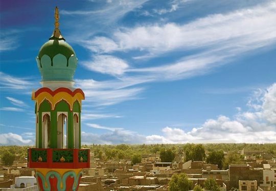
Historically, the old city of Peshawar was a heavily guarded citadel that consisted of high walls. In the 21st century, only remnants of the walls remain, but the houses and havelis continue to be structures of significance. Most of the houses are constructed of unbaked bricks, with the incorporation of wooden structures for protection against earthquakes, with many composed of wooden doors and latticed wooden balconies. Numerous examples of the city’s old architecture can still be seen in areas such as Sethi Mohallah. In the old city, located in inner-Peshawar, many historic monuments and bazaars exist in the 21st century, including the Mohabbat Khan Mosque, Kotla Mohsin Khan, Chowk Yadgar and the Qissa Khawani Bazaar. Due to the damage caused by rapid growth and development, the old walled city has been identified as an area that urgently requires restoration and protection.
The walled city was surrounded by several main gates that served as the main entry points into the city — in January 2012, an announcement was made that the government plans to address the damage that has left the gates largely non-existent over time, with all of the gates targeted for restoration.
Demographics
Population
The population of the Peshawar district in 1998 was 2,026,851. The city’s annual growth rate is estimated at 3.29% per year, and the 2016 population of Peshawar district is estimated to be 3,405,414. With a population of 1,970,042 according to the 2017 census, Peshawar is the sixth-largest city of Pakistan. and the largest city in Khyber Pakhtunkhwa, with a population five times higher than the second-largest city in the province.
Language
The primary native languages spoken in Peshawar are Pashto and Hindko, though English is used in the city’s educational institutions, while Urdu is understood throughout the city.
The district of Peshawar is overwhelmingly Pashto-speaking, though the Hindko-speaking minority is concentrated in Peshawar’s old city, Hindko speakers in Peshawar increasingly assimilate elements of Pashto and Urdu into their speech.
Religion
Peshawar is overwhelmingly Muslim, with Muslims making up 98.5% of the city’s population in the 1998 census. Christians make up the second-largest religious group with around 20,000 adherents, while over 7,000 members of the Ahmadiyya Muslim Community live in Peshawar. Hindus and Sikhs are also found in the city − though most of the city’s Hindu and Sikh community migrated en masse to India following the Partition of British India in 1947.
Though the city’s Sikh population drastically declined after Partition, the Sikh community has been bolstered in Peshawar by the arrival of approximately 4,000 Sikh refugees from the conflict in the Federally Administered Tribal Areas; In 2008, the largest Sikh population in Pakistan was located in Peshawar. Sikhs in Peshawar self-identify as Pashtuns and speak Pashto as their mother tongue. There was a small, but, thriving Jewish community until the late 1940s. After the partition and the emergence of the State of Israel, Jews left for Israel.
Afghan refugees
Peshawar has hosted Afghan refugees since the start of the Afghan civil war in 1978, though the rate of migration drastically increased following the Soviet invasion of Afghanistan in 1979. By 1980, 100,000 refugees a month were entering the province, with 25% of all refugees living in Peshawar district in 1981. The arrival of large numbers of Afghan refugees strained Peshawar’s infrastructure and drastically altered the city’s demography. During the 1988 national elections, an estimated 100,000 Afghan refugees were illegally registered to vote in Peshawar.
With the influx of Afghan refugees into Peshawar, the city became a hub for Afghan musicians and artists. Some Afghan refugees have established successful businesses in Peshawar, and play an important role in the city’s economy.
In recent years, the Peshawar district hosts up to 20% of all Afghan refugees in Pakistan. In 2005, Peshawar district was home to 611,501 Afghan refugees — who constituted 19.7% of the district’s total population. Peshawar’s immediate environs were home to large Afghan refugee camps, with Jalozai camp hosting up to 300,000 refugees in 2001 – making it the largest refugee camp in Asia at the time.
Afghan refugees began to be frequently accused of involvement with terrorist attacks that occurred during Pakistan’s war against radical Islamists. By 2015 the Pakistani government adopted a policy to repatriate Afghan refugees, including many who had spent their entire life in Pakistan. The policy of repatriation was also encouraged by the government of Afghanistan, though many refugees had not registered themselves in Pakistan. Unregistered refugees returning to Afghanistan without their old Afghan identification documents now have no official status in Afghanistan either.
Economy
Peshawar’s economic importance has historically been linked to its privileged position at the entrance to the Khyber Pass – the ancient travel route by which most trade between Central Asia and the Indian Subcontinent passed. Peshawar’s economy also benefited from tourism in the mid-20th century, as the city formed a crucial part of the Hippie trail.
Peshawar’s estimated monthly per capita income was ₨55,246 in 2015, compared to ₨117,924 in Islamabad, and ₨66,359 in Karachi. Peshawar’s surrounding region is also relatively poor − Khyber Pakhtunkhwa’s cities on average have an urban per capita income that is 20% less than Pakistan’s national average for urban residents.
Peshawar was noted by the World Bank in 2014 to be at the helm of a nationwide movement to create an ecosystem for entrepreneurship, freelance jobs, and technology. The city has been host to the World Bank assisted Digital Youth Summit — an annual event to connect the city and province’s youths to opportunities in the digital economy. The 2017 event hosted 100 speakers including several international speakers and approximately 3,000 delegates in attendance.
Transportation
Road
New flyovers, such as this one near the suburb of Hayatabad, have been constructed in recent years to improve traffic flow.
Peshawar’s east–west growth axis is centred on the historic Grand Trunk Road that connects Peshawar to Islamabad and Lahore. The road is roughly paralleled by the M-1 Motorway between Peshawar and Islamabad, while the M-2 Motorway provides an alternate route to Lahore from Islamabad. The Grand Trunk Road also provides access to the Afghan border via the Khyber Pass, with onwards connections to Kabul and Central Asia via the Salang Pass.
Peshawar is to be completely encircled by the Peshawar Ring Road in order to divert traffic away from the city’s congested centre. The road is currently under construction, with some portions open to traffic.
The Karakoram Highway provides access between the Peshawar region and western China, and an alternate route to Central Asia via Kashgar in the Chinese region of Xinjiang.
The Indus Highway provides access to points south of Peshawar, with a terminus in the southern port city of Karachi via Dera Ismail Khan and northern Sindh. The 1.9 kilometres (1.2 mi) Kohat Tunnel south of Peshawar provides access to the city of Kohat along the Indus Highway.
Motorways
Peshawar is connected to Islamabad and Rawalpindi by the 155 kilometers long M-1 Motorway. The motorway also links Peshawar to major cities in the province, such as Charsadda and Mardan. The M-1 motorway continues onwards to Lahore as part of the M-2 motorway.
Pakistan’s motorway network links Peshawar to Faisalabad by the M-4 Motorway, while a new motorway network to Karachi is being built as part of the China Pakistan Economic Corridor.
The Hazara Motorway is being constructed as part of CPEC, and is providing control-access motorway travel all the way to Mansehra and Thakot via the M-1 and Hazara Motorways.
Rail
Peshawar Cantonment railway station serves as the terminus for Pakistan’s 1,687 km (1,048 mi)-long Main Line-1 railway that connects the city to the port city of Karachi and passes through the Peshawar City railway station. The Peshawar to Karachi route is served by the Awam Express, Khushhal Khan Khattak Express, and the Khyber Mail services.
The entire Main Line-1 railway track between Karachi and Peshawar is to be overhauled at a cost of $3.65 billion for the first phase of the project, with completion by 2021. Upgrading the railway line will permit train travel at speeds of 160 kilometers per hour, versus the average 60 to 105 km per hour speed currently possible on existing tracks.
Peshawar was also once the terminus of the Khyber Train Safari, a tourist-oriented train that provided rail access to Landi Kotal. The service was discontinued as the security situation west of Peshawar deteriorated with the beginning of the region’s Taliban insurgency.
Air
Peshawar International Airport offers direct flights throughout Pakistan, as well as to Bahrain, Malaysia, Qatar, Saudi Arabia, and the United Arab Emirates.
Peshawar is served by the Bacha Khan International Airport, located in the Peshawar Cantonment. The airport served 1,255,303 passengers between 2014 and 2015, the vast majority of whom were international travelers. The airport offers direct flights throughout Pakistan, as well as to Bahrain, Malaysia, Qatar, Saudi Arabia, and the United Arab Emirates.
Culture
Music
After the 2002 Islamist government implemented restrictions on public musical performances, a thriving underground music scene took root in Peshawar. After the start of Pakistan’s Taliban insurgency in 2007–2008, militants began targeting members of Peshawar’s cultural establishment. By 2007, Taliban militants began a widespread campaign of bombings against music and video shops across the Peshawar region, leading to the closure of many others. In 2009, Pashto musical artist Ayman Udas was assassinated by Taliban militants on the city’s outskirts. In June 2012, a Pashto singer, Ghazala Javed, and her father were killed in Peshawar, after they had fled rural Khyber Pakhtunkhwa for the relative security of Peshawar.
Musicians began to return to the city by 2016, with a security environment greatly improved following the Operation Zarb-e-Azb in 2014 to eradicate militancy in the country. The provincial government in 2016 announced a monthly income of $300 to 500 musicians in order to help support their work, as well as a $5 million fund to “revive the rich cultural heritage of the province”.
Museums
The Peshawar Museum was founded in 1907 in memory of Queen Victoria. The building features an amalgamation of British, South Asian, Hindu, Buddhist, and Mughal Islamic architectural styles. The museum’s collection has almost 14,000 items and is well known for its collection of Greco-Buddhist art. The museum’s ancient collection features pieces from the Gandharan, Kushan, Parthian, and Indo-Scythian periods.
0 notes
Text
New Post has been published on Trekking in Pakistan
New Post has been published on https://trek.pk/bhalwal/
Bhalwal

Bhalwal (Punjabi, Urdu: بهلوال), is a city and capital of Bhalwal Tehsil of Sargodha District in the center of the Punjab province of Pakistan. It is the 99th largest city of Pakistan, according to the 2017 census. The town of Bhalwal is the headquarters of Bhalwal Tehsil and lies in an agricultural area, close to the M-2 motorway. Bhalwal is famous for the Orange crops of Pakistan.
0 notes
Text
New Post has been published on Trekking in Pakistan
New Post has been published on https://trek.pk/narowal/
Narowal

Narowal (Urdu: نارووال), is a city in the northeast of the Punjab province of Pakistan. According to the census of 2017, the City of Narowal has 103,067 inhabitants. It is the 94th largest city in Pakistan. Pakistani pop singer Abrar-ul-Haq is also from Narowal. Narowal is known for its University the campus of which was established in 2012 and for various famous politicians. University of Narowal’s Main Campus’s building has also been constructed in recent years on Shakargarh Road The city is also known for its Faiz Ahmed Park named after the Urdu poet Faiz Ahmed Faiz who was born in the village of Kala Qadir in Narowal District. A famous Sikh Temple, Gurdwara Darbar Sahib Kartarpur can be visited in the East of Narowal.
History
According to an old legend, Narowal was founded about 900 years ago. The city is the capital of Narowal District and became Narowal Tehsil in 1989.
0 notes
Text
New Post has been published on Trekking in Pakistan
New Post has been published on https://trek.pk/haroonabad/
Haroonabad

Haroonabad or Harunabad (Punjabi, Urdu: ہارون آباد) is a tehsil (sub-district) in Bahawalnagar District of the Punjab Province of Pakistan. The town is the headquarters of Haroonabad Tehsil and administrative subdivision of the district.[2] It is the 92nd largest city of Pakistan, according to 2017 census.
History
Haroonabad Town is a tehsil headquarter and an important Mandi town of Bahawalnagar District. The history of the town is not very old. It was laid out and established as a Mandi Town under the Satluj valley project during the colonization of the region in English rule in second decade of the 20th century. Before colonization, the site of the present Haroonabad Town was known as Toba Badru Wala. The word “Toba” in the local language means “pond”. It is said that there was a big natural pond to the north side of the railway station at a small distance where rain water was collected. The availability of water in this deserted area had attracted the natives. The main occupation of the natives was cattle farming and cultivation on a small scale during the rainy season. The caste of local people who lived there was “Joiya Badru”. This small settlement was named as “Toba Badru Wala” because of their caste.
Railway
In 1927, the branch railway line linking Fortabbas town with Bahawalnagar city was constructed. The railway station at Haroonabad town was built in the same year and was called Badru Wala Station. A grain market, a few shops and dwelling units were developed along Chaman Bazar, Railway Bazaar and Main Bazaar in the beginning. The establishment of irrigation system/canal system under the Satluj valley project in 1934 added to the agricultural production of the hinterland and provided a significant economic base to this small settlement. The construction of 3R and 4R Canals in the region brought the most of the area under the irrigation system. The town began to flourish as a Mandi town rapidly due to increasing economic and commercial activities. Near 4R canal village 72/4.R is located. Rajpoot people live in this village. These peoples are known as very rich and famous people who are interested in land load. The town was renamed as Haroonabad town after the name of Prince Haroon-ur-Rashid, the son of Nawab of Bahawalpur sir Sadeq Mohammad Khan V.
Post 1947
At the time of the partition of the subcontinent in 1947, a large number of refugees settled here and the population of the town was substantially increased. Development of some residential colonies, establishment of social services like educational and health institutions and provision of public utilities made living conditions in the town more attractive and resulted in rapid growth.
Sources: Wikipedia
0 notes
Text
New Post has been published on Trekking in Pakistan
New Post has been published on https://trek.pk/jatoi/
Jatoi
Jatoi (Urdu: جتوئ), is the capital city of Jatoi Tehsil (administrative subdivision), in Muzaffargarh district, Punjab province, Pakistan. It is the 91st largest city of Pakistan by population.
The city has a Govt. Girls’ degree college. It is built recently in 2013. It has Govt. Boys Degree College & High Schools for Boys & Girls. It also has a large number of private institutions. There is Sardar Kauray Khan Jatoi park and the library is also going to built soon by Kauray Khan’s trust in the name of Sardar Kauray Khan Jatoi. Jatoi is an agricultural city, with very fertile soil and water provided by a canal system and tube wells, producing two or three crops in a year. Major crops are cotton, wheat, sugarcane, rice, and sunflower. The major fruits are mango, dates, and Jamun. Politicians include Sardar Abdul Qayyum Jatoi, Syed Abdullah Shah Bukhari and their sons, and later ones including Khan Muhammad Khan, Sami Ullah Khan Laghari, Syed Jameel Shah Bukhari. The city has a mosque, located in the Kotla Rehm Ali shah, a rural part of Jatoi Tehsil. This mosque is single means of spiritual as well as enjoying a place for people of Jatoi and concerning areas. The literacy rate is about 5%. The environment has been damaged by intensive felling of trees, but in 2012 more than 1000 trees were planted. About 10 KM away from Jatoi City there is the famous Mosque Jamia Sakeena-Tu-Sughra is situated.
0 notes
Text
New Post has been published on Trekking in Pakistan
New Post has been published on https://trek.pk/sambrial/
Sambrial
Sambrial (Urdu: سمبڑيال), is a town of Sialkot District in the Punjab province of Pakistan. It is the capital of Sambrial Tehsil, an administrative subdivision of the district.[2] Sialkot Dry Port is located in Sambrial. Sialkot International Airport is located in Sambrial. It is the 90th largest city of Pakistan by population.
Location
The city is situated on the bank of Upper Chenab Canal and lies to the west of the district capital Sialkot. Sambrial is Tehsil of district Sialkot in Punjab Pakistan consisting 160 villages having 17 union councils.
0 notes
Text
New Post has been published on Trekking in Pakistan
New Post has been published on https://trek.pk/arif-wala/
Arif Wala
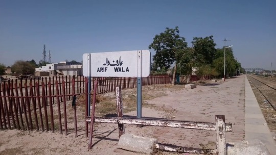
Arifwala (Urdu: عارِف والا), (Punjabi: عارفوالا ) is a Tehsil of Pakpattan District in the Punjab province of Pakistan. It is located to the southwest of Pakpattan.
History
In the nineteenth century, Arifwala was only a village named Chak No. 61/EB. Later, it was called Arifwala because of a Sufi Saint, “Arif Baba”, who stayed in the village. His Mazar can be seen in the graveyard near the Railway Station. In 1908, Deputy Governor “Hurbert” founded the new city of Arifwala.
Demography
Most of the population are farmers; about 75% of the population live in villages and only 25% live in the municipal urban area. But the trend is shifting with the increase of industrialization in the premises of Arifwala and people are moving to the urban area. Arifwala Tehsil covers an area of 295,146 acres (5 km2) with a population of about 720,000. The urban area covers 457 acres (1.82 km2) and the agriculture area covers 1274 acres (3.18 km²). Punjabi is the natively spoken language but Urdu is also widely used.
Economy
Agriculture is important to the local economy, particularly the growing of cotton, grain, potato, wheat, maize, and rice exported all over Pakistan and around the world. The grain market of Arifwala is one of the biggest grain markets in Pakistan. But the advanced way of agriculture, which is called Tunnel Farming, is at the peak. Now it is the big source of the economy in this area. Farmers here grow different kinds of vegetables which are also exported all over Pakistan.
Industry
The industry of Arifwala city is primarily an Agro-based. The main industries include Beverage & Food processing units, Rice Mills, Cotton Ginning & Pressing, Flour Mills, Fertilizer companies, Vegetable Ghee & Cooking Oil, Poultry Feed, Seed Processing, and leather products.
Climate
The climate of Arifwala is extreme, reaching 45 °C in summer, and down to 05 °C in winter. The soil of the suburbs is very fertile.
Hospitals
Tehsil Headquarter Hospital (THQ) Al Rehman Medicare Children Hospital Haider Family Hospital Sabir Hospital Fiaz Hospital Al Raheem Surgical Hospital BHU 67 E.B ARIFWALA
Sources: Wikipedia
0 notes
Text
New Post has been published on Trekking in Pakistan
New Post has been published on https://trek.pk/bhakkar/
Bhakkar

Bhakkar (Urdu: بهكّر/بکھر), is the principal city of Bhakkar District located in Punjab, Pakistan. It lies on the left bank of the Indus river. It is the 86th largest city in Pakistan.
Administration
Bhakkar city is also the administrative centre of Bhakkar Tehsil one of the four tehsils of the district. Bhakkar Tehsil is subdivided into 17 union councils, three of which form the city of Bhakkar.
History
Bhakkar was founded probably towards the close of the fifteenth century by a group of colonists from Dera Ismail Khan.[3] During the 15th century, Bhakkar saw a struggle for power between Sher Shah Suri and Humayun. It came under Humayun’s rule after he restored back the Mughal empire and he appointed Khan Khanan as the governor of the city alongside Multan, as Multan was a province during the Mughal empire which included the city of Bhakkar in it. it is in the name of Bakhar Khan.
Fray Sebastian Manrique, a 17th-century traveller, travelled to this city in 1641 and described it as the capital of a Kingdom of Bhakkar.
British rule
During British rule Bhakkar Town was part of Bhakkar tehsil of Mianwali District. It was located on the left bank of Indus River and was on the North-Western Railway line.[3]
The Imperial Gazetteer of India described the town as follows:
It stands on the edge of the Thal or sandy plain overlooking the low-lying alluvial lands along; the river, a channel of which is navigable as far as Bhakkar during the floods. To the west of the town, the land is low, well cultivated, and subject to inundation, while to the east the country is high and dry, treeless, and sandy. A rich extent of land irrigated from wells lies below the town, protected by embankments from inundations of the Indus, and produces two or three crops in the year. The neighboring riverain is full of date groves and fruit gardens; and in it stands a famous mango-tree, the fruit of which used to be sent to Kabul in the old days of Afghan rule. The municipality was created in 1874. Its income and expenditure during the ten years ending 1902–3 averaged Rs. 7,700. The income in 1903-4 was Rs. 7,500, chiefly derived from octroi; and the expenditure was Rs. 8,600. The population according to the 1901 census of India was 5,312, at that time the town contained a dispensary and a municipal vernacular middle school.
Places to Visit
Dilkusha Bagh
There is an Old Date Orchard, locally known as ‘Dilkusha Bagh’ which is believed by some to be a Mughal garden built by Humayun, however Humayun never visited the area, on his retreat to Iran, he went to another Bakhar in Sindh to seek help from Mahmood Khan, which was however denied by historian Henry Raverty.
0 notes
Text
New Post has been published on Trekking in Pakistan
New Post has been published on https://trek.pk/hasilpur/
Hasilpur
Hasilpur (Punjabi, Urdu: حاصل پور), is a city in Hasilpur Tehsil of Bahawalpur District in southern Punjab, Pakistan. The city is located between the Satluj River and the Indian border and lies 96 km east of the district Bahawalpur. Hasilpur is as old as Bahawalpur. Hasil Khan Abbasi settled the city with his own name in 1752. Hasil Khan built a mosque in 1768. In 1900 there were about 347 houses. A special rest house (Dolat Khana) for Sadeq Mohammad Khan V was also Here.
0 notes
Text
New Post has been published on Trekking in Pakistan
New Post has been published on https://trek.pk/lodhran/
Lodhran

Lodhran (Urdu: لودهراں), is a city and the capital of Lodhran District in the Punjab province of Pakistan. It is Pakistan’s 81st largest city. It is located on the northern side of River Sutlej. Lodhran is famous for cotton crop.
Administration
As well as being district capital, Lodhran is the administrative centre of Lodhran tehsil, which is subdivided into 28 Union Councils.
0 notes
Text
New Post has been published on Trekking in Pakistan
New Post has been published on https://trek.pk/khushab/
Khushab

Khushab (Urdu: خُوشاب) is a city as well as a district of Sargodha Division, located in the Punjab province of Pakistan.[2] The word Khushab means “sweet water.” Khushab city also serves as the headquarters of Khushab Tehsil, an administrative subdivision of the district Khushab.[3] It is the 77th largest city of Pakistan by population.
The city of Khushab is the location of the Khushab Nuclear Complex,[4] a critical part of the Pakistan’s Special Weapons Programme.
Demographics
The population according to the 1901 census was 11,403. Now it is 50,000.
Etymology
“Khushab” is a combination of two Persian words: khush (Persian: خُوش), meaning “sweet or tasty”, and aab (Persian: آب), meaning “water”. A common belief is that the Persians from the west first used the word khush-aab in admiration of the sweet and tasty water found in the historical city situated on the bank of Jhelum River. In time the city became known as Khushab.
Sources: Wikipedia
0 notes
Text
New Post has been published on Trekking in Pakistan
New Post has been published on https://trek.pk/taxila/
Taxila
Taxila (Urdu: ٹيکسلا), is a city in Rawalpindi District of the Punjab, Pakistan. Taxila is situated about 32 km (20 mi) north-west of Islamabad and Rawalpindi, along the historic Grand Trunk Road, near the important Sikh pilgrimage centre of Hasan Abdal, and the Mughal-era Wah Gardens.
Ancient Taxila was historically referred to as Takshashila in Sanskrit, and Takkasila in Pali. The earliest settlement at Taxila was founded around 1000 BCE at the Hathial site. The Hindu epic poem Mahābhārata is believed to have been first recited at Taxila, by the sage Vaiśampāyana. By some accounts, Taxila was home to one of the earliest, if not the first, universities in the world.
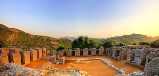
Taxila’s ruins are internationally renowned, and function as a series of interrelated sites, including a Mesolithic cave, the remains of 4 ancient cities, and Buddhist monasteries and stupas. The ancient ruins of Taxila were declared a UNESCO World Heritage Site in 1980.
Etymology
Taxila was in ancient times known in Pali as Takkasila, and in Sanskrit as Takshashila (IAST: Takṣaśilā). The city’s Sanskrit name means “City of Cut Stone”. The city’s ancient Sanskrit name alternately means “Rock of Taksha” – in reference to the Ramayana story that states the city was founded by Bharata, younger brother of the central Hindu deity Rama, and named in honour of Bharata’s son, Taksha.
The city’s modern name, however, is derived from the ancient Greek recording of the ancient city’s name, noted in Ptolemy’s Geography. The Greek transcription of Taxila became universally favoured over time, while the Pali and Sanskrit versions fell out of use.
History
Early settlement
The region around Taxila was settled by the neolithic era, with some ruins at Taxila dating to 3360 BCE. Ruins dating from the Early Harappan period around 2900 BCE have also been discovered in the Taxila area, though the area was eventually abandoned after the collapse of the Indus Valley Civilisation.
The first major settlement at Taxila was established around 1000 BCE. By 900 BCE, the city was already involved in regional commerce, as discovered pottery shards reveal trading ties between the city and Puṣkalāvatī.
Taxila was founded in a strategic location along the ancient “Royal Highway” that connected the capital at Pataliputra in Bihar, with ancient Peshawar, Puṣkalāvatī, and onwards towards Central Asia via Kashmir, Bactria, and Kāpiśa. Taxila thus changed hands many times over the centuries, with many empires vying for its control.
Achaemenid
Archaeological excavations show that the city may have grown significantly during the rule of the Persian Achaemenid Empire in the 6th century BCE. In 516 BCE, Darius I embarked on a campaign to conquer Central Asia, Ariana, and Bactria, before marching onto what is now Afghanistan and northern Pakistan. Emperor Darius spent the winter of 516–515 BCE in the Gandhara region surrounding Taxila and prepared to conquer the Indus Valley, which he did in 515 BCE, after which he appointed Scylax of Caryanda to explore the Indian Ocean from the mouth of the Indus to the Suez. Darius then returned to Persia via the Bolan Pass. The region continued under Achaemenid suzerainty under the reign of Xerxes I and continued under the Achaemenid rule for over a century.
Hellenistic and Mauryan
Alexander the Great invaded Taxila in 326 BCE, after the city was surrendered by its ruler, king Omphis. Greek historians accompanying Alexander described Taxila as “wealthy, prosperous, and well governed.” His troops were said to have found a university in Taxila, the like of which had not been seen in Greece.
After Alexander’s departure, Taxila came under the influence of Chandragupta Maurya, who turned Taxila into a regional capital. His advisor, Chanakya, was said to have taught at Taxila’s university. Under the reign of Ashoka, the city was made a great seat of Buddhist learning, though the city was home to a minor rebellion during this time.
Indo-Greek
In the 2nd century BCE, Taxila was annexed by the Indo-Greek kingdom of Bactria. Indo-Greeks build new capital, Sirkap, on the opposite bank of the river from Taxila. During this new period of Bactrian Greek rule, several dynasties (like Antialcidas) likely ruled from the city as their capital. During lulls in Greek rule, the city managed profitably on its own, to independently control several local trade guilds, who also minted most of the city’s autonomous coinage. In about the 1st century BCE or 1st century CE, an Indo-Scythian king named Azilises had three mints, one of which was at Taxila, and struck coins with obverse legends in Greek and Kharoṣṭhī. The last Greek king of Taxila was overthrown by the Indo-Scythian chief Maues around 90 BCE. Gondophares, founder of the Indo-Parthian Kingdom, conquered Taxila around 20 BCE, and made Taxila his capital. According to early Christian legend, Thomas the Apostle visits king Gondophares IV around 46 CE, possibly at Taxila given that that city was Gondophares’ capital city.
Kushan
In the first century CE, the Greek Neopythagorean philosopher Apollonius of Tyana visited Taxila, which his team described as a fortified city laid out on a symmetrical plan, similar in size to Nineveh. Inscriptions dating to 76 CE demonstrate that the city had come under Kushan rule by this time after the city was captured from the Parthians by Kujula Kadphises, founder of the Kushan Empire. The great Kushan ruler Kanishka later founded Sirsukh, the most recent of the ancient settlement at Taxila.
Decline
By the 300s CE, the Sasanian king Shapur II seems to have conquered Taxila, as evidenced by the numerous Sasanian copper coins found there. Taxila’s ancient university remained in existence during the travels of Chinese pilgrim Faxian, who visited Taxila around 400 CE. He wrote that ancient Taxila’s name translated as “the Severed Head”, and was the site of a story in the life of Buddha “where he gave his head to a man”.
The White Huns swept over Gandhāra and Punjab around 470 CE, causing widespread devastation and destruction of Taxila’s famous Buddhist monasteries and stupas, a blow from which the city would never recover. Xuanzang visited Taxila in 630 and 643 CE, and wrote that the city had already fallen into ruin by the time of his arrival.
Modern
The renowned archaeologist Sir Alexander Cunningham rediscovered the ruins of Taxila in the mid-19th century by identifying a local site known as Sarai Kala (or Sarai Khola) with ancient Taxila. Prior to that, the location of the ancient city of Taxila, known from literary texts, was uncertain.
Geography
Taxila is located 32 km (20 mi) north-west of the Pakistani capital Islamabad. The city is located approximately 549 meters (1,801 ft) above sea level.
Climate
Taxila features a humid subtropical climate (Köppen: Cwa)
Economy
Tourism
Taxila’s ruins, a UNESCO World Heritage Site, date from as early as 1000 BCE, and are a major tourist draw.
Taxila is one of northern Pakistan’s most important tourist destinations, and is home to the Taxila Museum which holds a large number of artifacts from Taxila’s excavations. Though the number of foreign visitors to the site drastically declined following the start of an Islamist insurgency in Pakistan in 2007, visitor numbers began to noticeably improve by 2017, after the law and order situation in the region had greatly improved following the start of the 2014 Zarb-e-Azb campaign launched by the Pakistani Army against radical Islamist militants.
In 2017, the Pakistani government announced its intention to develop Taxila into a site for Buddhist religious pilgrimage. As part of the efforts, it announced that an exhibition on the Buddhist heritage of the region would be held in Thailand, and that the Thai government would assist in conservation efforts at the site. Relics from Taxila were also sent to Sri Lanka for the 2017 Vesak holiday as part of an effort to showcase the region’s Buddhist heritage. The Pakistan Tourism Development Corporation also announced in 2017 that a tour bus service would be launched between the Taxila Museum and Islamabad.
In addition to the ruins of ancient Taxila, relics of Mughal gardens and vestiges of historical Grand Trunk Road are also found in Taxila. Nicholson’s Obelisk, named in honour of Brigadier John Nicholson who died in during the Sepoy Mutiny of 1857, is a monument from the British era that welcomes travelers arriving from Rawalpindi/Islamabad.
Industry
Taxila is home to Heavy Industries Taxila, a major Pakistani defence, military contractor, engineering conglomerate. The city’s economy is also closely linked to the large Pakistan Ordnance Factories at nearby Wah Cantt, which employs 27,000 people. Cottage and household industries include stoneware, pottery and footwear.
Transportation
Rail
Taxila is served by the Taxila Cantonment Junction railway station. Taxila Junction is served by the Karachi–Peshawar Railway Line, and is the southern terminus of the Khunjerab Railway, which connects Taxila to the Havelian railway station. A planned extension of the railway will eventually connect Taxila to China’s Southern Xinjiang Railway in Kashgar, as part of the China–Pakistan Economic Corridor.
Road
The M-1 Motorway, pictured near Taxila, links the city to Islamabad and Peshawar.
The ancient Grand Trunk Road is designated as N-5 National Highway, and connects the city to the Afghan border, and northern Punjab. The Karakoram Highway’s southern terminus is in nearby Hasan Abdal, and connects Taxila to the Chinese border near the Hunza Valley.
The city is linked to Peshawar and Islamabad by the M-1 Motorway, which in turn offers wider motorway access to Lahore via the M-2 Motorway, and Faisalabad via the M-4 Motorway.
Air
The nearest airport to Taxila is Islamabad International Airport located 36.5 kilometers away. Peshawar’s Bacha Khan International Airport is 155 kilometers away.
Education
University of Engineering and Technology, Taxila is a local branch of the University of Engineering and Technology, Lahore.
Taxila is home to many secondary educational institutes including CIIT Wah Campus, and HITEC University. The University of Engineering and Technology, Taxila was established in 1975 as a campus of the University of Engineering and Technology, Lahore, and offers bachelor, master, and doctoral degrees in engineering.
Ancient ruins
The Ruins of Taxila include four major cities, each belonging to a distinct time period, at three different sites. The earliest settlement at Taxila is found in the Hathial section, which yielded pottery shards that date from as early as the late 2nd millennium BCE to the 6th century BCE. The Bhir Mound ruins at the site date from the 6th century BCE, and are adjacent to Hathial. The ruins of Sirkap date to the 2nd century BCE, and were built by the region’s Greco-Bactrian kings who ruled in the region following Alexander the Great’s invasion of the region in 326 BCE. The third and most recent settlement is that of Sirsukh, which was built by rulers of the Kushan empire, who ruled from nearby Purushapura (modern Peshawar).
Culture
Modern Taxila is a mix of relatively wealthy urban, and poorer rural environs. Urban residential areas are general in the form of planned housing colonies populated by workers of the heavy mechanical complex & heavy industries, educational institutes and hospitals that are located in the area.
Museums
Taxila Museum has one of the most significant and comprehensive collections of stone Buddhist sculptures from the first to the seventh centuries in Pakistan (known as Gandharan art. The core of the collection comes from excavated sites in the Taxila Valley, particularly the excavations of Sir John Marshall. Other objects come from excavated sites elsewhere in Gandhara, from donations such as the Ram Das Collection, or from material confiscated by the police and customs authorities.
2 notes
·
View notes
Text
New Post has been published on Trekking in Pakistan
New Post has been published on https://trek.pk/layyah/
Layyah
Layyah (Punjabi and Urdu ليّہ), previously spelled as Leiah, is a city in the Punjab province of Pakistan. The city is the headquarter of Layyah District and Layyah Tehsil. It is the 72nd largest city in Pakistan.
Geography
It lies between 30–45 to 31–24 deg north latitudes and 70–44 to 71–50 deg east longitudes. The area consists of a semi-rectangular block of sandy land between the Indus River and the Chenab River in Sindh Sagar Doab. The total area covered by the district is 6,291 km2 with a width from east to west of 88 km and a length from north to south of 72 km.
History
The town was founded around 1550 by Kamal Khan Mirani, a descendant of Ghazi Khan Mirani who laid the foundation of Dera Ghazi Khan. Around 1610, the town was taken from the Mirani rulers by the Jaskani Balochs, who held it until 1787. Abdun Nabi Sarai was appointed Governor by Timur Shah Durrani, but three years later it was included in the Governorship of Muhammad Khan Sadozai, who transferred his seat of Government to Mankera. In 1794, Humayun Shah, the rival claimant to the throne of Kabul, was captured near Layyah and brought into the town, where his eyes were put out by order of Zaman Shah. Under the Sikh Government, the town once more became the center of administration for the neighboring tract, and after the British occupation in 1849, was for a time the headquarters of a Civil Administrative Division. This administrative status of Layyah was short-lived and the British reduced it to the level of Tehsil headquarters, making it a part of Dera Ismail Khan. In 1901, Layyah was transferred to the new District of Mianwali. Later on, it was made part of the Muzaffargarh District. In 1982, Layyah Tehsil was upgraded to District headquarters comprising three Tehsils: Layyah, Karor, and Chaubara. The municipality was created in 1875.
0 notes
Text
New Post has been published on Trekking in Pakistan
New Post has been published on https://trek.pk/wazirabad/
Wazirabad
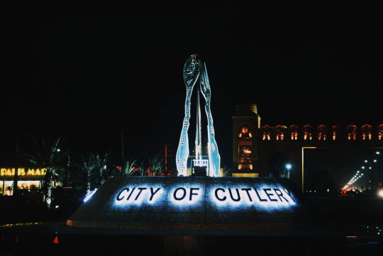
Wazirabad (Urdu/Punjabi: وزِيرآباد) is an industrial city located in Gujranwala District, Punjab, Pakistan. Famous for its cutlery products, it is known as the city of cutlery and is also quite famous for its foods.
Wazirabad is situated on the banks of the Chenab River nearly 100 kilometers north of Lahore on the Grand Trunk Road. It is 45 kilometers from Sialkot, 30 kilometers from the district capital – Gujranwala, and about 12 kilometers from Gujrat. The city of Wazirabad is the headquarters of Wazirabad Tehsil, an administrative subdivision of the district, the city itself is subdivided into 12 Union Councils.
History
The city was founded in 1645 AD by Wazir Hakim Illmmudiddin, an Amir of Shah Jahan. The town was taken over by Charat Singh around 1760 together with other towns in the District.[3] Maharaja Ranjit Singh occupied the town in 1809 and Avitabile was appointed as the Nazim of the city. He built an entirely new town, with a straight broad Bazar running through it, and side streets at right angles.
Cityscape
Inside the Old City, the First Residential Complex was built called Musamman Burj. It was constructed by Ilm ul din, a confidant of jehangir and was completed in 1636 AD during Shahjehan’s Rule. Oppostite the Musamman Burj, there is the Main bazar (Market) which is absolute Wide, is about 2km long and ends in the South of the City at Lahori Gate.
Another House called Kothi Sheik Niaz Ahmed was Constructed outside the old city about 2km from the burj on the road leading to Nizamabad but silently, the city outgrew its boundaries. Kothi and Mussamman burj both are now in the centre of Wazirabad thanks to the Urban Sprawl and Rapid Industrialization of the city.
Architecture
Built in the british Colonial era, the bridge was constructed to carry the Punjab Northern State Railway over the River Chenab. The First Brick was Laid on November 1st, 1871 and Completed in 1876, Though Later in 1878 necessary alterations were made.
Dak Chowki
The Dak chowki (mail station) is an age-old monument built by sher shah suri in 1542 A.D. It has now been declared a protected momument and is planned to be restored.
Gurdwara
The Forlorn Gurdwara Known as Gurdwara Gurukotha is situated in the City built by the Orders of Ranjit singh in memory of Guru har Gobind,the sixth of the sikh gurus (1595-1640), for he stayed in wazirabad during his long travels preaching through punjab and kashmir. The spherical, segmented dome of gurukotha gurdwara rises in splendour above the skyline of the city and is balanced off by four domes at the corner.
Transportation
Highways
Wazirabad is situated alongside the N-5 National Highway Which connects it to the nearby city District of Gujrat in the north and District Capital Gujranwala and the Provincial Capital Lahore in the south. Multiple Dual Carriageway also connect the city to Gujrat, Sialkot, Daska and Gujranwala.
E3 Expressway
The E3 Expressway or Kot Sarwar–Hafizabad–Wazirabad Expressway is a controlled-access expressway which links the N-5 National Highway at Wazirabad with the M-2/M-4 junction near Kot Sarwar, in Punjab, Pakistan. E3 also Connects the City with the Tehsil’s Union councils in the nearby areas.
Rail
Wazirabad Junction railway station is located in the city which has the Karachi – Peshawer Railway Line, Khanewal – Wazirabad Branch Line and the Wazirabad- Narowal Branch Line.
0 notes
Text
New Post has been published on Trekking in Pakistan
New Post has been published on https://trek.pk/kot-addu/
Kot Addu
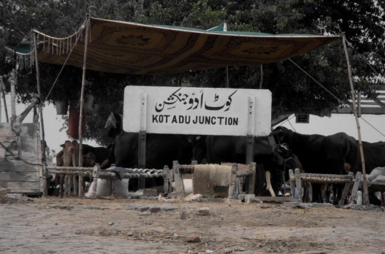
Kot Addu (Urdu کوٹ ادو ) is a city and tehsil in the Muzaffargarh District of the southern part of the Punjab province of Pakistan. This city is subdivided into 30 Union Councils[1] and has a population of over 104 thousand, making it the 67th largest city in Pakistan.[2] It is located just east of the Indus River, about 866 km (538 mi) from Karachi, 600 km (370 mi) from Islamabad, 100 km from Multan, 80 km from D.G.Khan, 60 km (37 mi) from Muzaffargarh, 60 km from Layyah, and 16 km (9.9 mi) from Taunsa Barrage. Kot Addu City attracts a large number of tourists every year, due to the Indus river and public gardens among other things. The city is served by Kot Addu Junction railway station.The Zip code of Kot Addu is 34050.It is the 69th largest city of Pakistan according to the 2017 census.
Geography and climate
Kot Addu is located almost exactly at the geographical center of Pakistan. The closest major city is Multan. The area around the city is a flat alluvial plain and is ideal for agriculture, with many citrus and mango farms. There are also canals that cut across the Muzaffargarh District, providing water to farms. During the monsoon season, the land close to the Taunsa Barrage is usually flooded.
Kot Addu has an arid climate with very hot summers and mild winters. The city has experienced some of the most extreme weather in Pakistan. The highest recorded temperature was approximately 51 °C (129 °F), and the lowest recorded temperature was approximately −1 °C (30 °F). The average rainfall is roughly 127 millimeters (5.0 inches). Dust storms are a common occurrence within the city.
Education
Like other major cities in Punjab, Kot Addu features a rich educational landscape. In the last few years, the city has observed a surge in the number of educational institutions. Colleges include private commerce and science colleges, schools, academies like Punjab Inter Science Academy, and a cadet college. Government degrees are provided for both men and women. Several colleges are affiliated with the Bahuddin Zakrya University, B.Z.U. Multan Pakistan, and Punjab University Lahore Pakistan. The names of some private institutions are, Kot Addu School of Economics and Management Sciences (Mr. Fiaz Hussain Malik, director), Punjab Higher Secondary School, Bismillah. Inter Science Academy, Punjab Group of Colleges, My School System, Dar-E-Arqam School, Oxford Grammar School, Professor Academy etc. A Government Technical College is also under construction.
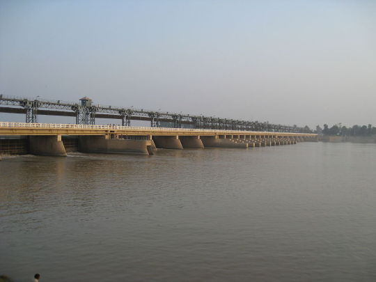
Taunsa Barrage
Taunsa Barrage is a barrage on the River Indus. It is situated 20 kilometres (12 mi) southeast of Taunsa Sharif and 16 kilometres (9.9 mi) from Kot Addu. This barrage controls water flow in the River Indus for irrigation and flood control purposes. This barrage serves 2.351 million acres (951,400 hectares) besides diverting flows from Indus River to the Chenab River through Taunsa Panjnad (TP) Link Canal. The barrage also serves as an arterial road bridge, a railway bridge, and crossing for gas and oil pipelines, telephone line and extra high voltage (EHV) transmission lines.[6] In 2011, the rehabilitation of the Taunsa Barrage was blamed for devastation of the Muzaffargarh district during the 2010 Pakistan floods.[7] Critics blamed the rehabilitation of the barrage, alleging that it failed to raise its height and strengthen protective embankments, used dysfunctional computer control system of the hoist gates and ignored hill-torrent management.
Industry
Kot Addu is a prominent commercial and industrial city in the Punjab province. It is connected by road and rail with Lahore, Karachi, Multan, Rawalpindi, Islamabad, Quetta, and Faisalabad; and also by air from Multan Airport to all Pakistani airports.
Agriculture
Kot Addu is an important agricultural area. The total area of Tehsil Kot Addu is 877,989 acres (355,310 ha), of which 4,24,521 acres are under cultivation. Main crops of the area include corn, cotton, rice, sugarcane, tobacco, wheat, and vegetables. Bajra, moong, mash, masoor, and oil seeds (such as mustard and sunflower seeds) are also grown in the district.
Mangoes, citrus, guavas, and pomegranates are Kot Addu’s most important fruit crops. Minor fruit crops include dates, jaman, pears, falsa and bananas are also grown.
One other local fruit is called a bare (Berry) . It is one of the main fruits grown in this region. Due to flooding, the crops are now rare, especially cotton and wheat products affected by this flooding. So, now a majority of the agricultural lands are covered by sugarcane. People either sell this sugarcane to sugar mills or produce Jaggery from sugarcane. KG Gurmani Agriculture Farm (Thatta Gurmani Bate Esan Wala Kot Addu).
Sources: Wikipedia
0 notes
Text
New Post has been published on Trekking in Pakistan
New Post has been published on https://trek.pk/kamalia/
Kamalia

Kamalia (Urdu/Punjabi: کمالیہ) is a city in the Toba Tek Singh District of Punjab, Pakistan. It is the administrative center of Kamalia Tehsil.[2] It is the 67th largest city of Pakistan by population and having the nearest cities like Rajana, Chichawatni, Pir Mahal.
Location
Kamalia is bounded in the South by River Ravi and Chichawatni, in the West by Pir Mahal, in the North by Rajana and Mamu-Kanjan, and in the East by Harappa and Sahiwal.
History
Kamalia is said to be existing even before the Alexander the Great. The legend suggests that Alexander tried to invade and win the then walled city (with used to exist some prehistoric name) in the morning when the people of the city opened its gate for a morning walk! Then the city was attacked and captured. But the conqueror moved on to some other places. Since the neighboring city Harappa is also prehistoric (but ruins now), so, it seems that Kamalia must be part of an ancient civilization who remained untouched from the wrath of the nature which could otherwise cause extinction. The old buildings amidst the “Iqbal Bazar” at the vantage point of the city, tell the story of a then progressive era.
The 1947 Partition caused the Sikh and Hindu population to migrate from the area with many of their hidden items still being found after ages. Some nobles even donated their properties to the trust of the Government. Government Praim Sati Trust (P.S.T) College is one of those properties; which is the only public (general-subjects) college in Kamalia other than the Government Technical College of Commerce.
A number of archaic and archaeological sites exist in Kamalia including Shamshan Ghat, Gurdawara and the ancient havelis with a grandeur.
Climate
The climate keeps changing with weathers. Summers are usually very hot and the temperatures may exceed 40 degrees, then comes Monsoon (Rainy season) with much closed environment and comparatively lesser rains as compared to the surrounding areas, then the Autumn with pleasant weather, then the Winters remain foggy and cold.
The most hazardous climatic threat to Kamalia is the flooding of River Ravi which is luckily a very rare phenomena.
Importance
Kamalia is famous for many things including the hand-woven or machine-woven cloth called “Khaddar”, poultry, sugarcane crop and not the least the Okra crop. Although the land is fertile and many other crops are also cultivated around the year which include Wheat, Cotton, Maze and Rice besides the “off-season” crops. Such variety of crops make it an important place for the Agriculture market. These crops are so much in abundance that many of these are exported to the other areas of the country. The Okra is dispatched across the country and even exported to Afghanistan. Whilst the poultry is also supplied to bigger cities like Lahore and Islamabad.
Dynamics
The people of Kamalia are mostly courteous and friendly. It is a very peaceful city with a minimal crime rate as compared to many other cities. The streets are mostly very narrow but surprisingly, this has increased closeness amongst the neighboring families who take care of each other through thick and thin.
Most of the people run their own micro-scale businesses including vendors selling in the main bazaars, the farmers, the commission agents at the agriculture and dry ration markets, and not the least; the owners and workers of the weaving machine units (looms).
Just like other areas of Pakistan, People are typically fond of politics. Pre-elections and the elections of every kind are enthusiastically participated in, with a handsome turnout. The local sports of Pigeon-keeping and kite-flying are also much liked. Rooftops are filled with pigeon-houses and kite-flying kits. The youth, by virtue of being Pakistani, are fond of Cricket. Although gone are the days when ample grounds including “Master-11” and others used to be heavens of the teens.
The availability of pure drinking water is yet another challenge. The city water table is getting lower gradually. But that is one issue. Fresh underground water is getting yellowish-brown and impure in more and more areas thereby making it inevitable for one to live comfortably.
Sources: Wikipedia
0 notes
Text
New Post has been published on Trekking in Pakistan
New Post has been published on https://trek.pk/ferozewala/
Ferozewala

Firozwala (Urdu: فِيروزوالا), is a city of Sheikhupura District in the Punjab province of Pakistan. The city is the headquarters of Firozwala Tehsil and is located near the provincial capital Lahore. Situated on the Grand Trunk Road, it is the 64th largest city of Pakistan.
Sources: Wikipedia
0 notes