Last Seen Blogs

miric96
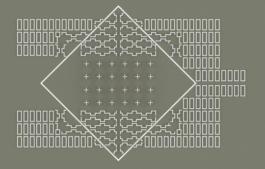
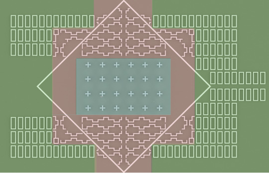
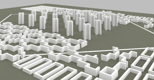
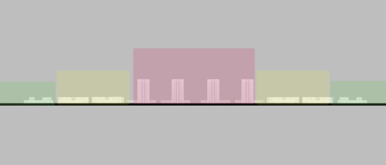
Infinite

haitiantimounfoundation
Haitian Timoun Foundation

hlel0lwakhe
Untitled

ghostlythunderbird
ShitsFuckedPleaseStandby

quillabex
Quillabex
Text
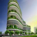
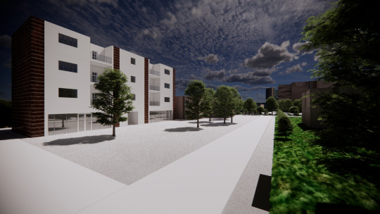
What can Architects Do to Help People in Slums?
What is a slum?
We consider a slum an unsafe and highly populated settlement on the outskirts of an urban area. The settlements lack services such as potable water, sanitation, as well as law enforcement.
According to the United Nations, more than a billion people live in slums today. It represents more of the 30 percent of urban population from 2000 to 2014 in developing countries. As a result, some estimations said that by 2030 one in four people will live in a slum.
Also, we take into consideration the site conditions in which many of the slums are. Places such as riverbanks or steep slopes are some of these examples. Other problems include discrimination, null representation of government, natural disasters, and limited access to own property.
How can we as Architects help the Slums?
All human beings deserve to have decent living conditions, unfortunately the lack of work or insufficient income are factors that lead people to settle in slums, in which the quality of life of the inhabitants tends to be very low, without the basic services such as electricity, water, sanitation.
As architects it is possible to contribute to the improvement of the living conditions of the inhabitants of the slums we focus the attention in providing the basic service such as the access of potable water, sanitation as well as the access of roof panels for electricity and better build conditions for their housing.
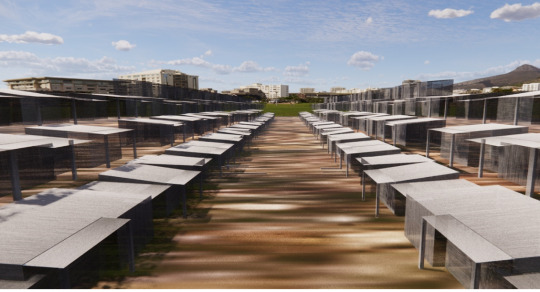
Implementation Systems: Diagrams
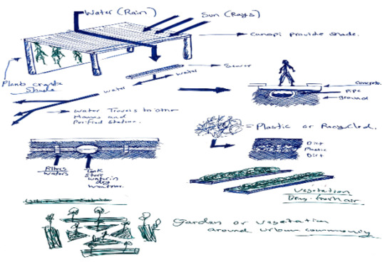
The ideas were composed to help the slums better their life rather than waste the resources at their hands.
Ex. 1 – Recycling of plastic with the help of a machine system that turns plastic into material for building rather than trash around the site.
Ex. 2 – Water system that captures water.
Ex. 3 Is the introduction of green to reduce the effects of the dry season and add shade to the slums.
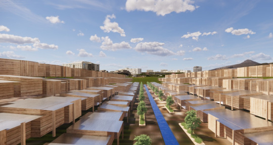
Electric Power ( Diagram )
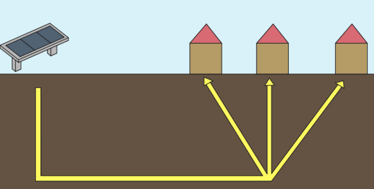
We know that a solar panel system like the one shown is not all that possible but, to make our point this is just a diagram that shows what we wanted to do. The idea is to have a small-scale solar panel on top of each roof and with the energy gathered by the sun, it would then transfer light into each slum providing warmth for the cold days and light for necessary utilities around.
Water Management ( Diagram )
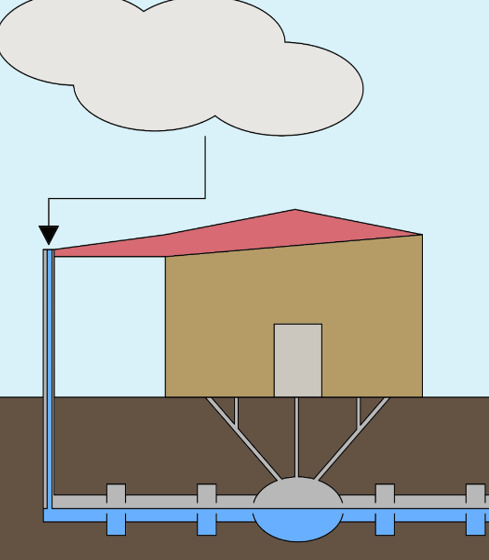
As an added measure for the slums to be sufficiently sustainable on their own, we implemented a water management system. The system would gather large amounts of rain water onto the roof and down the gutter. The gutter would then transfer the water through a filter which then pumps clean water through the pipes and into the slums of the people. The tank of water would keep people afloat in the dry seasons used for sanitation, washing, and cooking.
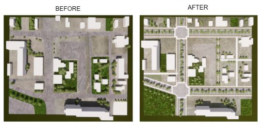
Slums ( Before )
Slums are generally composed of "houses" made of metal, wood, concrete, and brick. Most homes are overcrowded and with a limited drainage system without water or electricity to meet their basic needs.
Slums ( After )
By providing an appropriate drainage system, electricity, and water, living conditions would improve remarkably and help clean the air and improve the health of the inhabitants. Electricity would help practice daily necessities, such as keeping your food refrigerated and other things. With few actions, the life of the slum dwellers can be drastically changed, not only in everything in the community but also to each person emotionally, since better living conditions create happier and healthier communities.
Conclusion:
The slums are a place that takes time to change the quality of life of each inhabitant of this place but, we are sure that putting into practice each one of the proposals in this presentation would significantly improve the quality of life.
Each proposal expresses the basic needs of the inhabitants and motivation for a better lifestyle. Implementation of storm water treatment and solar energy is also a sustainable way to counteract the ravages of extreme climates, providing a viable solution to the problems they face every day.
Works Cited:
“What Is a Slum? Definition of a Global Housing Crisis.” Habitat for Humanity GB, June 12, 2018. https://www.habitatforhumanity.org.uk/what-we-do/slum-rehabilitation/what-is-a-slum/.
“Slum PPAB - UN-Habitat - A Better Urban Future | UN-Habitat.” Accessed November 9, 2021. https://unhabitat.org/sites/default/files/documents/2019-05/slum_almanac_2015-2016_psup.pdf.
“WWW-Sciencedirect-Com.ezproxy.uta.edu.” Accessed November 9, 2021. https://www-sciencedirect-com.ezproxy.uta.edu/science/article/pii/S0190740900001031?via%3Dihub.
0 notes
Text
New Urbanism vs Landscape Urbanism
The discussion about which is better between New urbanism and landscape urbanism could be endless, since each one defends its position and each one has qualities that would help to improve cities, but we think that New urbanism is the most complete to achieve a happy and sustainable city, which is the principal goal of this planning movement.
The main objective of the new urbanism movement is to create a better future for the inhabitants of a city, improve their standard of living by creating better spaces to live. New Urbanism also promotes the creation of walkable spaces, and mixed-use communities that contain housing, work places, shops, entertainment, parkas, and civic facilities and effective transportation systems implementing the use of trains, light rail and reducing the use of car by reducing the construction of new highways and roads.
(Archdaily photo)
In order to achieve all of this objectives, new urbanism implemented a list of 10 principles, which are useful and can be applied from a single building to an entire community:
1. Walkability
The design of street is friendly to pedestrians, people feel safe when walking on the street and they are most likely to go out and get their needs. Trees are also placed on streets, which offer shade and an enjoyable journey when people is walking.
2. Connectivity
Streets are designed to have less cars and more people walking in them, so everything is strategically connected so that this can be possible.
3. Mixed-Used & Diversity
A mixed used design is implemented so that people can have everything they need close to them. Shops, offices, apartments, and homes are placed strategically in the same place, this spaces are also designed for all kinds of people, the neighborhoods welcome people of all ages, income levels, cultures and races.
4. Mixed Housing
A variation of size, types and prices in housing is available.
5. Quality architecture & Urban design
Buildings emphasize beauty, aesthetic, and comfort and establish a sense of place, public space, establishing an attractive, quality realm.
6. Traditional Neighborhood Structure
Each neighborhood has their own public space in the center and everything they need within a 10 min walk.
7. Increased density.
Buildings, residences, shops, and services are close together to make walking more convienient, services and resources more efficient, and living areas more enjoyable.
8. Smart Transportation
A network of high-quality public transit connects cities, towns, and neighborhoods, while pedestrian-friendly design encourages more use of bicycles, rollerblades, scooters, and walking as daily transportation.
9. Sustainability
Eco friendly technologies are used to minimize effects on the environment.
10. Quality of Life.
These design principles produce a life that is well worth living by providing places that enrich, uplift, and inspire the human spirit.
Each of this principles complement each other to create a funcional community that benefits more that one sector, specially the residents because they have a healthier lifestyle with more walking and less stress, everything they need is closer, they have access to bike trails, nature and parks and have a more open space to enjoy, thus they have a happy and peaceful life.
Works cited
http://www.mlui.org/mlui/news-views/articles-from-1995-to-2012.html?archive_id=678#.YYGBLp7MJPa
https://prs3.com/8-principles-of-new-urbanism/
0 notes
Text
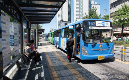
Feasible Transportation Systems in Downtown Arlington
Arlington is the third-largest city in North Texas; it has many attractions and has been one of the biggest cities in the United States without any form of public transportations until now. Arlington is also home to the largest university in North Texas, the University of Texas at Arlington, with more than 40,000 students, is an essential element for the economy of the city, and is vital to pay attention not only to the transportation system for students but also to each inhabitant of Arlington.
In 2016 an average of 1.89 cars per household was registered, only 3.7% of households without a car in their homes, which means that in the city of Arlington, it is almost impossible to transport yourself without using a car, here we reiterate the need of an efficient transportation system to reduce car use.
Public transportation is essential for the people, environment, and economy to flourish because it transports people or goods in a fast, reliable, and affordable way. Arlington is currently behind in implementing public transportation on its streets, and although there has been some progress with the implementation of via rideshare since 2018, it is still not enough. Based on the success of other cities like Houten in the Netherlands, where an estimated 98% of people in the city own a bicycle and 3.4 bicycles per household. Copenhagen balanced the use of bicycles with public transportation such as buses, trains, and cars. The proposal consists of three types of public transport of different scales. Each one works to meet the community's needs of efficiency and sustainability.
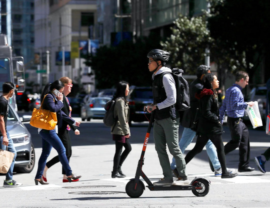
1. Bicycle & Scooter ( Small Scale )
The Rental transit systems will allow people to move through the spaces faster when going to the park, store, school, or office. It creates an incentive for people to exercise daily and not harm the environment with cars. It provides funds for the community and uses it to restore older neighborhoods and bring more attractions to the city and people with money.
2. Bus ( Medium Scale )
The introduction of bus transportation benefits the community by reducing emissions, carbon footprint, and air pollution from the daily use of cars. If people use public transport this will lower traffic and fatality rates, Not to mention it transports large amounts of people from point A to B.
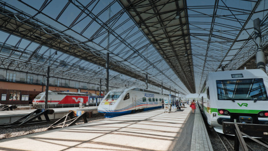
3. Train ( Large Scale )
Trains offer tourists from around the metroplex to connect within a matter of minutes from one another. They are also more sustainable in terms of energy consumption, noise and require less space required by other transit methods. It creates hundreds of jobs both maintaining and innovating the train systems and building stations, train stops, and the railway itself.
Conclusion:
Different types of transportation are needed every day to move people fast and safely to where they need to be. A city must meet the demand of the people inhabiting the space so that its economy grows. It is a factor for an efficient transport system that works for all types of people. In Portland, Oregon, by the mid-2000s, an attempt was made to integrate bicycles into the city but was unsuccessful because they only had in mind one group of people, the strong and fearless. Only 5% used these routes; when designing it's important to think about the needs and conditions of all the inhabitants to be successful in the new implementations.
No more use of cars and more people exercising will creates health benefits for the people and the reduction of harmful traits to the environment. A system that will benefit the whole city of Arlington and will keep it connected with the rest of the metroplex in moving forward by becoming a city worth visiting.
Work Cited
Montgomery, Charles. Happy City: Transforming Our Lives through Urban Design … https://www.amazon.com/Happy-City-Transforming-Through-Design-ebook/dp/B009LRWHPY.
https://www.wired.com/story/e-scooter-micromobility-infographics-cost-emissions/
https://www.bosch.com/products-and-services/market-specific-solutions/solutions-for-railways-and-train-station-facilities/
https://www.bondbuyer.com/news/dallas-dart-transit-pricing-taxable-and-tax-exempt-bonds
https://www.greaterohio.org/blog/2019/2/6/p6e5xew9mlv814nirb5jmkx7u4tkb5
1 note
·
View note
Text
Whyte’s Principles on Watters Creek
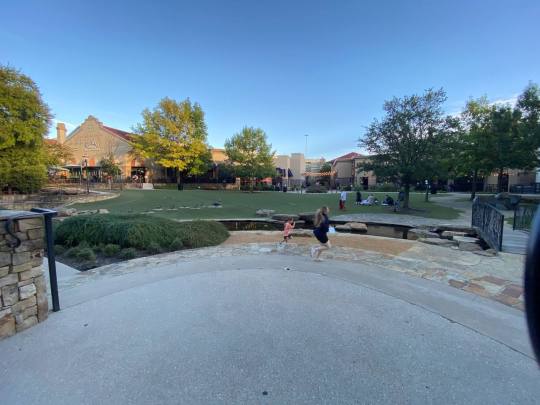
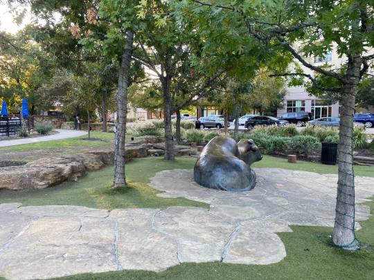
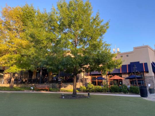
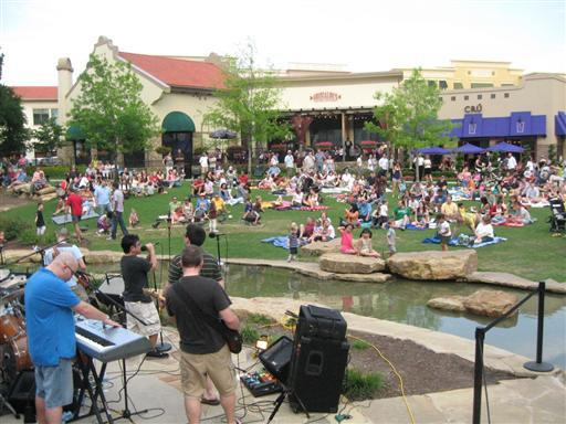
Our group decided to visit Watters Creek in Allen to observe all the elements that William H.Whyte mentions in his book “The social life of small urban spaces.” The plaza will undoubtedly attract more people, interact with each other, and offer a comfortable space where they can have a good time with friends and family.
1. Sitting Spaces
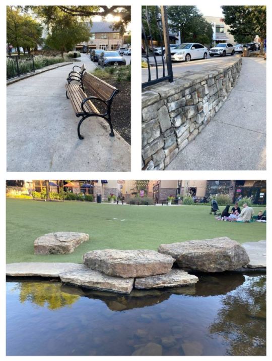
Whyte discovered that one of the elements in a plaza use is suitable space because he believes that sitting should be flexible and for all kinds of people and situations, in the shade, in the sun, in groups, alone. We visited Watters Creek and noticed big benches, but places looked like decorations but used as a sitting space. Examples are rocks by the water, patches of grass, and the walls as a division between spaces.
2. Physical and visual relationship to the street
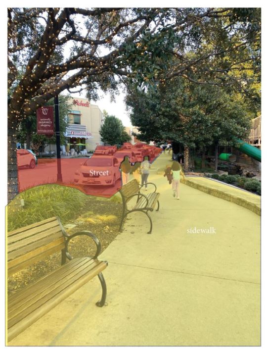
The plaza streets are filled with greenery and sidewalks wide enough to make people feel comfortable and safe in them. Both sidewalk and street-level allow people to view the plaza and its many uses of space.
3. Light
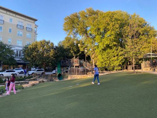
Watters Creek is an open space where is possible to have enough sunlight and shade from the trees. These two elements within the plaza allow people to decide where they feel most comfortable in either that be in the shade during summer or the sun in the winter.
4. Water
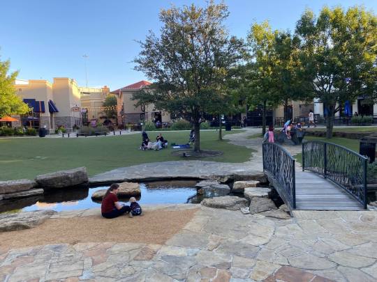
When we got to the plaza, the first thing we could see was the little creek in the middle of the plaza, where people sit to enjoy its tranquility and serenity, a common effect on people when we hear the sound of water. According to Whyte “One of the best things about water is the look, feel and sound of it.”
5. Trees
We mentioned before how important are the trees in a plaza to provide shade, but they are also important because they transmit a sense of protection, “the pleasure of being comfortably under a tree provide a satisfying enclosure; people feel cuddled, protected.” (p.46)
6. Food
Whyte believed that food was a factor element in a plaza because it complemented social life. “Food attracts people who attract more people.”. The Watters creeks have a great variety of restaurants in the middle of it, where people can sit outside with friends and family that interact with the plaza.
7. Triangulation
(Allen BubbleLife Photo)
When we visited the plaza it was a regular day and not many people were there but we know the space offers a variety of events for the people. which allows people to increase their social life and interact with people they did not know. “ Whyte describes a phenomenon he calls “triangulation” in which some external stimulus provides a social bond between people and prompts strangers to talk to each other as though they were not. ”(p.94).
Works Cited
Whyte, William H. “[William H. Whyte] the Social Life of Small Urban Space.” New Media Urbanism, 13 Feb. 2012, https://braverosie.wordpress.com/2012/02/12/the-social-life-of-small-urban-space-william-h-whyte/.
0 notes
Text
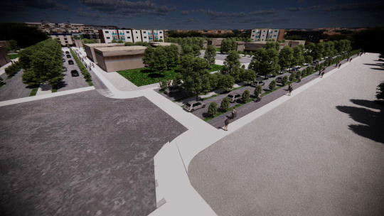
Road diet
In the modern era, we design around the car and not for the people as it should be. However, in recent times, our focus has changed in redesigning spaces for people of all kinds where they feel safe and bring in different businesses to the economy.
If we talk about how the city of Arlington has been designed, we see a lot of Hardscapes not only occupy lots of unnecessary space but bring heat to the surface, making days hotter. In our design Plan, we think that adding vegetation and simplifying the lanes to be more stable and orderly will make the street more functional and provide stability for the area.

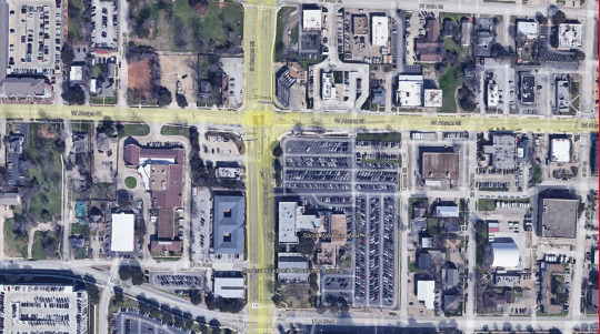
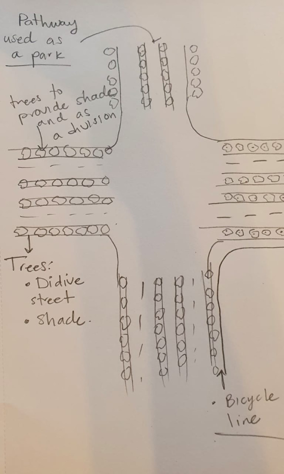
Abram and Cooper street intersection
Mobility on cooper street
The main problem throughout cooper street is the 8 lanes for cars driving at high speed. The lanes intersect at W. Abram st. and UTA Boulevard, with a small road for bicycles passing by, creating dangerous situations. The idea is to reduce the number of car lanes to 4 and make sidewalks with vegetation on the sides to protect people from cars. Accomplishing this action would move Cooper st. from a highway to a standard street with vegetation passage, creating fresh air in the heated months of the summer. The paths allow walkability up and down the streets without worrying about their safety, not to mention reducing the speed to 30 or 35 depending on the zones.
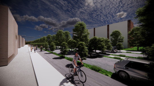
Parking is a large portion of the site where cars create traffic at all times of the day; instead of making story parking garages, can those spaces be made into parks or vegetation spaces. This would allow the city to move forward in a car-free direction where most of the transit would be by walking and riding bicycles. Transitioning into fewer cars would also reduce traffic, noise, and pollution and make the area more friendly, bringing in the business where people walk through the streets comfortably.
With this design people crossing the streets the transition from one building to another would be more accessible and easy to do without creating many distractions. designing for the people's safety and well-being should always be priority number one because it's the people who bring in the business, and living in the city, everything moves around people. By creating access to stores, schools, and apartments through safety protocols of lanes, the city can start to prosper more than ever.
Land use, housing, and business
Arlington is a city growing more and more, and with this also the problem of affordable housing. Demographics, income, and location are some of the factors faced in finding affordable housing.
We are currently in a decisive moment for the future in many aspects, but especially in combating pollution, health problems caused by this, and poverty, among others. We come from an era in which the main priority was automobiles, as mentioned before. We are changing to prioritize actions that promote sustainability, getting rid of parking lots with good transportation is now emerging.
We think that by creating affordable house area at this place will help attract more people to this part of the city, with a design of buildings with affordable house on top and business on the first floor will increase the movement in this zone and have an increment in economy, which will really help the city growth.
The set of proposals in this project creates in Arlington a safe zone with solutions to economic, health, and pollution problems. The idea of reducing the street lanes and adding vegetation with a street lane for walking and bicycles while creating a network that allows transit will make the inhabitants feel at home. The pedestrian-friendly street lanes filled with vegetation will bring business to the area and affordable housing for all people.
We believe that we are at a decisive moment to change and improve the direction of our cities. In Arlington, the project offers viable solutions with sustainable options to solve them.
0 notes
Text
Site visit
We visited South Cooper street and W Abrams st
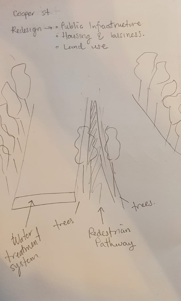
The elements we want to work or redesign are:
Rain water treatment.
Pedestrian pathways in the middle.
Bicycle lines on the side of the road.
Reduction of the street lanes to reduce car use to improve walkability.
Trees used to provide shade and as a barrier protection for pedestrians.
0 notes
Text
What’s the best density for Dallas-Fort Worth?
Density is an important part in the functioning of a city, it defines the number of people who live in a certain space.
It is difficult to establish an ideal density for cities in the United States, there is no model of what an optimal density could be, since different factors may be required to consider if a city is ideal in terms of density population.
Dallas is one of the most scattered cities in the country, its territory includes approximately 340 square miles and about 1.3 million people inhabit the area, resulting in a density of 3,818 people living in each square mile which means that some places in the Dallas area compared with other cities in the united states will have a low density population.
Although the density population of any place can be measured mathematically, it can also be measured from the perspective of the people who live in there . Density population is an important factor on new developments in city because density in urban areas make possible the improvement of space use in a city as well as to prevent the urban sprawl on its outskirts. First, the economic factor predominates the decision of units per acre in a site as well as the place in which is situated. In downtown areas of a city is where the High-Density dwellings are located due to the small space to develop around it. While most of the Medium-Density dwellings are located in the suburban areas around the city. However, the Low-Density dwelling are everywhere, they are more related to the outskirts of the city.
We chose 4 different places in the Dallas Fort Worth area to compare the density in each one of them, we will be able to visualize in the different photographs how the densest areas look, with a medium density and with a low density.
High-Density
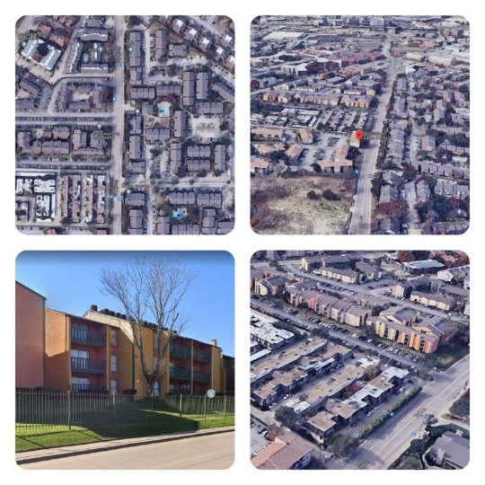
Vickery Meadow, Dallas, TX.
Approx. 36 people living in each acre.
Medium-density
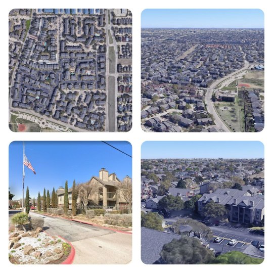
Far North Dallas, Dallas, TX.
Approx. 14 pople living per acre.
Low-Density

Marsh Ln, Addison, TX.
Appox. 11 people living in per acre.
As we mentioned before, the density level of some areas of Dallas is relatively low which can be very beneficial for a place, to see how low density population can benefit cities we take in consideration three factors as the main aspects for density in a city:
Green space
Natural light
The sense of community
The accessibility to green spaces not only approach nature to people, but also benefit their inhabitants health. Those private spaces allows also natural ventilation as well as reduce the sense of enclosure in a single monotonous space. Also, this private space can allows people to design their own green space according with their needs: it could be a private garden or as a place to harvest their own food. Another important aspect is that a private green space could provide natural light that can reduce the consumption of electricity in a single family residence.
In contrast, if the density of space is too high, buildings has to be taller, as a result some buildings obstruct the entrance of natural light on ground level. Also, it restrict the people temporary appropriation of their front door place. However, a high rise building could be secure on its surroundings, people have a feeling of endangerment as a lack of community sense due to this condition. Low density, on the other hand, brings more social interaction on street level, and connects people to their community.
We can say that low density is a great benefit for many cities, but this is not always the case, there are cities that may have low density population, but have poor urban planning and fail in many aspects that are complemented by low density to have a city in which its inhabitants live well. We can also see cities in which the density is very high, however they have good urban planning and the inhabitants do not even feel that they live in a city with high density. This is why we cannot rely on density levels to calculate the quality of life of people in a city.
Works cited
Harris, Al, et al. “How Dense Is Dallas?” SpareFoot Moving Guides, 26 Jan. 2017, www.sparefoot.com/moving/moving-to-dallas-tx/how-dense-is-dallas/.
Nelson, Garrett Dash. “Square Density.” Oh, the Humanity!, garrettdashnelson.github.io/square-density/.
0 notes
Text
Applying Haussmann’s and Burnham’s concepts in Dallas
The Urban Design for cities is under the criteria of creating commercial spaces and a place for authority. As a result of those actions, an Urban City concentrates a large number of inhabitants and functions. These two elements bring problems in the city like overpopulation, sanitation problems, and segregation among its citizens due to their social-economic status. These effects show in many cities around the world. The solution solves new developmental ideas in urban design.
Paris
Paris is one of the most important examples of how to implement a new urban design. After the dissolution of the First French Republic and the access of Napoleon III Bonaparte as the new emperor of the Second French Empire, he decided to renew the Paris City infrastructure. The political condition in which this implementation formed the development of Paris. Commission by Georges-Eugène Haussmann. He contemplated fixing the problems of the center of Paris. Massive public work on the overcrowded, dangerous, and unhealthy neighborhoods. The redesign of the new center of Paris, the demolition of many medieval places were needed. Haussmann had enough space to build buildings and boulevards that connected with those buildings as well as with new landmarks.
Creation of boulevards that connect with monuments as well as the railroad station.
Created a new Infrastructure to solve the sanitary problem.
Demolition of old Paris.
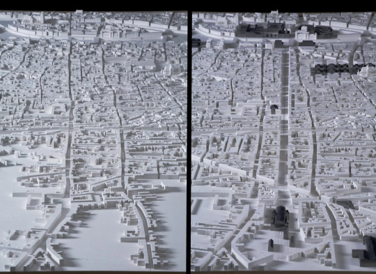
Paris, before and after Haussmann intervention 1852-1870
Chicago
Chicago is one of the cities in which we can see urban planning perfected over time. In 1906 the concern arose to plan several aspects of the city due to the rapid growth it was experiencing. Daniel Burnham recommended a series of projects that would oversee the betterment of the city's future. This plan prioritized the things Burnham considered most important for the city, but without neglecting what would arise in the future.
Improvement of the lakefront
A regional highway system
Improvement of railway terminals
New outer parks
Systematic arrangement of streets
Civic and cultural centers
Chicago’s new grid system
These aspects are due to their effectiveness have been the basis for the operation of other cities. The Dallas-Fort Worth area is one of them, and although it has not yet been possible to fully achieve perfection in the cities in terms of urban planning we can see some elements that implement the work and could be perfected and be a door for a more sustainable operation of the city in the future.
Highway System
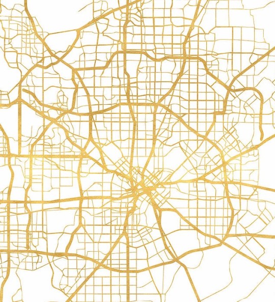
Dallas area highway system illustration
In an attempt to create an effective transportation system the Dallas area has built over many years highways that communicate with each other and we can see that most converge in downtown Dallas, which seems effective if we rely on the Burnham system, but we think that it has reached the point where it affects the city because it has prioritized this aspect leaving other more important ones in second place, and we think that it is something in which the city could improve significantly if they are implemented more green areas and public transportation routes to reduce the need for roads.
Improvement of railway terminals
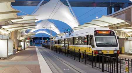
DART station in DFW
The improvement of the railway terminals was a factor in the Burnham plan. An aspect in improving the cities of Chicago and the Dallas areas was looking at the Arlington railway system lacks user-friendly stations and routes to reduce travel time from one place to another.
Parks
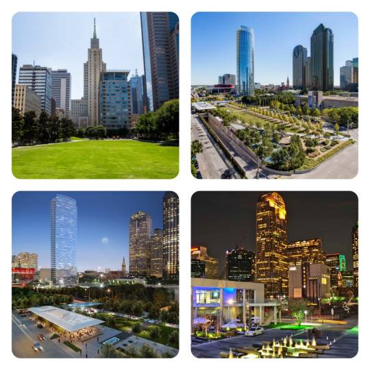
Different green areas in the Dallas area.
The introduction of parks in the Dallas-Fort Worth area is another concept that Burnham considered in his original plan, we think that in order to expand the city’s green spaces and parks a network of public parks that can be connected with some of the existent trails around the metropolitan area would benefit and help the city. There are examples in the creation of parks connecting the trails.
One Arts Plaza
Klyde Warren Park
Main Street Garden Park
Systematic arrangement of streets

Walkable Street Dallas Fort Worth area.
The Dallas area has been concerned about prioritizing spaces for pedestrians walking or people using a bicycle, this action is a path towards a sustainable city since by creating places where you can walk easily, car use is reduced, helping to reduce emissions of gases that pollute the environment.
Civic and cultural center
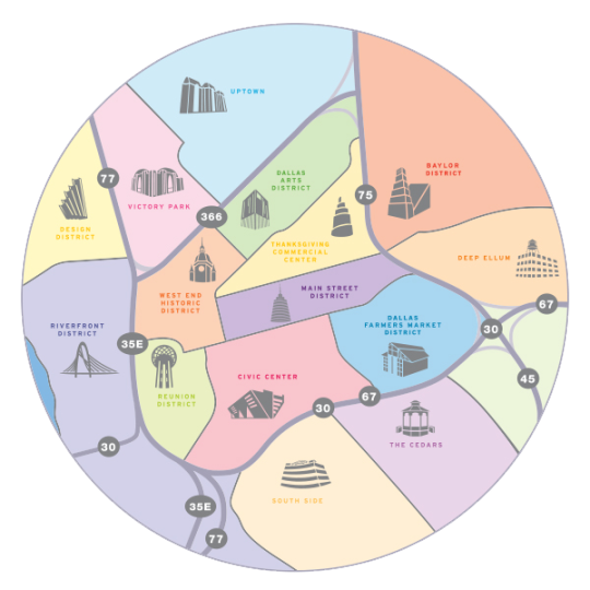
Dallas districts colored map
In the Dallas Fort Worth area, we can see the intention of connecting the elements in each district in one place. The district's connection to the different highways surrounding the area which facilitates access to these places. In each space, we can find a variety of important places such as museums, bookstores, parks, etc., just like the plan of Burnham and Haussmann that had the intention of connecting the spaces in the city of Paris and Chicago.
Works Cited
“Rail Insider-Dart's Light-Rail System Is about to Get Even Longer. Information for Rail Career Professionals from Progressive Railroading Magazine.” Progressive Railroading, www.progressiverailroading.com/passenger_rail/article/DARTs-light-rail-system-is-about-to-get-even-longer--54614.
“Chicago Architecture Center.” Architecture & Design Dictionary | Chicago Architecture Center, www.architecture.org/learn/resources/architecture-dictionary/entry/1909-plan-of-chicago/.
0 notes
Text
Success and Failures of an Utopian City: Radiant City
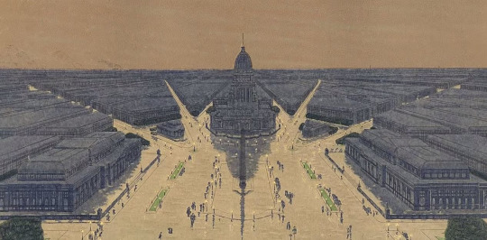
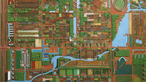
The concept of an deal city has been involved City Designers as well as Architects in a way to provide the best solutions to the problems that people faces in a city. Each problem is the result of a deep understanding of those problems. There have been some master plans that have been trying to solve those problems according to each era. There are the case of Garden City propose by Ebenezer Howard as well as the Broadacre City by Frank Lloyd Wright. This post is focus on the Le Corbusier idealistic city: Radiant City.
After the end of the World War I, Le Corbusier become with a radical idea propose for the center of Paris that was devastated by the war.
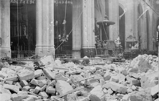
Paris after World War I
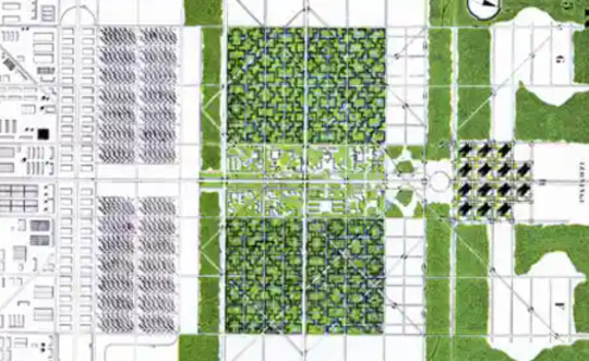
This Functionalism design was based on the ideas of harmony, equality, and accessibility to basic needs. it was designed in a way that its inhabitant were benefit by public transportation, green space and the abundance of sunlight due to its open spaces. It was divided in districts: Business district, Civic district, Housing district as well as that goes from Skyscrapers that would be used as the business district. With a height of 200 meter, these skyscrapers could be occupied by five to eight thousand people. In the center of this master plan, it was located the Civic District which would be connected by an underground train to the Housing District that was located on the outskirts of the city.
Radiant City Mater Plan :
Some of the successful points that was provided by the Radiant City consisted of :
Radiant City” was a linear and ordered metropolis of the future. Symmetry and axis allowed spaces to function separately as a whole
Fundamentals of the Project: Work, Live, Play, Transportation
Provide Efficient communication networks
Ensure the enlarged, vast areas of greenery throughout the city, Buildings surrounded by landscape
Increase access to the sun
Reduce the Urban traffic
Achieve maximum functionality at minimum cost regardless of the origin and social class of users
The Radiant City proposed a walkable city, division of spaces between vehicles and pedestrians and the importance of having exceptionally well-connected public transport that communicates with the different areas in the city.
Hierarchy of Spaces, Work, Living, Play
In contrast, as apparently be a solution of many problems in communities. In practices some of the ideas represent failures on the design such as:
Demolition of the Central Paris
The rigid orderly and aligned design
Limitation of expansion
The lack of sense of community which provide little connection to the space: absence of street life
Highly impractical against natural forces
Authoritarian, inflexible and simplistic
Separation of spaces which isolate areas
Form over tradition and cultures
Section :
0 notes
Text
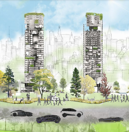
What is an Ideal City?
The ideal city is a perfect design where the needs of the people come first. The idea goes from transportation to infrastructure and sustainable resources in the city for its inhabitants. During design history, many concepts of an Ideal City have existed. Many recognized architects, having a dream of the perfect city. Some examples are consist of Broadacre city or the Radiant City of Le Corbusier, the Garden City, proposed in the 19th century for Ebenezer Howard.
Broadacre City, Frank Lloyd Wright
Radiant City, Le Corbusier
Now, there are other aspects that designers need to have in mind when creating a concept of an Ideal City. Topics surrounding the city would consist of natural resources, climate change, overpopulation, and socioeconomic classes. However, there are new tools that we can use to create and develop a new concept of this Utopian City. The development of new construction technology allows urban spaces and the design for eco-friendly and sustainable buildings.
The blog is a vision of an Ideal City that could fulfill those necessities. This concept focuses on infrastructure, technology implementation as well as sustainability as the main ideas. The main ideas provide solutions for an ideal city with the interaction of the people in the design process of the community.
The most important aspect of the design is the infrastructure that will improve the quality of design perception, keeping in mind the people’s ideas, beliefs, and cultural sense of community. The infrastructure provides sustainability, resources, and an expected prolonging of human life. The green space is a way of recreation for people to increase the level of walkability, physical activities will improve the health conditions of people. On the other hand, the city provides efficient and sustainable public transportation to reduce the use of private transit is the action will decrease the canyon effect that big cities experience
Technology is a vital tool that communicates the integration of green spaces, green walls in building design. It provides a better advantage of natural resources to improve a better connection between nature and architecture. As a result, the combination of technology within the design will play a vital role in developing an Ideal City.
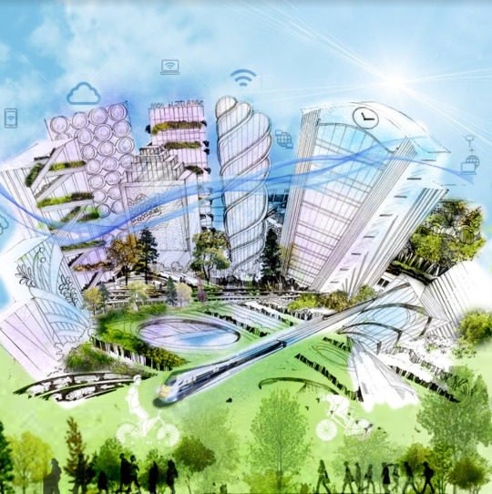
In conclusion, the perfect city will have technology and infrastructure providing a better quality of life for its inhabitants. The result being will maximize the limited natural resources and will provide a better use of them.
1 note
·
View note