#if you have thermal spring water recommendations please drop them in my ask
Text
Finished yet another can of the Avene Spring Water yesterday morning and opened my 4th overall bottle. Every time I'm at the end of the can spruting out the remainder on my face, I forget how good it feels to open a new, full can and spray an even amount of water on my clean, dry face.
#I bought the can in September '22 and it lasted me until April 12 '23 so a 300ml bottle with daily use lasts around 8 months#it's more than just overpriced water#if you have thermal spring water recommendations please drop them in my ask#I love my avene but I would also like to try others in the market#can't believe it's already my 4th bottle#skincare#skincare update#update#personal#consumerism
3 notes
·
View notes
Photo

Hi Michael,
I have recently stumbled onto your site and have been enjoying it very much. My husband and I are planning a trip to Yellowstone in a few weeks. We’d like to take in a few short hikes. We are both in our late 60s and in decent shape. We spent a few days in Arches this spring and took a few five-mile hikes through the park and enjoyed it thoroughly. What hike could you recommend for us? We are thinking about limiting our hikes to fives miles because of the change in elevation/terrain and weather conditions we may encounter there.
Thank you.
Jeanne
Strafford, N.H.
Hi Jeanne,
Thanks for writing and finding The Big Outside. You are heading to a fantastic park for short walks and hikes any time of year, although I think autumn is ideal because of good weather and fewer people; some of the photos in this story were shot on an October trip I took.
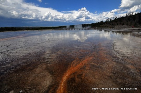
You should read my “Ultimate Family Tour of Yellowstone” for ideas on the best spots to visit and take very short walks while driving through the park, including the Midway Geyser Basin and America’s largest hot spring, Grand Prismatic.
Grand Prismatic Spring, Midway Geyser Basin, Yellowstone.
As for hikes of five miles and under, here are the ones I’d suggest, listed in no particular order.
Bunsen Peak
The summit of 8,564-foot Bunsen Peak, about five miles south of Mammoth Hot Springs, overlooks a huge swath of the park, from the Gallatin Range to the west, across the high plateau that comprises much of Yellowstone, to the Beartooth and Absaroka Mountains. The round-trip hike on the Bunsen Peak Trail is four miles.
Lamar River Valley
The Lamar River Valley in the park’s northeast corner is a great area for seeing wildlife like bison and elk and occasionally wolves. Hike out and back as far as you want on the Lamar River Trail, which is pretty flat and passes through open terrain with big views.
Hi, I’m Michael Lanza, creator of The Big Outside, which has made several top outdoors blog lists. Click here to sign up for my FREE email newsletter, or enter your email address in the box in the left sidebar or at the bottom of this story. Click here to get full access to all of my blog’s stories. Follow my adventures on Facebook, Twitter, Instagram, and Youtube.
View from near the summit of 10,243-foot Mount Washburn.
Mount Washburn
Mount Washburn is 6.2 miles out-and-back from Dunraven Pass on the Grand Loop Road; there’s a shorter, five-mile out-and-back to the summit from a trailhead on a dirt road just north of Washburn, that ascends more than 1,700 feet. The views from 10,243-foot Washburn take in the Tetons, Beartooth and Absaroka Mountains, and the Madison Range. The Indian paintbrush, lupine, and other wildflowers bloom in late July and early August. Hike it in early morning or evening for a good chance of seeing bighorn sheep.
View of Grand Canyon of the Yellowstone River from Lookout Point, North Rim Trail.
North Rim Trail, Grand Canyon of the Yellowstone
The North Rim Trail along the rim of the Grand Canyon of the Yellowstone River (lead photo at top of story) is arguably the park’s most scenic walk, with constant views into the deep canyon, including Lower Yellowstone Falls. (In fact, I put it on my list of the best national park dayhikes in the country.) Various points of road access allow you to choose a hiking distance, but the entire trail is fairly flat and under four miles. You can also walk across a bridge past Upper Yellowstone Falls to reach the south rim and make it a longer hike by following the South Rim Trail for the views from the other side.
Gear up right for hikes in Yellowstone. See my reviews of the best hiking shoes and the 7 best daypacks.
Uncle Tom’s Trail, Grand Canyon of the Yellowstone
The Uncle Tom’s Trail on the south rim of the Grand Canyon of the Yellowstone River is short—it only descends about 500 feet—but the metal stairs you follow down it lead to a spectacular viewpoint near the base of Lower Yellowstone Falls.
Fairy Falls
The Fairy Falls Trail, in the Midway Geyser Basin, leads to one of the park’s nicest waterfalls, 197-foot Fairy Falls, passing views of the park’s biggest and most colorful geyser, Grand Prismatic Geyser. There are a couple ways to get there, both fairly flat. The shorter route, five miles round-trip, begins a mile south of Midway Geyser Basin, where you cross a steel bridge. The longer route of eight miles round-trip begins at the parking area at the end of Fountain Flat Drive. From the falls, you can continue 0.6 mile one-way to Spray and Imperial geysers, and then double back.
Stay dry and happy. See my reviews of “The 5 Best Rain Jackets For the Backcountry.”
Old Faithful, Upper Geyser Basin.
Upper Geyser Basin
The Upper Geyser Basin is home to the world’s largest concentration of geysers, hundreds of them, including Old Faithful. You can walk the almost flat trail and boardwalk for several miles from Geyser Hill to Biscuit Basin and Black Sand Basin, or take a shorter tour. Get a map and guide to the Upper Geyser Basin and take time to explore it. You don’t want to miss this area.
The Big Outside helps you find the best adventures. Subscribe now to read ALL stories and get a free e-guide!
Mammoth Hot Springs, Yellowstone.
Mammoth Hot Springs
Mammoth Hot Springs, multi-hued travertine terraces formed by thermal waters rising through limestone, is unquestionably one of the most inspiring areas of the park. Water constantly pools and trickles down the terraces and steam billows from them. Boardwalks weave through the lower terraces and a one-way loop road through the upper terraces. Plan to explore this area for an hour or more of leisurely walking for the dramatic light of early morning.
Lone Star Geyser
The Lone Star Geyser Trail, which begins near Kepler Cascades, just south of Old Faithful, is an almost five-mile round-trip hike to Lone Star Geyser, which is several feet tall and erupts about every three hours. Go early in the morning to avoid the crowds and give yourself time to sit and wait for the geyser to blow.
Read about how climate change is affecting Yellowstone and other parks in my book
Before They’re Gone—A Family’s Year-Long Quest to Explore America’s Most Endangered National Parks.
Along the Blacktail Deer Creek Trail, Yellowstone National Park.
Blacktail Deer Creek Trail
The Blacktail Deer Creek Trail, which begins about 6.7 miles east of Mammoth on the Grand Loop Road, winds north across gently rolling grasslands and meadows with long views of partly forested hills and a good chance of seeing a bison herd. The trail drops more than 1,000 feet in 3.7 miles to the Black Canyon of the Yellowstone River, where, for a longer outing, you can hike either upriver or downriver along a trail through conifer forest, with views of the cliffs rising above the meandering river. But the first few miles of the Blacktail Deer Creek Trail are fairly easy, before it begins descending more steeply into the canyon, and you can turn back at any point.
See all of my stories about Yellowstone National Park, including “Photo Gallery: Yellowstone in Autumn,” and all of my stories about national park adventures at The Big Outside.
Good luck, thanks for writing.
Best,
Michael
I can help you plan the best backpacking, hiking, or family adventure of your life.
Got questions about hiking, backpacking, planning a family adventure, or any trip I’ve written about at The Big Outside? Email me at [email protected]. I’ll answer your questions to help ensure your trip is a success. See my Ask Me page for details.
—Michael Lanza
Tell me what you think.
I spent a lot of time writing this story, so if you enjoyed it, please consider giving it a share using one of the buttons below, and leave a comment or question at the bottom of this story. I’d really appreciate it.
0 notes
Text
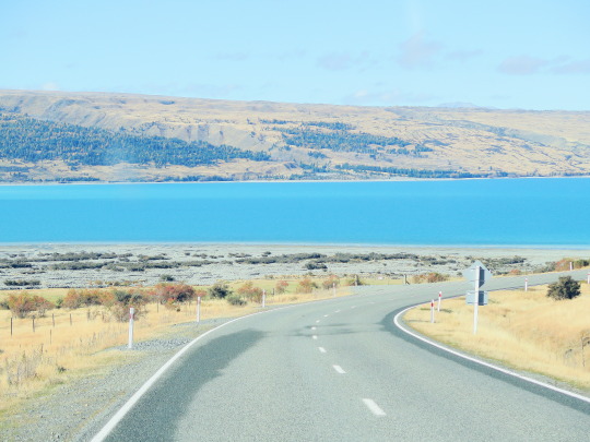
NZ South Island Trip - the substance (part 3)
Day 10: Mount Cook - Wanaka (Via Pukaki and Lindis Pass)
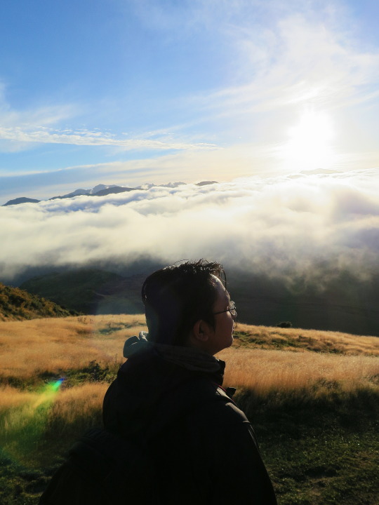
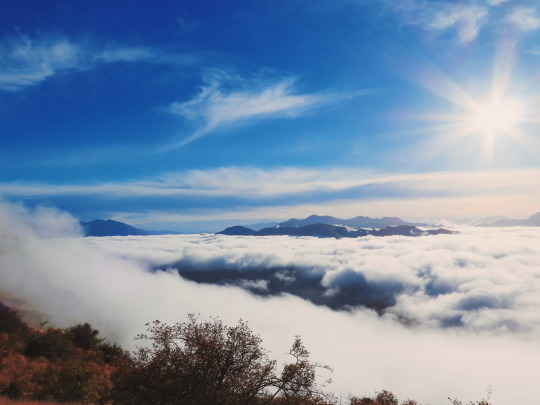
We planned to tramp in Hooker Valley Track, the most famous and easy tramping in Mount Cook after breakfast. However, from the nightfall we parked in White Horse Hill, Mount Cook was showered with the rain. The rain stopped almost midday and we also almost cancelled our tramping plan. However, as Hooker Valley Track has several lookout points, we decided to only take 30 minute tramping until reached Mueller Lookout and the suspension bridge. for those of you who plan to visit Mount Cook, if it’s clear day, then tramping until reach Hooker Lake is non-negotiable. another tips, if you plan to take tramping in NZ, don’t forget to take some sweets, energizing foods such as banana or subs, and lot of water should the area you’ll reach has no water source.

Alpine Memorial


please ignore the damaged dry skin.
Mount Cook is my another favorite place in South Island, It was very disappointing that we could not reach the Hooker Lake and the famous Red Hut :( make sure you check the hourly weather forecast as NZ’s weather may change drastically in one day.
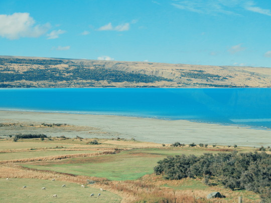
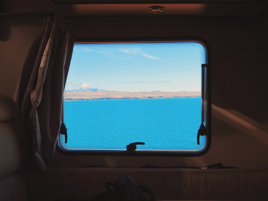
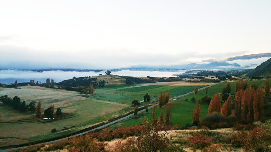
On the way to go to Wanaka, we planned to stop in Peter’s Lookout and we decided went down until reached the shore of Lake Pukaki. Lake Pukaki is another clear water lake in McKenzie District (yes, this must be my favorite district in NZ!) and the most turquoise one.
even though we had a lunch in Mount Cook, we believe that there’s nothing wrong to pulled over the Van to the Mount Cook Alpine Salmon. The salmons from Mount Cook Alpine Salmon were farmed in Southern Alps waterways, so it’s so much fresh! actually, I don’t like sashimi, uncooked foods make me sick, yet this salmon is an exception. the price for 500 gr salmon is about 35 NZD, another good deal for NZ’s meal.

you can taste the salmon with the view of Lake Pukaki.
We touched the campground in Wanaka after dark. It was really hard to find this campground in the night as the site is actually nestled in the fenced landscape, so it felt like resident’s property. if you are interested in this site, do not hesitate to enter into the fence after you passed the bridge over the Clutha River, then go straight until you find announcement board. From there, you take the right and follow the path until you find the big landscape by the river.
Campground: Albertown Campsite (6 NZD pp)
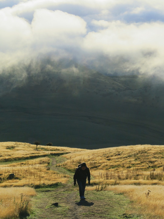
Day 11: Wanaka - Haast (Via Hawea and Mount Aspiring National Park)
It was unfortunate that we did not enjoy the campsite as we took off from the site before the sunrise to go to Wanaka’s most popular hiking track, Mount Roy. Yes, that was another day for hiking. Mount Roy or renowned as Roy’s Peak is zigzags steeply track with the height of 1578 masl. DOC categorizes this track as an easy one -_- However, as we have not practiced to hike before, this 6 hours return track changes to be 7,5 hours return for us hahahha. So, please spare one day and start at dawn for you to be able to hike this track and enjoy the peak for long enough. Roy’s Peak also provide the ample parking space so I believe it may contains hundreds of vehicles.

We started the hiking when the fog was still shroud the town and it was lovely. During the hike, we met other hikers returned and we were tempted to always ask “how much further from here to the top?” the answers in the beginning were much sap our willingness to proceed. However the other hikers convinced us that the view on the peak is priceless. After countless stop, consumed half of water supply and lost the breath, we reached the top around midday. so basically we spent 4.5 hours from the parking space to the Roy’s peak. HAHA what a lame duration.

we took 2.5 hours to return from the peak and it was painful as my toes were injured :( after the hike, almost my toes getting darker and it needs more than 3 months to recover. Hence, the reliable hiking boots is important here :)
when we went down, the fog dissipated gradually and finally we could enjoy the Wanaka from above.

tips: there is no water source during the track, so ensure to bring lot of water for this hike!
as we had an appointment in automotive workshop in Wanaka to replace the left mirror (yes, our left mirror was broken after Luthfan had an accident in Queenstown :p), we straightly went to the workshop without took a break. after admitted that we extremely tired after the hike, we decided to only camp in the region between Mt. Aspiring National Park and Haast. we found the empty space in the riverside with no mobile signal at all.
Campground: somewhere between Mt. Aspiring National Park and Haast (free).
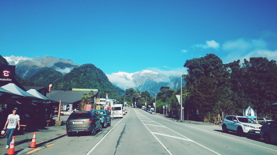
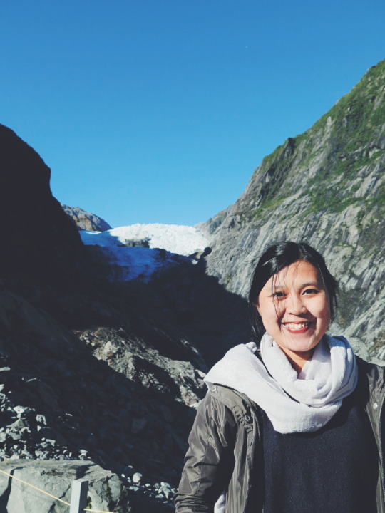
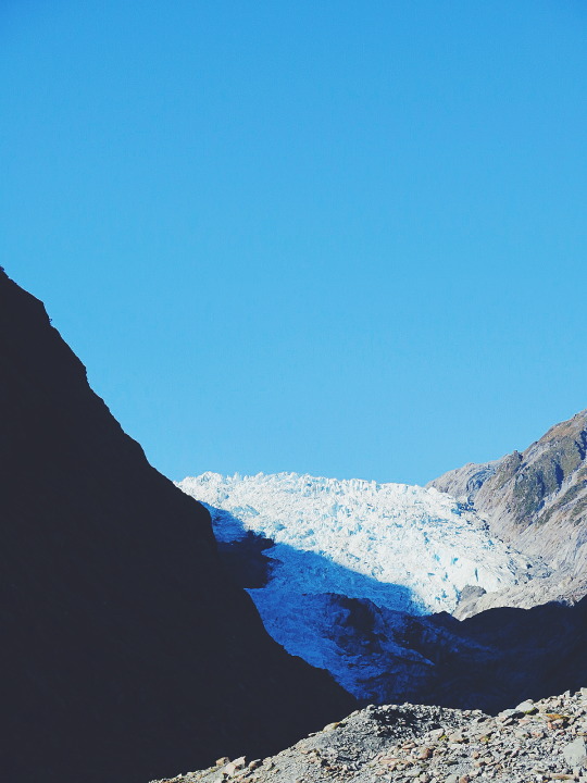
Day 12: Haast - Franz Joseph Glacier
It was rainy day on Haast until Glacier Country. Actually, we were not surprised as local forecast weather was quite precise. Consequently, we only spent the day with driving, eat, and laundry. In the next day, we planned to biking and tramping from our campsite to Terminal Face of Franz Joseph Glacier.
Why we chose Franz Joseph instead of Fox Glacier? After long research, we found out that face walk or tramping in Franz Joseph Glacier is free and reachable (even thought that we cannot as close as you’ve imagined to the ice). while in Fox, they said that you have to pay even for terminal walk. however, if you plan to take heli hike, some travelers said that ice landing in Fox is more beautiful than in Franz Joseph.
In this town, we took a lunch in Snake Bite Brewery and Alice May for dinner. Both of them served delicious dishes. and surprisingly the chef in Snake Bite is Indonesian and Sundanese! we even had a chitchat as to how he can be stranded in the small silent city, such as Franz Joseph. In some cases, it’s exhilarating when you found unforeseen things happened to you during your journey.
There is no free campground in Franz Joseph, hence we decided to camp in Rainforest Holiday Park. Similar with other Holiday Park, this place offers complete facilities such as powered site, wifi (what do you expect from NZ’s wifi -_-), laundry, dumpsite and freshwater facility, public kitchen, hot shower and even hot tub!
Campground: Rainforest Holiday park (39 NZD for van powered site)
Day 13: Franz Joseph - Greymouth
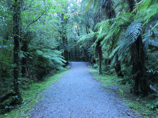
we left the campground around 07h30 after we completed cleaning rituals (change the grey water, refill the freshwater, and clean out the toilette cassette) earlier. biking in Franz Joseph is another thing you must try. you’ll pass the empty road, glacier water river, and thick rain forest for sure. we spent about 1 hour from our campsite to the Franz Joseph bike shelter.
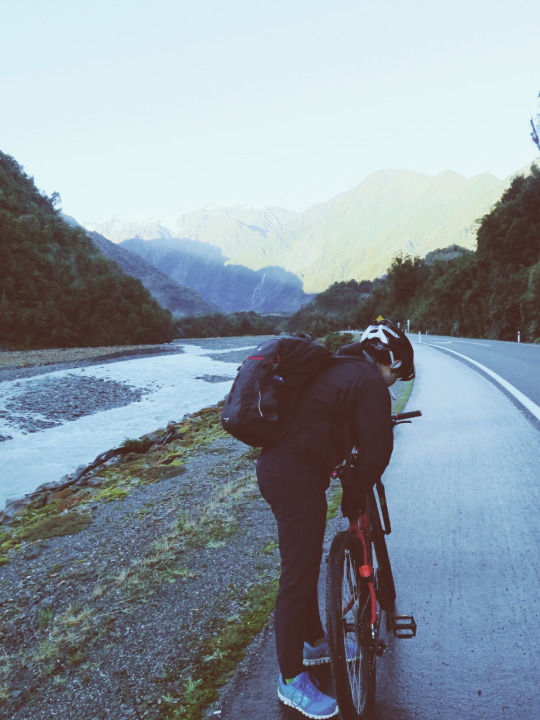
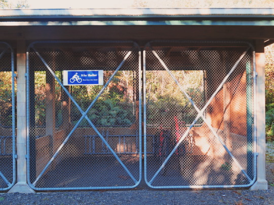
yes, even though in wilderness, you will still find decent safety facility here.
Terminal walk in Franz Joseph will take around 2.5 hours return from the car park. such duration includes having light meal and several stops along the track. You also will find the river which was originated from the glacier, so don’t panic if you run out of water.
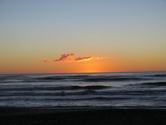
Around midday we continued the trip to camp in somewhere in West Coast. finally we chose a campground by the ocean in Greymouth to end the day. It was obviously everything you could have dreamed of for a seashore camping spot, direct access to the sea, perfect sunset, and starry night sky. you can make a bonfire if you want to. and the most important thing, Greymouth has KFC! :D


Campground: Ocean Beach (Free)
Day 14: Greymouth - Lyttleton (via Hanmer Springs)
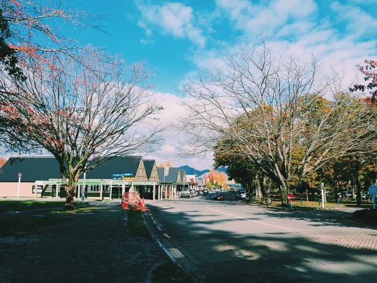
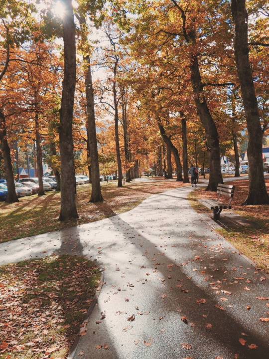
Before we went back to Christchurch, we planned to pay a visit to the Hanmer Springs, Hanmer Springs Thermal Pool in particular. yes, we’re kinda addicted to hot springs in NZ. The trip from Greymouth to Hanmer Springs would take around 3 hours. Hence, early departure is recommended, so you can soak up in thermal pools before the midday.
Hanmer Springs is another sentimental town in South Island. this place serves the perfect autumn color, nice weather, and beautiful parks to be enjoyed. this place is popular for short getaway from the nearest busy town such as Christchurch (definition of “busy” in NZ should be redefined in your mind).

on the way to Lyttleton, we stopped in Balmoral Recreation Reserve to take a lunch and power nap :p
We parked our van in the Lyttleton Boat Ramp, another dubious free campground near Christchurch :p our hesitation regarding this place was slowly faded away when other campers one by one came to this campground.
Campground: Lyttleton Boat Ramp (Free)
Day 15: Lyttleton - Christchurch
Please ensure to spare one free day to clean and refill all essences in the campervan prior to return it to the base. Wilderness requires the campers to return the van no later than 02h00 per day with the condition that the van has been refueled, the fresh/grey water has been refilled, and any waste has been disposed. Another thing should be noted is NZ is one of country which lack of garbage can (yet, the surrounding still clean I don’t know how). Please dispose any waste once you find a garbage can in the corners of the street.
We came back to Wilderness base around 01h00 and fortunately they offered a shuttle to drop us to the nearest airport hotel. As our flight tomorrow is in 06h00 morning, we chose Sudima Airport Hotel for our last night in NZ. Sudima Hotel was another good choice for us, spacious and super neat room and prefect location. This hotel is located precisely across the Christchurch International Airport and surrounded by International Antartica Centre and Countdown Supermarket (so you can easily buy tons of chocolate for souvenir or for your personal stock :p). We ended the day with chocolate shopping, cleaned out our boots, hours of packing, and accepted the fact that we have to leave this country tomorrow.
0 notes
Photo
Hi Michael,
I have recently stumbled onto your site and have been enjoying it very much. My husband and I are planning a trip to Yellowstone in a few weeks. We’d like to take in a few short hikes. We are both in our late 60s and in decent shape. We spent a few days in Arches this spring and took a few five-mile hikes through the park and enjoyed it thoroughly. What hike could you recommend for us? We are thinking about limiting our hikes to fives miles because of the change in elevation/terrain and weather conditions we may encounter there.
Thank you.
Jeanne
Strafford, N.H.
Hi Jeanne,
Thanks for writing and finding The Big Outside. You are heading to a fantastic park for short walks and hikes any time of year, although I think autumn is ideal because of good weather and fewer people; some of the photos in this story were shot on an October trip I took.
You should read my “Ultimate Family Tour of Yellowstone” for ideas on the best spots to visit and take very short walks while driving through the park, including the Midway Geyser Basin and America’s largest hot spring, Grand Prismatic.
Grand Prismatic Spring, Midway Geyser Basin, Yellowstone.
As for hikes of five miles and under, here are the ones I’d suggest, listed in no particular order.
Bunsen Peak
The summit of 8,564-foot Bunsen Peak, about five miles south of Mammoth Hot Springs, overlooks a huge swath of the park, from the Gallatin Range to the west, across the high plateau that comprises much of Yellowstone, to the Beartooth and Absaroka Mountains. The round-trip hike on the Bunsen Peak Trail is four miles.
Lamar River Valley
The Lamar River Valley in the park’s northeast corner is a great area for seeing wildlife like bison and elk and occasionally wolves. Hike out and back as far as you want on the Lamar River Trail, which is pretty flat and passes through open terrain with big views.
Hi, I’m Michael Lanza, creator of The Big Outside, which has made several top outdoors blog lists. Click here to sign up for my FREE email newsletter, or enter your email address in the box in the left sidebar or at the bottom of this story. Click here to get full access to all of my blog’s stories. Follow my adventures on Facebook, Twitter, Instagram, and Youtube.
View from near the summit of 10,243-foot Mount Washburn.
Mount Washburn
Mount Washburn is 6.2 miles out-and-back from Dunraven Pass on the Grand Loop Road; there’s a shorter, five-mile out-and-back to the summit from a trailhead on a dirt road just north of Washburn, that ascends more than 1,700 feet. The views from 10,243-foot Washburn take in the Tetons, Beartooth and Absaroka Mountains, and the Madison Range. The Indian paintbrush, lupine, and other wildflowers bloom in late July and early August. Hike it in early morning or evening for a good chance of seeing bighorn sheep.
View of Grand Canyon of the Yellowstone River from Lookout Point, North Rim Trail.
North Rim Trail, Grand Canyon of the Yellowstone
The North Rim Trail along the rim of the Grand Canyon of the Yellowstone River (lead photo at top of story) is arguably the park’s most scenic walk, with constant views into the deep canyon, including Lower Yellowstone Falls. (In fact, I put it on my list of the best national park dayhikes in the country.) Various points of road access allow you to choose a hiking distance, but the entire trail is fairly flat and under four miles. You can also walk across a bridge past Upper Yellowstone Falls to reach the south rim and make it a longer hike by following the South Rim Trail for the views from the other side.
Gear up right for hikes in Yellowstone. See my reviews of the best hiking shoes and the 7 best daypacks.
Uncle Tom’s Trail, Grand Canyon of the Yellowstone
The Uncle Tom’s Trail on the south rim of the Grand Canyon of the Yellowstone River is short—it only descends about 500 feet—but the metal stairs you follow down it lead to a spectacular viewpoint near the base of Lower Yellowstone Falls.
Fairy Falls
The Fairy Falls Trail, in the Midway Geyser Basin, leads to one of the park’s nicest waterfalls, 197-foot Fairy Falls, passing views of the park’s biggest and most colorful geyser, Grand Prismatic Geyser. There are a couple ways to get there, both fairly flat. The shorter route, five miles round-trip, begins a mile south of Midway Geyser Basin, where you cross a steel bridge. The longer route of eight miles round-trip begins at the parking area at the end of Fountain Flat Drive. From the falls, you can continue 0.6 mile one-way to Spray and Imperial geysers, and then double back.
Stay dry and happy. See my reviews of “The 5 Best Rain Jackets For the Backcountry.”
Old Faithful, Upper Geyser Basin.
Upper Geyser Basin
The Upper Geyser Basin is home to the world’s largest concentration of geysers, hundreds of them, including Old Faithful. You can walk the almost flat trail and boardwalk for several miles from Geyser Hill to Biscuit Basin and Black Sand Basin, or take a shorter tour. Get a map and guide to the Upper Geyser Basin and take time to explore it. You don’t want to miss this area.
The Big Outside helps you find the best adventures. Subscribe now to read ALL stories and get a free e-guide!
Mammoth Hot Springs, Yellowstone.
Mammoth Hot Springs
Mammoth Hot Springs, multi-hued travertine terraces formed by thermal waters rising through limestone, is unquestionably one of the most inspiring areas of the park. Water constantly pools and trickles down the terraces and steam billows from them. Boardwalks weave through the lower terraces and a one-way loop road through the upper terraces. Plan to explore this area for an hour or more of leisurely walking for the dramatic light of early morning.
Lone Star Geyser
The Lone Star Geyser Trail, which begins near Kepler Cascades, just south of Old Faithful, is an almost five-mile round-trip hike to Lone Star Geyser, which is several feet tall and erupts about every three hours. Go early in the morning to avoid the crowds and give yourself time to sit and wait for the geyser to blow.
Read about how climate change is affecting Yellowstone and other parks in my book
Before They’re Gone—A Family’s Year-Long Quest to Explore America’s Most Endangered National Parks.
Along the Blacktail Deer Creek Trail, Yellowstone National Park.
Blacktail Deer Creek Trail
The Blacktail Deer Creek Trail, which begins about 6.7 miles east of Mammoth on the Grand Loop Road, winds north across gently rolling grasslands and meadows with long views of partly forested hills and a good chance of seeing a bison herd. The trail drops more than 1,000 feet in 3.7 miles to the Black Canyon of the Yellowstone River, where, for a longer outing, you can hike either upriver or downriver along a trail through conifer forest, with views of the cliffs rising above the meandering river. But the first few miles of the Blacktail Deer Creek Trail are fairly easy, before it begins descending more steeply into the canyon, and you can turn back at any point.
See all of my stories about Yellowstone National Park, including “Photo Gallery: Yellowstone in Autumn,” and all of my stories about national park adventures at The Big Outside.
Good luck, thanks for writing.
Best,
Michael
I can help you plan the best backpacking, hiking, or family adventure of your life.
Got questions about hiking, backpacking, planning a family adventure, or any trip I’ve written about at The Big Outside? Email me at [email protected]. I’ll answer your questions to help ensure your trip is a success. See my Ask Me page for details.
—Michael Lanza
Tell me what you think.
I spent a lot of time writing this story, so if you enjoyed it, please consider giving it a share using one of the buttons below, and leave a comment or question at the bottom of this story. I’d really appreciate it.
0 notes
Photo

Hi Michael-
My husband and I live in Missoula with our two boys, ages three and five. We are spending three nights in Yellowstone, and it will be our kids’ first visit. Are there any sites or activities that were unexpectedly or just especially fun?
Thanks for your help and for the inspiration to get outside with the kids even when the thought of packing the car is feeling daunting.
Take care,
Laurie
Missoula
A hiker watching sunrise at Mammoth Hot Springs, Yellowstone National Park.
Hi Laurie,
Thanks for getting in touch. I’d be happy to offer some suggestions for what to see with your kids in Yellowstone. I’m glad you asked, actually, because you’ve given me an excuse to post a suggested family tour of Yellowstone in summer (or from spring through fall), which I’ve been wanting to do. I may have more suggestions below than you’ll fit into a long weekend, but I hope this is helpful and gives you ideas for a return visit.
By the way, our kids’ first trip to Yellowstone was at ages four and two and they loved it. Yours are at a great age to enjoy the park because the landscape there is so active and right in front of you, and so many features require only a short walk to see them. I’ll order my suggestions in a way that makes sense if you’re traveling through the park.
Entering Yellowstone through the North Entrance (via Livingston), you’ll hit Mammoth first. The walk around Mammoth Hot Springs is easy, gorgeous, and pretty cool for kids. Mine were fascinated by all the leaves, sticks, and other vegetative matter that had fallen into the springs and become crystallized. And there are usually elk grazing right in Mammoth village and along the road up to the springs.
Hi, I’m Michael Lanza, creator of The Big Outside, which has made several top outdoors blog lists. Click here to sign up for my FREE email newsletter. Subscribe now to get full access to all of my blog’s stories. Click here to learn how I can help you plan your next trip. Please follow my adventures on Facebook, Twitter, Instagram, and Youtube.
The northern road to the Lamar Valley is a great area for seeing wildlife: bison, elk, coyotes, maybe even bears and wolves if you’re lucky. (Winter is actually a better time to see wildlife; when your kids are a little older, you should take them cross-country skiing in Yellowstone, which I think is one of the greatest national park experiences.)
Heading south, stop at Tower Fall and take the short walk to this impressive, 132-foot-tall waterfall plunging below basalt pinnacles, with views of the canyon of the Yellowstone River. The drive over Mount Washburn and Dunraven Pass gets you to the highest spot on a road in the park, with quite spectacular views along the way. The 6.2-mile, round-trip hike up Mount Washburn from Dunraven Pass follows a wide path to the summit, which offers a 360-degree panorama of the entire park.
I can help you plan the best backpacking, hiking, or family adventure of your life. Find out more here.
The brink of Lower Yellowstone Falls, Grand Canyon of the Yellowstone River.
The Grand Canyon of the Yellowstone River is one of the scenic highlights of the park. I like cross-country skiing it in winter, but spring-summer-fall are cool, too, although busy with tourists there. If your family is up for it, hike the fairly flat, 6.4-mile, out-and-back of the North Rim Trail from Inspiration Point (near Canyon) to Upper Yellowstone Falls; you’ll pass several viewpoints of the canyon. (The trail also partly parallels the North Rim Drive, so you can take shorter walks to viewpoints along the trail from parking areas along the road.) One of the highlights is the steep but short (three-quarters-of-a-mile round-trip) spur trail to the very brink of 308-foot-tall Lower Yellowstone Falls (above photo).
Otherwise, take the very short walk to Artist Point for its killer view of the canyon, and the short walk to Upper Yellowstone Falls.
Check out my “10 Tips For Getting Your Teenager Outdoors With You”
and “My Top 10 Family Outdoor Adventures.”
When my kids were little, we walked down Uncle Tom’s Trail, which drops a very steep 500 feet down metal stairs bolted into the cliff to an overlook by Lower Yellowstone Falls—really cool spot, but it’s a strenuous climb back out for little kids. My four-year-old made it and, of course, I carried my two-year-old.
Continuing south, plan to pull over in the Hayden Valley and have binoculars, it’s another of the park’s great spots for seeing wildlife. Also, stop and take the walk around the Mud Volcano area, which isn’t as well-known but has wonderful, stinky, belching mud pots.
Abyss Pool, West Thumb Geyser Basin, Yellowstone.
On our last visit with our kids, I visited the West Thumb Geyser Basin for the first time and was blown away by the colors in the thermal features there. Highly recommend it. There are a couple of good restaurants in Grant Village, too.
If you had one to three days to spare (perhaps on a later visit), and bring or rent a canoe, paddle across Lewis Lake, pull the canoe up through the slack water connecting Lewis to Shoshone Lake, and then canoe around and camp on Shoshone Lake; it’s a classic, fairly easy backcountry trip in the park (although the wind can pick up and raise whitecaps on Shoshone Lake). The Shoshone Geyser Basin is widely considered the best backcountry geyser basin in Yellowstone.
Another classic hike is the overnight out to Heart Lake and the side hike up Mount Sheridan. Lots of wildlife, including grizzly bears, in that area (it’s typically closed in spring because of bear activity), and there’s a nice geyser basin at Heart Lake.
Plan your next great backpacking trip in Yosemite, Grand Teton, or other parks using my expert e-guides.
Old Faithful
Even though it’s easy for adults to be turned off by the massive crowd, take the kids to watch Old Faithful erupt. We were with other families with young kids for that, all age two to four, and they busted out laughing so hard that all the parents started laughing. Then hike around the Upper Geyser Basin to see the various geysers, Morning Glory Pool, etc. You may see bison and other wildlife there, too.
The kaleidoscopic Grand Prismatic Spring, in Midway Geyser Basin, is one of my favorite spots in the park. The Lower Geyser Basin has some belching mud pots, like Fountain Paint Pot, whistling fumaroles, and geysers, too, one of which erupted when my kids were there. In spring, you might see grizzly bears along the stretch of road between Midway and Lower Geyser Basins. The bears are known to feed on winter-killed elk in there in spring.
The road to West Yellowstone, following the Madison River, is very scenic and a good area to see bald eagles (there’s consistently a nest in a snag along the road there every spring); watch for trumpeter swans in the river.
Lastly, Norris Geyser Basin is worth taking some time to explore, as this online tour of Norris shows.
if you want to find books for young kids, the visitor center in Mammoth Hot Springs has a good bookstore, and I’m sure other visitor centers in the park do, too.
You should read my Ask Me post describing “The 10 Best Short Hikes in Yellowstone.”
You might also be inspired by my book, Before They’re Gone—A Family’s Year-Long Quest to Explore America’s Most Endangered National Parks, about taking our kids (at age nine and seven) on a series of national park wilderness adventures, including cross-country skiing in Yellowstone.
I hope that’s helpful. Let me know if you have other questions, and I’d love to hear how your trip goes. Get in touch anytime.
Thanks for following The Big Outside.
Best,
Michael
Hi Michael,
Holy cow. That’s a helluva response. My sincere thanks. We are really looking forward to getting out of Dodge and having family time in a beautiful spot. Thanks again for your help.
Take care,
Laurie
I can help you plan the best backpacking, hiking, or family adventure of your life.
Got questions about hiking, backpacking, planning a family adventure, or any trip I’ve written about at The Big Outside? Email me at [email protected]. I’ll answer your questions to help ensure your trip is a success. See my Ask Me page for details.
—Michael Lanza
Tell me what you think.
I spent a lot of time writing this story, so if you enjoyed it, please consider giving it a share using one of the buttons below, and leave a comment or question at the bottom of this story. I’d really appreciate it.
0 notes
Last Seen Blogs

dokidobe
yellow.dr.monv

assten
B

apointjm
Architectural Point

adhucstantess
Soy una Papa
caimand
Sin título