#Geographic information system
Text
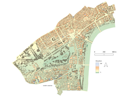
a digital surface model from first return LiDAR points with hillshade. displaying st james - the largest ward of the city of westminster. located in london, england.
#geomatics#gis#geographic information system#geography#geomorphometry#digital surface model#cartography#lidar#topography
3 notes
·
View notes
Text
#GIS Mapping Survey in India#GIS Mapping Survey#GIS Mapping Company in India#Geographic Information System#Drone Survey#aerial photography survey#aerial survey
0 notes
Text
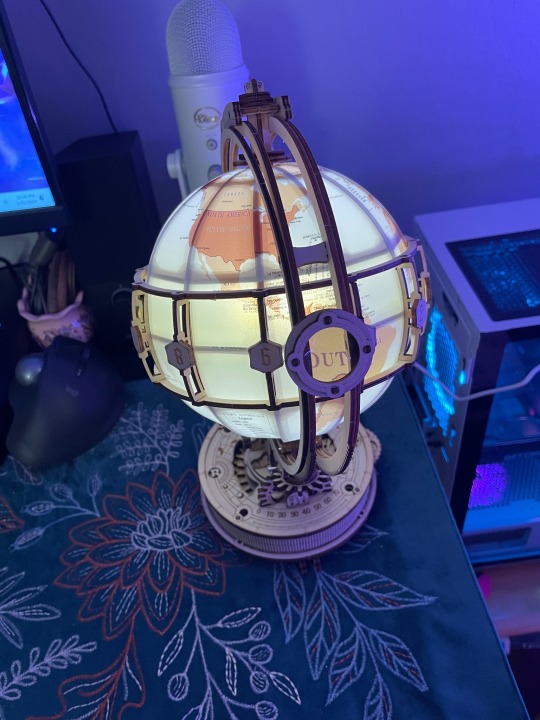
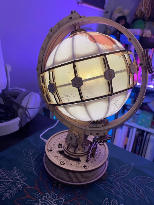
Finally got my globe model done 🥳
0 notes
Text
Integration of BIM & GIS: A Comprehensive Overview
Integration of Building Information Modeling (BIM) and Geographic Information System (GIS) offers a comprehensive approach to enhance collaboration and data integration in architectural and geospatial projects. By combining the detailed 3D modeling capabilities of BIM with the spatial data analysis of GIS, professionals can achieve a more holistic understanding

0 notes
Text
Banana Bunchy Top Disease: First Report in Cagayan Valley, Philippines

Abstract
The study on the occurrence and symptomatology of banana bunchy top disease (BBTD) was conducted to determine the occurrence and study the symptoms and associated signs that characterized BBTD in the banana farms in the province of Cagayan, Philippines. A survey and mapping were used to the major banana growing municipalities namely: Allacapan, Lasam, Gattaran and Baggao, in the province of Cagayan, North-eastern part of the Philippines. The data were analyzed using the frequency counts, weighted means, and percentages. The geo-referenced locations of the banana farms were analyzed using the QGIS software. BBTD – infected plants were described, occurrence was mapped and associated insect vector was investigated Results revealed that the most observable symptoms in the field involved stunting, ragged margins, upturned leaves, chlorotic reducing lamina width, petiole length and distance of the leaves. The whole growing banana plants may grow but obviously resulting to stunting. Banana crops that are infected with BBTV in the vegetative phase will not produce fruit. Black aphids (Pentalonia nigronervosa) are found always associated with the banana plants and thus transmit the virus. Ocurrence of BBTD was determined in September 2020 to September 2021 at Allacapan, Lasam, Gattaran and Baggao, Cagayan barangays/locations while typical symptoms of BBTD were first observed in all of the banana growing locations in the province of Cagayan, Philippines. Symptomatology and association of aphids confirmed the presence of BBTD. This is thought to be the first report of BBTD on banana (Musa spp.) in the province of Cagayan, Philippines.

Introduction
In the Philippines, banana is one of the most important fruit crops (Damasco et al., 2019). In Cagayan Valley, banana is the prime commodity under fruit crops. Like, any important crop, banana is attacked by pests and diseases. To date, the most devastating virus disease affecting yield losses of banana plantations in Africa, the South Pacific, and Asia, like the Philippines, is the banana bunchy top disease (BBTD) caused by the Banana bunchy top virus (BBTV). However, the incidence and distribution of BBTD have never been reported in Cagayan Valley Region, Philippines. From 2010 to 2012, the Philippine production of banana with more than 9.2 million metric tons, followed by a sharp decline in 2013 as a direct result of the damage wrought by typhoon Pablo. In terms of area planted, from a high of about 454,000 hectares in 2012, this declined to about 446,000 hectares is 2013 and further down to 443,000 hectares in 2014 and 2015 (PSA, 2014-2017). The most significant commercial production are located in Davao Region in Mindanao and Cagayan Valley in Luzon.
In Cagayan Valley, banana is the prime commodity under fruit crops. During the first quarter of 2019, the production was pulled down by 45.48%, with a shortage of 15,680 metric tons from 2018 of 34,481 metric tons due to super typhoons Ompong and Rosita in second semester of 2018 (PSA, 2019). Aside from the typhoon, other factors, such as changing weather patterns, pests, and diseases, affect the production of bananas. One of the significant constraint diseases is the banana bunchy top disease.
Banana bunchy top disease (BBTD) caused by the banana bunchy top virus (Babuvirus, Nanoviridae) is one of the most economically important diseases of bananas in many production regions of the world, including the Philippines (Dale, 1987). Banana plants can only be infected from (1) infected plant materials and (2) the banana aphid when carrying the virus. When people give away young banana plants or suckers to others, the BBTV can spread (Johansen, K et al., 2014).
The virus is transmitted in a persistent and circulative but non-propagative manner by the banana aphid, Pentalonia nigronervosa (Hafner et al., 1995, Hu et al., 1996). The aphid is a tiny black insect that, once feeding on an infected banana plant, becomes a carrier of the BBTV. The wind can carry many kilometers of aphids, which may further spread the BBTV. Hook et al., showed that the incubation period of BBTV or the appearance of symptoms in banana plants ranged from 25 to 85 days after aphid inoculation (Johansen, K et al., 2014). Initial symptoms in infected plants include marginal chlorosis, dark green dots, and streaks along the veins that often extend down the midrib and petiole. Infected plants become progressively stunted with malformed and more upright leaves, eventually resulting in a ‘bunchy’ appearance. Plants infected early with BBTV do not bear fruit, and fruits of later infected plants are typically deformed and unmarketable.
Hence, yield losses in severely infected plants can be as high as 100%. The virus is systemic, meaning that the disease is transmitted from the infected mother plant to subsequent suckers, and eventually, the whole mat dies (Hong-Ji, 2000b). Additionally, the virus spreads to suckers through the rhizome, and the entire banana mat eventually becomes infected (Dale and Harding 1998). It has been reported that the rate of BBTV re-infection in the field ranges from 5% in well-managed farms to 20% and 75% in medium- and traditionally-managed farms, respectively (Magnaye and Espino, 1990).
This study deals with the occurrence of the banana bunchy top in the major banana-producing areas in Cagayan province using GIS. Through GIS, it can capture, store, check, and display data related to positions on Earth’s surface. GIS can show many different kinds of data in one map, enabling people to see, analyze, and understand patterns and relationships (Gonzales A.T. et al., 2018). Since this research determined the distribution of BBTD in Cagayan province, the use of GIS is deemed needed.
Generally, this study determined the occurrence and distribution of banana bunchy top disease (BBTD) in banana plantations in Cagayan province, specifically in the municipalites of Allacapan, Lasam, Gattaran and Baggao using Geographic Information System (GIS). Specifically it aimed to determine the distribution and prevalence of BBTD and examine, describe, and document the BBTD symptoms from BBTD banana plantations in the Cagayan province.
Source : First report of Banana bunchy top disease (BBTD) on Banana (Saba variety) in Cagayan Valley Region, Philippines
#Geographic information system#GIS#Stunting#Occurrence#Banana bunchy top virus#Babuvirus#Musa spp.#Banana aphid#Pentalonia nigronervosa#Meristems
0 notes
Text
youtube
Ternyata Gampang ! Olah data DEM menjadi elevasi, kelerengan, dan kontur
Apa itu DEM ? mungkin teman-teman yang sudah pernah berkecimpung di dunia spasial tidak asing dengan istilah ini.
Jadi, menurut (Doyle, 1991 dan Purwanto, 2015 dalam Duantari Novita, 2017) DEM (Digital Elevation Model) adalah data digital yang menggambarkan geometri dari bentuk permukaan bumi atau bagiannya yang terdiri dari himpunan titik-titik koordinat hasil sampling dari permukaan dengan algoritma yang mendefinisikan permukaan tersebut menggunakan himpunan koordinat.
Digital Elevation Model (DEM) khususnya digunakan untuk menggambaran model relief rupa bumi tiga dimensi (3D) yang menyerupai keadaan sebenarnya di dunia nyata (real world) divisualisasikan dengan bantuan teknologi komputer grafis dan teknologi virtual reality (Mogal, 1993 dan Purwanto,2015 dalam Duantari Novita, 2017).
Dari mana kita bisa memperoleh Data DEM?
Data DEM seluruh kawasan Indonesia bisa diperoleh melalui
Data DEM Global dapat diperoleh melalui
Untuk membuat Kontur, Ketinggian, Elevasi maupun data lain diperlukan software GIS yaitu ArcGis. Data DEM yang diunduh berupa gambar dengan format .tif
Data tersebut diinput lalu diolah menggunakan "spacial tools" lalu disesuaikan dengan kebutuhan.
Langkah selanjutnya bisa dilakukan reclassify untuk mengklasifikasikan kelerengan, atau ketinggian tertentu. Dilanjutkan dengan convert raster ke polygonn dilanjutkan dissolve pada menu georeferencing. Kemudian edit atribute table untuk penyesuaian data. (sepertinya begitu kalau saya tidak salah ingat)
Lengkapnya lihat video yang saya peroleh dari yotuube di atas

#GIS#SIG#geographic information system#Indonesia#SHP#DEM#Peta#Kontur#Elevasi#Ketinggian#Spasial#Youtube
0 notes
Text
#gsourcetechnologies#engineeringservices#architectureservices#GISmapping#geographic information system#cadastralmapping#utility mapping#map digitization
1 note
·
View note
Text
The Role of GIS and Remote Sensing in Disaster Response and Management
Introduction
Geographic Information System (GIS) and Remote Sensing (RS) technologies are playing an increasingly important role in disaster response and management. Disasters such as floods, wildfires, earthquakes, and hurricanes are becoming more frequent and severe, and these technologies can provide valuable information to emergency responders and decision-makers in such situations.
GIS…

View On WordPress
#Assess Damage and Plan Recovery#Geographic Information System#Geography#GIS#Identify and Map Vulnerable Areas#Plan Evacuation Routes#Remote Sensing and Digital Image Processing (DIP)#The Role of GIS and Remote Sensing in Disaster Response and Management#The Role of GIS and Remote Sensing in Disaster Response and Management Examples#The Role of GIS and Remote Sensing in Disaster Response and Management Solutions
0 notes
Text
Know the Many Power Distribution Design Services
Your search for the best power distribution design services ends here. Power has become an essential need like food and air as only it will help you or anyone to use all their electrical and electronic things. Even imagining being without power for a few hours is not possible in this digital world. Hence having the best technical field support for executing the best power distribution designs is critical for uninterrupted power supply. Only
If you want to design or field support for private or municipal power distribution in the US, check out the many power distribution design services offered by an experienced and professional company.
What are Power Distribution Design Services?
Power distribution is the last stage of delivering the electricity from the transmission system to the end users. Hence, the design to its execution should be perfect for uninterrupted power supply to a specific area. Distribution substations using transformers connect to the transmission system to lower medium voltage to the range of 2 to 35 kV. Hence the best Power Distribution Design Services enable building distribution substations inside or near a city, village, or industrial area.
The Types of Power Distribution Systems
Primary distribution is for large consumers like factories and small substations with voltages ranging from 3.3 to 11 kV. The secondary distribution is for direct power supply from substations to residential customers with voltages ranging from 120 to 230 and for big properties up to 400 through single to three phases. There are many classifications of power distribution systems depending upon primary or secondary distribution lines, that include.
AC and DC distribution systems as per the nature of the current
Overhead and underground distribution systems according to the construction types
Radial, Ring main, and inter-connected distribution systems depending upon the basis of connection schemes
What are the Many Power Distribution Services?
Since power has become an essential need for people worldwide, especially in the US, you need the best company to provide many power distribution services. There are many services, from designing the power substations to distributing them to the end consumer.
Take ownership of the power project from start to end
Offer excellent field verification of existing facilities
Design new facilities with CAD drawings for entry into the work management system of utility partners
Provide voltage, overhead and underground rebuilds, conversions, and substation feeder exits
Mi Tech offers all the above power design distribution services and excellent Technical Field Support from 1985 throughout the US efficiently and cost-effectively.
#Best Field Service Engineers#Communication Design Management and Sevices#Right of Way Services#Geographic Information System
0 notes
Text
#GIS Mapping Survey in India#GIS Mapping Survey#GIS Mapping Company in India#Geographic Information System#Drone Survey#aerial photography survey#aerial survey
0 notes
Text
Might have an even better diss idea! My supervisor is super involved with GIS so I might do something with that! Hell yeah
#history#geographic information system#dark academia#aesthetic#studyblr#light academia#medieval studies
0 notes
Text
Reading papers and stumbled upon a

#Geographic information systems (GIS) and entomological research: A review#from 2010#how many other people has it tripped up#i say things
776 notes
·
View notes
Text
#geographic information system#best GIS company in india#GIS company in India#GIS services#GIS service providers in india#GIS services in india#top GIS company in india#gis coordinate system for india#geographical information system in india#geographic information system services
0 notes
Text
Journal of Computer Science Research
Bilingual Publishing Co., founded in 1984, has been dedicated to cultural work of bilingual academic research, international journal publishing, conferences, and topical cooperation for more than 30 years.
ISSN: 2630-5151(Online)Email:[email protected]
Editor-in-Chief
Dr. Lixin TaoPace University, United States
Journal of Computer Science Research is an international open-access, peer-reviewed journal specializing in computer science. As technology progresses, computer science and technology has become an integral component of the everyday lives for most. As such, the journal aims to…

View On WordPress
#Cartography#Cultural Geography#Economic Geography#Geodetics#Geographic Information System#Geomorphology#Health Geography#Legal Geography#Risks and Disasters#Rural Geography#Spatial Analysis and Modeling#Urban Geography
0 notes
Last Seen Blogs

btsbrisus
Brisus

a2bmoversworld
A2B Movers San Francisco

deceptichubs
Iron Bellies

leighrussian-blog
Mostly mature

chiefhideoutmagazine
Untitled