nomitigada
se dejó mecer por el hueco / apretado aún suyo
.
naivement. lotofagos.
quantum satis.
no mitigada.
.
2605 posts
Don't wanna be here? Send us removal request.
Last Seen Blogs

bobfox504
bobfox


kenchoplanmanagement
Kencho Plan Management

sweetinmarcesible
Piscis ⚡️
fridaheroina
Frida Heroína
Text


Anatomical illustrations in Oranda zenku naigai bungouzu oyobi kengou (property of Kyoto University Library)
Lifting a flap on each page reveals muscular, cardiovascular, or skeletal anatomies.
347 notes
·
View notes
Text
Ever since I was a little child I always knew I wanted my content removed for violating Tumblr's Community Guidelines
22K notes
·
View notes


Photo

Turkic World Map
Mahmud Kashgari’s map of the Turkic world from the late 11th century. North is on the left. The thick orange lines are mountains. Green is water.
Found here.
466 notes
·
View notes
Photo
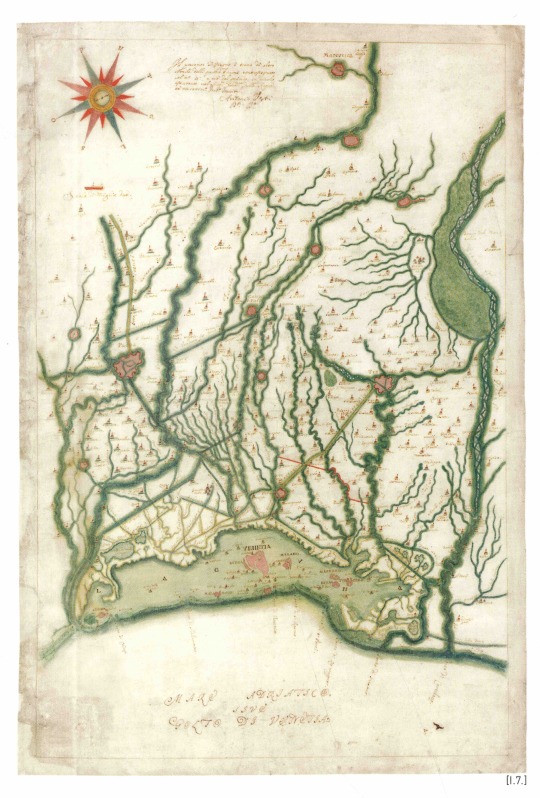
Antonio Vestri, Hydrographic System of the Venice Lagoon, 1709
171 notes
·
View notes
Photo

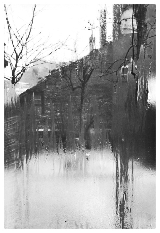
The Light Shines Everywhere * - Sieuwke Valk , 1951.
Dutch, 1922 - 2014
Illustration
* Christmas book ,Publisher Ploegsma Amsterdam, 1951
115 notes
·
View notes
Text
APPUNTI PER UN'ILIADE
Una piccola cartolina, frammenti di un sopralluogo per un progetto in corso all'isola dell'Asinara a febbraio 2022.
6 notes
·
View notes
Text

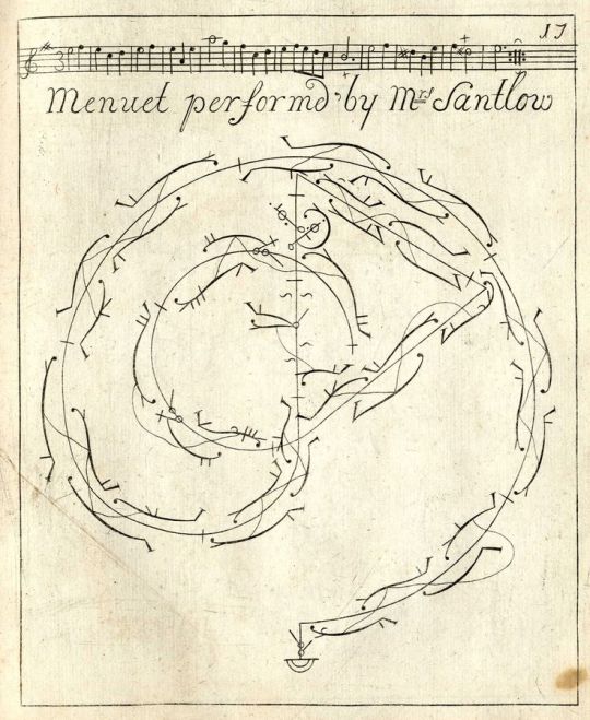
There are two major different types of Marshall Islands navigation charts: meddo and mattang. Meddo are like island maps, while Mattang are training tools that illustrated ocean movement, wind patterns and wave interactions around the islands. Mattang navigation stick chart is made from the flexible midribs of coconut fronds, with individual islands represented by the lashed junction of the fronds.
Stick charts are an incredible form of cartography that maps the prevailing ocean wave crests and directions. They enabled navigators to find their way across the vast distances between islands. Navigators and their apprentices memorised the charts before a voyage rather than consulting them during the journey. The use of stick charts ended after World War II, when electronic technologies were introduced to the Marshall Islands. Craftspeople make these charts today for display on the walls of homes both in the Marshalls and overseas. They stand as proud statements of their heritage as some of the world’s finest navigators.
It was collected by P.G. Black in 1906 and is one of the Australian Museum’s 200 Treasures, in the Westpac Long Gallery.
1 note
·
View note
Text

Carlos Coronas
Sin título, 1996
Museo de Bellas Artes de Asturias
2 notes
·
View notes
Text
142 notes
·
View notes
Text

Hélio Oiticica, Metaesquema No. 179, (gouache and ink on board), 1956 [MoMA, New York, NY. © Projeto Hélio Oiticica]
82 notes
·
View notes
Photo
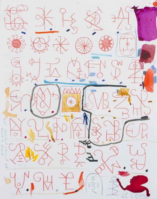
Elijah Burgher, Alphabet of Bachelors, colored pencil and ink on paper, 14x11″, 2015
182 notes
·
View notes