
mapas-y-planos
mapas y planos
basados en la realidad y la ficción
53 posts
Don't wanna be here? Send us removal request.
Last Seen Blogs

shinee-dorky
SHINING WORLD

indonesiansblog
TRAVELING, RIDING, ADVENTURE INDONESIA 🇲🇨

whatthehellbatch
All Fandoms Go

puuvillaa
a little bit weird but harmless

irraetional
Art blog! This blog right here! It's my art blog!
Photo
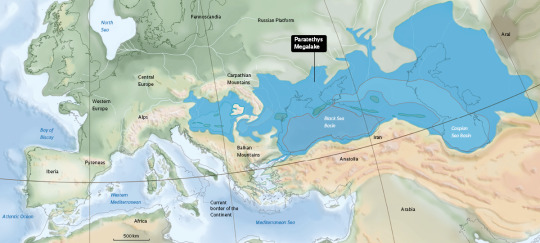
Paratethys was the largest lake in Earth’s history.
The world’s largest lake formed 12 million years ago and then disappeared, giving rise to the Caspian and Black Seas.
501 notes
·
View notes
Photo

Almost 80% of Spanish GDP is in urban areas, the highest percentage in the entire EU. And a third of the GDP is monopolized by Madrid and Barcelona. But Spain is not the only country with great city-country inequalities.
by @elordenmundial
106 notes
·
View notes
Photo
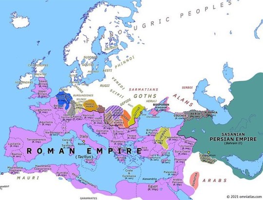
NEW MAP: Europe 276: Marcus Claudius Tacitus (early 276) https://buff.ly/3sFZ99Q In late 275 the Roman Senate ended the post-Aurelian interregnum by appointing the aged Marcus Claudius Tacitus as emperor. Tacitus soon faced serious challenges: that winter Germanic tribes invaded Gaul while the Heruli overran much of Asia Minor. He defeated the Heruli in 276, but died—probably assassinated—while returning west, after a reign of just six months. #thirdcentury #asiaminor #ancientrome #bithynia #cappadocia #carta #europe #europeanhistory #gothic #galatia #goths #historical #historicalmaps #histories #historybuff #historymajor #historymaker #historynerd #lowergermania #romanemperor #maps #militaryhistory #pontus #roman #romanempire #romanhistory #romans #spqr #uppergermania #newmap (at Ankara, Turkey)
https://www.instagram.com/p/CNJ-a7uAsvT/?igshid=5bw89dvop1hq
8 notes
·
View notes
Photo
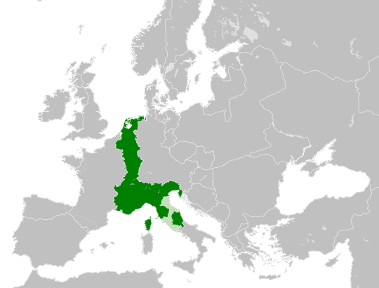
The bizarre shape of the kingdom of Francia Media, 843–855.
398 notes
·
View notes
Photo

US States Renamed for Countries with Similar GDPs
561 notes
·
View notes
Photo

Population of the Americas in 1950 and 2020by country
410 notes
·
View notes


Photo
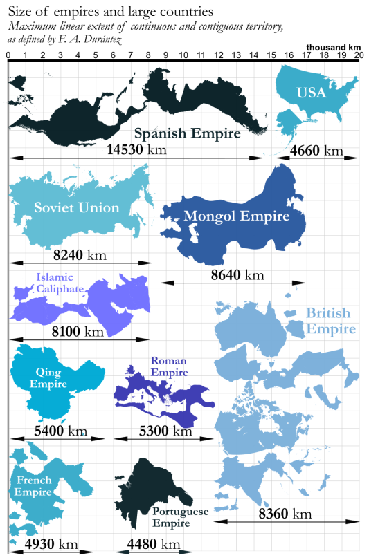
Imperios más tochos de la historia.
El español revienta todos.
137 notes
·
View notes
Photo
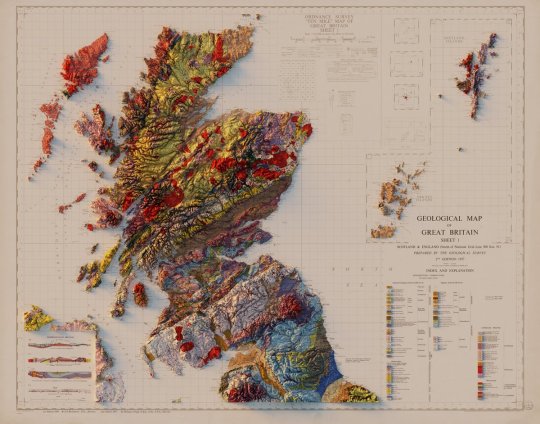
Geological Map of Great Britain - Sheet 2 - Scotland & England (North of National Grid Line 500 Km N) -1957.
Shaded relief by @geo_spatialist.
220 notes
·
View notes

