
eddiescandura
Eddie Scandura
Hi! My name is Eddie Scandura. I am from Huntington Beach, California studying Geography at the University of Oregon, aspiring to become a Transport Planner. Agricultrual Science Promoter Volunteer in Paraguay for the Peace Corps. Trained as a Human Geographer and have a year's experience with Geographic Information Systems. Acquired map orientation and directional skills as an Eagle Scout. Other capabilities include a moderate-to-strong ability to speak Spanish. I am a fast learner and great communicator.
35 posts
Don't wanna be here? Send us removal request.
Last Seen Blogs

sabrinabhadd893
Untitled

pedrovillarejoshop
Pedro Villarejo ***Shop***

cemeteryfvck-blog
✞no fun club✞

allea85-blog
Nano MGI specialis kecantikan

plasticheartswriting
paper bags && plastic hearts
Photo
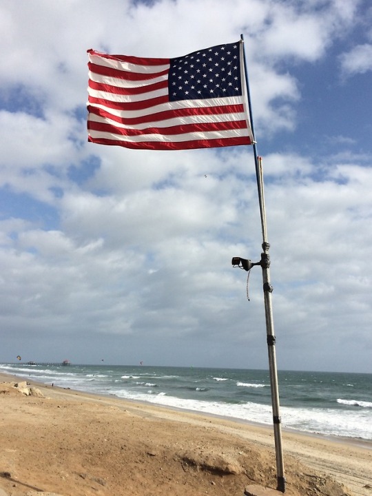
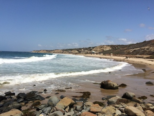

One of the major cornerstones in Geography is understanding the biological, physical and chemical components that create physical landscapes across the map. As a geographer I used my training and spatial thinking to understand why, for example, the wind is blowing the American flag eastward (inland) during the day and reverses direction at night (offshore)? This is because during the day, there is high pressure over the ocean and low pressure over land, which causes air to flow from the high to low areas along a pressure gradient. Since land heats and cools faster than water, a massive cycle of air movement is caused by the warming of land along the coastline. As the land temperature rises, air is forced to expand, ascend, and form a low pressure system that collects surface breezes from the Pacific Ocean (McKnight, 129). Once the sun sets, lands cools down and the water temperature rises and there is high pressure over land and low pressure over the ocean, and air continues to flow from high to low at night. By doing so there is an offshore flow blowing westward towards the ocean, better known as a land breeze (McKnight, 130).
Project Completion: April 22th, 2015 to May 14th, 2015
0 notes
Text
Check Out My Résumé!
https://docs.google.com/document/d/1hAgUVVYIXS5oh3fFk4wdRWe0jhdsxYji32yzl4dMaeA/edit?usp=sharing
0 notes
Photo
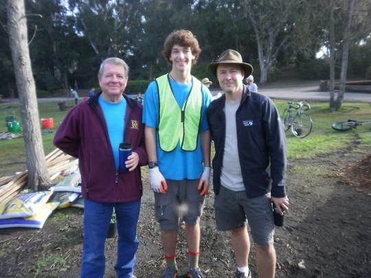
A photo of My Scoutmaster on my left, Eagle Mentor and I after completing my Eagle Scout project! I led a group of scouts and volunteers to plant 16 trees in Huntington Beach Central Park to improve three areas that had deteriorated. All areas were mulched to give a clean, fresh appearance. The Deodar Cedars and Toyon trees planted today will benefit the park for decades. This project took six months in planning and fulfils one of the major requirements for Eagle Scout.
Volunteer work
Eddie Scandura’s Eagle Project
Date: December 2013
0 notes
Photo

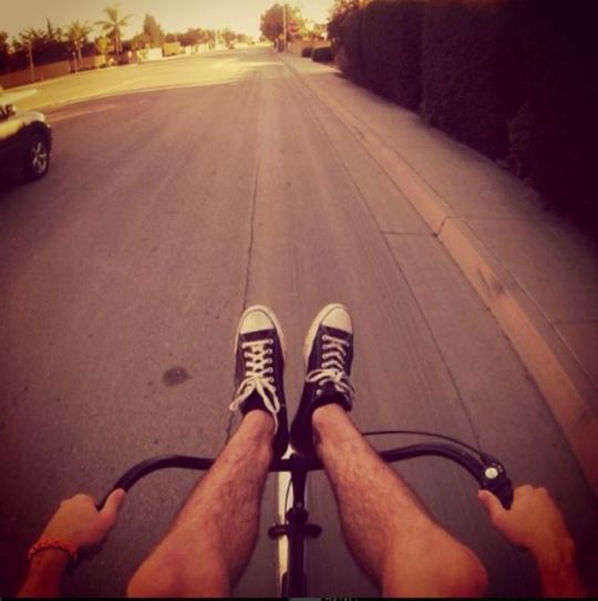
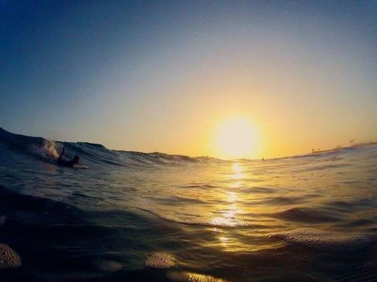
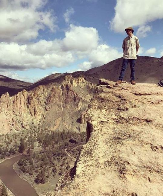
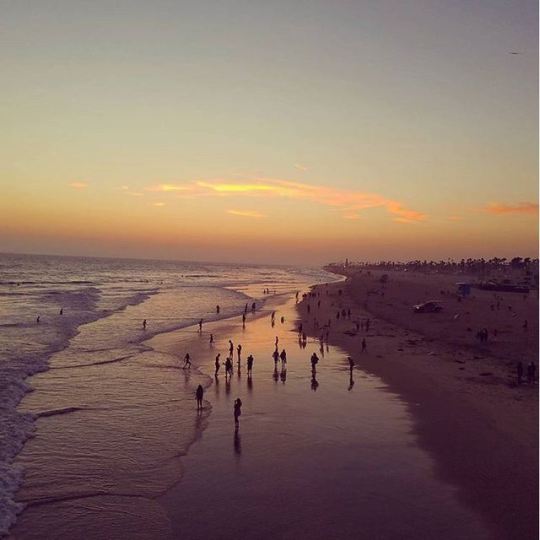
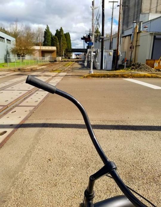
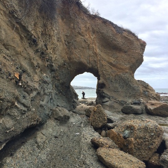
My personal hobbies include taking photos with my GoPro and my Samsung Galaxy S7 while hiking, biking, and surfing. I took an introductory to photo course during my senior in high school, and that is when I developed a passion for photography, learned about the importance of lighting and positioning. I believe that biking and hiking keep you connected to your interests because I am always anxious to explore new places around my hometown and current residence. And I noticed that riding my bike fuels my interests in transportation on the local scale, whereas hiking along beaches and in the mountains keeps me in shape and connected to nature. I come from a beach town commonly known as “Surf City” Huntington Beach, where the annual US Open of Surf takes place, so surfing is something that I grew up doing and I always try to get in the water every time I am back home.
Personal Hobbies and Interests
Photographer: Eddie Scandura
Photos taken from May 2014 to July 2017
0 notes
Photo
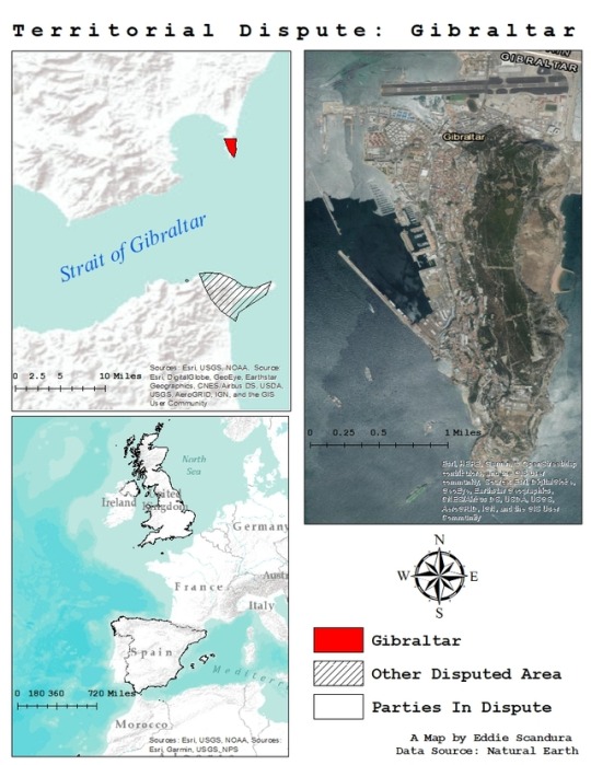
Political geography is widely known as one of the main linchpins of human geography, focusing on concepts like colonization, importance of borders, territoriality, nation and statehood, the political organization of space, and geopolitics. I read about how the town of Gibraltar was captured by the British during the Spanish War of Succession and today is a disputed territory between Spain and the United Kingdom. The British regard the town of Gibraltar as an overseas territory, yet the Spanish have a problem with that because it is on their soil and they believe that they have every right to assert political power and control over the area. I used my training in Geographic Information Science by collecting data from Natural Earth, creating a contextual map of Gibraltar and displaying the disputed territory in three different frames. The top left visualizes the relative location of Gibraltar to Spain and Morocco as well as the strait. In the top right I used a satellite imagery base map to show the exact location of the town. And in the bottom left I used a World Terrain Base map to show western Europe and Northern Africa, and outlined the two parties in dispute: Spain and the United Kingdom.
Territorial Dispute: Gibraltar
Map completed: March 15th, 2018
A Map by Eddie Scandura
0 notes
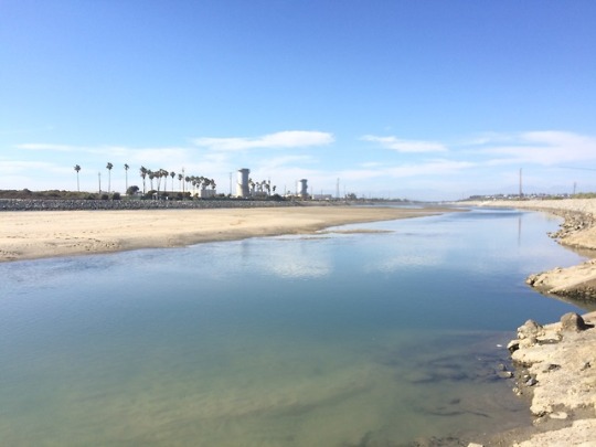
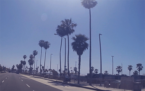
Photo

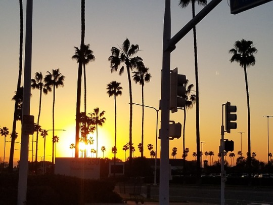
Life and times in California and Oregon
0 notes
Photo
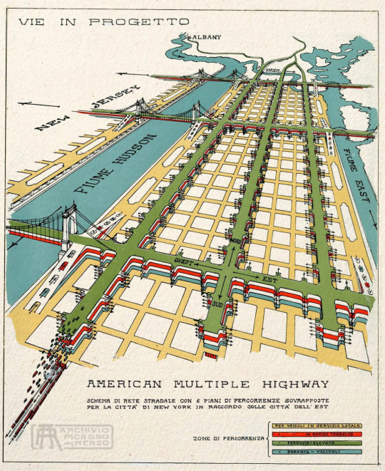
Design proposal for a six-leveled highway system, New York City
238 notes
·
View notes
Photo
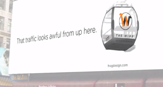
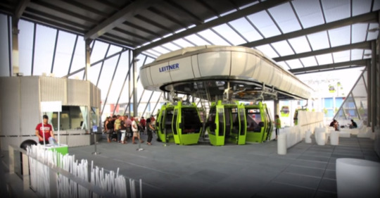
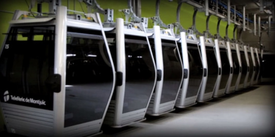
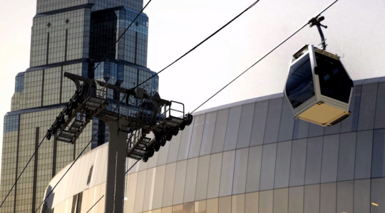
We were promised flying cars…so where are they?
We may not be too far from the stuff of sci-fi fantasies. In this fascinating talk at TEDxKC, designer Jared Ficklin introduces a new type of transportation: high-speed urban cable cars that run on wires above the ground. Modeled after ski lifts, these fast, energy efficient cable cars reduce traffic, save cities money, and help everyone avoid a heinous morning commute. We’d swap New York’s jam-packed subways for these flying pod cars any day.
Watch his whole talk here.
458 notes
·
View notes

Photo
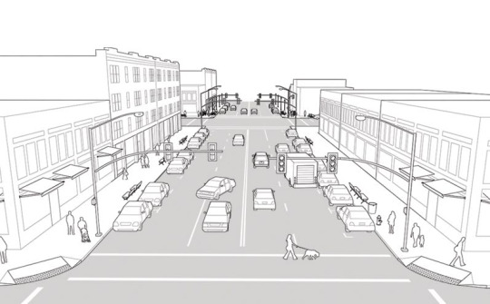
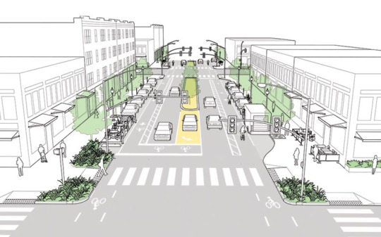
“before” picture of a typical American “neighborhood main street”
“after” sketch. Check out the sharp corners, bump-out sidewalks, center turn lane, parklet, dedicated truck loading zone and of course the buffered bike lanes
NACTO Urban Street Design Guide
via bikeportland: Three local agencies just endorsed these visions for better streets, 19.12.13.
616 notes
·
View notes
Photo
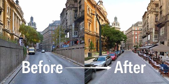
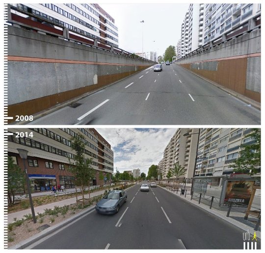
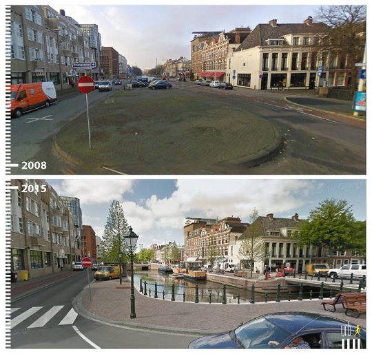
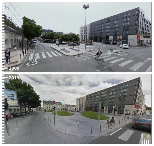
Urban planning and neighborhood revitalization. The day-lighting of the river in the middle is my favorite! See dozens more, here.
868 notes
·
View notes
Photo
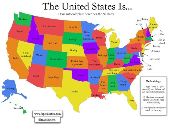
Top Google autocomplete results for “[state] is…”
92 notes
·
View notes
Photo

Likelihood of collision with deer in each state - State Farm, 2012
313 notes
·
View notes
Photo
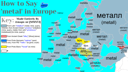
How to Say 'metal’ in Europe with Etymology
Requested by lemonaadechase
533 notes
·
View notes
Video
The history of colonization, 1492 - 2008
Click here to see more maps
283 notes
·
View notes