#satellite photography
Text
The reason for the season(s)
This video shows Us how the Earth’s fixed axis changes the angle of sunlight throughout the year. The satellite is geolocked in its position with the earth to give the same perspective from its vantage point.
237 notes
·
View notes
Text
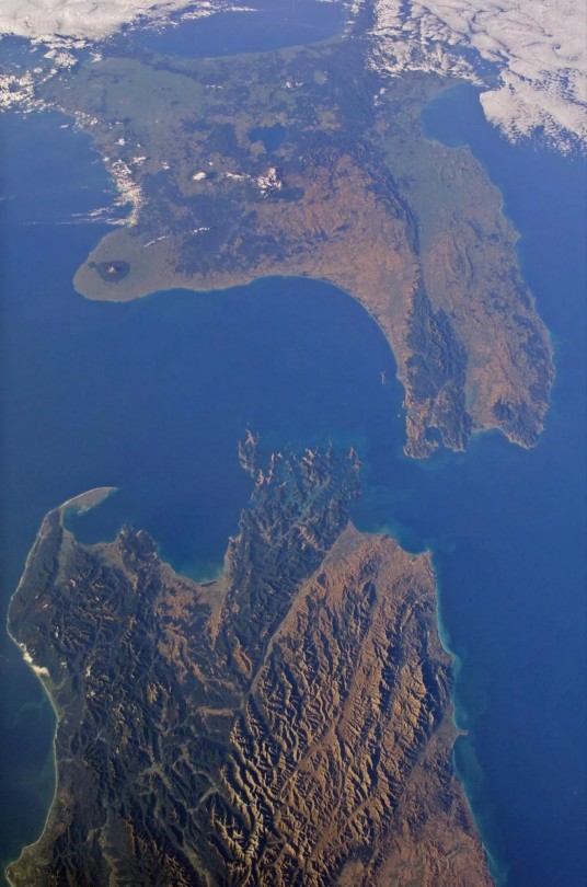
Aotearoa/New Zealand from the ISS
48 notes
·
View notes
Photo


Low Orbit Tourist
65 notes
·
View notes
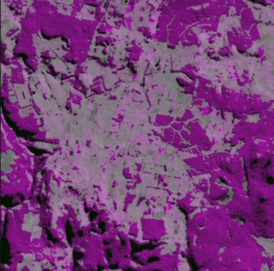
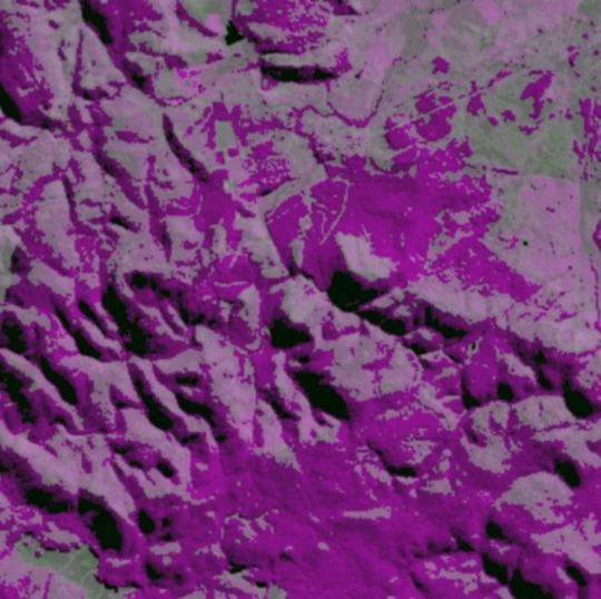
Text
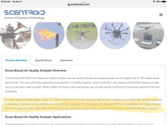
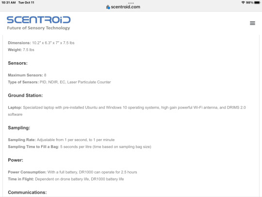
Thursday I have an appointment with the bank, to open an account to raise money for air/water quality monitoring drones plus staff. I’d like to purchase 3 to start 2 full air quality labs and one water lab drone.
My plans don’t stop there, there is a possibility of a drone with a 20 hr flight time just have to look into sensors for it. But it will cover more ground and give us better locations to trouble spots.
Trying for spring as currently the flying labs are going to be flown spring to fall. Winter we will crunch the data into kml files for importing into google earth. Going to try for open source to all environmental monitoring data. If you’re into this kind of work maybe young, create new map overlays, etc prove yourself program to help get younger generations into high technology jobs and keep them here at home in canada 🇨🇦.
My plan please support me to achieve DR1000 flying labs plus the water one and hiring of crews plus personnel to work the data onsite and offsite to be put online for those interested in using the data for their organizations. Hopefully your with me and our environment we only have one home “EARTH “ please support what you can
Send mail to
Steve Philpott eyeball in the sky
10 beauchamp dr Espanola Ontario canada P5E 1R1
#research#research artic#canada#photography#satellite photography#photo#actually disabled#disabilties#tumblr milestone#government#fun#pc government#canadian#pollution#doug ford#london#ford nation#25 posts#london eye#london eyeball#water pollution#pollutants air
13 notes
·
View notes
Text
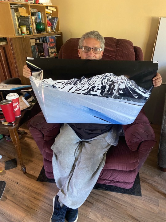
First poster in
Surprise here is my first picture printed
Want to do more as welll
$100 per poster mailed to your door
3 notes
·
View notes
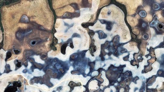
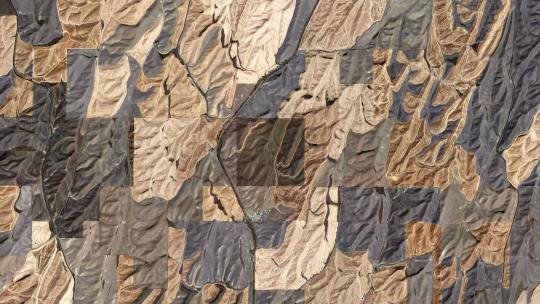
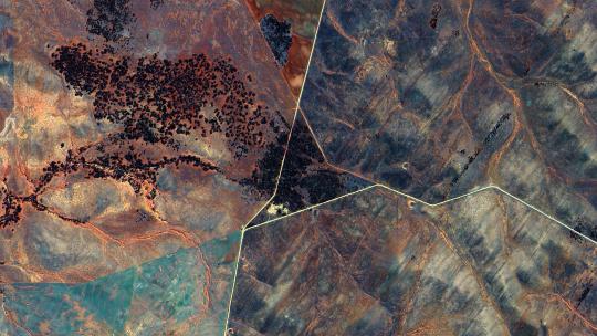
Text


Landsat images I like from the Floating Forests project on Zooniverse #1
1 note
·
View note
Text

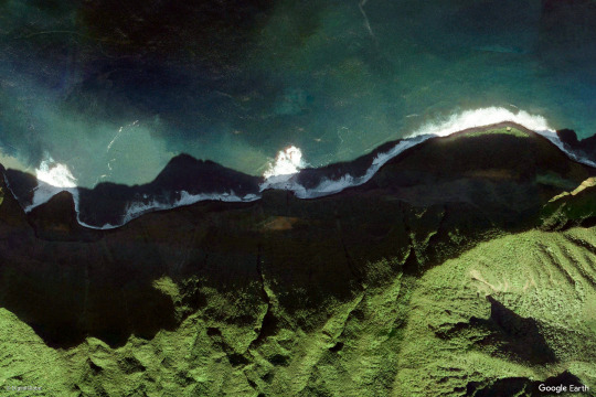
earth views
#nature#photography#mountains#google earth#satellite images#green#blue#ocean#beach#sea#landscape#landscapes
8K notes
·
View notes
Text
Here’s Super Blue Moon 2023.
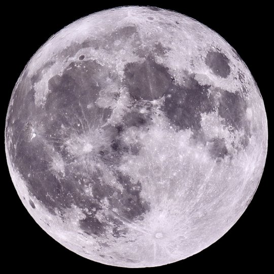
You can see a Bat flying right in front of the moon: 🦇💫
#blue moon#moon light#super blue moon#space#camera#hd#video#super moon#satellite#earth#nasa#amazing#photography#nature#tumblr#art#bat#universe#awesome#photographers on tumblr#astronomy#solar system#night#aesthetic#night sky#stars#galaxy#planet#cosmos#full moon
2K notes
·
View notes
Text
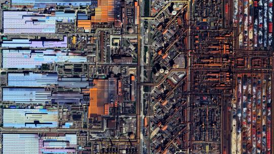
Gwangyang industrial complex - South Korea
🌏
4k link
#4k#wallpaper#google earth#satellite view#aerial photography#south korea#Gwangyang#steel works#industrial#factory#factorio#intricate#abstract#texture#pattern#earth art#earth from space#earth from above#landscape#atlas#dji
2K notes
·
View notes
Text
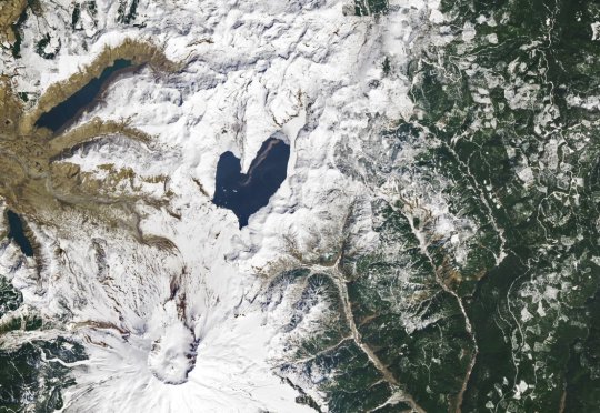
Love from Earth l NASA Earth l Spirit Lake
#earth#lakes#winter#valentines day#nasa#photography#heart shaped#planets#space#sky#geology#satellites#spirit lake#usa#astrophotography
311 notes
·
View notes
Text
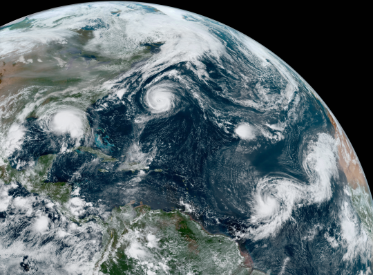
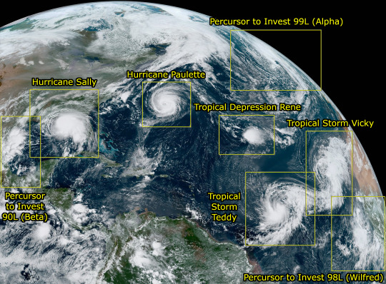
forever thinking about this satellite photograph from the 2020 atlantic hurricane season that captured 5 tropical cyclones (hurricanes, plus tropical storms and tropical depressions which are basically weaker classifications of hurricanes) and 3 other weather systems that would develop into tropical cyclones shortly after, all in the same single photograph.
#i think about this all the time fr. 2020 was suchhhhh a good year for meteorology!!!#at the time of this photograph i was being rekt by sally lol#id in alt#1k#100#weather#meteorology#hurricane#earth#storm#rain#satellite#photography#bluh
8K notes
·
View notes
Text
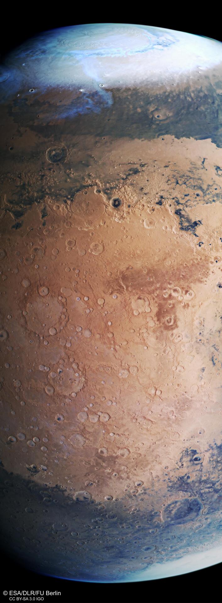
Mars, as seen by ESA's Mars Express satellite
#go for queue deploy#esa#european space agency#mars#solar system#planet#satellite#space#outer space#space exploration#spaceflight#science#space and astronomy#astronomy#space photography#technology#engineering#stem#exploration#mars express#mars exploration#esa mars express
1K notes
·
View notes
Text
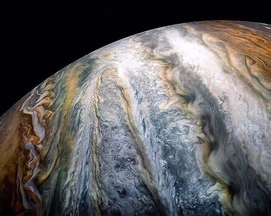
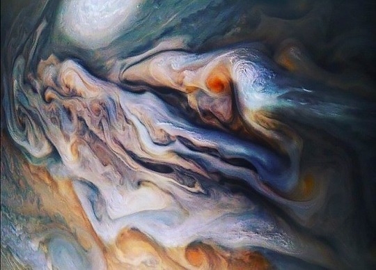
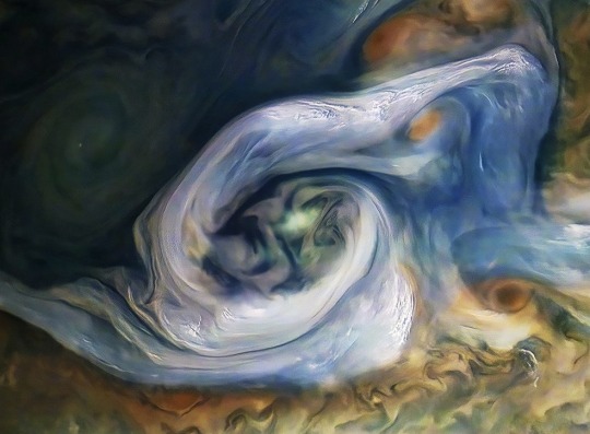
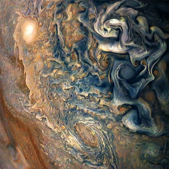
just Jupiter looking mesmerizing. x
#it’s out of this world beautiful!#(catch that? proud of ya!)#jupiter#space#planets#satellite#how do I tag this#cottagecore#beautiful#yeah that fits#photography#classic academia
2K notes
·
View notes
Text

James Ball / Docubyte / Britain In Space – Airbus Satellite Container / Photography / 2002–2017
95 notes
·
View notes
Text

#research#research artic#canada#photography#satellite photography#photo#actually disabled#disabilties#tumblr milestone#government#fun#pc government#canadian#pollution#doug ford#london#ford nation#25 posts#london eye#london eyeball
12 notes
·
View notes
Text
For those who are or think they are being tracked by RCMP or OPP just turn off your location service simple solve but bigger problems as this is harassment in a big way.
#environment#lake superior#wetlands#science#electrical inspection#electrical#home repair#home#hacking#us cellular#disabledcreator#disabilties#disabled discrimination#actually disabled#satellite photography#security system#disabled rights#Opp#rcmp#pc government#pc party#doug ford
1 note
·
View note
Last Seen Blogs

jrgiddens
Jake Giddens - Illustrator

lelakiku
Tanpa judul
starbuck
i don't know if i can stand it
beingharsh
Line of chance, line of hips, line of flight
gtjorgegonzalez
Jorge González