#oldest continuously inhabited settlement in North America
Text
Ruins of Sacred City of Caral, Peru.
Located in Peru, are an ancient archaeological site that represents the remains of one of the oldest known civilizations in the Americas. Caral is considered to be one of the most important archaeological discoveries in the region and has been recognized as a UNESCO World Heritage Site.
The city of Caral was inhabited between 2600 and 2000 BCE, making it roughly 4,000 to 4,600 years old. This makes Caral one of the oldest cities in the Americas and predates other well-known ancient civilizations such as the Mayans and the Incas.
Caral is situated in the Supe Valley, approximately 120 miles (190 kilometers) north of Lima, the capital of Peru. The site is part of the larger Caral-Supe Archaeological Complex, which encompasses multiple settlements and sites in the region.
Caral showcases impressive urban planning and architectural features. The city is arranged in a grid-like pattern, with several monumental structures and plazas. The most notable structure is the Great Pyramid, also known as the Pyramid of Caral, which is a large stepped pyramid at the center of the city.
Caral provides valuable insights into the social, cultural, and religious practices of its ancient inhabitants. Archaeological evidence suggests that Caral was a ceremonial center with a complex religious system. Various artifacts, such as figurines and musical instruments, have been discovered, shedding light on the rituals and beliefs of the Caral civilization.
The people of Caral developed sophisticated agricultural techniques to sustain their civilization. They built an extensive system of terraces and irrigation channels, allowing them to cultivate crops such as maize, cotton, and beans. The success of their agricultural practices contributed to the growth and sustainability of the city.
The Ruins of Caral have undergone extensive preservation efforts to protect the archaeological remains. The site is open to tourists, and visitors can explore the ancient city and learn about its history through guided tours. The Peruvian government, in collaboration with international organizations, continues to work on preserving and promoting the cultural heritage of Caral.
The discovery of Caral has challenged previous notions about the development of civilization in the Americas and has contributed significantly to our understanding of ancient cultures in the region. It serves as a testament to the ingenuity and achievements of early human societies in the Americas.
#edisonmariottiEdison MariottiEdison Mariotti
link: https://shre.ink/9CSv
.br
Ruínas da Cidade Sagrada de Caral, Peru.
Localizado no Peru, é um antigo sítio arqueológico que representa os restos de uma das mais antigas civilizações conhecidas nas Américas. Caral é considerada uma das descobertas arqueológicas mais importantes da região e foi reconhecida como Patrimônio Mundial da UNESCO.
A cidade de Caral foi habitada entre 2600 e 2000 aC, tendo cerca de 4.000 a 4.600 anos de idade. Isso faz de Caral uma das cidades mais antigas das Américas e antecede outras civilizações antigas bem conhecidas, como os maias e os incas.
Caral está situada no Vale Supe, aproximadamente 120 milhas (190 quilômetros) ao norte de Lima, capital do Peru. O sítio faz parte do maior Complexo Arqueológico Caral-Supe, que engloba vários assentamentos e sítios da região.
Caral apresenta impressionante planejamento urbano e características arquitetônicas. A cidade é organizada em um padrão de grade, com várias estruturas monumentais e praças. A estrutura mais notável é a Grande Pirâmide, também conhecida como Pirâmide de Caral, que é uma grande pirâmide escalonada no centro da cidade.
Caral fornece informações valiosas sobre as práticas sociais, culturais e religiosas de seus antigos habitantes. Evidências arqueológicas sugerem que Caral era um centro cerimonial com um complexo sistema religioso. Vários artefatos, como estatuetas e instrumentos musicais, foram descobertos, lançando luz sobre os rituais e crenças da civilização Caral.
O povo de Caral desenvolveu técnicas agrícolas sofisticadas para sustentar sua civilização. Eles construíram um extenso sistema de terraços e canais de irrigação, permitindo-lhes cultivar culturas como milho, algodão e feijão. O sucesso de suas práticas agrícolas contribuiu para o crescimento e sustentabilidade da cidade.
As Ruínas de Caral passaram por extensos esforços de preservação para proteger os restos arqueológicos. O local é aberto aos turistas e os visitantes podem explorar a cidade antiga e conhecer sua história por meio de visitas guiadas. O governo peruano, em colaboração com organizações internacionais, continua trabalhando na preservação e promoção do patrimônio cultural de Caral.
A descoberta de Caral desafiou noções anteriores sobre o desenvolvimento da civilização nas Américas e contribuiu significativamente para nossa compreensão das culturas antigas da região. Ele serve como um testemunho da engenhosidade e das realizações das primeiras sociedades humanas nas Américas.

0 notes
Text
Dominican Republic - The most beautiful places in the world.
Introduction
Briefly introduce the Dominican Republic as a popular travel destination.
Mention its stunning beaches, crystal-clear waters, vibrant culture, and delicious cuisine.
When it comes to tropical paradises, few places can rival the beauty and charm of the Dominican Republic. This stunning Caribbean island boasts an eclectic mix of cultures, an inviting climate, and breathtaking landscapes that have captured the hearts of travelers from around the world.
If you're looking for a holiday destination that offers a little bit of everything, the Dominican Republic should definitely be on your radar. From the soft sands of its countless beaches to the vibrant culture that permeates every aspect of daily life, there's something for everyone to enjoy here.
One of the most alluring features of the Dominican Republic is its weather. With temperatures ranging from 26-30°C year-round, this is the perfect destination for those looking to escape the colder climates of the Northern Hemisphere. The island is also blessed with over 300 days of sunshine per year, making it a great choice for a beach holiday or outdoor adventure.
If you're wondering when the best time to visit the Dominican Republic is, it really depends on your priorities. The peak tourist season runs from December to April, when the weather is dry and sunny. This is also the time when many North Americans and Europeans flock to the island to escape the winter blues. As a result, prices can be higher and crowds can be larger during this time.
If you're looking for a more affordable and quieter time to visit, consider traveling between May and November. This is the rainy season in the Dominican Republic, but it doesn't necessarily mean constant downpours. Instead, you can expect brief afternoon showers followed by sunny skies. Plus, this time of year is perfect for those looking to explore the island's lush rainforests and natural wonders.
When it comes to accommodation, the Dominican Republic has a wide range of options to suit all budgets and preferences. From luxurious all-inclusive resorts to budget-friendly guesthouses, there's no shortage of places to stay. Many of the resorts are located in Punta Cana, which is a popular tourist hub due to its stunning beaches, golf courses, and water sports.
But the Dominican Republic is much more than just beaches and resorts. The country is home to a rich cultural heritage that blends African, European, and Indigenous influences. In fact, Santo Domingo, the capital city, is the oldest continuously inhabited European settlement in the Americas, with a history that dates back over 500 years.
Whether you're looking to explore the historic architecture of the city's colonial zone, dance the night away to the sounds of merengue and bachata, or indulge in the mouth-watering flavors of the local cuisine, there's no shortage of cultural experiences to be had in the Dominican Republic.
In conclusion, the Dominican Republic is a magical and enchanting destination that offers something for everyone. With its inviting climate, stunning beaches, rich culture, and natural wonders, it's no wonder why this island paradise has captured the hearts of travelers for decades. So, pack your bags and get ready for an unforgettable adventure in one of the most beautiful places on earth!
Best time to visit the Dominican Republic
Discuss the ideal time to visit the Dominican Republic, considering weather, prices, and crowds.
Mention that the peak season is from December to April, while the rainy season is from May to November.
When planning a trip to the Dominican Republic, it's essential to choose the right time to visit. The best time to visit the country is from December to April, during the dry season. The weather during these months is sunny and warm, with little to no rainfall, making it perfect for outdoor activities and beach lounging. The temperature averages around 27°C (81°F) during the day and drops to around 20°C (68°F) at night.
However, the dry season is also the peak tourist season, which means that the prices for accommodation, flights, and activities can be quite high. If you want to avoid the crowds and save some money, consider visiting during the shoulder seasons, which are May-June and September-October. These months are less crowded, and the prices are more reasonable.
The rainy season in the Dominican Republic starts in May and lasts until November. During this time, the weather is hot and humid, with frequent rainfall, especially in the afternoons. However, the rainfall doesn't usually last long, and the sun often comes out soon after. Also, the rain can help cool down the temperature, making it more comfortable for outdoor activities.
While the rainy season might not be the best time for beach activities, it's a great time to visit the countryside and enjoy the lush greenery and the natural wonders that the Dominican Republic has to offer. Additionally, the rainy season is the best time for surfing, with some of the best waves of the year hitting the coasts.
One of the most exciting times to visit the Dominican Republic is during Carnival, which takes place in February. Carnival is a colorful and vibrant celebration, where locals dress up in elaborate costumes and parade through the streets, dancing to the sounds of merengue and bachata music. The atmosphere is electric, and the celebrations go on for several days.
Another popular event in the Dominican Republic is the Santo Domingo Jazz Festival, which takes place in November. The festival attracts some of the world's best jazz musicians, and the concerts are held in various locations throughout the city, including the historic Zona Colonial.
In conclusion, when planning a trip to the Dominican Republic, it's important to consider the weather and the peak seasons. While the dry season is the best time for beach activities, the shoulder seasons can be more affordable and less crowded. The rainy season is an excellent time to visit the countryside and enjoy the lush greenery, and it's also the best time for surfing. Additionally, visitors can enjoy exciting events like Carnival and the Santo Domingo Jazz Festival. No matter when you choose to visit, the Dominican Republic is sure to provide an unforgettable experience.
Accommodation options
Describe the different types of accommodation available in the Dominican Republic, including resorts, hotels, villas, and apartments.
Mention the pros and cons of each option, as well as their average costs.
When it comes to accommodation options in the Dominican Republic, there are a variety of choices available to suit every budget and preference. From all-inclusive resorts to cozy villas, the island offers something for everyone.
For those looking for an all-inclusive experience, there are plenty of resorts to choose from, particularly in the popular tourist areas of Punta Cana and Bavaro. These resorts typically offer everything you could want for a relaxing vacation, including multiple pools, restaurants, bars, and entertainment options. Many also offer organized activities, such as yoga classes or water sports, as well as access to private beaches.
If you're looking for a more authentic experience, there are also plenty of small guesthouses and bed and breakfasts scattered throughout the island. These options offer a more intimate and personalized experience, often with friendly hosts who are happy to share insider tips and local knowledge. They may also offer homemade breakfasts and other meals, made with fresh, local ingredients.
For those who prefer a bit more space and privacy, renting a villa or apartment is a great option. There are many stunning villas available for rent throughout the island, often with private pools and sweeping views of the ocean. Some villas also come with staff, such as housekeepers or chefs, who can help make your stay even more luxurious. Apartments are also available in many areas, particularly in cities like Santo Domingo, and offer a more affordable option for longer stays.
No matter which type of accommodation you choose, it's important to research the location carefully to ensure it meets your needs. Some resorts, for example, may be located far from the nearest town, while some villas may require a car to access. It's also a good idea to check reviews from previous guests to get a sense of the quality of service and amenities.
One thing to keep in mind when booking accommodation in the Dominican Republic is that prices can vary widely depending on the time of year. High season, which runs from December to April, tends to be the most expensive, while low season, from May to November, can offer significant savings. However, it's important to keep in mind that this is also hurricane season, so be sure to check the weather forecast before booking.
Overall, the Dominican Republic offers a wide range of accommodation options to suit every taste and budget. Whether you're looking for a luxurious all-inclusive resort, a cozy guesthouse, or a private villa, you're sure to find the perfect place to stay on this beautiful Caribbean island.
Top tourist attractions
List the top tourist attractions in the Dominican Republic, such as the beaches of Punta Cana, the historic city of Santo Domingo, and the natural wonders of Samaná.
Provide a brief description of each attraction, including what to see and do, and any tips for visiting.
When it comes to the Dominican Republic, there's no shortage of must-visit destinations and experiences for travelers. From stunning beaches to historic cities to natural wonders, this Caribbean island has it all. Let's take a closer look at some of the top tourist attractions in the Dominican Republic:
Punta Cana: This world-famous resort town is located on the eastern coast of the Dominican Republic and is known for its pristine beaches and crystal-clear waters. Some of the top beaches to visit in Punta Cana include Bavaro Beach, Macao Beach, and Juanillo Beach. There are also plenty of water sports and outdoor activities to enjoy, such as snorkeling, scuba diving, and zip-lining.
Santo Domingo: As the capital city of the Dominican Republic, Santo Domingo is a must-visit destination for history and culture buffs. The city's Colonial Zone is a UNESCO World Heritage Site and is home to many historic buildings and monuments, such as the Alcazar de Colón and the Cathedral of Santa Maria la Menor. Other top attractions in Santo Domingo include the National Palace, the Malecon waterfront, and the Mercado Modelo market.
Samaná: Located on the northeastern coast of the Dominican Republic, Samaná is a natural paradise with lush rainforests, pristine beaches, and breathtaking waterfalls. Some of the top attractions in Samaná include the El Limon waterfall, the Los Haitises National Park, and the Playa Rincon beach. Visitors can also go whale-watching during the winter months, when humpback whales migrate to the waters off the coast of Samaná.
La Romana: This coastal city is located on the southern coast of the Dominican Republic and is known for its luxury resorts and golf courses. One of the top attractions in La Romana is the Altos de Chavon cultural village, which is a replica of a 16th-century Mediterranean village and features art galleries, shops, and restaurants. Visitors can also take a boat tour of the nearby Saona Island, which is a protected nature reserve.
Puerto Plata: This northern coastal city is known for its Victorian architecture and historic landmarks, such as the Fort of San Felipe and the Amber Museum. Visitors can also take a cable car ride to the top of Mount Isabel de Torres, which offers panoramic views of the city and the surrounding landscape. Other top attractions in Puerto Plata include the Ocean World Adventure Park and the Damajagua Waterfalls.
No matter where you choose to visit in the Dominican Republic, you're sure to have an unforgettable vacation filled with sun, sand, and adventure. So pack your bags, grab your sunscreen, and get ready to experience all that this beautiful island has to offer!
Outdoor activities
Discuss the various outdoor activities available in the Dominican Republic, such as snorkeling, scuba diving, surfing, hiking, and zip-lining.
Mention the best places to do each activity, as well as any recommended tours or guides.
The Dominican Republic is a haven for outdoor enthusiasts and adventure seekers. With its stunning natural landscapes, crystal-clear waters, and warm tropical climate, the country offers a wealth of outdoor activities for travelers of all ages and interests.
One of the most popular activities in the Dominican Republic is snorkeling. The country boasts some of the most spectacular coral reefs in the Caribbean, which are teeming with colorful fish, sea turtles, and other marine life. Some of the best places to snorkel in the Dominican Republic include Punta Cana, Bayahibe, and the National Park of the East.
Scuba diving is also a must-do activity in the Dominican Republic. The country is home to several world-class dive sites, including the shipwrecks of La Caleta and the underwater caverns of Punta Cana. Novice and experienced divers alike can enjoy the clear waters and abundant marine life in the Caribbean Sea.
For those who prefer to stay above the water, surfing is a thrilling activity that can be enjoyed year-round in the Dominican Republic. The country's north coast is particularly popular among surfers, with waves that are perfect for all levels of experience. The beaches of Cabarete, Playa Grande, and Encuentro are among the top surf spots in the country.
Hiking is another popular activity in the Dominican Republic, with several scenic trails that offer stunning views of the country's natural beauty. One of the most famous hiking trails is the Pico Duarte, the highest peak in the Caribbean. The trek to the summit takes around two days and offers breathtaking views of the surrounding mountains and valleys.
Zip-lining is a fun and exhilarating way to explore the Dominican Republic's lush rainforests and stunning landscapes. There are several zip-lining tours available in the country, with lines that stretch over the treetops and offer stunning views of the natural beauty below.
Overall, the Dominican Republic offers a wealth of outdoor activities for travelers who want to experience the country's natural beauty and thrill-seeking adventures. Whether you want to snorkel among colorful coral reefs, dive into underwater caverns, catch some waves on a surfboard, hike to the summit of a mountain, or zip-line through the rainforest canopy, the Dominican Republic has something for everyone.
Cultural experiences
Describe the unique cultural experiences available in the Dominican Republic, such as visiting local markets, learning to dance merengue or bachata, and trying traditional dishes like mofongo or sancocho.
Provide details on where to find these experiences and any recommended tour operators or local guides.
When visiting the Dominican Republic, there are plenty of cultural experiences that you won't want to miss out on. From exploring bustling markets to learning to dance merengue or bachata, here are some unique cultural experiences to add to your itinerary:
If you want to immerse yourself in local culture, start by visiting the bustling markets that are found throughout the country. The Mercado Modelo in Santo Domingo is one of the most popular markets in the city and is home to dozens of vendors selling everything from handmade crafts to fresh produce. You can also find a wide range of souvenirs, clothing, and accessories that make great gifts to take home. Another must-visit market is the Mercado de la Pulga in Puerto Plata, where you can find unique antiques and vintage items.
For a true taste of Dominican culture, try learning to dance merengue or bachata. These two styles of music and dance are a cornerstone of Dominican culture and can be found throughout the country. One great place to learn is at the Casa de la Cultura in Santo Domingo, which offers dance classes for beginners and advanced dancers alike. You can also take private lessons or attend group classes at local dance schools in cities like Punta Cana and Puerto Plata.
Of course, no visit to the Dominican Republic would be complete without trying some of the delicious local cuisine. Some must-try dishes include mofongo, a mashed plantain dish served with meat or seafood, and sancocho, a hearty stew made with meat, vegetables, and root vegetables. You can also try street food like empanadas, fried plantains, and chicharrones, which are all delicious and affordable.
If you're interested in history and architecture, the colonial city of Santo Domingo is a must-visit destination. The city's Zona Colonial is a UNESCO World Heritage site and is home to some of the oldest and most beautiful buildings in the Caribbean. You can also visit the Alcázar de Colón, a museum housed in the former home of Christopher Columbus' son, Diego.
Finally, if you want to experience Dominican culture in a more laid-back setting, head to a local colmado. These small, neighborhood stores are found throughout the country and are a gathering place for locals. You can buy snacks, drinks, and other essentials, and often find live music and dancing in the evenings.
In conclusion, the Dominican Republic offers a wealth of cultural experiences that are sure to enrich your vacation. Whether you're exploring bustling markets, learning to dance, or trying local cuisine, there's something for everyone. So pack your bags and get ready to experience the rich and vibrant culture of the Dominican Republic!
Nightlife and entertainment
Discuss the vibrant nightlife and entertainment scene in the Dominican Republic, particularly in cities like Punta Cana and Santo Domingo.
Mention the top clubs, bars, and restaurants, as well as any recommended events or festivals.
When it comes to nightlife and entertainment, the Dominican Republic is truly a paradise for partygoers. The island is famous for its lively atmosphere, exotic drinks, and non-stop music, making it a top destination for those looking to let loose and have a good time. In this article, we'll explore some of the best nightlife and entertainment options the Dominican Republic has to offer.
One of the most popular nightlife destinations in the Dominican Republic is Punta Cana. Here, you can find a wide range of bars and clubs, each with its own unique atmosphere and style. From laid-back beach bars to upscale nightclubs, Punta Cana has something for everyone. For those looking for a high-end experience, Coco Bongo is a must-visit. This nightclub features acrobatic performances, live music, and a variety of drinks to choose from. Another popular spot is Imagine, which boasts an underwater-themed atmosphere and a variety of entertainment options, from live music to aerial performers.
Santo Domingo, the capital of the Dominican Republic, is another great place to experience the island's vibrant nightlife. The city is home to a variety of bars, clubs, and restaurants, ranging from trendy and modern to traditional and cultural. One of the most famous bars in Santo Domingo is La Briciola, which has been serving drinks and delicious Italian food for over 25 years. Another popular spot is Parada 77, a trendy bar that attracts a young and lively crowd.
For those who prefer a more relaxed atmosphere, the Dominican Republic also has a variety of beach bars and lounges. In Cabarete, you can find many beachfront bars where you can enjoy a drink while taking in the beautiful sunset. One of the most popular is Mojito Bar, which features a laid-back atmosphere, live music, and a variety of tropical drinks.
When it comes to entertainment, the Dominican Republic is also home to many cultural events and festivals. The country's music and dance scene is particularly lively, with merengue and bachata being the most popular genres. The Dominican Republic also hosts several music festivals throughout the year, including the Dominican Republic Jazz Festival and the Festival Presidente de la Musica Latina.
In terms of safety, it's important to exercise caution when enjoying the nightlife in the Dominican Republic. Be aware of your surroundings, don't leave your drink unattended, and avoid walking alone at night. It's also a good idea to use a taxi or ride-sharing service to get around.
In conclusion, the Dominican Republic offers a wide range of nightlife and entertainment options, from high-end nightclubs to laid-back beach bars. Whether you're looking to dance the night away or enjoy a relaxing drink by the water, the island has something for everyone. Just remember to stay safe and have fun!
Safety and travel tips
Provide important safety and travel tips for visitors to the Dominican Republic, such as avoiding certain areas, drinking bottled water, and carrying a copy of your passport at all Times.
Also mention any specific cultural or social customs to be aware of, such as tipping and dress codes.
When it comes to traveling to the Dominican Republic, it's important to be aware of some safety and travel tips to ensure a smooth and enjoyable trip. Here are some valuable insights and experiences shared by Internet users and travel experts.
Stay aware of your surroundings
Like any other destination, it's important to be vigilant and aware of your surroundings at all times in the Dominican Republic. Stay away from any areas that feel unsafe, especially at night. It's also a good idea to keep your valuables in a secure place and avoid wearing expensive jewelry or flashing large amounts of cash.
Stay hydrated and avoid tap water
The Dominican Republic is known for its hot and humid climate, so it's important to stay hydrated throughout the day. However, it's recommended to drink only bottled water, as tap water is not always safe for consumption. Many hotels and restaurants offer bottled water, so be sure to ask for it if it's not provided.
Use reputable transportation
When it comes to transportation in the Dominican Republic, it's important to use reputable sources, such as licensed taxis or Uber. Avoid taking unofficial taxis or hitchhiking, as these may be unsafe.
Learn some Spanish phrases
While many Dominicans speak English, it's always helpful to learn some basic Spanish phrases, especially if you plan to venture off the beaten path. This can help you communicate with locals and navigate your way around the country more easily.
Respect local customs and traditions
The Dominican Republic has a rich and vibrant culture, and it's important to respect local customs and traditions. This includes dressing modestly when visiting religious sites, asking for permission before taking photos of locals, and being mindful of noise levels in residential areas.
Be cautious with food and drinks
The Dominican Republic has a delicious cuisine, but it's important to be cautious with what you eat and drink to avoid getting sick. Stick to cooked foods and avoid raw fruits and vegetables that may have been washed in tap water. It's also a good idea to avoid drinking tap water or ice cubes in drinks.
Carry a copy of your passport
It's always a good idea to carry a copy of your passport with you when traveling in the Dominican Republic. This can help in case of lost or stolen documents, and may be required for certain activities or accommodations.
By following these safety and travel tips, you can enjoy a memorable and stress-free trip to the Dominican Republic. Whether you're soaking up the sun on the beach, exploring the vibrant cities, or immersing yourself in the local culture, this beautiful country is sure to leave a lasting impression on you.
Conclusion
Summarize the key points of the article and encourage readers to visit the Dominican Republic for an unforgettable vacation.
I hope this plan helps you write an informative and engaging article about travel and holidays in the Dominican Republic. Good luck!
The Dominican Republic is a breathtaking Caribbean island that offers an incredible array of experiences for travelers. From its stunning beaches and crystal-clear waters to its vibrant culture and delicious cuisine, the Dominican Republic has something for everyone. Whether you're looking for adventure, relaxation, or a mix of both, this island paradise is the perfect destination for an unforgettable vacation.
One of the main draws of the Dominican Republic is its pristine beaches, which are among the best in the world. With more than 1,000 miles of coastline, the country is home to a wide range of beaches, from secluded coves to bustling resort areas. The most famous of these is Punta Cana, which boasts miles of soft white sand, turquoise waters, and an array of water sports and activities. Other must-visit beaches include Playa Grande, Playa Rincon, and Playa Dorada.
Beyond its beaches, the Dominican Republic is rich in culture and history, with a fascinating mix of indigenous, African, and European influences. One of the best ways to experience this culture is by visiting the historic city of Santo Domingo, which was founded by Christopher Columbus in 1496 and is home to some of the oldest colonial buildings in the Americas. Other cultural highlights include visiting local markets, learning to dance merengue or bachata, and trying traditional dishes like mofongo or sancocho.
For those seeking adventure, the Dominican Republic offers a wealth of outdoor activities, including snorkeling, scuba diving, surfing, hiking, and zip-lining. Samaná, in particular, is a popular destination for eco-tourism, with its stunning waterfalls, lush forests, and whale watching tours.
When it comes to nightlife, the Dominican Republic does not disappoint. The country has a vibrant party scene, particularly in cities like Punta Cana and Santo Domingo. Whether you're looking for top-notch clubs, lively bars, or delicious restaurants, you'll find plenty of options to keep you entertained.
Of course, as with any travel destination, it's important to take safety precautions and be aware of any potential risks. Visitors to the Dominican Republic should be careful when traveling alone or at night, avoid certain areas, and take care when drinking alcohol or using public transportation.
Overall, the Dominican Republic is an incredible destination that offers something for everyone. Whether you're looking for relaxation, adventure, culture, or nightlife, this island paradise has it all. So why not pack your bags and start planning your next unforgettable vacation to the Dominican Republic today?
#holidays#travel#traveling#vacation#explore#places to visit#travelgram#destination#travelblogger#last minute travel#tourism#turismo#trip#worldtraveler#exploretheworld#exploretheplanet#exploretheglobe#explorethecity#exploretheunknown#igtravel#bucketlist#adventuresinfinity#travel blog#passportready
0 notes
Text
lost colony of roanoke
The origins of one of the America’s oldest unsolved mysteries can be traced to August 1587, when a group of about 115 English settlers arrived on Roanoke Island, off the coast of what is now North Carolina. Following an earlier, failed attempt at settlement on Roanoke two years earlier, these colonists intended to form the first permanent English outpost in the New World. Later that year, it was decided that John White, governor of the new colony, would sail back to England in order to gather a fresh load of supplies. But just as he arrived, a major naval war broke out between England and Spain, and Queen Elizabeth I called on every available ship to confront the mighty Spanish Armada.
In August 1590, White finally returned to Roanoke, where he had left his wife and daughter, his infant granddaughter and the other settlers three long years before. He found no trace of the colony or its inhabitants, and few clues to what might have happened, apart from a single word—“Croatoan”—carved into a wooden post.
Investigations into the fate of the “Lost Colony” of Roanoke have continued over the centuries, but no one has come up with a satisfactory answer. “Croatoan” was the name of an island south of Roanoke that was home to a Native American tribe of the same name. Perhaps, then, the colonists were killed or abducted by Native Americans.
0 notes
Photo

June 21st is...
Arizona Day - Arizona became a state on Valentine’s Day in 1912. Arizona is home to the oldest continuously inhabited settlement in North America. Established around 1000 A.D., the village of Old Oraibi is located on the Hopi Indian Reservation in Navajo county. Known as the Grand Canyon State, Arizona brings the wilderness to you. The breathtaking views of the Colorado Plateau, which incidentally took over 70 million years to form into towering stone, are now one of nature’s grand centerpieces.
Day Of The Gong - Mighty and gentle, earthy, and celestial, this extraordinary instrument is a conduit of Creation. With an international cultural history, the gong offers sensory and multi-dimensional sounds. Thanks to artisans worldwide, gongs come in an array of sizes, designs, and origins. As an instrument, they are both beautiful in design and performance. While gongs originate in the East or Southeast Asia, they also have an ancient history in Rome.
Daylight Appreciation Day - It recognizes the summer solstice (the longest day of daylight in the northern hemisphere) and encourages people to celebrate the many benefits of the sun.The day also offers an opportunity to learn more about the importance of daylighting. Daylighting is using skylights, windows, and other architectural openings to naturally light interior spaces. Doing so helps not only to reduce energy consumption but may also have health benefits.
Go Skateboarding Day - Retailers, sponsors, parks, and individuals around the world host events showcasing this rebellious and creative culture. A combination of athleticism, dance, and art, skateboarding has grown up in an urban world. It also crosses multicultural divides and speaks to a diverse population. Skaters test the laws of gravity with a variety of ariels and twists, thrilling their fans.
Indigenous Peoples Day - It’s all about bringing people together from different walks of life to share in the contributions of Indigenous People to our society. You’ll find an eclectic mix of contemporary and traditional music while learning about how Indigenous Peoples helped to develop our agriculture, language and social customs. The day is also about how governments are creating crucial partnerships with Indigenous Peoples to protect their land, heritage and culture in modern times.
International Yoga Day - One of the best and oldest ways to release the tension building up in both the body and the mind is practicing yoga. The benefits of practicing yoga, such as mastering countless techniques of controlling the body and the mind, have been widely recognized by the Western world for years, and International Yoga Day aims to continue to inform people how much dedicating a bit of time to the art of yoga can improve their lives. It is not just a physical practice, but also a mental one, with many of the teachings of yoga reflecting mental and spiritual states, and allowing your body to wander and drift into unknown realms that will give you a focus in your life and a calmness with your soul.
Peaches ‘n Cream Day - Peaches’ n’ Cream is a simple, traditional, and delicious summertime dessert. Make some homemade vanilla ice cream to sweeten the deal, and your peaches’ n’ cream will be all the cooler
Selfie Day - While the act of taking a selfie may predate social media, smartphones, and the word itself (which is now in the Oxford Dictionary), the popularity of taking these self-portraits keeps increasing. And the ability to take them gets easier all the time. Selfie sticks and multi-functional camera phones make it all too convenient to take these kinds of photographs as well as group selfies (aka groupies).
World Giraffe Day - Whether you’re into conserving their native habitats, enjoy hanging out with our necky friends at the zoo or you just appreciate the joy of nature’s most weird and wonderful creatures, World Giraffe Day is a day of observance when you can really put your neck out!
World Humanist Day - There is a philosophy of belief that indicates that humanity is more than just the puppets of some divine being or subject to a list of metaphysical oddities and creatures with their own designs. Instead, humanism believes that we are whole in and of ourselves and that our good behavior and civility is not reliant on anything except a true and honest desire to be decent people. Most of all this philosophy raises the importance of personal responsibility, if we behave as monsters, it is we who are monsters, there is no “The Devil Made Me Do It”. World Humanist Day celebrates this ideology and those who practice it, bringing reason and science to the world of faith and irrationality.
World Motorcycle Day - Today motorcycles are used for an increasing number of applications, including delivery driving, passenger conveyance, recreation, and even just daily commuting. This is due, in no small part, to the incredible gas mileage these vehicles get, and how compact and easy they are to store even if you live in an apartment. Whether you’re using your motorcycle to get around from day to day, or are an enthusiast or hobbyist who goes on long rides as part of your yearly vacation, World Motorcycle Day is for you.
World Music Day - Music has existed for as long as mankind has found its voice, and quite possibly before. Every culture of the world has its own form of music, as distinct and unique to its area as language and cuisine. In the western world, we are familiar only with scales, known as the diatonic scale which should be familiar to anyone who took music classes or choir in school. But this is not the only or even the first scale that music can use. There’s the chromatic scale, which has 12 notes instead of the 7, and the octatonic scale, which has 8 notes, but these are just the beginning. In every part of the world, there are different scales and musical formats used, and these create a form of music that has its own signature. Then when you add in the cultural themes, the variety of instruments, and the forms of voice singing that can go along with it, music is a truly endless adventure. World Music Day celebrates this adventure and those that dare to take it.
#arizona#gong#daylight#skateboard#indegenous people#yoga#peaches n cream#selfie#giraffe#Humanist#motorcycle#music
16 notes
·
View notes
Text
Puerto Rico's History
XV Century
Taíno Indians who inhabited the territory, called the island Boriken or Borinquen which means: "the great land of the valiant and noble Lord" or "land of the great lords". Today this word -used in various modifications- is still popularly used to designate the people and island of Puerto Rico. The Taíno Indians, who came from the Orinoco River in present Venezuela, inhabited the major portion of the island when the Spaniards arrived. The Taíno Indians, lived in small villages or "bateyes", and were organized in clans, led by a Cacique, or chief. They were a peaceful people who, with a limited knowledge of agriculture, lived on such domesticated tropical crops as pineapples, cassava, and sweet potatoes supplemented by seafood.
1492
On April 17, Ferdinand and Isabella of Spain signed the agreement to finance and set the terms of Columbus's voyage to the Indies. The document is known as the Capitulations of Santa Fe. The agreement established that Columbus would become the viceroy and governor of all discovered land and rights to 10% of all assets brought to Spain, among other terms.
On August 3, the fleet of three ships --the Niña, the Pinta, and the Santa María-- set forth from Palos, Spain. The first sighting of land came at dawn on October 12. They landed at San Salvador, in the Bahamas. Thinking he had reached the East Indies, Columbus referred to the native inhabitants of the island as "Indians," a term that was ultimately applied to all indigenous peoples of the New World.
1493
Christopher Columbus
After the success of Columbus's first voyage, he had little trouble convincing Ferdinand and Isabela of Spain, to follow up immediately with a second voyage. Unlike the exploratory first voyage, the second voyage was a massive colonization effort. On September 25, Christopher Columbus set sail from Cádiz, Spain with 17 ships and almost 1,500 men. The second voyage brought European livestock (horses, sheep, and cattle) to America for the first time.
On November 19, Christopher Columbus discovered the island in his second voyage to the New World. He found the island populated by as many as 50,000 Taíno or Arawak Indians. The Taíno Indians who greeted Columbus made a big mistake when they showed him gold nuggets in the river and told him to take all he wanted. Originally the newcomers called the island San Juan Bautista, for St. John the Baptist and the town was named Puerto Rico ("rich port") for its abundance of natural resources, specially gold and its excellent location. It was not until later that the two names were switched. Thanks in part to the enthusiasm of ambitious Juan Ponce de León, a lieutenant to Columbus, the city of Puerto Rico, it quickly became Spain's most important military outpost in the Caribbean.
1501
The Spanish Crown permitted export of slaves to America.
1503
Governor Nicolás de Ovando opposes the importing of slaves.
First slaves arrive in Hispañola.
1505
On March 25, Vicente Yañez Pinzón Captain was appointed "corregidor" of the island San Juan Bautista and governor of the fort that he was to construct therein.
1506
On May 20, Christopher Columbus died in Valladolid, Spain.
1508
Spanish colonization begins. King Ferdinand II of Aragon assigned Ponce de León to lead an official expedition to the island.
On January 14, first school in Puerto Rico was established in Caparra.
On June 15, 1508, Nicolas de Ovando, the viceroy of Espanola (Hispaniola), granted Ponce de Leon the privilege to explore and subjugate the island of San Juan Bautista.
On August 8, Juan Ponce de León founded the Caparra Village near the bay on the north coast, not far from the modern city of San Juan. It became the first European settlement in Puerto Rico.
Puerto Rican archeologist, Don Ricardo Alegria estimated that the island had some 30,000 inhabitants.
1509
The Spanish authorities refused to grant to Diego Columbus (Christopher's son) privileges to all discovered land, as a results, the Crown officially appointed Juan Ponce de León governor of the island.
The first repartimiento in Puerto Rico was established, this system consisted of distributing among officials and colonists fixed numbers of Indians for wage-free and forced labor.
The Spanish Crown instituted the encomienda after several priests protested against the treatment to Indians under the repartimiento system. The terms of the new agreement specified that Spaniards were obliged to pay the Indians for their labor and to teach them the Christian religion, but they soon reduced the Indians to a condition of abject slavery, claiming that the Indians were inferior and subhuman; therefore Indians were forced to work from dawn until dusk, under threat of corporal punishment and death.
In his book "La colonización de Puuerto Rico", historian Salvador Brau states that the repartimiento recorded 60,000 Indians, six years later in 1515, only 14,636 remained.
Juan Garrido is the first African identified in Puerto Rico. A free man, he arrived with the Ponce De León expedition. Garrido later participates in the colonization of Florida and serves with Spanish explorer Hernan Cortex in the conquest of Mexico.
1510
Differences between Spaniards and Taíno Indians began and conflicts soon arose as the settlers began subjugating the Taino.
The Cacique Urayoán ordered his warriors to drown Diego Salcedo to determine whether or not the Spaniards were immortal, as they believed that Spanish colonizers had divine powers. It is told that after they drowned Diego, they watched him for several days until they were sure that he was dead.
1511
The Taíno Indians' after learning through the drowning of Diego Salcedo, that the Spanish were mortal, revolted against Spaniards with no success. Ponce de León orders 6,000 shot on the spot in the town square; survivors flee to mountains or left the island.
Diego Columbus won rights to all land discovered by his father after presenting his case to the courts in Madrid. King Ferdinand ordered Ponce de Leon to be replaced as governor by Diego Columbus. Ponce de León not wishing to serve Diego, obtained title to explore the Upper Bahamas and areas to the North.
On August 8, Pope Julius II created two dioceses in Puerto Rico, the bishop of which were all suffragans of the archbishopric of Seville. The Canon of Salamanca, Alonso Manso, was appointed bishop of the Puerto Rican diocese and took possession in 1513 - the first bishop to arrive in America.
On November 11, the Spanish Crown granted a Coat of Arms to the Island of Puerto Rico.
1512
On September 26, the first school of advanced studies was established by Bishop Alonso Manso.
On December 27, the Burgos Law is issued, by Ferdinand II, the Catholic, of Aragón, regulated relations between Spaniards and the conquered Indians, particularly to ensure the spiritual and material welfare of the latter, who were often severely treated.
After the Taino upprising in 1511, a second settlement in San Germán was founded.
1513
On January 27, with the decline of Taino slaves, African slaves were introduced into the island.
On July 28th, the Complementary Declaration was established. Granting natives who were clothed, Christian, and capable could live their own lives.
On March, Ponce de León sailed into the Bahamas headed toward Florida.
1514
The Spanish Crown granted permission to Spaniards to marry native Taíno Indians.
Hernando de Peralta received permission to obtain 2 white slaves, possibly Arab or Arab Descent.
Caribe Indians attacked settlements along the banks of the Daguao and Macao rivers that had been founded by Diego Columbus.
Mona Island is officially annexed to Puerto Rico.
1515
On July, a hurricane strikes the island, killing many Indians.
1517
King Carlos V authorized the importation of 4,000 slaves to the Caribbean.
1519
Government Center is moved from Villa de Caparra to the isle of San Juan.
Puerto Rico became the general headquarters of the Inquisition, after Pope Leo X declared the island the first ecclesiastical headquarters in the New World.
1520
On July 12, King Charles I of Spain issued a royal decree collectively emancipating the remaining Taíno population. The order came into place due to the large number of Taino deaths attributed to the continuing bondage systems. A population of 60,000 was reduced to 4,000 in seven years.
1521
Juan Ponce de Leon
Caribe Indians attacked the south coast.
The city and the Island exchanged names, and the City of San Juan Bautista de Puerto Rico became the official capital.
Casa Blanca (White House) was built. The house was owned by Ponce de León's family until the late 18th century.
The ever arriving Spaniards settlers, many of them gold-seekers, brought no women on their ships. To populate the country, the Spaniard took Indian women. With the arrival of African slaves, other elements were added. This historic intermingling has resulted in a contemporary Puerto Rico without racial problems.
Juan Ponce de León organized an expedition, setting out for Florida, where he suffered serious injuries. He took refuge on La Habana, Cuba, where he died.
1522
On January 24, San Jose Church is founded, it is the oldest church still in use in America.
1523
The first sugar cane processing plant is built.
The Convento de Santo Domingo (Dominican Friars Community) was built. The convent organized the first library in the island.
1524
The first hospital was built, called Concepción, by Bishop Alonso Manso.
1528
On their attempt to capture the Island the French attacked many settlements. On October 11, the French sacked and burned San Germán. All the other first settlements-Guánica, Sotomayor, Daguao and Loíza-had disappeared. Only the capital remained.
1530
Sugar became the most important agricultural product.
Governor Francisco Manuel de Landó conducted the first census. The Taino population had almost vanished. Lando's census reports only 1148 Tainos remaining in the island.
On July 26, August 23, and August 31, within 6 weeks three storms strikes the island.
1532
The construction of Santa Catalina Palace, the governors house, began. Later the name was changed to La Fortaleza.
1533
On July 26, a hurricane strikes the island.
A month later, on August 23, another hurricane strikes the island.
1537
On July, a hurricane strikes the island. Few weeks later, on August another hurricane strikes the island. Many slaves died.
1539
Concerned about potential threats from European enemies and recognizing the strategic importance of Puerto Rico, Spain began constructing massive defenses around San Juan. The construction of San Felipe del Morro Castle began. The fort featured 18-foot-thick walls; San Cristóbal and San Geronimo Forts also garrisoned troops, were built with the financial subsidy from the Mexican mines. Next the Spaniards constructed a wall, parts of which still survive, around the entire city.
1542
The coconut tree was introduced to the island. The coconut is indigenous to the Indo-Malaysian region. It spread by sea currents with the average maximum distance of 3,000 miles, on which the coconut will remain afloat and still remain viable. Considering these limitations there were no or little chance of a coconut seed reach the New World. Most authorities agree that the coconut was introduced to the New World by Portuguese and Spanish traders.
1544
The second hospital was built, called San Ildefonso.
Charles V, Holy Roman Emperor and King of Spain decreed that the natives be as free. In reality though, the declaration of equality did not end the colonial social class system.
1559
Juan Ponce de León remains were brought to San Juan.
1570
The gold mines were declared depleted.
1587
Engineers Juan de Tejada and Juan Bautista Antonelli lay out the main design for El Morro still seen today.
1595
On November 22, Sir Francis Drake, hero of the battle of the Spanish Armada, with 26 vessels, in the company of Sir John Hawkins, tried fruitlessly to conquer the island and set San Juan city on fire (battlemap).
1598
On June 15, the British Navy led by George Clifford, 3rd Earl of Cumberland, landing in Santurce, conquered the island and held it for several months, it is forced to abandon his conquest owing to an outbreak of plague among his troops (battlemap).
Ginger replaces sugar as Puerto Rico's main cash crop.
1599
Spain sent 400 soldiers, 46 cannon and a new governor, Alonso de Mercado, to rebuild San Juan.
1600 - 1797
1600
San Juan is enclosed by very formidable ramparts in the Caribbean.
1616
Arecibo and San Blás de Illescas (later called Coamo) were founded.
On September 15, a hurricane strikes the island.
1619
Bernardo de Balbuena became Bishop of Puerto Rico.
1625
On September 25, Holland attacks San Juan, under the leadership of Boudewijn Hendrick (Balduino Enrico), besieging El Morro and La Fortaleza, burning the city, but the Spanish repel the Dutch troops (battlemap).
1626
On September 15, a hurricane strikes the island.
A month later, on October, another hurricane strikes the island.
1634
King Philip IV of Spain began fortifying the San Cristóbal Fort (the largest Spanish fort in the New World), along with six fortresses linked by a line of sandstone walls surrounding the city.
1639
The San Juan Gate was built as the entry to San Juan.
1648
In San Germán, Porta Coeli Catholic Church was finished.
1673
A hurricane strikes the island.
1692
Ponce is founded.
1702
The British attack Arecibo, with no success.
1720
A hurricane strikes the island.
1722
On August 28, a hurricane strikes the island.
1740
On September 11-12, a hurricane strikes the island.
1742
On October 27-28, a hurricane strikes the island.
1765
Commissioned by Charles III of Spain to investigate contraband activity, Lieutenant General Alexander O'Reilly conducted a census. Puerto Rico's population had reached 44,883, of whom 5,037 were slaves, making an 11.2 percent, a very low ratio, considered the lowest for the Caribbean.
1770
Cockfighting began in the island.
1772
On August 28, a hurricane strikes the island, accompanied by an earthquake.
1780
On June 13, a hurricane strikes the island.
1781
On August 1st, a hurricane strikes the island.
1783
John Adams, then Secretary of State, and who would later become the second President of United States, proposed the political annexation of Cuba and Puerto Rico to the United States.
1785
On August 24-29, a hurricane strikes the island.
1786
The first History of Puerto Rico was published by Brother Iñigo Abbad y Lasierra. The book titled "Historia Geográfica, Civil y Política de Puerto Rico was published in Madrid, constitutes a complete history of Puerto Rico from the time of its discovery in 1493 until 1783.
1787
On May 2, an earthquake occurred with an approximate magnitude of 8 on the Richter scale.
Alexander Hamilton, then Secretary of the Treasury of the United States, proposed the annexation to the United States of Cuba, Puerto Rico, the western territories and the entire American Hemisphere.
1797
The French and Spanish declare war on England. The British attempt to conquer the island, an invasion by 7,000 British troops and 64 warships under the command of General Ralph Abercromby, attacked San Juan. Captain General Don Ramon de Castro and his army resisted the attack

7 notes
·
View notes
Text
DNA of world's oldest natural mummy unlocks secrets of Ice Age tribes in the Americas
A legal battle over a 10,600-year-old ancient skeleton -- called the 'Spirit Cave Mummy' -- has ended after advanced DNA sequencing found it was related to a Native American tribe.
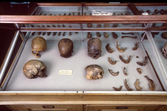
The revelation has been published in Science as part of a wide-ranging international study that genetically analyzed the DNA of a series of famous and controversial ancient remains across North and South America including Spirit Cave, the Lovelock skeletons, the Lagoa Santa remains, an Inca mummy, and the oldest remains in Chilean Patagonia. The study also looked at the second oldest human remains from Trail Creek Cave in Alaska -- a 9,000-year-old milk tooth from a young girl.
Scientists sequenced 15 ancient genomes spanning from Alaska to Patagonia and were able to track the movements of the first humans as they spread across the Americas at "astonishing" speed during the Ice Age, and also how they interacted with each other in the following millennia.
The team of academics not only discovered that the Spirit Cave remains -- the world's oldest natural mummy -- was a Native American but they were able to dismiss a longstanding theory that a group called Paleoamericans existed in North America before Native Americans.
The ground-breaking research also discovered clues of a puzzling Australasian genetic signal in the 10,400 year old Lagoa Santa remains from Brazil revealing a previously unknown group of early South Americans -- but the Australasian link left no genetic trace in North America. It was described by one of the scientists as 'extraordinary evidence of an extraordinary chapter in human history'.
Professor Eske Willeslev, who holds positions both at St John's College, University of Cambridge, and the University of Copenhagen, and led the study, said: "Spirit Cave and Lagoa Santa were very controversial because they were identified as so-called 'Paleoamericans' based on craniometry -- it was determined that the shape of their skulls was different to current day Native Americans. Our study proves that Spirit Cave and Lagoa Santa were actually genetically closer to contemporary Native Americans than to any other ancient or contemporary group sequenced to date."
The Lagoa Santa remains were retrieved by Danish explorer Peter W. Lund in the 19th century and his work led to this 'Paleoamerican hypothesis' based on cranial morphology that theorised the famous group of skeletons could not be Native Americans. But this new study disproves that theory and the findings were published by Professor Willeslev with representatives from the Brazilian National Museum in Rio on Tuesday, November 6 2018.
He added: "Looking at the bumps and shapes of a head does not help you understand the true genetic ancestry of a population -- we have proved that you can have people who look very different but are closely related."
The scientific and cultural significance of the Spirit Cave remains, which were found in 1940 in a small rocky alcove in the Great Basin Desert, was not properly understood for 50 years. The preserved remains of the man in his forties were initially believed to be between 1,500 and 2000 years old, but during the 1990s new textile and hair testing dated the skeleton at 10,600 years old.
The Fallon Paiute-Shoshone Tribe, a group of Native Americans based in Nevada near Spirit Cave, claimed cultural affiliation with the skeleton and requested immediate repatriation of the remains under the Native American Graves Protection and Repatriation Act.
The request was refused because the ancestry was disputed, the tribe sued the federal government and the lawsuit pitted tribal leaders against anthropologists, who argued the remains provided invaluable insights into North America's earliest inhabitants and should continue to be displayed in a museum.
The deadlock continued for 20 years until the tribe agreed that Professor Willeslev could carry out genome sequencing on DNA extracted from the Spirit Cave for the first time.
Professor Willeslev said: "I assured the tribe that my group would not do the DNA testing unless they gave permission and it was agreed that if Spirit Cave was genetically a Native American the mummy would be repatriated to the tribe."
The team painstakingly extracted DNA from the petrus bone from the inside of the skull proving that the skeleton was an ancestor of present-day Native Americans. Spirit Cave was returned to the tribe in 2016 and there was a private reburial ceremony earlier this year that Professor Willeslev attended and details have just been released.
The geneticist explained: "What became very clear to me was that this was a deeply emotional and deeply cultural event. The tribe have real feelings for Spirit Cave, which as a European it can be hard to understand but for us it would very much be like burying our mother, father, sister or brother.
"We can all imagine what it would be like if our father or mother was put in an exhibition and they had that same feeling for Spirit Cave. It has been a privilege to work with them."
The tribe were kept informed throughout the two-year project and two members visited the lab in Copenhagen to meet the scientists and they were present when all of the DNA sampling was taken.
A statement from the Fallon Paiute-Shoshone Tribe, said: "The Tribe has had a lot of experience with members of the scientific community, mostly negative. However, there are a handful of scientists that seemed to understand the Tribe's perspective and Eske Willerslev was one of them.
"He took the time to acquaint himself with the Tribe, kept us well-informed of the process, and was available to answer our questions. His new study confirms what we have always known from our oral tradition and other evidence -- that the man taken from his final resting place in Spirit Cave is our Native American ancestor."
The genome of the Spirit Cave skeleton has wider significance because it not only settled the legal and cultural dispute between the tribe and the Government, it also helped reveal how ancient humans moved and settled across the Americas. The scientists were able to track the movement of populations from Alaska to as far south as Patagonia. They often separated from each other and took their chances travelling in small pockets of isolated groups.
Dr David Meltzer, from the Department of Anthropology, Southern Methodist University, Dallas, said: "A striking thing about the analysis of Spirit Cave and Lagoa Santa is their close genetic similarity which implies their ancestral population travelled through the continent at astonishing speed. That's something we've suspected due to the archaeological findings, but it's fascinating to have it confirmed by the genetics. These findings imply that the first peoples were highly skilled at moving rapidly across an utterly unfamiliar and empty landscape. They had a whole continent to themselves and they were travelling great distances at breath-taking speed."
The study also revealed surprising traces of Australasian ancestry in ancient South American Native Americans but no Australasian genetic link was found in North American Native Americans.
Dr Victor Moreno-Mayar, from the Centre for GeoGenetics, University of Copenhagen and first author of the study, said: "We discovered the Australasian signal was absent in Native Americans prior to the Spirit Cave and Lagoa Santa population split which means groups carrying this genetic signal were either already present in South America when Native Americans reached the region, or Australasian groups arrived later. That this signal has not been previously documented in North America implies that an earlier group possessing it had disappeared or a later arriving group passed through North America without leaving any genetic trace."
Dr Peter de Barros Damgaard, from the Centre for GeoGenetics, University of Copenhagen, explained why scientists remain puzzled but optimistic about the Australasian ancestry signal in South America. He explained: "If we assume that the migratory route that brought this Australasian ancestry to South America went through North America, either the carriers of the genetic signal came in as a structured population and went straight to South America where they later mixed with new incoming groups, or they entered later. At the moment we cannot resolve which of these might be correct, leaving us facing extraordinary evidence of an extraordinary chapter in human history! But we will solve this puzzle."
The population history during the millennia that followed initial settlement was far more complex than previously thought. The peopling of the Americas had been simplified as a series of north to south population splits with little to no interaction between groups after their establishment.
The new genomic analysis presented in the study has shown that around 8,000 years ago, Native Americans were on the move again, but this time from Mesoamerica into both North and South America.
Researchers found traces of this movement in the genomes of all present-day indigenous populations in South America for which genomic data is available to date.
Dr Moreno-Mayar added: "The older genomes in our study not only taught us about the first inhabitants in South America, but also served as a baseline for identifying a second stream of genetic ancestry, which arrived from Mesoamerica in recent millennia and that is not evident from the archaeological record. These Mesoamerican peoples mixed with the descendants of the earliest South Americans and gave rise to most contemporary groups in the region."
210 notes
·
View notes
Text
Early human history
(It’s a little Euro-centric. Sorry about that. Also, please note that many dates are approximate or debated.)
Paleolithic: begins 3,300,000 years before present (YBP), with the earliest use of stone tools by hominins
2,000,000—1,500,000 YBP: hominins begin leaving Africa for southern Europe and Asia
400,000—300,000 YBP: use of fire begins
Middle Paleolithic: 300,000 YBP—50,000 YBP
People live in hunter-gatherer bands. Use of knapped stone tools. Nomadic. Much leisure time; often hungry. Begin to produce works of art: cave painting, rock art, jewelry, etc. Beginning of religious behavior such as burial and ritual.
300,000 YBP: appearance of Homo sapiens
250,000 YBP: appearance of Homo neanderthalensis
200,000 YBP: Homo sapiens sapiens appears (eastern Africa)
170,000 YBP: humans are wearing clothes by this date
70,000 YBP: earliest example of abstract or symbolic art (cross-hatch, South Africa)
67,000—40,000 YBP: Neanderthal admixture to Eurasian humans
Upper Paleolithic: 50,000—10,000 YBP. Begins with a marked increase in the diversity of artifacts. Campsites with storage pits. Artistic work blossoms. First evidence of fishing. More complex social groupings, due to more varied/reliable food sources and specialized tool types.
50,000 YBP: Homo sapiens sapiens begins to leave Africa
50,000 YBP: 1st sewing needles found
50,000—40,000 YBP: possible development of language.
50,000—40,000 YBP: Homo sapiens sapiens is in Australia
45,000—43,000 YBP: European early modern humans
42,000 YBP: earliest evidence of advanced deep-sea fishing (East Timor): could make ocean crossings to Australia and other islands
40,000 YBP: Neanderthal extinction
40,000 YBP: oldest known figurative art
40,000—20,000 YBP: oldest known ritual cremation (Australia)
36,000 YBP: Humans are in Japan
35,000 YBP: oldest known figurative art of human figures (rather than zoomorphic humanlike figures)
33,000 YBP: oldest known domestic dog skull found (Europe and Siberia)
31,000 YBP: last glacial maximum (many humans forced out of northern Europe by glaciers)
30,000 YBP: spear-thrower/atlatl is in use
30,000 YBP: oldest known calendars (Dordogne, France: a lunar calendar, possibly used to time hunting expeditions)
29,000 YBP: earliest known ovens
28,000 YBP: oldest found twisted rope
28,000—24,000 YBP: oldest known pottery (figurines, not vessels)
27,000 YBP: humans are in Siberia, above the arctic circle
26,000 YBP: people around the world use fiber work
25,000 YBP: Oldest known permanent settlement (Czech Republic)
25,000 YBP: bow and arrow are in use
22,000 YBP: nets, bolas are in use
20,000 YBP: oldest pottery storage/cooking vessels (China)
16,000—13,000 YBP: first human migration into North America
16,000—11,000 YBP: Caucasian hunter-gatherer expansion into Europe
15,000—14,700 YBP: earliest supposed domestication of the pig
14,000—13,000 YBP: blue eyes first appear (Italy and Caucasus)
14,000—12,000 YBP: oldest evidence for prehistoric warfare (Sudan)
13,000—10,000 YBP: end of last glacial period, climate warms, glaciers recede
13,000 YBP: flood on Lake Agassiz in North America may account for American deluge myths. Other floods in this era in the Middle East may be the origins of the Noah/Utnapishtim myths.
13,000—11,000 YBP: earliest proposed domestication of sheep
12,9000—11,700 YBP: Younger Dryas: period of sudden cooling and return to glacial conditions
12,000 YBP: earliest suggested domestication of the goat
11,000 YBP: blond hair appears in Europe
11,600 YBP: Abrupt period of global warming accelerates glacial retreat
11,000 YBP: earliest found proto-religious site on earth (Gobekli Tepe, Turkey)
11,000 YBP: emergence of Jericho, one of the oldest continuously inhabited cities in the world
11,000 YBP: giant short-faced bears and giant ground sloths go extinct. Equidae goes extinct in North America
10,500 YBP: earliest supposed date for domestication of cattle
Neolithic: begins 10,000 BYP. The terms “Neolithic” and “Bronze Age” are culture-specific to the Old World, whose stages of cultural development were different than those of the New World. Neolithic Revolution/Agricultural Revolution saw the change from mostly nomadic hunting/gathering to agriculture and settlement. The “Bronze Age” refers to the development of the use of bronze, possibly proto-writing, and urban civilization.
10,000 YBP: beginnings of permanent settlements and agriculture
10,000 YBP: domestication of maize (southern Mexico)
10,000 YBP: Quaterny extinction event concludes: many ice-age megafauna go extinct, including megatherium (giant ground sloths), woolly rhinoceros, Irish elk, cave bears, cave lions, saber-toothed cats. Mammtho goes extinct in Eurasia and North America, preserved in small island populations until ~3650 BYP/1650 BCE
10,000—9,000 YBP/8000—7000 BCE: In northern Mesopotamia, cultivation of barley and wheat begins, initially for beer/gruel/soup, and then for bread. Begins with a planting stick, and then a primitive plow. Round stone tower built in Jericho.
10,000—5,000 YBP/8000—3000 BCE: Identical ancestors point: all the common ancestors of all present-day humans were alive during this era.
9,500 YBP/7500 BCE: earliest supposed domestication of the cat
8,000—5,000 YBP/6000—3000 BCE: development of proto-writing in China, southeast Europe (Vinca symbols) and west Asia (proto literate cuneiform).
6,500—4,500 YBP (4500—2500 BCE): Proto-Indo-European spoken north of the Black Sea
6,200 YBP/4200 BCE: domestication of cotton in Peru
6,000 YBP/4000 BCE: civilization develops in Mesopotamia/Fertile Crescent (Iraq). Earliest supposed dates for domestication of horse and chicken. Invention of potter’s wheel.
5,700 YBP/3700 BCE: Minoan culture begins on Crete
5,500 YBP/3600—3500 BCE: Uruk period in Sumer. First evidence of mummification in Egypt.
5,500 YBP/3500 BCE: oldest known depiction of a wheeled vehicle (Poland)
5,400—4,300 YBP/3400—2300 BCE: domestication of cotton in Mexico
5,300 YBP/3000 BCE: Bronze Age begins in near east. Newgrange built in Ireland.
5,200 YBP/3200 BCE: Norte Chico civilization in Peru
5,150 YBP/3150 BCE: first dynasty of Egypt
5,100 YBP/3100 BCE: Skara Brae, Scotland
5,000—4,000 YBP/3000—2000 BCE: Stonehenge built (smaller stone circle)
~5,000 YBP/3000 BCE: Egyptian calendar invented
5,000 YBP/3000 BCE: first known use of papyrus, Egypt
4,700 YBP/2700 BCE: Old Kingdom begins, Egypt
4,600 YBP/2600 BCE: writing developed in Sumer and Egypt: beginning of recorded history
Ancient history
4,600 YBP/2600 BCE: oldest known surviving literature, Sumerian
4,600 YBP/2600 BCE: emergence of Maya culture, Yucatan
4,560 YBP/2560 BCE: Great Pyramid completed, Egypt
4,560 YBP/2560 BCE: Land of Punt (Horn of Africa) appears in Egyptian records
4,500—3,500 YBP/2500—1500 BCE: Kerma culture in Nubia
4,500 YBP/2500 BCE: Mammoth goes extinct
4,200 YBP/2200 BCE: Stonehenge completed in its current form
4,100 YBP/2100 BCE: 5 Sumerian poems of Bilgamesh, King of Uruk are composed: origin of the Epic of Gilgamesh
4,000 YBP/2000 BCE: domestication of the horse
3,780 YBP/1780 BCE: oldest record of the Code of Hammurabi
3,600 YBP/1600 BCE: Eruption of Thera (Santorini), resulting in tsunamis that cause the collapse of Minoan civilization on Crete: possible origin of Atlantis myth
3,600 YBP/1600 BCE: Mycenaean Greek culture. Shang Dynasty in China. Beginning of Hittite dominance in eastern Mediterranean.
3,500 YBP/1500 BCE: Composition of Rigveda completed
3,450 YBP/1450 BCE: Mycenaen Greece, first deciphered writing in Europe
3,400—2,400 YBP/1400—400 BCE: Olmec civilization, Mexico
3,200 YBP/1200 BCE: Oracle bone script, first written records in Old Chinese
3,200—3,150 YBP/1200—1150 BCE: Bronze Age collapse in southwest Asia and eastern Mediterranean, the setting of the Iliad and Odyssey (composed about 400 years later)
3,180 YBP/1180 BCE: Disintegration of the Hittite Empire
3,100 YBP/1100 BCE: use of iron spreads
3,050—2,800 YBP/1050—800 BCE: alphabetic writing; Phoenician alphabet spreads around the Mediterranean.
3,046 YBP/1046 BCE: Zhou Dynasty, China
~3,000 YBP/1000 BCE: Rule of King David, Israel. First temple completed.
2,890 YBP/890 BCE: composition of the Iliad, Odyssey
2,800 YBP/890 BCE: rise of the Greek city-states
2,785 YBP/785 BCE: rise of the Kingdom of Kush
Classical Antiquity
776 BCE: first recorded Olympic games
753 BCE: founding of Rome (according to tradition)
745 BCE: Tiglath-Pileser III is King of Assyria (founds Assyrian Empire)
660 BCE: first Emperor of Japan (according to tradition)
653 BCE: rise of the Persian Empire
612 BCE: fall of the Assyrian empire
600 BCE: evidence of writing system, Zapotec civilization, Oaxaca, Mexico
563 BCE: Buddha born
551 BCE: Confucius born
550 BCE: founding of Persian Empire by Cyrus the Great
549 BCE: Mahavira, founder of Jainism, born
539 BCE: fall of Babylonian Empire (liberation of Jews by Cyrus the Great)
509 BCE: founding of the Roman Republic (according to tradition)
508 BCE: democracy instituted at Athens
~500 BCE: completion of the Euclid’s Elements
500 BCE: Pingala uses zero and binary numeral system (India)
499 BCE: beginning of Greco-Persian wars
480 BCE: Battle of Thermopylae
475 BCE: Warring States period begins in China
470 BCE: Birth of Socrates
449 BCE: end of Greco-Persian wars
447—432 BCE: Building of Parthenon in Athens
427 BCE: birth of Plato
389 BCE: birth of Aristotle
323 BCE: death of Alexander the Great
300 BCE: construction of the Great Pyramid of Cholula begins in Mexico
260 BCE: earliest written records in south Asia (Middle Indo-Aryan)
221 BCE: Beginning of imperial rule in China, Qin Dynasty, beginning of construction of the Great Wall of China
206 BCE: Han Dynasty begins, opens Silk Road
202 BCE: Scipio Africanus (Rome) defeats Hannibal (Carthage)
200 BCE: paper invented in China
166 BCE: Maccabees defeat Seleucide Empire’s army. Hasmonean Dynasty begins in Judea.
146 BCE: Roman conquest of Greece
44 BCE: Julius Caesar murdered
37 BCE: Herodian Dynasty founded, making Judea a Roman client state
27 BCE: Formation of the Roman Empire (under Octavius); Pax Romana begins
18 BCE: Temple of Jerusalem reconstructed under orders by Herod
4 BCE: birth of Jesus
29 CE: crucifixion of Jesus
43 CE: Rome enters Britain for first time
68 CE: Nero dies; Year of Four Emperors
70 CE: Destruction of Jerusalem by the armies of Titus
79 CE: Destruction of Pompeii
220 CE: Three Kingdoms period begins in China
280: Jin Dynasty, China
285: Diocletian splits Roman Empire into East and West, begins large-scale persecution of Christians
292: Capital of Roman Empire officially moved from Rome to Milan
313: Edict of Milan allows religious freedom in the Roman Empire
325: First council of Nicaea
330: Constantinople named; becomes capital of Eastern Roman Empire
354: birth of Augustine of Hippo (Roman Numidia; present-day Algeria)
380: Arianism declared heretical by Theodosius I, Eastern Roman Emperor
395: Theodosius I outlaws all religions but “Catholic” Christianity (meaning non-heretical, officially condoned Christianity: not the same as the modern Catholic church)
406: Romans expelled from Britain
407-409: Germanic tribes (Visigoths etc.) cross into Roman Gaul for the first time
410: Visigoths sack Rome
429-439: Vandals conquer large stretch of North Africa
455: Vandals sack Rome
476: Last Western Roman Emperor (Romulus Augustulus) forced to abdicate by Odoacer, Chief of the Heruli. Official end of Ancient History.
56 notes
·
View notes
Photo

Acoma Pueblo - or Sky City - is built atop a sheer-walled, 367-foot sandstone bluff in a valley studded with sacred, towering monoliths. Archaeologists have carbon dated remains in the Pueblo to 1150 A.D., though some evidence suggests the Acoma people may have been there centuries before. Today the pueblo is said to be the oldest continuously inhabited community in North America. The bluff shown in the distance of the 5th image is said to have been the first settlement that the Acoma people were called to and their pilgrimage to find a permanent home. Archaeologists have found evidence of settlement on the bluff, which today is no longer accessible. During the era of Spanish colonialism, Spanish explorers repeatedly came to the Acoma people's lands. The first decided to leave the village alone after they realized it wasn't gold they were seeing sparkling on the Pueblos, but simply shimmering mica windows. Future waves, however, insisted on colonizing the pueblos. After successfully fighting back several attempts, the Acoma were eventually overtaken in 1599 during what is known as the Acoma massacre - over 800 men women and children were killed during the three-day battle for control of the pueblo. As punishment for their rebellion, the Spanish missionaries forced the Acoma men to walk all the way to the mountain showed in the 8th photo to collect timber to build the Spanish church. Construction began in 1629 on the massive San Esteban del Rey Mission - using exclusively slave labor - and took years to complete. During the time of Spanish rule, the Acoma we're forbidden to practice their religion. They used the white ladders to mark their secret worship kivas. The Acoma won back their freedom in the Pueblo Revolt of 1680—also known as Popé's Rebellion. This uprising of the indigenous Pueblo people against the Spanish colonizers was said to be the only successful thwarting of a monarchy by indigenous peoples. The rebellion killed 400 Spanish and drove the remaining 2,000 settlers out of the province. . . #acoma #acomapueblo #newmexico #igersnewmexico #travelphotography #southwest #bigsky #explorepage #explore #exploreeverything (at Acoma Pueblo, New Mexico) https://www.instagram.com/p/Bz-kpRWpoeW/?igshid=1amddc77giemt
#acoma#acomapueblo#newmexico#igersnewmexico#travelphotography#southwest#bigsky#explorepage#explore#exploreeverything
1 note
·
View note
Link

7 Continents of the World and their Countries
The continents are the large tracts of land that we can see on our planet. They are inhabited by terrestrial organisms, such as human beings, chimpanzees or lions. We have small lands, known as islands, where existence is also possible, but which alone could not form a continent. There are 7 continents on the planet, although many people combine Asia and Europe into one, known as Eurasia. On the other hand, others decide to combine North America with South America, creating the American continent.
In general, the recognized continents are Africa, Antarctica, Asia, Australia, Europe, North America and South America.
CONTINENT AREA (KM) POPULATION MOST POPULOUS CITY Asia 43,820,000 20,185,064 Shanghai, China Africa 30,370,000 1,002,234,000 Lagos, Nigeria Antarctica 13,720,000 4,490 McMurdo Station, US Australia 3,478,200 29,127,000 Sydney, Australia Europe 3,390,000 738,199,000 Moscow, Russia North America 9,460,000 542,056,000 Mexico City, Mexico South America 6,890,000 392,555,000 Sao Paulo, Brazil
Asia
Asia is a continent bounded by the border of Europe, containing part of Russia in its interior
Asia is the largest continent and contains the largest population, approximately 4.3 billion people. This is why it is an important part of the world economy. It is located in the northern and eastern hemispheres, occupying 30% of the total land area. It is also known for its dense settlements and for containing large overpopulated regions.
It contains 60% of the population of the planet, an amazing fact if we compare it with the rest of the continents.
The boundaries of this continent are not established exactly so the separation between Europe and Asia is quite diffuse. Hence, many people call both continents Eurasia, considering them one. In the eastern part, Asia is bathed by the Pacific Ocean, on the south by the Indian Ocean and on the north by the Arctic Ocean.
The continent is known to have a wide variety in terms of culture, environments, ethnic groups, its economic and historical past and its systems of government.
Africa
The African continent has a large number of inhabitants, with ages less than nineteen
Africa is the second largest continent in the world, being also the second with the largest population. It is made up of 54 countries that make up the home of more than one billion people. Approximately 15% of the world's population lives on this continent.
Africa is located in the center of the Earth so that Ecuador passes through its center. It is the only continent that extends from the north, with colder temperatures, towards the south, with more temperate zones, although in general, its climate is tropical. According to the historians in this continent, the birth of the human species is located, since the oldest fossils were found in it. At present, many different species live on their land.
On the north, it is bathed by the Mediterranean Sea, on the southeast by the Indian Ocean, on the northeast by the Suez Canal and the Red Sea, and on the west by the Atlantic Ocean. The African population is the youngest in the world, perhaps due to the shortest life expectancy, to contract diseases, due to the continuous wars and the nonexistent birth control. Approximately 50% of its residents are under 19 years of age.
Antarctica
The continent of Antarctica is a very cold climate and sex that allows the survival of species very different from other places
Antarctica is the continent that is located to the south, located on it the South Pole land and consisting mostly of permanent glaciers. It is one of the places on the planet where life is more complicated. Therefore, it has a very small population, less than 5,000 residents, being the continent with the smallest number of inhabitants.
Approximately 98% of its surface is covered by ice of a thickness of 1.9 kilometers.
It is the fifth largest continent, having twice the size of Australia. It is known for having a dry, cold climate and being the windiest. It contains the highest elevation of the seven continents, reaching -89 degrees of temperature. This hostile environment causes few organisms to survive and there are few resources, so for a long time remained unexplored.
Australia

Representation of the Australian continent on a map with its different cities and deserts
The Australian continent is the smallest of the seven, being called by some as the continent island. It is surrounded by the Indian Ocean and the Pacific Ocean is very rich in biodiversity and ecosystems. It is composed of a large number of islands, highlighting the island of Tasmania. Among the closest neighboring countries, we find Indonesia, the Solomon Islands, New Zealand or New Guinea.
It contains the Great Barrier Reef, the world's largest reef, which extends up to 2,000 kilometers northeast of the Australian coast and, the largest monolith on Earth, Mount Augustus.
Before British settlers arrived, Australia was inhabited by Indians, for approximately 40,000 years, so it counted on 250 different language groups. Today, it is considered one of the richest countries in the world, as well as one of the most developed. In addition, it is classified as one of the main countries in terms of quality of life, education, health, economic freedom, and also in the protection of political rights and freedoms.
Europe

Classification of the European Union with the different flags of each country
Europe is the second smallest continent in the world. It contains 50 countries and is the third largest population, after Asia and Africa. Russia is the largest European country, accounting for 40% of its surface. Know that this country also has part of its territory on the Asian continent.
It is divided from Asia by the basin that divides the Ural Mountains and the Caucasus, the Urals River, the Caspian Sea, the Black Sea and the water courses that connect the Black Sea with the Aegean Sea. Europe is surrounded by the Arctic Ocean in the north, by the Atlantic Ocean in the west and by the Mediterranean Sea in the south and east.
The ancient Greece of Europe is known to be the birthplace of Western culture. Since the beginning of the 15th century, it has played a very important role in history, even during the industrial revolution. During the sixteenth and twentieth centuries the countries of Europe were controlled by America, some parts of Africa and Oceania. This is due to the strategic situation between America and the rest of the continents. However, at present, it begins to have a great influence on the rest of the countries and continents.
North America

The North American continent seen from above, in all its extension and surrounded by different oceans
The North American continent resides in the northern part of the hemisphere. It is surrounded by the Arctic Ocean in the north, by the Atlantic Ocean in the east, by the southwest by the Pacific Ocean and by the southeast by the Caribbean Sea. Its population amounts to 565 million people, containing 7.5% of the world's population.
Much of the area of this continent is dominated by Canada, the United States of America, Greenland, and Mexico. Although it also contains small states from Central America and the Caribbean regions.
South America

Outline of the most outstanding elements of South America
South America is located in the western hemisphere with much of its surface in the southern part and a small portion in the northern hemisphere. It is surrounded by the Pacific Ocean, on its west side, by the Atlantic Ocean on the north and east side, and by the northwest by the Caribbean Sea. It is considered the fourth largest continent, and the fifth in terms of population.
It has great diversity in terms of geography and biodiversity. In Venezuela, there is the highest waterfall in the world, known as El Salto del Ángel. The Amazon River is the largest in the world and the Atacama Desert is also located within this continent. Its biodiversity is characteristic of the place, with unique animal species, such as the anaconda, or the jaguar. Its tropical forests contain the largest proportion of species on the planet. Brazil is the largest country in this continent, occupying more than half of its surface.
Most of the population is located on the west and east coasts, while the southern and inland areas have fewer inhabitants. South America was colonized during long periods of history, by the Spanish and Portuguese, helping these languages to expand through these territories until the present time.
2 notes
·
View notes
Text
Turning 21: The Transition from Territory to Statehood in Illinois
Illinois became the 21st state in the Union on December 3, 1818, making 2018 its Bicentennial year. This month we are joining other Chicago-area cultural heritage institutions in celebrating the Illinois' Bicentennial by hosing a special pop-up display of archival documents and rare books from our collections: correspondence, maps, books, and more that date to the time period when Illinois was transforming from French-held "Illinois Country" to the 21st state in the Union.
This exhibit is a part of Chicago Open Archives, a month-long series of events throughout the city and suburbs connecting community members with the collections, programs, and services of local archival repositories. Learn more at http://chicagoarchivists.org/coa
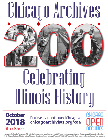
The physical exhibit of reproductions will be on display at the University of Chicago's Joseph Regenstein Library throughout the month of October, with some original materials on display in the Special Collections Research Center. For those of you who cannot visit in person, scroll down for a virtual view of our selections for this exhibit.
Transition from Territory to Statehood in Illinois
The oldest item displayed is a 1778 letter that was written when Illinois was a part of the American Revolutionary War's western theater. The letter, signed by George Wythe, George Mason, and Thomas Jefferson, congratulates George Rogers Clark on his appointment as the leader of a military expedition to the Northwest Territory. This was the beginning of a secret mission during the war later known as the Illinois Campaign, or Clark's Northwestern Campaign. Clark was ordered to seize control of Kaskaskia, Vincennes, and several other villages in French and British-held "Illinois Country." In the letter, the Virginia General Assembly mentions Native American raids in the territory which were instigated by the British. They also assure Clark that he and his soldiers will receive bounties of land as compensation. The nearby hand-drawn plat map demarcates the tract of 150,000 acres granted to Clark's soldiers in 1784.

Transcription of letter:
To George Rogers Clark Williamsburg Janry 3, 1776
Sir,
As some Indian Tribes to the westward of / the Missisippi have lately, without any provo- /cation massacred many of the Inhabitants upon / the Frontiers of this Commonwealth, in the / most cruel & barbarous manner, & it is intended / to revenge this injury & punish the Aggressors / by carrying the war into their own country. / We congratulate you upon your appoint / ment to conduct so important an Enterprize / in which we most heartily wish you / Success, and we have no Doubt that some / further reward in Lands in that country / will be given to the Volunteers who shall / engage in this Service, in addition to the / usual pay. If they are so fortunate to / Succeed, We think it just & reasonable that / each Volunteer entering[?] as a common Soldier in this Expedition, should be allowed three / hundred acres of Land, & the Officers in the / usual proportion, out of the Lands which may be conquered in the country now in / the possession of the said Indians; so as / not to interfere with the claims of any / friendly Indians, or of any people willing / to become Subjects of this Commonwealth, / and for this we think you may safely / confide in the justice & generosity of the / Virginia Assembly.
We are Sir Yr Most Hble. Servts
G. Wythe G. Mason Th. Jefferson
Letter from Virginia General Assembly to George Rogers Clark, January 3, 1778. Historical Manuscripts Collection, Box 24, Folder 15.
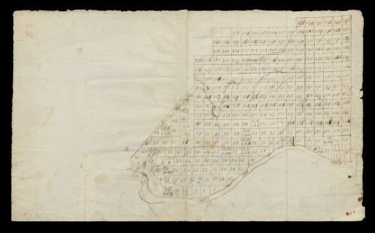
Plat of the Illinois Grant, 1784. Reuben T. Durrett Collection of Portraits, Illustrations, and Cartographic Material, Box 2, Folder 12.
Following the Revolutionary War, some, such as Gilbert Imlay, profited from the land grant system as surveyors. The 1797 edition of Imlay's popular A topographical description of the western territory of North America… served as an encyclopedia of North America for new settlers.
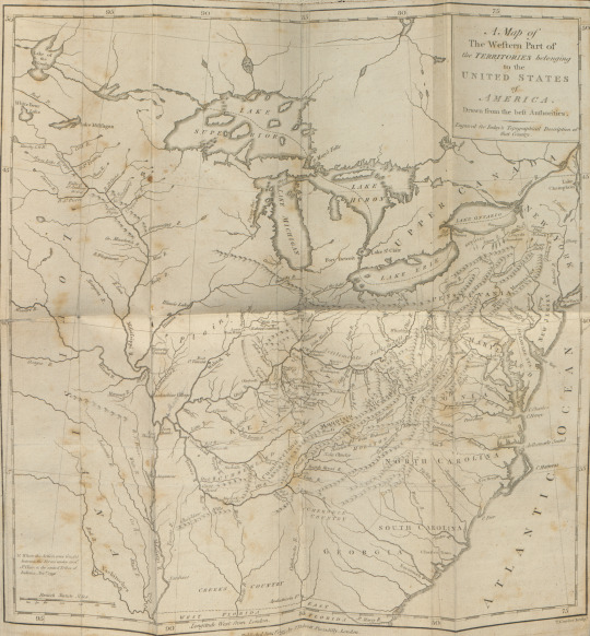
Imlay’s description of the Illinois country:
“The triangular tract of land at the head of this great vale, and between the Mississippi, the Ohio, and lake Erie (as that lake is vulgarly called), the country of the Illinois, is the finest spot of earth upon the globe, swelling with moderate hills, but no mountains, watered by the finest rivers, and of the most delightful climate; the soil, as appears from the woods with which it is clothed, is of the most abundant fruitfulness in vegetation. It abounds with coal; and there are multitudes of salt springs in all parts of it. There are mines of iron, copper, and lead. Wild rye grows here also spontaneously.” (p. 101)
Imlay’s Topographical description also reproduced the text of one Mr. Patrick Kennedy’s journal of an expedition in 1773 from Kaskaskia to the head of the Illinois river.


Imlay, Gilbert (1754?-1828?). A topographical description of the western territory of North America… London: Printed for J. Debrett, 1797. F352.I33 Rare c.1
The practice of granting Illinois land to volunteer soldiers continued in the War of 1812. American Nicholas Biddle van Zandt's 1818 Description of Military Lands describes three tracts of bounty lands, including the Illinois Military Tract which was situated between the Mississippi and Illinois rivers. The aim of Van Zandt’s text was to “give a faithful, a substantial, and, it is hoped, a satisfactory view of the Illinois and Missouri territories” and to aid settlers in selecting “the very spot upon which he may fix his habitation and his home.” Van Zandt also describes the Illinois Territory as a whole including an early description of the Chicago River and its potential as a “safe and commodious harbor for shipping” and the means by which the sand bank blocking the entrance to Lake Michigan might be removed.


Van Zandt, Nicholas Biddle. A full description of the soil, water, timber, and prairies of each lot, or quarter section of the Military Lands between the Mississippi and Illinois rivers. Washington City: Printed by P. Force, 1818. F547.M6 V28 1818 Rare c.1
Numerous accounts of the Illinois Territory were published, many with hopes of attracting emigrants. Irish author Thomas Ashe expounded upon the natural history of the area in Memoirs of mammoth, and various other extraordinary and stupendous bones…
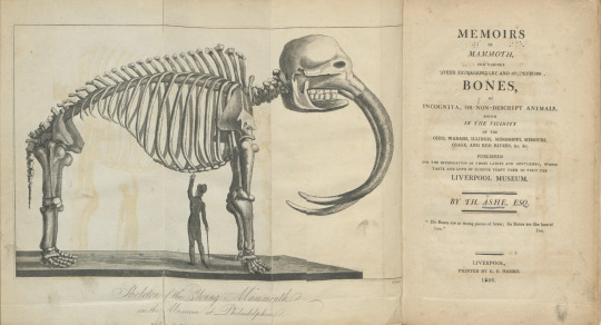
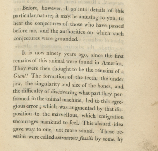
Ashe, Thomas (1770-1835). Memoirs of mammoth, and various other extraordinary and stupendous bones … found in the vicinity of the Ohio, Wabash, Illinois, Mississippi, Missouri, Osage, and Red Rivers. Liverpool: Printed by G. F. Harris, 1806. QE882.U7A8 Rare c.1
Adlard Welby’s A Visit to North America and the English Settlements in Illinois with a Winter Residence in Philadelphia included a description of the German settlement of Harmony, Illinois. Harmony was a settlement mostly comprised of poor Germans, though any person who agreed to live by the communal rules was allowed to join the community. The settlement lived by the principle of a communion of goods. That is, all of the harvested crops went into a communal store, and each person received the necessary amount of food. The tavern owner told author Adlard Welby: “We have every thing we can want, for our comfort and something more.”
Welby, Adlard. A Visit to North America and the English Settlements in Illinois with a Winter Residence in Philadelphia. London: Printed for J. Drury, 1821. E41.W44 1821 Rare c.1
Morris Birkbeck, a British emigrant to the Illinois Territory who would later serve as Secretary of State of Illinois, described his American travel experiences and the establishment of the English Settlement, in Illinois Territory in Notes on a journey in America, from the coast of Virginia to the Territory of Illinois. First published in Philadelphia 1817, Notes, and its follow up, Letters from Illinois (1818), were wildly popular with multiple editions being published both in the United States and abroad, including multiple translations. The hand-colored map on display was published in the 1st London edition of Birkbeck’s Notes and includes all of the land traversed by Birkbeck’s party. Note the interesting placement of the borders of Indiana and the Illinois Territory; the location of Birkbeck’s settlement in the southeastern portion of the territory, on the Little Wabash River is captioned “The Prairie Settlement.”

Birkbeck, Morris (1764-1825). Notes on a journey in America: from the coast of Virginia to the Territory of Illinois. London: Printed by Severn & Redington, for Ridgway and Sons, 1818. E162.B617 1818 Rare c.1
Birkbeck’s Letters from Illinois recounts his experiences living in the English Settlement and served to introduce Europeans (and hopefully convince them to emigrate) to the advantages of America.
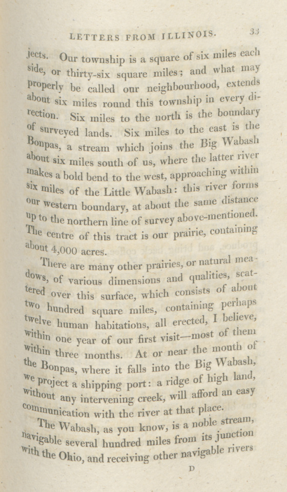
Birkbeck, Morris (1764-1825). Letters from Illinois. London: Printed for Taylor and Hessey, 1818. F545.B61 Rare c.1
British emigrant John Woods’ Two years’ residence describes his journey from England to the English Settlement in Illinois, along with the flora, fauna, agriculture, buildings, and business in the region. Woods' “Map of the allotments” shows the towns and ranges of the lower portion of Illinois.

Woods also provided a description of Birkbeck’s settlement, Wanborough:
“Mr. Birkbeck’s settlement, called Wanborough, is situated at the north-west corner of the English Prairie, and contains 25 cabins, a tavern, a store or two, and several lodging houses; and several carpenters, bricklayers, brick-makers, smiths, wheelwrights, and sawyers; also a taylor and butcher ... The building lots, at Wanborough, are some of five, and others of two and a half acres, laid out, like most of the American towns, in streets that cross each other at right angles, running north and south; the cross ones east and west. The lots are in the woods, but a considerable quantity of the wood is now cleared.” (p. 160-161)
Woods, John (-1829). Two years’ residence in the settlement on the English Prairie, in the Illinois country, United States: with an account of its animal and vegetable productions, agriculture, &c. &c., with the habits and customs of the back-woodsmen. London: Printed for Longman, Hurst, Rees, Orme, and Brown, 1822. F547.E2W9 1822 Rare c.2
As Illinois inched closer to statehood in 1817, Cook and Blackwell - the first printers in Illinois - published a list of laws, many to establish county seats and courthouses. (Cook County, Illinois is named for printer Daniel Cook).
Laws passed by the Legislative council, and House of representatives, of Illinois territory, at their fifth session, held at Kaskaskia, 1816-'17. Kaskaskia, I.T.: Printed by Cook and Blackwell, printers to the territory, 1817. KFI1225.2 1816, Lincoln Collection
Counties and major cities in early Illinois were very different from what they are now. Kaskaskia was the capital of the Illinois Territory from 1809 to 1818. Located on the Mississippi River, it was flooded many times and the decision was made to move the capital to Vandalia in 1819, 70 miles northeast of St. Louis. Louis Beck's 1823 A gazetteer of the states of Illinois and Missouri… includes a plan for the new capital and the neighboring streets. It also describes Chicago as a small place of 10 or 15 homes in Pike County.


Beck, Lewis C. (1798-1853). A gazetteer of the states of Illinois and Missouri…Albany: Printed by C.R. and G. Webster, 1823. F539.B390 Rare c.1
#illinois#english settlement#illinois territory#statehood#chicago open archives#illinois country#early chicago#kaskaskia#vandalia
39 notes
·
View notes
Text
REASONS WHY THE DOMINICAN REPUBLIC SHOULD BE ON YOUR TRAVEL WISH LIST
Of the 25 countries in the Caribbean, the Dominican Republic is ranked at the top with awe-inspiring beaches, year-round golf, a rich culture, the tallest mountain peak in the Caribbean, and a fast-growing economy. In fact, this country neighboring Haiti is considered the second largest gold mine in the world filled with opportunities. It’s no wonder that the Dominican Republic has taken the lead as a top destination location for tourists with direct international flights, grand accommodations, a wide array of things to do, and of course, the Dominican Food.
The Dominican Republic has more than five international airports scattered across the island, Punta Cana and Las Americas being the most popular, with over 50 airline services. There are numerous American Airlines, Delta, JetBlue Airways, United, and Spirit Airlines flights daily flying direct to locations around the world. Not only is it easy to get to the island from anywhere, but upon arrival tourists simply purchase a $10 “tourist card” that serves as a visa. The immigration process is quick and straightforward, and the airports are easy to navigate.
The Dominican Republic is known for its’ superb amenities and impressive accommodations. Punta Cana, located on the easternmost tip of the island, is known for its 32km stretch of clear waters and beaches and is home to resorts and hotels appreciated by tourists from around the world. Take for example the Occidental Punta Cana with direct access to El Cortesito beach. This hotspot has recently been renovated boasting a relaxed resort vibe. Here, accommodations are spread out, maximizing the space of the property, guaranteeing guests space to escape into tranquil peace. For those looking to get active, there are funky foam parties, dance lessons, kayaks for rent, yoga classes, rotating nightly entertainment and more. At this resort and many others located in the heart of Punta Cana, guests come from around the world to enjoy the Caribbean resort lifestyle.
Just north along the coast sits Bávaro beach with crystal clear calm waters protected by a coral reef. This sandbar is the ideal natural swimming pool filled with little fish. Barceló Bávaro Grand Resort, nestled next to this stretch of calm ocean, offers many activities for guests like paddle boards, non-motorized sports, beach volleyball and soccer, water polo, a casino, and a shopping promenade. Guests also have access to banana boat rides, windsurfing, jet skis, catamarans, and scuba diving. With all of these action activities, Barceló Bávaro Grand Resort also has the infamous U-Spa with hydrotherapy, thermal pools, and massage therapies to relax and unwind. This resort provides for vacation go-getters and those who prefer to rest and relax.
Santo Domingo, the nation’s capital, is full of life. When visiting the city look no further than staying at El Embajador, A Royal Hideaway Hotel. This hotel, located in the center of city life, has expansive gardens and a beautiful outdoor pool hidden away from the concrete jungle outside. The hotel has been renovated and completely modernized except for the lobby, boasting its traditional look full of artwork with a grand piano. The hotel has two restaurants overlooking the gardens, and if you listen carefully, you can hear the bright green cotorra “pirate” birds chirping. El Embajador creates the perfect balance for guests looking to experience the city with an escape to nature.
Whether you choose to stay on the eastern side of the island in Punta Cana and Bavaro or venture to the capital, Santo Domingo, there is much to do outside of the resorts. On the east, if you choose to step away from the piña coladas and shoreline, check out whale watching, explore DownTown Punta Cana, shop for local amber and larimar, go dancing, or catch a baseball game. Explore hidden caves, hike the 27 waterfalls, or swim in natural lagoons. There is never a shortage of adventures on the east coast.
Make your way to Santo Domingo. This lively city is home to roughly three million people and has preserved many historical sites for residents and tourists to enjoy. Most notably, the Colonial Zone was the first permanent settlement of the Americas and to this day remains the oldest continually inhabited city. The very first cathedral, castle, monastery, hospital, university, and fortress built in the New World still stand along with the residence of Christopher Columbus’ son, Diego Colon called the Alcazar de Colon. All of these historic sites are open to the public, and the square is filled with families picnicking, couples sharing ice cream, and vendors selling snacks from carts.
The Dominican Republic is dense in culture, and one thing that cannot be overlooked is the Dominican food. The island is full of delicious fruit, like mango, passionfruit, banana, plantain, guava, papaya, starfruit, pineapple, avocado, coconut, and lime, just to name a few. There are also stand out specialties worth trying like Mangú, made of mashed plantains, Tostones, made by frying plantains, Sancocho, essentially a meat and root vegetable stew, and Tres Leches, a dessert made with three kinds of milk. Resorts across the island offer both traditional island food choices as well as a plethora of common gourmet options from around the world, ensuring every palate is satisfied!
The Dominican Republic is the perfect place to visit for families, couples, and singles looking to explore a new place and enjoy the island lifestyle. There is never a shortage of activities to do, foods to try, or people to meet. Add the Dominican Republic to your travel wish-list and start planning the getaway of a lifetime!
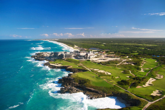
1 note
·
View note
Text
27 of the Best Things to do in Bermuda
New Post has been published on https://www.travelonlinetips.com/27-of-the-best-things-to-do-in-bermuda/
27 of the Best Things to do in Bermuda
Looking for things to do in Bermuda? Look no further, because you are going to love these ideas. Often mistaken for a Caribbean vacation destination, Bermuda is actually located in the North Atlantic Ocean, but thanks to the Gulf Stream, it remains a comfortable temperature throughout the year.
Bermuda is only a 2-hour flight from New York, 3-hours from Toronto, and less than 7 hours from London England, making it an ideal beach vacation for everyone! With its colonial past, restaurants, and museums, there are plenty of things to see and do, even when the temperature dips to around 60 degrees. There are so many places to visit in Bermuda, it will surprise you for a small island.
Things to do in Bermuda
1. Take a Jet Ski Tour from South Hampton
Get out on the water and explore by Jetski
A Jet Ski Tour takes you all around the harbor and outer island to see places in Bermuda that you might not get to visit. This is a very cool way to see Bermuda’s multimillion-dollar mansions, the H.M.S. Vixen shipwreck, and to feed the fish that love flocking to the jet skis for little bits of bread. When you are on a jet ski, you really get to see the beauty of Bermuda’s turquoise waters.
2. World’s Smallest Drawbridge, Somerset Bridge
While on our jet ski tour we passed the smallest working drawbridge in the world. Somerset Bridge is a fun attraction in Bermuda connecting Somerset Island with the main island. Dating back to 1620, the bridge is such a symbol of Bermuda, it is featured on the Bermuda dollar. Operated by hand, the tiny 32-inch gap is just enough to allow a sailboat’s mast to go through.
3. Explore Saint George’s
Visit Saint George, Bermuda
Saint George is a UNESCO World Heritage Site as it is the oldest continuously inhabited English settlement in the Western Hemisphere. With Colonial buildings and cobblestone streets, it is a beautiful place to explore.
Even though it is located on the island’s eastern tip, it isn’t far away from Bermuda’s resorts and beaches. Nowhere is far in Bermuda. The narrow lanes take you back in time to the 18th century where the old merchant houses have been well-preserved.
4. Tour a Tall Ship
The Tall Ships of Bermuda
One of the most popular attractions in Saint George is the life-size replica of “Deliverance” a 17th-century ship that was built by the survivors of the shipwreck, Sea Venture. The Deliverance is known as “The ship that saved America” as it brought supplies to the colony at Jamestown, Virginia in 1610.
5. See the Unfinished Church
One of the most striking scenes on the island that we visited was the unfinished church of Saint George. One can only imagine how beautiful this Gothic church would be if it were completed, but due to many problems over the years, it was never done. And that is what gives it its charm. Due to funding problems and hurricanes, it was never completed, but visitors can explore the ruins for free.
6. Saint Peter’s Church
Dating back to 1612. Saint Peter’s Church is the oldest continuously running Anglican church outside of Britain.
7. Cathedral fo the Most Holy Trinity
Cathedral fo the Most Holy Trinity aka, Bermuda Cathedral is worth visiting the 155-step tower for views of Hamilton Harbour.
8. Stroll the Streets of Hamilton, Bermuda
We loved the town of Hamilton, Bermuda.
Named after the Governor of Bermuda Sir Henry Hamilton in 1788, Hamilton has a cosmopolitan flair that is Instagram-ready. The sea express ferry service is a great way to get to Hamilton from different parts of the island. Our hotel, the Fairmont Southhampton offered free ferry service to Hamilton. There are a lot of things to do in Hamilton, Bermuda so be sure to give it some time
9. Front Street
Hamilton is the capital of Bermuda and the colorful colonial buildings of Front Street are must visit when on the island. Grab an iced latte and stroll along the waterfront shopping for trinkets to take home.
Beaches of Bermuda
No trip to Bermuda would be complete without visiting its beautiful beaches. Bermuda is known for its pink sand, crystal clear turquoise waters, and powdery white sand. Here are some not-to-miss beaches when visiting Bermuda.
10. Bermuda’s Pink Sand Beaches
The Pink Sand Beaches are a great way to enjoy Bermuda
One of the top things to see in Bermuda are its beaches. There are so many of them that it is a good idea to get in your electric car or scooter to discover them. There are some beaches that are more famous than others. Here are a few to get you started.
11. Horseshoe Bay Beach
Named so because of its horseshoe shape, Horseshoe Bay offers a blend of turquoise waters and soft pink sand made up of crushed coral and calcium carbonate. It is one of Bermuda’s top attractions is Horseshoe Bay Beach. While on the beach you can rent everything from towels, chairs, and umbrellas to stand-up paddle boards, and boogie boards.
12. Elbow Beach
Epic views from the beaches of Bermuda
Located just outside the city of Hamilton, Elbow Beach is a very popular beach due to the fact that three different resorts are on it. And with good reason. Elbow Beach has a coral reef right off shore that is great for snorkeling. There is also a shipwreck just 100 meters (300 feet) from shore and you can join a guided snorkeling or kayaking tour to see it.
13. Warwick Long Bay
These are the top things to do in Bermuda
Warwick Long Bay is Bermuda’s longest beach at half a mile. With trees, long grass, and sand dunes lining the coast, it’s one of Bermuda’s most picturesque beaches.
14. Tobacco Bay Beach
Tobacco Bay Beach is a lovely small beach with limestone rock formations reaching 25 feet high offering shelter. There’s a beach bar here, and there’s great snorkeling. It’s located near Saint George’s.
15. John Smith Bay Beach
The private beach at the Fairmont Southampton in Bermuda
Another beautiful pink sand beach, John Smith Bay was named after Captain John Smith. Snorkeling is located right offshore, and it is a popular spot for diving. Especially night diving.
16. Sea Glass Beach
Black Bay and Sea Glass Beach in Hamilton are unique beach fronts where colourful sea glass has washed up upon the shore. Due to a glass-making factory that was once located here, the waste was dumped into the sea and it has since spit it back out creating a glassy waterfront. Taking glass from the beach is illegal. Please leave the glass behind for future generations to admire.
17. Walsingham Nature Reserve
Located in Hamilton Parish, the Walsingham Nature Reserve is known by the locals as Tom Moores Jungle. It is here that you’ll find many grottos and caves of Bermuda.
18. The Crystal and Fantasy Caves
Everyone loves exploring caves, and touring the Crystal & Fantasy Caves makes for a great trip. With azure blue underground pools and crystal chandelier clusters, these caves are beautiful. You can take a guided tour of both caves with floating pathways spanning clear blue lakes with crystallized soda straws hanging overhead. Each cave is a different experience, but you’ll miss nothing as they both have great lighting.
One very cool story we learned was how the Crystal Cave was discovered by two young boys searching for a lost cricket ball in 1905. Can you imagine how excited they were?
19. Blue Hole Park
Outdoor lovers will enjoy exploring Blue Hole Park’s caves and grottos. The Blue Hole is a popular swimming spot with a deep pool surrounded by mangrove trees. The Blue Hole isn’t the only grotto though, there’s also Castle Grotto, Walsingham, Subway, Deep Blue, Vine, and Fern Sink.
20. Glass Bottom Kayaking
Bermuda is filled with watersports opportunities, and one of our favorite ways to explore any coast is to go kayaking. There are guided tours around the island and Bermuda offers unique experiences with glass bottom kayaks to showcase its crystal clear waters. You can easily book a trip with your hotel concierge.
Different tours offer eco-adventures for marine life watching to see the HMS Vixen shipwreck or a paddle through Whalebone Bay to Walsingham Nature Reserve & Blue Hole Park where you’ll explore a 12-acre nature preserve.
21. Whale Watching
In March and April, humpback whales migrate through Bermuda. Whale watching tours are offered during this time to catch views of the 10,000 whales making their way north to the Arctic Circle.
22. Watch the Sunset from Gibbs Hill Lighthouse
The island of Bermuda is stunning.
While in the area, head out to Gibbs Hill for dinner at Bermuda’s highest point. The 185 step spiral staircase takes you up a 117-foot lighthouse for the best view of the island. The Dining Room restaurant offers delicious Italian cuisine with a spectacular outdoor setting.
Bermuda’s British Naval History
23. The Royal Naval Dockyard
The America’s Cup Super Yacht Regatta in Bermuda
When we visited Bermuda, we spent a lot of time at the Royal Naval Dockyard since we were there for America’s Cup. Once known as the symbol of British military power, it has been transformed today into a popular tourist destination and home to cruise ships.
There’s the clocktower shopping mall built at the historic 18th-century clocktower, the National Museum of Bermuda, The Royal Navy Cemetery, and a replica of a Royal Navy sloop-of-war; a three-masted warship that was used during the 18th century.
25. Fort Saint Catherine
Fort Saint Catherine can be toured to learn about the military past of Bermuda. It was the stronghold of the British Empire from the 1600s to the 20th century. Tours are available and there are many tunnels and towers to explore in Bermuda’s largest fort.
26. Traditional Afternoon Tea
The British influence cannot be denied in Bermuda, and they even have high tea to prove it. Take a break from the sunshine at the Crown & Anchor in the Hamilton Princess & Beach Club.
27. Cycle the Railway Trail
The Great Canadian Trans Railway Trail is popular here in Canada, and Bermuda has its own rail trail. Albeit a few thousand km shorter. The 18-mile rail-trail takes you to beaches and beautiful ocean views. The railway was in operation from 1931 to 1948 from Saint George to Somerset. In 1986, it was transformed into hiking and cycling trails.
Where to Stay in Bermuda
There are plenty of vacation rentals and luxurious accommodation options in Bermuda.
Fairmont Southhampton.
This is where we stayed in Bermuda. Located on the South Shore. The Southhampton has a private beach club located directly beside the Famous Horseshoe Bay Beach. The Fairmont Dock on Southshore Road in Southhampton offers complimentary ferry services to the capital city of Hamilton. Its central location sitting high on a hill with shuttle service and easy access makes it a great place to stay in Bermuda. Book it here and read reviews on TripAdvisor.
Waterlot Inn
The Waterlot Inn is a steakhouse dating back 350 years. Its historic buildings were used by seafarers for the storage of cargo. When you enter, it feels as if you’ve stepped back in time to a waterfront cottage of the 1600s. Check rates and availability here.
How to Get Around Bermuda
The best way to see the island of Bermuda is by scooter
The best way to get around Bermuda is to Rent a Scooter to Explore the Island. When visiting Bermuda, we loved having the freedom of renting a motorscooter to explore every corner of the island.
The roads are safe and well maintained and by purchasing insurance at an extra $15 per day, we felt secure knowing should anything happen we’d be covered. This was hands down a great way to explore Bermuda. There are no regular car rentals in Bermuda but you can now rent mini electric cars to scoot around the island.
Read Next more Caribbean and Tropical Island Travel
Source link
0 notes
Text
Igniting Writing ‘Explore’ Contest 2019, Submission by Cameron from Igniting Writing
We have just received another ‘Explore’ themed teen creative writing contest entry, submitted by Cameron from Igniting Writing! The competition, led in tandem by Igniting Writing, Lake Erie Ink, Fighting Words and Young Writers Project, is now up to five entries and this is the second from an Igniting Writing group member. Cameron’s entry is titled ‘The World Inside the World’ and it’s a very different take on the explore theme, going with a writing style reminiscent of a Victorian adventure or a Utopian exploration! Have a read of Cameron’s contest entry here:
So it was, that in the Autumn of 1916 – while the War to End All Wars was raging away in the thundering west – the crew, the Intrepid Explorers for Pay (otherwise known as the IEP) in their black machine: a flying vehicle based upon the indomitable sketchings of a certain Leonardo Da Vinci, turned North and flew towards the Arctic – wherein their next commission lingered.
Now, it would not be correct to say that the IEP lived out their lives in the occupation of professional explorers extraordinaire; instead, it would be much more correct to say that they were mercenaries, who specialised in the particular niceties of exploration, adventure and dangerous but exhilarating research.
The Intrepid Explorers for Pay’s newest client was a shadowy company that had called the crew to an unknown location somewhere near the North Pole, though the exact co-ordinates were undefined and the IEP found themselves flying by ear. The client was a business calling itself Manumissions LLC, and, according to the representative who had approached the Captain of the IEP, were “a company who makes considerable profit out of selling armaments to revolutionaries trying to dethrone tyrants and/or bureaucratic tyrannies. We have done business in the past with a certain Gavrilo Princip, and we have just done a very lucrative transaction with a Russian: a Mr Lenin, a Bolshevik... though, I’m sure he won’t amount to much.”
The IEP themselves were made up of three members. Captain John Schmitt was a German who had lived in England for fifteen years but had fled the country to join and take command of the crew after a wave of anti-German sentiment swept the West coinciding with the birth of the Great War. He spoke with a perfect English accent which only took on German inflections in times of great stress or excitement, and dressed in an impeccable suit which suffused him in an air of reliability.
First Officer Lord Rexford was the oldest member of the IEP and seemed in his bearing and mannerisms the perfect embodiment of the bureaucrat. When he spoke, it was in the Queen’s English, and his posture and actions were modelled on those of a perfect gentleman.
The third member of the crew was Weapons Officer Miss De Trice. She was an anomaly, not only was she the first ever female aeronaut in recorded history, but she was also the first ever aeronaut whose first name was unknown to just about everyone apart from herself. Nevertheless, she performed her duties aboard the black machine with consummate ease and brilliance. And so, armed with its three bumbling, bless’d, and byzantine human cargo, the black machine of the Intrepid Explorers for Pay flew high over the icy tundra, towards where Manumissions (LLC) officials waited on the ice, gesturing and waving to the adventurers above.
“Our job for you is an interesting one indeed! and one that we hope you can take upon yourselves with the same confidence that you exhibited when communicating with our representative.” So said a tall company official, standing beside a wide and deep hole that penetrated the ice very near to the centre of the North Pole.
“Please don’t keep on old fellow,” said First Officer Lord Rexford. “Just tell us our job, what what. I say this with the utmost respect you understand, what.”
“Yes,” said Captain Schmitt. “My first officer of course speaks the truth. We are people who enjoy doing jobs in the shortest space of time as is efficient; it would be very pleasing to us if you could tell us the purpose of our hiring so that we could get to it straight away. We, my good sir, do not hang around.”
“Well yes of course,” said the official smiling with cold, expressionless eyes. “This hole,” and he pointed to the immensity before them, “is a direct route down into the centre of the Earth. We as an organisation are fascinated with the idea that the planet is hollow and the latest scientific studies show that this is almost certain to be the truth. Your job is to fly down that hole in your craft and investigate the hollow Earth. Return and report to us about what you find and you will have a rich reward,” he said, sneering.
Inside the hole the air was cold; all three of the members of the IEP wore their warmest clothing and huddled over their instruments as they sent the flying machine into a faster and faster dive through the bowels of the planet. Then, with a sudden burst of heat the machine exploded into the widest space that any of the IEP had ever seen. They were hanging near the roof of a well-lit cavern and looked down on a gargantuan expanse of lustrous foliage: tall and steaming forests and vast fields and…
“Is that a village…? No, a city… No, a town!” exclaimed Weapons Officer De Trice. And it was, a large collection of tall houses and other structures that were too numerous to be a town and too few to be a city.
“Quick,” said Captain Schmitt, “set a course for the town. This! all of this! It is amazing.”
They flew, and then touched down in a wheat field near the town which puffed smoke into the thick air from a dozen chimneys. Yet when the IEP emerged blinking into the light of the subterranean day, they found themselves surrounded by soldiers.
“Are you emissaries of the Inner Earth Empire?” asked a soldier.
“No!”
“Then come with us, you must be from Outer Earth, welcome to the free colony of Virginia.” The three were escorted through the town until they reached the largest and longest city hall. Taken up winding steps they were brought into the presence of the Mayor of the town, an old woman with strange, careworn features and an accent reminiscent of old cave systems and dripping stalactites. Informed of their coming and of them being inhabitants of the Outer Earth, she smiled at them and after refreshments were brought by an old waiter, she launched into the history of the Free Colony.
“Our ancestors were members of an English settlement funded by Sir Walter Raleigh in the early days of the colonisation of America, but they ran out of supplies and the natives attacked. They fled for a long time through the wild – always harried by the doggish natives – until they came to a curious, cavernous crack in the Earth. Having nowhere else to go and finding that the sides of the hole were perilous but climbable they descended from the surface and the natives chose not, out of some mythical respect and fear of the place, to follow. They emerged inside the Hollow Earth and found the hospitable landscape that you have discovered. Finding that they were happy here, they created our town and traded with other towns: other groups of people that had fallen through the cracks of the world to relocate underground, for three centuries. This was until the last decade or so when they – and this troubles me to tell it – formed into an alliance against us, calling themselves the Inner Empire and, lustful of the land that we farm, warred against us.”
She continued in this story for a long time and, as she expounded upon the atrocities of the war of Inner Earth, the three Intrepid Explorers for Pay, even the secretive Miss De Trice, found themselves sickened by the plight of Virginia, and all at once leaping up they hurried from the room, a half-formed, hair-brain scheme flickering in their minds. Climbing back into their black flying machine, trailed by a phalanx of puzzled Virginian officers, they took the ship up, up, up until they turned it and flew it away from Virginia and towards the hostile lands of the Inner Empire.
As they approached however, a shot rang out, and a cannon shell hurtled over the open cockpit of the machine. “Quick,” instructed Schmitt, his German accent becoming more pronounced. “Put up the flag De Trice, do not fire, we want to end this strange war.” A white flag slid from the interior of the craft as it settled down upon the ground, swarming as it was with soldiers and ordnance. When they reached it Schmitt and Sir Rexford leapt out, but De Trice remained within and lifted off again, sending the craft to hover ten meters above the ground. Meanwhile, on the earth beneath, the two IEPs found themselves surrounded by more armed soldiers, these with features that seemed even more alien, aiming strange muskets and rifles.
“Put down your guns, what what,” said Sir Rexford, “we’ve only come for peace.”
“And how would you bring us peace?!” said a soldier in green epaulettes, pushing forward so all could see that he was a General. “We outnumber you Outer Earthers, two to a thousand.”
"Three my good fellow,” said Sir Rexford, “three my good man.” And looking up they all saw the black machine above them, flag retracted and weapons extended, hovering like a grotesque bird of prey. There was a long standoff while the three realised that after this they had no idea what to do next and the Inner Empire’s soldiers prepared themselves for the slaughter that was sure to follow. But then Schmitt started up, a new light burning behind his eyes.
“You should have peace because… because above this world – in my world – there is a war, a Great War. Millions are dying but no one will declare for peace, there are machine guns, poisonous gases, barbed wire fences...” And he went on describing the apocalypse occurring above their heads even now. In fact, as Schmitt went on, they all seemed to perceive the tremor from falling shells and the feeling of mud and rats and lice crawling with insidious feet over their skin. In the end, as Schmitt illuminated all human depravity before them, peace seemed the only option and they all knew they had to submit.
Afterwards, as the General commanded his troops to retreat and the Virginians dismantled their gun emplacements, the three Intrepid Explorers for Pay flew back to the Free Colony of Virginia and endured the celebratory feasts and long dances held in their honour. All that had gone before seemed to become a dream. Somewhere in the midst of the days that followed Schmitt’s climactic speech, Weapons Officer De Trice deserted them.
“I’m done,” she said. “This was the greatest adventure of my life and I will not end it with us going back to that horrible company and getting our payment. I don’t want a payment! I’m going exploring with some Virginians – there’s another world within this world, what is beyond the Inner Empire? Now that we are not at war I can go and find it out.”
Schmitt nodded; he could only admire her. “You’re the true explorer out of all of us,” he said, but Miss De Trice was gone.
Later First Officer Sir Rexford took the machine and returned to the outside world. “I’m not done, what what, still things to do out there old chap.” Schmitt promoted him to Captain Sir Rexford and let him leave. Schmitt remained.
He walked to the centre of the town after an afternoon of feasting. Laying his head against the trickling coolness of a fountain he stared up at the pirouetting minarets that stretched above him; and he wondered, considering that he was at peace and the war was above not below, was this place Heaven and the upper-world Hell, or was it the other way around?
#igniting writing#fighting words#lake erie ink#young writers project#creative writing#writing competition#writing challenge#writing contest#writing club#writing group#writing for teens#teen writers
0 notes
Photo
From Acoma Pueblo's website: Acoma Pueblo is built atop a sheer-walled, 367-foot sandstone bluff in a valley studded with sacred, towering monoliths. Since 1150 A.D., Acoma Pueblo has earned the reputation as the oldest continuously inhabited community in North America. The mesa-top settlement is known worldwide for its unique art and rich culture. West of Albuquerque. FYU: Laguna Pueblo has an awesome green chile cheeseburger and/or breakfast burritos. 😋 (at Sky City, Acoma, NM)
15 notes
·
View notes
Photo

So it's #FlashbackFriday and I #DaaGodfatherOfSolar decide to flashback to #June21, #NationalArizonaDay recognizes the state that joined 48 states into a contiguous unit. #Arizona became a state on #Valentine’sDay in 1912. #Arizona is home to the oldest continuously inhabited settlement in North America. Established around 1000 A.D., the village of #OldOraibi is located on the #HopiIndian Reservation in #Navajo county. The #GrandCanyon State brings the wilderness to you. The breathtaking views of the #Colorado Plateau that took over 70 million years to form into towering stone precipices are now one of nature’s grand centerpieces. Carved into the limestone cliffs along #BeaverCreek, a well-preserved dwelling towers above the scrubland below. Home to the Sinagua Indians around 1500 AD, the #Aztecs mistakenly named it Montezuma Castle. Like many of the Western states, Arizona Easterners came with the prospect of land, gold, and adventure. Cowtowns were born, and battle lines were drawn between those who wanted the territory and those who were already there. Find your way to the Saguaro National Park to see the mighty cacti of the west. These majestic plants of the desert can grow up to 50 feet tall and under the right conditions can live to over 150 years old. If you’re not buying the line “It’s not the heat, it’s the humidity,” and the soaring daytime summer temperatures of Arizona get to you, Lake Mead may be the cure. With #hiking, watersport, #camping, and #beaches, there’s plenty of ways to relax, have fun and cool off. #love #phototheday #style #hats ...brought to you by #DaaGodfather aka #DaaGodfatherOfSolar your #SolarBrotherNo1 #ClimateChange #LovePeaceSolar (at United States) https://www.instagram.com/p/BzRT52IBKCL/?igshid=1741vlwp9jz95
#flashbackfriday#daagodfatherofsolar#june21#nationalarizonaday#arizona#valentine#oldoraibi#hopiindian#navajo#grandcanyon#colorado#beavercreek#aztecs#hiking#camping#beaches#love#phototheday#style#hats#daagodfather#solarbrotherno1#climatechange#lovepeacesolar
0 notes
Text
Story of Roanoke
One of America’s oldest unsolved mysteries can be traced back to August 1587, where a small colony was founded off the eastern coast of North America. This settlement, on the island known as Roanoke, would have been the first English colony in the New World. Due to an unanticipated and chilling event, the initial plan did not play out as it was intended to.
Before getting to the captivating part of the story, there is some background that is worth acknowledging. The colony of Roanoke was an attempt by Queen Elizabeth of England to establish a permanent settlement in the New World. The mayor of Roanoke, John White, established a colony and made contact with the Native American tribes among them, even though they weren’t exactly high-fiving the British for moving in. A few years later, White finally returned to Roanoke with additional resources and manpower only to discover the complete disappearance of the colony and its inhabitants. As if the situation couldn’t get any worse, the only clue that lead to a potential explanation was the word “Croatoan” carved into a tree along the colony’s borders. Ever since, the lost colony of Roanoke has left historians in a state of complete and utter fascination for centuries.
Despite this event happening over 400 years ago, people are still talking about it. Why does this story continue through generations? Why won’t it just die? The answer is simple: the need to find a satisfactory answer. The missing puzzle pieces that create an intense mystery allow for a story to be passed down from generation to generation because people want to know the origin and history of their country, as well as it being a entertaining tale to tell. The fascination surrounding the story of Roanoke has been integrated into today’s pop culture in many ways: horror shows, books, art pieces and more. In fact, as years have passed, new ideas have been generated and people have used different media to express their interpretations of what could have lead to the disappearance of Roanoke.
0 notes
Last Seen Blogs

q-uzi
Uziel

muhammad987
Untitled

guigz1-coldwar
GuiGZ1's Cold War

b-a-s-s-b-o-y
Hollow Inside

speakersdaily
Untitled